Regional overview
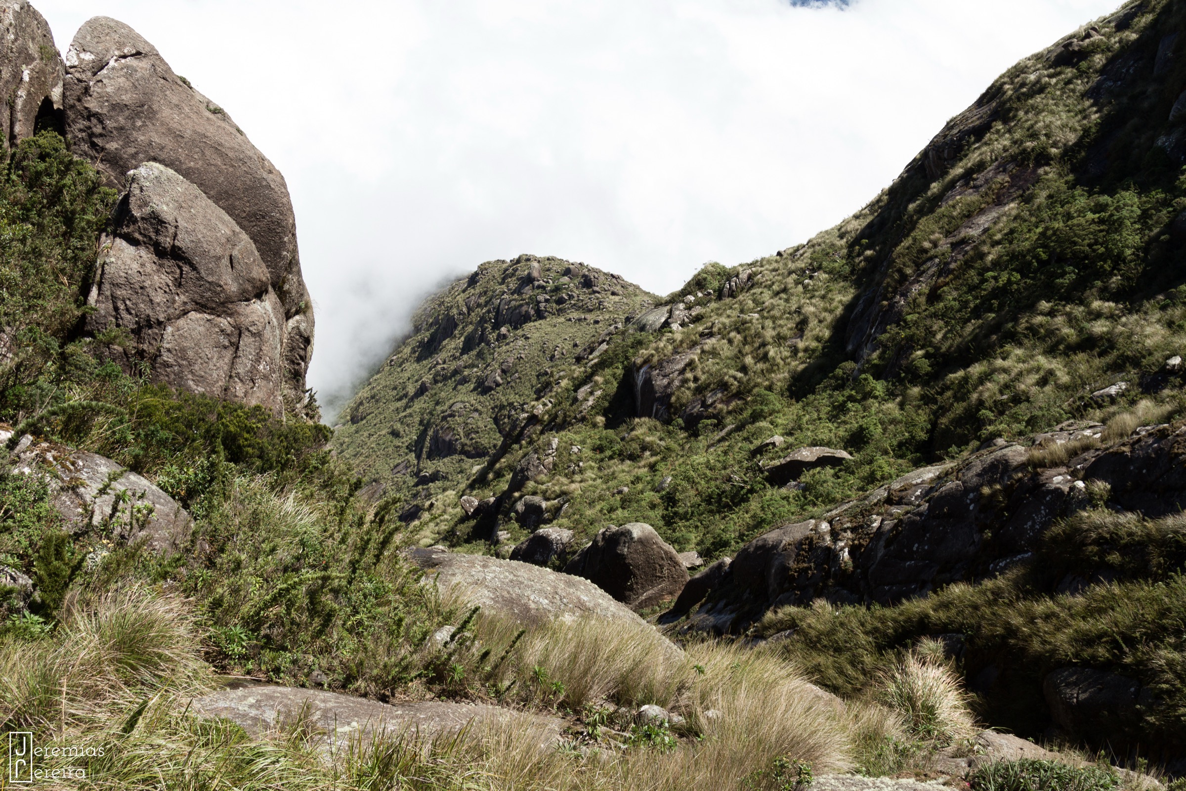
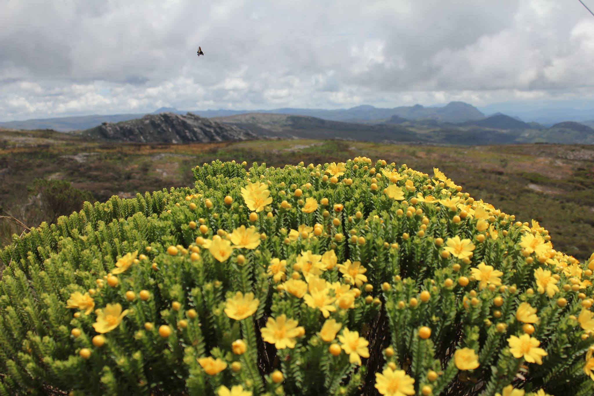
The Pico do Itambé region is the high rocky-campo country of the central Serra do Espinhaço in Minas Gerais, centred on Santo Antônio do Itambé, Serro, Capivari, Milho Verde and São Gonçalo do Rio das Pedras. The walking character is dry-season mountain hiking on quartzite/rocky-field terrain, historic tropeiro paths, waterfalls and high viewpoints rather than alpine technical routes.
The core protected area is Parque Estadual do Pico do Itambé, created in 1998 and administered by Minas Gerais’ Instituto Estadual de Florestas. The park includes the 2,002 m Pico do Itambé, headwaters feeding the Jequitinhonha and Doce systems, cerrado, campo rupestre and forested valleys. The surrounding Serro/Milho Verde district adds Estrada Real heritage, waterfalls and Espinhaço ridge walks.
The practical hiking season is normally April to October. Wet-season storms can close or make routes unsafe, especially waterfall gorges and the summit route. Authorisation is reported as required for the Pico do Itambé and Tropeiros routes; current park contact and guide arrangements must be checked locally before publication.
Selection rationale
The five hikes combine the region’s defining summit, the park’s waterfall and historical trails, and two nearby Serro/Milho Verde Espinhaço walks that complete the catalogue with historic-route and waterfall/ridge terrain.
Summary table
| # | Hike | Country | Route type | Distance | Gain | Max elevation | Difficulty |
|---|---|---|---|---|---|---|---|
| 1 | Pico do Itambé summit | Brazil | Out-and-back | 11.3 km | 856 m | 2,002 m | Hard |
| 2 | Parque Estadual do Pico do Itambé waterfall trail | Brazil | Out-and-back with side spurs | c. 5.6-6 km | Unresolved | Unresolved | Easy-moderate |
| 3 | Trilha dos Tropeiros: Santo Antônio do Itambé-Capivari | Brazil | Point-to-point | 12 km | Unresolved | Unresolved | Moderate |
| 4 | São Gonçalo-Milho Verde via Pico do Raio | Brazil | Point-to-point | 12.4 km | 427 m | Unresolved | Moderate |
| 5 | Cachoeira do Lajeado / Milho Verde | Brazil | Out-and-back | 2.9 km | 58 m | Unresolved | Easy |
1. Pico do Itambé summit

Snapshot
Itinerary
The route climbs from the Santo Antônio/park side through cerrado, campo rupestre and rocky upper slopes to Pico do Itambé, the dominant landmark of the surrounding Espinhaço. Return follows the ascent route.
Why it is essential
This is the region’s namesake summit and one of the classic high points of the Serra do Espinhaço.
Equipment
Mountain hiking equipment, sun protection, 2-3 litres of water, warm/wind layer, offline navigation.
Hazards and notes
Exposed high campo, heat, storms, limited shade and wet-season closures. Authorisation is required according to park/tourism sources.
GPX / KML links
| Source | URL | Format / access | Reuse status |
|---|---|---|---|
| AllTrails — Pico do Itambé | alltrails.com | Source map / route page | AllTrails terms apply; reuse unresolved |
External links
2. Parque Estadual do Pico do Itambé waterfall trail

Snapshot
Itinerary
The park waterfall trail links Água Santa, Fumaça, Neném and Rio Vermelho waterfalls. The farthest waterfall, Rio Vermelho, is reported 2.8 km from the main road, making a c. 5.6 km return before side exploration.
Why it is essential
This is the park’s accessible water-and-forest counterpart to the summit hike and includes named waterfalls described in park/tourism sources.
Equipment
Standard hiking equipment, grippy shoes, insect protection, water.
Hazards and notes
Slippery rock, sudden rain, stream rises and wet-season closure risk. Waterfall heights reported in secondary park summary: Água Santa 7 m and 30 m drops, Fumaça 20 m, Neném 8 m, Rio Vermelho 36 m.
GPX / KML links
| Source | URL | Format / access | Reuse status |
|---|---|---|---|
| OpenStreetMap search | openstreetmap.org | Map data / search | OSM data is ODbL; no official GPX/KML found |
External links
3. Trilha dos Tropeiros: Santo Antônio do Itambé-Capivari

Snapshot
Itinerary
The route follows an old tropeiro corridor between Santo Antônio do Itambé and Capivari, crossing Espinhaço foothill terrain used historically by merchants and muleteers.
Why it is essential
It is the region’s principal documented historical walking route and connects the park gateway with the Capivari side of the Itambé massif.
Equipment
Standard to mountain hiking equipment, sun protection, water, offline navigation.
Hazards and notes
Navigation errors, private-land boundaries and wet-season erosion possible. Authorisation is reported as required for the Tropeiros route.
GPX / KML links
| Source | URL | Format / access | Reuse status |
|---|---|---|---|
| OpenStreetMap search | openstreetmap.org | Map data / search | OSM data is ODbL; no GPX/KML found |
External links
4. São Gonçalo-Milho Verde via Pico do Raio

Snapshot
Itinerary
The route links two historic Serro districts by crossing open Espinhaço terrain and the Pico do Raio area, with broad views and campo rupestre vegetation.
Why it is essential
It gives the catalogue a classic village-to-village Espinhaço traverse close to Pico do Itambé rather than another short waterfall walk.
Equipment
Standard hiking equipment, sun protection, water and navigation backup.
Hazards and notes
Exposed campos, heat, limited shade and possible private/property access issues.
GPX / KML links
| Source | URL | Format / access | Reuse status |
|---|---|---|---|
| AllTrails — São Gonçalo-Milho Verde via Pico do Raio | alltrails.com | Source map / route page | AllTrails terms apply; reuse unresolved |
External links
5. Cachoeira do Lajeado / Milho Verde

Snapshot
Itinerary
A short walk from the Milho Verde side reaches the Lajeado waterfall/rocky stream area, a well-known local objective among the district’s many waterfalls.
Why it is essential
Although short for this catalogue’s normal distance band, it is one of the best-documented and most representative Milho Verde waterfall walks in the immediate Pico do Itambé region.
Equipment
Standard hiking equipment, grippy shoes, sun protection.
Hazards and notes
Slippery slabs, flash rises after storms, swimming hazards and private/local access rules.
GPX / KML links
| Source | URL | Format / access | Reuse status |
|---|---|---|---|
| AllTrails — Cachoeira Lajeado | alltrails.com | Source map / route page | AllTrails terms apply; reuse unresolved |
External links
External links
| Source | URL |
|---|---|
| AllTrails — Pico do Itambé | alltrails.com |
| AllTrails — São Gonçalo-Milho Verde via Pico do Raio | alltrails.com |
| AllTrails — Cachoeira Lajeado | alltrails.com |
| Wikipedia — Pico do Itambé State Park | en.wikipedia.org |