Regional overview
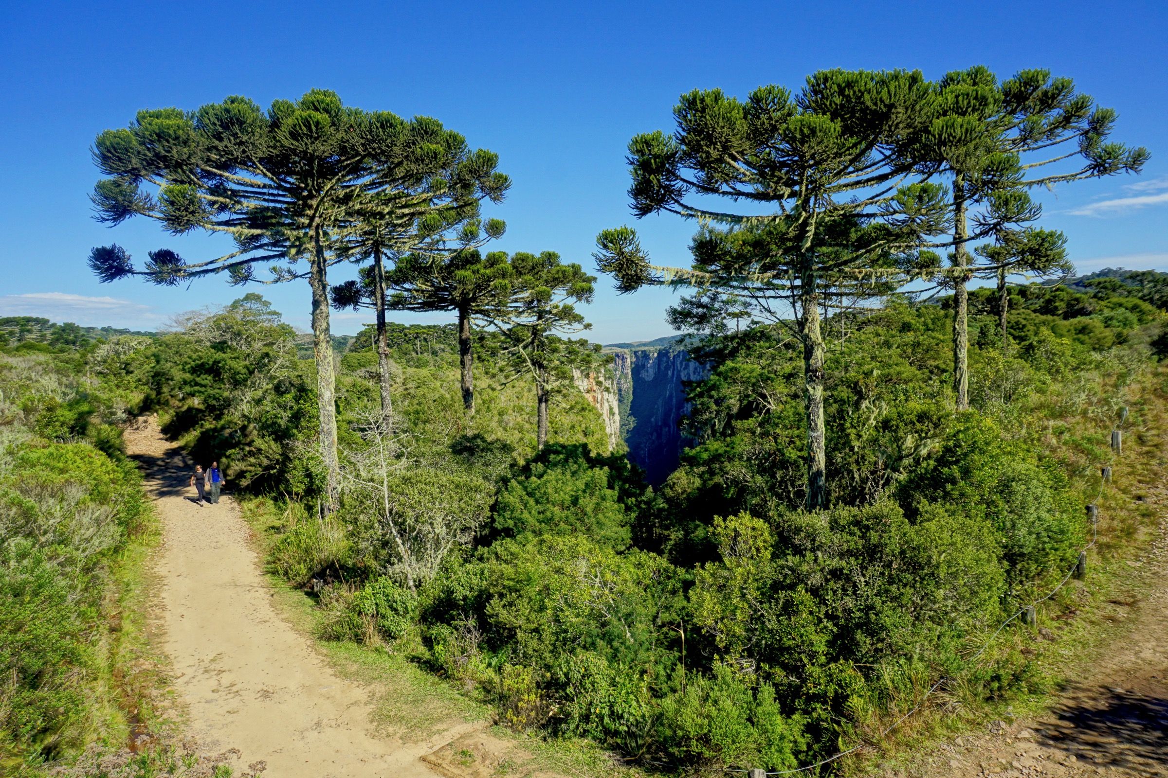
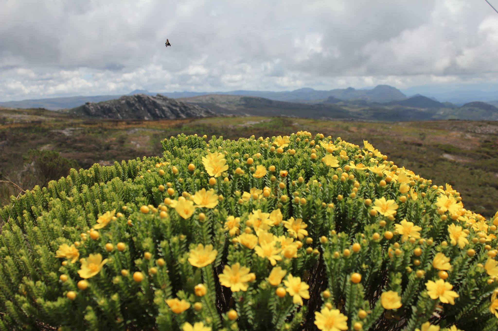
Itatiaia is Brazil’s oldest national park, created in 1937 and straddling the high crest of the Serra da Mantiqueira on the border of Rio de Janeiro, Minas Gerais, and São Paulo states. The park is split into two halves with very different walking characters. The Parte Alta, accessed from the town of Itatiaia via Engenheiro Passos and the Estrada do Parque Nacional, is a granite plateau between roughly 2,200 m and 2,791 m, dominated by campos de altitude grassland, glacially modelled rock outcrops, peat bogs, and the Pico das Agulhas Negras, the highest summit in Rio de Janeiro state. The Parte Baixa, entered from the Itatiaia town park gate, drops into dense Atlantic forest and a string of waterfalls between roughly 700 m and 1,400 m.
Most of the iconic walks listed here leave the upper park. The Abrigo Rebouças hut and the Maromba campsite both serve as common starting points; the Garganta do Registro pass on the BR-485 access road is the operational gateway. Trailheads in the high section are typically reached by 4x4 transfer from Itatiaia town or Engenheiro Passos along a rough mountain road; the lower-park waterfalls are reached by short drives from the Parte Baixa visitor centre.
Best conditions are the cool, drier months from April to September. Winter nights on the plateau frequently drop below zero with frost, occasional snow, and ice on north-facing slopes; summer brings heavy thunderstorms, lightning on exposed ridges, and fast-moving cloud. Park entry, vehicle access on the Parte Alta road, and the Abrigo Rebouças overnight quota are all subject to ICMBio booking; verify current rules before travel.
Selection rationale
The five entries combine the regional icon and Brazil’s highest non-Amazonian summit by some readings (Pico das Agulhas Negras), the most spectacular granite-tower viewpoint of the upper plateau (Prateleiras), a contrasting east-side summit (Pedra do Altar above the Aiuruoca valley), a representative high-plateau wander around glacial lakes (Cinco Lagos), and the Parte Baixa’s classic forest-waterfall walk (Véu da Noiva). They cover both halves of the park and span the full character of Itatiaia walking.
Summary table
| # | Hike | Country | Route type | Distance | Gain | Max elevation | Difficulty |
|---|---|---|---|---|---|---|---|
| 1 | Pico das Agulhas Negras via Abrigo Rebouças | Brazil | Out-and-back | 4.8 km | 406 m | 2,791 m | Hard |
| 2 | Prateleiras circuit | Brazil | Loop / out-and-back | 10.1 km | 447 m | 2,548 m | Hard |
| 3 | Pedra do Altar | Brazil | Out-and-back | 5.6 km | 261 m | 2,665 m | Moderate-Hard |
| 4 | Circuito dos Cinco Lagos | Brazil | Loop | 12 km | ~500 m | ~2,665 m | Hard |
| 5 | Cachoeira Véu da Noiva (Parte Baixa) | Brazil | Out-and-back | 2.0 km | ~80 m | ~880 m | Easy |
1. Pico das Agulhas Negras via Abrigo Rebouças

Snapshot
Itinerary
From Abrigo Rebouças at roughly 2,385 m the path crosses the Vale do Aiuruoca headwaters, climbs a rocky shoulder, and traverses the campos de altitude toward the base of the Agulhas Negras ridge. The upper section follows a marked rock route through a chimney with fixed cables, finishing with a short exposed scramble onto the summit blocks at 2,791 m. The descent retraces the line of ascent. Most parties walk the full route from Garganta do Registro at the BR-485 pass when the Parte Alta road is closed to vehicles, in which case total mileage roughly doubles.
Why it is essential
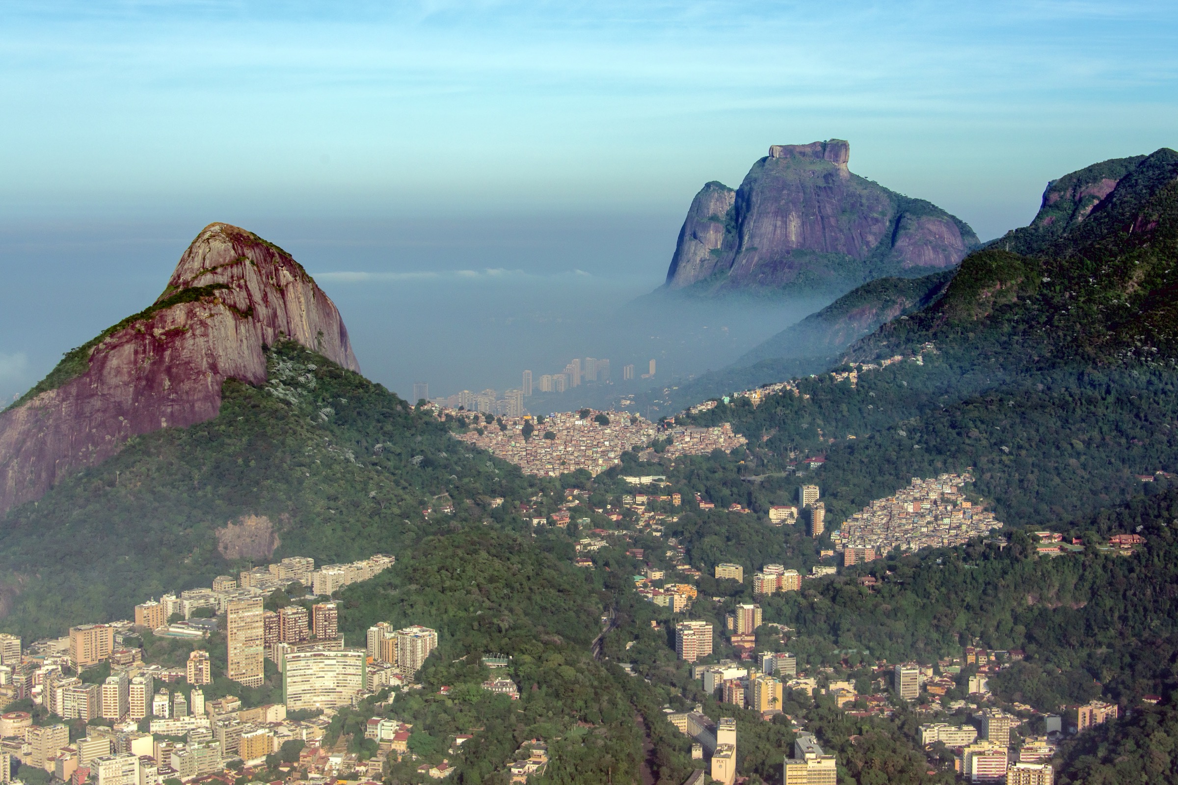
Pico das Agulhas Negras is the highest summit in Rio de Janeiro state and the defining objective of the upper Itatiaia plateau; the summit gives a sweeping view over the Mantiqueira, the Vale do Paraíba, and the Aiuruoca headwaters and is the most recognised mountain icon of southeastern Brazil.
Equipment
Mountain hiking kit, sturdy boots with good edging, warm and waterproof layers, gloves, hat, headtorch for late descents, and gloves for the upper cables. A short helmet is sensible in the busy summer season when other parties are above the chimney. Carry plenty of water; there are no reliable springs near the summit.
Hazards and notes
The summit chimney is exposed and very slippery when wet; lightning risk on the plateau is severe in summer storms. Frost and verglas on the upper rock is common in winter dawns. ICMBio controls Parte Alta road access and Abrigo Rebouças overnight quotas; trail registration and a quota cap apply. Cell coverage is patchy.
GPX / KML links
| Source | URL | Format / access | Reuse status |
|---|---|---|---|
| AllTrails: Trilha do Pico das Agulhas Negras | alltrails.com | Source route page | AllTrails terms; GPX export/reuse not verified |
| Wikiloc: Pico das Agulhas Negras (Abrigo Rebouças) | wikiloc.com | Source route page | Wikiloc terms; check author |
External links
- ICMBio — Parque Nacional do Itatiaia
- Wikipedia — Pico das Agulhas Negras
- Wikipedia (pt) — Parque Nacional do Itatiaia
2. Prateleiras circuit

Snapshot
Itinerary
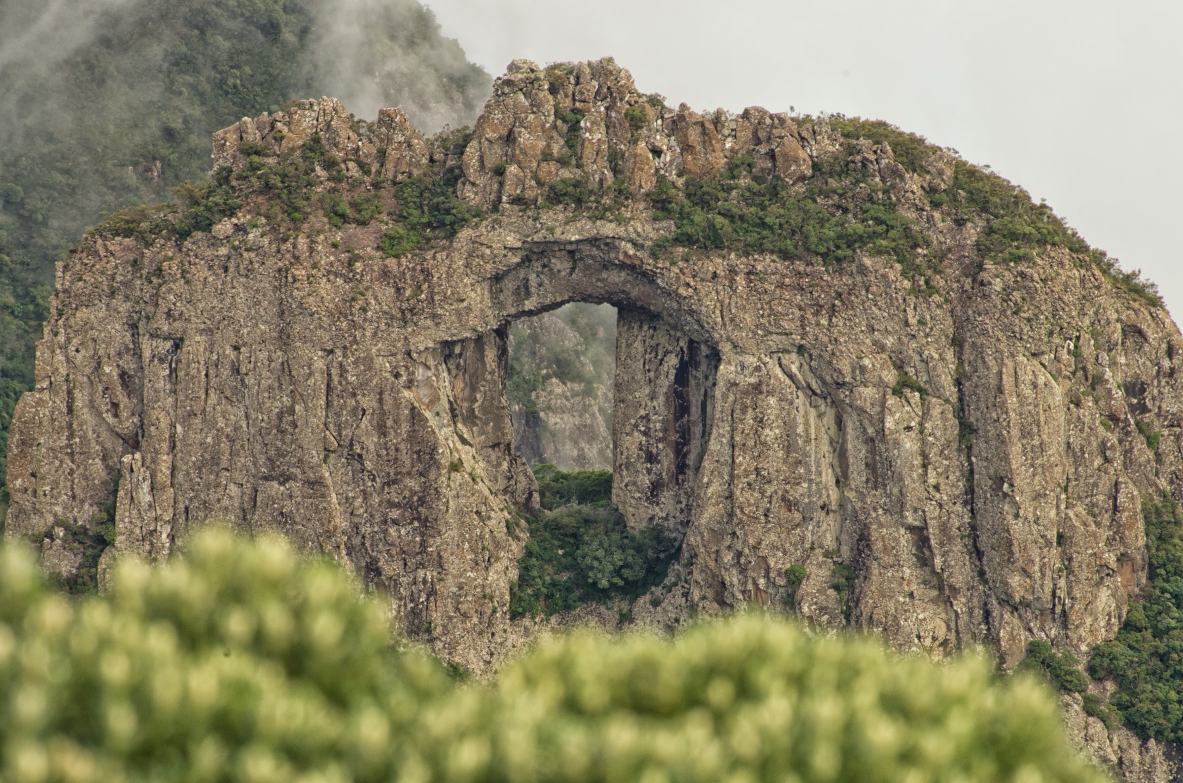
The trail leaves the Prateleiras parking area on the Parte Alta access road and crosses open campos de altitude before contouring around the base of the slabby Prateleiras massif. A side path leads to the summit blocks, gained by an exposed scramble between layered granite shelves that give the peak its name. The descent rejoins the main path with options to extend toward Pedra do Maciço or back along the road.
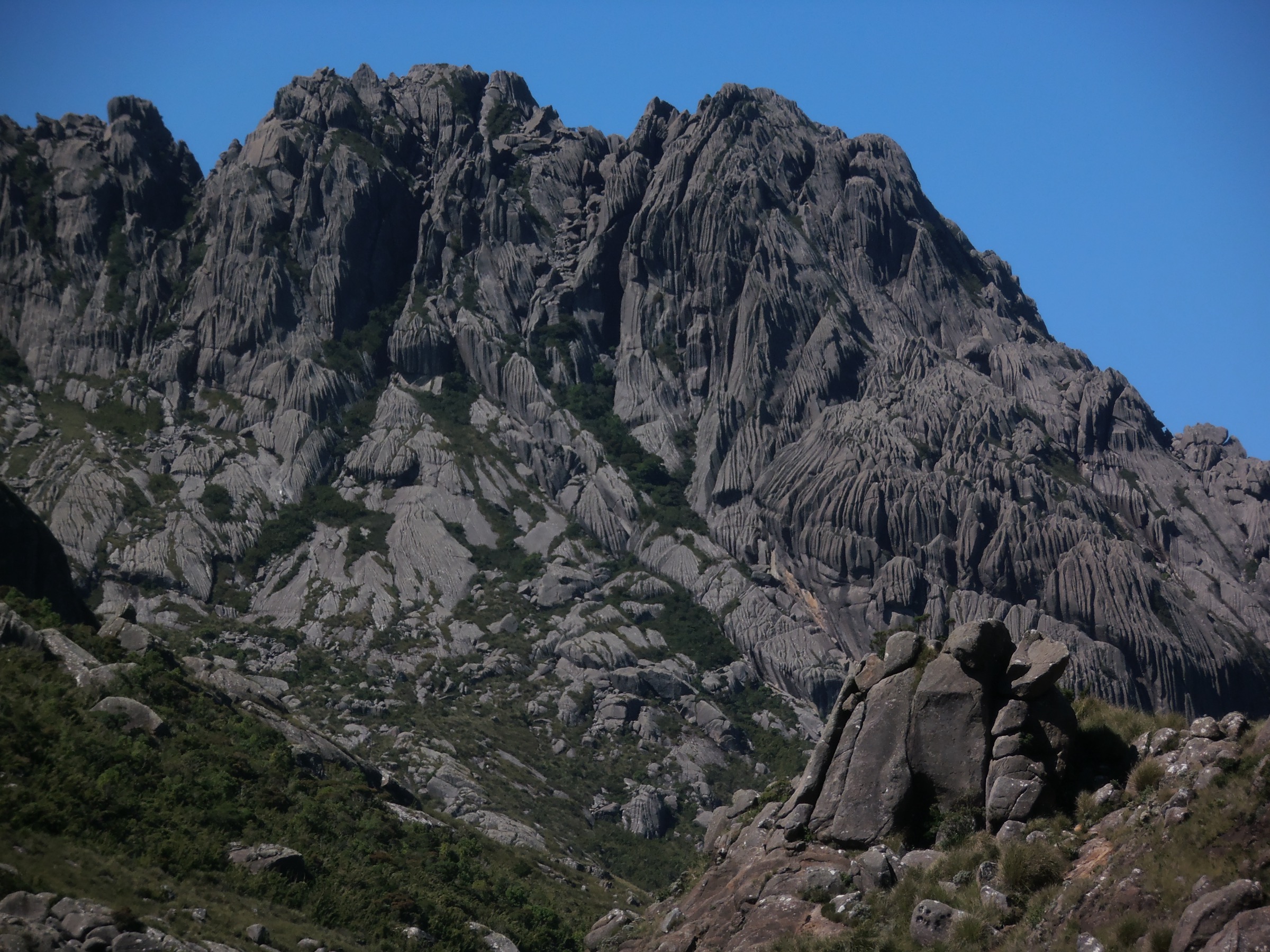
Why it is essential
The Prateleiras is the most photogenic rock formation in the Parte Alta and gives the defining summit-and-plateau image of upper Itatiaia, with a summit panorama over the Mantiqueira spine and the Vale do Paraíba.
Equipment
Mountain hiking kit, sturdy boots, gloves for the upper scramble, warm and waterproof layers, plenty of water. Trekking poles are useful on the long return across the plateau.
Hazards and notes
The final scramble is committed and exposed; route-finding between the layered shelves is non-trivial in cloud. The plateau attracts severe thunderstorms in summer; turn back if cells build over the Mantiqueira. Sensitive vegetation; stay on marked tracks.
GPX / KML links
| Source | URL | Format / access | Reuse status |
|---|---|---|---|
| AllTrails: Trilha das Prateleiras | alltrails.com | Source route page | AllTrails terms; GPX export/reuse not verified |
| Wikiloc: Pico das Prateleiras (Itatiaia) | wikiloc.com | Source route page | Wikiloc terms; check author |
External links
3. Pedra do Altar

Snapshot
Itinerary
From the trailhead on the Estrada do Parque Nacional, the path rises across open grassland before reaching a series of granite outcrops above the Vale do Aiuruoca. A short rocky scramble leads to the flat slab summit, which overlooks Pico do Altar’s namesake valley, the Garganta do Registro pass, and Agulhas Negras to the east. The descent retraces the ascent.
Why it is essential
The Altar gives the cleanest east-facing panorama in the upper park and one of the most direct contrasts between the slabby plateau summits and the Vale do Aiuruoca’s deeply cut canyons.
Equipment
Mountain hiking kit, sturdy boots, gloves for the short scramble, warm and waterproof layers, water.
Hazards and notes
The short upper scramble is exposed; lightning risk on the plateau is severe in summer storms. Frost is possible on the rock in winter dawns.
GPX / KML links
| Source | URL | Format / access | Reuse status |
|---|---|---|---|
| AllTrails: Trilha da Pedra do Altar | alltrails.com | Source route page | AllTrails terms; GPX export/reuse not verified |
| Wikiloc: Pedra do Altar (Itatiaia) | wikiloc.com | Source route page | Wikiloc terms; check author |
External links
4. Circuito dos Cinco Lagos

Snapshot
Itinerary
The loop wanders the Itatiaia high plateau, linking Lago Azul, Lago Negro, Lago do Vale, Lago dos Patos, and Lago dos Cristais between bands of rock and campos de altitude. Tracks are intermittently cairned and easily lost in fog. The route can be combined with a summit detour to Agulhas Negras or shortened to a single-lake out-and-back.
Why it is essential
The Cinco Lagos loop is the classic high-plateau exploration in Brazil, giving the fullest sense of the upper Itatiaia tundra and its alpine lake basins.
Equipment
Mountain hiking kit with full navigation backup (map, compass, GPS), waterproof and warm layers, headtorch, plenty of water. Gaiters are useful when the peat is wet.
Hazards and notes
Plateau visibility can drop to a few metres in minutes; do not commit to the loop without compass and GPS. Lightning is the dominant risk in summer storms. Stay on tracks: the upper bogs are easily damaged. Permit and Abrigo Rebouças quota arrangements apply.
GPX / KML links
| Source | URL | Format / access | Reuse status |
|---|---|---|---|
| Wikiloc: Travessia Rebouças - Cinco Lagos | wikiloc.com | Source route page | Wikiloc terms; check author |
| AllTrails: Cinco Lagos (Itatiaia) | alltrails.com | Source route page | AllTrails terms; GPX export/reuse not verified |
External links
5. Cachoeira Véu da Noiva (Parte Baixa)
Photo status: No licence-compatible image found in this pass.
Snapshot
Itinerary
A short, well-graded forest track leaves the Parte Baixa visitor centre and follows the Rio Campo Belo upstream past several smaller waterfalls before reaching the Véu da Noiva, a tall multi-tier cascade dropping into a forested amphitheatre. The same path is used on return; a longer link via the Cachoeira Itaporani can extend the day to roughly 5 km.
Why it is essential
The Véu da Noiva is the most accessible and most photographed waterfall in Itatiaia’s Atlantic forest sector and gives a fast, family-friendly contrast to the demanding plateau routes of the Parte Alta.
Equipment
Standard day-hiking kit; swim gear is optional for the cool pool below the falls. Trail surfaces become slick after rain.
Hazards and notes
Stones around the pool are very slippery; flash flooding can occur after heavy rain. The path is well marked. Park gates close in late afternoon; check current opening hours with ICMBio.
GPX / KML links
| Source | URL | Format / access | Reuse status |
|---|---|---|---|
| Wikiloc: Cachoeira Véu da Noiva (Itatiaia) | wikiloc.com | Source route page | Wikiloc terms; check author |
| AllTrails: Cachoeira Véu da Noiva | alltrails.com | Source route page | AllTrails terms; GPX export/reuse not verified |
External links
Missing data / follow-up work
- Confirm measured GPX statistics for the Cinco Lagos loop; sources vary between 10 km and 14 km depending on which lakes are visited.
- Verify Pedra do Altar summit altitude against an authoritative topographic source.
- Locate a licence-compatible photograph of Cachoeira Véu da Noiva on Wikimedia Commons or Flickr Commons.
- Confirm current ICMBio booking rules and Parte Alta road access seasonality.
- Verify public-transport options between Itatiaia town and the Parte Alta trailheads beyond informal 4x4 transfer.
- Consider Travessia Ruy Braga (Itatiaia — Parque Estadual do Papagaio) as a separate multi-day candidate; intentionally excluded from this day-hike list.
External links
| Source | URL |
|---|---|
| Wikipedia — Pico das Agulhas Negras | en.wikipedia.org |
| Wikipedia (pt) — Parque Nacional do Itatiaia | pt.wikipedia.org |
| Wikipedia (pt) — Pico das Prateleiras | pt.wikipedia.org |
| ICMBio — Parque Nacional do Itatiaia | gov.br/icmbio |
| Wikimedia Commons — Parque Nacional do Itatiaia | commons.wikimedia.org |
| Wikimedia Commons — Pico das Prateleiras | commons.wikimedia.org |
| Wikimedia Commons — Pedra do Altar | commons.wikimedia.org |
| AllTrails — Itatiaia best trails | alltrails.com |