Regional overview
The high Serra da Mantiqueira around Campos do Jordão and São Bento do Sapucaí is one of southeastern Brazil’s most accessible alpine-flavoured walking landscapes. Granite and gneiss domes such as Pedra do Baú, the Bauzinho and Ana Chata rise above the Paiol Grande valley, while the broader plateau west of the range carries the classic ridge viewpoints of Pico do Itapeva, Pico Selado, Pedra do Forno, Pico Agudo and Pico do Imbiri, all roughly between 1,600 m and 2,080 m. Campos de altitude, rocky outcrops, and patches of mixed araucária-Atlantic forest dominate the upper terrain.
The main hiking centres are Campos do Jordão (state-park trails, Pico do Itapeva, Morro do Elefante), São Bento do Sapucaí (Pedra do Baú complex), Pindamonhangaba (the southern approach to Itapeva), Santo Antônio do Pinhal (Pico Agudo), and Gonçalves and Monte Verde across the Minas Gerais border (Pedra do Forno, Pico Selado). Trailheads are usually reached by private vehicle or local transfer from the highway network connecting São Paulo, Taubaté, and the Vale do Paraíba; intercity buses serve the main towns but exact onward connections to trailheads were not separately verified.
Best conditions are the cool, drier months from roughly April to September. Winter nights can drop below zero with frost and occasional snowfall on the high points; summer brings strong thunderstorms, lightning on exposed ridges, and rapid fog. Pedra do Baú is the regional icon and requires negotiating fixed steel ladders and cables, so it sits at a notably higher hazard level than the other walks listed here.
Selection rationale
The five entries combine the regional icon (Pedra do Baú), Campos do Jordão’s classic high viewpoint (Pico do Itapeva), the easier outlier in the same Baú complex (Pedra do Bauzinho), the most distinctive Gonçalves-side viewpoint (Pedra do Forno), and a forested state-park walk to a waterfall (the Galharada in the Parque Estadual de Campos do Jordão). They spread across four different trailheads and three character types: granite-dome scramble, ridge mirador, easier viewpoint, and araucária-forest waterfall walk.
Summary table
| # | Hike | Country | Route type | Distance | Gain | Max elevation | Difficulty |
|---|---|---|---|---|---|---|---|
| 1 | Pedra do Baú via Paiol Grande | Brazil | Out-and-back | 5.0 km | 405 m | 1,950 m | Hard |
| 2 | Pico do Itapeva (short summit walk) | Brazil | Out-and-back | 3.1 km | 170 m | 2,030 m | Moderate |
| 3 | Pedra do Bauzinho and viewpoint | Brazil | Out-and-back | 4.5 km | 272 m | 1,850 m | Moderate |
| 4 | Pedra do Forno (Gonçalves) | Brazil | Out-and-back | 2.9 km | 268 m | 1,970 m | Moderate |
| 5 | Trilha dos Campos e Cachoeira do Galharada | Brazil | Out-and-back | 8.4 km | Unresolved | ~1,700 m | Easy-Moderate |
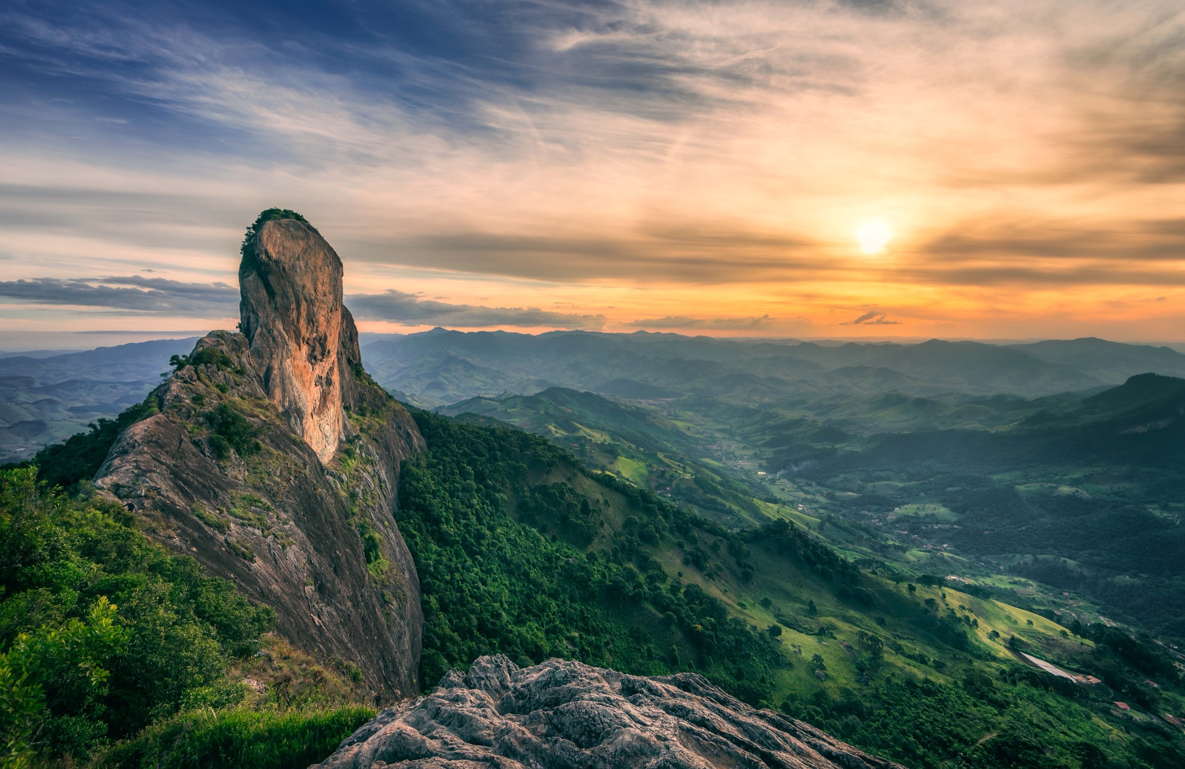
1. Pedra do Baú via Paiol Grande

Snapshot
Itinerary
The route begins at the Paiol Grande access on the north face and climbs through forest to the base of the rock, where the upper section is negotiated by a fixed metallic staircase of around 600 steps bolted to the granite to reach the summit at roughly 1,892 m. The descent is normally made by the same line; an alternative south-face descent on rock steps is sometimes used. Local operators run the route with mandatory guides and helmets.
Why it is essential
Pedra do Baú is the most recognisable granite landmark in the southern Mantiqueira and gives the defining high-mountain summit experience in this sub-region, with panoramic views back over Campos do Jordão, the Paraíba valley, and the surrounding domes.
Equipment
Mountain hiking gear plus a helmet for the fixed-cable section; gloves and a head for exposure are useful. Guide services typically supply the helmet and verify the upper route is closed in bad weather.
Hazards and notes
The final ladder/cable section is steep, exposed, and unsuitable in rain, lightning, or strong wind. The summit is closed during storms. Booking through a licensed operator is mandatory according to the municipality and the Baú Ecoturismo operator. Frost on metal steps is possible in winter dawns.
GPX / KML links
| Source | URL | Format / access | Reuse status |
|---|---|---|---|
| AllTrails: Trilha face Norte Bauzinho - Pedra do Baú | alltrails.com | Source route page | AllTrails terms; GPX export/reuse not verified |
| Wikiloc: Pedra do Baú - via Ferrata | wikiloc.com | Source route page | Wikiloc terms; check author |
External links
- Wikipedia — Pedra do Baú
- Prefeitura de São Bento do Sapucaí — Subida na Pedra do Baú
- Baú Ecoturismo — Subida na Pedra do Baú
- Guia de Áreas Protegidas SP — MONA Pedra do Baú
2. Pico do Itapeva (short summit walk)

Snapshot
Itinerary
The short walk leaves the Pico do Itapeva visitor area on the crest of the Serra da Mantiqueira, follows a clearly marked path along the upper escarpment past lavender gardens and viewpoints, and continues to the actual high point above the Vale do Paraíba. A longer linking route from the Pindamonhangaba side is documented on Wikiloc but is logistically far more demanding and is not the standard objective.
Why it is essential
Pico do Itapeva is Campos do Jordão’s classic Mantiqueira mirador and one of the most accessible 2,000-metre summits in southeastern Brazil, with a sweeping view over more than ten cities of the Paraíba valley.
Equipment
Standard day-hiking kit: warm and waterproof layers, sun protection, water, snacks. No technical equipment required.
Hazards and notes
The high crest is exposed to wind, fast-moving fog, and occasional winter frost. Storms in summer bring lightning risk on the open summit, so turn back if cells build up.
GPX / KML links
| Source | URL | Format / access | Reuse status |
|---|---|---|---|
| AllTrails: Pico do Itapeva | alltrails.com | Source route page | AllTrails terms; GPX export/reuse not verified |
| Wikiloc: Subida Pico do Itapeva (Pinda → Campos) | wikiloc.com | Source route page | Wikiloc terms; check author |
External links
- Wikipedia (pt) — Pico do Itapeva
- Guia Melhores Destinos — Pico do Itapeva
- Wikimedia Commons — Pico do Itapeva category
3. Pedra do Bauzinho and viewpoint

Snapshot
Itinerary
The path leaves Paiol Grande, climbs through the lower forest, and reaches the small rock outcrop of the Bauzinho, set directly opposite the main Pedra do Baú face. The standard short loop visits the Bauzinho viewpoint and the nearby Ana Chata; the upper Pedra do Baú itself requires the fixed-steps route described in entry 1.
Why it is essential
The Bauzinho gives the best frontal view of the Pedra do Baú complex without the via-ferrata-style ladders, and is the obvious lower-commitment counterpart to the full Baú climb.
Equipment
Standard day-hiking kit and sturdy boots; no special technical gear needed for the Bauzinho viewpoint section.
Hazards and notes
Some short rocky steps near the viewpoint require care, especially when wet. The wider Pedra do Baú complex has commercial access controls; verify current entrance arrangements with Baú Ecoturismo before travel.
GPX / KML links
| Source | URL | Format / access | Reuse status |
|---|---|---|---|
| AllTrails: Baúzinho - Pedra do Baú - Ana Chata | alltrails.com | Source route page | AllTrails terms; GPX export/reuse not verified |
| Wikiloc: Bauzinho - São Bento do Sapucaí | wikiloc.com | Source route page | Wikiloc terms; check author |
External links
4. Pedra do Forno (Gonçalves)
Photo status: No licence-compatible image found in this pass.
Snapshot
Itinerary
The trail climbs from the Juncal access road through closed araucária and Atlantic forest, passing springs and shaded gradients of moderate steepness. A short fixed-ladder section near the top reaches the summit dome, which carries a small chapel and a 360-degree panorama over Gonçalves, Monte Verde, Campos do Jordão, and the Pedra do Baú group.
Why it is essential
Pedra do Forno is the defining Gonçalves-side summit on this stretch of the Mantiqueira and gives a particularly broad overview tying the SP and MG sides of the range together.
Equipment
Standard day-hiking kit and sturdy boots; the short metallic-rung section near the top is straightforward in dry conditions but a helmet is sensible if you carry one.
Hazards and notes
The short fixed-rung section at the top is exposed and should not be attempted in wet or icy conditions. Forest can be slippery after rain; expect mud through summer. Cell coverage is variable.
GPX / KML links
| Source | URL | Format / access | Reuse status |
|---|---|---|---|
| AllTrails: Trilha Pedra do Forno | alltrails.com | Source route page | AllTrails terms; GPX export/reuse not verified |
| Wikiloc: Pedra do Forno - Gonçalves / MG | wikiloc.com | Source route page | Wikiloc terms; check author |
| Outdooractive: Pedra do Forno Trail | outdooractive.com | Source route page | Outdooractive terms |
External links
5. Trilha dos Campos e Cachoeira do Galharada
Photo status: No licence-compatible image found in this pass.
Snapshot
Itinerary
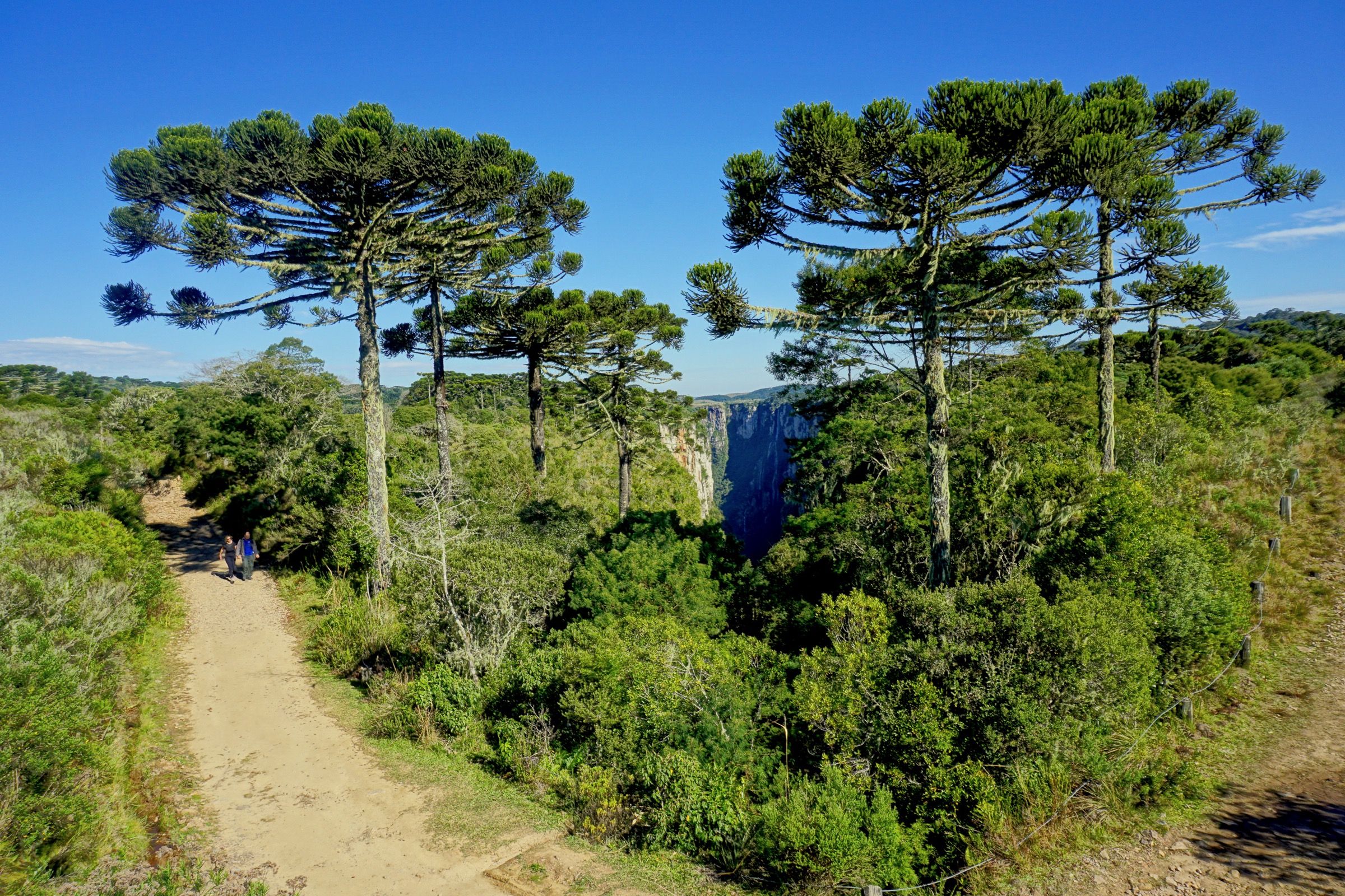
The walk crosses the upper campos de altitude and araucária groves of the state park along the Trilha dos Campos before linking onto the short extension to the Cachoeira do Galharada, a multi-tier waterfall in the forest. Surfaces are mostly graded path with minor rocky sections; the route is flat to gently rolling.
Why it is essential
The Galharada walk gives the clearest day-hike view of the Parque Estadual de Campos do Jordão’s mosaic of araucária forest, altitude grassland, and waterway, contrasting sharply with the open rock summits elsewhere in the selection.
Equipment
Light day-hiking kit, waterproof layer, sun protection, and water; the trail is well marked and does not require navigation gear.
Hazards and notes
Surfaces become slippery after rain; the waterfall area can be cold even in summer. Park gates close in late afternoon; plan to be back at the entrance before closing. Frost is possible on winter mornings.
GPX / KML links
| Source | URL | Format / access | Reuse status |
|---|---|---|---|
| Wikiloc: Circuito Horto Florestal - Campos do Jordão | wikiloc.com | Source route page | Wikiloc terms; check author |
| Guia de Áreas Protegidas SP: Trilha da Cachoeira | guiadeareasprotegidas.sp.gov.br | Official route page | Government open content; verify reuse terms |
External links
- Wikipedia (pt) — Parque Estadual de Campos do Jordão
- Governo de SP — Parque Estadual Campos do Jordão
- Dicas de Viagem — Horto Florestal
Missing data / follow-up work
- Confirm exact distance and elevation profile of the Trilha dos Campos + Galharada combination from a measured GPX track.
- Verify public-transport options to Paiol Grande (Baú), Pico do Itapeva visitor centre, Pedra do Forno trailhead, and Horto Florestal entrance.
- Locate licence-compatible photographs of Pedra do Forno and the Cachoeira do Galharada on Wikimedia Commons.
- Confirm whether the Bauzinho / Ana Chata route currently requires guided access in addition to the main Pedra do Baú summit.
- Verify altitude figure of 1,850 m for the Bauzinho viewpoint against a topographic source.
- Confirm operator booking and access rules for the Pedra do Forno fixed-rung section.
- Consider Pedra da Mina as a separate strenuous candidate entry; it is traditionally an overnight and is intentionally excluded here.
External links
| Source | URL |
|---|---|
| Wikipedia — Pedra do Baú | en.wikipedia.org |
| Wikipedia (pt) — Pico do Itapeva | pt.wikipedia.org |
| Wikipedia (pt) — Parque Estadual de Campos do Jordão | pt.wikipedia.org |
| Wikipedia — Mantiqueira Mountains | en.wikipedia.org |
| Prefeitura de São Bento do Sapucaí — Subida na Pedra do Baú | saobentodosapucai.sp.gov.br |
| Baú Ecoturismo | bauecoturismo.com.br |
| Guia de Áreas Protegidas SP — MONA Pedra do Baú | guiadeareasprotegidas.sp.gov.br |
| Governo de SP — Parque Estadual Campos do Jordão | saopaulo.sp.gov.br |
| Mantiqueira Ecoturismo — Pedra do Forno | mantiqueiratur.com.br |
| AllTrails — Pedra do Baú POI | alltrails.com |
| AllTrails — Campos do Jordão best trails | alltrails.com |
| Wikimedia Commons — Pico do Itapeva category | commons.wikimedia.org |
| Wikimedia Commons — Monumento Natural Estadual da Pedra do Baú | commons.wikimedia.org |