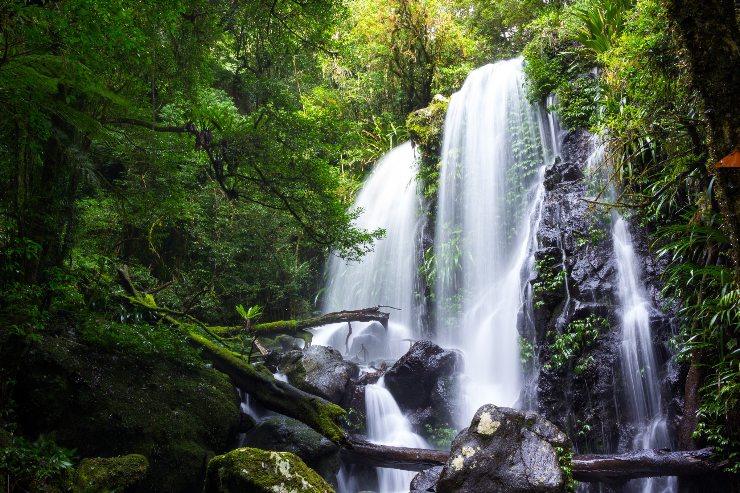
Regional overview
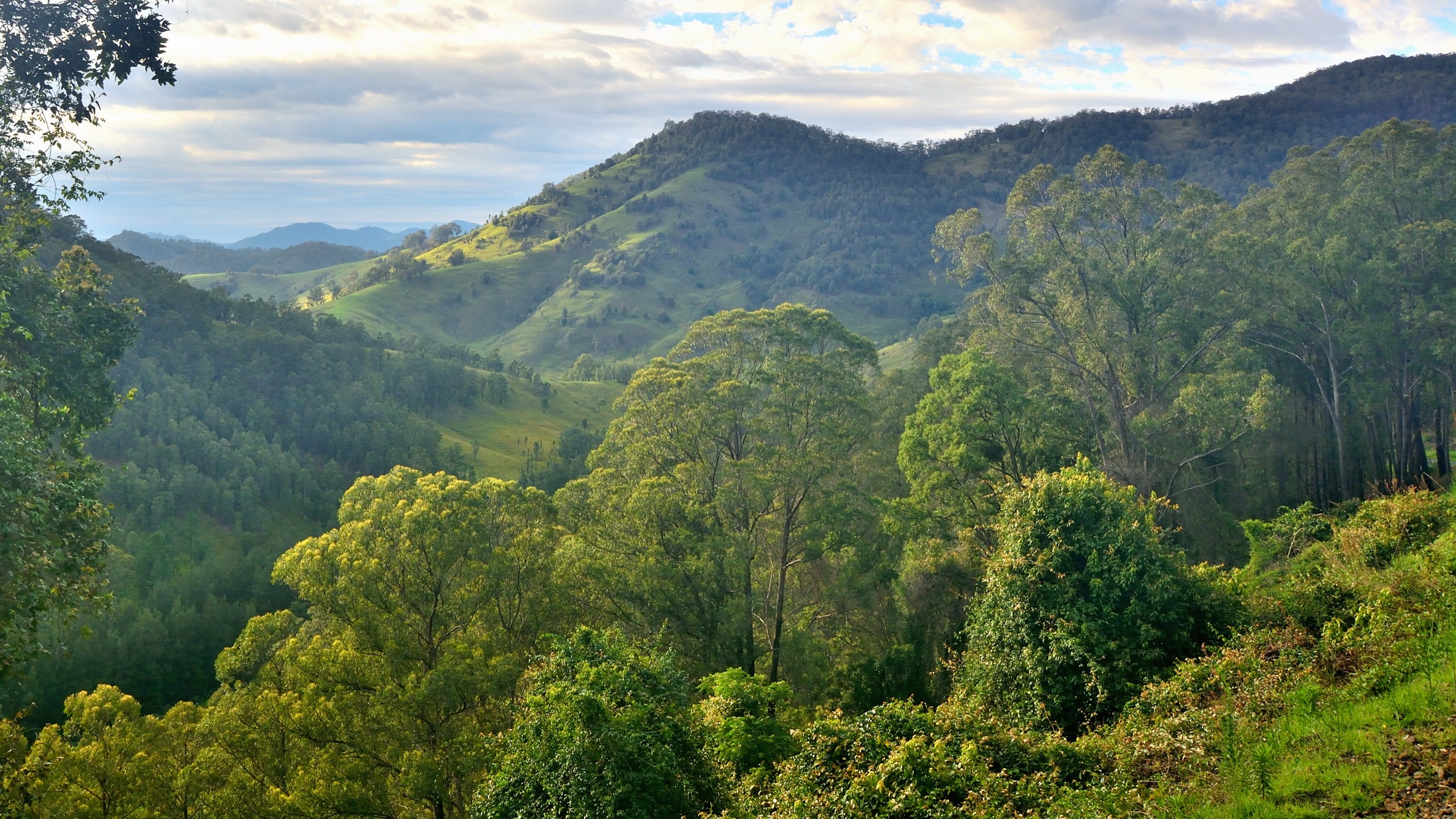
Lamington National Park and Border Ranges National Park sit either side of the Queensland–New South Wales border on the McPherson Range, the northern rim of the eroded Tweed Volcano. Both parks are inscribed in the Gondwana Rainforests of Australia World Heritage Area, and together they hold one of the largest continuous stands of subtropical and cool-temperate rainforest on the Australian mainland — subtropical vine forest at the lower altitudes, Antarctic beech (Nothofagus moorei) on the highest ridges, and long lines of cliffed caldera-rim lookouts facing back across the Tweed Valley to Wollumbin (Mount Warning). The Lamington plateau sits mainly between 800 and 1,100 m, with Bithongabbel at 1,175 m as its high point; Border Ranges rises to about 1,150 m at Roberts Plateau.
The walking spectrum is dense. Lamington concentrates its day-hikes around two lodge-based road-heads: Green Mountains at O’Reilly’s on the Queensland side, reached from Canungra, and Binna Burra above the Numinbah Valley. Border Ranges is reached from Kyogle by the gravel Tweed Range Scenic Drive, which loops along the caldera rim past a string of short lookout walks. All five entries in this selection lie on the McPherson Range — the Lamington side is managed by the Queensland Parks and Wildlife Service (QPWS), and Border Ranges by the New South Wales National Parks and Wildlife Service (NPWS). The country is Yugambeh on the northern (Lamington) side and Bundjalung on the southern (Border Ranges) side.
The dominant hazards are rain-related. The plateau catches moist onshore flow off the Coral and Tasman seas and averages 1,700–3,000 mm of rainfall a year, most of it between November and April. Creek crossings on the Toolona, Box Forest and Coomera circuits become dangerous quickly after heavy rain; leeches and paralysis ticks are common in wet forest; and rainforest boardwalk, roots and moss-covered rock stay slippery for days after the last shower. Fog on the caldera rim is routine, tracks are closed after storms, and both parks have a fire-closure system in summer. Autumn to early spring (April–October) is the driest and most stable walking window.
Summary table
| # | Hike | Route type | Distance | Estimated time | Difficulty | Verification |
|---|---|---|---|---|---|---|
| 1 | Toolona Creek Circuit | Loop | QPWS: 17.4 km; Trail Hiking Australia: 17 km | QPWS: 6–7 h; Trail Hiking Australia: 6 h | Grade 4 / hard | Route verified via QPWS + Trail Hiking Australia |
| 2 | Box Forest Circuit | Loop | QPWS: 10.9 km; Trail Hiking Australia: 10 km; Aussie Bushwalking: 10.6 km | 3.5–4 h | Grade 4 / hard | Route verified via QPWS + Trail Hiking Australia + Aussie Bushwalking |
| 3 | Coomera Circuit | Loop | QPWS: 17.4 km; Trail Hiking Australia: 18 km | QPWS: ~7 h | Grade 4 / hard | Route verified via QPWS + Trail Hiking Australia + Aussie Bushwalking |
| 4 | Tullawallal Circuit | Loop | QPWS: 5 km; Trail Hiking Australia: 5 km | ~2 h | Grade 3 / moderate | Route verified via QPWS + Trail Hiking Australia |
| 5 | Pinnacle Walk and Lookout | Out-and-back | NPWS: 600 m return; Trail Hiking Australia: 600 m | ~40 min | Grade 2 / easy | Route verified via NPWS + Trail Hiking Australia |
Before you go
Access
The Lamington circuits are reached from two separate road-heads. Green Mountains (O’Reilly’s) is a 36 km sealed climb from Canungra on the Queensland side and covers Toolona Creek and Box Forest; Binna Burra is a 34 km sealed climb from Nerang via Beechmont and covers Coomera and Tullawallal. There is no scheduled public transport to either trailhead; both are self-drive from Brisbane or the Gold Coast, and the Binna Burra road was rebuilt after the 2019 bushfire. Border Ranges NP is reached from Kyogle via Lions Road and the gravel Tweed Range Scenic Drive; the Pinnacle car park is on the eastern half of that drive. QPWS and NPWS websites should be checked for closures on the day.
Standard kit
- Sturdy walking shoes or light boots — rainforest tracks are slick with mud, moss-covered roots and stone steps rather than technical footing.
- Full waterproof shell (jacket) plus a light warm layer; the plateau can be 8–10 °C cooler than the coast and much wetter.
- Water: 1 litre for the Pinnacle and Tullawallal, 2–3 litres for Toolona, Box Forest and Coomera in warm weather.
- Insect repellent and long trousers for tick and leech pressure; a small salt shaker or DEET repellent works on leeches.
- Offline map (QPWS Green Mountains or Binna Burra track map, or the equivalent 1:25,000 sheet), compass and headtorch for the long circuits.
- Personal locator beacon is standard practice on the three long circuits, and QPWS asks all walkers to sign the trailhead intentions book.
Common hazards
- Flash flooding of creeks: the Toolona, Box Forest and Coomera circuits all cross creeks that rise rapidly after heavy rain and can strand parties.
- Slippery boardwalk, roots and rock in the rainforest — falls are the commonest injury.
- Leeches and paralysis ticks are near-constant from October to April; check body and gear at the trailhead.
- Stinging trees (Dendrocnide) grow beside several tracks — do not brush past unknown broad-leaved plants.
- Fog on the caldera rim can reduce visibility to under 20 m; the summit and lookout sections above Toolona and Coomera are the most exposed.
- Fire closures apply in high fire-danger weather; both agencies close tracks preemptively.
- Dogs are not permitted on any of the tracks below.
1. Toolona Creek Circuit
Snapshot
Itinerary
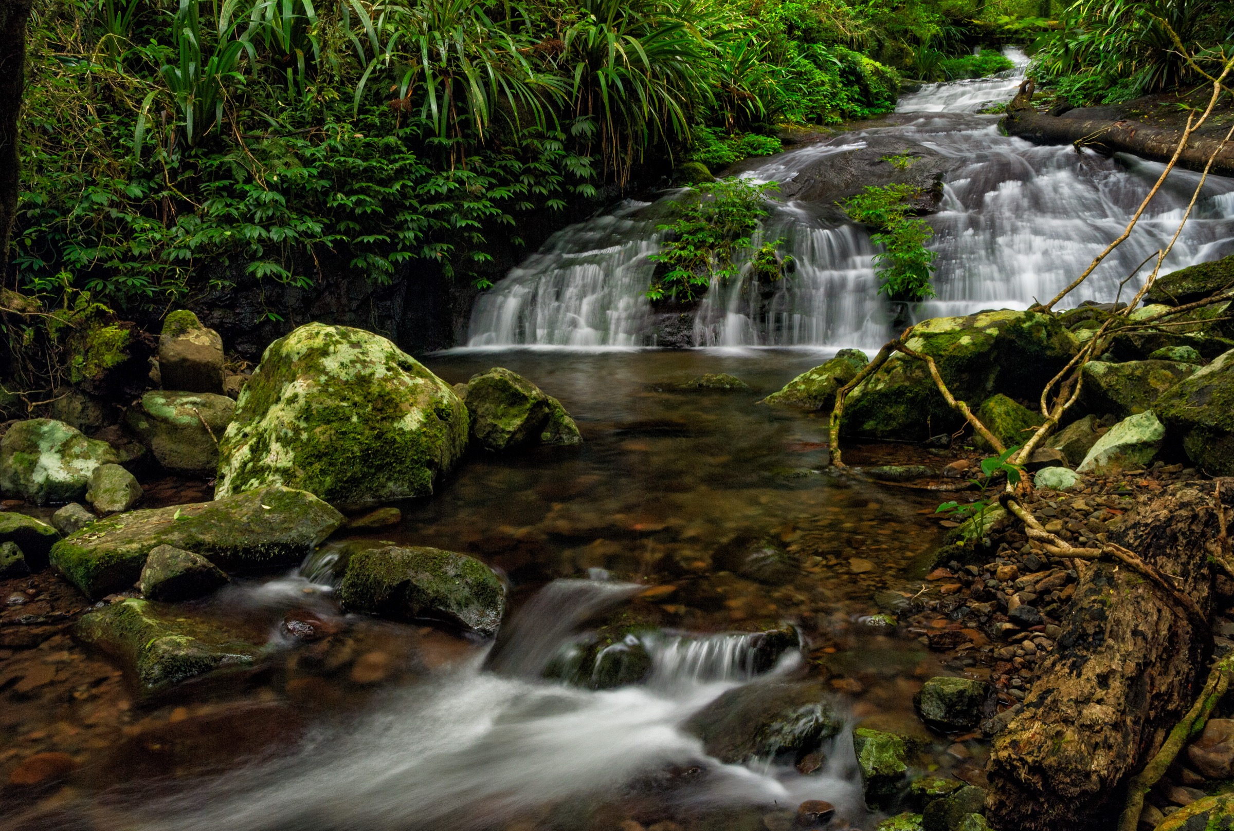
The route leaves the Green Mountains day-use area at O’Reilly’s on the Box Forest track, meets the West Canungra Creek track at the Picnic Rock junction, and follows Toolona Creek upstream through a long series of falls and cascades — including Elabana, Chalahn, Gwongurai and Toolona Falls — into the head of the Toolona Gorge. From the head of the gorge the track climbs onto the McPherson Range, joins the Border Track along the QLD/NSW state line near Wanungara Lookout at about 1,195 m, then contours back west along the plateau rim and descends the Border Track through subtropical rainforest to the Green Mountains trailhead. The return leg gives long southward views into the NSW side of the caldera in clear weather.
Why it is essential
Toolona Creek is the marquee long day-walk of the Green Mountains side of Lamington: a single circuit that strings together the park’s densest run of named falls, a full run along the McPherson Range summit ridge, and the highest lookout section of the Border Track. It is the walk QPWS itself promotes as the flagship Green Mountains day objective.
Hazards and notes
- Creek crossings in the Toolona Gorge become dangerous after heavy rain; do not attempt in flood.
- Sustained rainforest track — moss-covered roots, mud and stone steps are slippery in any conditions.
- Fog on the plateau ridge above Wanungara can reduce visibility to a few metres.
- Leeches and paralysis ticks are heavy in warm, wet months.
- Sign the trailhead intentions book and carry a PLB.
GPX / KML links
| Source | URL | Format | Notes |
|---|---|---|---|
| QPWS — Toolona Creek circuit | parks.qld.gov.au | Official park page | No GPX published on the official page in this pass |
| QPWS — Green Mountains map (PDF) | parks.des.qld.gov.au | Official PDF map | QPWS terms |
| Trail Hiking Australia — Toolona Creek Circuit | trailhiking.com.au | Third-party route page with stats | GPX copyright per site notice; secondary reference |
Further reading
2. Box Forest Circuit
Snapshot
Itinerary
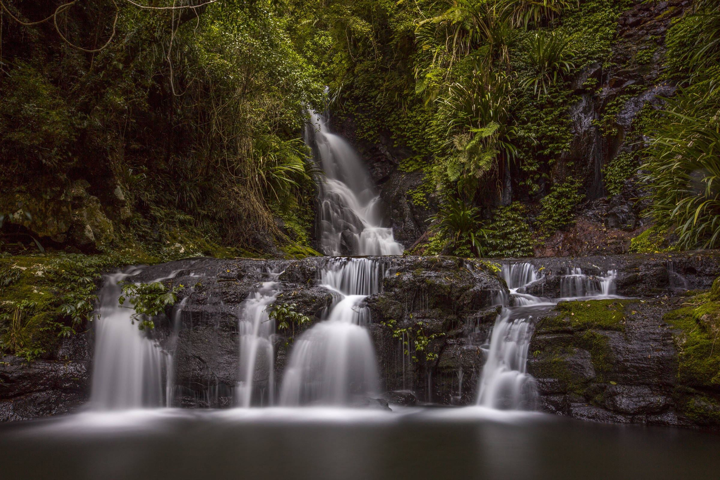
The route leaves the Green Mountains day-use area on the Border Track, drops off the plateau onto the Box Forest track, and works down into the head of the Canungra Creek catchment through a stand of ancient brush box (Lophostemon confertus). The track descends past Tullerigumai (Box Log) Falls, then contours through subtropical vine forest to Elabana Falls — the most photographed waterfall in Lamington — before continuing past Yanbacoochie and Darragumai Falls. From Picnic Rock the return climbs steadily back onto the Border Track and follows it west to the trailhead.
Why it is essential
Box Forest is the classic half-day loop of the Green Mountains side and the shortest way to see Elabana Falls and the park’s oldest brush box stand. It shares the first and last kilometre with the Toolona circuit but stays low enough to be walkable in weather that would close the higher plateau leg.
Hazards and notes
- Creek crossings above Wajinya Falls are unsafe in high water; check flow before committing.
- Leeches and paralysis ticks are heavy in warm, wet months.
- Slippery moss-covered rock at the creek crossings and around the falls.
- Fallen trees can block the track after storms — check QPWS conditions before travel.
GPX / KML links
| Source | URL | Format | Notes |
|---|---|---|---|
| QPWS — Box Forest circuit | parks.qld.gov.au | Official park page | No GPX published on the official page in this pass |
| QPWS — Green Mountains map (PDF) | parks.des.qld.gov.au | Official PDF map | QPWS terms |
| Trail Hiking Australia — Box Forest Circuit | trailhiking.com.au | Third-party route page with stats | Secondary reference |
| Aussie Bushwalking — Box Forest | aussiebushwalking.com | Third-party route page | Secondary reference |
Further reading
- QPWS — Box Forest circuit
- Trail Hiking Australia — Box Forest Circuit
- Aussie Bushwalking — Box Forest
3. Coomera Circuit
Snapshot
Itinerary
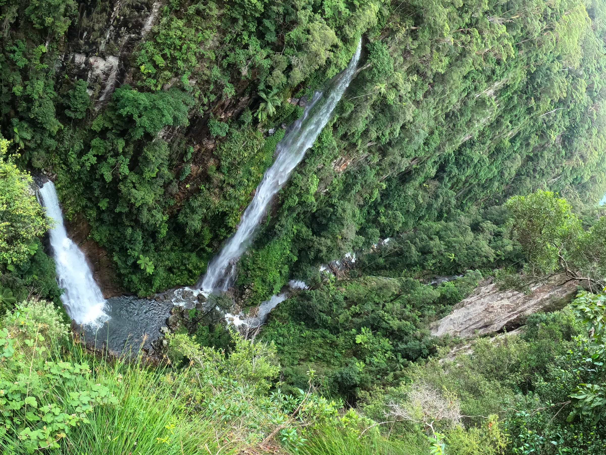
From the Binna Burra upper day-use area the route follows the Border Track for 1.9 km, then branches left onto the Coomera Circuit and descends into the Coomera valley. About 5.5 km in, a short spur reaches the cantilevered Coomera Falls lookout, from which the Coomera and Yarrabilgong falls drop side by side into a 160 m gorge. The circuit then contours through the head of the gorge, passing Bahnamboola, Kagoonya and Neerigomindalala falls with several rock-hop creek crossings, before climbing steadily back onto the Border Track and returning south to the trailhead.
Why it is essential
Coomera is the marquee long day-walk on the Binna Burra side and the counterpart to Toolona on the Green Mountains side. It is the walk that combines Lamington’s biggest single waterfall view — the Coomera Falls lookout over the gorge — with a full traverse of the Coomera catchment’s cascades.
Hazards and notes
- The Coomera River rises rapidly; do not attempt the circuit in or after heavy rain.
- The Coomera Falls lookout is cantilevered — stay behind the rail; the drop is unfenced beyond it.
- Slippery rock at the crossings and around each of the named falls.
- Leeches and paralysis ticks are heavy in warm, wet months.
- Sign the trailhead intentions book and carry a PLB.
GPX / KML links
| Source | URL | Format | Notes |
|---|---|---|---|
| QPWS — Coomera circuit | parks.qld.gov.au | Official park page | No GPX published on the official page in this pass |
| QPWS — Binna Burra map (PDF) | parks.des.qld.gov.au | Official PDF map | QPWS terms |
| Trail Hiking Australia — Coomera Circuit | trailhiking.com.au | Third-party route page with stats | Secondary reference |
| Aussie Bushwalking — Coomera Circuit | aussiebushwalking.com | Third-party route page | Secondary reference |
Further reading
4. Tullawallal Circuit
Snapshot
Itinerary
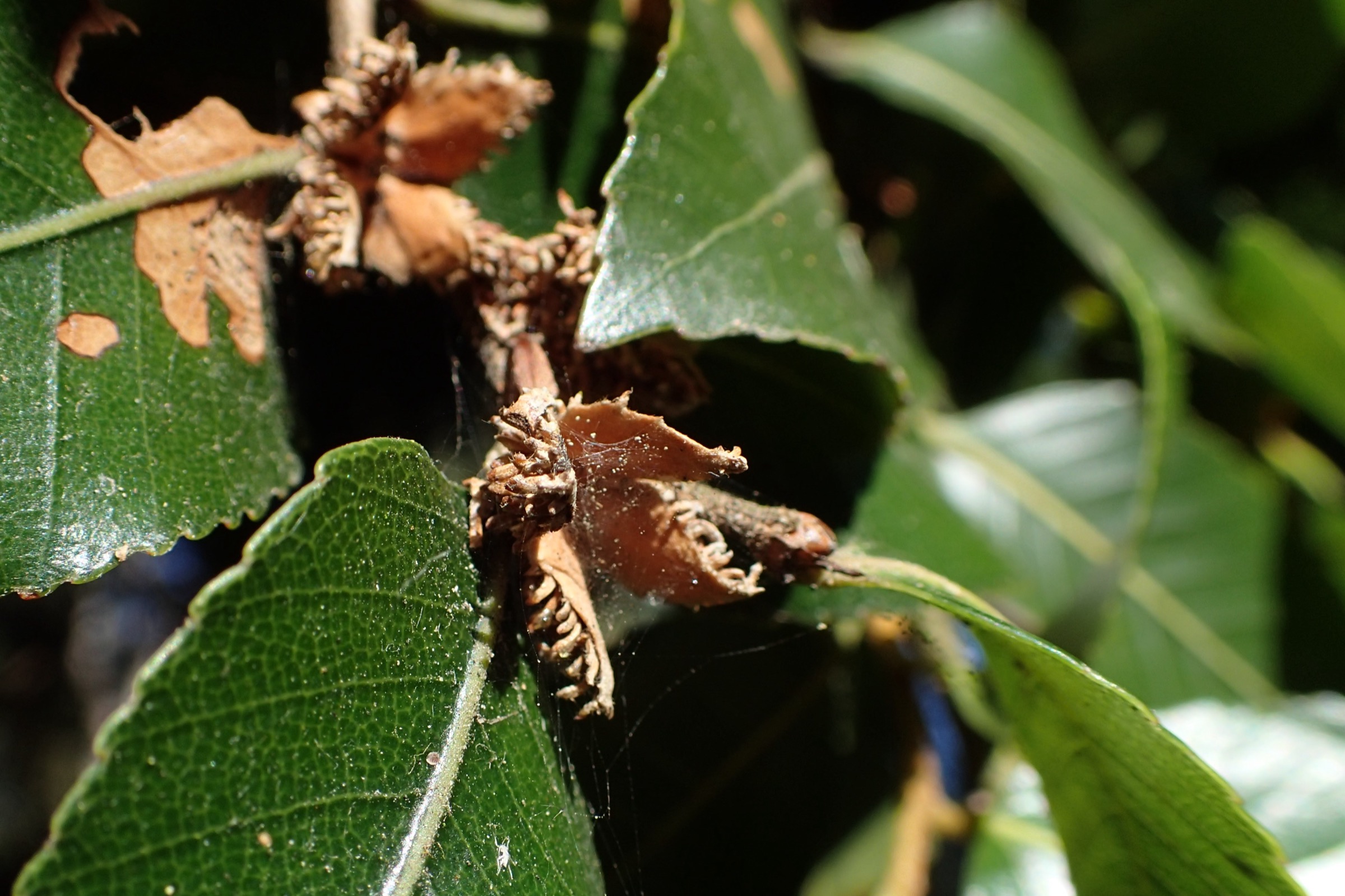
The route follows the Border Track from the Binna Burra upper day-use area for 1.9 km through subtropical rainforest and strangler fig country, then branches right onto the Tullawallal Circuit. A short side-track climbs to the Tullawallal summit (about 947 m), where a compact stand of Antarctic beech (Nothofagus moorei) marks the northernmost occurrence of the species in Australia and one of the surviving links to Gondwana’s cool-temperate rainforests. The circuit returns via a parallel forested spur to rejoin the Border Track and drops back to the trailhead.
Why it is essential
Tullawallal is the short walk that shows the Binna Burra plateau’s most important habitat transition — from warm subtropical vine forest at the trailhead to cool-temperate Antarctic beech on the summit — in about two hours, and it is the closest most day visitors will come to Gondwanan beech forest without committing to the long Coomera or Toolona circuits.
Hazards and notes
- Roots and boardwalk are slippery when wet or after frost.
- Leeches after wet weather; ticks in warm months.
- The summit stand is a fragile relict — stay on the formed track and do not scramble on the beech roots.
- Sign the trailhead intentions book.
GPX / KML links
| Source | URL | Format | Notes |
|---|---|---|---|
| QPWS — Tullawallal circuit | parks.qld.gov.au | Official park page | No GPX published on the official page in this pass |
| QPWS — Binna Burra map (PDF) | parks.des.qld.gov.au | Official PDF map | QPWS terms |
| Trail Hiking Australia — Tullawallal Circuit | trailhiking.com.au | Third-party route page with stats | Secondary reference |
Further reading
5. Pinnacle Walk and Lookout
Snapshot
Itinerary
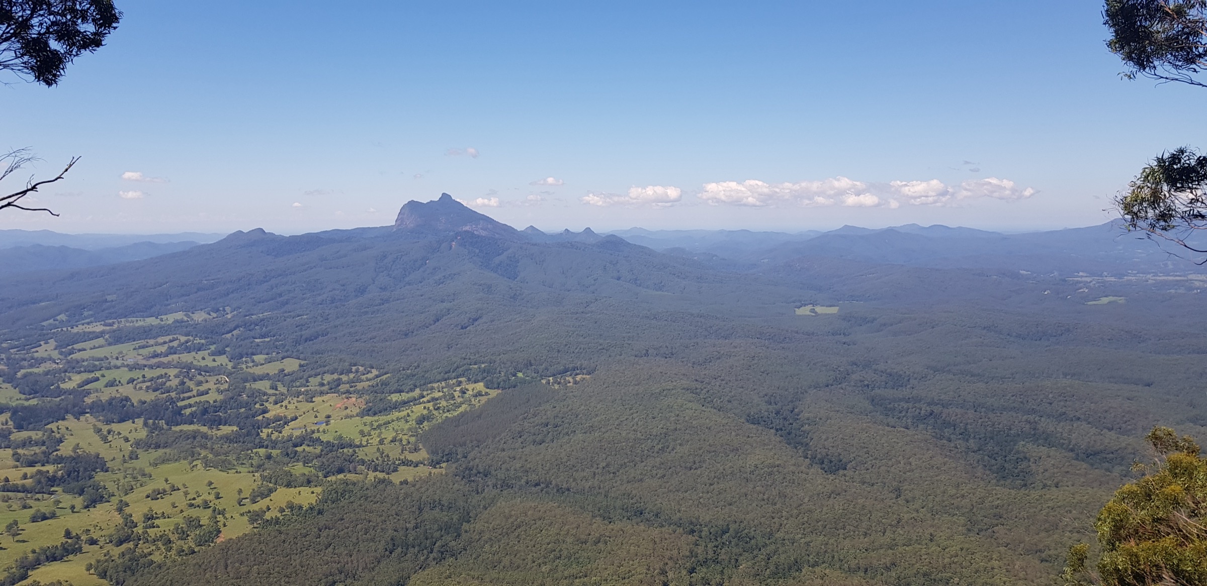
The short walk leaves the Pinnacle Road car park on a 1 m wide hard-packed track through subtropical rainforest, climbs a short flight of concrete steps and reaches a purpose-built platform on the very edge of the Tweed Caldera escarpment. From the platform the view opens 360° across the whole Tweed Valley, taking in Wollumbin (Mount Warning) directly to the east and the McPherson Range circling round to the Lamington plateau in the north. Return by the same track.
Why it is essential
The Pinnacle is the defining caldera-rim view of the Border Ranges — the walk that puts the whole eroded Tweed Volcano in a single frame, with Wollumbin as its central plug. It complements the four Lamington rainforest circuits by giving the reciprocal view: the same landscape seen from the NSW side of the McPherson Range.
Hazards and notes
- The gravel Tweed Range Scenic Drive is flood-prone from December to May and can be slippery in patches; check NPWS alerts before travel.
- Stay behind the platform rail; the escarpment drop is unfenced beyond it.
- Border Ranges NP is subject to fire closures in high-danger weather.
- Dogs are not permitted.
GPX / KML links
| Source | URL | Format | Notes |
|---|---|---|---|
| NPWS — Pinnacle walk and lookout | nationalparks.nsw.gov.au | Official park page | No GPX published on the official page in this pass |
| Trail Hiking Australia — Pinnacle Walk and Lookout | trailhiking.com.au | Third-party route page with stats | Secondary reference |
Further reading
Missing data
- Elevation gain, loss and maximum elevation for the Lamington circuits are not published by QPWS on the current park pages; the values quoted come from Trail Hiking Australia (Toolona, Box Forest, Coomera, Tullawallal) or Aussie Bushwalking (Box Forest) as secondary references and should be treated as approximate.
- Box Forest total ascent varies between sources (585 m per Trail Hiking Australia versus 378 m per Aussie Bushwalking); the higher figure treats the O’Reilly’s-to-loop link as part of the walk, the lower treats the circuit alone.
- No open-licence GPX or KML files were located for any of the five walks on the official QPWS or NPWS pages in this pass. Route geometry should be redrawn from OSM or the official QPWS/NPWS PDFs rather than reused from third-party sources.
- QPWS park pages (parks.qld.gov.au / parks.des.qld.gov.au) block automated fetching; times, distances and closures should be reconfirmed in a browser before travel.
Verification status
- Toolona Creek Circuit — Route verified against QPWS and Trail Hiking Australia; media verified via Wikimedia Commons.
- Box Forest Circuit — Route verified against QPWS, Trail Hiking Australia and Aussie Bushwalking; media verified via Wikimedia Commons.
- Coomera Circuit — Route verified against QPWS, Trail Hiking Australia and Aussie Bushwalking; media verified via Wikimedia Commons.
- Tullawallal Circuit — Route verified against QPWS and Trail Hiking Australia; media verified via Wikimedia Commons (species-representative image from a European stand of the same species — noted in the figcaption).
- Pinnacle Walk and Lookout — Route verified against NPWS and Trail Hiking Australia; media verified via Wikimedia Commons.
Further reading
Nearby Great Dividing Range guides on Storm
- ACT, Namadgi and the Brindabella Ranges
- Atherton Tablelands / Cairns Highlands
- Barrington Tops
- Blue Mountains
- QPWS — Green Mountains section
- QPWS — Binna Burra section
- NPWS — Border Ranges National Park
- Gondwana Rainforests of Australia World Heritage Area
- Wikipedia — Lamington National Park
- Wikipedia — Border Ranges National Park