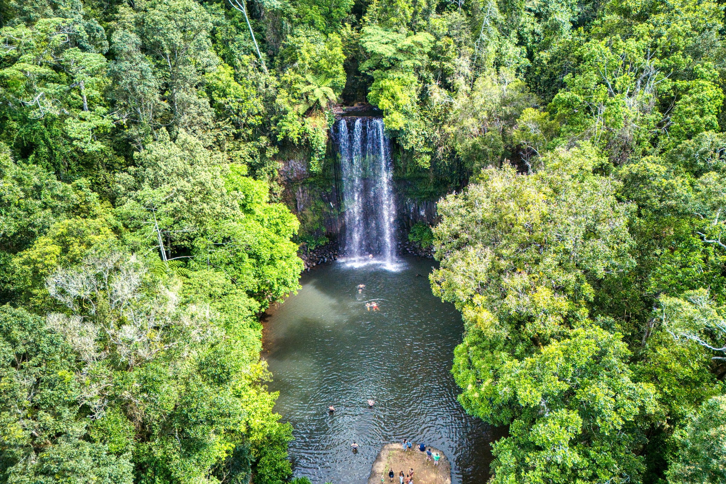
Regional overview
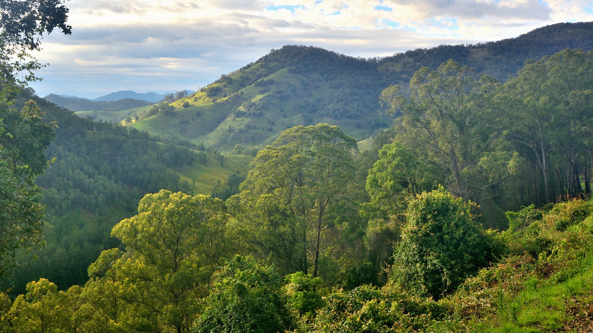
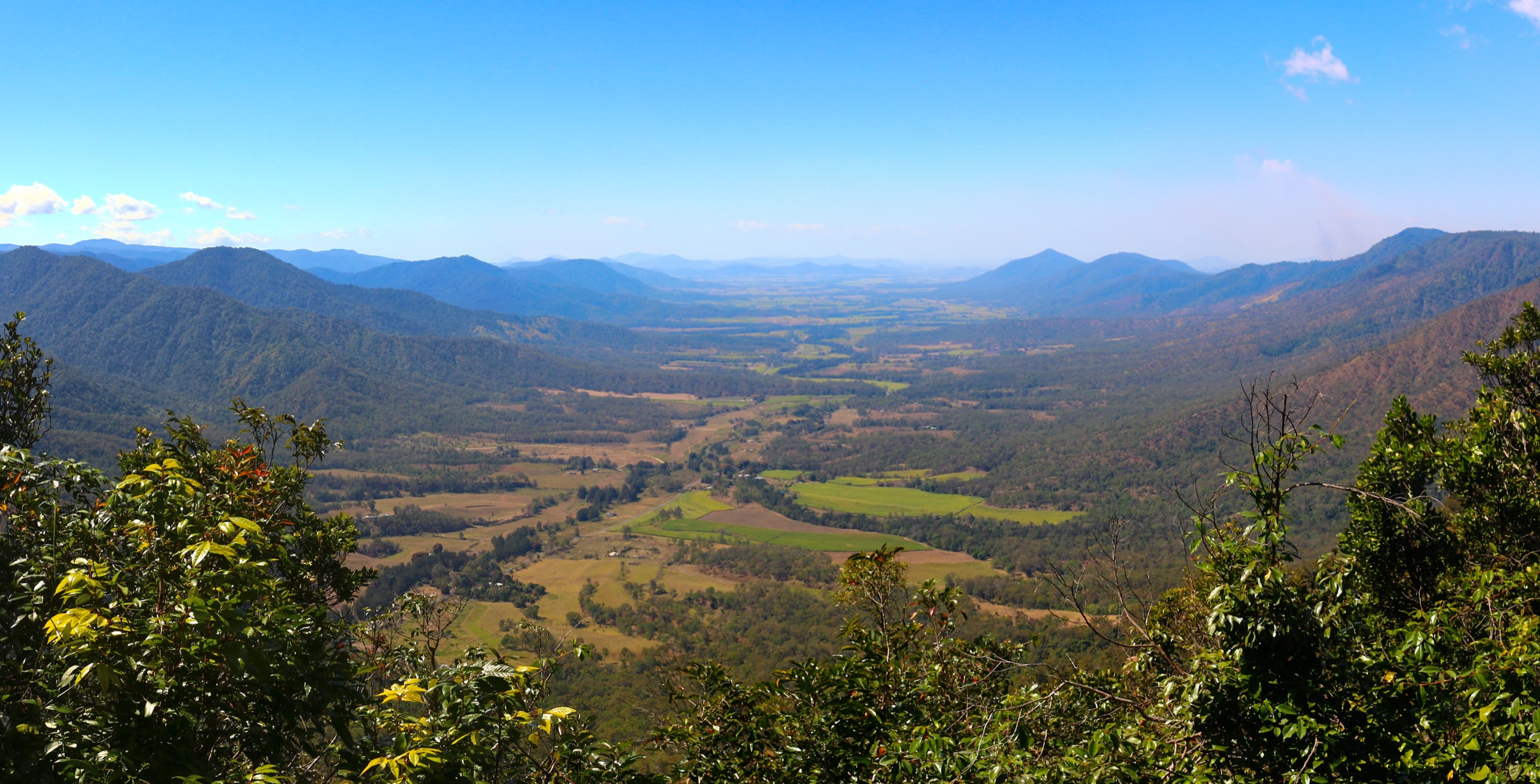
The Atherton Tablelands sit between 700 m and 1,200 m on the volcanic plateau immediately west of Cairns, forming the highland core of the Wet Tropics of Queensland World Heritage Area. The plateau is bounded to the east by the Bellenden Ker Range — home to Mount Bartle Frere (1,622 m), Queensland’s highest peak — and to the west by the drier ridges falling toward the Herbert River headwaters. Basalt from the youngest phase of volcanism (about 10,000 to 20,000 years ago) produced the Crater Lakes district around Yungaburra: Lake Eacham (Yidyam) and Lake Barrine, both maar craters filled by rain and groundwater, and the vertical explosion pipe at Mount Hypipamee. The three main highland national parks — Wooroonooran, Crater Lakes and Palmerston — together protect the largest expanse of intact upland tropical rainforest on the Australian continent.
The plateau’s Traditional Owners are the Ngadjon-Jii people through the crater-lake country and much of the eastern escarpment, the Yidinji people around Lake Barrine and the eastern rim, the Mamu people through the Palmerston corridor south to the Johnstone River, and the Dyirbal / Jirrbal peoples on the higher southern country. Ngadjon-Jii names — including Yidyam for Lake Eacham and Barany for Lake Barrine — are used consistently on Queensland Parks and Wildlife Service (QPWS) interpretation. The Wet Tropics is one of Australia’s oldest continuously occupied rainforest cultural landscapes, and Ngadjon-Jii oral history describes the volcanic maar-forming events, giving the region an unusually deep documented human-geological memory.
The reliable walking season is May to October: cool mornings on the plateau, dry tracks and safe creek crossings on the escarpment routes. The wet season (November to April) brings cyclone risk, extended track closures, road washouts, high leech loads and dangerous flash floods on the escarpment gorges. Access is by sealed road from Cairns via either the Kuranda Range (Kennedy Highway) or the Gillies Range (Gillies Highway) — both are steep, winding and slower than map distance suggests. Yungaburra and Malanda are the main plateau walking bases; Josephine Falls is the sealed trailhead for Bartle Frere on the eastern side. There is no scheduled public transport to any of the trailheads listed below — a hire vehicle or organised tour is required from Cairns.
Selection rationale
The five walks are chosen to cover the ecological, geological and difficulty spectrum of the plateau. Lake Eacham and Mount Hypipamee together are the definitive Crater Lakes walks and give the article its volcanic-geology thread. The Waterfall Circuit at Millaa Millaa is the region’s most iconic scenic drive-and-walk combination and covers the plateau’s headline waterfalls in a compact loop. Nandroya Falls in Palmerston National Park is the standard escarpment rainforest walk on the descent to the Johnstone River. Mount Bartle Frere is the definitive strenuous route — Queensland’s highest summit — and gives the article its serious mountain day. Between the five, the article covers crater lake, volcanic pipe, plateau waterfall, escarpment rainforest and coastal-range summit — each of the plateau’s five signature landscape types.
Summary table
| # | Hike | Country | Route type | Distance | Gain | Max elevation | Difficulty |
|---|---|---|---|---|---|---|---|
| 1 | Lake Eacham (Yidyam) Circuit | Australia | Loop | ~3.0 km | ~30 m | ~750 m | Grade 2 (QPWS) |
| 2 | Mount Hypipamee Crater and Dinner Falls Circuit | Australia | Lollipop | ~1.2 km | ~50 m | ~1,000 m | Grade 2 (QPWS) |
| 3 | Waterfall Circuit — Millaa Millaa, Zillie and Ellinjaa | Australia | Short walks with drive linkages | ~1.5 km on foot | ~80 m combined | ~800 m | Grade 2 (QPWS) |
| 4 | Nandroya Falls Circuit, Palmerston | Australia | Loop | ~6.6 km | ~250 m | ~380 m | Grade 3 (QPWS) |
| 5 | Mount Bartle Frere summit via Josephine Falls | Australia | Out-and-back | ~15 km | ~1,500 m | 1,622 m | Grade 5 (QPWS) |
1. Lake Eacham (Yidyam) Circuit
Snapshot
Itinerary
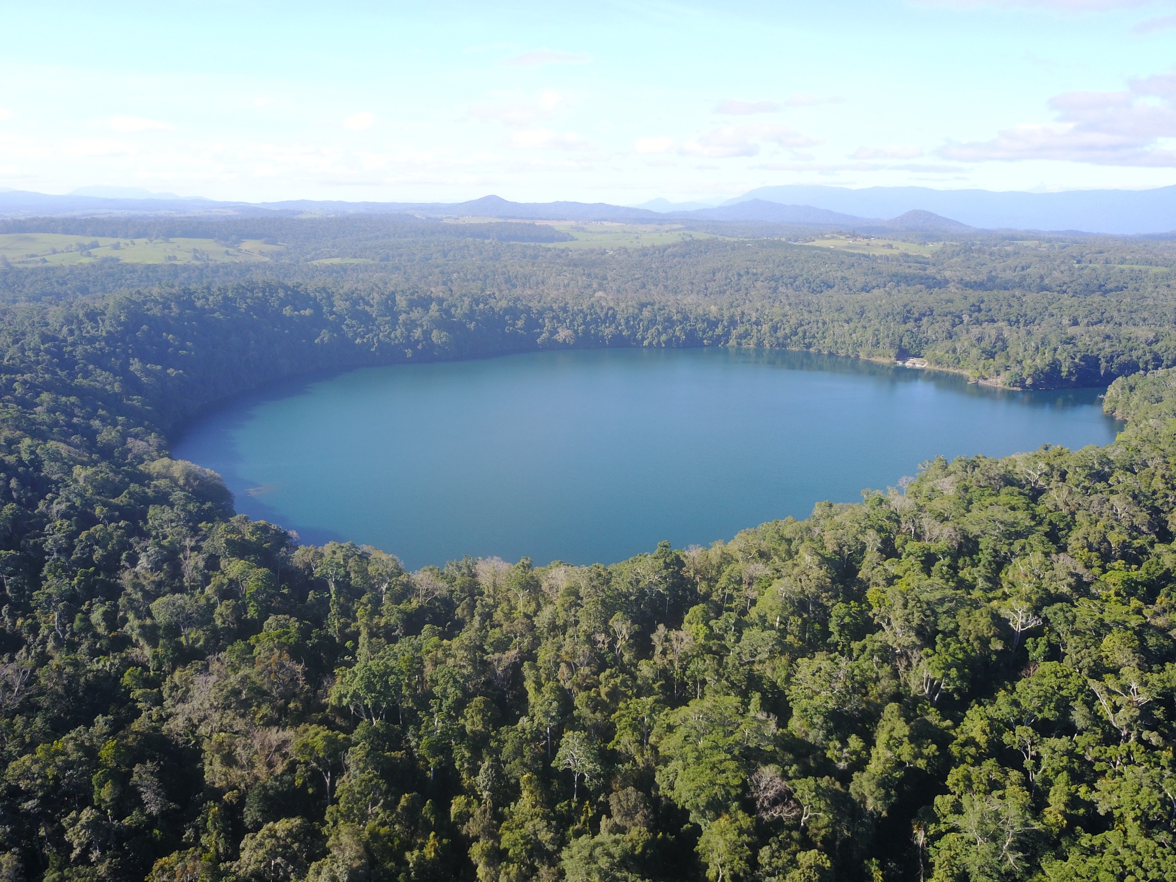
The Lake Eacham day-use area sits on the northern shore, with a large picnic ground, kiosk, boat ramp and a signposted trailhead at the western end of the lawns. The lake circuit follows a level, well-formed rainforest track around the rim, threading between buttressed strangler figs, umbrella trees and dense understorey. The track passes small clearings at Kauri Point and the eastern jetty before rejoining the day-use area. Interpretive signage covers the maar volcanism that created the crater and the Ngadjon-Jii oral tradition of the volcanic events. Swimming is permitted from the eastern jetty and day-use lawns and is a highlight of the circuit in warm weather; wild saw-shelled turtles and eels are commonly seen in the shallows.
Why it is essential
Lake Eacham is the most accessible of the plateau’s crater lakes and the signature Ngadjon-Jii cultural site of the region. The loop is short, level and rainforest-immersive, and it pairs naturally with Mount Hypipamee as a full “volcanic day” out of Yungaburra.
Equipment
- Trail runners or light walking shoes
- Swimwear and quick-dry towel
- Insect repellent
- Rain shell
- 1 L water
- Binoculars for canopy birds (Victoria’s riflebird and spotted catbird are common)
Hazards and notes
- Track is slippery after rain — the tread is basalt clay in places.
- Leeches active November to April.
- No lifeguards; supervise children in the water.
- Do not feed the wildlife — musky rat-kangaroos have become habituated at the day-use area.
- Watch for freshwater turtles at the swimming point; do not attempt to catch or handle them.
GPX / route file
| Source | URL | Format | Notes |
|---|---|---|---|
| QPWS — Crater Lakes National Park | parks.qld.gov.au | Web page | Official route source; Lake Eacham map PDF available |
Sources
2. Mount Hypipamee Crater and Dinner Falls Circuit
Snapshot
Itinerary
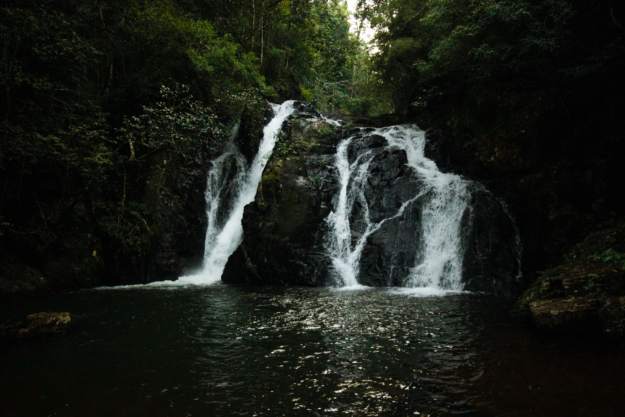
The Mount Hypipamee day-use area is a small clearing on the Kennedy Highway with picnic tables and a signposted trailhead. The main spur climbs gently through cool upland rainforest — mossy trunks, tree ferns and abundant epiphytes — to a fenced viewing platform at the lip of the Mount Hypipamee crater, a near-vertical volcanic pipe some 138 m across and about 82 m deep, its floor a stagnant green pool covered in duckweed. The vent is unusual in that it appears to have been formed by a single explosive gas eruption rather than by lava emission. From the crater platform, a short loop returns via Dinner Falls, a two-tiered fall on the very uppermost reach of the Barron River. The lower pool is a permitted swimming site in the dry season and is one of the few genuinely cold swims in the Wet Tropics.
Why it is essential
Mount Hypipamee is the plateau’s most extraordinary single geological feature and pairs a rare tropical explosion crater with a cold, clear rainforest fall on the Barron headwaters. The walk is short but the site’s geological and ecological interest is disproportionate.
Equipment
- Trail runners
- Warm layer (the site is often 10 °C cooler than Cairns)
- Rain shell (frequent afternoon rain year-round)
- Swimwear if visiting Dinner Falls
- Insect repellent
- 1 L water
Hazards and notes
- Crater viewing platform is fenced but the rim beyond is unfenced — keep children back.
- Dinner Falls lower pool is very cold and deep; swim from the platform side only.
- Slippery basalt clay on the return loop after rain.
- Highland site — sudden mist and rain can close visibility on the highway drive.
- Do not throw objects into the crater — it is a scientifically significant limnological site.
GPX / route file
| Source | URL | Format | Notes |
|---|---|---|---|
| QPWS — Mount Hypipamee National Park | parks.qld.gov.au | Web page | Official route source |
Sources
- QPWS Mount Hypipamee National Park — journeys
- Wikimedia Commons — Dinner Falls
- Wikipedia — Mount Hypipamee National Park
3. Waterfall Circuit — Millaa Millaa, Zillie and Ellinjaa
Snapshot
Itinerary
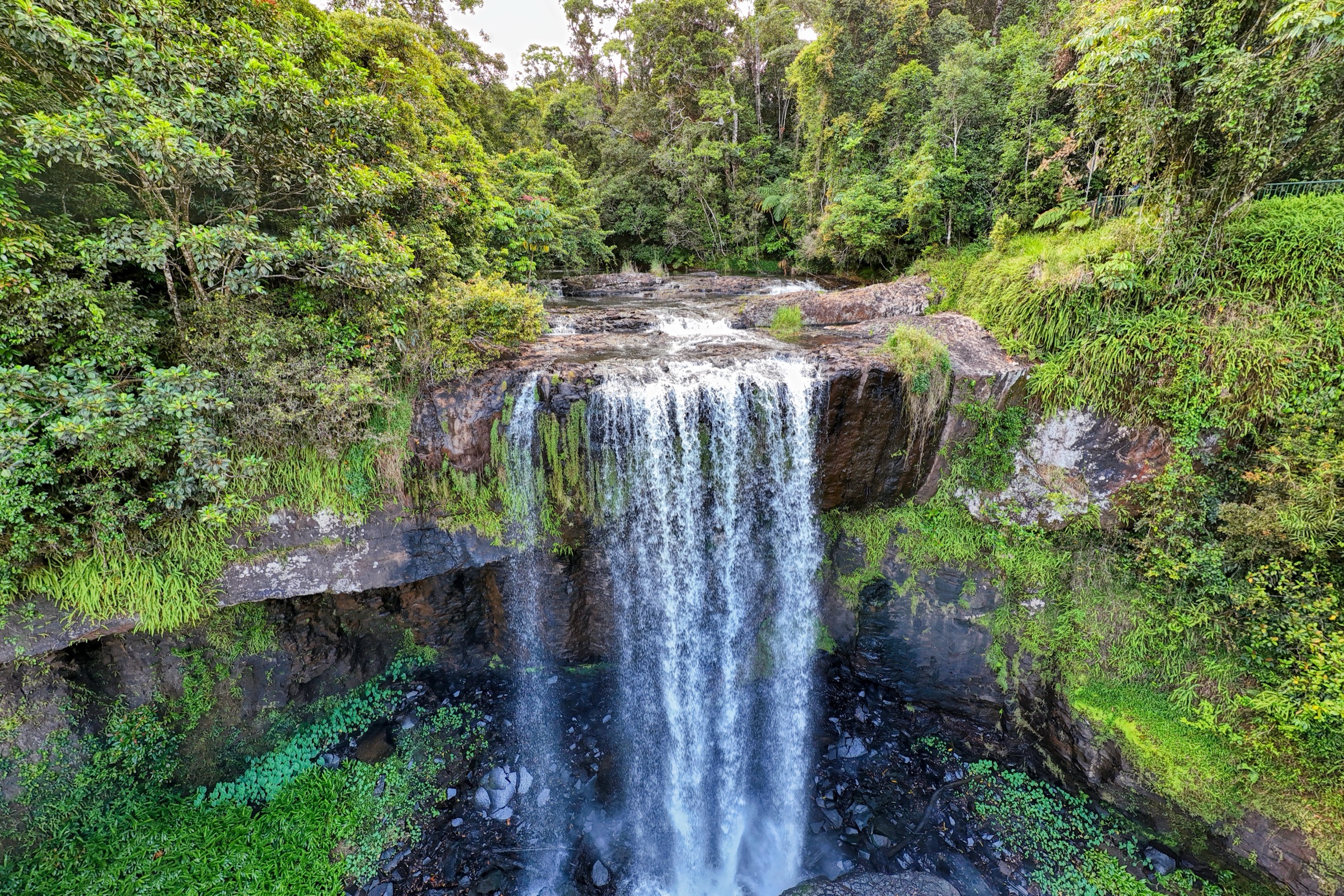
The Waterfall Circuit begins at Millaa Millaa Falls, on Theresa Creek Road 1.5 km north-west of Millaa Millaa township. The Millaa Millaa car park has a picnic ground, kiosk and a signposted 400 m return path down to a fenced viewing platform at the base of the fall — a symmetrical 18 m single-drop plunge into a rounded amphitheatre pool that is the most photographed waterfall in Queensland. Swimming is permitted from the beach at the base. From Millaa Millaa the drive continues 6.5 km north on Theresa Creek Road to Zillie Falls, where a short signposted spur gives a top-of-falls view over Zillie Creek plunging into a fern-lined amphitheatre. A further 6 km brings the drive to Ellinjaa Falls, where a 600 m return track descends steeply through rainforest to the base of a broad columnar-basalt fall on Ellinjaa Creek. The drive closes the loop back to Millaa Millaa on Palmerston Highway.
Why it is essential
The three-falls circuit is the classic scenic-drive walk of the Atherton Tablelands and covers the plateau’s headline waterfall types in a single compact loop. Each fall is short, distinct and photogenic, and together they give a full survey of plateau-edge waterfall geomorphology on the basalt.
Equipment
- Trail runners
- Swimwear and quick-dry towel for Millaa Millaa
- Rain shell
- 1 L water and snacks
- Insect repellent
- Camera with polarising filter if available
Hazards and notes
- Millaa Millaa pool is deep and cold; do not jump from the cliffs.
- Ellinjaa descent has slippery basalt steps — take care in wet weather.
- Zillie Falls lookout is a top-of-falls view only; the base is not accessible.
- Do not stand under overhanging basalt columns at Ellinjaa; occasional rockfall.
- The drive linkages are narrow rural roads with wet-weather flooding risk.
GPX / route file
| Source | URL | Format | Notes |
|---|---|---|---|
| QPWS — Palmerston / Wooroonooran walks | parks.qld.gov.au | Web page | Official route source for adjoining park walks |
| Tropical Tablelands tourism — Waterfall Circuit | athertontablelands.com.au | Web page | Drive-loop description |
Sources
- QPWS Wooroonooran National Park — journeys
- Wikimedia Commons — Zillie Falls, October 2024
- Wikimedia Commons — Millaa Millaa Falls, October 2024
- Wikipedia — Millaa Millaa Falls
4. Nandroya Falls Circuit, Palmerston
Photo status: No licence-compatible Nandroya Falls image located in this pass.
Snapshot
Itinerary
The Henrietta Creek day-use and camping area sits on the Palmerston Highway near the eastern edge of the Wooroonooran section. The Nandroya Circuit leaves the day-use area through complex mesophyll vine forest with strangler figs, buttressed trees and heavy epiphyte load, dropping gently to a bridge over Henrietta Creek. The signposted circuit runs anti-clockwise through a mature Palmerston rainforest to a signed junction at approximately 2.5 km, where a short spur descends to the base of Nandroya Falls — a two-tier plunge into a large pool that is the standard swimming point on the walk. The main loop continues over a series of small ridge crossings before returning via the upper Douglas Creek Falls option (an added 600 m spur) to the day-use area. The whole circuit is under continuous canopy and is a good survey of the classic Palmerston rainforest structure.
Why it is essential
Nandroya is the definitive Palmerston rainforest walk and the most accessible day-length loop in Wooroonooran. It gives the article a genuine escarpment-rainforest character that Lake Eacham, Mount Hypipamee and Millaa Millaa cannot supply, and it slots naturally between them and the Bartle Frere summit day.
Equipment
- Sturdy walking shoes with good grip
- Swimwear and quick-dry towel
- Dry-bag for camera and valuables
- Insect repellent (leeches heavy year-round in Palmerston)
- 2 L water
- Rain shell (Palmerston is one of the wettest sections of the Wet Tropics)
- First-aid kit
Hazards and notes
- Slippery basalt boulders and clay tread throughout.
- Flash-flood risk on Henrietta Creek and Douglas Creek after rain — do not attempt crossings in fast water.
- Leech activity heavy year-round; the wet season adds ticks.
- No phone signal in the Palmerston corridor.
- Do not swim after heavy rain or when the pool is discoloured.
GPX / route file
| Source | URL | Format | Notes |
|---|---|---|---|
| QPWS — Wooroonooran National Park (Palmerston section) | parks.qld.gov.au | Web page | Official route source; Henrietta Creek area map PDF |
Sources
5. Mount Bartle Frere summit via Josephine Falls
Snapshot
Itinerary
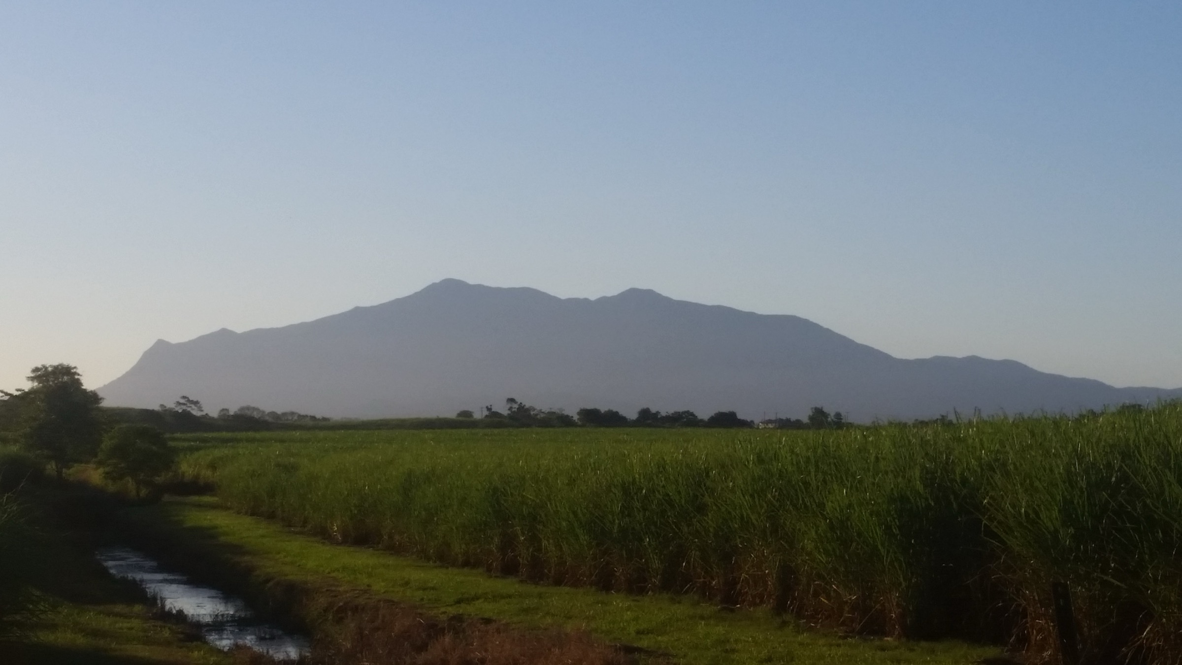
The Josephine Falls car park is at the end of a short sealed road off the Bruce Highway. The Bartle Frere trailhead is a signposted junction 200 m along the Josephine Falls access track. The route climbs steeply and continuously through lowland tropical rainforest — buttressed trees, palms and heavy epiphytes — with the tread often muddy and rough. The Big Rock camping site at approximately 6 km (roughly 900 m elevation) is the standard overnight bivouac and the point at which most parties assess whether to continue. Above Big Rock the track becomes a boulder-hop through progressively stunted montane forest, then dwarf cloud forest above about 1,400 m. The final approach to the south peak crosses open boulder fields with significant exposure in wet or windy conditions; the summit itself is a small platform at 1,622 m with panoramic views (weather permitting) across the Bellenden Ker Range and out to the Coral Sea. Return is on the same line — the descent is knee-punishing and typically slower than the ascent.
Why it is essential
Bartle Frere is Queensland’s highest peak and the definitive strenuous day-hike in the Wet Tropics. The route covers the full rainforest altitudinal transect from lowland mesophyll to cloud-forest summit and is the only walk in the region that puts a fit party genuinely into alpine-analogue Australian montane vegetation. It is the mountain day the article requires.
Equipment
- Sturdy boots with good grip (muddy rooty tread throughout)
- Trekking poles strongly recommended
- 3–4 L water — no reliable clean source above Big Rock
- Warm layer and full waterproof shell for the summit
- Long sleeves and long pants (stinging tree, cutting grass, leech and tick load)
- Gaiters
- Headtorch with spare batteries — the day is long and the descent often runs into dark
- Personal Locator Beacon (PLB) or satellite messenger
- Topographic map plus GPS with the route pre-loaded
- First-aid kit including snake-bite bandage
- Emergency shelter (bivvy bag) for a possible unplanned overnight
Hazards and notes
- Grade 5 walk — QPWS recommends this route only for highly experienced parties.
- Weather changes rapidly; the summit is cloud-shrouded most days and can be dangerous in wind or rain.
- Boulder fields near the summit are slippery in wet weather; exposed steps have serious consequence.
- Stinging tree (Dendrocnide) grows along the track — avoid brushing broad-leaved shrubs.
- Ticks and leeches heavy year-round.
- No phone signal above the trailhead — carry a PLB.
- Deaths and rescues have occurred on this route; do not attempt if fitness or weather are marginal.
- Josephine Falls itself is a fatal-drowning site — swim only from the fenced signed pool.
GPX / route file
| Source | URL | Format | Notes |
|---|---|---|---|
| QPWS — Wooroonooran National Park (Bartle Frere trail) | parks.qld.gov.au | Web page | Official route source; Bartle Frere trail map PDF |
| QPWS — park alerts | parks.qld.gov.au | Web page | Check for closures before travel |
Sources
- QPWS Wooroonooran National Park — journeys
- Wikimedia Commons — Silhouette of Mount Bartle Frere from Sundown
- Wikipedia — Mount Bartle Frere
Region-level sources
| Source | URL |
|---|---|
| QPWS Crater Lakes National Park | parks.qld.gov.au |
| QPWS Mount Hypipamee National Park | parks.qld.gov.au |
| QPWS Wooroonooran National Park | parks.qld.gov.au |
| QPWS park alerts | parks.qld.gov.au |
| Wet Tropics Management Authority | wettropics.gov.au |
| Tropical Tablelands tourism | athertontablelands.com.au |
| Wikipedia — Atherton Tableland | en.wikipedia.org |
| Wikipedia — Wooroonooran National Park | en.wikipedia.org |
| Wikipedia — Mount Bartle Frere | en.wikipedia.org |
Further reading
Nearby Great Dividing Range guides on Storm
- ACT, Namadgi and the Brindabella Ranges
- Barrington Tops
- Blue Mountains
- Bunya Mountains / South Burnett
- QPWS Wooroonooran National Park — about
- Wikipedia — Ngadjon-Jii people
- Wikipedia — Mamu people
Missing data / follow-up work
- No licence-compatible photograph of Nandroya Falls was located in this pass; a future upload from Flickr Creative Commons or a fresh field photograph is the natural fix.
- QPWS does not publish direct GPX or KML downloads for any of the walks listed above. All route files are official web-page or PDF sources.
- Precise trailhead coordinates for Henrietta Creek, Josephine Falls and the three Waterfall Circuit stops are shown only on QPWS short-walk PDF maps; extract before publishing a machine-readable route database.
- Cyclone-driven wet-season closures of the Palmerston Highway and the Bartle Frere trail can affect access at short notice — confirm current park alerts before travel.
- The distinction between the eastern (Josephine Falls) and western (Broken Nose, Lamins Hill) Bartle Frere approaches, and the through-traverse option, is worth a dedicated technical note in a future update.