Regional overview
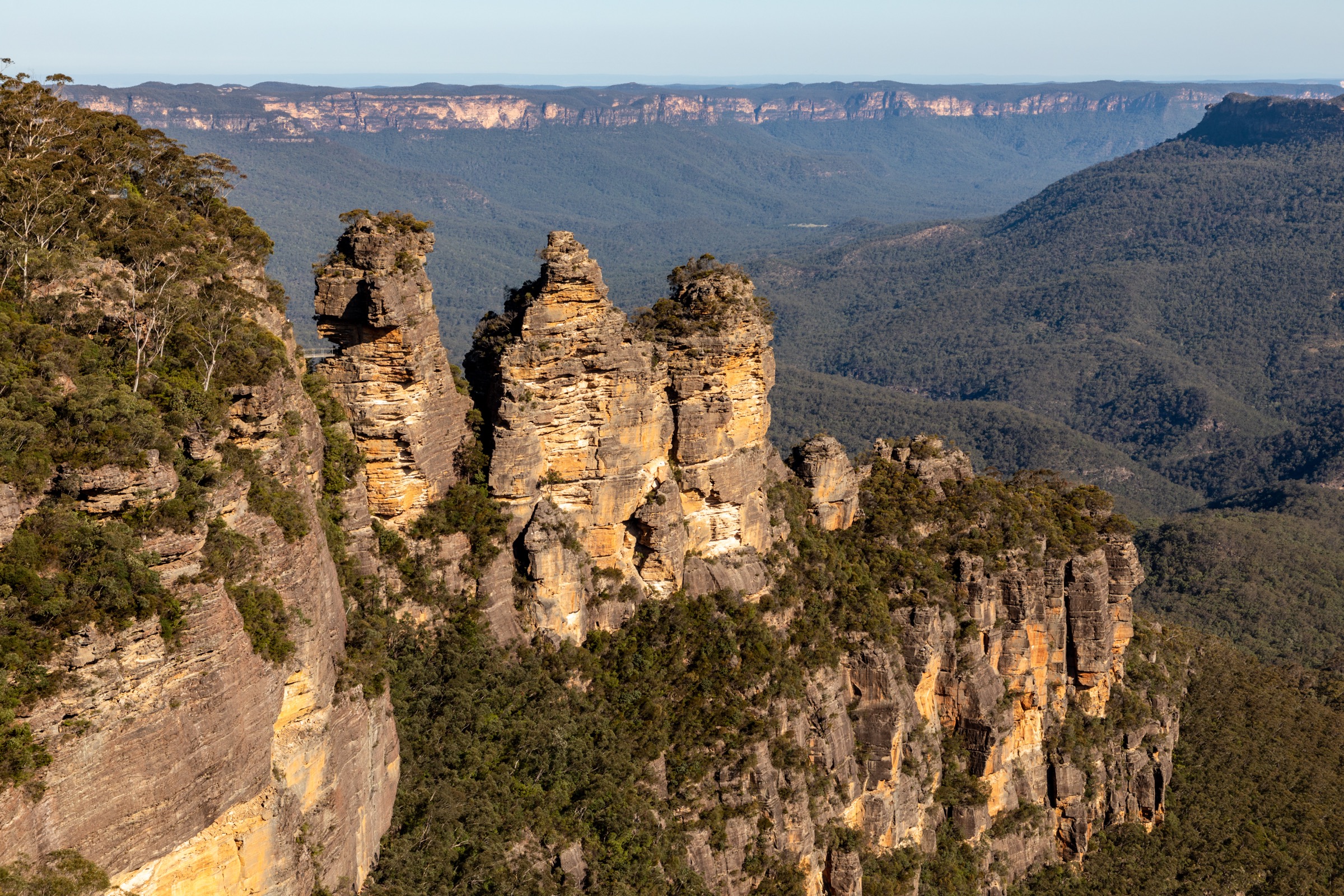
The Blue Mountains rise on the eastern edge of the Great Dividing Range about 60 km west of Sydney, forming a sandstone plateau at 700–1,100 m dissected by a network of deep canyons — the Grose, Jamison, Megalong and Kanangra valleys — with cliff lines that in places drop more than 400 m in a single step. Blue Mountains National Park protects roughly 267,000 hectares of this landscape and forms the central block of the Greater Blue Mountains World Heritage Area, inscribed by UNESCO in 2000 for its exceptional eucalypt diversity and near-continuous unbroken sandstone escarpment. The plateau is Darug Country to the east and Gundungurra Country to the west and south, and the two nations have deep and continuing connections to these ridgelines, waterways and rock-shelter sites.
The main walking centres run along the Great Western Highway between Wentworth Falls, Katoomba, Leura and Blackheath, all reached by train from Sydney Central on the Blue Mountains line and served by frequent NPWS-signposted trailheads within walking distance of the stations. Most of the classic day-walks are variations on the same pattern: a descent from the escarpment on a historic hand-cut stone stairway, a valley or canyon-floor section beside a creek or beneath waterfalls, and a stiff climb back to the rim. Distances are modest by mountain standards — typically 5 to 12 km — but cumulative elevation change is significant and the return climbs on hot days are the most common cause of rescues.
The season is effectively year-round. Temperate autumn and spring (March to May, September to November) give the most reliable conditions; winter (June to August) is cool, often frosty on the plateau, and canyon shadows can hold overnight ice. Summer walking is possible but the plateau records total-fire-ban days most years, storms can develop rapidly on the escarpment, and canyons should never be entered before, during or after heavy rain because of flash-flood risk. Cliff exposure is a constant theme: NSW Ambulance and Police Rescue attend serious falls in the park every year, and NPWS lookouts are frequently unfenced beyond the built platforms. Personal Locator Beacons are strongly recommended in the Grose Valley and on any long valley-floor descent, and hikers should treat published times as the minimum for a fit party.
Selection rationale
The five walks are chosen to give a spread across the Blue Mountains’ signature landscape types — a slot canyon (Grand Canyon), a cliff-cut waterfall route (Wentworth Pass / National Pass), a long valley descent to an iconic ridge feature (Ruined Castle), a Grose Valley classic to the eucalypt cathedral of Blue Gum Forest (Perry’s Lookdown), and the plateau clifftop viewpoint circuit at the heart of the region (Prince Henry Cliff Walk with the Three Sisters at Echo Point). All are on NPWS-signposted tracks and all sit within 30 km of one another, so a two- or three-day visit can reasonably link them by train and short drives. National Pass itself is currently closed between Valley of the Waters and Slacks Stairs due to rockfall, so the Wentworth Falls entry describes the practical Wentworth Pass loop that hikers now use to cover the same escarpment. Mount Solitary and the Grand Cliff Top Walk multi-day route were considered but sit outside the day-hike envelope for most parties.
Summary table
| # | Hike | Country | Route type | Distance | Gain | Max elevation | Difficulty |
|---|---|---|---|---|---|---|---|
| 1 | Grand Canyon Track (Blackheath) | Australia | Loop | ~6.3 km | ~250–300 m | ~1,050 m | Grade 3 (AWTGS) |
| 2 | Wentworth Pass loop (Wentworth Falls) | Australia | Loop | ~5 km | ~300 m | ~870 m | Grade 4 (AWTGS) |
| 3 | Ruined Castle from Golden Stairs | Australia | Out-and-back | ~6.6–8.5 km | ~350–500 m | ~1,000 m | Grade 4 (AWTGS) |
| 4 | Perry’s Lookdown to Blue Gum Forest | Australia | Out-and-back | ~6.4 km | ~600 m | ~1,010 m | Grade 4 (AWTGS) |
| 5 | Prince Henry Cliff Walk (Katoomba to Leura) | Australia | Point-to-point | ~7 km | ~200 m | ~1,020 m | Grade 3 (AWTGS) |
1. Grand Canyon Track (Blackheath)
Snapshot
Itinerary
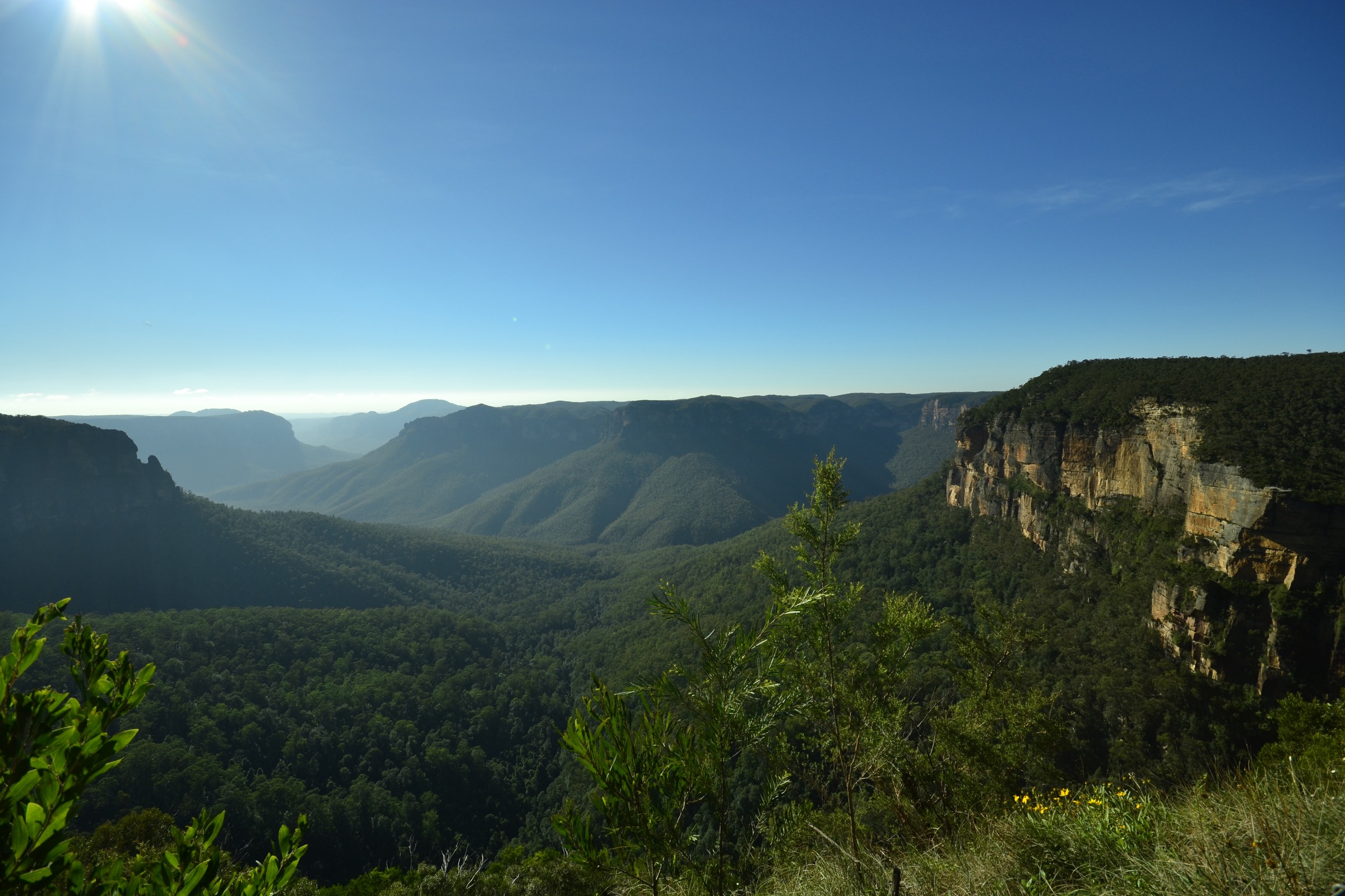
The loop leaves the Grand Canyon car park on Evans Lookout Road and drops immediately through Neates Glen on a stone-cut stairway into the head of Greaves Creek. The track descends steadily through subtropical rainforest of coachwood, sassafras and tree ferns, passes beneath overhanging sandstone walls carved into shallow amphitheatres, and crosses the creek several times on stepping stones. About halfway around, the route threads a short sandstone tunnel and continues along a ledge cut into the canyon wall directly beneath a series of trickling waterfalls, including Beauchamp Falls. The path then climbs steadily up Rodriguez Pass onto the Grose Valley rim and finishes at Evans Lookout, which gives an open panorama east down the Grose Valley towards Mount Banks. A signposted 1 km road walk along the fire trail returns to the Grand Canyon car park.
Why it is essential
The Grand Canyon is the accessible flagship of the Blue Mountains’ slot-canyon country and one of the great short walks in the New South Wales park network. It packs a full canyon-floor traverse, a hand-cut historic stairway, tunnels, ledges and waterfalls into a half-day loop that is doable by most fit walkers without any technical canyoning gear.
Equipment
- Sturdy walking shoes with grip on wet sandstone
- Waterproof jacket
- Warm layer (canyon floor stays cool year-round)
- 1.5–2 L of water
- Headtorch (short tunnels; low light in the deepest section)
- Map and GPS
- No swimming or drone use
Hazards and notes
- Do not enter the canyon before, during or after heavy rain — Greaves Creek floods rapidly.
- Stone steps and creek stones are slippery in the wet.
- The return climb up Rodriguez Pass is sustained; pace the descent accordingly.
- Blackheath area closes on total-fire-ban days and during storm alerts — check NPWS.
- Cliff edges above Evans Lookout are unfenced beyond the platform.
- Pit toilet at trailhead only; no water on route.
GPX / route file
| Source | URL | Format | Notes |
|---|---|---|---|
| NPWS — Grand Canyon track | nationalparks.nsw.gov.au | Web page | Official route source; NPWS does not publish a direct GPX download |
| Wildwalks — Grand Canyon Track | wildwalks.com | Web page + map | Route stats cross-check |
| Trail Hiking Australia — Grand Canyon Track | trailhiking.com.au | Web page | Distance and grade cross-check |
Sources
- NPWS — Grand Canyon track
- NPWS — Grand Canyon track, visitor info
- Wildwalks — Grand Canyon Track
- Wikimedia Commons — Evans Lookout, Grand Canyon Track
2. Wentworth Pass loop (Wentworth Falls)
Snapshot
Itinerary
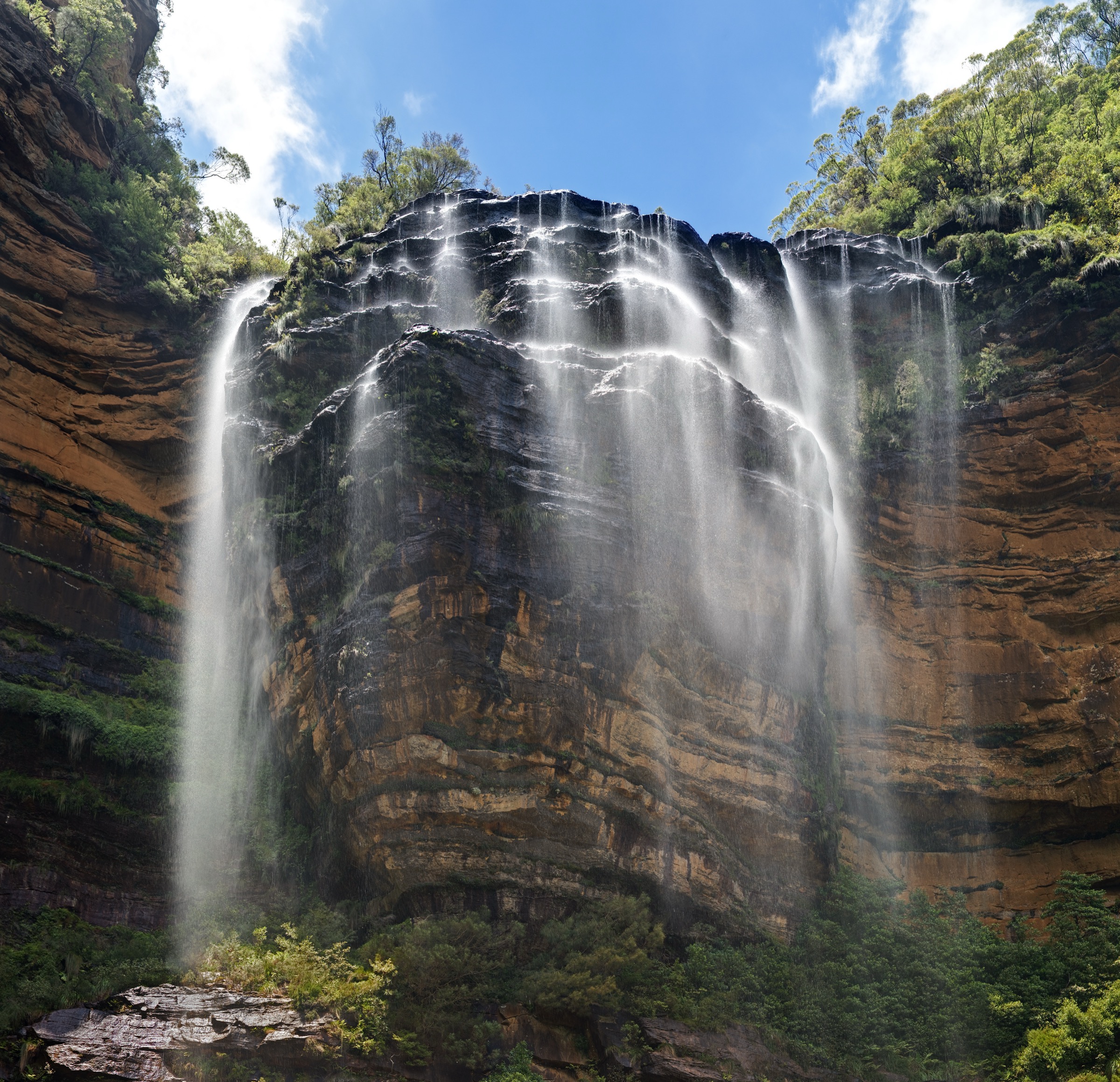
The loop begins at the Wentworth Falls picnic area, crosses Jamison Creek at the top of the falls, and follows the escarpment past Jamison and Fletchers lookouts to the top of the Grand Stairway — a hand-cut sandstone staircase built into the cliff face in the early 1900s. Below the stairway the historic National Pass ledge runs south along the base of the upper cliff line, but the section between Valley of the Waters and Slacks Stairs is currently closed to walkers due to rockfall. The practical loop now descends Slacks Stairs from the west, joins the Wentworth Pass route on the valley floor beside Empress Falls and the Valley of the Waters series of cascades, and climbs back to the plateau via the stepped Empress track to the Conservation Hut. From there the Shortcut Track returns east along the rim to the Wentworth Falls picnic area. Variants that reach the base of Wentworth Falls itself require a there-and-back detour on the Wentworth Falls track from the picnic area.
Why it is essential
The Wentworth Falls escarpment holds one of Australia’s most historic engineered walking routes and threads a chain of major waterfalls — Wentworth, Empress, Sylvia and Lodore — under the plateau rim. The Wentworth Pass loop gives the full character of the National Pass corridor while the classic ledge section is closed for rockfall repairs.
Equipment
- Sturdy boots with grip on wet stone
- Waterproof jacket
- 2 L of water
- Trekking poles useful on the wet, stepped descents
- Headtorch for a late finish
- Map and GPS
- No swimming in the pools above Wentworth Falls (drop-off)
Hazards and notes
- National Pass ledge closure between Valley of the Waters and Slacks Stairs is signposted; do not cross the barriers.
- Steep, wet, stepped sections throughout — surfaces are slippery in rain.
- Cliff-edge exposure above the Grand Stairway; supervise children.
- Section climbs are cumulative; treat this as a hard walk.
- Empress Falls itself is a popular canyoning descent; foot walkers pass along the plateau rim above it.
- Confirm current NPWS alerts before departure.
GPX / route file
| Source | URL | Format | Notes |
|---|---|---|---|
| NPWS — Wentworth Pass loop walking track | nationalparks.nsw.gov.au | Web page | Official route source |
| NPWS — National Pass | nationalparks.nsw.gov.au | Web page | Historic route context; partial closure noted |
| Wildwalks — National Pass walking track | wildwalks.com | Web page + map | Route stats cross-check |
Sources
- NPWS — Wentworth Pass loop walking track
- NPWS — National Pass
- Wildwalks — National Pass walking track
- Wikimedia Commons — Upper Wentworth Falls
3. Ruined Castle from Golden Stairs
Snapshot
Itinerary
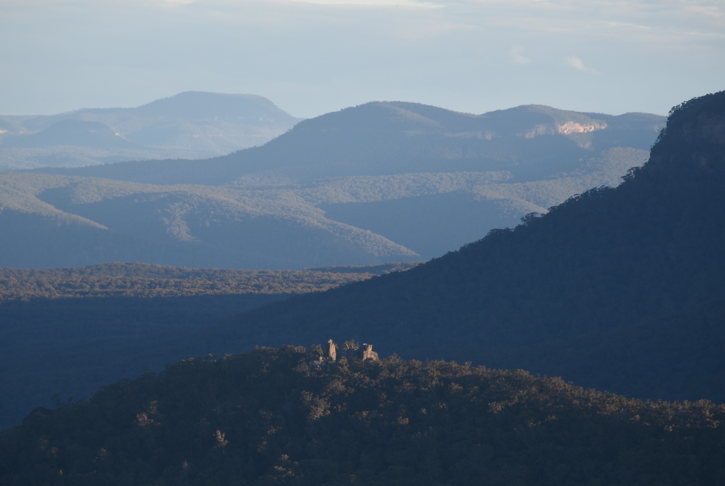
The route drops from the Golden Stairs car park down the Golden Stairs themselves — a steep hand-cut stone stairway built by shale miners in the 1880s — onto the Federal Pass, the historic valley-floor track that runs the length of the Jamison Valley beneath the northern escarpment. From the base of the stairs the Federal Pass turns west and contours through cool rainforest of coachwood and sassafras beneath the Narrow Neck cliffs, passing the tumbled foundations of shale miners’ cottages and occasional old mine cuttings. After roughly 2.5 km the marked side track climbs left onto the Ruined Castle ridge and reaches a saddle beneath the rock formation. A short, rocky scramble up the final tor gives an open 360-degree view over the Jamison Valley to Mount Solitary directly south and to the Three Sisters and Katoomba escarpment across the valley to the north-east. Return is on the same line back to the Golden Stairs; a longer variant continues east along the Federal Pass and ascends via the Scenic Railway or the Furber Steps to the Katoomba clifftop.
Why it is essential
Ruined Castle is the classic mid-Jamison Valley objective and the only landform that lets a day walker stand on a summit in the middle of the valley itself, with the escarpment on all sides. The combined hand-cut stairways, rainforest floor and standalone rock summit give a full sample of Jamison Valley walking in a single day.
Equipment
- Sturdy boots
- Sun protection (open on the ridge)
- Warm layer (valley floor is cool year-round)
- 2–3 L of water (no water on route)
- Trekking poles for the Golden Stairs return climb
- Map and GPS
- Personal Locator Beacon recommended
- Headtorch for a long day
Hazards and notes
- Golden Stairs ascent on the return is the crux — pace early and carry enough water.
- Rocky scramble at the summit tor is exposed on all sides — dangerous in wet or windy conditions.
- Snake activity through the warmer months.
- No mobile coverage on the valley floor.
- Federal Pass and side tracks are subject to closures after storms — check NPWS alerts.
- Do not attempt in extreme heat; return climbs generate serious heat load.
GPX / route file
| Source | URL | Format | Notes |
|---|---|---|---|
| NPWS — Ruined Castle walking track | nationalparks.nsw.gov.au | Web page | Official route source |
| NPWS — Golden Stairs walking track | nationalparks.nsw.gov.au | Web page | Trailhead descent context |
| Wildwalks — Ruined Castle Walk | wildwalks.com | Web page + map | Distance and grade cross-check |
Sources
- NPWS — Ruined Castle walking track
- NPWS — Golden Stairs walking track
- Wildwalks — Ruined Castle Walk
- Wikimedia Commons — Ruined Castle, Jamison Valley
4. Perry’s Lookdown to Blue Gum Forest
Snapshot
Itinerary
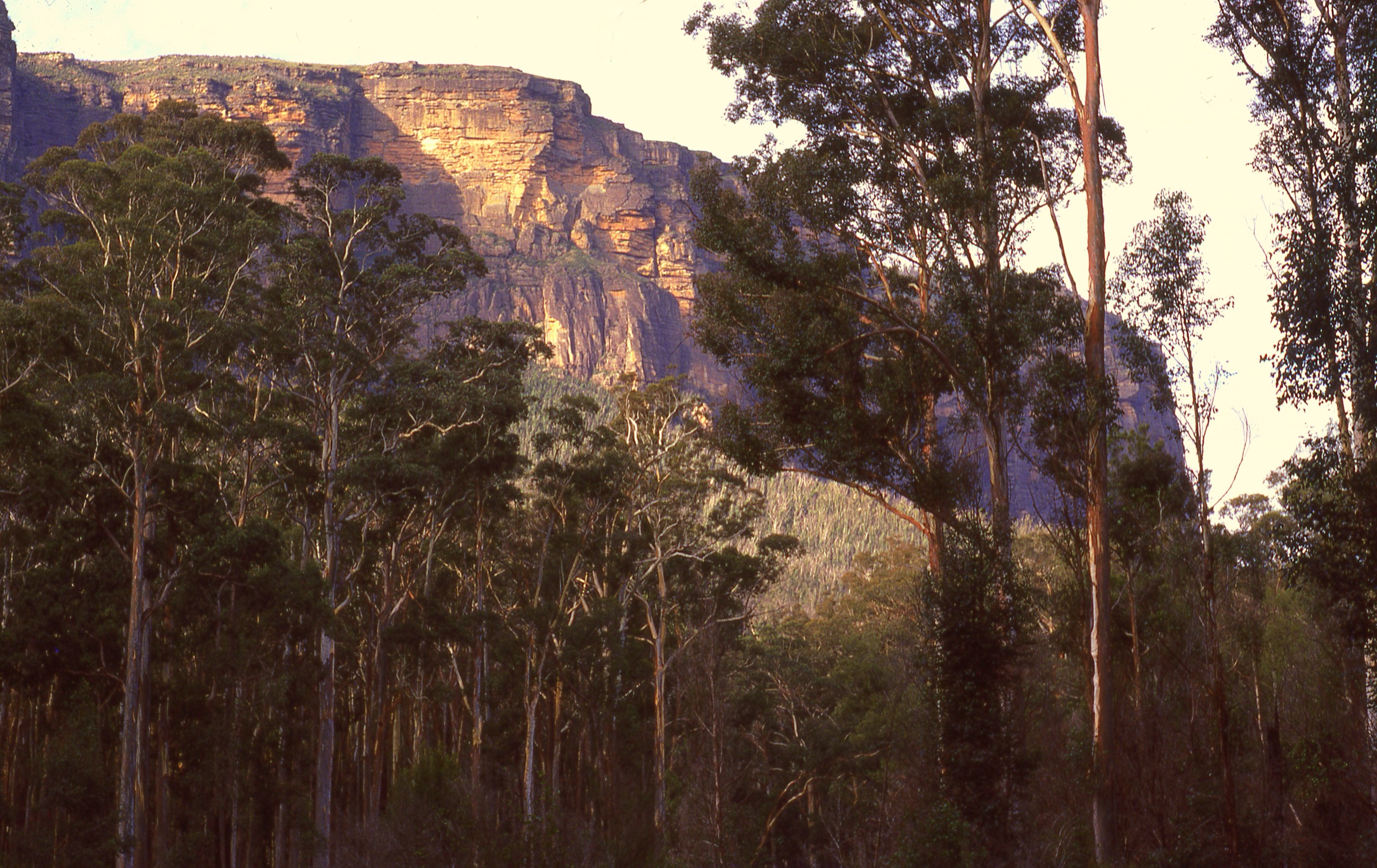
Perry’s Lookdown sits on the northern rim of the Grose Valley about 7 km east of Blackheath. The track leaves the car park along the plateau for a short distance to the lookdown itself, where the ground drops away in a single 600 m fall to the Grose River. The descent is entirely on a stepped and switch-backing track cut into the cliff line, with fixed stone steps and railings on the exposed upper section, and reaches the valley floor at a signposted junction on Govetts Creek. From the junction, a short walk south-east along the river track enters Blue Gum Forest — a cathedral of Sydney blue gum (Eucalyptus deanei) trees rising 40–50 m from the fertile alluvial flats. Acacia Flat camping area lies a few hundred metres further into the forest for parties overnighting. Day walkers return on the same line, treating the 600 m climb back to Perry’s as the serious effort of the day; the alternative escape via Docker Head or Rodriguez Pass to Evans Lookout involves a substantially longer route and is generally split as an overnight walk.
Why it is essential
Blue Gum Forest is the emotional heart of the Blue Mountains — the site of the 1930s conservation campaign that led to the creation of Blue Mountains National Park — and Perry’s Lookdown is the shortest signposted foot descent to it. The route packs a full Grose Valley experience into a single day for fit walkers.
Equipment
- Sturdy boots
- 3 L of water minimum (no water on route above Govetts Creek)
- Sun protection
- Warm layer (valley floor is cool year-round)
- Trekking poles for the return climb
- Map and GPS
- Personal Locator Beacon strongly recommended (NPWS gear list)
- Headtorch for a long day
- First-aid kit
Hazards and notes
- The return climb of ~600 m is the most serious commitment on this list — turn around in time to allow the ascent in daylight.
- Cliff-edge exposure on the upper switchbacks; the platform at Perry’s Lookdown is fenced but the rim on either side is not.
- No mobile coverage on the valley floor.
- Snake and leech activity in the warmer months.
- Do not attempt in heat above ~30 °C on the plateau; rescue is slow.
- Blackheath area subject to storm and fire-ban closures — check NPWS alerts.
- Acacia Flat requires an NPWS camping booking for overnight parties.
GPX / route file
| Source | URL | Format | Notes |
|---|---|---|---|
| NPWS — Perrys Lookdown to Blue Gum Forest walking track | nationalparks.nsw.gov.au | Web page | Official route source |
| Wildwalks — Perrys Lookdown to Blue Gum Forest | wildwalks.com | Web page + map | Distance and elevation cross-check |
| NPWS — Blue Gum Forest | nationalparks.nsw.gov.au | Web page | Site history and access context |
Sources
- NPWS — Perrys Lookdown to Blue Gum Forest walking track
- NPWS — Blue Gum Forest
- Wildwalks — Perrys Lookdown to Blue Gum Forest walking track
- Wikimedia Commons — Blue Gum Forest
5. Prince Henry Cliff Walk (Katoomba to Leura)
Snapshot
Itinerary
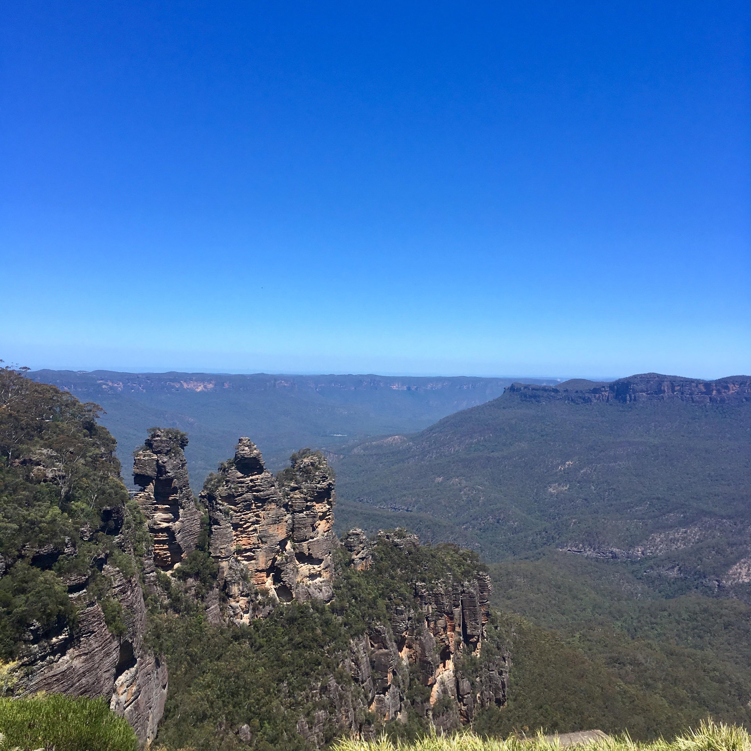
The Prince Henry Cliff Walk follows the northern rim of the Jamison Valley between Katoomba and Leura, threading a chain of more than 20 signposted lookouts along the escarpment. The standard direction is west to east: starting near Katoomba Cascades or the Scenic World precinct, the track passes Katoomba Falls, then follows the rim through Katoomba Cascades and along the clifftop to Echo Point, where the Three Sisters rock formation drops directly below the viewing platforms. East of Echo Point the track dips into Leura Forest, crosses a sequence of hanging swamps with sedges and Christmas bells in season, passes Leura Cascades and the Bridal Veil, Linda and Lila falls, and finishes at the Gordon Falls picnic area in Leura. The route is on stone-and-timber stepped paths throughout and is mostly graded, with occasional stairs.
Why it is essential
Prince Henry is the iconic Blue Mountains clifftop viewpoint walk and the direct foot connection between the two main tourist towns. It threads the Three Sisters, the entire Katoomba–Leura clifftop lookout chain and a sequence of hanging waterfalls into a single half-day route reachable directly by train, and gives the standard aerial perspective on the valleys traversed by the harder hikes in this list.
Equipment
- Walking shoes
- Sun protection
- 1.5–2 L of water
- Warm layer for the plateau
- Wind and waterproof layer
- Map (multiple side tracks branch off the rim)
Hazards and notes
- Numerous cliff edges are unfenced beyond the built platforms; supervise children closely.
- Track is popular at Echo Point and Katoomba Falls but can be lightly used between Leura Forest and Gordon Falls.
- Weather can change rapidly on the rim; sudden storms are the main hazard.
- Sections can become slippery in rain.
- Total-fire-ban and storm closures apply on high-risk days — check NPWS alerts.
- Multiple side tracks descend to the valley floor; do not commit to a descent without water and time.
GPX / route file
| Source | URL | Format | Notes |
|---|---|---|---|
| NPWS — Prince Henry Cliff walk | nationalparks.nsw.gov.au | Web page | Official route source |
| Wildwalks — Prince Henry Cliff Walk | wildwalks.com | Web page + map | Route stats cross-check |
| Blue Mountains Explorer Bus — Prince Henry Cliff Walk | explorerbus.com.au | Web page | Bus-linked variant |
Sources
- NPWS — Prince Henry Cliff walk
- Wildwalks — Prince Henry Cliff Walk
- Wikimedia Commons — Echo Point Lookout
Region-level sources
| Source | URL |
|---|---|
| NPWS — Blue Mountains National Park | nationalparks.nsw.gov.au |
| NPWS — Grand Canyon track | nationalparks.nsw.gov.au |
| NPWS — National Pass | nationalparks.nsw.gov.au |
| NPWS — Wentworth Pass loop walking track | nationalparks.nsw.gov.au |
| NPWS — Ruined Castle walking track | nationalparks.nsw.gov.au |
| NPWS — Perrys Lookdown to Blue Gum Forest walking track | nationalparks.nsw.gov.au |
| NPWS — Prince Henry Cliff walk | nationalparks.nsw.gov.au |
| Wildwalks — Blue Mountains (Katoomba, Blackheath, Wentworth Falls) | wildwalks.com |
| UNESCO — Greater Blue Mountains Area | whc.unesco.org |
| Wikipedia — Blue Mountains (New South Wales) | en.wikipedia.org |
| Wikipedia — Blue Gum Forest | en.wikipedia.org |
Further reading
Nearby Great Dividing Range guides on Storm
- ACT, Namadgi and the Brindabella Ranges
- Atherton Tablelands / Cairns Highlands
- Barrington Tops
- Bunya Mountains / South Burnett
- UNESCO — Greater Blue Mountains Area
- Wikipedia — Darug people
- Wikipedia — Gundungurra people
- Wildwalks — Blue Mountains walks index
Missing data / follow-up work
- National Pass ledge is currently closed between Valley of the Waters and Slacks Stairs due to rockfall; the Wentworth Falls entry describes the Wentworth Pass loop as the practical route. Confirm current NPWS alerts before travel.
- NPWS does not publish direct GPX or KML downloads for any of the walks listed above. Wildwalks provides interactive maps but not open GPX. Route files should be derived from OpenStreetMap or an official topographic map where required.
- Elevation gain figures for the Grand Canyon, Wentworth Pass loop and Ruined Castle walks vary between sources (NPWS quotes distances and grade but not cumulative gain); values here are approximate and should be treated as such.
- The Grand Cliff Top Walk multi-day trail (Wentworth Falls to Blackheath, 3-day route) can be walked as day sections but is excluded from the main selection because the natural day-splits overlap heavily with the routes already listed.
- Mount Solitary (Jamison Valley) was considered but sits outside the day-hike envelope for most parties; it is typically walked as an overnight trip from Ruined Castle.
- Total-fire-ban days and post-storm closures affect all routes in the park; confirm status with NPWS on the day of departure.