.jpg)

Regional overview
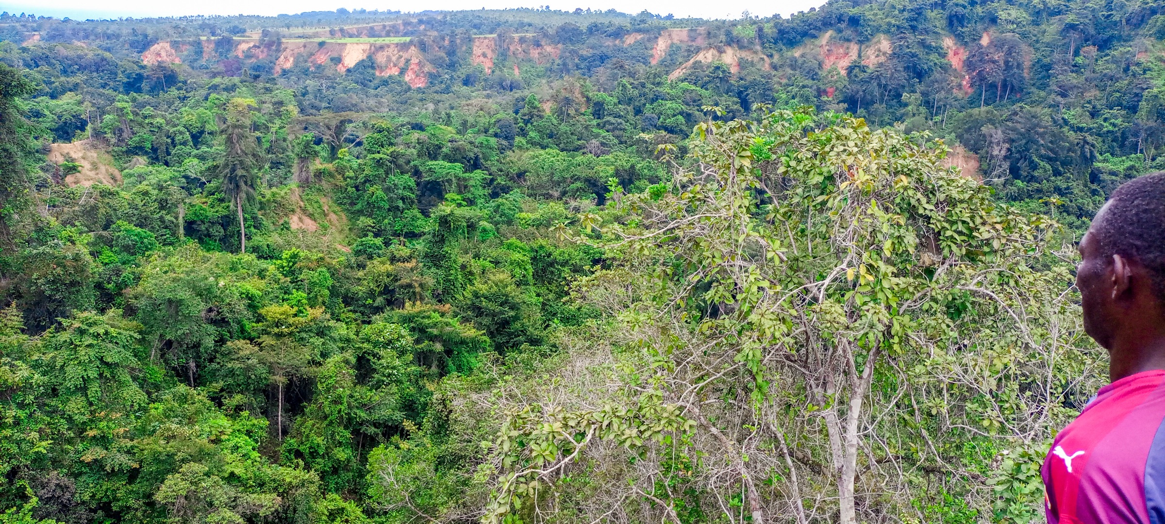
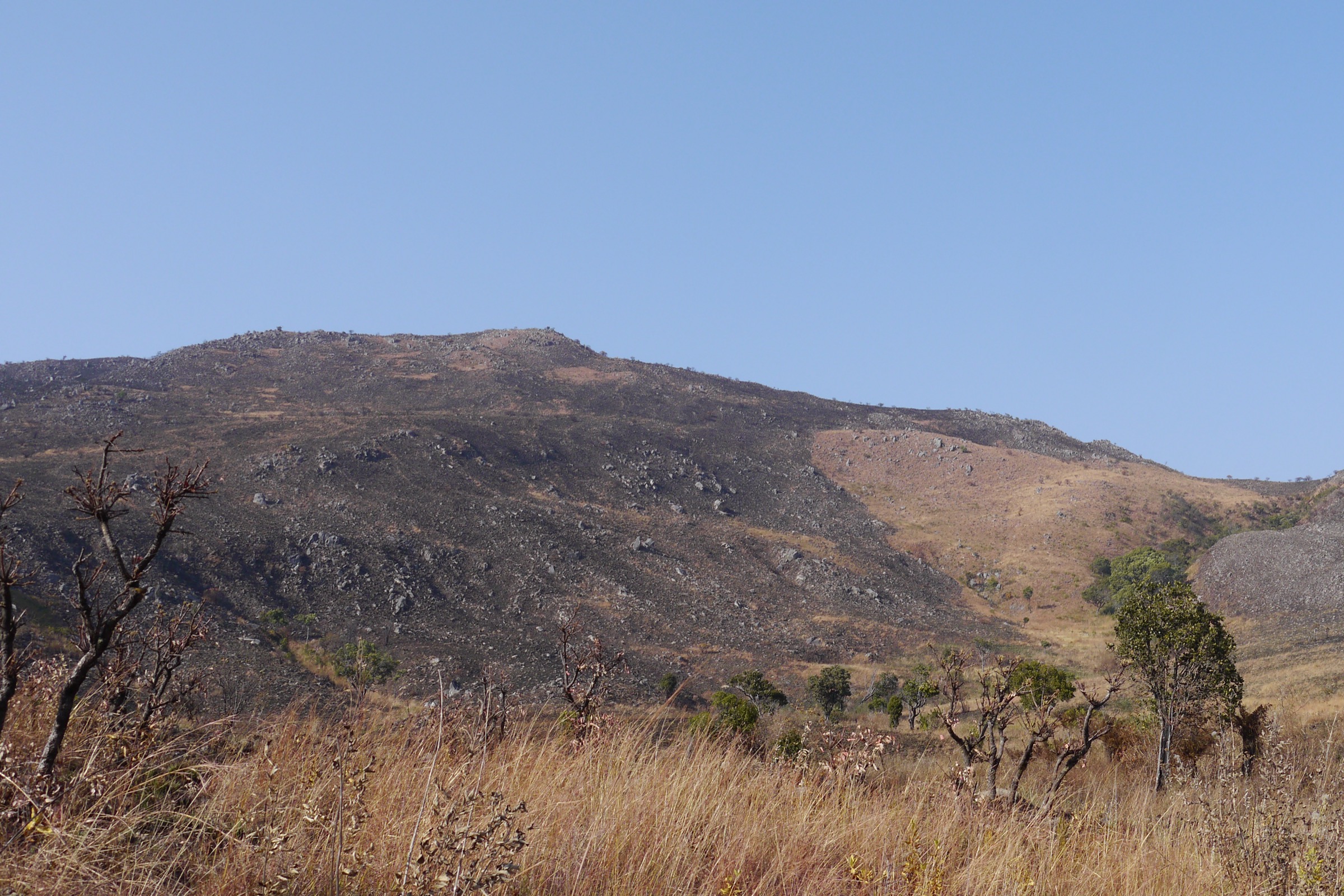
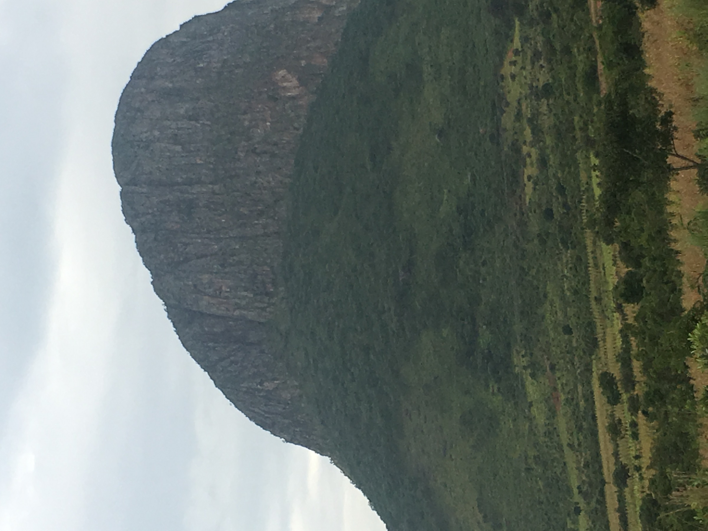
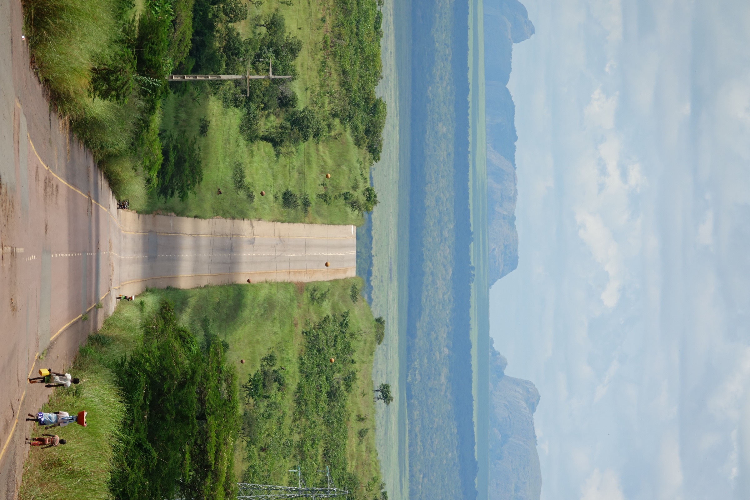
The Bié Plateau — Portuguese Planalto do Bié — is the broad central upland of Angola, averaging roughly 1,500 to 1,800 m and rising on its western edge to Mount Moco at about 2,620 m, Angola’s highest summit. Together with the adjacent Huambo highlands it forms the country’s main watershed: the Cuanza (Kwanza), the Cubango (Okavango), the Cuando and the Cassai all rise from the plateau, draining respectively to the Atlantic, to the Okavango Delta, to the Zambezi and to the Congo. The vegetation is predominantly miombo woodland, dambo seasonal grassland and patches of Afromontane forest on the higher ridges of the Moco massif. Most rivers run high from December to April; the practical walking season is the cool dry season from roughly May to September.
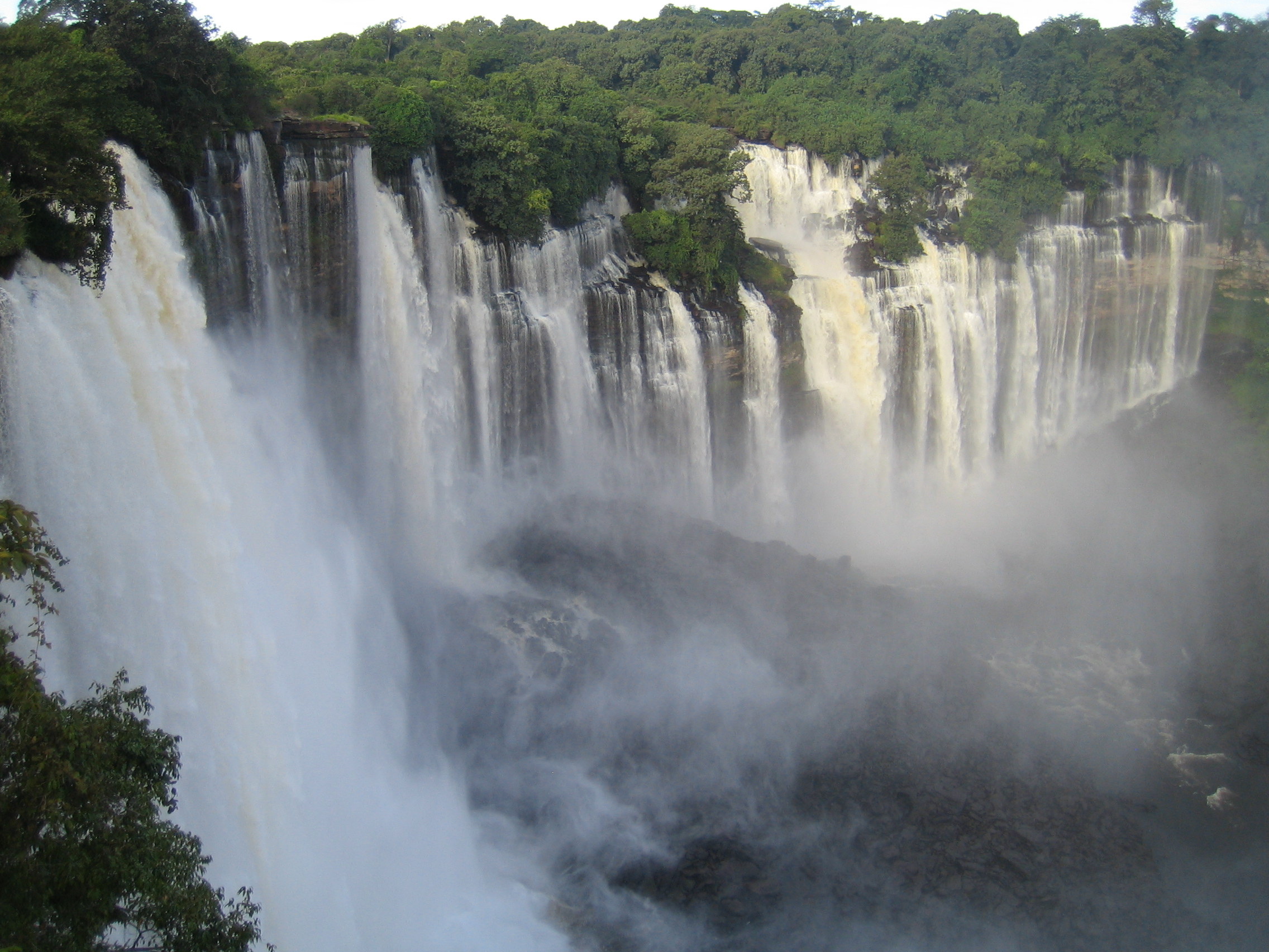
The plateau and its outliers in Malanje Province also hold Angola’s two most celebrated cultural-geological landmarks — Kalandula Falls on the Lucala River, a 105 m, 400 m-wide curtain that is one of the largest waterfalls in Africa by volume, and the Pedras Negras de Pungo Andongo, a cluster of 150 to 200 m conglomerate pinnacles standing out of the savanna and historically the fortress of the Kingdom of Ndongo. Cangandala National Park, north of Malanje, is the last sanctuary of the palanca-negra-gigante (giant sable antelope, Hippotragus niger variani), Angola’s national symbol, of which only a few dozen individuals survive.
Walking infrastructure across the plateau is essentially absent. Twenty-seven years of civil war (1975 to 2002) left the country with one of the densest landmine contaminations in the world, and demining by the HALO Trust, the Angolan national authority CNIDAH and partner organisations continues into the mid-2020s. The U.S. Department of State currently lists Angola at Level 2 (Exercise Increased Caution), citing crime, health, demonstrations and “the lingering presence of landmines in rural areas,” with the Luanda metropolitan area at Level 3. Every entry below must therefore be treated as informal: hike statistics are derived from PeakVisor, OpenStreetMap, Wikipedia and tourism portals rather than from any official trail registry, and route distances and elevation gains are approximate unless explicitly noted.
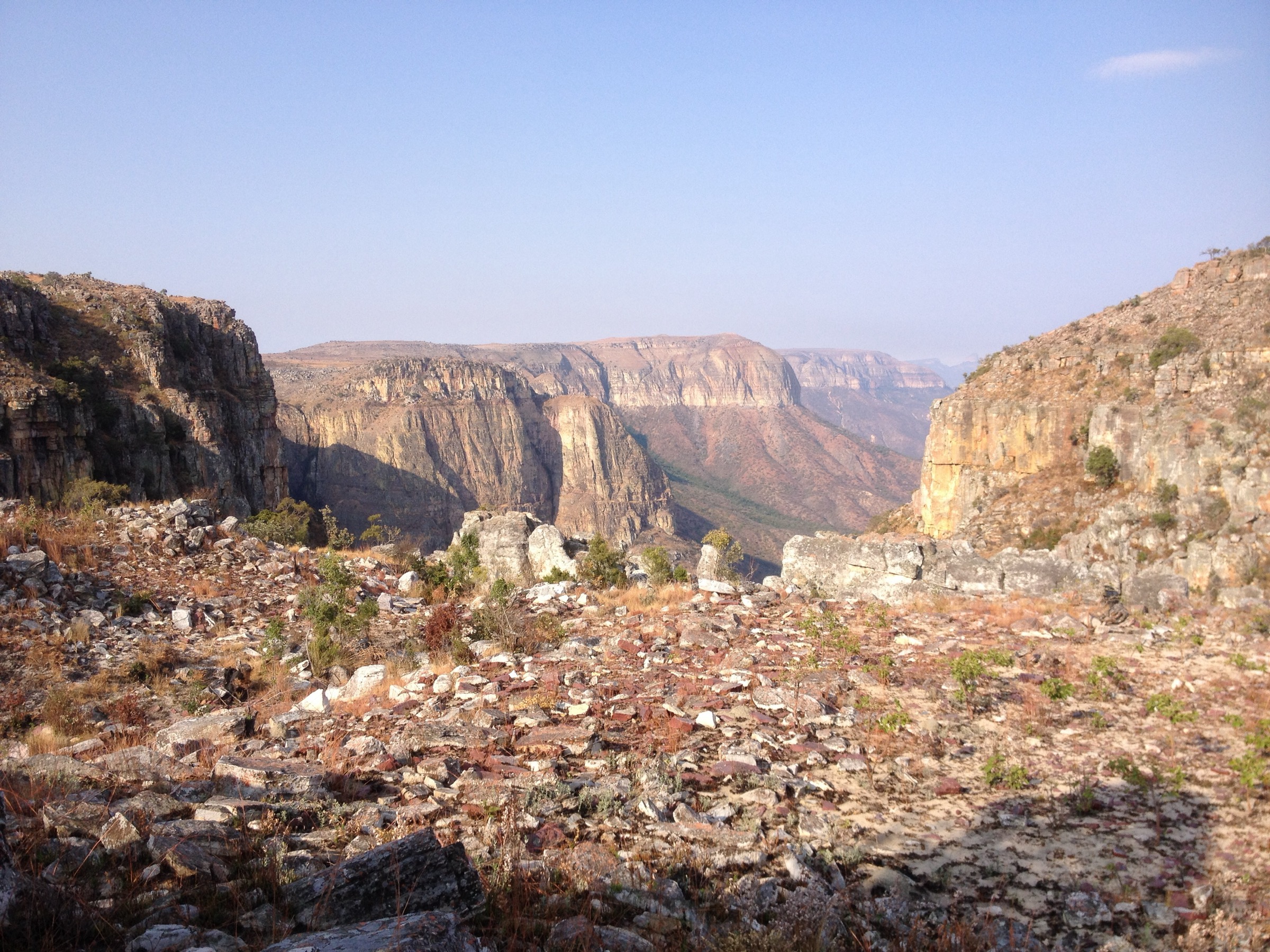
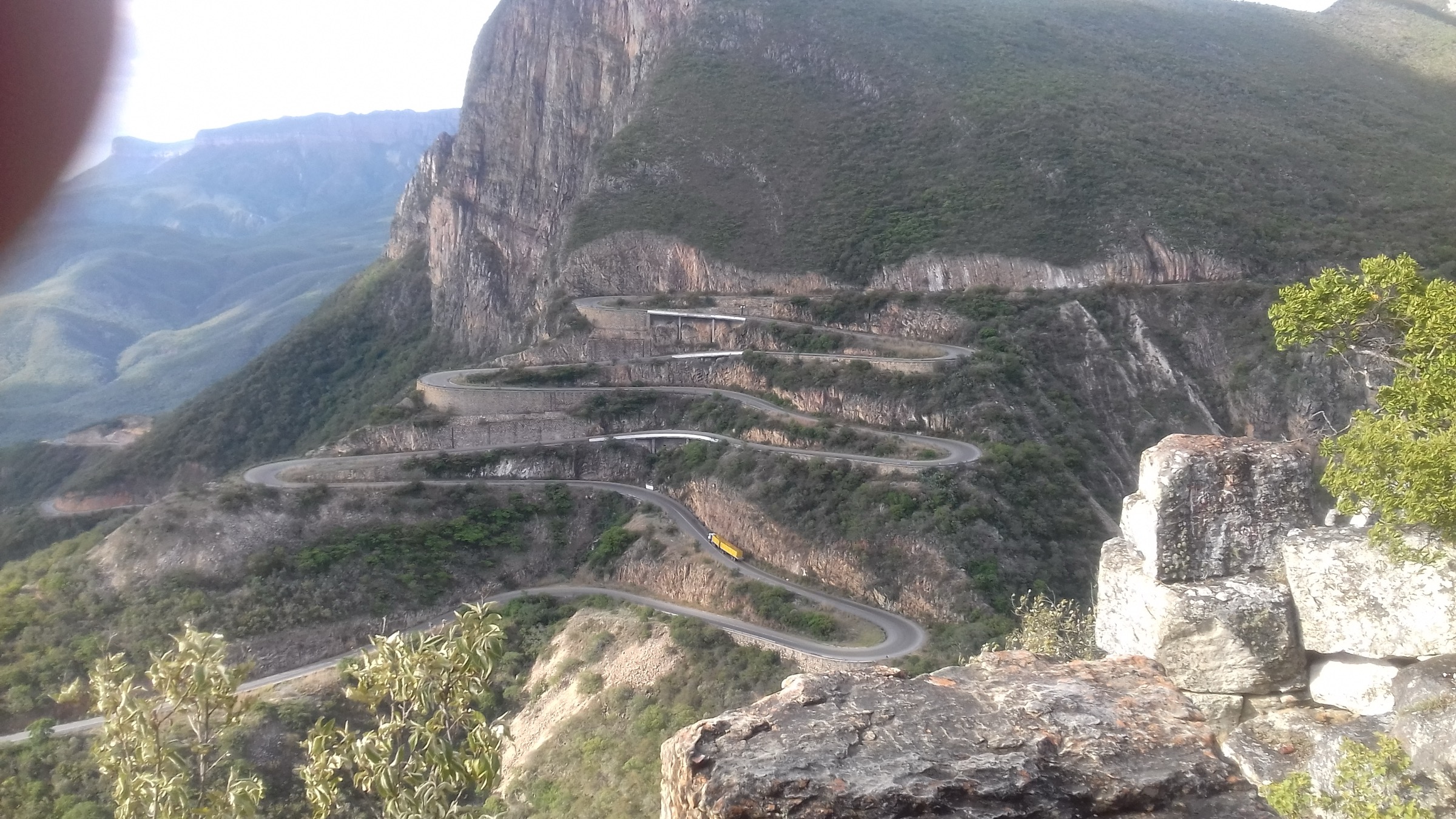
Sibling articles in this catalogue cover the southern Angolan highlands — the Huíla Highlands around Lubango and the Serra da Leba / Chela Escarpment. This entry stays north of those, on the central plateau of Bié, Huambo and Malanje Provinces, and does not duplicate any Huíla-side objectives.
Selection rationale
The five entries cover the defining landscape types of the plateau: the iconic summit (Mount Moco, Angola’s highest), a watershed / source walk (Nascente do Rio Cuanza), a cultural-geological circuit (Pedras Negras de Pungo Andongo), the great waterfall (Kalandula) and a savanna conservation walk (Cangandala National Park). Mount Moco is the only true summit objective at altitude; Kalandula and Pungo Andongo are the most widely documented day-objectives in the highlands grouping and are catalogued here on the understanding that, although Malanje lies on the northern margin of the plateau rather than its core, the Lucala / Cuanza drainage and the conglomerate pinnacles are best understood as Bié Plateau features. The Cuanza headwaters walk anchors the watershed narrative; the Cangandala walk gives the miombo-and-dambo ecosystem and a tangible conservation rationale.
Summary table
| # | Hike | Country | Route type | Distance | Gain | Max elevation | Difficulty |
|---|---|---|---|---|---|---|---|
| 1 | Mount Moco summit from Kanjonde | Angola | Out-and-back summit hike | ~12-16 km round-trip | ~800-1,100 m | ~2,620 m | Moderate-hard |
| 2 | Nascente do Rio Cuanza headwaters walk | Angola | Short interpretive walk | ~2-4 km | Minor | ~1,500 m order of magnitude | Easy |
| 3 | Pedras Negras de Pungo Andongo circuit | Angola | Short loop / linked viewpoints | ~3-6 km | ~100-200 m | ~1,200 m (rim of formations) | Easy-moderate |
| 4 | Kalandula Falls viewpoint walk | Angola | Short out-and-back to upper and lower viewpoints | ~2-4 km | ~100-150 m | ~1,000 m order of magnitude | Easy-moderate |
| 5 | Cangandala National Park miombo walk | Angola | Guided savanna / dambo walk | Unresolved | Minor | ~1,150 m order of magnitude | Easy |
1. Mount Moco summit from Kanjonde
Snapshot
Itinerary
The standard approach drives from Huambo or Caála via Ussoque to Kanjonde, the only village close enough to the mountain to act as a trailhead. Permission from the soba (village chief) is customary, and a Kanjonde-based guide is essentially required: there are no signed trails, paths are footpaths and grazing tracks, and the route changes year to year as patches of native forest are cut and replanted. From the village at roughly 1,600 m the path climbs broadly southeast through miombo and farm land onto open montane grassland, then traverses small relict patches of Afromontane forest harbouring Mount Moco’s endemics before reaching the summit ridge and high point at about 2,620 m. Descent retraces the ascent line. Most online trip reports give a long single-day round-trip of roughly 12 to 16 km with 800 to 1,100 m of net ascent, but no official figure is published.
Why it is essential
Mount Moco is Angola’s highest peak, the centrepiece of the Western Angola Endemic Bird Area, and the only continuously vegetated Afromontane summit on the plateau. It was designated an Important Bird Area by BirdLife International and supports Swierstra’s Francolin, the Angola Cave Chat, the Angola Slaty Flycatcher and Ludwig’s Double-collared Sunbird, alongside Protea and Erica species. In April 2026 the Angolan government formalised protection of the massif, the first national protected status for the site, though active patrolling and signage remain limited. It is the defining mountain objective of the highlands.
Equipment
Mountain hiking equipment: sturdy boots, warm and weatherproof layers, hat and gloves for the upper slopes, sun protection, navigation backup (offline GPS strongly recommended — paths are informal), plenty of water, food, and a headtorch in case of late descent. A village guide from Kanjonde is essentially required for route-finding and is arranged on arrival.
Hazards and notes
- Persistent landmine and unexploded-ordnance risk in rural Angola; check the latest HALO Trust district clearance status and confirm route safety with local guides before walking. Although Huambo Province has been heavily demined since 2002, residual contamination still occurs.
- No formal mountain rescue infrastructure exists in Angola; self-rescue, satellite communication and contingency planning are essential.
- Civil-war-era unexploded ordnance is still occasionally reported across the highlands.
- Malaria prophylaxis is required: at 1,500-1,800 m the plateau sits at the upper edge of intense transmission, and the lower approaches from Huambo and Caála are high risk.
- Wildfires and smoke haze are common in the dry season as miombo and grassland is burned; the upper slopes can lose visibility quickly.
- Mount Moco has no formal trail registration or fee system; the customary protocol is a courtesy visit to Kanjonde’s soba.
GPX / KML links
| Source | URL | Format / access | Reuse status |
|---|---|---|---|
| OpenStreetMap — Mount Moco location | openstreetmap.org | Source map / location | OSM data is ODbL; not a route file |
| PeakVisor — Morro de Môco | peakvisor.com | Peak profile / map | Third-party; reference only |
| Wikiloc search — Mount Moco | wikiloc.com | Search page | Wikiloc terms apply if a track is later selected; no GPX selected here |
External links
- Wikipedia — Mount Moco
- Britannica — Mount Moco
- MountMoco.org — Kanjonde village and access
- Mongabay — Mount Moco protected status, April 2026
- BirdLife / Cambridge — Mount Moco IBA and Swierstra’s Francolin paper
- U.S. Department of State Angola Travel Advisory
2. Nascente do Rio Cuanza headwaters walk
Snapshot
Itinerary
From Kuito the route runs roughly 200 km south on the Chitembo road to Mumbué commune, where a signed and locally publicised feature, the Nascente do Rio Kwanza, marks the headwater spring of the Cuanza — Angola’s longest internal river (about 960 km) and the source of the national currency name. The walk drops a short distance off the access track to the spring and the head of the dambo grassland that feeds the first kilometres of the river, then loops as far around the wet ground as conditions allow before returning by the access track. Government communications from the Bié provincial administration confirm the site, and recent expansion plans include the construction of small visitor hotels at the Cuanza source.
Why it is essential
The Cuanza headwaters walk is the most direct way to experience the Bié Plateau as a watershed: the same plateau gives rise to the Cubango / Okavango, the Cuando and the Cassai, and the Cuanza source is the most accessible and the most culturally weighted of the four. The walk is short and easy and pairs well with a regional 4WD circuit linking Kuito, Chitembo and Cangandala. It is the only entry in this catalogue that targets the headwaters narrative directly.
Equipment
Standard hiking equipment: light boots or trail shoes (the dambo edges are damp even in the dry season), sun and rain protection, water, food and a local guide. There is no formal site infrastructure.
Hazards and notes
- Persistent landmine and unexploded-ordnance risk in rural Angola; check the latest HALO Trust district clearance status before walking. Bié Province was one of the most heavily mined areas during the civil war and demining continues; do not stray off used tracks.
- No formal mountain rescue or evacuation infrastructure on the central plateau.
- Civil-war-era unexploded ordnance contamination is documented in Bié Province.
- Malaria prophylaxis is required; mosquito exposure is highest near standing water in the dambo.
- Access tracks become impassable in the wet season (November to April).
- The site has no official visitor centre; published statistics, signage and any planned hotel infrastructure should be verified locally before travel.
GPX / KML links
| Source | URL | Format / access | Reuse status |
|---|---|---|---|
| Wikimapia — Nascente do Rio Kwanza (Cuanza) | wikimapia.org | Source map / location | Wikimapia terms apply; not a route file |
| Mapcarta — Nascente do rio Kwanza / Bié | mapcarta.com | Source map / location | Third-party; reference only |
| OpenStreetMap search — Mumbué Chitembo | openstreetmap.org | Source map / search | OSM data is ODbL; not a route file |
External links
- Wikipedia — Cuanza River
- Wikipédia (PT) — Rio Cuanza
- Welcome to Angola — Principais rios de Angola
- Hotéis Angola — Confluente do Rio Kwanza, Bié
- U.S. Department of State Angola Travel Advisory
3. Pedras Negras de Pungo Andongo circuit
Snapshot
Itinerary
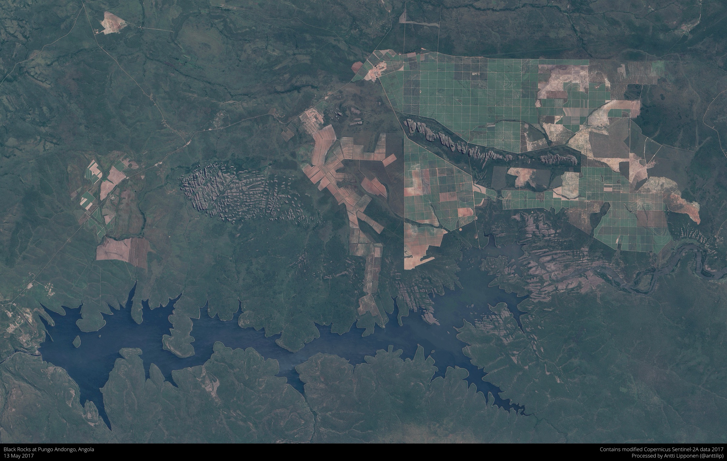
From the village of Pungo Andongo on the N230, footpaths lead among a cluster of dark conglomerate pinnacles — granite-pebble conglomerates standing 150 to 200 m above the surrounding savanna, spread over roughly 50 km². The customary circuit links several of the principal formations on informal tracks, taking in the “footprints” believed locally to be those of Queen N’Ginga M’Bandi and her father King N’Gola Kiluange, and several upper-level viewpoints onto the surrounding plain. The site sits at the edge of the historic Kingdom of Ndongo, of which Pungo Andongo was the fortress capital before the Portuguese conquest of 1671. Most visitors return to the village by the same line.
Why it is essential
The Pedras Negras are the most photographed inland landscape of Angola after Kalandula Falls and the only entry in this catalogue that combines a major geological feature with a foundational episode in Angolan history. The walk is short enough to combine with Kalandula in a single weekend circuit from Luanda or Malanje, and the geological story — Cretaceous-era conglomerate weathered into inselberg-style pinnacles — is unique on the plateau.
Equipment
Standard hiking equipment: grippy footwear (rock surfaces become slick when dusty), strong sun protection, plenty of water, food and a local guide from the village. There is no formal site infrastructure and no signposting.
Hazards and notes
- Persistent landmine and unexploded-ordnance risk in rural Angola; check the latest HALO Trust district clearance status before walking. Malanje Province has been demined along main routes but residual risk remains in unfrequented terrain.
- No formal mountain rescue infrastructure.
- Civil-war-era unexploded ordnance is documented in Malanje Province; do not leave used tracks.
- Malaria prophylaxis is required for the entire Malanje region; the site is at lower elevation than the Bié core and transmission is more intense.
- Rock surfaces become extremely hot from late morning onward in the dry season; an early-morning visit is standard.
- The site is occasionally subject to informal visitor fees collected in the village; carry small-denomination cash.
GPX / KML links
| Source | URL | Format / access | Reuse status |
|---|---|---|---|
| OpenStreetMap — Pungo Andongo / Pedras Negras | openstreetmap.org | Source map / location | OSM data is ODbL; not a route file |
| Mindat — Pedras Negras locality | mindat.org | Geological locality profile | Third-party; reference only |
| Wikiloc search — Pungo Andongo | wikiloc.com | Search page | Wikiloc terms apply if a track is later selected; no GPX selected here |
External links
- Wikipedia — Black Rocks at Pungo Andongo
- Tourist Landmarks — Pedras Negras de Pungo Andongo
- Hotéis Angola — Pedras Negras, Malanje
- U.S. Department of State Angola Travel Advisory
4. Kalandula Falls viewpoint walk
Snapshot
Itinerary
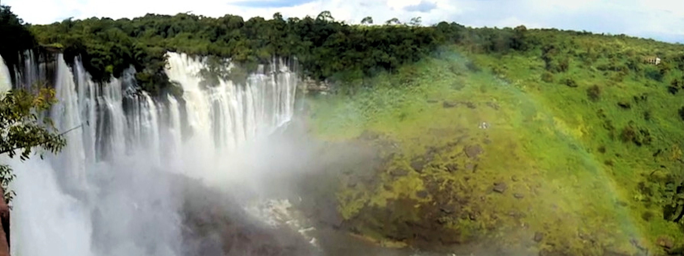
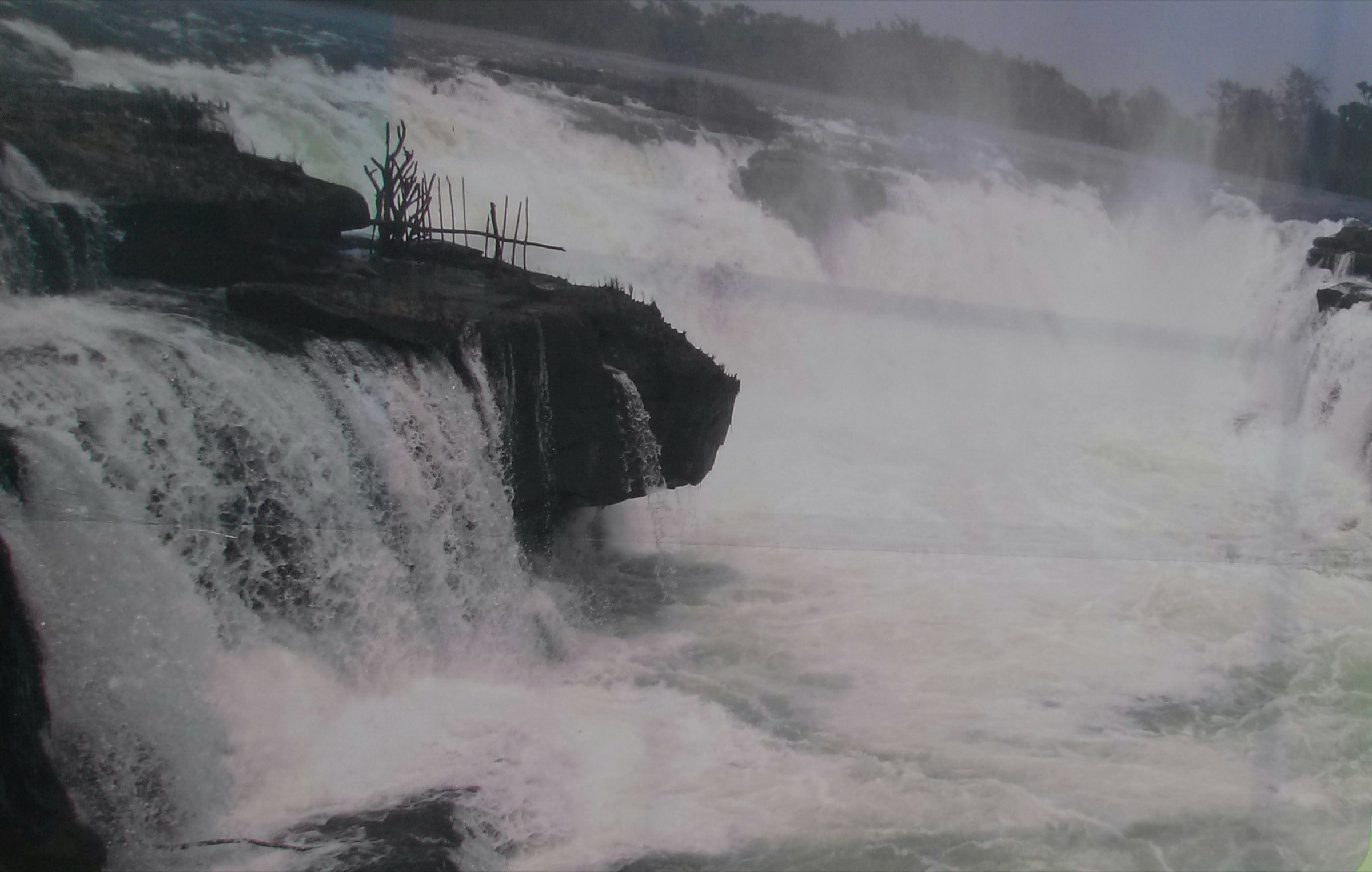
From the rim road and the small Pousada Calandula above the falls, a short footpath leads to the upper viewpoint directly across from the curtain — 105 m high and 400 m wide, one of the largest waterfalls in Africa by volume. From the upper rim, a steeper path drops through forest to a lower viewpoint at the base of the falls and the plunge pool, where local guides usually meet visitors at the head of the descent. The complete circuit links the upper rim viewpoint, a side viewpoint on the rim and the lower base viewpoint, returning to the rim by the same descent path. Source accounts vary slightly on the precise distance Kalandula sits from Malanje (cited figures range from 85 to about 95 km on the EN225).
Why it is essential
Kalandula is Angola’s most famous natural attraction and the only major waterfall in the highlands grouping. It sits on the Lucala River, the main right-bank tributary of the Cuanza, and is therefore directly connected to the same Bié Plateau drainage celebrated at the Cuanza headwaters walk. As a short, scenic, family-grade walk it is the most accessible of the highlands’ five essentials and the standard first objective for visitors arriving from Luanda.
Equipment
Standard hiking equipment: grippy footwear, sun and rain protection, plenty of water, a light waterproof for spray near the base. A local guide is helpful for the lower descent and is generally arranged at the rim.
Hazards and notes
- Persistent landmine and unexploded-ordnance risk in rural Angola; check the latest HALO Trust district clearance status before walking. Although the Kalandula site itself is heavily visited, do not stray off used paths in the wider Malanje rural area.
- No formal mountain rescue infrastructure.
- Civil-war-era unexploded ordnance contamination is documented in Malanje Province.
- Malaria prophylaxis is required; transmission is intense throughout Malanje.
- The descent to the lower viewpoint is steep, rocky and slippery, especially after rain; flow above the lip is dangerous at high water.
- The N230 / EN225 road network around Malanje has improved markedly in the 2020s but conditions still vary; allow for delays on the final approach.
GPX / KML links
| Source | URL | Format / access | Reuse status |
|---|---|---|---|
| OpenStreetMap — Kalandula Falls | openstreetmap.org | Source map / location | OSM data is ODbL; not a route file |
| Wikiloc search — Kalandula | wikiloc.com | Search page | Wikiloc terms apply if a track is later selected; no GPX selected here |
External links
- Wikipedia — Kalandula Falls
- Angola Tourism — Kalandula Falls
- Africa’s Eden — Kalandula Falls and Malanje region
- CNN Travel — Kalandula Falls feature
- U.S. Department of State Angola Travel Advisory
5. Cangandala National Park miombo walk
Snapshot
Itinerary
Cangandala is Angola’s smallest national park at roughly 630 km², gazetted on 25 June 1970 specifically to protect the palanca-negra-gigante (giant sable antelope, Hippotragus niger variani), Angola’s national symbol. The park lies on the central plateau between the Cuije, Cuige and Luando catchments, in an Angolan Wet Miombo Woodlands ecoregion mosaic of miombo woodland, dambo grassland and gallery forest. Walking inside the park is entirely guide-led; the small surviving palanca-negra herd, of the order of 60 to 100 animals depending on year and source, is fenced and monitored, and most foot itineraries combine a vehicle transfer with shorter walks on miombo tracks to observation points, dambo edges and water-points. No fixed route geometry is published.
Why it is essential
Cangandala is the only national park on or immediately adjacent to the Bié Plateau and the only protected area in Angola where the palanca-negra-gigante still survives. The miombo walk is therefore the conservation entry in this catalogue, and a tangible counterpart to the cultural-geological landscape walks at Pungo Andongo and Kalandula. The species was widely feared extinct until the early 2000s, and Cangandala is the cornerstone of its recovery.
Equipment
Standard hiking equipment: closed footwear suitable for grass and brush, full sun protection, water, food, insect repellent and a light long-sleeved layer. All walks are with the park ranger; visitors should not enter the park unaccompanied.
Hazards and notes
- Persistent landmine and unexploded-ordnance risk in rural Angola; check the latest HALO Trust district clearance status before walking. Cangandala suffered heavy poaching and disturbance during the civil war and remains carefully monitored; do not leave guided routes.
- No formal mountain rescue infrastructure.
- Civil-war-era unexploded ordnance contamination is documented across northern Malanje and the park’s wider catchment.
- Malaria prophylaxis is required; mosquito exposure in miombo and dambo terrain is high.
- The palanca-negra herd is small and intensively managed; viewing depends on ranger availability and is not guaranteed.
- Park infrastructure and opening arrangements are limited; confirm visit logistics with the park administration in Malanje before travel.
GPX / KML links
| Source | URL | Format / access | Reuse status |
|---|---|---|---|
| OpenStreetMap — Cangandala National Park | openstreetmap.org | Source map / location | OSM data is ODbL; not a route file |
| iOverlander — Cangandala National Park | ioverlander.com | Crowd-sourced traveller log | Third-party; reference only |
External links
- Wikipedia — Cangandala National Park
- Wikipedia — Giant sable antelope
- Mongabay — Angolan conservationist Kerllen Costa interview
- The New Humanitarian — Rare sable antelope survives the war
- U.S. Department of State Angola Travel Advisory
Missing data / follow-up work
- Mount Moco summit hike: no official route geometry, distance or elevation-gain figure is published; the values given are estimates derived from PeakVisor and trip reports. An official GPX track from the Mount Moco Project or BirdLife Angola would be preferable.
- Nascente do Rio Cuanza walk: no published route file; one source elevation figure of 1,234 m is markedly low for the central plateau and not consistent with regional topography, so the snapshot uses an order-of-magnitude plateau figure.
- Pedras Negras de Pungo Andongo: no published route file or signed circuit length; the entry uses a range estimate based on the cluster’s extent.
- Kalandula Falls: distance from Malanje city is reported variably in published sources (85 to ~95 km); no formal trail signage from the rim to the base viewpoint is documented.
- Cangandala National Park: no public walking route data was located; the entry is labelled Candidate only pending a published guided itinerary.
- All published GPX / KML route files in this catalogue are external; no third-party tracks have been re-hosted.
- Landmine and UXO contamination remains a real factor across all rural districts of the central plateau; the HALO Trust district clearance status should be checked before any walking trip.
- The U.S. State Department lists Angola at Level 2 (Exercise Increased Caution) as of 5 March 2026, with the Luanda metropolitan area at Level 3; conditions should be re-checked before travel.
- Photo coverage of the Bié Province plateau itself, including the Cuanza headwaters and Cangandala, is thin on Wikimedia Commons; representative images from the wider plateau have been used and labelled accordingly.
External links
| Resource | Link |
|---|---|
| Wikipedia — Mount Moco | en.wikipedia.org |
| Wikipedia — Cuanza River | en.wikipedia.org |
| Wikipedia — Black Rocks at Pungo Andongo | en.wikipedia.org |
| Wikipedia — Kalandula Falls | en.wikipedia.org |
| Wikipedia — Cangandala National Park | en.wikipedia.org |
| Wikipedia — Giant sable antelope | en.wikipedia.org |
| Britannica — Mount Moco | britannica.com |
| PeakVisor — Morro de Môco | peakvisor.com |
| BirdLife / Cambridge — Swierstra’s Francolin paper | cambridge.org |
| Mongabay — Mount Moco protected status, April 2026 | news.mongabay.com |
| MountMoco.org — Kanjonde village and access | mountmoco.org |
| Wikipédia (PT) — Rio Cuanza | pt.wikipedia.org |
| Wikimapia — Nascente do Rio Kwanza | wikimapia.org |
| Welcome to Angola — Principais rios | welcometoangola.co.ao |
| Hotéis Angola — Pedras Negras, Malanje | hoteisangola.com |
| Angola Tourism — Kalandula Falls | angola-tourism.com |
| Africa’s Eden — Kalandula Falls and Malanje region | africaseden.travel |
| CNN Travel — Kalandula Falls feature | cnn.com |
| Mongabay — Kerllen Costa interview | news.mongabay.com |
| HALO Trust — Angola programme | halotrust.org |
| U.S. Department of State Angola Travel Advisory | travel.state.gov |