
Regional overview
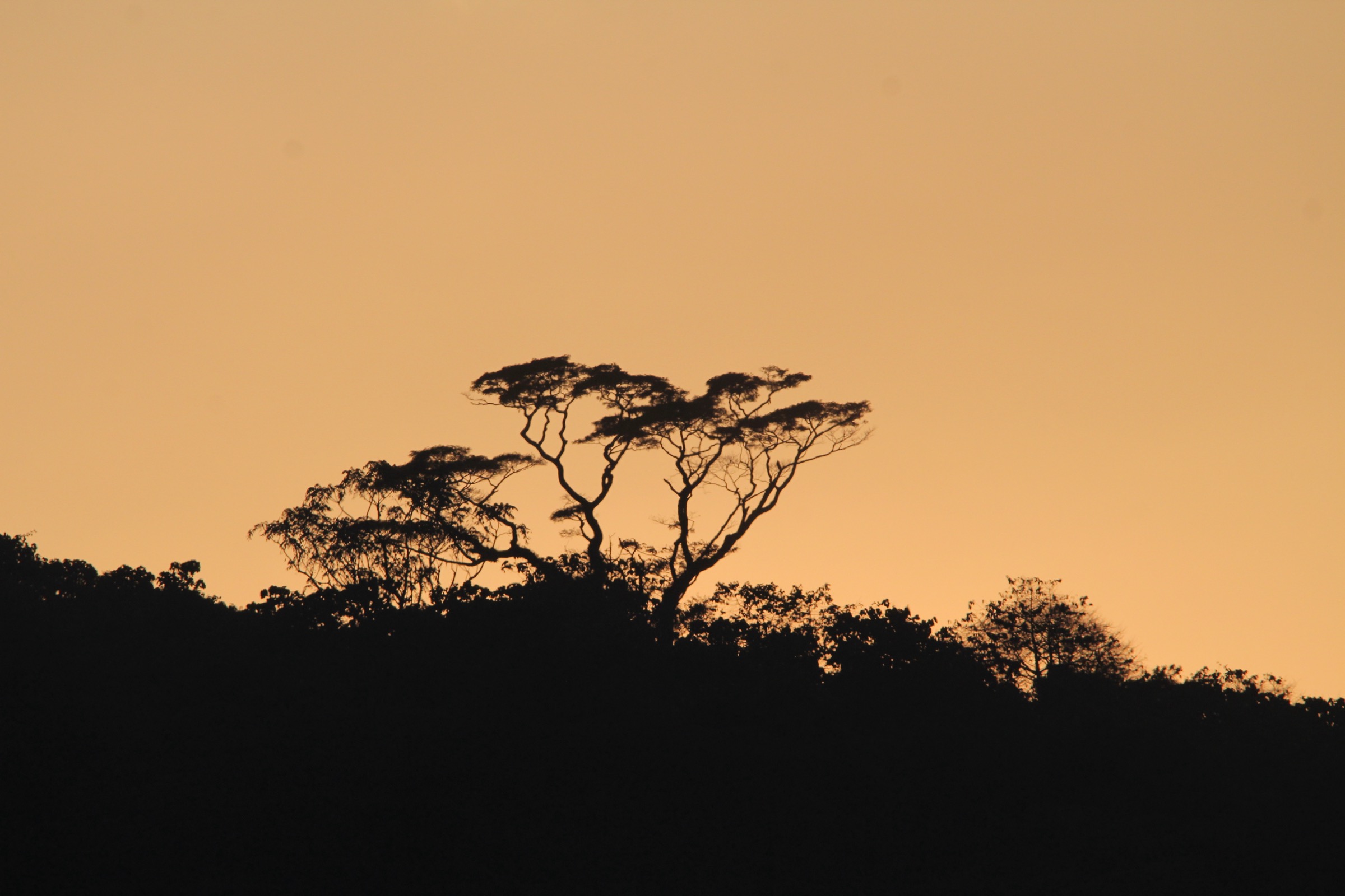
The Mayombe Mountains are low, humid coastal mountains extending through the Republic of the Congo, the Democratic Republic of the Congo, Angola’s Cabinda enclave, and adjoining Gabon. The range is forested, river-cut, and culturally important, but it has very little public day-hiking infrastructure in the sources checked.
The best documented walking candidates are gorge viewpoints, biosphere-reserve forest walks, village/ridge approaches, and protected-area forest routes. The Mayombe climate is hot and humid, with a main dry season from about June to September and a rainy season from about October to May. Even in the dry season, forest paths can be slippery and overgrown.
This entry selects exactly five essential research targets. Only Diosso has a clearly identifiable visitor landscape and reusable photo candidate; the other routes remain Candidate only because public trail geometry and GPX files were not found.
Selection rationale
The selection balances one iconic gorge, two biosphere-reserve forest walks, one river-gorge/highland objective, and one Angola/Cabinda protected-area forest objective. The list is intentionally conservative because the range is under-documented for independent hiking.
Summary table
| # | Hike | Country | Route type | Distance | Gain | Max elevation | Difficulty |
|---|---|---|---|---|---|---|---|
| 1 | Diosso Gorge rim and Loango cultural walk | Republic of the Congo | Loop/out-and-back, unresolved | Unresolved | Unresolved | Gorge depth about 80 m | Candidate only |
| 2 | Dimonika Biosphere Reserve forest walk | Republic of the Congo | Guided forest walk, unresolved | Unresolved | Unresolved | Unresolved | Candidate only |
| 3 | Luki Biosphere Reserve forest walk | Democratic Republic of the Congo | Guided forest walk, unresolved | Unresolved | Unresolved | 160-350 m reserve elevation range | Candidate only |
| 4 | Sounda Gorge / Kouilou-Niari viewpoint walk | Republic of the Congo | Out-and-back, unresolved | Unresolved | Unresolved | about 396 m site high point in checked summary | Candidate only |
| 5 | Maiombe National Park forest-edge walk | Angola | Guided forest walk, unresolved | Unresolved | Unresolved | Unresolved | Candidate only |
1. Diosso Gorge Rim and Loango Cultural Walk

Snapshot
Itinerary
The candidate route links the Diosso Gorge viewpoint/rim area with the Loango cultural landscape around Diosso. No official mapped foot route was found, so the itinerary should be limited to confirmed public paths and viewpoints after local verification.
Why it is essential
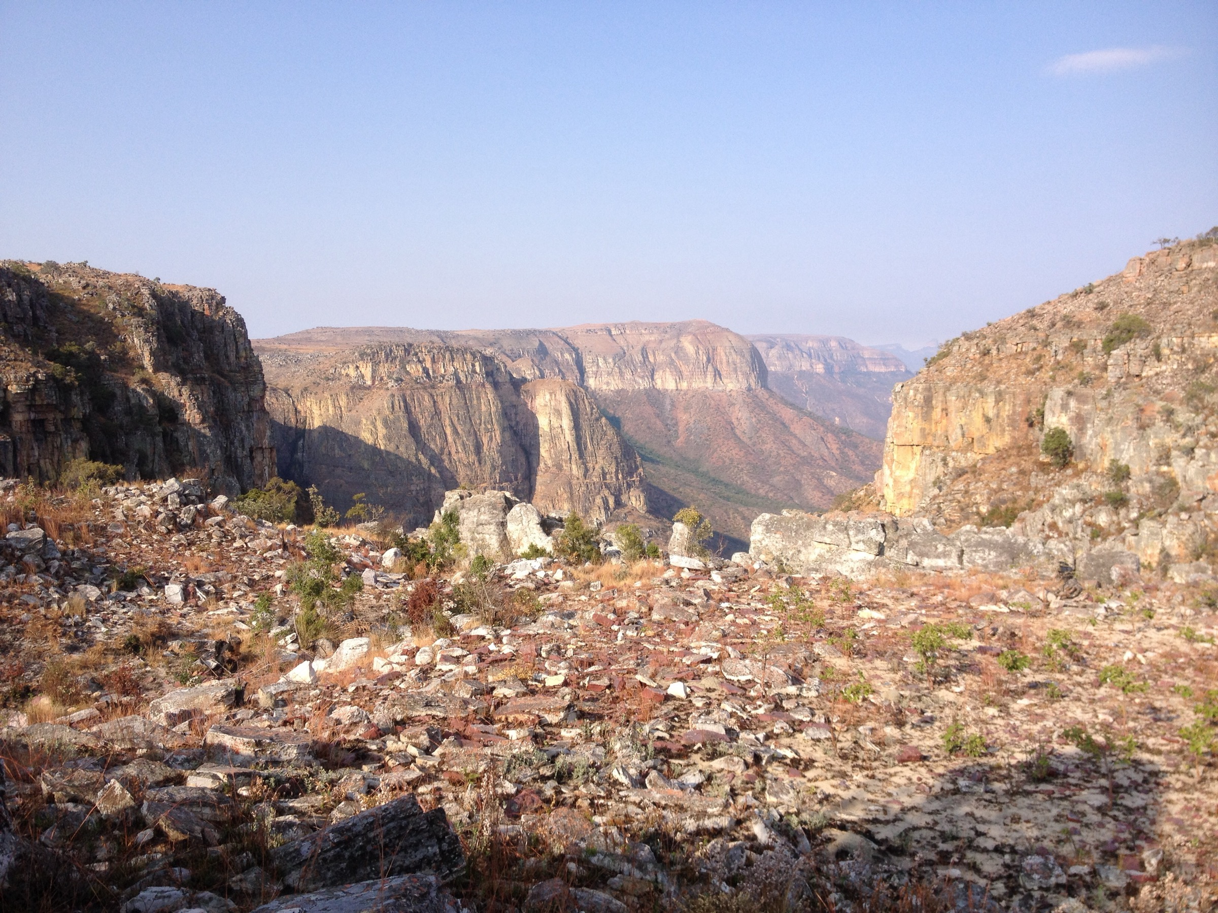
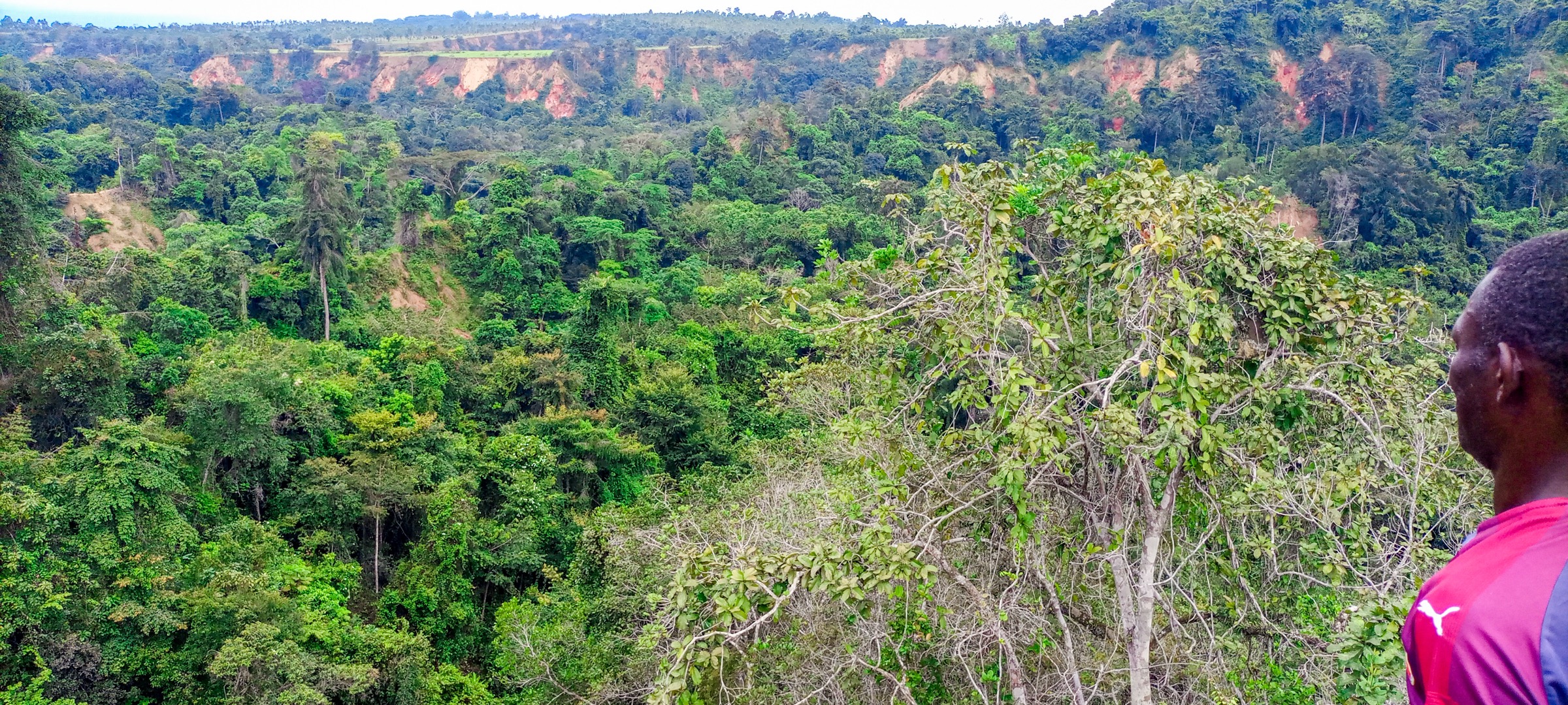
Diosso Gorge is one of the most recognisable natural sites in the coastal Mayombe area, with red lateritic cliffs, forested gullies, and nearby Loango heritage sites.
Equipment
Standard hiking equipment, sun protection, water, and footwear with grip for eroded laterite paths.
Hazards and notes
Stay away from unstable cliff edges and eroded slopes. Access rules, safe viewpoints, and whether paths descend into or only skirt the gorge need local confirmation.
GPX / KML links
| Source | URL | Format / access | Reuse status |
|---|---|---|---|
| OpenStreetMap search | openstreetmap.org | Map/search | OSM data ODbL; candidate geometry check only |
| Wikiloc search | wikiloc.com | Search | Wikiloc terms apply; no GPX selected |
External links
2. Dimonika Biosphere Reserve Forest Walk
Snapshot
Itinerary
The candidate route is a guided forest walk in Dimonika Biosphere Reserve, using locally permitted tracks or research/forest paths. No public route line, visitor trail, or GPX file was found.
Why it is essential
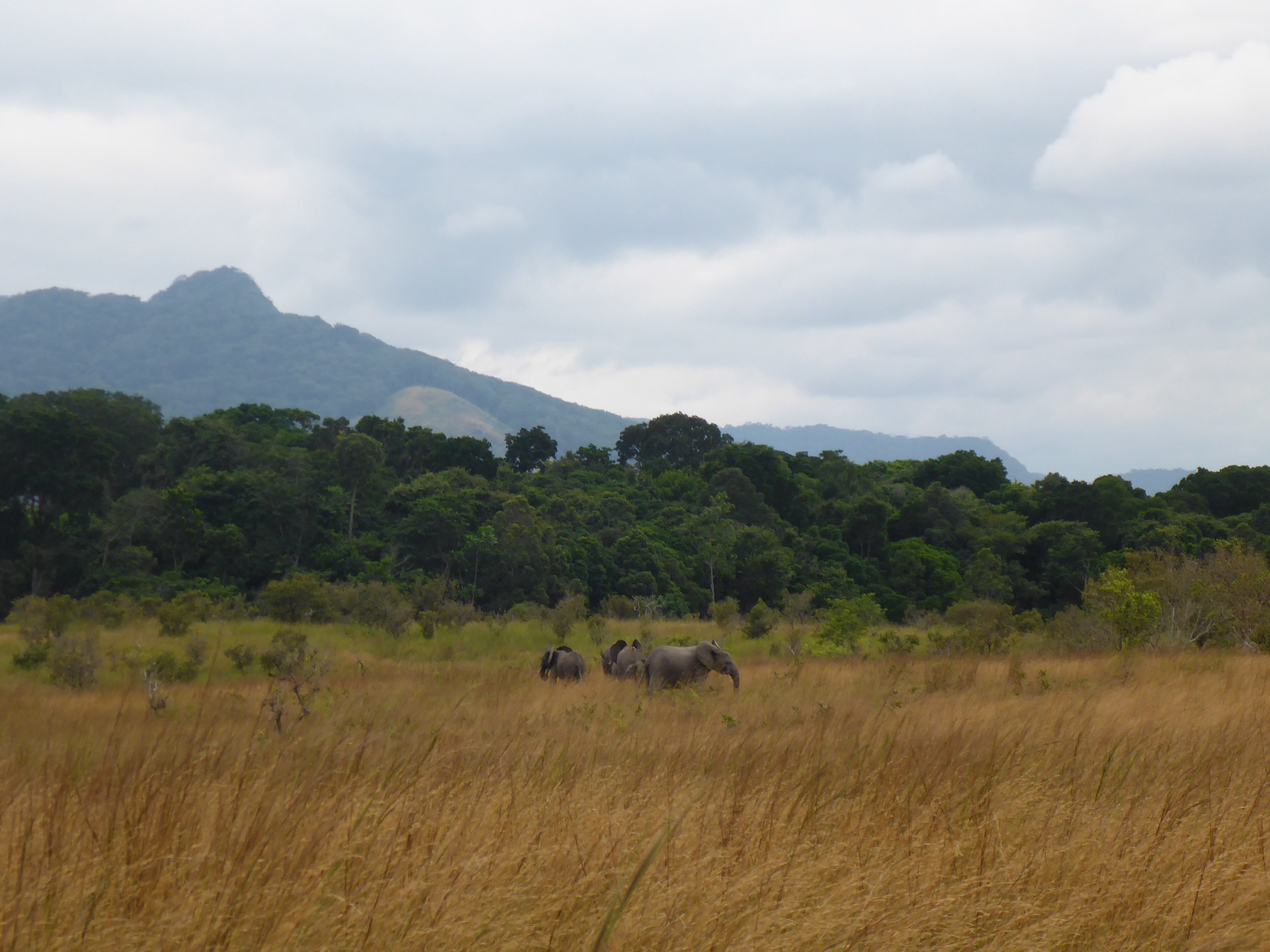
Dimonika is a UNESCO Biosphere Reserve in the central Mayombe chain, representing the range’s humid forest, recolonising forest communities, wildlife habitat, and conservation challenges.
Equipment
Mountain hiking equipment, rain protection, insect protection, and a local guide. Waterproof footwear is recommended.
Hazards and notes
The reserve is affected by human pressure, including settlement, agriculture, and mining in some sources. Current access and safety conditions must be checked locally.
GPX / KML links
| Source | URL | Format / access | Reuse status |
|---|---|---|---|
| OpenStreetMap search | openstreetmap.org | Map/search | OSM data ODbL; candidate geometry check only |
| Wikiloc search | wikiloc.com | Search | Wikiloc terms apply; no GPX selected |
External links
3. Luki Biosphere Reserve Forest Walk
Snapshot
Itinerary
The candidate route is a guided walk through the Luki forest reserve/biosphere reserve, using permitted forest paths. No official public route, distance, or downloadable route file was found.
Why it is essential
Luki represents the Democratic Republic of the Congo side of the Mayombe, with humid tropical forest, a recognised biosphere-reserve designation, and a long conservation history.
Equipment
Standard to mountain hiking equipment, rain protection, insect protection, and a local guide.
Hazards and notes
Local permissions, research-zone restrictions, forest degradation, hunting pressure, and safe access must be checked before field use.
GPX / KML links
| Source | URL | Format / access | Reuse status |
|---|---|---|---|
| OpenStreetMap search | openstreetmap.org | Map/search | OSM data ODbL; candidate geometry check only |
| Wikiloc search | wikiloc.com | Search | Wikiloc terms apply; no GPX selected |
External links
4. Sounda Gorge / Kouilou-Niari Viewpoint Walk
Snapshot
Itinerary
The candidate route visits viewpoints around the Kouilou-Niari at Sounda Gorge. No official day-hike route or public GPX was found, so the route should be treated as a field-verification target only.
Why it is essential
Sounda adds a major river-gorge landscape to the Mayombe set and represents the range’s deeply incised, forested river terrain.
Equipment
Standard hiking equipment, water, sun/rain protection, and sturdy footwear.
Hazards and notes
Hydropower project activity, road access, land permissions, and safe viewpoints need current local confirmation. Avoid unstable slopes and river edges.
GPX / KML links
| Source | URL | Format / access | Reuse status |
|---|---|---|---|
| OpenStreetMap search | openstreetmap.org | Map/search | OSM data ODbL; candidate geometry check only |
| Wikiloc search | wikiloc.com | Search | Wikiloc terms apply; no GPX selected |
External links
5. Maiombe National Park Forest-Edge Walk
Snapshot
Itinerary
The candidate route is a permitted guided walk on the Angolan/Cabinda side of the Mayombe forest. No public route line, visitor trail, or GPX was found.
Why it is essential
Maiombe National Park gives the catalogue an Angola/Cabinda representative and connects to the proposed wider Mayombe transboundary forest landscape.
Equipment
Mountain hiking equipment, rain protection, insect protection, and local guiding/permit confirmation.
Hazards and notes
Security, border-zone access, park operations, and guide requirements require current confirmation. Do not assume independent access.
GPX / KML links
| Source | URL | Format / access | Reuse status |
|---|---|---|---|
| OpenStreetMap search | openstreetmap.org | Map/search | OSM data ODbL; candidate geometry check only |
| Wikiloc search | wikiloc.com | Search | Wikiloc terms apply; no GPX selected |
External links
Missing data / follow-up work
- No official GPX/KML found for any of the five hikes.
- Route distances and elevation gains remain unresolved across the Mayombe entries.
- Luki and Maiombe access rules need official/local confirmation.
- Current safety conditions and protected-area guide requirements need field verification.
- Additional Commons/Flickr searches may find more reusable Mayombe forest imagery, but no reliable candidate was selected in this pass beyond Diosso.
External links
| Source | URL |
|---|---|
| Mayombe | en.wikipedia.org |
| Dimonika Biosphere Reserve | en.wikipedia.org |
| Gorges de Diosso | fr.wikipedia.org |
| Gorges de Sounda | fr.wikipedia.org |
| Luki biosphere reserve summary | ru.wikipedia.org |