Regional overview
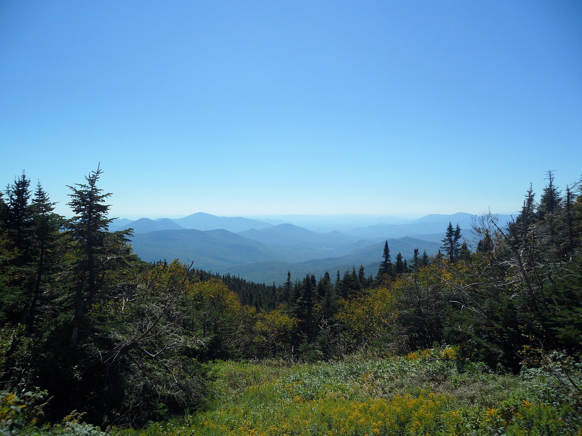
The Mount Jefferson / Three Fingered Jack sector occupies the central spine of the Oregon High Cascades, the volcanic arc that runs south from Mount Hood toward the Three Sisters and Bend region. The two named peaks anchor the Mount Jefferson Wilderness (about 111,000 acres / 45,000 ha), which Congress designated in 1968. Mount Jefferson itself rises to 3,201 m (10,502 ft), making it Oregon’s second-highest summit; Three Fingered Jack, an older and more deeply eroded stratovolcano, tops out at 2,394 m (7,854 ft). Both are non-trivial mountaineering objectives, and neither is part of the hiking catalogue here — what brings people to this sector on foot is the necklace of glacier-backed lakes, meadow basins and volcanic ridges below the peaks.
The walking landscape has two distinct halves. East of the divide, on the Deschutes National Forest side, the country opens into drier meadow and lava country around Three Fingered Jack and Jack Lake — short approach, big mountain views, classic wildflower hike. West of the divide, on the Willamette National Forest side, the trails climb out of dense coniferous forest into the lake-and-meadow basins under Jefferson’s western flank — longer, wetter, more committed days, with Jefferson Park as the iconic objective. The 2003 B&B Complex fires and the 2017 Whitewater Fire reshaped large parts of the wilderness, and several of the most-walked approaches still cross burn zones with the regrowth-fireweed and silver-snag aesthetic that goes with them.
The defining operational fact for day-hikers is the Central Cascades Wilderness Permit system, in force from 15 June to 15 October each year across the Mount Jefferson, Mount Washington and Three Sisters wildernesses. Day-use permits are required at quota trailheads (Whitewater, Pamelia Lake, Jack Lake, Marion Lake and others in this sector) and are issued on Recreation.gov. Pamelia Lake additionally sits inside a long-standing limited-entry zone with its own daily cap. Permits are issued in two waves — an advance lottery in spring and a rolling release a few days ahead — and the most popular trailheads (Whitewater above all) routinely sell out for summer Saturdays within minutes. Outside the permit window the trails are open without quota, but snow, blowdown and short daylight windows are then the limiting factors.
The standard hiking window runs from late June, when the high meadows clear of snow, through mid-October. Mosquitoes are heavy from snowmelt through early August, particularly at Jefferson Park, Hunts Cove and Pamelia Lake — local advice is to bring head-nets, not just repellent. There is no public transport into any of the trailheads. Access is by private vehicle from Salem or Bend, and most of the gravel approach roads are open only from late May through October.
Selection rationale
The five walks below were chosen to span the sector’s geographic and difficulty range rather than cluster on Jefferson Park, which dominates almost every other “best of” list for this area:
- Russell Lake via Whitewater Trail — the signature alpine meadow-and-lake approach into Jefferson Park, the single most iconic objective in the wilderness.
- Hunts Lake via Pamelia Lake — the quieter, deeper Jefferson basin day, accessed through the special limited-entry Pamelia Lake zone.
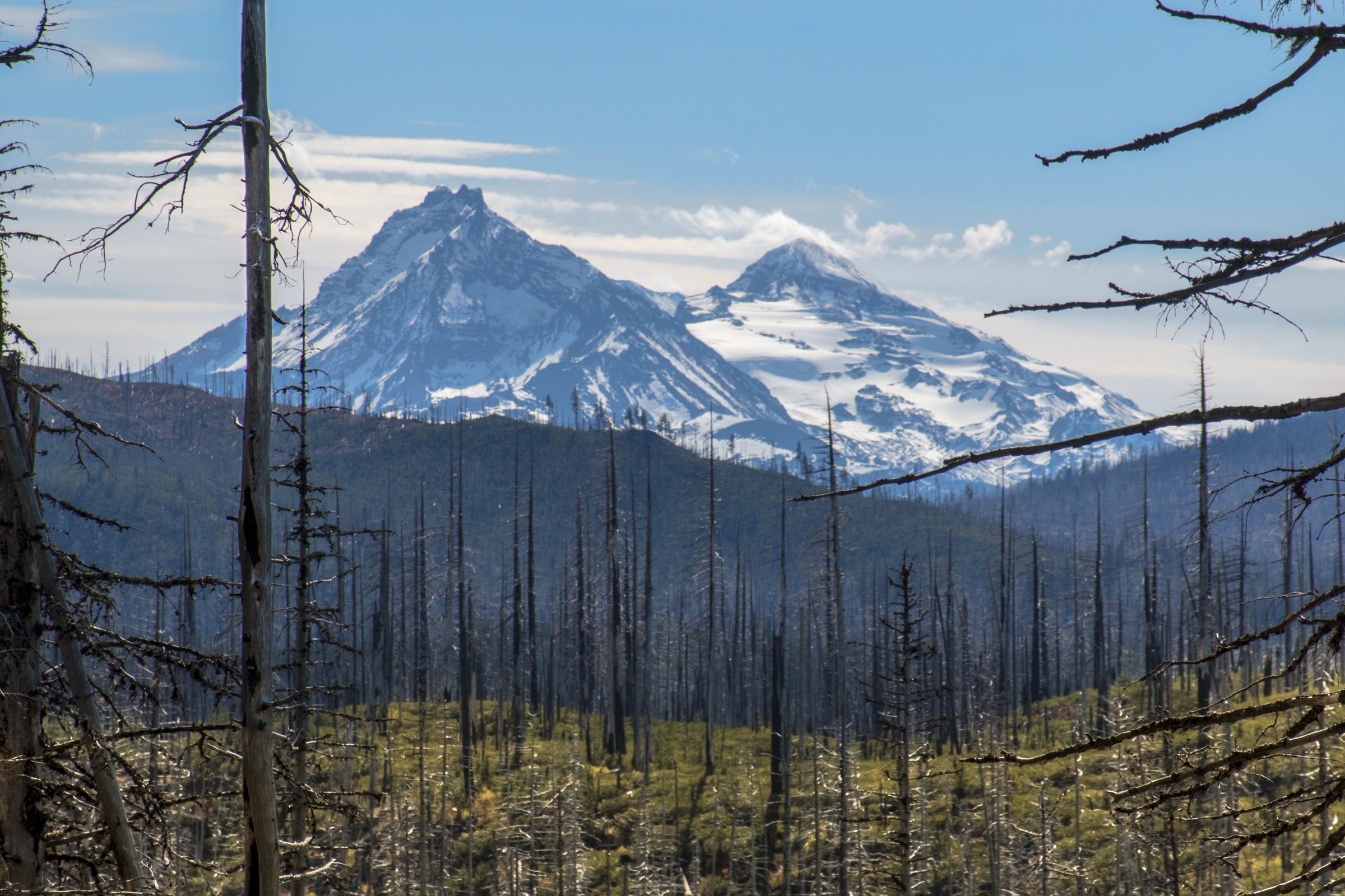
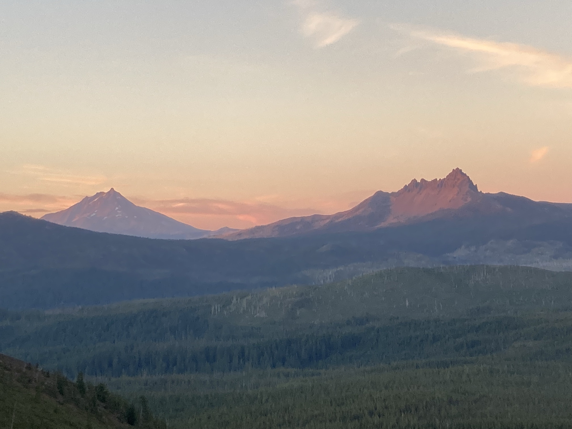
- Three Fingered Jack via Canyon Creek Meadows and Wasco Lake — the defining east-side meadow-and-volcano loop and the easiest way to put the Three Fingered Jack spires above your shoulder.
- Marion Lake Trail — a moderate west-side forest-and-lake classic that gives a representative Willamette-Cascades day without the full Jefferson Park commitment.
- Cone Peak / Iron Mountain wildflower loop — a Western Cascades wildflower ridge to balance the lake-basin character of the four wilderness picks, and the only one of the five that lies outside the Central Cascades permit area.
Summary table
| # | Hike | Country | Route type | Distance | Gain | Max elevation | Difficulty |
|---|---|---|---|---|---|---|---|
| 1 | Russell Lake via Whitewater Trail | United States | Out-and-back | 18.8 km | 620 m | 1,799 m | Hard |
| 2 | Hunts Lake via Pamelia Lake and Hunts Cove | United States | Out-and-back | 19.3 km | 751 m | 1,606 m | Hard |
| 3 | Three Fingered Jack, Canyon Creek Meadows and Wasco Lake | United States | Loop | 12.2 km | 378 m | 1,848 m | Moderate |
| 4 | Marion Lake Trail | United States | Out-and-back / loop variant | 8.4 km | 284 m | 1,285 m | Moderate |
| 5 | Cone Peak / Iron Mountain wildflower loop | United States | Loop | 10.8 km | 564 m | 1,656 m | Moderate |
1. Russell Lake via Whitewater Trail and the Pacific Crest Trail
Snapshot
Itinerary
From the Whitewater Trailhead the Whitewater Trail (#3429) climbs steadily through a corridor of standing dead and regenerating forest left by the 2017 Whitewater Fire, gaining the ridge that separates the Whitewater drainage from the Russell Creek basin. After about 4 km the trail joins the Pacific Crest Trail (#2000); turning north on the PCT, the route contours along the eastern flank of the ridge before dropping into Jefferson Park itself, the broad meadow basin under the north face of Mount Jefferson.
Inside Jefferson Park the trail passes Scout Lake and Bays Lake — both popular swim and lunch stops — before reaching Russell Lake, the largest of the basin’s lakes and the conventional turnaround for the day. From the Russell Lake shore the north face of Jefferson dominates the southern horizon, with Park Butte to the west and the broad meadow plain stretching back to the south. Return is by the same route; the climb back to the PCT junction is the principal effort of the second half.
Why it is essential
Jefferson Park is the iconic Mount Jefferson alpine landscape and the single best short-format introduction to the wilderness. The combination of a glacier-backed volcano, a string of trout-stocked lakes and an open meadow basin makes it the headline objective for the entire sector, and the Whitewater approach is the shortest and least committing way in.
Equipment
- Sturdy boots, trekking poles for the burn-zone descent
- Sun protection — the burn corridor is fully exposed
- Head-net and DEET-strength repellent through early August
- Water filter (Scout, Bays and Russell Lakes are reliable sources inside the basin)
- Navigation backup; cell coverage is unreliable
Hazards and notes
- The Whitewater Fire burn zone has unstable standing snags; avoid camping or lingering directly beneath dead trees on windy days.
- Russell Creek, crossed near the head of the basin on some side trips, runs muddy from glacial melt by mid-afternoon — early crossings are safer.
- Stay on durable surfaces in Jefferson Park’s meadow basin; off-trail wandering damages fragile vegetation that is slow to recover at this elevation.
- Central Cascades day-use permit must be reserved on Recreation.gov before arrival; rangers check at the trailhead.
Sources
- USDA Forest Service — Whitewater Trailhead
- USDA Forest Service — Central Cascades Wilderness Permits
- AllTrails — Russell Lake via Whitewater Trail and PCT
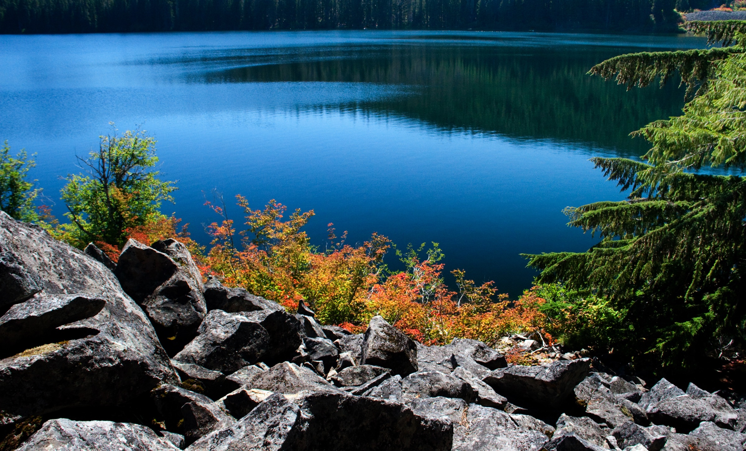
2. Hunts Lake via Pamelia Lake and Hunts Cove
Snapshot
Itinerary
From the Pamelia Lake Trailhead the Pamelia Lake Trail (#3439) follows Pamelia Creek through old-growth Douglas-fir for roughly 3 km to the shore of Pamelia Lake, a sediment-floored basin lake directly beneath the western shoulder of Mount Jefferson. At the lake junction the Hunts Creek Trail (#3440) turns south and climbs steeply through forest, paralleling Hunts Creek toward the upper basin.
Higher up the route joins the Hunts Cove Trail (#3430) and contours below the lava bluffs that define the cove, reaching Hunts Lake at the head of the basin under the southwest face of Jefferson. Hunts Lake itself is set in a tight rock-bound cirque with the Hunts Creek outflow at its eastern lip; on a clear day the upper west glacier of Jefferson hangs directly above the lake. Return is by the same route, with the option to bypass the Hunts Cove section and finish with a lakeside lunch back at Pamelia.
Why it is essential
Hunts Cove is the deeper, quieter Jefferson lake-basin objective, and the only one of the catalogue that approaches the volcano from the southwest. The combination of an old-growth approach, a working creek climb and the rock-bound upper cove gives a strong contrast to the meadow-floored Jefferson Park route — and the Pamelia Lake daily-entry cap keeps numbers low even when the rest of the wilderness is busy.
Equipment
- Sturdy boots, trekking poles for the Hunts Creek climb
- Head-net and repellent — the lake shores are notorious through July
- Water filter; Pamelia Lake water is silty, Hunts Creek and Hunts Lake are cleaner
- Layered insulation; the upper cove is shaded and cool even in August
- Navigation backup
Hazards and notes
- The Pamelia Limited Entry Area requires a separate permit on top of the Central Cascades day-use permit — both must be reserved on Recreation.gov.
- Hunts Creek can run fast in early summer; the upper crossing is unbridged.
- Blowdown is common on the Hunts Creek and Hunts Cove segments after winter storms; expect occasional logs.
- Stay on durable surfaces in the upper cove meadows — soils are thin and recovery is slow.
Sources
- USDA Forest Service — Pamelia Lake Trailhead
- USDA Forest Service — Central Cascades Wilderness Permits
- AllTrails — Hunts Lake via Pamelia Lake, Hunts Creek and Hunts Cove
3. Three Fingered Jack, Canyon Creek Meadows and Wasco Lake
Snapshot
Itinerary
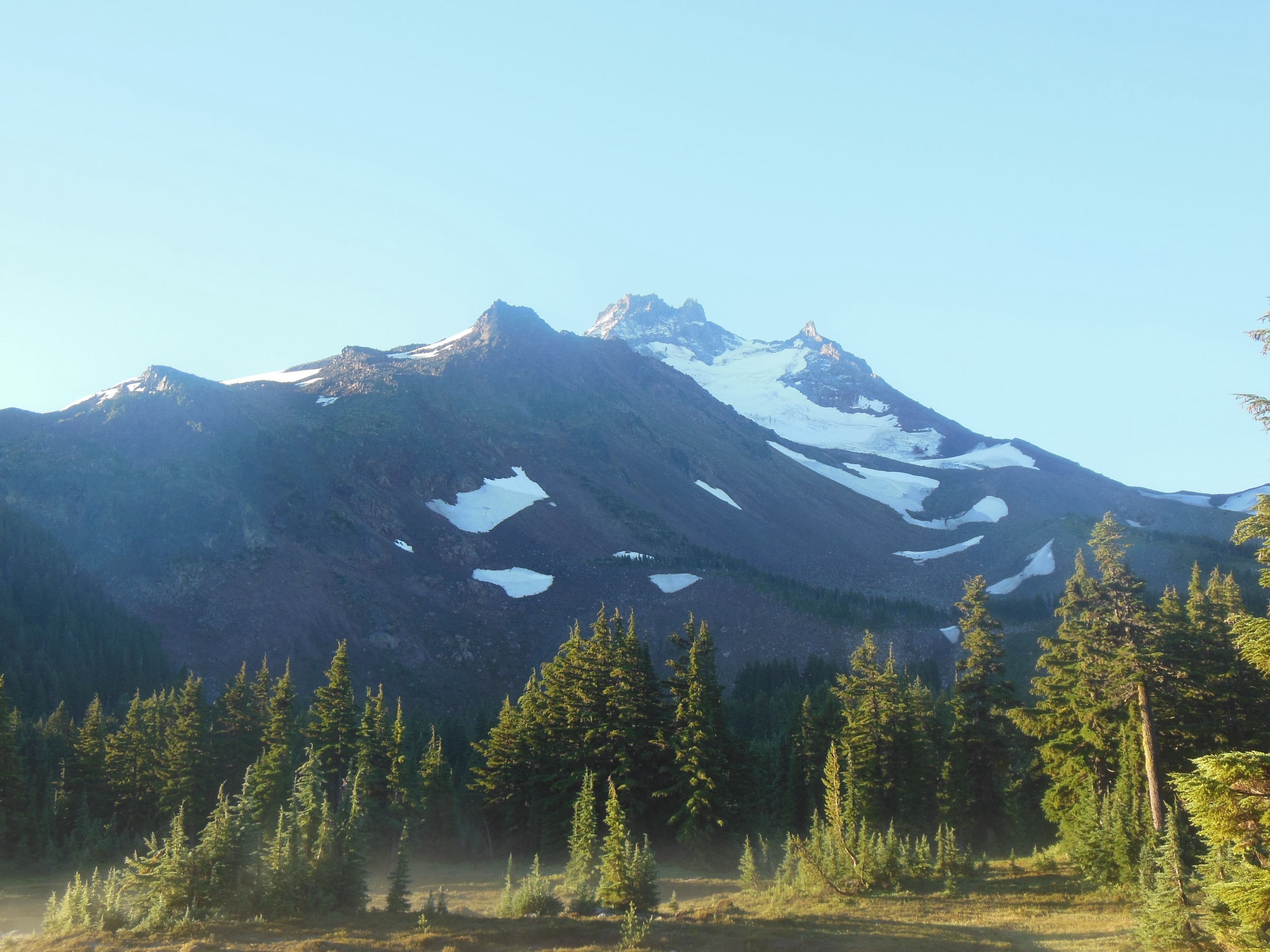
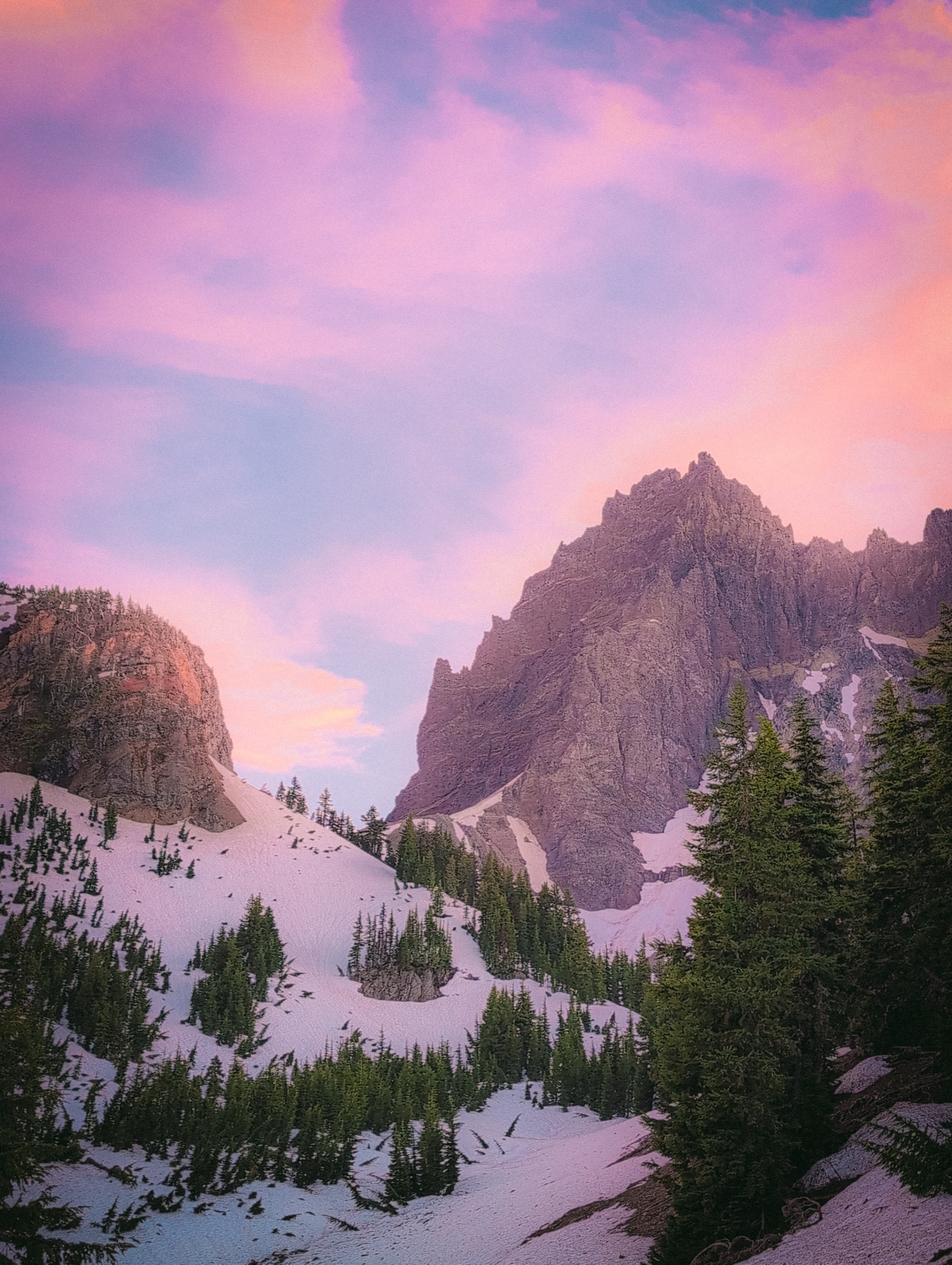
From Jack Lake the trail follows the Canyon Creek Trail through a corridor of standing snags from the 2003 B&B Complex Fire — the fireweed-and-larch regrowth landscape that now defines the lower part of the loop. The forest opens into the lower Canyon Creek Meadows after about 2 km, and the trail climbs gently to the upper meadows under the eastern flank of Three Fingered Jack, where the crumbling volcanic spires that give the mountain its name stand directly above the basin.
The conventional loop turns north onto the Minto Pass Tie (#4015), drops to Wasco Lake — a small forest-set lake on the PCT corridor — and rejoins the Old Summit Trail (#4014) back to Jack Lake. An optional out-and-back to the high tarn under Three Fingered Jack adds about 1.5 km and 100 m of climbing on a steeper, looser side path; it is the upper-meadow detour that most trip reports describe as the highlight, but it is also the section where staying on durable surfaces matters most.
Why it is essential
This is the defining Three Fingered Jack walk, and the easiest way in the entire sector to put the mountain directly above your shoulder without committing to a long day. The combination of B&B burn-zone regrowth, mid-summer meadow bloom and the dark volcanic spires of the peak is the visual signature of the east-side wilderness.
Equipment
- Trail shoes or light boots; the loop is short but the upper section is loose
- Sun protection — the burn corridor and meadows are fully exposed
- Head-net and repellent in July
- 2+ litres of water; Canyon Creek is reliable, Wasco Lake is filterable
- Light insulation for the elevation
Hazards and notes
- The optional upper-tarn scramble is loose and unsigned; do not attempt the spire scrambles themselves, which are graded loose rock on a heavily eroded edifice.
- Stay on durable surfaces in the upper meadows — the alpine meadow vegetation here is fragile and recovery from off-trail trampling is slow.
- The B&B burn zone has standing snags; do not linger under dead trees on windy days.
- Jack Lake Road can hold snow into June and become rough after summer storms; high-clearance vehicles are not required, but tyres should be in good condition.
Sources
- USDA Forest Service — Jack Lake Trailhead
- USDA Forest Service — Central Cascades Wilderness Permits
- AllTrails — Three Fingered Jack, Canyon Creek Meadows and Wasco Lake
4. Marion Lake Trail
Snapshot
Itinerary
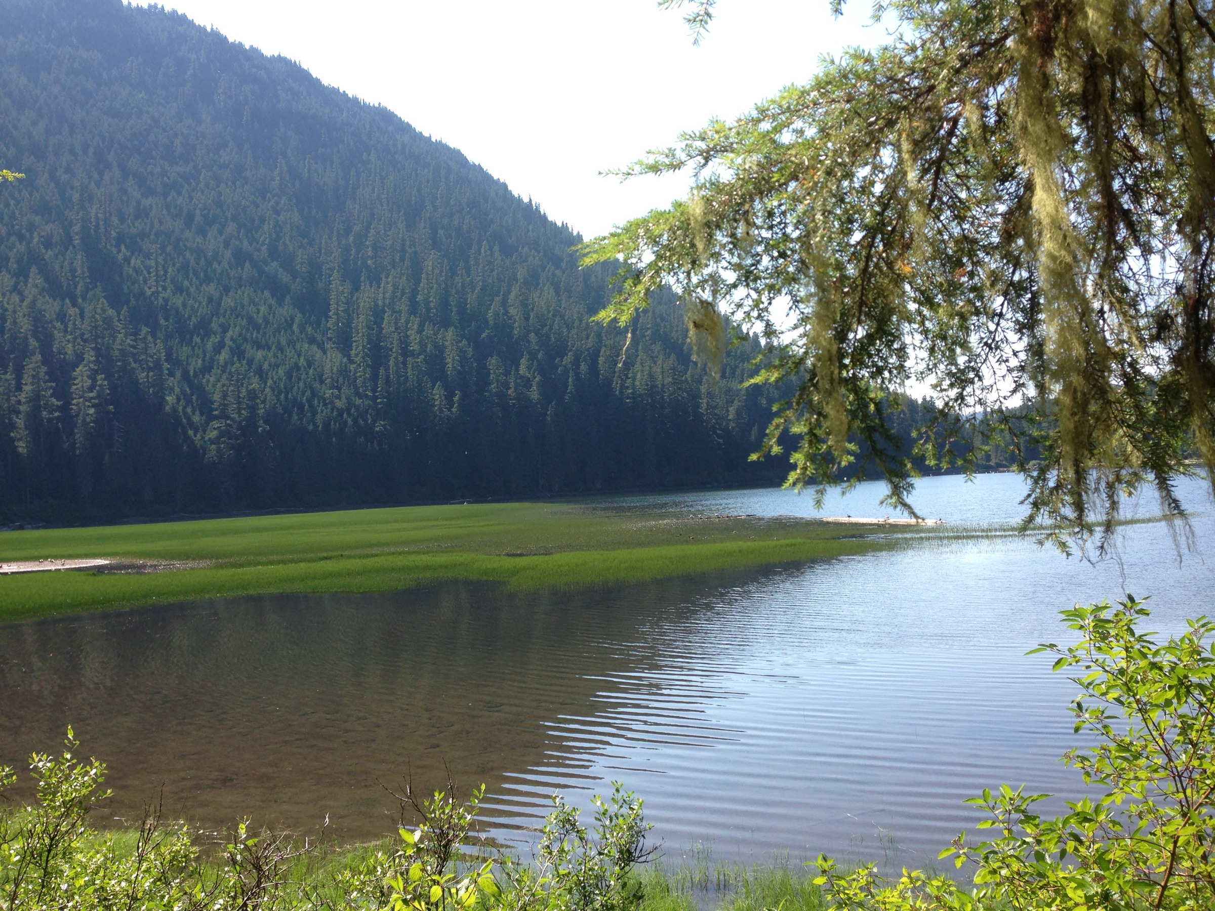
From the Marion Lake Trailhead the route climbs gently through dense Douglas-fir and hemlock for about 2 km to small, shallow Lake Ann — the conventional first stop and a popular short-walk turnaround. Above Lake Ann the trail steepens briefly, gains a forested bench and arrives at the western shore of Marion Lake itself, set in a basin under the northwestern outliers of Three Fingered Jack.
Most parties wander south along the shoreline to the lake’s outlet — a short, optional loop that gives the day a clean structure — before returning to the trailhead by the same path. The outlet section drops into a small slot canyon over Marion Falls a short distance below the lake; the falls are signed but easy to miss from the main trail, and the spur down to the view is worth the few minutes.
Why it is essential
Marion Lake is the classic west-side Oregon Cascades day-hike: a moderate forest climb, a glacier-set lake under volcanic ridges, and a real-day timeframe rather than the full alpine commitment of Jefferson Park or Hunts Cove. It is the obvious entry-level walk for the wilderness and the only one of the five that families and walkers acclimating to the Central Cascades can reasonably treat as a half-day outing.
Equipment
- Trail shoes or light boots; poles useful when the tread is wet
- Repellent — the shoreline is mosquito-heavy through July
- Water and snacks; Marion Lake is filterable, Lake Ann less so
- Light layer for the forest shade
Hazards and notes
- Slippery roots and rock on the wet sections of the upper climb; the falls spur is short but exposed.
- Camp-fires are prohibited near Marion Lake and Lake Ann under wilderness regulations — bring a stove if cooking is planned.
- Blowdown is common on the lower trail in spring; check Forest Service alerts before driving in if you are first into the trail for the season.
Sources
- USDA Forest Service — Marion Lake Trailhead
- USDA Forest Service — Central Cascades Wilderness Permits
- AllTrails — Marion Lake Trail
5. Cone Peak Trail / Iron Mountain wildflower loop
Snapshot
Itinerary
From the Tombstone Pass Sno-Park the route climbs through old-growth Douglas-fir and noble fir onto the Cone Peak meadows, a sequence of open south-facing slopes that hold one of the densest wildflower assemblages in the Western Cascades — paintbrush, lupine, larkspur, columbine, valerian and tiger lily in mid-summer, with a long bloom sequence stretching from June into August.
Above the Cone Peak shoulder the trail joins the ridge connector across to Iron Mountain, traverses through a short forest section, and finishes with a short steep climb up the southwest face of Iron Mountain to a fenced viewing platform on the former lookout site at 5,455 ft. On a clear day the platform gives a north-to-south sweep of the High Cascades volcanoes: Mount Hood, Mount Jefferson, Three Fingered Jack, the Sisters, Mount Washington, and Diamond Peak on the far southern horizon. Descent is via the Iron Mountain Trail back to the Tombstone Pass area, closing the loop.
Why it is essential
This is the wildflower-ridge counterpoint to the lake-basin character of the four wilderness picks, and the only one of the five that delivers a full panorama of the volcanic arc rather than a single peak. It is also the only walk in the catalogue that sits outside the Central Cascades permit area, which makes it the obvious fallback when the Whitewater, Pamelia and Jack Lake permits are sold out.
Equipment
- Boots, trekking poles for the steeper Iron Mountain push
- Sun protection — the meadow ridge is fully exposed
- 2 litres of water; there are no reliable on-route sources
- Light insulation for the summit platform
Hazards and notes
- The summit climb is steep and partly on loose rock; the fenced platform is solid but the approach steps can be icy in early season.
- Wildflower-meadow ground is fragile; stay on the tread, do not pick flowers, and do not let dogs run off-trail through the bloom.
- The Tombstone Pass parking area lies directly on US-20; cross the highway with care.
- Afternoon thunderstorms are a real summer hazard on the exposed ridge — descend if cells build.
Sources
- USDA Forest Service — Willamette National Forest, Sweet Home Ranger District
- AllTrails — Cone Peak Trail
Further reading
| Source | URL |
|---|---|
| USDA Forest Service — Willamette National Forest | fs.usda.gov |
| USDA Forest Service — Deschutes National Forest | fs.usda.gov |
| USDA Forest Service — Central Cascades Wilderness Permits | fs.usda.gov |
| Recreation.gov — Central Cascades Wilderness Permits | recreation.gov |
| Wikipedia — Mount Jefferson (Oregon) | en.wikipedia.org |
| Wikipedia — Three Fingered Jack | en.wikipedia.org |
| Wikipedia — Mount Jefferson Wilderness | en.wikipedia.org |
| Wikimedia Commons — Category: Mount Jefferson (Oregon) | commons.wikimedia.org |
| Oregon Hikers Field Guide — Mount Jefferson Wilderness | oregonhikers.org |
| OpenStreetMap (ODbL 1.0) | openstreetmap.org |