Regional overview
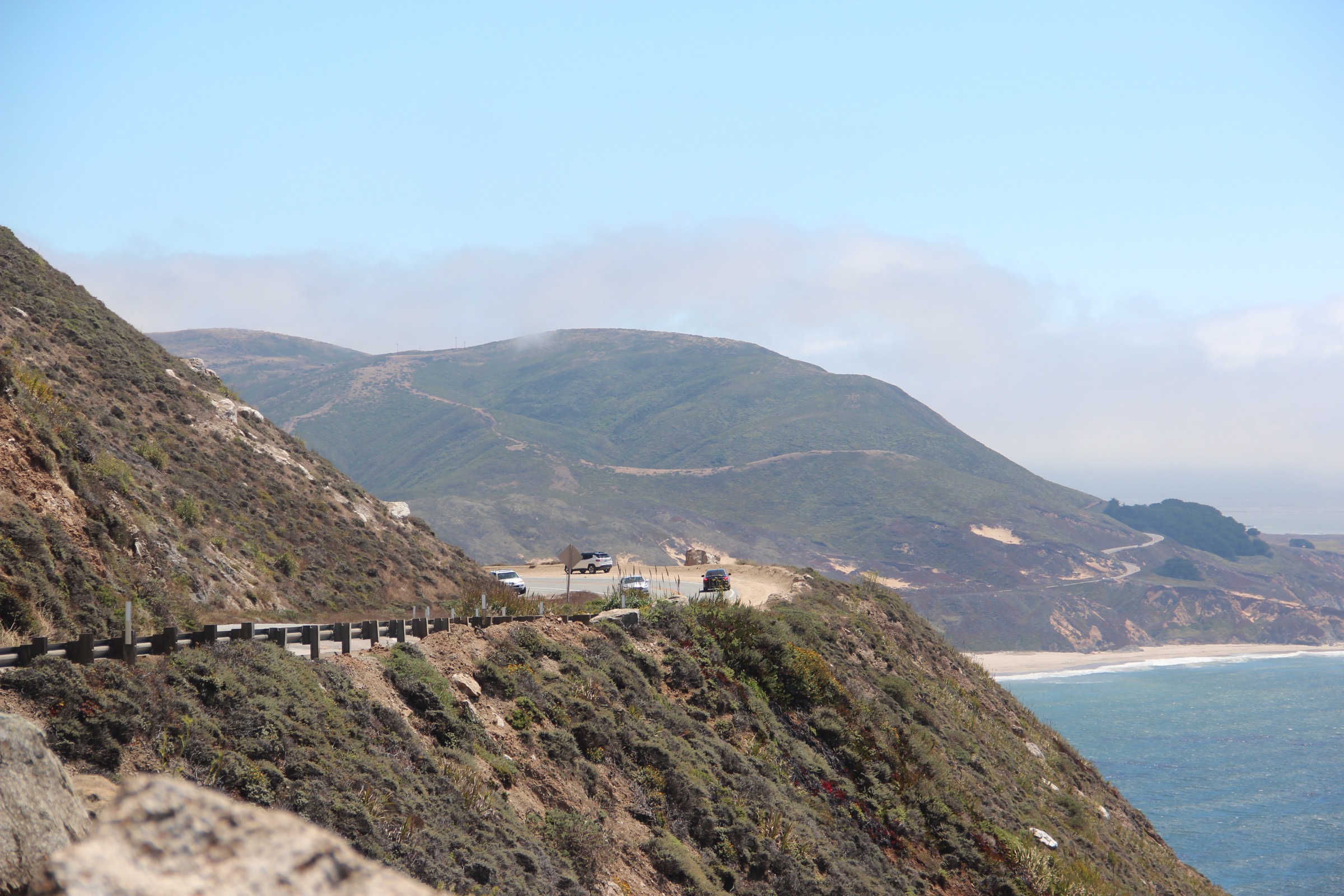
The mountains around San Francisco Bay are the northern arc of the California Coast Ranges, a low but complex system of fault-block ridges and marine-terrace peaks pushed up along the San Andreas and Hayward faults. None of them are high by western standards — Mount Diablo tops out at 1,173 m (3,849 ft), Mount Tamalpais at 784 m (2,571 ft) — but they rise directly from tidewater, so vertical gains of 500–800 m from a sea-level trailhead are the norm. The ranges split into three walking areas around the Bay. Marin, north of the Golden Gate, holds the coastal peaks and headlands of Mount Tamalpais State Park, the Golden Gate National Recreation Area (GGNRA) and Point Reyes National Seashore. The East Bay, on the far side of the fault, is dominated by Mount Diablo and its state park, ringed by the East Bay Regional Park District’s grassland preserves at Sunol and Ohlone. The Peninsula and the northern end of the Santa Cruz Mountains, running south from San Francisco toward the interior of the range, carry a chain of coastal-redwood and skyline preserves managed by the Midpeninsula Regional Open Space District (MROSD) and the Peninsula Open Space Trust (POST).
Because the sea is so close, walking here is governed by fog and heat rather than snow. Coastal ridges from Point Reyes to the Marin Headlands sit under a summer marine layer that keeps daytime temperatures in the mid-teens Celsius even in August, while inland grasslands above the Diablo Range and Sunol regularly exceed 35 °C on the same days. Rain falls almost entirely between November and April; grassland ridges are electric green from January to April and burnt gold from June through the first storms. There is no snow line — Mount Diablo occasionally dusts white in winter, but the trails stay walkable year-round. Fire closure is the seasonal constraint that matters most: Cal Fire and the National Park Service close individual preserves during Red Flag warnings, and the 2020 Woodward Fire on Point Reyes still shapes trail work on the Inverness Ridge side of the seashore.
Access is unusually good for a mountain area. San Francisco’s Golden Gate Bridge feeds directly into Marin; BART, Muni and Golden Gate Transit reach GGNRA trailheads at the Golden Gate Bridge, Marin Headlands and Sausalito, and County Connection and BART link to Walnut Creek for Mount Diablo. Most trailheads in the East Bay parks, MROSD preserves and Point Reyes still require a car for the final approach. Parking fees apply at Mount Tamalpais, Mount Diablo and Point Reyes, but no permits are needed for day hiking anywhere in the region. Dogs are prohibited on National Park Service and Mount Tamalpais State Park trails; MROSD, EBRPD and GGNRA rules vary by preserve and trail. The main safety issues are mundane — poison oak everywhere below 600 m, ticks in the coastal scrub, and the occasional mountain lion or rattlesnake — with the honest hazard being over-committing to an inland ridge in summer heat with no water.
For neighbouring California ranges, see the companion entries on Mount Whitney and the Southern High Sierra and Sequoia and Kings Canyon.
Selection rationale
The five routes below spread across the three walking areas around the Bay and cover the region’s core landscapes:
- Mount Tamalpais East Peak — the summit of Marin, the highest walkable point on the north side of the Golden Gate.
- Marin Headlands Coastal Trail — the coastal-bluff walk, with the Pacific on one side and the Golden Gate on the other.
- Tomales Point — the northern spine of Point Reyes, elk range and the range’s classic long ocean-peninsula route.
- Mount Diablo Grand Loop — the East Bay summit day, and the biggest single-day climb in the region.
- Purisima Creek Redwoods loop — the Peninsula redwood-canyon route, on the northern end of the Santa Cruz Mountains.
Each hike stands on its own trailhead; none are true out-and-back summits except by choice. Highly technical scrambles, closed sections of the Woodward Fire scar, and multi-park thru-hikes such as the Bay Area Ridge Trail are excluded.
Summary table
| # | Hike | Country | Route type | Distance | Gain | Max elevation | Difficulty |
|---|---|---|---|---|---|---|---|
| 1 | Mount Tamalpais East Peak (Matt Davis–Rock Spring loop) | USA | Loop | 14.2 km | 523 m | 784 m | Hard |
| 2 | Marin Headlands Coastal Trail (Rodeo Beach loop) | USA | Loop | 8.0 km | 335 m | 290 m | Moderate |
| 3 | Tomales Point Trail | USA | Out-and-back | 15.6 km | 365 m | 170 m | Moderate |
| 4 | Mount Diablo Grand Loop | USA | Loop | 10.3 km | 550 m | 1,173 m | Hard |
| 5 | Purisima Creek Redwoods (Harkins Ridge–Purisima Creek loop) | USA | Loop | 11.3 km | 528 m | 640 m | Moderate |
1. Mount Tamalpais East Peak (Matt Davis–Rock Spring loop)
Snapshot
Itinerary
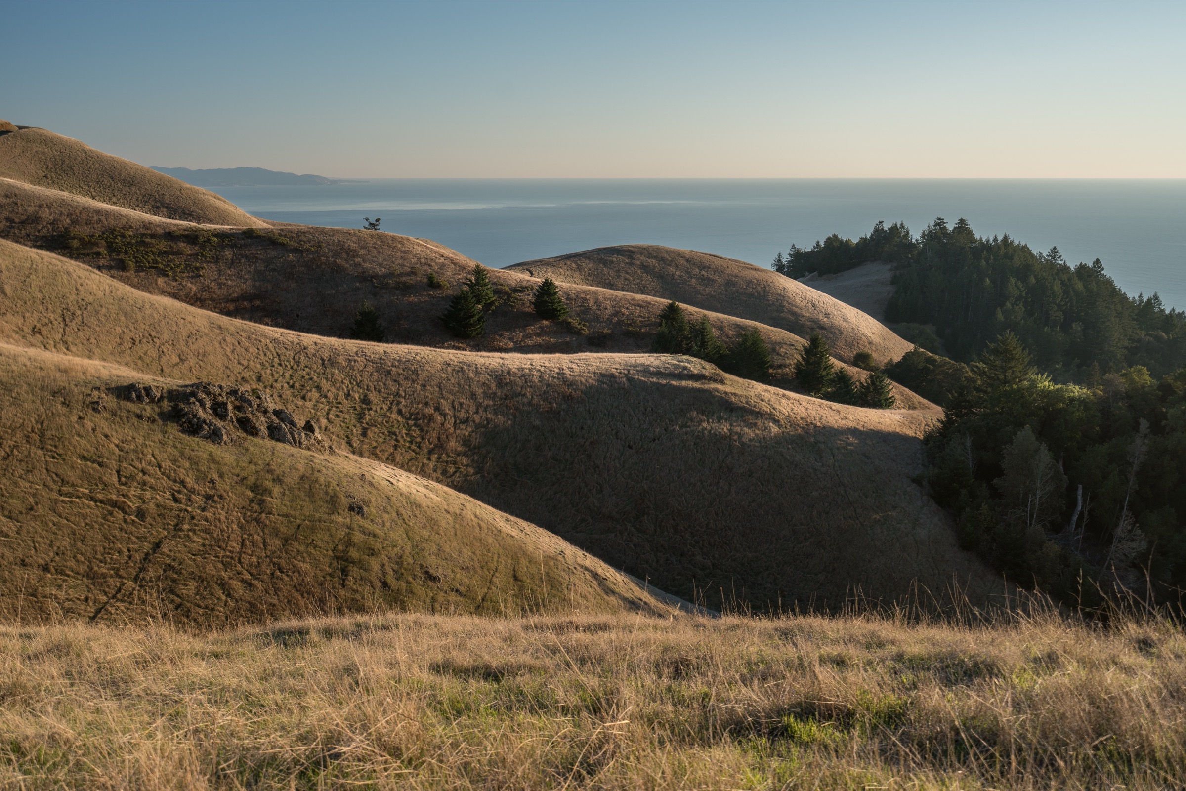
From Pantoll Ranger Station at 460 m on Panoramic Highway, the Matt Davis Trail traverses east across the south flank of the mountain through mixed Douglas-fir and bay laurel, contouring above the Bootjack drainage. After a short climb the route connects to the Old Railroad Grade, the near-level bed of the historic Mount Tamalpais Railway that operated between 1896 and 1930; this section wraps around the mountain’s south face on a steady 5 % grade to the East Peak parking area at roughly 730 m. A short summit spur — the Plank Walk / Verna Dunshee route — reaches the fire lookout at 784 m, the highest point in Marin County. The descent returns west along the Rock Spring–Lakeview Trail to the West Point Inn, then drops through Rock Spring and back to Pantoll. AllTrails records the standard Matt Davis–Rock Spring loop at 14.2 km with 523 m of gain and moderate-to-hard difficulty.
Why it is essential
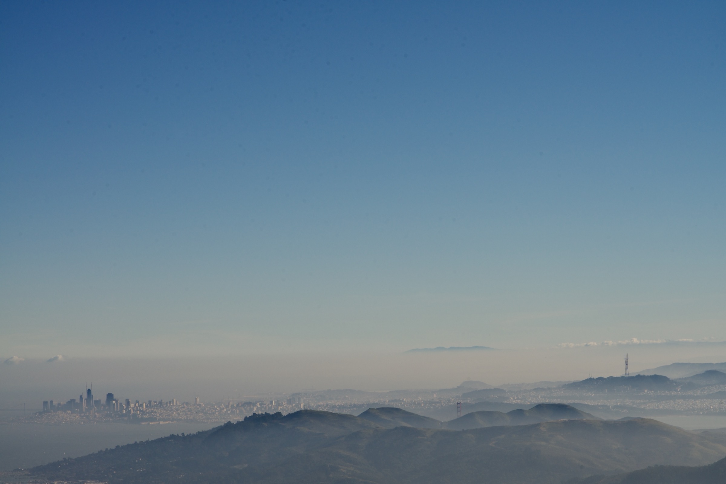
East Peak is the summit of Marin, the highest walkable point north of the Golden Gate, and its full 360° panorama covers the Farallon Islands, Point Reyes, the San Francisco skyline, Mount Diablo and — on clear winter mornings — the Sierra Nevada crest. The loop combines that summit with a section of the 1896 railway grade and the redwood-fern drainages that give Mount Tamalpais its name.
Equipment
Hiking shoes with grip, layered clothing including a wind shell for the summit ridge, sun protection, 1.5–2 L water, food, and a downloaded offline map. Trekking poles help on the steep Matt Davis descent variant. Winter storms can bring cold rain — carry a full waterproof shell between November and March.
Hazards and notes
Poison oak lines almost every lower trail on the mountain. Ticks are present year-round in the coastal-scrub belt. The summit road (East Ridgecrest Boulevard) is regularly closed for storm damage, wildfire recovery or wildlife management — confirm current status with California State Parks before driving to Pantoll. Dogs are prohibited on state-park trails. Cellular signal is intermittent below the summit.
GPX / route file
| Source | URL | Format / access | Reuse status |
|---|---|---|---|
| AllTrails — East Peak via Matt Davis to Rock Spring Loop | alltrails.com | Source map / downloadable route via AllTrails account | AllTrails terms apply; direct GPX not retrieved |
| California State Parks — Mount Tamalpais State Park | parks.ca.gov | Official park page and map PDF | No public GPX; official trail context |
Further reading
- California State Parks — Mount Tamalpais State Park
- AllTrails — East Peak via Matt Davis to Rock Spring Loop
2. Marin Headlands Coastal Trail (Rodeo Beach loop)

Snapshot
Itinerary
From the Fort Cronkhite lot behind Rodeo Beach, the Coastal Trail climbs north above Rodeo Lagoon, then contours a series of exposed grass-and-scrub bluffs above the Pacific. Old Cold War-era military installations — Nike missile sites, gun batteries and Hill 88 — punctuate the ridge. At the north end of the coastal section the route turns inland on the Wolf Ridge Trail, crosses to the Bay side of the peninsula, and returns south on the SCA (Stephen Christopher Ascher) Trail through coyote-brush and coffeeberry scrub, dropping back to the lagoon and Rodeo Beach. The NPS trail-length signage gives about 8 km round-trip for the standard bluff-and-ridge loop; the local variant along Hill 88 adds a short spur.
Why it is essential
This is the coastal-bluff walk of the Bay Area — a short, non-technical loop that pairs open Pacific horizons with the mouth of the Golden Gate. It also delivers the widest concentration of accessible World War II and Cold War coastal-defence relics in the region.
Equipment
Hiking shoes, wind shell (the ridge is exposed and often colder than the beach), sun protection, water, and a downloaded offline map. Binoculars are useful in whale-migration season.
Hazards and notes
Fog can drop visibility on the ridge to a few metres within minutes; carry a wind layer even in summer. Ticks and poison oak line the SCA Trail sections. Cliff edges along the Coastal Trail are unstable — stay on trail. Dogs are permitted on-leash on some Marin Headlands trails (varies by section); check the GGNRA pet map before travelling with a dog.
GPX / route file
| Source | URL | Format / access | Reuse status |
|---|---|---|---|
| NPS — Marin Headlands hiking | nps.gov | Official page and trail map PDF | No public GPX; NPS trail context |
| AllTrails — Coastal Trail, Wolf Ridge and SCA Trail Loop | alltrails.com | Source map / downloadable route via AllTrails account | AllTrails terms apply |
Further reading
3. Tomales Point Trail
Snapshot
Itinerary
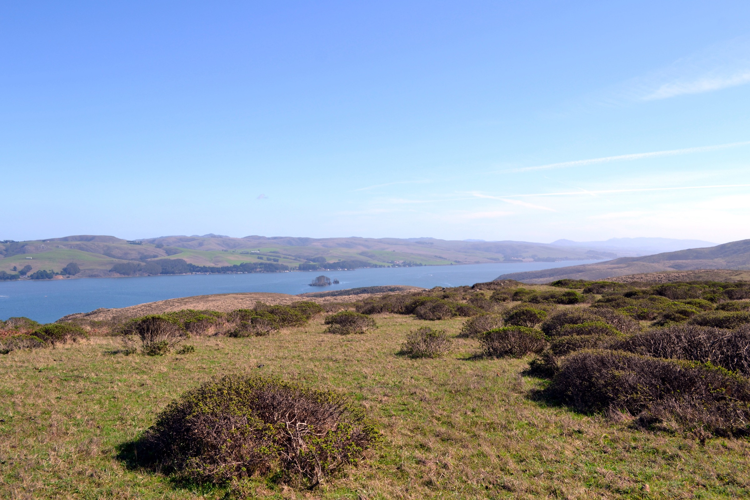
The trail leaves the historic Pierce Point Ranch complex on the exposed grassland spine of the Tomales Point peninsula and heads north-north-west, with the Pacific Ocean on the west and Tomales Bay on the east. The path is broad, mostly former ranch road, and rolls over a series of low grass ridges above sea cliffs. The Lower Pierce Point Ranch area of vegetation transitions to open coastal prairie about 2 km in; from there it is another 5.5 km on a fading tread through coyote brush and lupine to the northern tip, where cliffs drop 60 m to the mouth of Tomales Bay opposite Bodega Head. NPS lists the round-trip as 9.5 miles (15.3 km); AllTrails records 15.9 km with about 375 m of gain.
The Tomales Point herd of tule elk (Cervus canadensis nannodes) — reintroduced to Point Reyes in 1978 — is almost always visible along the ridge. Following the National Park Service’s December 2024 final decision on the Tomales Point Area Plan, the 3 m (10 ft) elk enclosure fence at the south end of the peninsula is in the process of being removed; the herd is transitioning to a free-range population, and walkers may now encounter elk south of the former fence line.
Why it is essential
Tomales Point is the classic Point Reyes long walk — a peninsula-spine route with the ocean on both sides, one of the largest tule elk populations in California, and, at the tip, a sea-cliff outlook on the Point Reyes fault where the Pacific and North American plates meet. It is also the longest maintained purely on-trail hike within the seashore.
Equipment
Hiking shoes, wind shell (the ridge is completely unsheltered), sun protection, at least 2 L water (there is none on the route), food, and a downloaded offline map. Binoculars for elk, whales and shorebirds. Full waterproofs November–March.
Hazards and notes
There is no water and no shelter on the entire route — turn back if fog closes visibility on the outer point. Ticks are widespread in the coastal-scrub sections; long trousers are recommended in spring and summer. Rattlesnakes appear on warm days. Dogs are prohibited on all Point Reyes trails. Confirm current conditions with the NPS Tomales Point page before driving — the 2020 Woodward Fire recovery still shapes trail work elsewhere in the seashore, and Pierce Point Road is occasionally closed in storms.
GPX / route file
| Source | URL | Format / access | Reuse status |
|---|---|---|---|
| NPS — Hike the Tomales Point Trail | nps.gov | Official trail page | No public GPX; NPS route context |
| AllTrails — Tomales Point Trail | alltrails.com | Source map / downloadable route via AllTrails account | AllTrails terms apply |
Further reading
- NPS — Tomales Point, Pierce Ranch, and Tule Elk
- NPS — Hike the Tomales Point Trail
- NPS — Tomales Point Area Plan (2024 final decision)
4. Mount Diablo Grand Loop
Snapshot
Itinerary
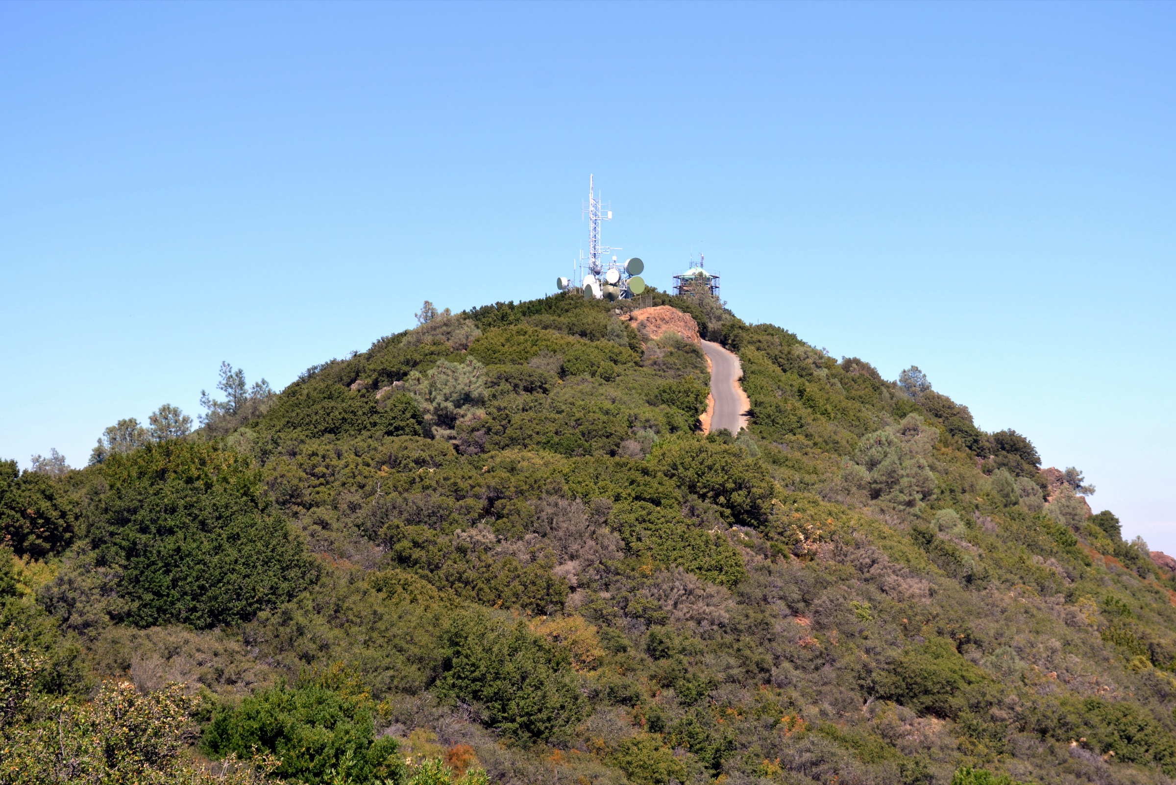
The loop leaves the Juniper Campground area at roughly 900 m and descends north-west on the Deer Flat Road, an old fire road, cutting through blue-oak woodland to Deer Flat at 720 m. From Deer Flat the Meridian Ridge Road climbs east along an open sandstone spine, joining the North Peak / Prospectors Gap system before pulling up the final rocky ridge to the summit at 1,173 m. The descent returns via the Summit Trail, then loops west on the Juniper Trail past its namesake grove and back to the trailhead. Save Mount Diablo’s route guide and AllTrails both list the loop at 6.3–6.4 miles (10.1–10.3 km) with about 550 m of gain and 4–4.5 hours of moving time.
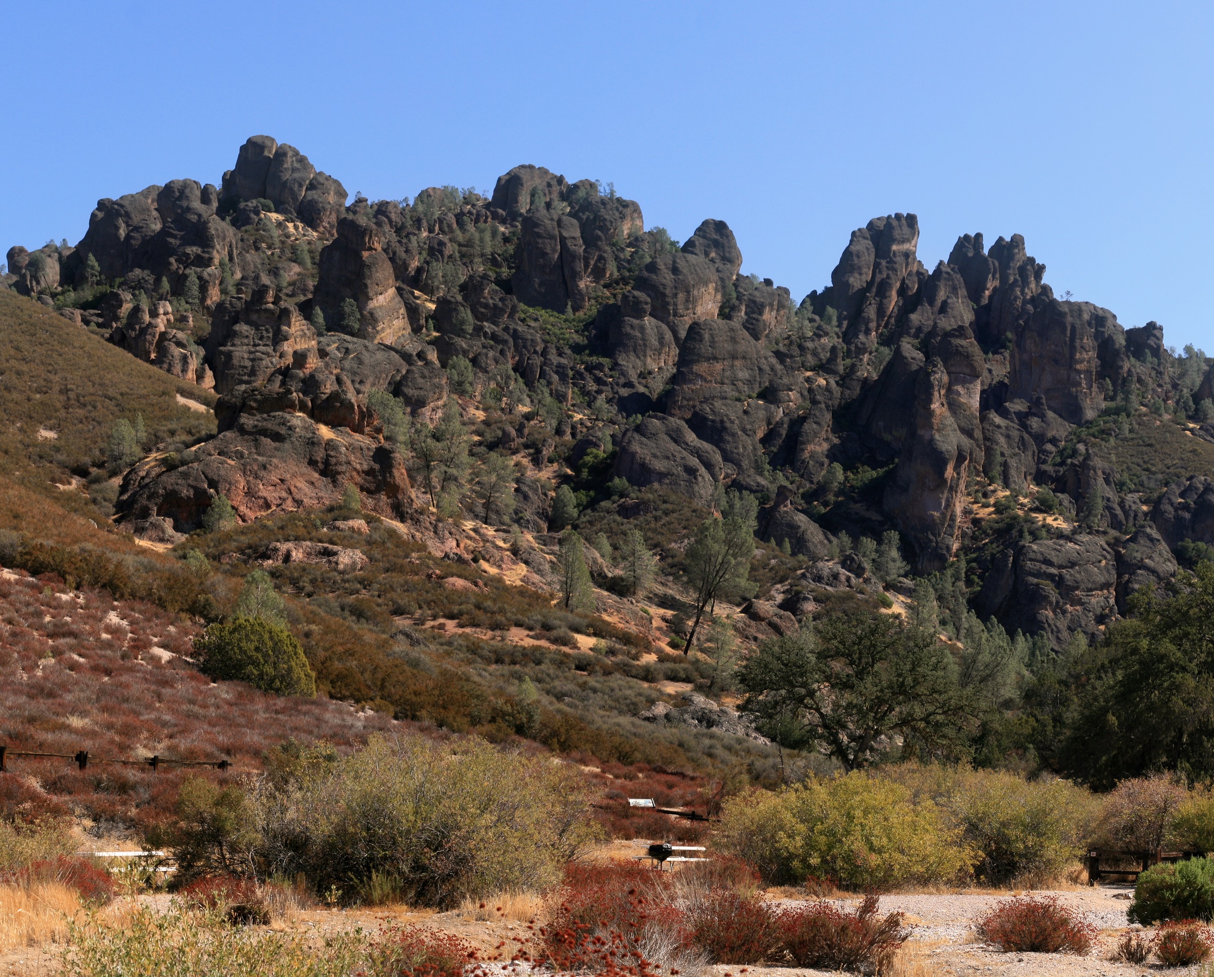
The Mount Diablo summit block is a Franciscan-mélange assemblage of pillow basalts, chert and greywacke thrust up along the range-front faults; on very clear winter days the view covers roughly 40,000 km² and stretches from Mount Lassen in the north to Mount Loma Prieta in the south.
Why it is essential
Mount Diablo is the summit of the Bay Area’s inner Coast Ranges and the biggest single climb in the region as a day-hike. The Grand Loop is the standard route to the top from within the park, and pairs the classic panoramic summit with the sandstone geology and grassland ecology of the east side.
Equipment
Sturdy hiking shoes, sun protection (there is essentially no shade above Deer Flat), at least 2 L water per person, food, wind shell for the summit ridge, and a downloaded offline map. Trekking poles help on the descent.
Hazards and notes
Summer heat is the headline hazard — heat-related emergencies are the single most common rescue call in the park. Rattlesnakes are common on warm days; ticks are present year-round. The park closes trails during Red Flag fire warnings and after heavy winter storms; confirm current conditions with California State Parks. Dogs are permitted on paved roads only, not on the Grand Loop’s dirt trails.
GPX / route file
| Source | URL | Format / access | Reuse status |
|---|---|---|---|
| Save Mount Diablo — The Grand Loop | savemountdiablo.org | Official trail description | No public GPX; route and context |
| AllTrails — Mount Diablo Grand Loop | alltrails.com | Source map / downloadable route via AllTrails account | AllTrails terms apply |
Further reading
- California State Parks — Mount Diablo State Park
- Save Mount Diablo — The Grand Loop
- AllTrails — Mount Diablo Grand Loop
5. Purisima Creek Redwoods (Harkins Ridge–Purisima Creek loop)
Snapshot
Itinerary
From the Skyline trailhead at roughly 640 m on the crest of the northern Santa Cruz Mountains, Harkins Ridge Trail drops west along a broad grass-and-scrub ridge, descending steadily into second-growth coast redwood forest. The trail loses about 500 m over 5 km, reaching Purisima Creek at 150 m near the western (Higgins-Purisima Road) trailhead. The return leg climbs east up the creek on the Purisima Creek Trail through the largest redwood grove in San Mateo County — the preserve protects around 4,700 acres of coastal-redwood ecosystem, including some old-growth remnants missed by the 19th-century mills — then joins the North Ridge Trail to regain the Skyline crest and close the loop. AllTrails and MROSD’s own trail descriptions record the Harkins Ridge–Purisima Creek loop at 6.9–7.1 miles (11.1–11.4 km) and about 520–530 m of gain.
Why it is essential
Purisima Creek Redwoods is the largest and highest-elevation redwood-canyon preserve on the Peninsula and the essential Santa Cruz Mountains day-hike within reach of the Bay Area. The loop combines an open ridge with the deepest redwood canopy on the Peninsula and finishes with a sustained climb rather than a shuttle logistics headache.
Equipment
Hiking shoes with tread for muddy conditions, waterproof shell November–April, water and food, and a downloaded offline map. The canyon holds fog and cool damp air even in mid-summer — pack a light warm layer.
Hazards and notes
The trails are shared with mountain bikes and equestrians on marked sections; on Harkins Ridge in particular, bike traffic descends fast on weekends. Poison oak and ticks are present. MROSD closes some routes during and after major storms — check the preserve page before driving. Dogs are permitted on designated trails only; consult the MROSD dog map. There is no water on the loop.
GPX / route file
| Source | URL | Format / access | Reuse status |
|---|---|---|---|
| MROSD — Purisima Creek Redwoods Preserve | openspace.org | Official preserve page and PDF trail map | No public GPX; official trail context |
| AllTrails — Harkins Ridge and North Ridge Loop | alltrails.com | Source map / downloadable route via AllTrails account | AllTrails terms apply |
Further reading
- MROSD — Purisima Creek Redwoods Preserve
- Bay Area Ridge Trail — Purisima Creek Redwoods
- AllTrails — Harkins Ridge and North Ridge Loop
Further reading
| Source | URL |
|---|---|
| California State Parks — Mount Tamalpais | parks.ca.gov |
| California State Parks — Mount Diablo | parks.ca.gov |
| NPS — Golden Gate National Recreation Area | nps.gov |
| NPS — Point Reyes National Seashore | nps.gov |
| Midpeninsula Regional Open Space District | openspace.org |
| East Bay Regional Park District | ebparks.org |
| Marin County Parks | marincountyparks.org |
| Peninsula Open Space Trust | openspacetrust.org |
| Bay Area Ridge Trail Council | ridgetrail.org |
| Save Mount Diablo | savemountdiablo.org |
| Wikimedia Commons — Category: Mount Tamalpais | commons.wikimedia.org |
| Wikipedia — California Coast Ranges | en.wikipedia.org |