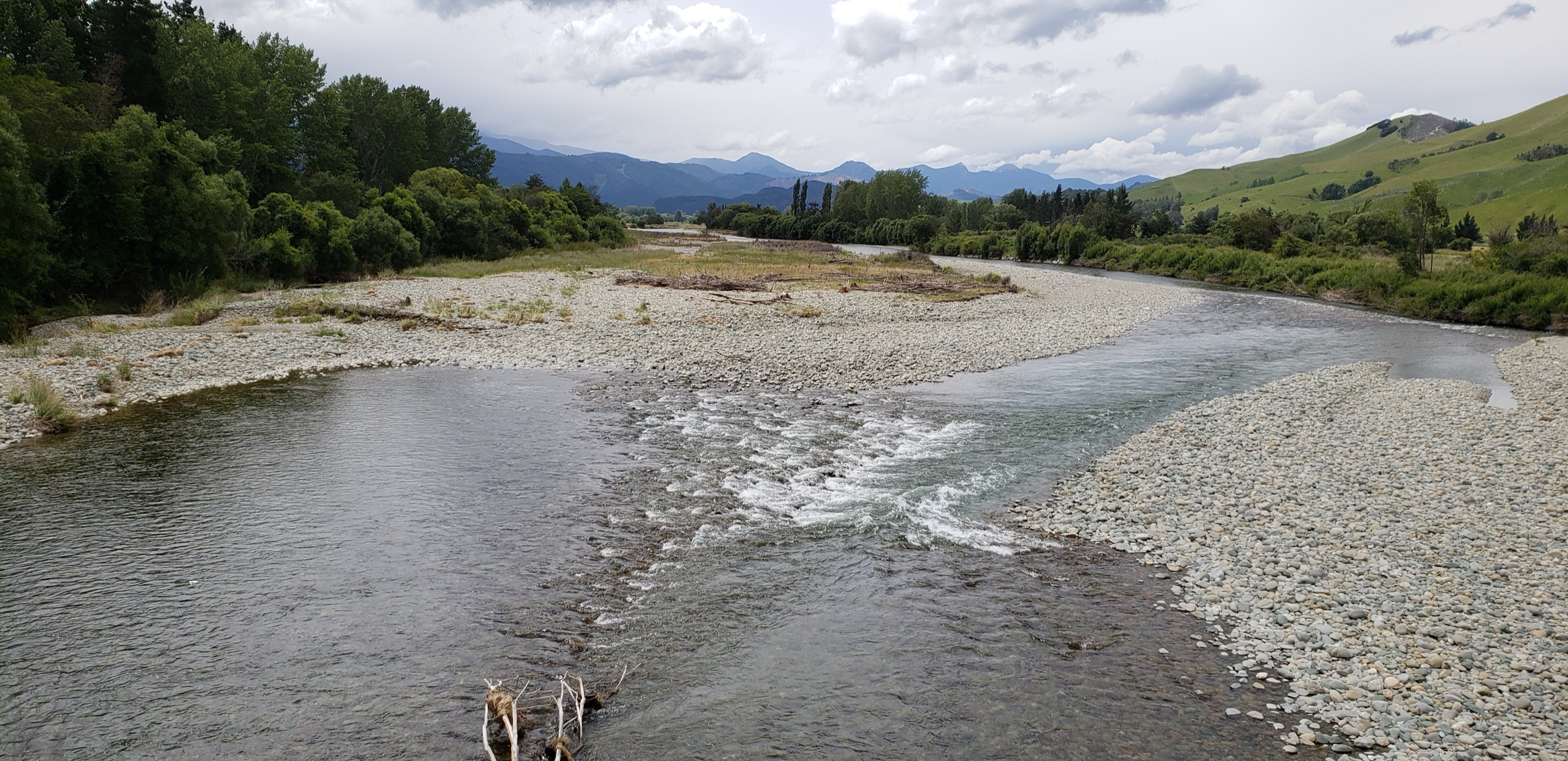
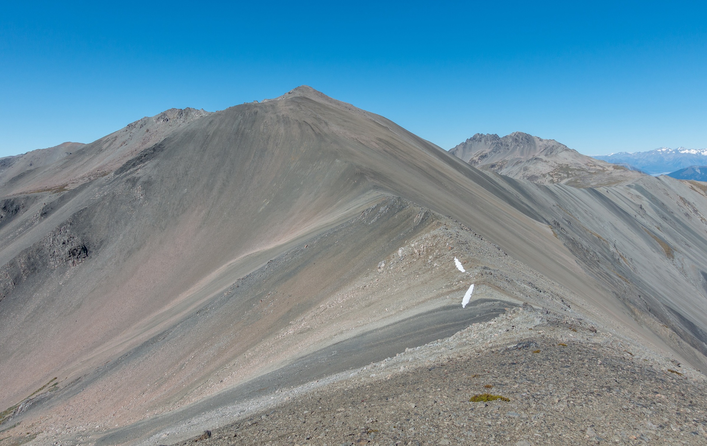
Regional overview
The Gordon Range is a compact ridge on the north-western edge of Mount Richmond Forest Park, south-west of Nelson. The southern end of the range runs above the Wai-iti Valley, south of Belgrove, and is reached from State Highway 6 by turning onto Wai-iti Valley Road and then onto the steep 4WD forestry road that climbs to Inwood Lookout (1,051 m) at the ridge shoulder. Inwood Lookout — a fire lookout built in 1970 and used as a hang-glider launch — is the effective trailhead for every walking route treated below.
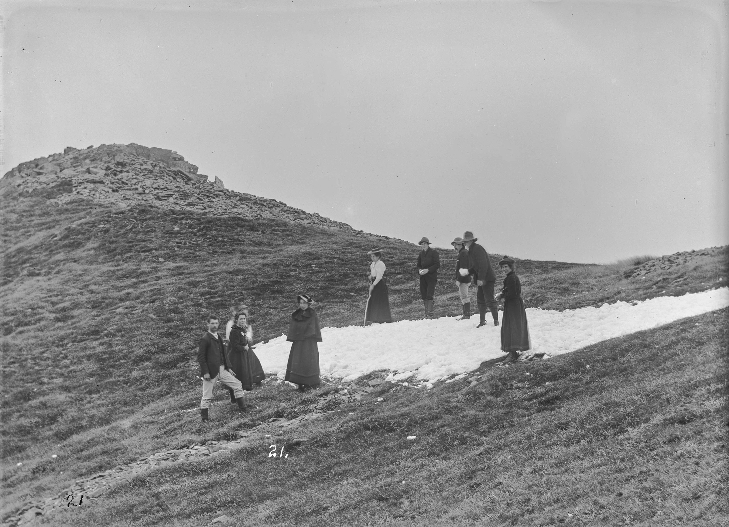
The southern Gordon Range is short and exposed rather than a big-tops network. Beyond the lookout, the ridge climbs gently through tussock, sub-alpine scrub and pockets of beech forest to the higher tops around Gordon’s Knob (1,592 m per Wikipedia coordinates), the range’s namesake summit. This is the country where botanist Frederick Gibbs recorded the first known ascent on 16 November 1895 — the photograph above is his party on the summit snowfield and is the cover for that reason. From these tops the views extend across Golden Downs Forest and Tasman Bay to Kahurangi National Park, and south-east to the St Arnaud Range and the Nelson Lakes country.
Documentation for the range is patchy. There is no dedicated DOC track page for a Gordon Range Track or a Gordon’s Knob Track; the reliable descriptions come from Wilderness Magazine, the Nelson Trails site and independent trip reports, cross-checked against the Wikipedia summit record. Route statistics vary between sources, so ranges are used below where the underlying figures do not agree. Wai-iti Road above the sealed section is a working forestry road controlled by OneFortyOne and is only suitable for 4WD vehicles.
Neighbouring Mount Richmond Forest Park country covered elsewhere in this catalogue includes the connected traverse from the same trailhead across to the Northern Gordon Range and Hunter’s Hut, and the broader Richmond Alpine Route and Te Araroa section further east.
Catalogue decision
No catalogue-compliant set of five public essential day-hikes could be verified for the southern Gordon Range in this pass. The range is small and there is no dense network of maintained tracks on the southern side. Two objectives are strong enough to describe in detail — Inwood Lookout itself, reached by walking or biking the Wai-iti Road forestry climb, and the marked ridge climb over the tops to Gordon’s Knob — and everything else is either a continuation of the same route or a walk that belongs in the Northern Gordon Range note.
This entry is published as a reduced research note. It is honest about what has been verified and does not pad the count with invented tracks.
Verification summary
| Status item | Result |
|---|---|
| Public day-hike selection | Two candidates identified; secondary sources only, no dedicated DOC track page |
| Official DOC route pages | Not found for a Gordon Range Track or Gordon’s Knob Track in this pass |
| Route geometry | AllTrails, Wilderness Magazine and Nelson Trails route data; not reconciled against an official GPX |
| Access / trailhead | Inwood Lookout well documented; Wai-iti Road above the sealed section is 4WD-only, forestry-controlled |
| GPX / KML / source route files | Wilderness Magazine hosts a downloadable GPX for the Hunter’s Hut traverse; no verified reusable licence for the southern-side variant |
| Photo sourcing | 1895 F G Gibbs “Snow Scene on Gordon’s Knob” available on Wikimedia Commons in the public domain |
| Publication status | Reduced research note; not a finished five-hike catalogue entry |
Candidate summary
| # | Candidate | Trailhead | Route type | Distance | Gain | Max elevation | Difficulty |
|---|---|---|---|---|---|---|---|
| 1 | Wai-iti Road to Inwood Lookout | Wai-iti Road, Wai-iti Valley | Out-and-back (4WD road walk / bike) | 17.4 km return | 711 m | 1,051 m | Hard |
| 2 | Inwood Lookout to Gordon’s Knob | Inwood Lookout | Out-and-back ridge climb | 11–13 km return | 650–725 m | 1,592 m | Hard |
Candidate 1: Wai-iti Road to Inwood Lookout
Snapshot
Itinerary
The route climbs Wai-iti Road, a forestry access track controlled by OneFortyOne. From the sealed Wai-iti Valley Road, the track pushes through recently felled pine beneath a line of power pylons, then climbs steeply northwards to about 750 m and turns south along the ridge to reach the open grass flat at Inwood Lookout. Views open west and north over Golden Downs Forest and the Waimea Plains toward Mount Owen and Tasman Bay. Return is by the same road.
Why it is essential
Inwood Lookout is the effective gateway to the southern Gordon Range and, at 1,051 m with a 1970-vintage fire tower on top, the highest fire lookout in the country. Walking or biking the road up is the honest way to reach the tops when a 4WD is not available and doubles as a strong training day for the harder ridge walks above.
Equipment
- Sturdy walking shoes or trail-running shoes for the graded surface
- Weatherproof shell and warm mid-layer for the ridge shoulder
- 2 L water and food for a full day out
- Sun protection — most of the climb is exposed
- Head torch with spare batteries in case of a late finish
Hazards and notes
- Wai-iti Road above the sealed section is 4WD-only and is a working forestry road; keep clear of active harvest operations and mountain-bike/vehicle traffic.
- The forestry road is controlled by OneFortyOne; access status can change without notice.
- The upper section is exposed to strong nor-west and southerly winds; conditions on the ridge can differ sharply from the valley.
- No water on the climb; carry the day’s supply.
Candidate 2: Inwood Lookout to Gordon’s Knob
Snapshot
Itinerary
From Inwood Lookout, the track heads out onto the Gordon Range ridge, alternating between open tussock, low sub-alpine scrub and short stretches of beech forest. Cairns and white markers guide the line as the ridge rises past intermediate points to the summit block of Gordon’s Knob at 1,592 m. Views on a clear day take in Kahurangi National Park, the Red Hills, the St Arnaud Range and the inland Kaikōura Ranges. Return is by the same ridge.
Why it is essential
Gordon’s Knob is the highest named summit on the range and the historical Gibbs first-ascent site — the only day objective on the southern side that reaches an alpine top rather than a ridge shoulder. Reaching it from Inwood Lookout is the shortest hard climb to a Gordon Range summit and the practical benchmark day walk for the southern side.
Equipment
- Tramping boots with good ankle support — loose scree and unstable rock on the upper sections
- Softshell, rain shell and warm mid-layer; hat and gloves outside midsummer
- 2 L water and food for a hard day out
- Map, compass and GPS with the ridge route pre-loaded
- Head torch with spare batteries — dawn or late finish likely
- Trekking poles for the steep descent
- Personal Locator Beacon recommended
Hazards and notes
- The track is unmaintained above the lookout; expect loose scree, boot-slippery grass slopes and no continuous cut trail.
- Poor visibility and strong wind on the ridge make navigation difficult; carry the route on GPS as a backup.
- The turn-off from the ridge onto the summit line can be missed if cairns are covered by cloud or fresh snow.
- Snow patches can linger into early summer; treat as a mountain route until conditions are known.
- No water on the ridge; carry the day’s supply.
Other leads considered
| Lead | Evidence found | Decision |
|---|---|---|
| Traverse to Hunter’s Hut via the Gordon Range tops | Wilderness Magazine records 8.2 km one way, ~4–5 h to hut, 723 m gain from Inwood Lookout | Assigned to the Northern Gordon Range note because the objective is the northern-side descent to Motueka Left Branch and the connection to Te Araroa |
| Short walk at Inwood Lookout | Nelson Trails describes the site as an open grass flat with a fire tower; no dedicated short walk on the summit | Not a hike in its own right; treated as the trailhead for the Gordon’s Knob climb |
| Wai-iti River Walk | AllTrails records a valley-floor walk from the Wai-iti River area | Excluded — it sits in the Wai-iti Valley floor rather than on the Gordon Range |
| Continuation over Point 1519 south to the Motueka Left Branch | Wilderness Magazine describes Point 1519 as the ridge shoulder south of which the track drops to the river | Treated as the descent section of the Northern Gordon Range traverse rather than a separate southern day walk |
GPX / KML / route-file status
| Source | URL | Format | Licence / terms | Reuse status |
|---|---|---|---|---|
| Wilderness Magazine — Hunter’s Hut via Gordon Range | wildernessmag.co.nz | Route page hosts a small GPX download | Wilderness Magazine terms apply | Reference only; use for the ridge geometry, not redistribution |
| AllTrails — Hunter’s Hut via Gordon Range | alltrails.com | Route page | AllTrails terms | Secondary comparison only |
| AllTrails — Gordon Range Track | alltrails.com | Route page | AllTrails terms | Secondary comparison only |
| OSM — Mount Richmond Forest Park boundary | openstreetmap.org | Protected-area relation | ODbL | Context only |
Photos
A modern licence-compatible landscape photograph of the southern Gordon Range or the summit tops was not located in this research pass. Follow-up work should search Wikimedia Commons and Flickr Creative Commons for imagery once route verification is complete.
Follow-up work
- Cross-check the Wilderness Magazine and Nelson Trails distance and elevation figures against an official DOC track description if one is later published.
- Confirm current access status for Wai-iti Road with OneFortyOne.
- Reconcile the reported summit elevations — 1,592 m per Wikipedia versus higher unnamed peaks quoted at 1,685 m in secondary trip reports.
- Source a licence-compatible modern landscape photograph of Gordon’s Knob, the summit ridge or the Wai-iti-side approach.
Further reading
| Resource | Link |
|---|---|
| Nelson Trails — Gordon’s Knob | nelsontrails.co.nz |
| Nelson Trails — Inwood Lookout | nelsontrails.co.nz |
| Wilderness Magazine — Hunter’s Hut, Mt Richmond Forest Park | wildernessmag.co.nz |
| DOC blog — From Inwoods Lookout to the Hunters Hut | blog.doc.govt.nz |
| DOC — Mount Richmond Forest Park | doc.govt.nz |
| Tinytramper — Gordons Knob | tinytramper.com |
| Wikipedia — Gordons Knob | en.wikipedia.org |
| MetService — Nelson regional forecast | metservice.com |