Regional overview
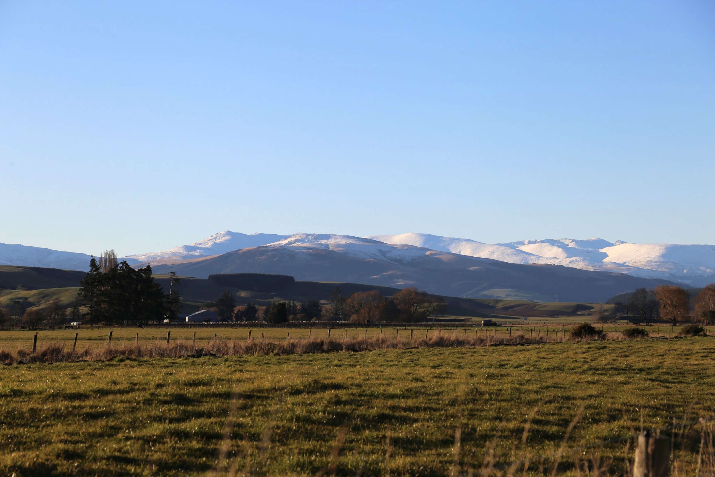
The Southern Garvies are the low, forested and river-flat southern end of the Garvie Mountains, on the Northland Southland side of the range where the ridge falls toward the Waikaia River. Walking here is concentrated on Piano Flat, the DOC campsite and river-flat trailhead cluster at the mouth of the Waikaia Forest Conservation Area, and the Waikaia Forest tracks that leave from it — a red-beech and mountain-beech landscape with the sector’s tops rising to the north as the higher central Garvies.
One access corridor matters: Piano Flat, at the end of Piano Flat Road out of Waikaia, is the trailhead for all three routes in this entry. There is no public transport to Piano Flat; access is by private vehicle from Waikaia township. DOC’s own listing treats Piano Flat as the walking hub of the Waikaia Forest Conservation Area, but the campsite context itself is not a separate verified day walk.
Two catalogue framing notes shape this entry. First, this pass yields fewer than the catalogue’s usual five hikes: DOC verifies two Waikaia Forest walks (Titan Rocks and Piano Flat Creek Loop), publishes a closure alert for a third (Ngahere Ara Track), and the fourth candidate — the Waikaia River Track — has AllTrails and OpenStreetMap footprints but no DOC route page and conflicting access tags in OSM. Rather than pad the set with unverified routes, only the two verified and one clearly labelled candidate objectives are listed here. Second, the sector overlaps with the combined Waikaia Forest and Welcome Rock catalogue entry for the broader Garvie Mountains; this Southern-Garvies entry is the granular Waikaia-side detail, and the merged entry is the range-wide overview.
Selection rationale
The three selections represent everything DOC-verifiable or plausibly verifiable in the Southern Garvies from this research pass. Titan Rocks Track is the sector’s headline objective — the tops route with the strongest DOC-published statistics. Piano Flat Creek Loop Track is the practical short DOC-graded tramping loop from the campsite. Waikaia River Track is a candidate river-flat loop from Piano Flat that needs official access confirmation before it can be promoted to a resolved objective. Ngahere Ara Track is deliberately excluded — DOC’s Waikaia Forest listing carries a live closure alert on that track, first published 8 December 2025 and last reviewed 21 May 2026.
Summary
| # | Hike | Trailhead | Route type | Distance | Difficulty |
|---|---|---|---|---|---|
| 1 | Titan Rocks Track | Piano Flat, Waikaia Forest | Out-and-back | DOC: 5.5 km return | Expert (DOC) |
| 2 | Piano Flat Creek Loop Track | Piano Flat, Waikaia Forest | Loop | DOC: 2.3 km loop | Advanced tramping track (DOC) |
| 3 | Waikaia River Track (candidate) | Piano Flat | Candidate river-flat loop | Unresolved; AllTrails / OSM footprint only | Candidate |
1. Titan Rocks Track
Snapshot
Itinerary
From Piano Flat, the track leaves the river flats and climbs steadily north through beech forest and scrub to the Titan Rocks tor country at the sector’s tops, then returns by the same line to Piano Flat.
Why it is essential
Titan Rocks is the sector’s headline objective — the highest, most physical DOC-verified route in the Southern Garvies and the only Waikaia-side day walk that reaches the tops landscape of the range.
Equipment
- Sturdy tramping boots
- Waterproof shell, warm mid-layer and spare warm layer
- Warm hat and gloves outside midsummer
- Map, compass and offline GPS
- Headlamp with spare batteries — 7 h DOC time makes headlamp finishes plausible
- 2.5–3 L water and food for a full day
- Personal Locator Beacon
- First-aid kit
Hazards and notes
- DOC and AllTrails disagree on route length, so treat the day as at least 5.5 km with an upper bound above that — plan by the DOC 7 h time budget rather than distance alone
- Expert DOC grade — expect rough tread, poled sections and route-finding
- Weather-sensitive tops — snow, mist and high wind can shut the day
- Check DOC alerts for current track and forest conditions before departure
2. Piano Flat Creek Loop Track
Snapshot
Itinerary
A short loop from Piano Flat through beech forest along Piano Flat Creek, returning by a separate arm to the campsite car park.
Why it is essential
Piano Flat Creek Loop is the practical short DOC-graded loop from the Waikaia Forest hub — the sector’s stand-alone forest walk when tops weather rules out the Titan Rocks day, or as a warm-up walk from the campsite.
Equipment
- Sturdy walking shoes or light tramping boots
- Waterproof shell, warm layer
- Water and snack
- Insect repellent
Hazards and notes
- Advanced tramping track grade — expect a rougher tread and less-formed surface than a short walk
- Slippery underfoot after Southland rain
- Dogs are not allowed on the conservation land unless a specific permit applies
- Check DOC alerts before departure
3. Waikaia River Track (candidate)
Snapshot
Itinerary
A proposed river-flat loop from Piano Flat along the Waikaia River, using the OpenStreetMap footprint of the Waikaia River Track (OSM way 1200724371). The exact loop line, distance and access legality are subject to DOC confirmation before this can be published as a fully resolved objective.
Why it is essential
The Waikaia River Track candidate would be the sector’s low-effort river-flat option — a complement to Titan Rocks’ tops day and Piano Flat Creek’s short forest loop. It is included here so the sector’s third potential objective is on the record, not as a resolved day walk.
Equipment
- Sturdy walking shoes or light tramping boots
- Waterproof shell, warm layer
- Water and snack
- Offline map and current local access confirmation
Hazards and notes
- Access legality was not confirmed with DOC in this pass — treat as a candidate objective, not a resolved route
- OpenStreetMap access tags conflict on the Waikaia River Track corridor
- River-edge footing and possible flood risk after Southland rain
- No official DOC route page was found in this pass for this specific loop
Missing data / follow-up work
- Waikaia River Track access needs to be confirmed with DOC or another authoritative local source before this candidate can be promoted to a resolved objective.
- Titan Rocks geometry — the DOC 5.5 km return figure and the AllTrails route variant disagree; ascent, maximum elevation and true ground distance need reconciliation from a measured GPX source.
- Ngahere Ara Track is deliberately excluded: DOC’s Waikaia Forest listing carries a live closure alert on that track (first published 8 December 2025, last reviewed 21 May 2026). Keep it excluded until DOC changes the closure status.
- No route-specific open-licence photography was found in this pass for Titan Rocks, Piano Flat Creek or the Waikaia River corridor; only the sector-wide Garvie Mountains cover is used.
- The sector overlaps with the combined Waikaia Forest and Welcome Rock catalogue entry; the range-wide Garvie Mountains overview belongs there, and this entry stays focused on the Waikaia-side detail.
Further reading
| Resource | Link |
|---|---|
| DOC — Waikaia Forest Conservation Area | doc.govt.nz |
| DOC — Titan Rocks Track | doc.govt.nz |
| DOC — Piano Flat Creek Loop Track | doc.govt.nz |
| DOC — Ngahere Ara Track (closed at time of writing) | doc.govt.nz |
| OpenStreetMap — Waikaia River Track (way 1200724371) | openstreetmap.org |
| OpenStreetMap — Titan Rocks (node 9139315533) | openstreetmap.org |
| MetService — Southland regional forecast | metservice.com |
| Wikipedia — Garvie Mountains | en.wikipedia.org |
| Wikimedia Commons — Garvie Mountains | commons.wikimedia.org |