About this entry
The Garvie Mountains do not carry enough independently verified named day-hikes to support separate northern, central and southern sub-region articles. This entry merges the region into a single five-hike catalogue. Hikes 1–3 are sourced primarily from DOC and the Welcome Rock operator. Hikes 4–5 are candidate-only: sources conflict on access or route status, and they are included to represent under-covered parts of the range rather than as recommended routes. When better local sources become available, this entry will be reworked to firm up the last two lines.
Regional overview
The Garvie Mountains sit in northern Southland, between the Nokomai and Waikaia catchments. Public walking is concentrated around Waikaia Forest Conservation Area to the south and the private Welcome Rock Station / Roaring Lion Trail on the Garston side to the north. The walking character is a mix of beech forest, Waikaia River terraces, old gold-mining and sawmilling features, high tussock, schist outcrops, 4WD high-country access and working station land.
DOC describes Waikaia Forest as a large island of beech forest, with Piano Flat at the southern end providing a camping area, picnic area and several walking tracks. In this pass the most sourceable public Waikaia walks are Piano Flat Creek Loop and Titan Rocks Track. Ngahere Ara Track is excluded from the five because the DOC Waikaia Forest listing includes a closure alert (last reviewed 21 May 2026).
Welcome Rock provides the region’s strongest longer day-walk. It is a private, booked 27 km high-country loop following the Roaring Lion water race above Garston, open to hikers and bikers from 1 October to 30 April; winter walking is limited to hut access by arrangement.
Expect limited services, no verified public transport to trailheads, changeable high-country weather, snow or impassable 4WD roads in winter, and access rules that vary between DOC conservation land, private stations and booked trail operations.
Selection rationale
Roaring Lion, Titan Rocks and Piano Flat Creek are the strongest catalogue selections. Waikaia River Track and Potters No. 2 are included to complete a five-line merged Garvie entry, but both need further official or local verification before being read as essential day-hikes.
Summary table
| # | Hike | Country | Route type | Distance | Approx. gain | Max elevation | Difficulty |
|---|---|---|---|---|---|---|---|
| 1 | Roaring Lion Trail / Welcome Rock Loop | New Zealand | Booked private loop | 27 km | 543 m | 1,152 m | Moderate–hard |
| 2 | Titan Rocks Track | New Zealand | Out-and-back | 5.5 km (DOC) | Not verified | Above bushline | DOC Expert |
| 3 | Piano Flat Creek Loop Track | New Zealand | Loop | 2.3 km (DOC) | Not verified | ~333 m | DOC Advanced |
| 4 | Waikaia River Track | New Zealand | Loop | ~10 km (secondary) | ~286 m | ~295 m | Moderate (candidate) |
| 5 | Potters No. 2 Tramping Track: Huts to Grave | New Zealand | Out-and-back | ~2.7 km (secondary) | ~75 m | ~1,243 m | Easy walking; rough access (candidate) |
Before you go
Permits and access
Waikaia Forest Conservation Area is managed by DOC; no permit is required for day walking on Piano Flat Creek or Titan Rocks, but dogs need a DOC permit. Welcome Rock / Roaring Lion is a private, paid, booked trail — bookings must be made through the operator, and winter walking is only by arrangement for hut access. Potters No. 2 and the Waikaia River loop cross land where the legal walking status could not be independently confirmed in this pass; check with DOC or the landholder before travel.
Standard Garvie day-hiking kit
For beech forest, river valleys and high-country tops:
- Sturdy boots or trail shoes with grip; Waikaia beech tracks are often muddy and root-strewn.
- Waterproof and windproof shell; a warm spare layer even in summer at 1,000–1,200 m.
- Map and offline navigation for Titan Rocks and Potters routes; DOC maps for Waikaia Forest and the operator map for Welcome Rock.
- Water and food for the full day; there is no reliable resupply anywhere along these routes.
- Personal locator beacon or reliable emergency communication for Titan Rocks and any Potters-side day.
Common hazards
DOC classifies Titan Rocks as Expert and Piano Flat Creek Loop as Advanced despite its short length. Above-bushline weather changes fast, and Southland high-country snow can persist into late spring. Rivers and 4WD access roads can be impassable after storms. Welcome Rock is exposed to wind on the water-race high sections and shares the trail with mountain bikers.
1. Roaring Lion Trail / Welcome Rock Loop
Snapshot
Itinerary
The route follows the Roaring Lion water race as a 27 km single-track loop across Welcome Rock Station. From the historic ski hut trailhead, it crosses high-country tussock, schist outcrops, beechwood pockets and open viewpoints above Garston before returning to the trailhead. Walk with the operator map or the Great Hikes / Great Rides app; the trail is paid and booked.
Why it is essential
This is the strongest longer day-walk found in the northern Garvie / Garston margin, and it represents the gold-mining water-race history and open high-country landscape better than the shorter Waikaia Forest loops.
Hazards and notes
- Private booked trail: respect operator access rules and confirm your booking before travel.
- Open only to hikers and bikers between 1 October and 30 April; winter is hut access only, by arrangement.
- Exposed to wind on the high water-race sections; carry a warm spare layer even in summer.
- No licence-compatible route-specific image was located for this entry.
GPX / KML links
| Source | URL | Format | Notes |
|---|---|---|---|
| Welcome Rock — Walk the Trail | welcomerock.co.nz | Official operator route page | Source-map reference; booking required |
| Welcome Rock Trails Map (PDF) | welcomerock.co.nz | Operator PDF map | Terms not stated for GPX reuse |
| OpenStreetMap: The Roaring Lion (Private) | openstreetmap.org | OSM way | ODbL; tagged private, foot=yes |
Further reading
- Welcome Rock — Walk the Trail
- Welcome Rock — Important Information
- NZ Geographic — Roaring Lion, hidden gold
2. Titan Rocks Track
Snapshot
Itinerary
From the Piano Flat side of Waikaia Forest, follow the marked route toward Titan Rocks. DOC describes it as a rewarding tramp with excellent views from above the bushline. Return by the same route. The DOC and AllTrails distance figures conflict sharply; walk with the DOC route page as primary.
Why it is essential
Titan Rocks is the strongest public high-country objective in the Waikaia Forest part of the Garvies. It gives the catalogue a genuine above-bushline route rather than only low forest loops.
Hazards and notes
- DOC rates the route Expert — above-bushline weather, navigation and timing are the main risks.
- Dogs require a DOC permit.
- Distance and elevation statistics need follow-up; DOC lists 5.5 km return while a common secondary source describes a much longer variant.
- No licence-compatible route-specific image meeting our resolution floor was located for this entry.
GPX / KML links
| Source | URL | Format | Notes |
|---|---|---|---|
| DOC Titan Rocks Track | doc.govt.nz | Official route page | Primary route source; DOC terms |
| OpenStreetMap: Titan Rocks | openstreetmap.org | OSM point | ODbL; place point only |
Further reading
3. Piano Flat Creek Loop Track

Snapshot
Itinerary
The loop starts at Piano Flat and passes through beech forest with visible signs of early sawmilling days. It returns to the Piano Flat area and can be combined with campsite or picnic access.
Why it is essential
This is the most compact verified DOC loop at Piano Flat and gives the catalogue a low-level beech-forest and local-history walk to balance the longer high-country routes.
Hazards and notes
- DOC classifies the track as Advanced despite its short length; expect roots, mud and steep short sections.
- Dogs require a DOC permit.
- Check DOC alerts before travel — Ngahere Ara at Piano Flat is currently closed.
GPX / KML links
| Source | URL | Format | Notes |
|---|---|---|---|
| DOC Piano Flat Creek Loop Track | doc.govt.nz | Official route page | Primary source; DOC terms |
Further reading
4. Waikaia River Track
Snapshot
Itinerary
The secondary-source route starts from Piano Flat, follows the Waikaia River area and crosses the river twice by swing bridges before closing back to the start. A DOC route page was not found in this pass, so the exact official status and maintained route line remain unresolved.
Why it is essential
If access is confirmed, this would be the strongest river-loop day walk in Waikaia Forest and would complement Titan Rocks and Piano Flat Creek with a longer valley-and-river route.
Hazards and notes
- Access status is unresolved: the OSM way named Waikaia River Track carries both
foot=yesandaccess=notags. Confirm with DOC or a local source before walking. - River levels and swing-bridge access should be checked after storms.
- No licence-compatible route-specific image was located for this entry.
GPX / KML links
| Source | URL | Format | Notes |
|---|---|---|---|
| OpenStreetMap: Waikaia River Track | openstreetmap.org | OSM way | ODbL; access tags conflict |
Further reading
5. Potters No. 2 Tramping Track: Huts to Grave
Snapshot
Itinerary
The secondary-source route is a short out-and-back from the Potters Huts area to a grave-site turnaround in high Garvie country. No official route page, public access page or reusable GPX source was found in this pass. Included here only to hold a placeholder line for the central Garvies until better sources appear.
Why it is essential
Reserved as a research placeholder for the central Garvies. Replace with a stronger route as soon as DOC, LINZ, a local club or the landholder identifies a better verified line.
Hazards and notes
- Legal access, road condition, exact trailhead and route status are unresolved — treat as candidate only.
- Secondary data notes 4WD road access and impassable winter roads.
- No licence-compatible route-specific image was located for this entry.
GPX / KML links
| Source | URL | Format | Notes |
|---|---|---|---|
| OpenStreetMap: Potters Huts | openstreetmap.org | OSM feature | ODbL; huts only, not route geometry |
| OpenStreetMap: Potters peak | openstreetmap.org | OSM point | ODbL; peak point only |
Further reading
- DOC Waikaia Forest Conservation Area — nearest official land-manager page for the wider area.
Verification notes
- The three-way northern / central / southern Garvie split is not supported by the current route inventory; this merged entry is the defensible catalogue shape.
- Ngahere Ara Track is excluded because DOC’s Waikaia Forest listing carries a closure alert (last reviewed 21 May 2026).
- Titan Rocks distance and elevation figures conflict between DOC (5.5 km return) and a common secondary source (~15.5 km, ~1,215 m). DOC is treated as primary until reconciled.
- Waikaia River Track is a candidate only — OSM access tags conflict, and no DOC route page was located.
- Potters No. 2 is a candidate placeholder for the central Garvies — legal access, road condition and route status all require authoritative confirmation before it can be treated as recommended.
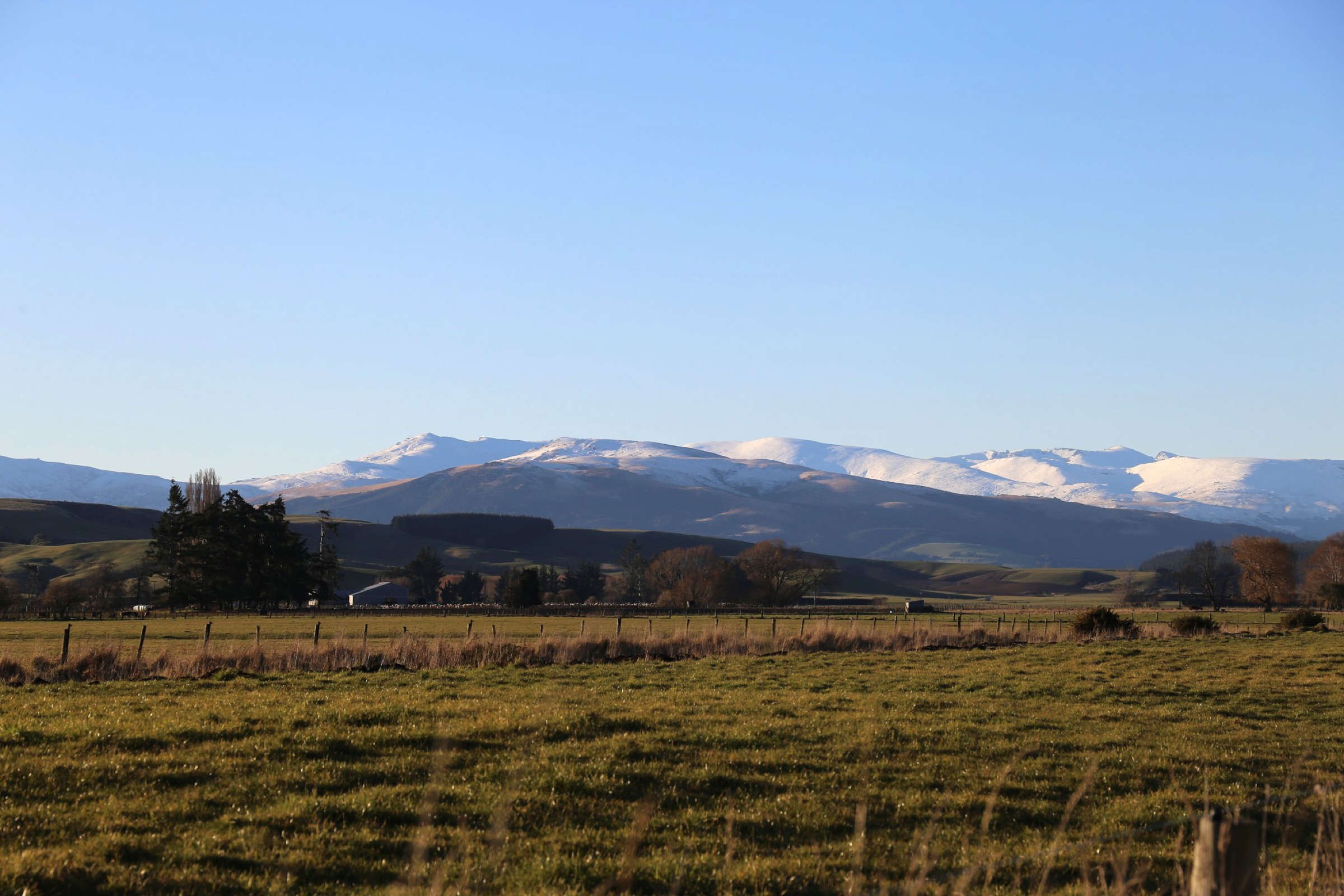
- No licence-compatible, route-specific images were found for Roaring Lion, Titan Rocks, the Waikaia River loop or Potters No. 2; the cover photo shows the southern Garvies from the Waikaia River confluence, and the Piano Flat entry uses a Waikaia township context photo.
Further reading
| Source | URL |
|---|---|
| DOC Waikaia Forest Conservation Area | doc.govt.nz |
| DOC Piano Flat Creek Loop Track | doc.govt.nz |
| DOC Titan Rocks Track | doc.govt.nz |
| DOC Ngahere Ara Track | doc.govt.nz |
| Welcome Rock — Walk the Trail | welcomerock.co.nz |
| Welcome Rock — Important Information | welcomerock.co.nz |
| NZ Geographic — Roaring Lion, hidden gold | nzgeo.com |
| Wikipedia — Garvie Mountains | en.wikipedia.org |