About this entry
“Northern Brunner Range” is a practical catalogue subdivision rather than a Department of Conservation visitor-area label. DOC describes Victoria Forest Park as being built around the Victoria and Brunner ranges, but does not publish a “Northern Brunner” walking-area page, and the walking objectives at the range’s northern end sit inside several distinct access catchments — Lake Christabel on the Grey Valley side, Lyell in the Upper Buller Gorge, the Matiri Valley on the Kahurangi edge, and Murchison further north again. Several of the routes below are therefore boundary picks whose sources do not explicitly say “Northern Brunner Range” but which best represent the walkable northern access country available to a party using Reefton, Murchison or Nelson as a base. Where a route is more strictly associated with a neighbouring range or park, this is called out in the route section.
Regional overview
The northern access country of the Brunner Range is the wet, forested corridor country between the Grey Valley at Reefton’s northern end, the Upper Buller Gorge at Lyell, and the Matiri Valley on the western edge of Kahurangi National Park. The Brunner Range main divide runs south from this country toward the Reefton mining corridor and the Southern Brunner walking catalogue; the northern approaches to that divide are dominated by long river-and-forest access valleys, historic goldfield settlements at Lyell, and the nationally recognised Old Ghost Road trail from Lyell to the Mokihinui.
The walking character here is West Coast forest and river-country tramping — not alpine ridge walking. Expect wet forest, unbridged streams, mud, and West Coast rain, plus one heavily engineered heritage trail (the Old Ghost Road) that carries most of the region’s route-map infrastructure. Public transport does not run to any of the trailheads. Access is by private vehicle from Reefton, Westport, Murchison or Nelson via the SH6 / SH7 corridor system through the Buller Gorge.
Best walking runs summer through autumn in dry, settled weather. Lake Christabel and the Old Ghost Road section need low rivers and stable ground to be safe day objectives, and heavy West Coast rain can close tracks and turn streams into channels at short notice. Standard equipment is tramping boots, waterproof shell, warm mid-layer, navigation independent of scenic-area waymarks, food and water for a long forest day, and a personal locator beacon on the harder routes.
Selection rationale
Five day-scale routes are presented across the northern access country of the Brunner Range. The Lake Christabel from Palmer Road approach is the best lake-and-forest objective inside Victoria Forest Park’s northern backcountry, treated here as a long day section rather than an overnight tramp. The Old Ghost Road — Lyell to Lyell Saddle Hut section carries the region’s strongest heritage-route infrastructure and is the anchor day-walk of the Upper Buller corner, though the route itself is more strictly a Buller / Kahurangi border trail. The short Lyell Creek Walk balances the harder Lyell objective with a compact heritage counterpoint. The Lake Matiri Hut Track is a boundary pick on the Kahurangi edge, included because Matiri is one of the most practical northern access valleys near the Brunner country. The Six Mile Walk near Murchison rounds out the day catalogue with an accessible lower-level northern approach walk where more range-specific public tracks are scarce.
The full Old Ghost Road (85 km, multi-day, Lyell to Mokihinui) sits outside a day-hike article; it is treated here only as the Lyell-to-Lyell-Saddle-Hut section. For the range’s better-documented southern mining corridor, see the Southern Brunner Range guide.
Summary
| # | Hike | Trailhead | Route type | Distance | Gain | Difficulty |
|---|---|---|---|---|---|---|
| 1 | Lake Christabel from Palmer Road | Palmer Road / Palmer Flat | Out-and-back | 20.28 km return (AllTrails) | 655 m (AllTrails) | Hard |
| 2 | Old Ghost Road — Lyell to Lyell Saddle Hut | Lyell historic reserve / campsite | Point-to-point heritage trail | 17.22 km one way (AllTrails) | 1,096 m (AllTrails) | Hard |
| 3 | Lyell Creek Walk | Lyell historic area | Out-and-back heritage creek walk | 3.86 km return (AllTrails) | 211 m (AllTrails) | Moderate |
| 4 | Lake Matiri Hut Track | Matiri Valley road end | Point-to-point / out-and-back | 4.18 km one way (AllTrails) | 209 m (AllTrails) | Moderate |
| 5 | Six Mile Walk | Six Mile access near Murchison | Out-and-back | 5.15 km return (AllTrails) | 136 m (AllTrails) | Easy–Moderate |
1. Lake Christabel from Palmer Road
Snapshot
Itinerary
From the Palmer Road / Palmer Flat trailhead, follow the Lake Christabel Track through forest and river country to Lake Christabel and the hut area. Return the same way. The DOC hut page verifies the hut and location; the AllTrails Palmer Flat to Lake Christabel record supplies the day-hike statistics as a secondary source.
Why it is essential
Lake Christabel is the best lake-and-forest objective inside Victoria Forest Park’s northern backcountry — a genuine backcountry lake reached by a well-defined access route, with a DOC hut at the destination for parties who prefer to break the day into two.
Equipment
- Full tramping day kit — boots, waterproof shell, warm mid-layer
- Emergency shelter
- Map, compass, GPS and a personal locator beacon
- Food and water for a long forest day
Hazards and notes
- Remote valley travel — no phone reception across most of the route
- River and stream conditions — the route can be unsafe after heavy rain
- Wet forest with mud, roots and slow ground
- Slow exits if a day goes wrong; plan the shelter and PLB use in advance
2. Old Ghost Road — Lyell to Lyell Saddle Hut
Snapshot
Itinerary
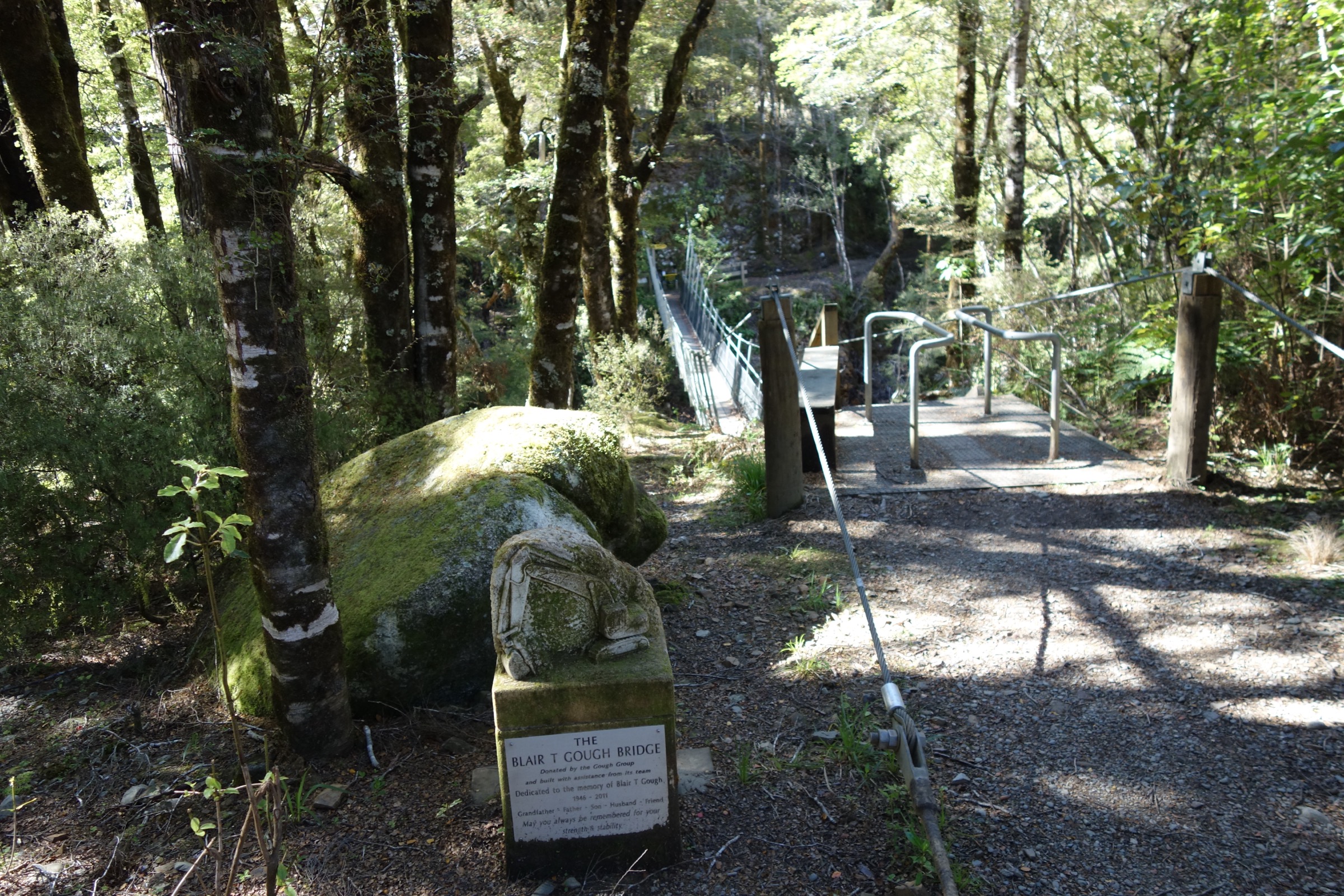
Climb the southern end of the Old Ghost Road from the Lyell goldfield through forest to Lyell Saddle Hut. The official Old Ghost Road site describes the whole route as an 85 km revived gold-miners’ road from Lyell to the Mokihinui — the Lyell-to-Lyell-Saddle-Hut section is the day-scale southern extract from that.
Why it is essential
This is the nationally recognised heritage route in the northern access country of the Brunner Range, and by far the strongest single day-section in the group in terms of route-map infrastructure, engineering and profile. The Old Ghost Road as a whole is more strictly a Buller–Kahurangi border trail than a Brunner Range route, but its southern end climbs directly out of the Upper Buller Gorge into the range’s northern access catchment.
Equipment
- Backcountry day kit — boots, waterproof shell, warm mid-layer
- Headlamp
- Navigation backup
- Water and food for a long climb
- Shuttle or pickup arrangement if not returning
Hazards and notes
- Long ascent — about 1,096 m over 17 km
- Remote forest — plan the day carefully around daylight
- Shared bike traffic — walkers should keep to the left and give way to riders on descents
- Weather and fatigue — the descent back to Lyell adds significantly to the day
3. Lyell Creek Walk
Snapshot
Itinerary
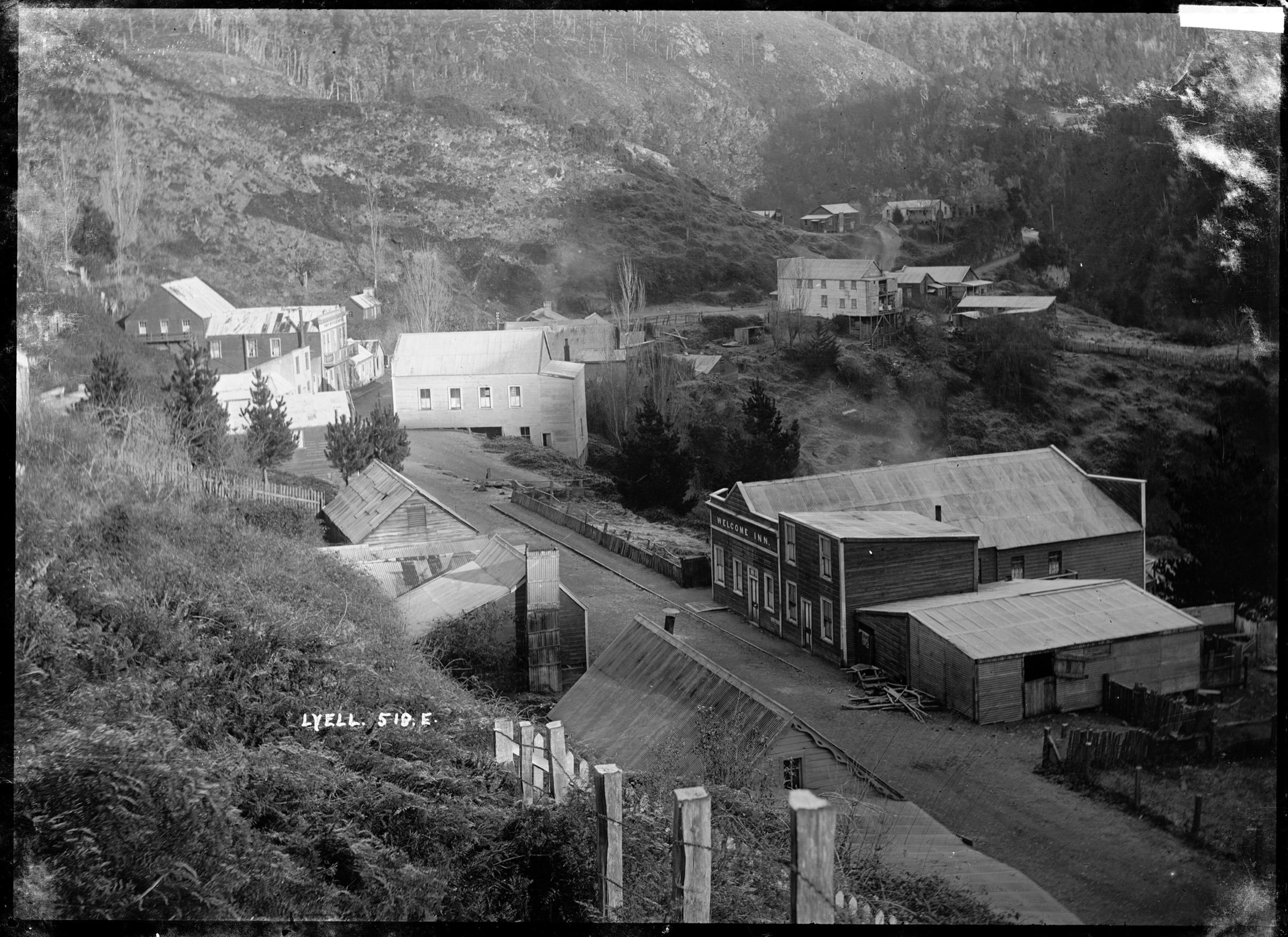
Walk from the Lyell historic area along the creek and goldfield access track — a short forest-and-river heritage outing through the remains of the former mining settlement.
Why it is essential
Lyell Creek is the short historical counterpoint to the Old Ghost Road, representing the goldfield access history of the northern range margin at a walking scale accessible to any party stopped at the Lyell campsite. It also gives a compact bad-weather fallback when the longer objectives are closed by rain.
Equipment
- Walking shoes or light boots
- Rain layer
- Water and a snack
Hazards and notes
- Wet track in forest sections
- Creek and river margins — take care with children and dogs
- Old mining features — respect signage and stay on the marked track
4. Lake Matiri Hut Track
Snapshot
Itinerary
Follow the Lake Matiri Hut Track from the Matiri Valley road end to the hut and lake area. Included here as a boundary pick because Matiri is one of the most practical northern access valleys near the Brunner country; the route itself is more strictly on the Kahurangi National Park edge than on the Brunner Range proper.
Why it is essential
Lake Matiri gives an accessible lake-and-hut objective on the northern edge of the range system, and a much shorter walking day than Lake Christabel or the Old Ghost Road section — useful as a rest-day objective on a bigger northern-access trip.
Equipment
- Day kit — boots, rain layer, warm mid-layer
- Overnight gear if staying at the hut
Hazards and notes
- Remote road access to the Matiri Valley road end
- Wet ground and slow travel in mud
- River and stream conditions — check after rain
- Boundary framing — the route sits on the Kahurangi edge; DOC route status should be confirmed for the current season
5. Six Mile Walk
Snapshot
Itinerary
Short forest and river-margin walk in the Murchison access country. Included here as a boundary pick where more range-specific public tracks are scarce — the walk is the accessible northern-approach counterpart to the harder Lyell and Lake Christabel options.
Why it is essential
Six Mile is the lower-level, accessible northern approach walk in the group, and gives a Murchison-based party a compact walking day when the longer objectives further into the range are out of reach for the weather window or the schedule.
Equipment
- Walking shoes or light boots
- Rain layer
- Water and a snack
Hazards and notes
- Wet track in forest sections
- River and stream margins — take care after rain
- Access verification — confirm current signage and trailhead parking before travel
Further reading
- Southern Brunner Range: essential day-hikes — the better-documented Reefton-side mining-heritage corridor at the range’s southern end.
- Central Victoria Range: essential day-hikes — the sibling range on the eastern side of the Grey Valley, sharing much of the Waiuta / Big River walking landscape.
- Old Ghost Road — official trail site — the canonical source for the full 85 km Lyell-to-Mokihinui trail, its map and current status.
- Department of Conservation — Victoria Forest Park — the canonical current-status source for park access, tracks and huts on the Brunner Range’s southern and eastern sides.
Missing data / follow-up work
- Lake Christabel from Palmer Road: elevation profile is secondary AllTrails only; maximum elevation is unresolved; verify current road access and hut status via DOC before travel.
- Old Ghost Road — Lyell to Lyell Saddle Hut: maximum elevation is unresolved; verify shuttle options at the Lyell Saddle Hut end and current shared-trail etiquette from the official trail site.
- Lyell Creek Walk: no official DOC route page has been located to corroborate the AllTrails record; verify with the current Lyell historic reserve signage on site.
- Lake Matiri Hut Track: the DOC Matiri page could not be verified in this pass; confirm route status, hut booking rules and Kahurangi-park regulatory framing before travel.
- Six Mile Walk: no official DOC route page has been located; verify current trailhead access and signage against Nelson-Tasman tramping club trip reports.
- Boundary framing: several routes above sit outside the strict Brunner Range on their sources; a future research pass should identify any Brunner-specific ridge, hut or valley routes that would tighten the catalogue.
- Route photos: additional per-hike images for Lake Christabel, Lake Matiri and Six Mile are still to be sourced under commercially reusable licences; no route-specific candidates were found in this pass.