Regional overview
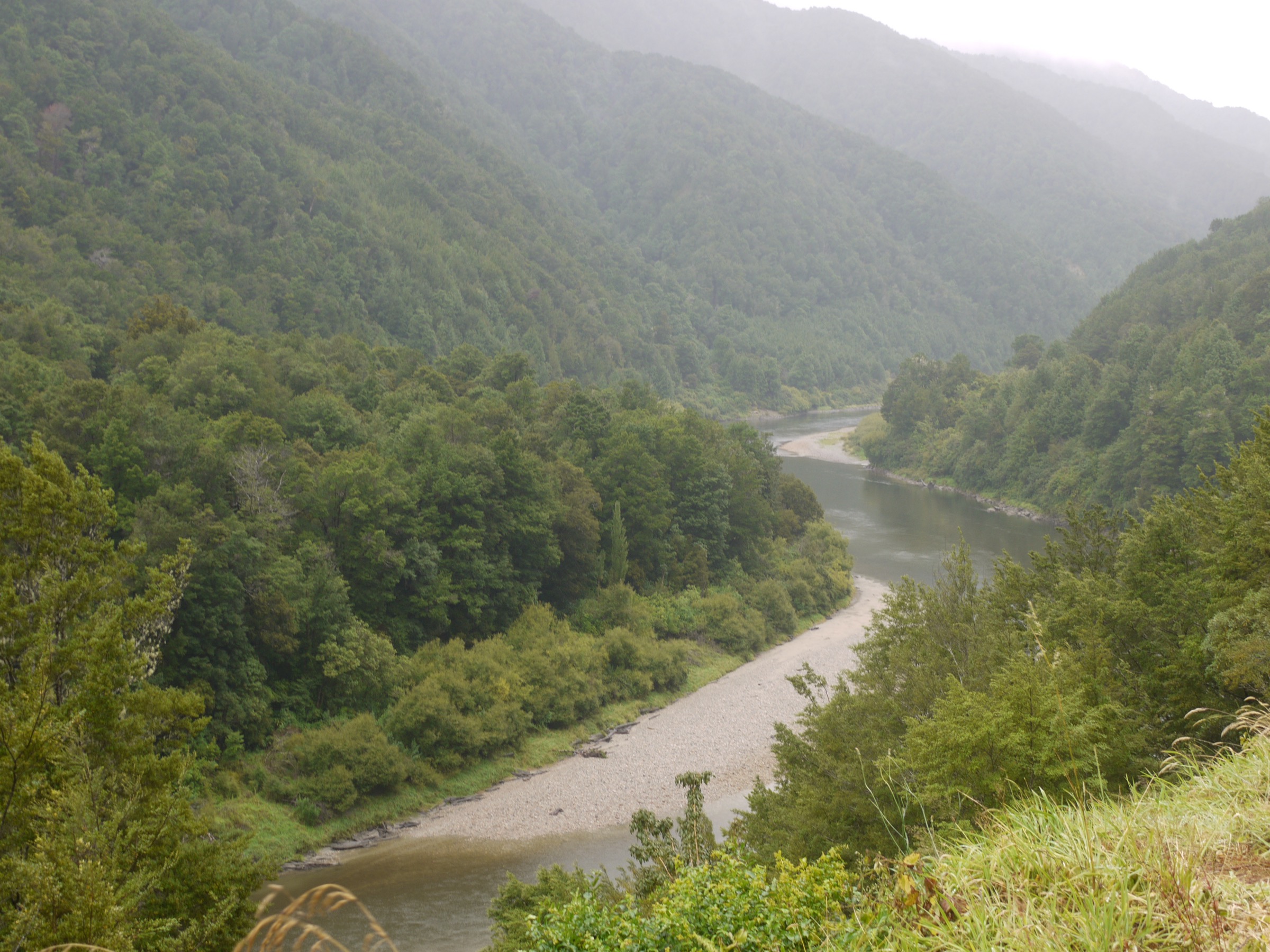
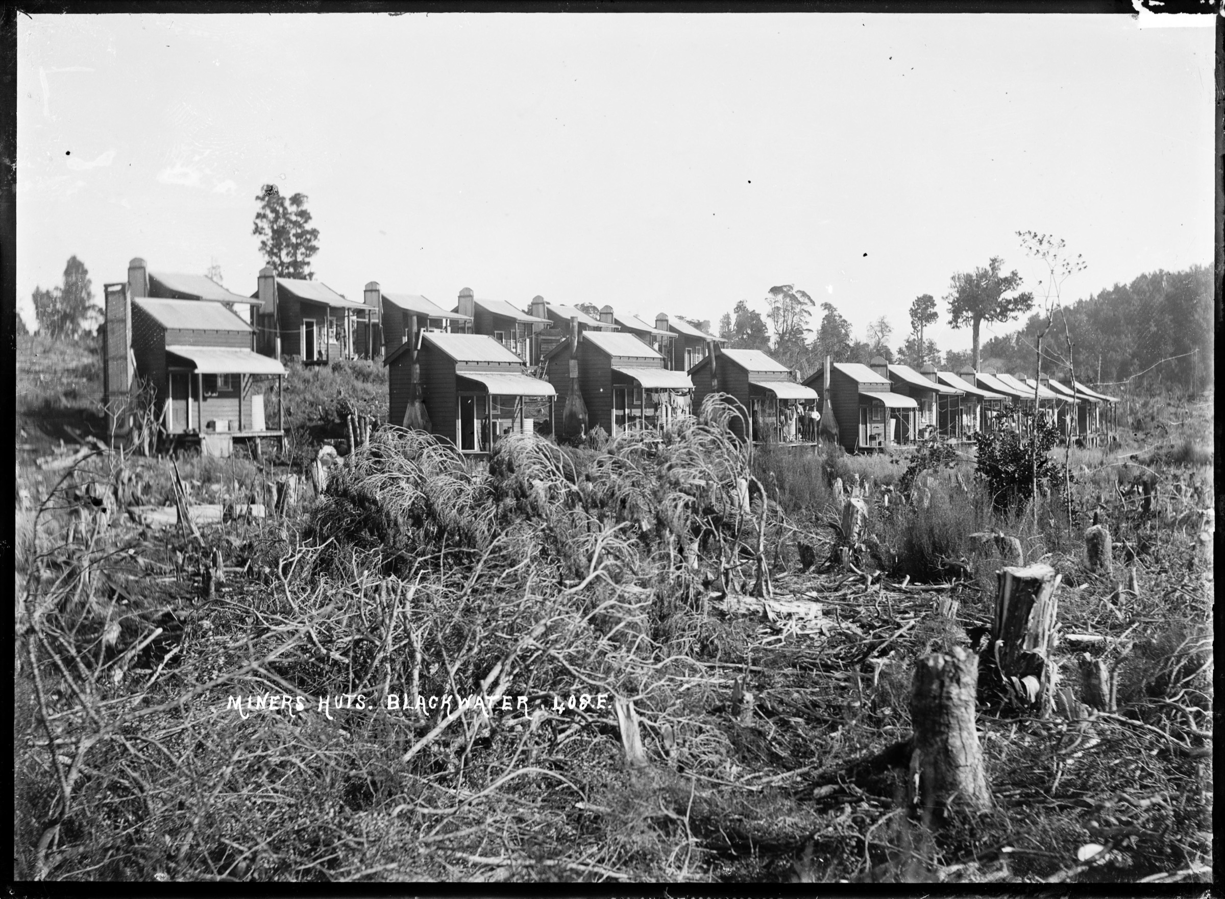
The Southern Brunner Range walking selection is the Reefton / Big River / Blacks Point side of Victoria Forest Park — a coherent mining-heritage landscape that stitches four settled walking corridors together on the south and east side of the range. The Department of Conservation describes Victoria Forest Park as a network of mining-era tracks, pack routes and hut approaches threaded through wet West Coast beech forest, and DOC’s Reefton Walks brochure is the strongest official source for the group. The essential-value of the region is the ability to walk a coherent historic mining landscape — pack tracks, tramways, water races, batteries, engine houses, coal pits and town remains — rather than to reach a specific summit.
Access clusters around three corridors. Waiuta on the eastern side gives the western end of the Waiuta–Big River pack route and links directly into the ghost-town. Big River, on the far side of the pack route, holds a DOC hut, the Big River battery remains and the walk out to Golden Lead Battery. Blacks Point, 2 km east of Reefton on SH7, is the trailhead for the Murray Creek loop and the connecting Lankey Creek tram track. Globe Hill / Rosstown Road on the Reefton side gives the Fossickers Lake reclamation walk at the former Globe Progress Mine.
The walking character is West Coast forest, not alpine. Expect mud, wet roots, unbridged stream crossings and West Coast rain. Old mine workings are everywhere: stay on marked routes near relics and shafts because the ground can be undermined or capped and the timber structures are unstable. Public transport does not run to any of the trailheads; access is by private vehicle from Reefton, itself served by the SH7 corridor between Christchurch and Westport. Best walking runs year-round for the shorter Reefton-side walks in settled weather; the longer Waiuta–Big River pack route and the Big River to Golden Lead walk need dry ground and low streams to be safe day objectives. Winter adds cold and short daylight; heavy rain can close streams and turn tracks into channels at any time of year.
Selection rationale
Five day-scale routes are presented across the Southern Brunner Range. The Waiuta to Big River Track is the classic ghost-town-to-goldfield pack traverse; the Big River to Golden Lead Battery walk extends the mining catalogue into deeper forest on the far side of Big River Hut; the Murray Creek Track is the compact self-contained loop from Blacks Point; the Lankey Creek Tram Track to Murray Creek carries a sharper, tramway-focused mining walk that links back into the Murray Creek network; and the Fossickers Lake Track rounds out the day catalogue with the region’s most accessible mine-reclamation walk at the former Globe Progress tailings site.
Readers who prefer a range-based framing for the same walking landscape should also see the sibling Central Victoria Range guide — the Waiuta, Big River and Murray Creek walks in this article are the same physical routes, presented there under the Victoria Range name and paired with the Waiuta Town Walk and Snowy Battery Track. Longer through-trips beyond Big River, the full Brunner Range main-divide traverse and any excursion into unstable relic ground sit outside this day-hike entry.
Summary
| # | Hike | Trailhead | Route type | Distance | Gain | Difficulty |
|---|---|---|---|---|---|---|
| 1 | Waiuta to Big River Track | Waiuta | Point-to-point pack track | 10.7 km one way (DOC); 13.2 km (AllTrails) | 620 m (AllTrails) | Hard |
| 2 | Big River to Golden Lead Battery | Big River Hut | Out-and-back | 7 km one way / about 14 km return (DOC) | Unresolved | Moderate–Hard |
| 3 | Murray Creek Track | Blacks Point | Loop | 9.7 km round trip (DOC); 10.9 km (AllTrails) | 623 m (AllTrails) | Moderate–Hard |
| 4 | Lankey Creek Tram Track to Murray Creek | Lankey Creek car park | One-way connector or extended loop | 4 km to junction (DOC) | Unresolved | Moderate–Hard |
| 5 | Fossickers Lake Track | Globe Hill kiosk | Out-and-back / lake loop | 8 km return (DOC) | Unresolved | Easy–Intermediate |
1. Waiuta to Big River Track
Snapshot
Itinerary
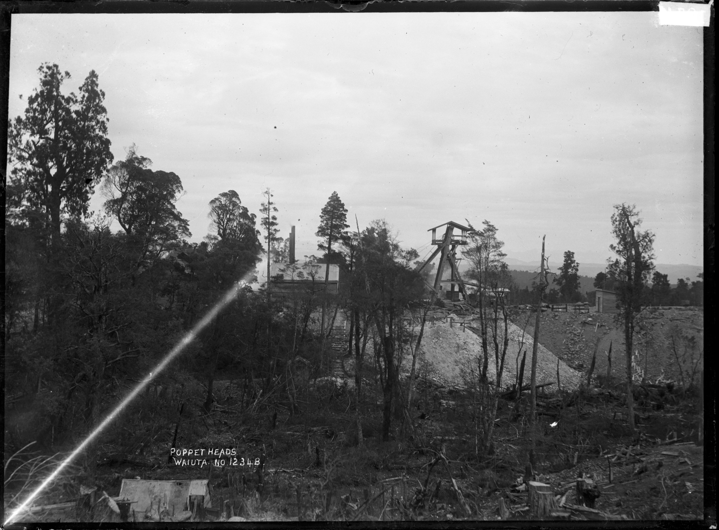
From Waiuta, follow the signposted benched pack track past St George Mine, the stamper battery, Big River South Mine and other mining sites to Big River Hut. The route is walked most often as a one-way with pickup or overnight; a same-day return doubles the distance and moves the day firmly into “long” territory.
Why it is essential
This is the classic ghost-town-to-goldfield traverse of the Southern Brunner Range — a benched miners’ pack track that links two of the West Coast’s most important historic mining zones through wet beech forest, and the anchor day-walk of the whole corridor.
Equipment
- Tramping boots, rain gear and a warm layer
- Map, compass and GPS
- Food and water for a long forest day
- Hut booking and overnight kit if staying at Big River
Hazards and notes
- Remote track — no phone reception across most of the route
- Old mining features — undermined ground, unstable timber, capped shafts; stay on the marked route
- Slips and wet roots — expect West Coast track conditions
- Long return if no pickup at Big River — plan the overnight or the shuttle in advance
2. Big River to Golden Lead Battery
Snapshot
Itinerary
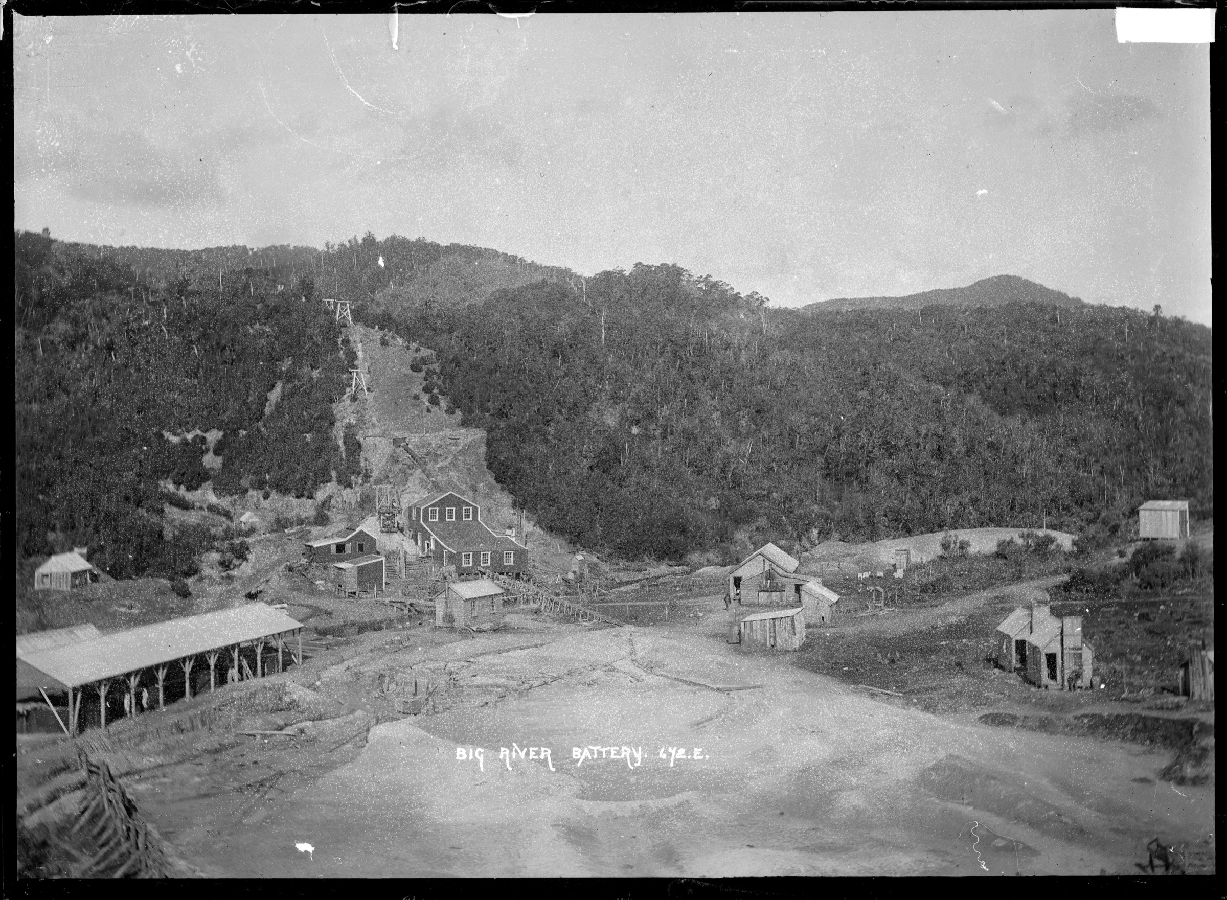
From Big River Hut, cross Big River at the battery site, follow the old mine road to the Big River Engine House, continue to a historic sawmill site, then along an old coal tramway before descending to Deep Creek and the Golden Lead Battery. Return the same way.
Why it is essential
The Big River to Golden Lead walk holds the densest concentration of historic mining relics in the Southern Brunner Range catalogue — engine house, sawmill and tramway remnants, and the battery remains itself — all reached from a remote DOC hut inside the beech-forest interior of Victoria Forest Park.
Equipment
- Tramping boots and rain gear
- Map, compass and GPS
- Food and water for a full backcountry day
- Torch or headlamp for late returns to Big River Hut
Hazards and notes
- Deep Creek descent — steep and slippery in wet conditions
- River and creek levels — DOC says the track is impassable during and after heavy rain
- Old mining hazards — stay on the marked route
- Remote access — Big River is a day’s walk or 4WD ride from the nearest sealed road
3. Murray Creek Track
Snapshot
Itinerary
From the Murray Creek car park, walk or ride the loop past the Inglewood and Ajax gold mines, the Chandlers open-cast coal pit, Cementown, and mine shafts, a steam winch, boilers and stamping-battery relics. The route returns to the same car park at Blacks Point.
Why it is essential
Murray Creek is the most compact and accessible mining-heritage circuit in the Reefton / Southern Brunner block. It packs multiple mine sites, coal and gold workings and industrial relics into a single self-contained loop right off SH7, and is the natural starting point for anyone new to the region’s walking landscape.
Equipment
- Boots and rain gear
- Map and GPS
- Headlamp useful for late exits
- Bike-specific gear for the shared bike sections if riding
Hazards and notes
- Old mining features everywhere — undermined ground, unstable timber, capped shafts
- Wet roots and slippery bridges in the forest
- Advanced bike section between Ajax Mine and Blacks Point — walkers should treat as one-way traffic near riders
- Shared bike/walk use on the loop
4. Lankey Creek Tram Track to Murray Creek
Snapshot
Itinerary
From the Lankey Creek car park on SH7 about 3 km east of Blacks Point, climb steeply to a tram track overlooking the Inangahua River and Lankey Creek, passing old coal and gold mine remains, winches and a battery. Turn left near the Energetic Mine site to follow Murray Creek back to SH7 at Blacks Point, or continue the full Murray Creek loop for a much longer day.
Why it is essential
Lankey Creek is the sharper, tramway-focused mining walk of the Reefton corridor — the shortest way to reach a genuinely industrial tramway landscape from SH7 and the natural extension of the Murray Creek loop into a bigger day.
Equipment
- Boots and rain gear
- Map, compass and GPS
- Food and water for the extended-loop option
Hazards and notes
- Steep initial climb to gain the tram track
- Old mine relics and unstable timber near the tramway
- Wet bush and slippery ground after rain
- Junction navigation at the Energetic Mine — take the correct branch to avoid extending the day unexpectedly
5. Fossickers Lake Track
Snapshot
Itinerary
From the Globe Hill information kiosk, walk or bike along the gravel road past the Globe Pit, around Fossickers Lake and through replanted beech forest. DOC states the lake is the former Globe Progress Mine tailings storage facility.
Why it is essential
Fossickers Lake is the most accessible mine-landscape reclamation walk in the Reefton catalogue, and the day-walk that closes the loop on the Southern Brunner mining-heritage story — from historic ghost-town workings at Waiuta to modern reclamation at Globe Progress in a single catalogue.
Equipment
- Walking shoes or light boots
- Rain layer
- Water and a snack
Hazards and notes
- Mine landscape — respect signage and fenced areas
- Water safety around the lake
- Shared bike/walk use on the road-grade approach
Further reading
- Central Victoria Range: essential day-hikes — the range-based framing of the same walking landscape, adding the Waiuta Town Walk and Snowy Battery Track to the Waiuta / Big River / Murray Creek core.
- Department of Conservation — Victoria Forest Park — the canonical current-status source for park access, tracks and huts.
- Department of Conservation — Reefton Walks brochure — the primary official source for the mining-heritage walk network around Reefton.
Missing data / follow-up work
- Waiuta to Big River Track: full elevation profile (loss on the one-way, maximum elevation) is not published by DOC and should be measured from LINZ contours; verify current shuttle options at the Big River end.
- Big River to Golden Lead Battery: full-route elevation gain and maximum elevation are unresolved; the AllTrails 342 m figure applies to the shorter Engine House variant, not the full Golden Lead return.
- Murray Creek Track: maximum elevation unresolved; verify current status of the shared bike section near Ajax Mine.
- Lankey Creek Tram Track: elevation gain and maximum elevation are unresolved; junction signage at the Energetic Mine link into Murray Creek should be re-checked against current DOC advice.
- Fossickers Lake Track: elevation profile is unresolved from the DOC page; no licence-compatible route-specific image was found in this pass, and the DOC page image is credited to DOC/copyright.
- Route photos: additional per-hike images for Murray Creek, Lankey Creek and Fossickers Lake are still to be sourced under commercially reusable licences; the DOC hero images for these routes are CC BY-NC 4.0 and are not usable here.