.jpg)


.jpg)
Regional overview
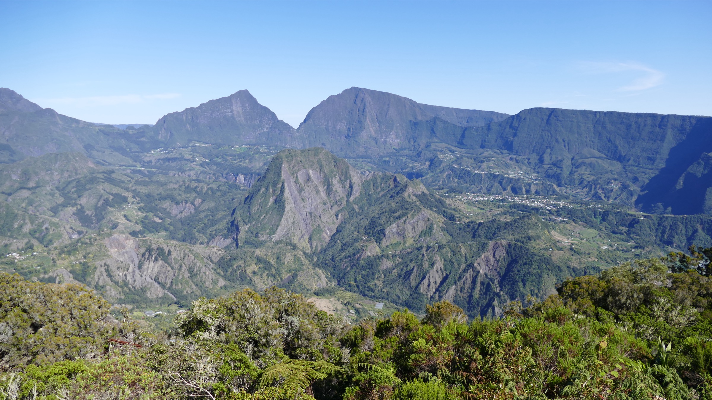
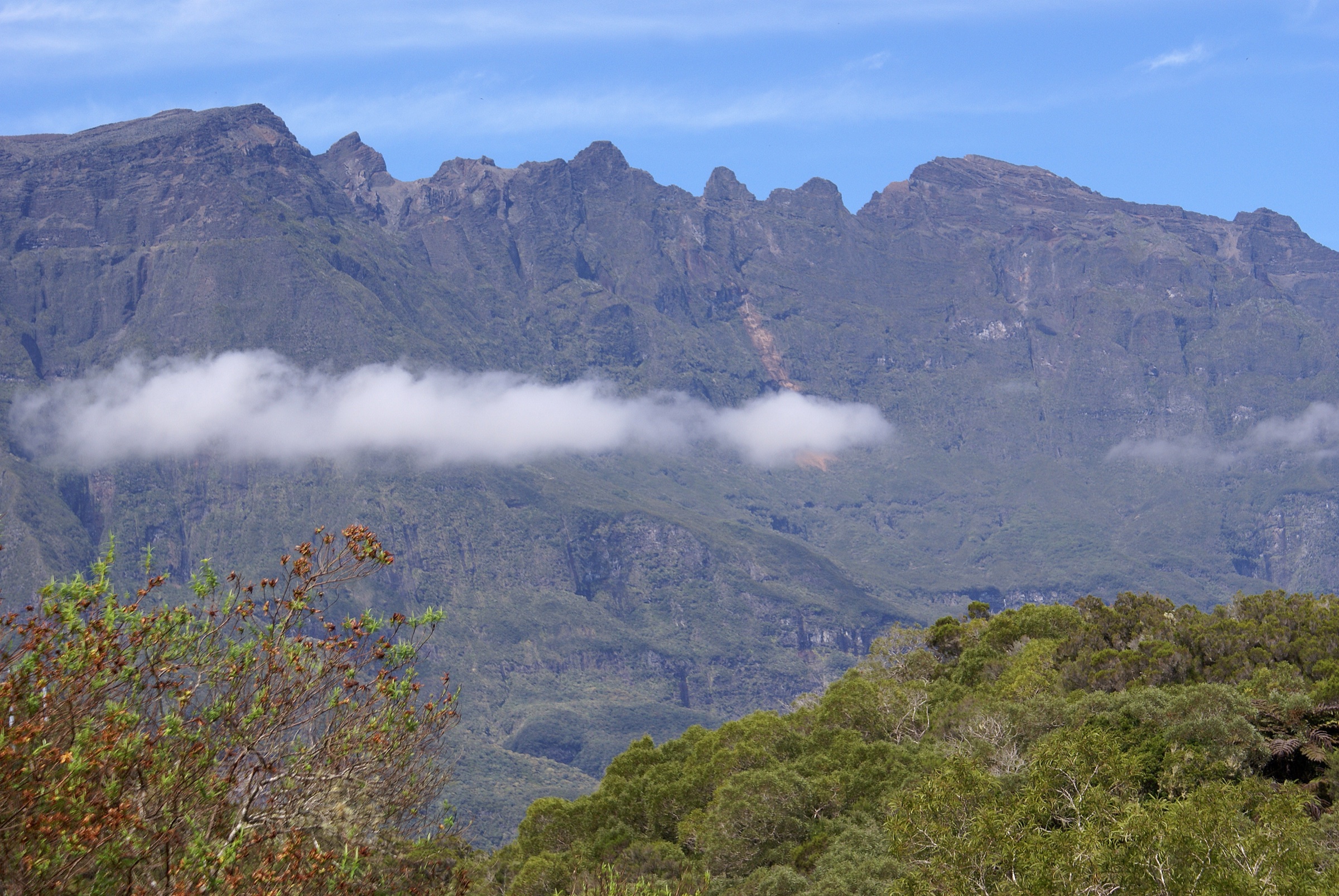
The Piton des Neiges is the dormant central shield volcano of Réunion, rising to 3,070.5 m and the highest summit in the Indian Ocean. Built up from below sea level over more than two million years, the volcano has been deeply eroded by torrential tropical rainfall and gravitational collapse, leaving a star-shaped massif whose flanks have been hollowed out by the three great cirques of Cilaos to the south, Salazie to the north-east and Mafate to the west. The whole edifice was inscribed on the UNESCO World Heritage list in 2010 as the Pitons, cirques and remparts of Réunion Island.
The massif’s last confirmed eruptions are dated to around 12,000 to 25,000 years ago and the volcano is now classified as dormant, though it remains structurally part of the same hotspot system that feeds the still-active Piton de la Fournaise on the south-east side of the island. The summit dome is built of trachytic and basaltic lavas pierced by the famous volcanic bombs scattered across the upper slopes. Beyond the three cirques, the massif is framed by the Roche Écrite ridge on the north, the Maïdo-Grand Bénare rampart on the west, and the Bélouve-Bébour forested plateau on the east; together these ramparts enclose the volcano in a 30 km circle of cliffs and ridges.
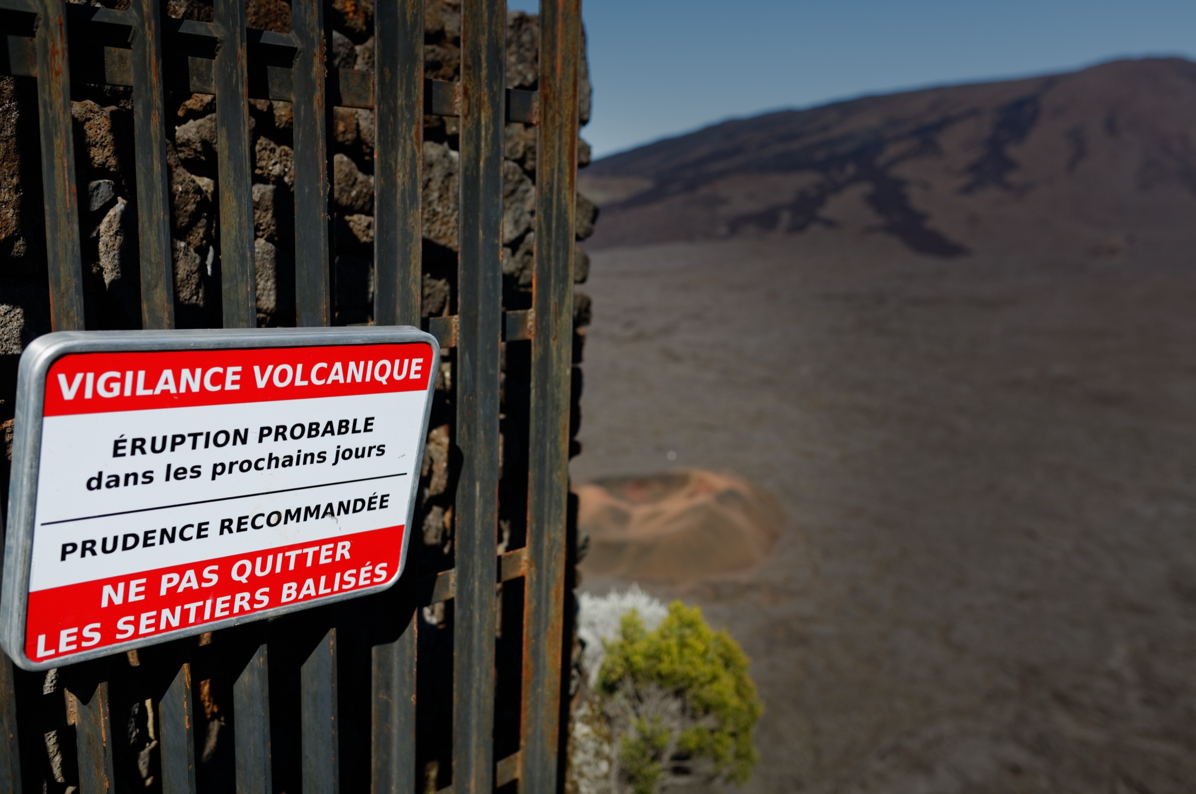
The walking season is the austral winter dry season, roughly May to November, when mornings tend to clear before mid-cloud builds over the high massif. Summit hikes above 2,000 m demand a first-light start; by mid-morning the upper slopes are typically in cloud. Cyclone season runs from November to April and brings closures without notice; the official Vigilance / Pré-Alerte / Alerte system restricts park access during alerts. Parc national de La Réunion and the Office National des Forêts (ONF) publish trail-status notices that should be consulted before any walk, especially after heavy rain.
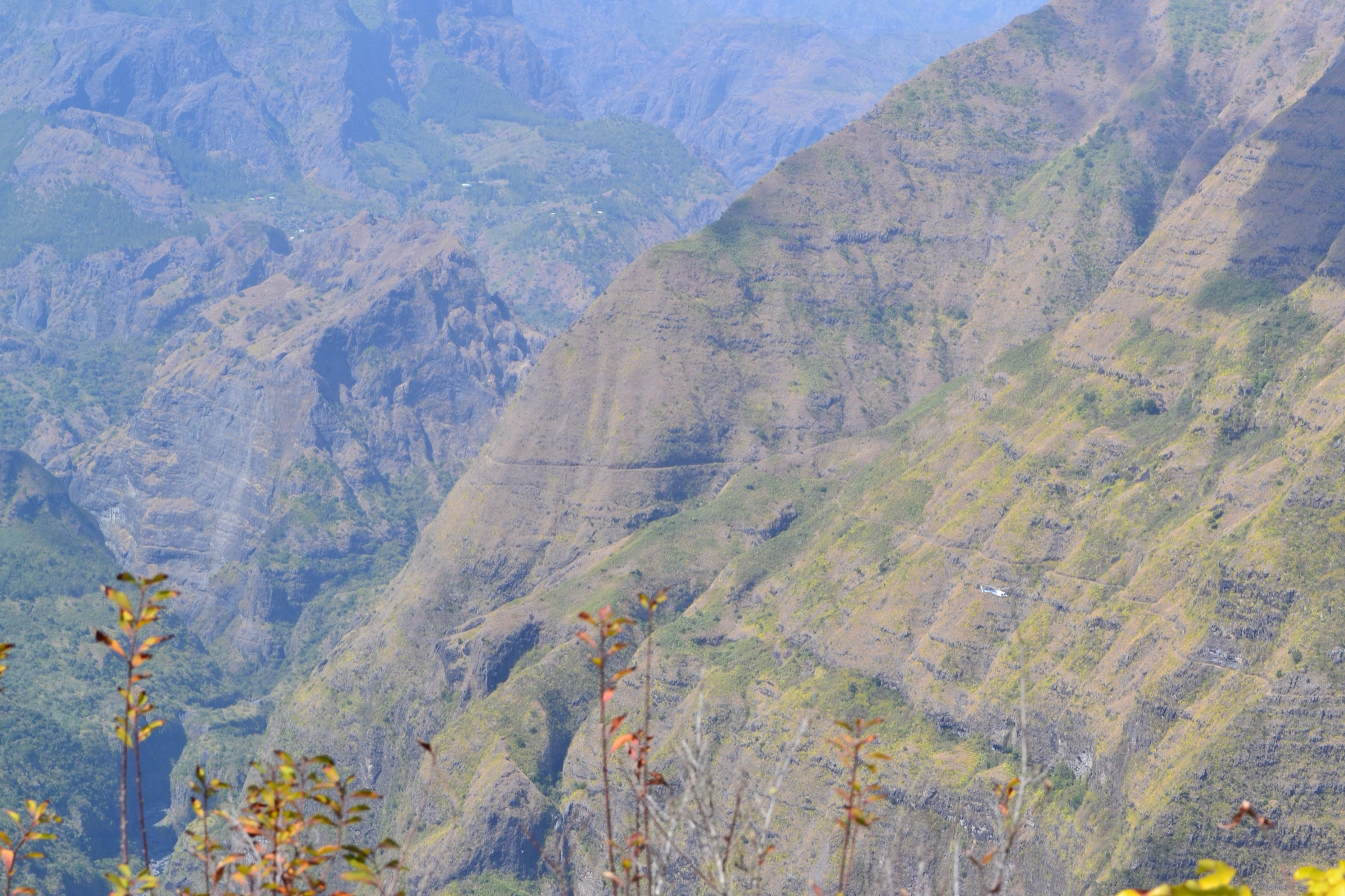
Access to the massif is car-based on a network of mountain roads: the RN5 climbs from Saint-Louis up to Cilaos, the Route forestière du Maïdo climbs from Saint-Paul to the western rampart, the RD41 / Mamode Camp road climbs from Saint-Denis toward the Roche Écrite, and the Route forestière de Bébour-Bélouve runs from La Plaine-des-Palmistes onto the eastern plateau. The Car Jaune intercity network serves Cilaos and several lower-elevation trailheads but does not reach the high mountain car parks (Bloc, Maïdo summit, Gîte de Bélouve), which require private transport.
Selection rationale
The five hikes below cover the defining day-walks of the massif as a whole, deliberately distinct from the in-cirque Salazie selection: the summit of the Piton des Neiges itself (the only practicable day-summit on the volcano), the highest panoramic viewpoint over Cirque de Mafate (Grand Bénare from Le Maïdo), the northern rampart belvedere over Salazie and Mafate (Roche Écrite from Mamode Camp), a longer loop variant past the Trois Roches and Mazerin junction that frames the Trou de Fer in the broader Bébour-Bélouve forest ecology rather than the short Salazie out-and-back, and a sample of the protected high-altitude tamarind forest on the Sentier des Tamarins. The set ranges from a 2-hour family forest walk to a very hard 14 km, 1,700 m summit day.
Summary table
| # | Hike | Country | Route type | Distance | Gain | Max elevation | Difficulty |
|---|---|---|---|---|---|---|---|
| 1 | Sommet du Piton des Neiges from Cilaos / Bloc | France (Réunion) | Out-and-back summit hike (long day or split overnight) | ~14 km | ~1,700 m | ~3,070.5 m | Very hard |
| 2 | Grand Bénare from Le Maïdo | France (Réunion) | Out-and-back ridge hike on GR R2 | ~14 km | ~620 m | ~2,898 m | Hard |
| 3 | Roche Écrite from Mamode Camp | France (Réunion) | Out-and-back rampart hike | ~16 km | ~900 m | ~2,277 m | Hard |
| 4 | Trou de Fer loop from Bélouve via Trois Roches / Mazerin | France (Réunion) | Forest plateau loop | ~10-12 km | ~250 m | ~1,520 m | Moderate |
| 5 | Forêt de Bébour-Bélouve / Sentier des Tamarins | France (Réunion) | Plateau forest loop | ~6-7 km | ~150 m | ~1,500 m | Easy |
1. Sommet du Piton des Neiges from Cilaos / Bloc
Snapshot
Itinerary
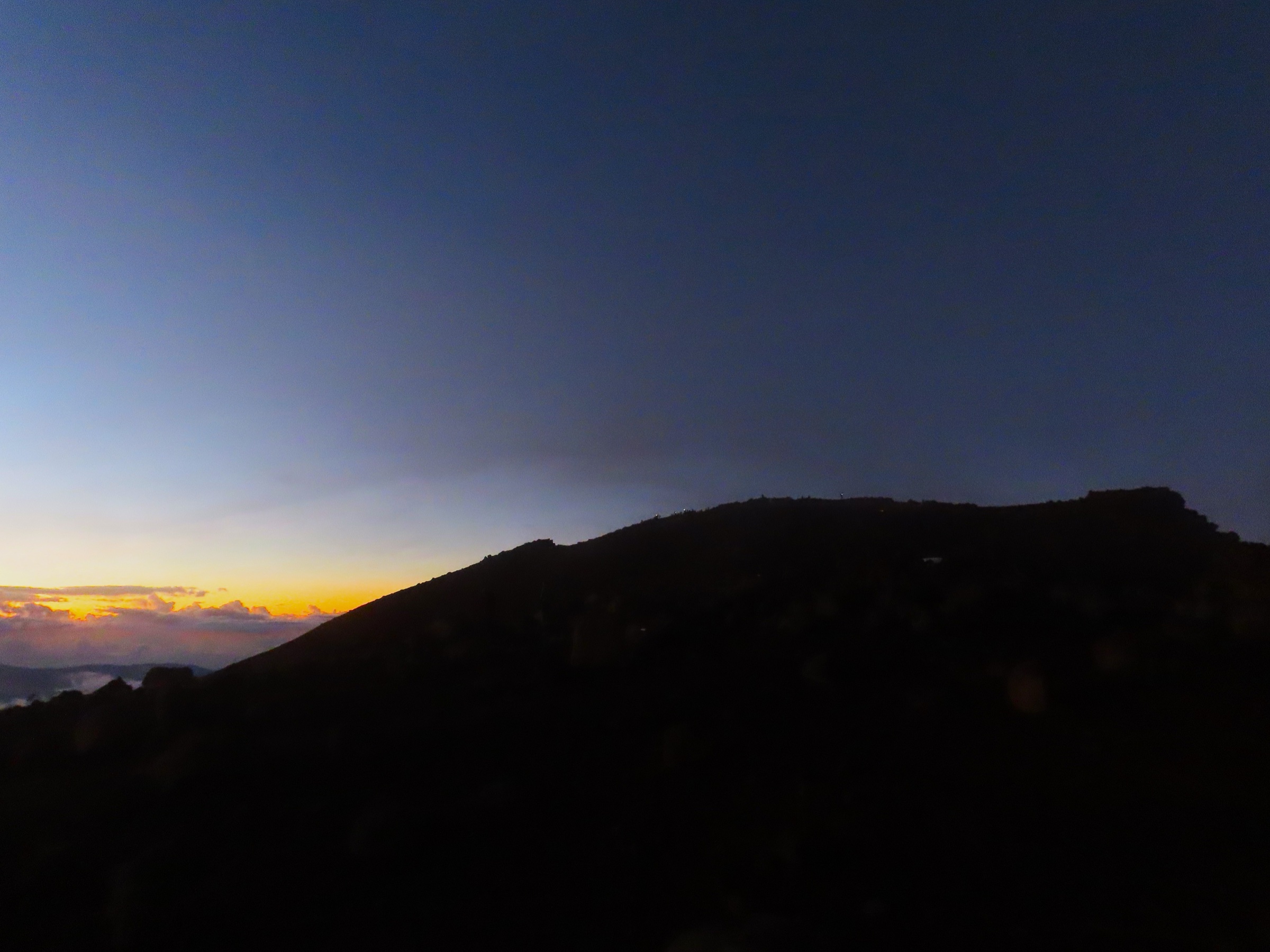
From the Bloc car park above Cilaos the marked path climbs steadily north-east through tamarind and acacia forest, then enters the Brûlé du Bloc, an open zone of fern, broom and lava. The trail crosses the Plateau du Petit Matarum and zigzags up the southern shoulder of the volcano toward the Gîte de la Caverne Dufour at 2,478 m, reached after roughly 4 hours and ~1,100 m of climb. Most parties sleep at the gîte and continue at 03:00-04:00 to reach the summit for sunrise. The upper section above the refuge climbs a steep rocky path and then a long scree slope of trachytic blocks and volcanic bombs to the summit cross at 3,070.5 m. The view at dawn covers the three cirques below the cloud layer, the Piton de la Fournaise to the south-east, the Maïdo / Grand Bénare rampart to the west, and the curve of the Indian Ocean horizon. Return is by the same path, with the descent typically taking 4-5 hours back to Bloc.
Why it is essential
The Piton des Neiges is the structural and symbolic heart of the entire massif, the highest summit of the Indian Ocean and a UNESCO-inscribed feature. Reaching the summit on foot is the signature mountain objective of Réunion and a rite of passage for serious island hikers; the dawn panorama from the cross over the three cirques is widely cited as the finest single viewpoint in the western Indian Ocean.
Equipment
Full mountain hiking equipment: sturdy boots with good grip, warm insulating layer, hat, gloves and windproof shell for the summit (where dawn temperatures are often near freezing), headtorch with spare batteries for the pre-dawn ascent, sun protection for the descent, 2-3 L water, food. Trekking poles strongly recommended for the long descent. Reservation at the Gîte de la Caverne Dufour through the official national park booking system is normally required.
Hazards and notes
Altitude effects (headache, breathlessness) are common above 2,500 m, particularly for hikers arriving directly from sea level. The upper scree is slippery and rolls underfoot. Weather changes very quickly and the summit can be in dense cloud, strong wind or icy conditions even in the dry season. The path is well marked but route-finding in pre-dawn cloud is non-trivial. Cyclone-season conditions can close the entire route.
GPX / route file
| Source | URL | Format | Licence / terms | Reuse status |
|---|---|---|---|---|
| Parc national de La Réunion — Rando tec-tec — Sommet du Piton des Neiges | randotectec.reunion-parcnational.fr | Official GPX | Public-sector data, terms on the parent portal | Not re-hosted |
| Île de la Réunion Tourisme — Sommet du Piton des Neiges depuis Cilaos | en.reunion.fr | Official tourism route description | Site terms apply | Source data only |
| OpenStreetMap — Piton des Neiges | openstreetmap.org | Source map / location | OSM data is ODbL | Source data only |
Further reading
- Parc national de La Réunion — Rando tec-tec — Piton des Neiges
- Île de la Réunion Tourisme — Sommet du Piton des Neiges
- Randopitons — Piton des Neiges par le Bloc
- Wikipedia — Piton des Neiges
2. Grand Bénare from Le Maïdo
Snapshot
Itinerary
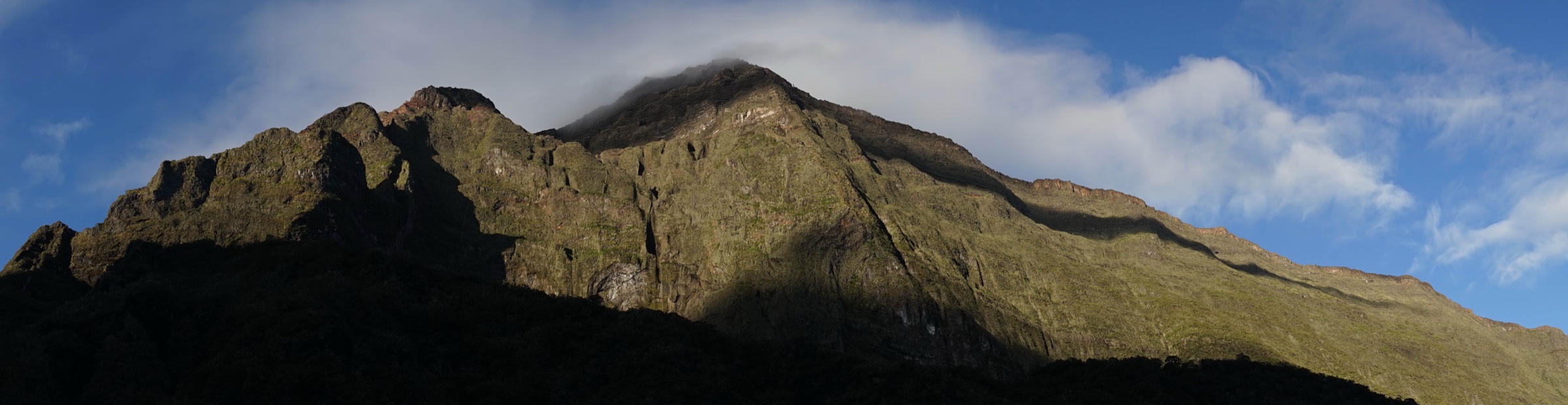
From the Belvédère du Maïdo at ~2,200 m, where the road ends on the lip of the Cirque de Mafate, the path follows the GR R2 southward along the rim of the cirque. The first kilometres run along an open ridge through heather and broom, with the entire Cirque de Mafate dropping away to the east and the coastal plain of Saint-Paul falling to the west. The trail crosses the Petit Bénare (~2,680 m), then climbs a stony saddle and a final boulder-strewn ridge to the cairn of the Grand Bénare at ~2,898 m. The summit panorama covers the cirques of Mafate (immediately below), Cilaos (to the south-east beyond the Col du Taïbit) and the dome of the Piton des Neiges itself, with the Indian Ocean on the far side. Return is by the same ridge to Le Maïdo.
Why it is essential
The Grand Bénare is the high point of the entire western rampart of the massif and offers the most complete single panorama over the Cirque de Mafate. Unlike the Piton des Neiges itself, it can be done as a moderate day out from a high-altitude road head, making it the most accessible 2,800+ m summit on the island. It is the showcase day-hike from the Maïdo viewpoint.
Equipment
Mountain hiking equipment: sturdy boots, warm and windproof layers (the ridge is exposed at all times), hat and gloves outside high summer, sun protection (the upper ridge has almost no shade), 2-3 L water (no water on route), food, and a headtorch for early starts. Trekking poles are useful on the descent.
Hazards and notes
The Maïdo road is normally closed early morning (or vehicle queues form) during peak weekends; arriving before 07:00 is strongly recommended both for parking and for clear views. Lightning storms develop quickly in summer along the ridge. The ridge is exposed to falls on the Mafate (eastern) side in a few places. The Maïdo plateau is also under elevated fire risk in dry years and may be partly closed by ONF after major fires (notably 2010 and 2011).
GPX / route file
| Source | URL | Format | Licence / terms | Reuse status |
|---|---|---|---|---|
| Randopitons — Grand Bénare depuis le Maïdo | randopitons.re | GPX download on free account | Personal-use terms; not re-hosted | Not re-hosted |
| Visorando — Le Grand Bénare depuis le Maïdo | visorando.com | GPX download on free account | Visorando terms; not re-hosted | Not re-hosted |
| OpenStreetMap — Grand Bénare | openstreetmap.org | Source map / location | OSM data is ODbL | Source data only |
Further reading
- Île de la Réunion Tourisme — Le Grand Bénare
- Randopitons — Grand Bénare par le Maïdo
- Mon GR — GR R2 La Grande Traversée
- Wikipedia (FR) — Grand Bénare
3. Roche Écrite from Mamode Camp
Snapshot
Itinerary
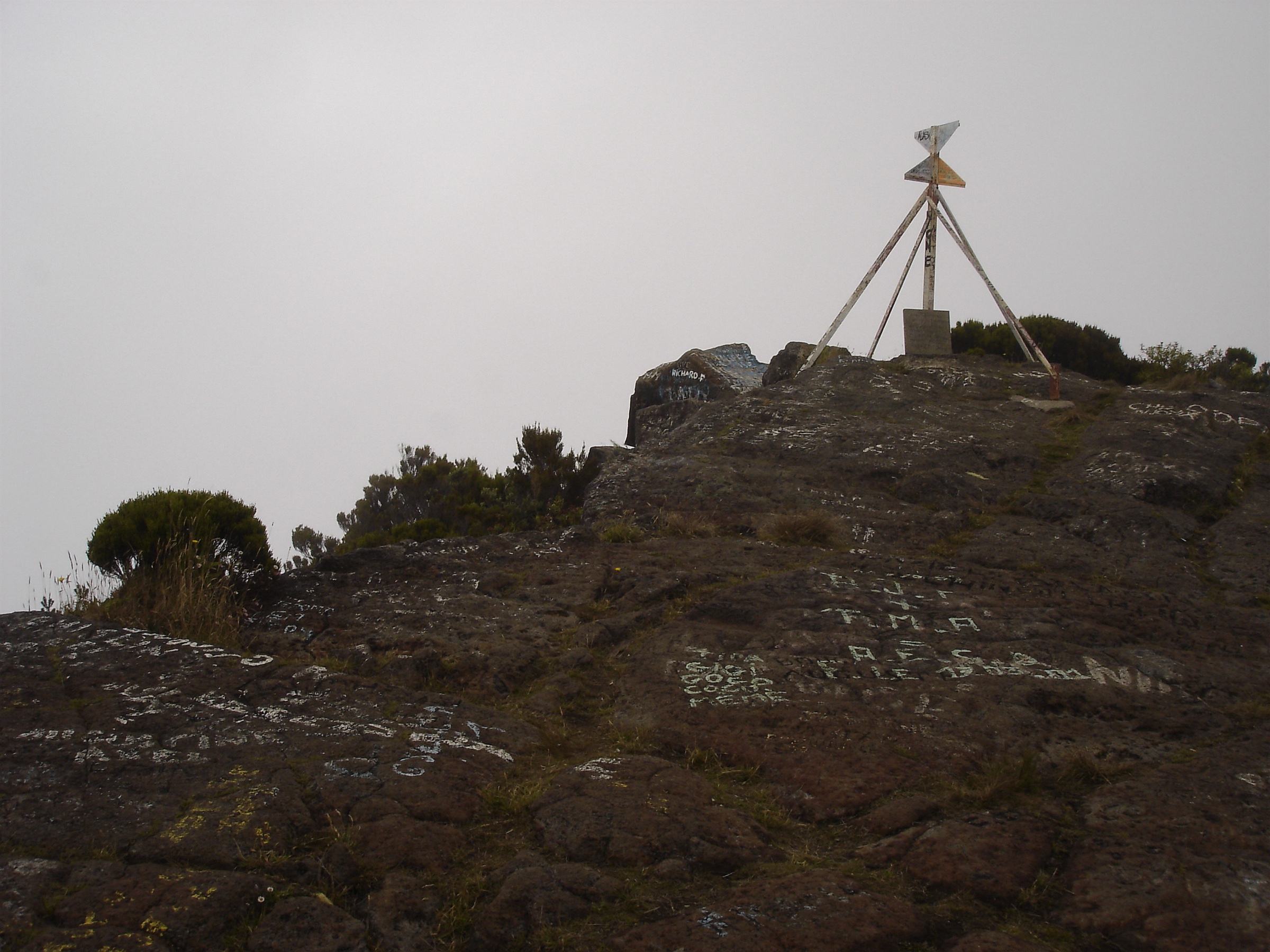
From the Mamode Camp / Plaine d’Affouches car park at the end of the road above Saint-Denis, the path climbs gently south through cryptomeria and tamarind forest onto the Plaine des Chicots, a high plateau of heather and broom. The Gîte de la Plaine des Chicots (~1,830 m) lies roughly midway and is a possible break point or overnight option. From the gîte the trail continues south-east, climbs through a forest of dwarfed tamarinds and then onto the open ridge to the Caverne de la Roche Écrite. The final climb tackles the rocky summit dome of the Roche Écrite at ~2,277 m, where the view drops directly into Cirque de Salazie to the east, Cirque de Mafate to the south-west, and over the city of Saint-Denis and the northern coast far below. Return is by the same path.
Why it is essential
The Roche Écrite is the high point of the northern rampart and the only summit on the massif that puts a hiker simultaneously on the rim of two cirques (Salazie and Mafate) while looking down at the capital and the ocean. It is also the core habitat of the critically endangered Réunion cuckooshrike (tuit-tuit) and the focus of one of the longest-running endemic-bird conservation programmes in the French overseas territories.
Equipment
Mountain hiking equipment: sturdy boots, warm insulating layer, windproof / waterproof shell, hat and gloves outside high summer, sun protection, 2-3 L water (no reliable water on route above the start), food, and a headtorch for early starts. Trekking poles strongly recommended.
Hazards and notes
The ridge is exposed and cold; weather changes rapidly above 2,000 m. The forest sections are popular with mountain bikers, joggers and trail runners; hikers should expect to share the path on weekends. The Roche Écrite Nature Reserve protects the endemic tuit-tuit and dogs are not allowed in the reserve area. Cyclone-season closures are common.
GPX / route file
| Source | URL | Format | Licence / terms | Reuse status |
|---|---|---|---|---|
| Randopitons — La Roche Écrite par la Plaine d’Affouches | randopitons.re | GPX download on free account | Personal-use terms; not re-hosted | Not re-hosted |
| Île de la Réunion Tourisme — La Roche Écrite | en.reunion.fr | Official tourism route description | Site terms apply | Source data only |
| OpenStreetMap — Roche Écrite | openstreetmap.org | Source map / location | OSM data is ODbL | Source data only |
Further reading
- Île de la Réunion Tourisme — La Roche Écrite
- Randopitons — La Roche Écrite
- Parc national de La Réunion — Réserve naturelle de la Roche Écrite
- Wikipedia (FR) — Roche Écrite
4. Trou de Fer loop from Bélouve via Trois Roches / Mazerin
Snapshot
Itinerary
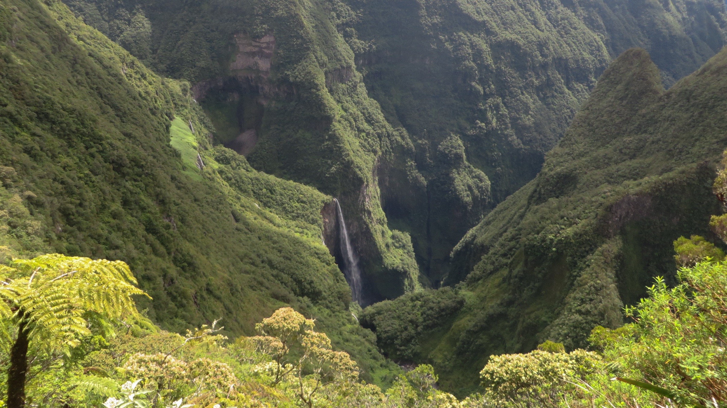
From the Gîte de Bélouve at ~1,500 m the loop sets off west on the Allée Cavalière through tamarind and fanjan forest, with duckboards over the wettest sections. After about 3 km the Mazerin junction signs a southward branch toward the Trois Roches, a cluster of basalt blocks beside a stream where the path crosses the Rivière des Marsouins. The loop continues east through dense montane forest, reaches the Belvédère du Trou de Fer on the canyon rim and gives the full view down into the 300 m chasm, where the Bras de Caverne plunges in a series of ribbon falls (the same belvedere is also reached by the short out-and-back from Bélouve documented in the Cirque de Salazie article). From the belvédère the return follows a more direct path back to the gîte through the upper Bélouve plateau, closing the loop. This framing puts the Trou de Fer in the context of the wider Bébour-Bélouve forest ecology rather than as a single objective.
Why it is essential
The Trou de Fer is Réunion’s most photographed waterfall feature and the eastern hydrological frontier of the Piton des Neiges massif. The loop variant gives a much fuller experience of the high-altitude tamarind forest on the Bébour-Bélouve plateau than the short out-and-back, with the additional Trois Roches viewpoint over the Rivière des Marsouins headwaters. The Bébour-Bélouve massif as a whole is the largest contiguous high-altitude indigenous forest left on Réunion.
Equipment
Standard hiking equipment: hiking shoes or boots with very good grip (the duckboards are notoriously slippery), weatherproof shell, warm layer for the plateau, sun protection, 1.5-2 L water, food. Trekking poles are highly useful. A headtorch is sensible given the unpredictable cloud.
Hazards and notes
Duckboards become extremely slippery when wet, which is most of the time. The Eastern Zone of Trou de Fer was reported as temporarily closed in late 2024 and conditions should be re-checked with ONF and the Parc national before travel. Cloud and rain reach the plateau most afternoons; an early start gives the best chance of an open view. Drones are not permitted without authorisation inside the national park.
GPX / route file
| Source | URL | Format | Licence / terms | Reuse status |
|---|---|---|---|---|
| Randopitons — Trou de Fer par Trois Roches et Mazerin | randopitons.re | GPX download on free account | Personal-use terms; not re-hosted | Not re-hosted |
| Visorando — Le Trou de Fer par le gîte de Bélouve et l’Allée Cavalière | visorando.com | GPX download on free account | Visorando terms; not re-hosted | Not re-hosted |
| OpenStreetMap — Trou de Fer | openstreetmap.org | Source map / location | OSM data is ODbL | Source data only |
Further reading
- Île de la Réunion Tourisme — Forêts de Bébour-Bélouve
- Randopitons — Trou de Fer par Trois Roches et Mazerin
- ONF — Loisirs en forêt, La Réunion
- Wikipedia (FR) — Trou de Fer
5. Forêt de Bébour-Bélouve / Sentier des Tamarins
Snapshot
Itinerary
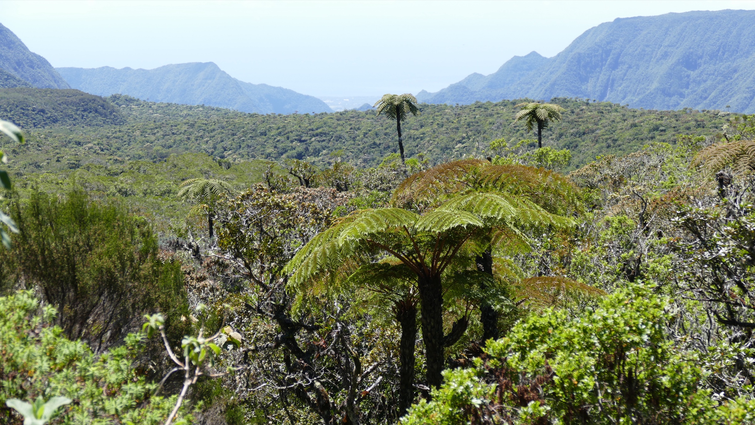
The Sentier des Tamarins loops through the protected core of the Bébour-Bélouve forest, the largest contiguous high-altitude indigenous forest on Réunion. From the Gîte de Bélouve or a marked roadside trailhead on the Route forestière, the path enters a closed canopy of tamarins des hauts (Acacia heterophylla), fanjan tree ferns, ambaville and endemic ground orchids. Several wooden interpretation panels installed by ONF describe forest dynamics, the role of tamarins in the post-disturbance succession of the forest, and the bird species present (paille-en-queue, oiseau-vert, tec-tec). The loop crosses a series of small streams on log bridges and re-emerges at the start, with optional short detours to viewpoints over the Plaine des Marsouins. The walk can be combined with the Trou de Fer loop (entry 4) for a full plateau day.
Why it is essential
The Bébour-Bélouve forest is the most accessible old-growth tamarind forest of the entire massif and the standard introduction to Réunion’s high-altitude indigenous ecology. The loop walks through groves of tamarins des hauts that are central to the Réunionnais cultural identity (the wood is used for traditional Creole architecture) and lets walkers experience the ecology of the massif without committing to a high-summit day.
Equipment
Standard hiking equipment: hiking shoes or trainers with reasonable grip, light waterproof shell, sun protection, 1-1.5 L water, picnic. No technical equipment is required.
Hazards and notes
Paths are wet and slippery in places year-round. The forest is dense and disorientation off the marked path is possible in mist; staying on the signed loop is important. The site is a protected national park zone: no off-trail walking, no fires, no plant collection. The Route forestière is sometimes closed after major rain or for forestry operations.
GPX / route file
| Source | URL | Format | Licence / terms | Reuse status |
|---|---|---|---|---|
| Randopitons — Boucle de Bélouve par la Forêt des Tamarins | randopitons.re | Index of forest loops with downloadable GPX | Personal-use terms; not re-hosted | Not re-hosted |
| ONF — Loisirs en forêt, La Réunion | onf.fr | Official forest-walking information | Site terms apply | Source data only |
| OpenStreetMap — Forêt de Bélouve | openstreetmap.org | Source map / location | OSM data is ODbL | Source data only |
Further reading
- Île de la Réunion Tourisme — Forêts de Bébour-Bélouve
- ONF — Loisirs en forêt, La Réunion
- Randopitons — Forêt Bélouve / Bébour
- Wikipedia (FR) — Forêt de Bélouve
Missing data / follow-up work
- Distance and elevation-gain figures for the summit of the Piton des Neiges vary by source (Bloc start vs Cilaos village start, single-day vs split overnight); the catalogue uses the Parc national / Rando tec-tec figures (~14 km, ~1,700 m) from Bloc. Cilaos-village starts add ~5 km and ~400 m.
- Grand Bénare distance differs between Randopitons (~13.6 km), Visorando (~14 km) and IRT (~16 km variants via Petit Bénare and back across Le Maïdo); the catalogue uses the ~14 km figure.
- Roche Écrite distance varies by ±1 km between IRT and Randopitons; the catalogue uses the ~16 km Mamode Camp out-and-back. Some parties use the Gîte de la Plaine des Chicots as an overnight to shorten the summit day.
- The Trou de Fer loop length depends on whether walkers take the full Mazerin / Trois Roches branch or shortcut directly to the belvédère; both variants are signed but distance reporting differs by ~2 km between sources.
- The Eastern Zone of Trou de Fer has experienced partial closures in 2024-2025; current status must be checked with ONF and the Parc national de La Réunion before travel.
- The Bébour-Bélouve / Sentier des Tamarins exists in multiple loop variants of 3 km to 9 km; the catalogue uses a representative 6-7 km figure but parties should confirm the variant at the trailhead.
- All published GPX / KML route files referenced are external; no third-party tracks are re-hosted.
- Cyclone-season closures (November to April) may affect every route on the massif; the official Réunion Vigilance status should be checked for any wet-season visit.
- An equivalent in-cirque Salazie set (Piton d’Anchaing, Hell-Bourg, Mare à Poule d’Eau, Cap Anglais, short Trou de Fer out-and-back) is published in a separate sibling article and is intentionally not duplicated here.
Further reading
| Resource | Link |
|---|---|
| Parc national de La Réunion | reunion-parcnational.fr |
| Parc national de La Réunion — Rando tec-tec (official trail database) | randotectec.reunion-parcnational.fr |
| Île de la Réunion Tourisme (IRT) | reunion.fr |
| ONF — Loisirs en forêt, La Réunion | onf.fr |
| Randopitons — Piton des Neiges massif | randopitons.re |
| Mon GR — GR R2 La Grande Traversée | mongr.fr |
| Fédération Française de la Randonnée — GR R1 tour du Piton des Neiges | ffrandonnee.fr |
| Rando tec-tec — Sommet du Piton des Neiges (GPX) | randotectec.reunion-parcnational.fr |
| Île de la Réunion Tourisme — Sommet du Piton des Neiges | en.reunion.fr |
| Île de la Réunion Tourisme — Grand Bénare | en.reunion.fr |
| Île de la Réunion Tourisme — Roche Écrite | en.reunion.fr |
| Île de la Réunion Tourisme — Forêts de Bébour-Bélouve | en.reunion.fr |
| Randopitons — Piton des Neiges par le Bloc | randopitons.re |
| Randopitons — Grand Bénare par le Maïdo | randopitons.re |
| Randopitons — Roche Écrite par la Plaine d’Affouches | randopitons.re |
| Randopitons — Trou de Fer par Trois Roches et Mazerin | randopitons.re |
| Visorando — Grand Bénare depuis le Maïdo | visorando.com |
| Visorando — Trou de Fer via Bélouve | visorando.com |
| Wikipedia — Piton des Neiges | en.wikipedia.org |
| Wikipedia (FR) — Grand Bénare | fr.wikipedia.org |
| Wikipedia (FR) — Roche Écrite | fr.wikipedia.org |
| Wikipedia (FR) — Trou de Fer | fr.wikipedia.org |
| Wikipedia (FR) — Forêt de Bélouve | fr.wikipedia.org |