


Regional overview
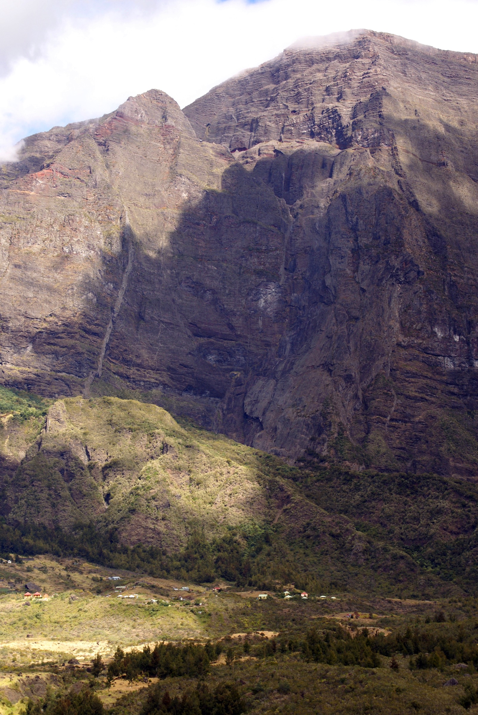
The Cirque de Mafate is the roadless western cirque of the Piton des Neiges shield volcano, the wildest and most isolated of Réunion’s three great cirques alongside Salazie to the north-east and the Cirque de Cilaos to the south. It is enclosed by 1,500-2,200 m remparts and drained by the Rivière des Galets, which exits through a deeply incised canyon to the lower west coast. There are no roads inside the cirque; the inhabited îlets of La Nouvelle, Marla, Cayenne, Aurère, Grand Place and Îlet des Orangers are linked only by footpaths, mule tracks and helicopter rotations. Like the rest of the Piton des Neiges massif, Mafate sits inside Parc national de La Réunion, inscribed on the UNESCO World Heritage list in 2010 as the Pitons, cirques and remparts of Réunion Island.
The principal day-walker access points are Col des Bœufs (from the Salazie side), Maïdo and Grand Bord (from the west-coast hauts), Dos d’Âne and Cap Noir (north-west rim), Sans Souci (south-west) and the Rivière des Galets / Deux Bras approach from the lower west. Logistics drive route choice because most îlets are several hours from any road; many classic Mafate itineraries are multi-day, and day-hikes therefore concentrate on rim viewpoints, single-pass entries to a near îlet, or compact loops at low elevation along the river.
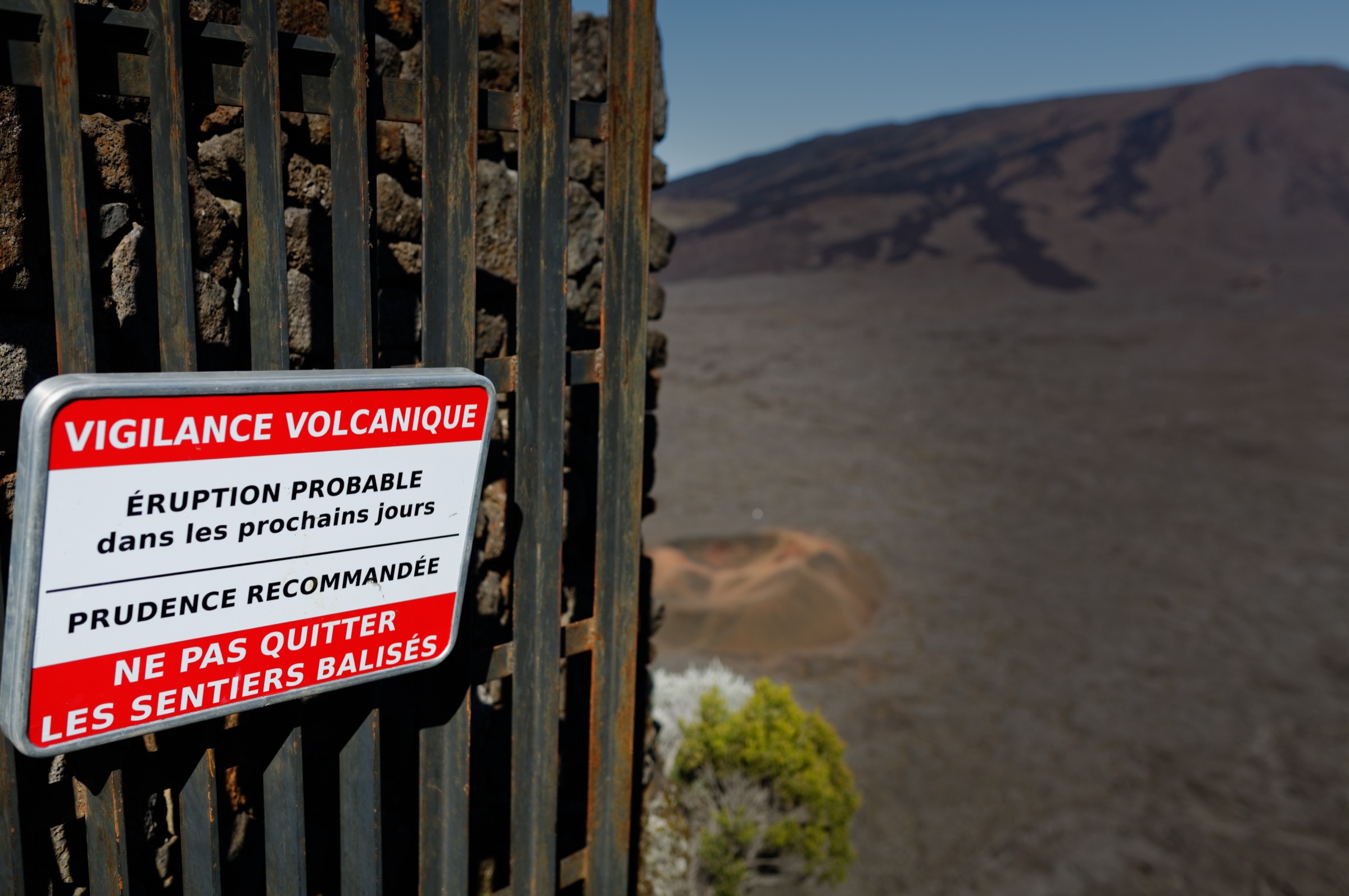
The walking season is the austral winter dry season, roughly May to November, when mornings tend to be clearer before mid-cloud builds over the ramparts. Cyclone season runs from November to April; trails can be closed without notice after heavy rain, and the official Réunion vigilance system (Vigilance, Pré-Alerte, Alerte) restricts access during alerts. The Office National des Forêts (ONF) and Parc national de La Réunion publish closure notices that should be consulted before any walk, particularly after major rain events, when fords on the Rivière des Galets can be impassable.
Access is by car or bus to the rim trailheads: the D48 / D52 to Col des Bœufs (parking surveillé), the Route forestière du Maïdo (RF8) from Saint-Paul to Maïdo and Grand Bord, the D1 to Dos d’Âne for Cap Noir, the Route de Sans Souci for the Canalisation des Orangers, and the Rivière des Galets access road from La Possession for Deux Bras. Car Jaune intercity buses do not reach most trailheads; the local Kar’ouest network covers parts of the western approach but private transport is usually necessary.
Selection rationale
The five hikes below cover Mafate’s defining day-walk experiences: the classic high-pass entry to the cirque’s largest îlet (La Nouvelle from Col des Bœufs), an inner-cirque loop linking three of the most recognisable îlets and river features (Marla, Trois Roches and the Plaine aux Sables), a low-elevation river / footbridge route through the Rivière des Galets to Cayenne, the compact rim viewpoint classic from Dos d’Âne (Cap Noir), and the long balcony canalisation across the western remparts to the Îlet des Orangers. The Canalisation des Orangers exceeds the catalogue’s normal distance target and is retained as a strenuous exception because it is the defining Mafate balcony route. All five have official Rando tec-tec route records and downloadable GPX / KML files.
Summary table
| # | Hike | Country | Route type | Distance | Gain | Max elevation | Difficulty |
|---|---|---|---|---|---|---|---|
| 1 | La Nouvelle par le Chemin Charrette | France (Réunion) | Out-and-back from Col des Bœufs | ~13.0 km | ~612 m | ~1,959 m | Moderate |
| 2 | Boucle de Marla, Trois Roches et Plaine aux Sables | France (Réunion) | Inner-cirque loop from La Nouvelle | ~12.3 km | ~899 m | ~1,623 m | Hard |
| 3 | Deux Bras à Cayenne par les passerelles | France (Réunion) | Lower-cirque river loop | ~11.7 km | ~535 m | ~557 m | Moderate |
| 4 | Cap Noir, chemin entre deux mondes | France (Réunion) | Short rim viewpoint loop | ~3.1 km | ~251 m | ~1,298 m | Easy |
| 5 | Canalisation des Orangers de Sans Souci à l’Îlet des Orangers | France (Réunion) | Long out-and-back balcony route | ~26.8 km | ~1,209 m | ~991 m | Moderate but very long |
1. La Nouvelle par le Chemin Charrette
Snapshot
Itinerary
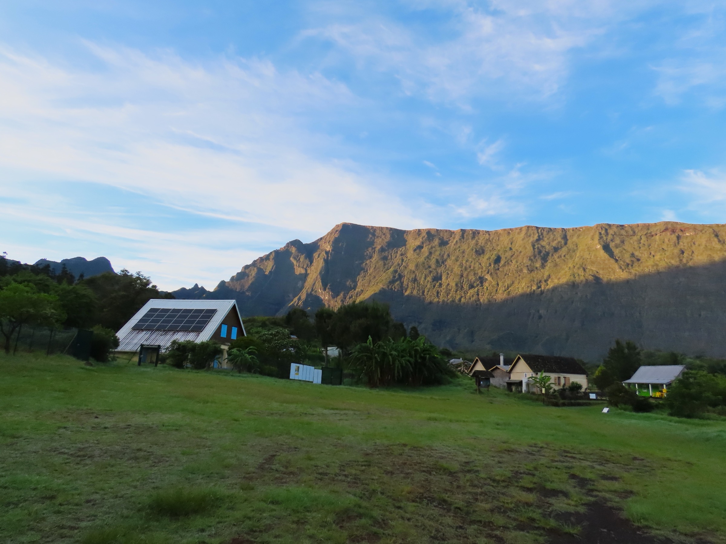
From the guarded Col des Bœufs car park at about 1,960 m, the path drops over the rim of the cirque and descends gently through the Plaine des Tamarins, a high tamarind woodland on the upper Mafate floor. The Chemin Charrette is a broad, historically engineered mule track with a steady moderate gradient, traversing forest and open viewpoints into the heart of the cirque. After roughly 6 km the path arrives at La Nouvelle, the largest inhabited îlet of Mafate at about 1,425 m, with a chapel, gîtes, a primary school and small shops. Return is by the same route back to Col des Bœufs.
Why it is essential
This is the standard first-entry day-hike into roadless Mafate and the easiest way to reach a major inhabited îlet without committing to a multi-day traverse. It samples the Plaine des Tamarins, the Chemin Charrette engineering, and the lived-in Creole landscape of La Nouvelle in a single fit day-walker’s outing.
Equipment
Mountain hiking equipment: sturdy footwear, weatherproof shell, warm layer for the col, sun protection, at least 2 L of water, food, headtorch in case of late descent, and map / GPS. Trekking poles are useful on the return climb.
Hazards and notes
The official record advises starting around 07:00 because cloud often builds over the cirque by midday. Road access to Col des Bœufs is a long winding climb that should be checked locally, particularly after rain. The route enters the national park core; stay on marked paths and respect îlet privacy.
GPX / route file
| Source | URL | Format | Licence / terms | Reuse status |
|---|---|---|---|---|
| Rando tec-tec / Parc national de La Réunion — La Nouvelle par le Chemin Charrette | randotectec.reunion-parcnational.fr | GPX | Official portal; reuse terms unresolved | Not re-hosted |
| Rando tec-tec / Parc national de La Réunion — same route, KML | randotectec.reunion-parcnational.fr | KML | Official portal; reuse terms unresolved | Not re-hosted |
| OpenStreetMap — La Nouvelle, Mafate | openstreetmap.org | Source map / location | OSM data is ODbL | Source data only |
Further reading
- Rando tec-tec — La Nouvelle par le Chemin Charrette
- Île de la Réunion Tourisme — Cirque de Mafate
- Wikipedia (FR) — La Nouvelle (La Réunion)
- Parc national de La Réunion
2. Boucle de Marla, Trois Roches et Plaine aux Sables
Snapshot
Itinerary
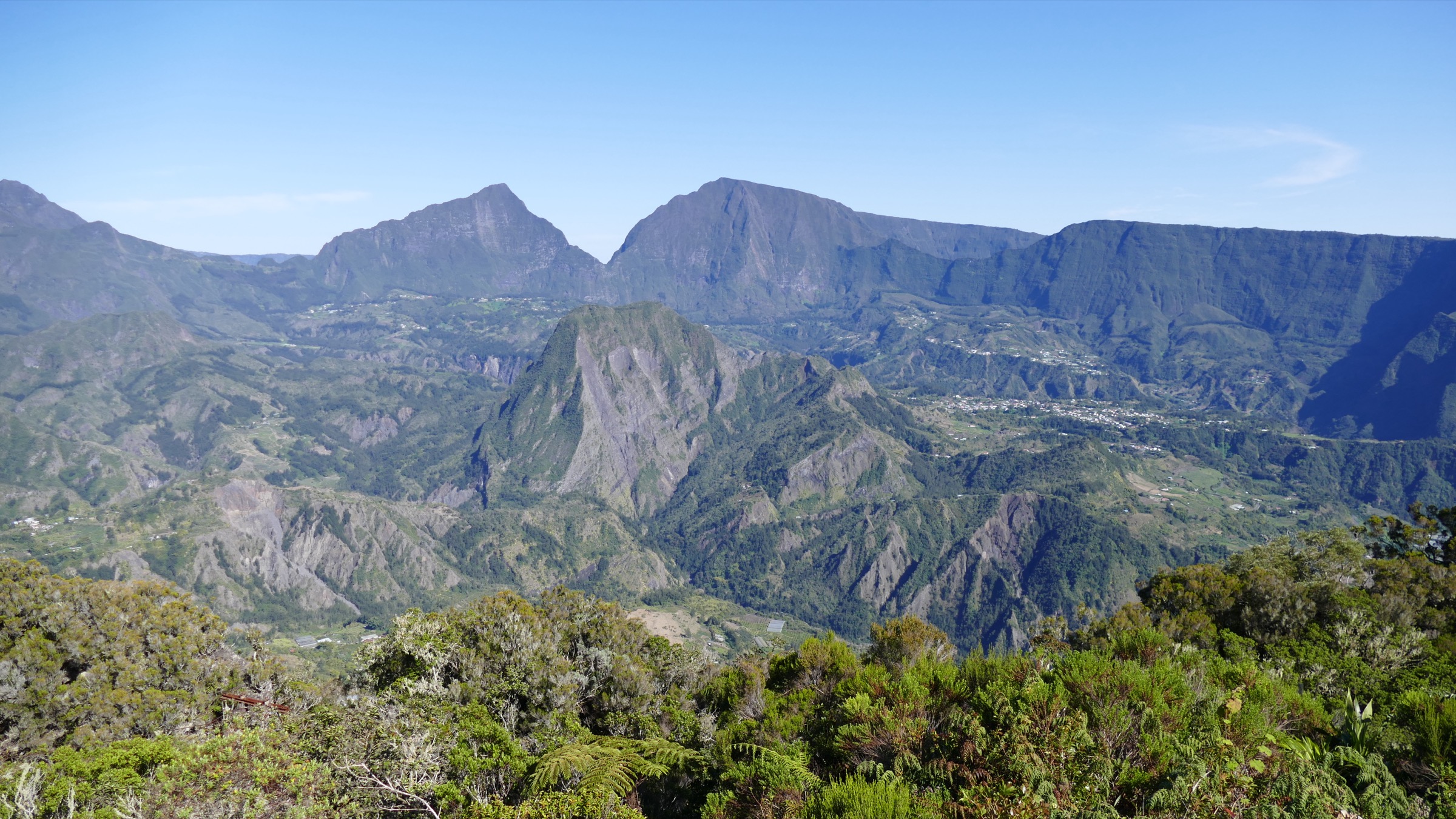
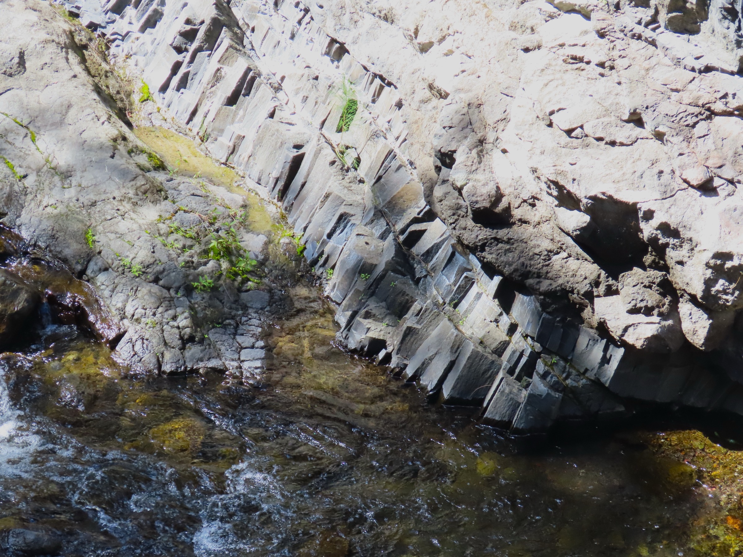
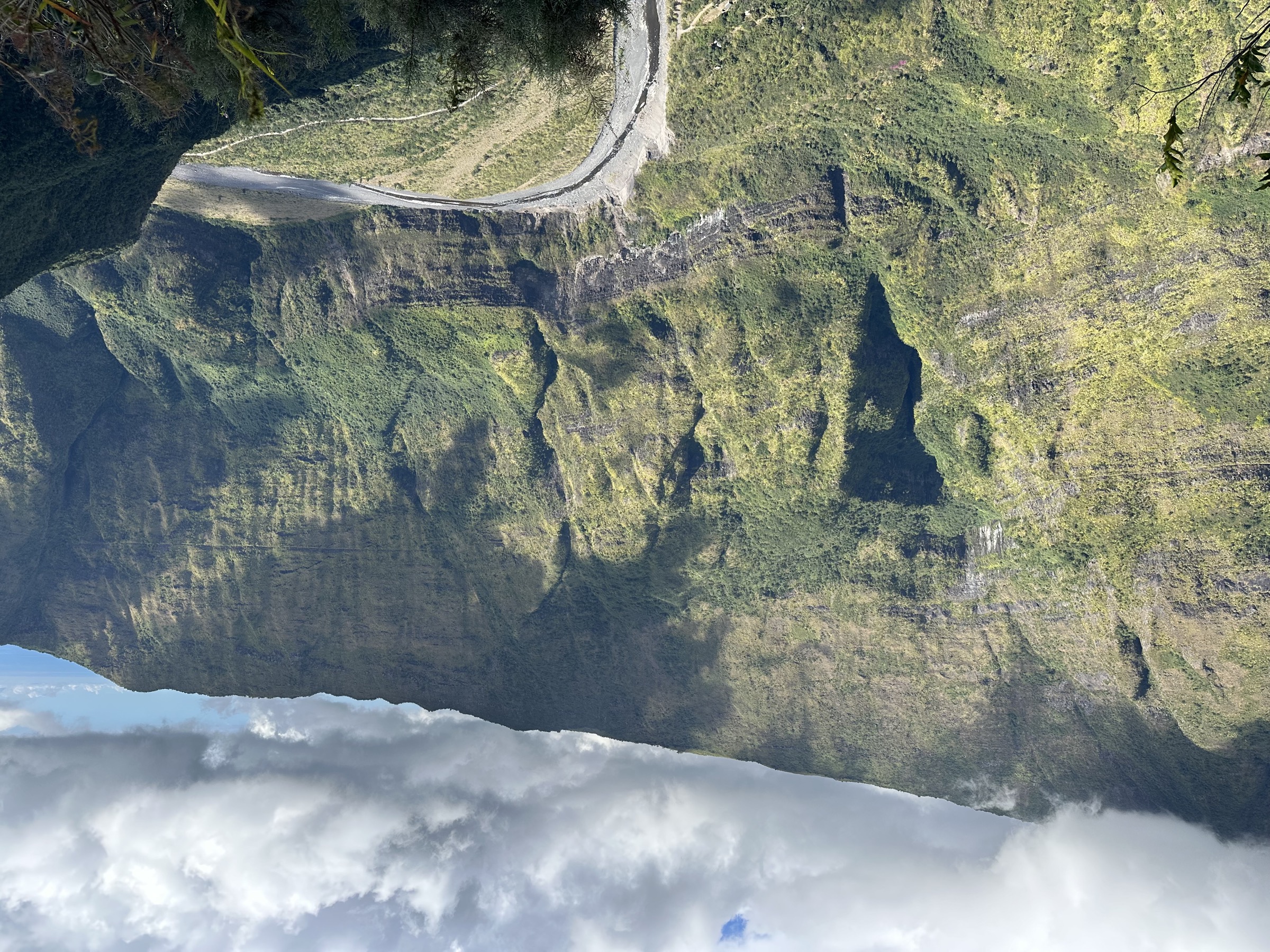
From La Nouvelle the loop strikes south-west across the Plaine aux Sables, a sandy upper basin between the îlet and the rim. It then descends steeply toward the Rivière des Galets and the Trois Roches site, where the river cuts a stepped basalt staircase over three large boulders. The path climbs from the riverbed up the south wall to Marla, the highest inhabited îlet in Réunion at about 1,620 m, sheltered beneath the Grand Bénare and Piton des Neiges ramparts. From Marla the loop returns north through inner Mafate terrain — open tamarind woodland, dyke ridges and traverses above the river — back to La Nouvelle.
Why it is essential
The route links three of Mafate’s most recognisable inner-cirque features in a single day: La Nouvelle (the largest îlet), Marla (the highest), and Trois Roches (the river’s signature waterfall and pothole site). It is the standard inner-cirque day for walkers who have already entered Mafate and are spending one or more nights at La Nouvelle.
Equipment
Mountain hiking equipment: sturdy boots with good grip, weatherproof layer, sun protection, navigation backup, at least 2 L of water, food, and headtorch. Trekking poles are useful on the steep descents to the river and on the climb to Marla.
Hazards and notes
The official record recommends an early start (around 08:00) to benefit from viewpoints before cloud builds. River and ravine conditions can change after rain; the Trois Roches descent is steep and rocky and is best avoided in the wet. Because the start is inside the cirque, the day must be combined with at least one approach and one exit walk.
GPX / route file
| Source | URL | Format | Licence / terms | Reuse status |
|---|---|---|---|---|
| Rando tec-tec / Parc national de La Réunion — Boucle de Marla, Trois Roches et Plaine aux Sables | randotectec.reunion-parcnational.fr | GPX | Official portal; reuse terms unresolved | Not re-hosted |
| Rando tec-tec / Parc national de La Réunion — same route, KML | randotectec.reunion-parcnational.fr | KML | Official portal; reuse terms unresolved | Not re-hosted |
| OpenStreetMap — Marla, Mafate | openstreetmap.org | Source map / location | OSM data is ODbL | Source data only |
Further reading
- Rando tec-tec — Boucle de Marla, Trois Roches et Plaine aux Sables
- Île de la Réunion Tourisme — Mafate
- Wikipedia (FR) — Marla
- Wikipedia (FR) — Trois Roches (La Réunion)
3. Deux Bras à Cayenne par les passerelles
Snapshot
Itinerary
The official loop starts at Deux Bras at the lower entry to the cirque, follows the river corridor of the Rivière des Galets, crosses a series of passerelles (suspension footbridges) installed by the Parc national de La Réunion, and climbs to the Îlet de Cayenne, a small inhabited îlet on a perched bench above the river. The return descends to the river and rejoins the outbound path back to Deux Bras. Compared with the high Col des Bœufs or Maïdo approaches the route stays largely below 600 m and travels through riverbed, gallery forest and exposed traverses.
Why it is essential
This route shows a fundamentally different Mafate from the high-rim approaches: a hot, low river corridor through the gorge of the Rivière des Galets, footbridge engineering installed for îlet access, and the lived-in îlet of Cayenne. It is the standard low-elevation introduction to the cirque and the only major day-hike that stays close to the Rivière des Galets.
Equipment
Standard to mountain hiking equipment: sturdy shoes with good grip, sun hat and high-SPF sun protection, rain layer, food, map / GPS and substantial water — at least 2.5 L in hot weather. Trekking poles are useful on the passerelle approaches and ravine descents.
Hazards and notes
The official record warns of ravine crossings and wet-season Rivière des Galets floods, especially November to March. Crues can damage vehicle crossings and fords; when 4x4 access to Deux Bras is impossible, the alternative entry from Dos d’Âne adds about 3 h 30 and more than 650 m of additional ascent and descent. Check river and access status with the ONF or Parc national de La Réunion before departure.
GPX / route file
| Source | URL | Format | Licence / terms | Reuse status |
|---|---|---|---|---|
| Rando tec-tec / Parc national de La Réunion — Deux Bras à Cayenne par les passerelles | randotectec.reunion-parcnational.fr | GPX | Official portal; reuse terms unresolved | Not re-hosted |
| Rando tec-tec / Parc national de La Réunion — same route, KML | randotectec.reunion-parcnational.fr | KML | Official portal; reuse terms unresolved | Not re-hosted |
| OpenStreetMap — Îlet de Cayenne, Mafate | openstreetmap.org | Source map / location | OSM data is ODbL | Source data only |
Further reading
- Rando tec-tec — Deux Bras à Cayenne par les passerelles
- Île de la Réunion Tourisme — Mafate
- Wikipedia (FR) — Rivière des Galets
- Parc national de La Réunion
4. Cap Noir, chemin entre deux mondes
Snapshot
Itinerary
From the Cap Noir road-end parking above Dos d’Âne, a short signed path drops onto the rim and links the two principal lookouts of Cap Noir and the Roche Verre Bouteille. Fixed handrails and a few short ladder steps protect the most exposed traverses. The path then loops back inland through forest to the car park. The total distance is short, but the route gains roughly 250 m on a steep but well-protected line.
Why it is essential
Cap Noir is the compact viewpoint classic of Mafate: a 3 km loop that delivers the cirque’s signature dramatic look into the roadless basin from the western rim, without requiring a full-day descent. It is the standard half-day option for visitors who want to see Mafate before committing to a longer walk or a multi-day traverse.
Equipment
Standard hiking equipment: grippy shoes, rain layer, sun protection, water, and a small daypack. Keep hands free for ladder and handrail sections. Trekking poles are best stowed on the exposed steps.
Hazards and notes
Although short, the route has exposure, fixed handrails and ladders. The official record advises avoiding it in heavy rain, high wind or poor visibility, and recommends an early start because heat and cloud build through the morning.
GPX / route file
| Source | URL | Format | Licence / terms | Reuse status |
|---|---|---|---|---|
| Rando tec-tec / Parc national de La Réunion — Cap Noir, chemin entre deux mondes | randotectec.reunion-parcnational.fr | GPX | Official portal; reuse terms unresolved | Not re-hosted |
| Rando tec-tec / Parc national de La Réunion — same route, KML | randotectec.reunion-parcnational.fr | KML | Official portal; reuse terms unresolved | Not re-hosted |
| OpenStreetMap — Cap Noir, Dos d’Âne | openstreetmap.org | Source map / location | OSM data is ODbL | Source data only |
Further reading
- Rando tec-tec — Cap Noir, chemin entre deux mondes
- Île de la Réunion Tourisme — Cap Noir et Roche Verre Bouteille
- Wikipedia (FR) — Dos d’Âne
- Parc national de La Réunion
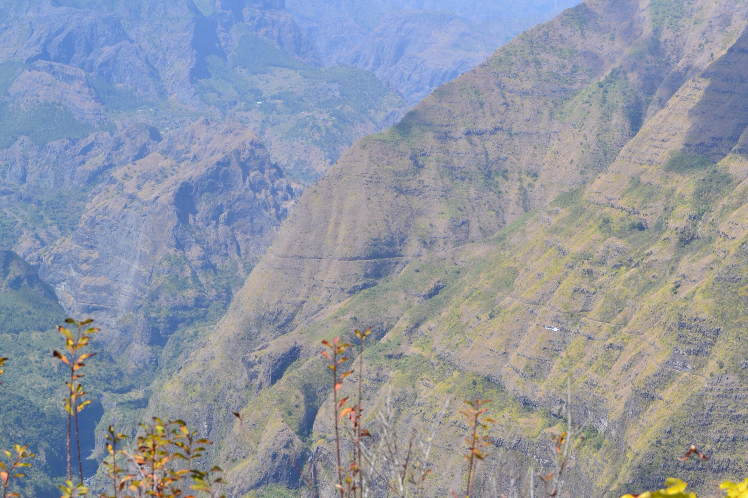
5. Canalisation des Orangers de Sans Souci à l’Îlet des Orangers
Snapshot
Itinerary
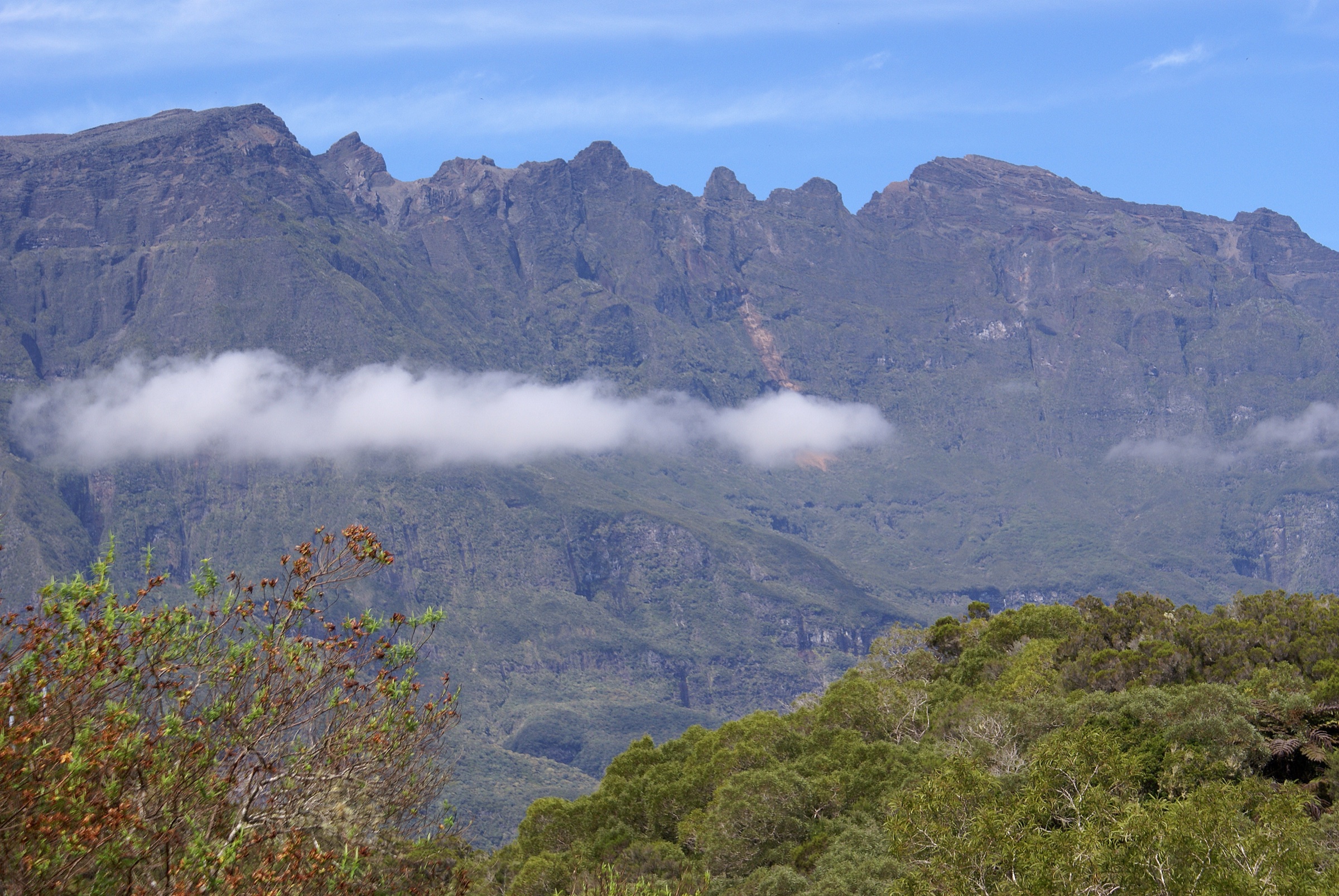
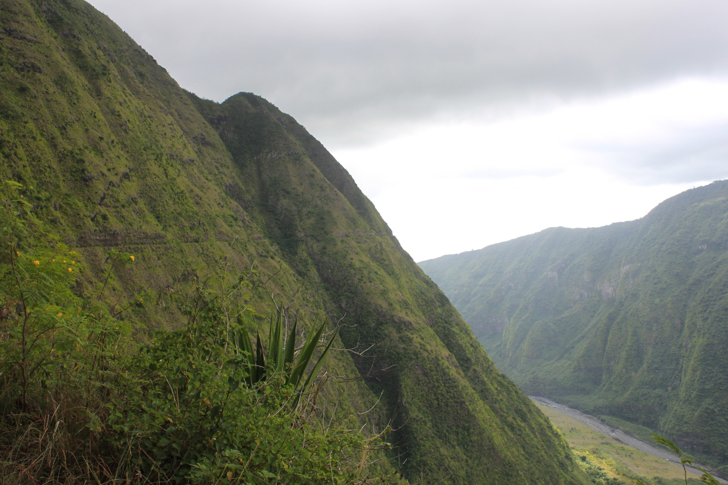
From the red water cistern at Sans Souci, the path drops onto the historic Canalisation des Orangers, a colonial-era water channel cut across the western flank of Mafate. The route follows the canalisation as a ledge path across the rampart, with long open traverses above the Rivière des Galets and intermittent views into the inner cirque. After roughly 13 km the path reaches the area of the Îlet des Orangers, a small inhabited îlet on a perched bench. Return is by the same canalisation path back to Sans Souci.
Why it is essential
The Canalisation des Orangers is one of Mafate’s most famous access routes and the defining western balcony of the cirque: long, exposed to sun, historically and visually distinctive, and very representative of the way paths were engineered across the Réunion remparts. It is retained as an essential but strenuous exception to the catalogue’s normal day-hike envelope.
Equipment
Mountain hiking equipment for a long day: sturdy shoes or boots, sun hat, sunglasses, high-SPF sun protection, rain layer, headtorch, food, map / GPS and substantial water — the official note records a source after the dam, but extra carry is normal. Trekking poles are useful on the long return.
Hazards and notes
This route exceeds the normal 25 km catalogue target and is retained as an essential but strenuous exception. The official record warns that the path is little shaded, daylight fades quickly late in the day, the canalisation is very slippery when wet, and wet-season rockfall and cascades can affect the path. Vehicle vandalism at the Sans Souci parking is also noted by the official source; do not leave valuables in cars.
GPX / route file
| Source | URL | Format | Licence / terms | Reuse status |
|---|---|---|---|---|
| Rando tec-tec / Parc national de La Réunion — Canalisation des Orangers de Sans Souci à l’Îlet des Orangers | randotectec.reunion-parcnational.fr | GPX | Official portal; reuse terms unresolved | Not re-hosted |
| Rando tec-tec / Parc national de La Réunion — same route, KML | randotectec.reunion-parcnational.fr | KML | Official portal; reuse terms unresolved | Not re-hosted |
| OpenStreetMap — Îlet des Orangers, Mafate | openstreetmap.org | Source map / location | OSM data is ODbL | Source data only |
Further reading
- Rando tec-tec — Canalisation des Orangers de Sans Souci à l’Îlet des Orangers
- Île de la Réunion Tourisme — Canalisation des Orangers
- Wikipedia (FR) — Îlet des Orangers
- Parc national de La Réunion
Missing data / follow-up work
- Official GPX / KML files are listed for all five routes via Rando tec-tec, but explicit route-file reuse terms were not located in this pass and no third-party tracks have been re-hosted.
- Licence-compatible photos specifically matching every named route were not found; the Trois Roches loop image shows the Marla / Grand Bénare dyke landscape rather than the Trois Roches site itself, and the Canalisation des Orangers image is a representative Mafate canalisation view.
- The Canalisation des Orangers route exceeds the normal day-hike distance target and should be treated as a strenuous exception suited only to fit, experienced walkers with a very early start.
- 4x4 access to Deux Bras, Col des Bœufs road access, bus schedules, and ONF / open-trail status need local confirmation before use; the Rivière des Galets corridor can be closed at short notice after rain.
- Wet-season river conditions and cyclone damage can change access rapidly between November and April; the official Réunion vigilance status should be checked for any wet-season visit.
Further reading
| Resource | Link |
|---|---|
| Parc national de La Réunion | reunion-parcnational.fr |
| Rando tec-tec — official hiking portal | randotectec.reunion-parcnational.fr |
| Île de la Réunion Tourisme (IRT) | reunion.fr |
| ONF — Loisirs en forêt, La Réunion | onf.fr |
| Mon GR — GR R2 La Grande Traversée | mongr.fr |
| Fédération Française de la Randonnée — GR R1 tour du Piton des Neiges | ffrandonnee.fr |
| Kar’ouest — réseau de bus de l’Ouest de La Réunion | karouest.re |
| UNESCO World Heritage — Pitons, cirques and remparts of Réunion Island | whc.unesco.org |
| Wikipedia (FR) — Cirque de Mafate | fr.wikipedia.org |
| Wikipedia (FR) — La Nouvelle | fr.wikipedia.org |
| Wikipedia (FR) — Marla | fr.wikipedia.org |
| Wikipedia (FR) — Rivière des Galets | fr.wikipedia.org |
| Wikipedia (FR) — Dos d’Âne | fr.wikipedia.org |
| Wikipedia (FR) — Îlet des Orangers | fr.wikipedia.org |