.jpg)


Regional overview
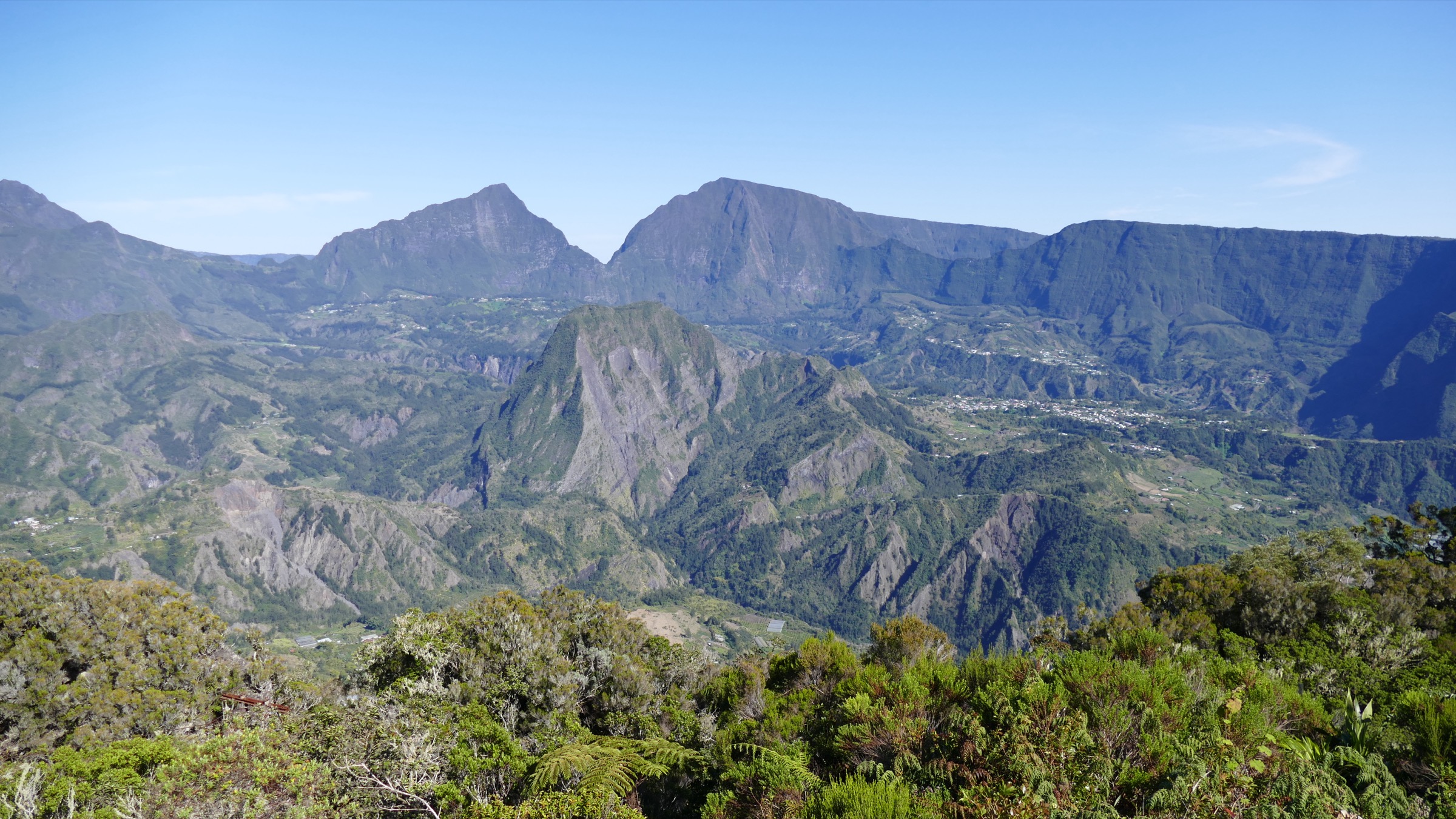
Piton de la Fournaise is the active basaltic shield volcano that forms the southeastern third of Réunion, an Indian Ocean island roughly 700 km east of Madagascar and an overseas department of France. The summit shield rises to 2,632 m at the rim of the Cratère Dolomieu, fed by the same hotspot that built the much older Piton des Neiges to the northwest. Wikipedia and the Smithsonian Global Volcanism Program rank Fournaise among the most active volcanoes in the world, with eruptions on average every nine to twelve months; the most recent began on 18 January 2026 and a further phase started on 13 February 2026. The hiking interest is concentrated inside and around the Enclos Fouqué, the youngest of three nested east-facing calderas that wrap the central shield and contain almost all recent lava flows.
The day-walks divide neatly into three landscapes. First, the road from Bourg-Murat climbs across the high pastures of the Plaine des Cafres and the lava-and-scoria desert of the Plaine des Sables to the trailhead at Pas de Bellecombe-Jacob at 2,311 m. Second, the trails that drop into the Enclos Fouqué from Pas de Bellecombe-Jacob reach the parasitic cone of Formica Léo and the foot of the central shield, with longer routes climbing to the rim of the Cratère Dolomieu. Third, a series of short belvedere walks along the route forestière du Volcan look down into the Rivière des Remparts and the Cratère Commerson without entering the active enclosure.
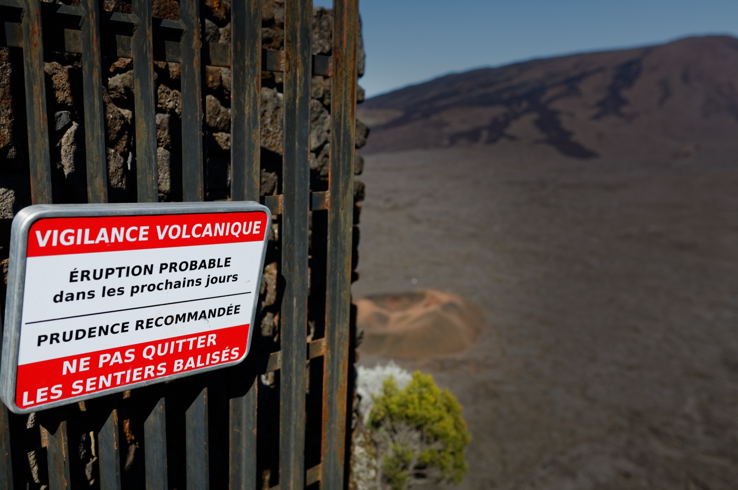
Access is governed entirely by the volcanic alert system. The Préfecture de La Réunion publishes ORSEC Volcan bulletins on four levels — vigilance (background), alerte 1 (eruption probable or imminent), alerte 2 (eruption inside the Enclos) and alerte 2-2 (eruption threatening road or populated areas). At alerte 1 or above, the Enclos Fouqué and the staircase from Pas de Bellecombe-Jacob are closed; at alerte 2-2 the route nationale 2 (RN2) and the route forestière du Volcan can also close. The Observatoire Volcanologique du Piton de la Fournaise (OVPF/IPGP) operates the seismic and deformation network that informs these decisions. Every hike below has its access conditional on these bulletins, and trail status must be checked the morning of departure on the Préfecture and OVPF sites.
Beyond the alert framework, the volcanic plateau is hard country: bare lava and scoria, no shade, no surface water, no fixed shelters once below Pas de Bellecombe, and weather that closes in extremely quickly. Cloud typically rolls up from the eastern Grand Brûlé in the late morning, so the standard guidance from the Parc national de La Réunion and Île de la Réunion Tourisme (IRT) is to start at first light, drink steadily and turn back well before midday cloud arrives. Austral winter, May to October, is the practical season; the surface is cold at night, often well below 5 °C at the trailhead, and frosts are recorded in July and August.
Selection rationale
The five entries cover the defining landscapes of the volcanic area in proportion to how visitors actually use it. The Formica Léo loop is the signature short walk on to the floor of the Enclos Fouqué, and is the only entry on this list reachable in under two hours of walking from the car park; the Cratère Dolomieu rim from the same trailhead is the long summit-grade day. The Plaine des Sables traverse from Pas des Sables to the foot of the Bellecombe stairs is the iconic lunar-landscape walk between the two halves of the volcanic plateau. The Piton de Bert overlook is the rampart walk that gives the wide view back over the central shield without descending into the Enclos. Nez de Bœuf is the short accessible belvedere that anchors the route forestière du Volcan and works well for half-day visits or acclimatisation before the longer routes.
Summary table
| # | Hike | Country | Route type | Distance | Gain | Max elevation | Difficulty |
|---|---|---|---|---|---|---|---|
| 1 | Formica Léo loop from Pas de Bellecombe-Jacob | France (Réunion) | Out-and-back / short loop into the Enclos | ~5-6 km | ~150-200 m | ~2,311 m (rim) | Easy-moderate |
| 2 | Cratère Dolomieu rim from Pas de Bellecombe-Jacob | France (Réunion) | Out-and-back across the Enclos to the summit shield | 12-13 km | ~520-550 m | ~2,632 m | Hard |
| 3 | Plaine des Sables traverse | France (Réunion) | Point-to-point lava-plateau walk along the RF2 / GR R2 | ~5-7 km (variant dependent) | Modest (~150 m) | ~2,360 m (Pas des Sables) | Easy-moderate |
| 4 | Piton de Bert overlook from Foc-Foc | France (Réunion) | Out-and-back along the rampart | ~13-14 km | ~200-620 m (source range) | 2,274 m | Moderate |
| 5 | Nez de Bœuf belvedere | France (Réunion) | Short out-and-back to the viewpoint | <1 km (belvedere); ~2 km with summit | Minor (~50-75 m) | 2,136 m | Easy |
1. Formica Léo loop from Pas de Bellecombe-Jacob
Snapshot
Itinerary
From the car park at Pas de Bellecombe-Jacob at 2,311 m, the route follows the cliff edge of the Rempart de Bellecombe for the first 300 m, then turns down the engineered metal-and-stone staircase to the gate at the bottom of the rempart, where the official entry into the Enclos Fouqué begins. The descent loses roughly 150 m. From the gate, a cairned path crosses recent pāhoehoe and ʻaʻā lava onto the broad caldera floor and reaches Formica Léo, a perfect 50 m parasitic cone discovered in 1753 and named after the antlion pit it resembles. A short loop circles the cone before the path retraces back to the foot of the staircase. The return climb is the only sustained effort of the walk.
Why it is essential
Formica Léo is the iconic short objective of the Enclos Fouqué — the only way to stand on the active floor of one of the world’s most photographed shield volcanoes inside half a day from the road. The walk also samples every key feature of the area in miniature: the panoramic Bellecombe rim, the Rempart de Bellecombe staircase, the Plaine des Sables vista on the drive in, and a parasitic cone on recent lava.
Equipment
Standard hiking equipment with mountain additions: sturdy boots with good grip on lava, weatherproof shell, warm layer for the rim at dawn, full sun protection (no shade anywhere), 1.5-2 L of water per person, snacks, headtorch for an early start, and trekking poles for the staircase return. A high-visibility layer is useful in mist.
Hazards and notes
The Enclos Fouqué is closed to walkers as soon as the Préfecture de La Réunion raises the ORSEC Volcan alert to alerte 1 (eruption probable or imminent), alerte 2 (eruption inside the Enclos) or alerte 2-2 (eruption threatening infrastructure); the OVPF/IPGP bulletins are the official source and trail status must be checked the morning of departure. Lava surfaces give no shade and reflect heat; sun exposure is extreme. Weather changes very rapidly and cloud typically rises over the caldera by late morning, so an early start (gate of the Rempart staircase from first light) is the standard guidance. The metal staircase is exposed to wind and can be slippery when wet. Off-trail walking on lava is prohibited inside the Parc national.
GPX / route file
| Source | URL | Format | Licence / terms | Reuse status |
|---|---|---|---|---|
| Randopitons — Piton de la Fournaise depuis Pas de Bellecombe (2018) | randopitons.re | Page with GPX download for the longer circuit | Randopitons terms; account required for GPX | Not re-hosted |
| OpenStreetMap — Pas de Bellecombe-Jacob | openstreetmap.org | Source map | ODbL | Source data |
External links
- Wikipedia — Piton de la Fournaise
- Wikipedia — Pas de Bellecombe-Jacob
- Wikipedia — Formica Leo
- Parc national de La Réunion
- Île de la Réunion Tourisme — Piton de la Fournaise (Pas de Bellecombe-Dolomieu)
- Préfecture de La Réunion — ORSEC Volcan bulletins
- Observatoire Volcanologique du Piton de la Fournaise (OVPF/IPGP)
2. Cratère Dolomieu rim from Pas de Bellecombe-Jacob
Snapshot
Itinerary
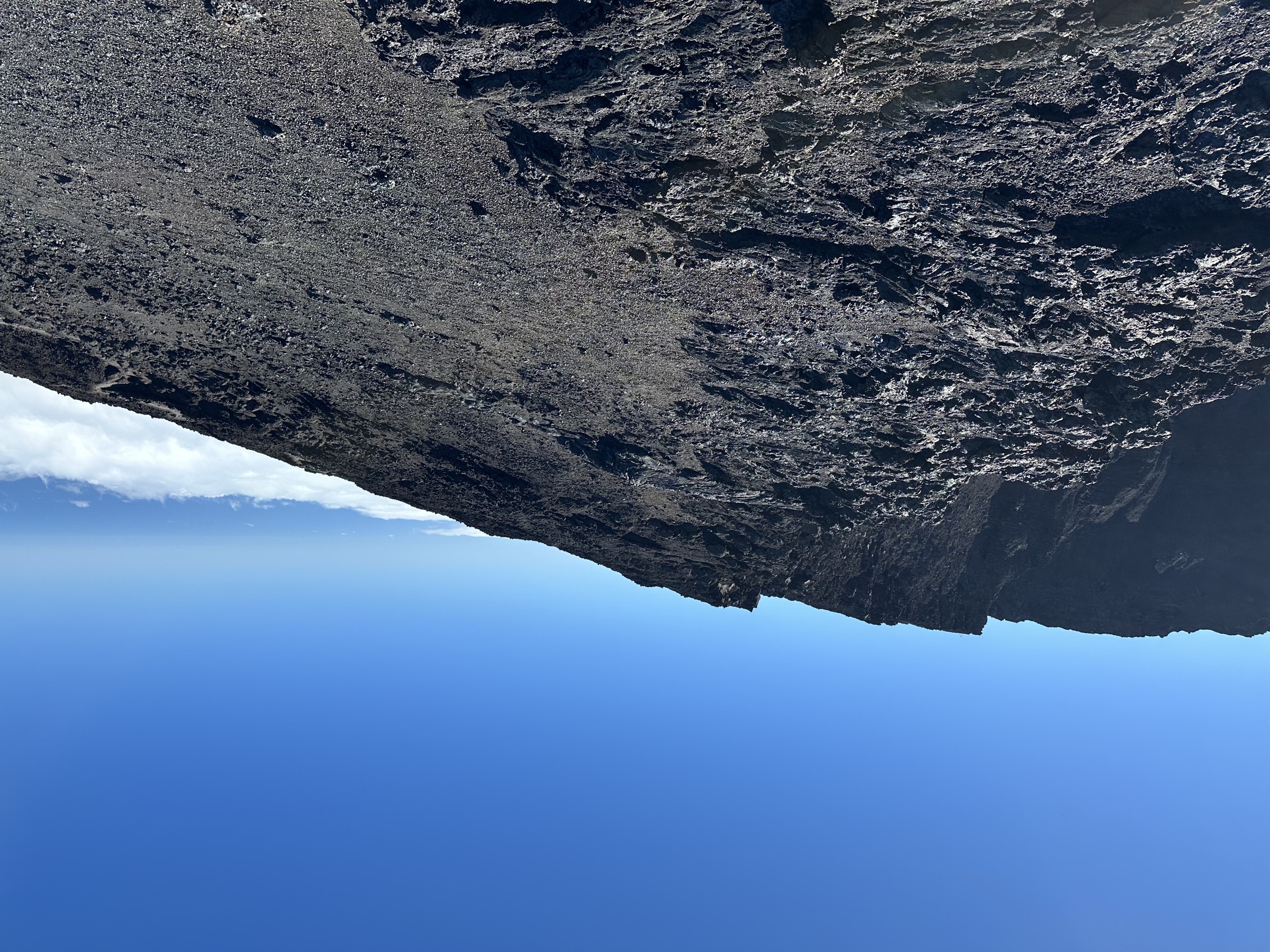
The first part of the day follows the Formica Léo route — out from the parking, along the rim, down the metal staircase and across the caldera floor past Formica Léo. From the cone, the cairned trail bears east-southeast across the Enclos floor toward the central shield. The historical Chapelle de Rosemont waypoint at about 2,250 m has been buried by 2018-era lava and is no longer the standard marker. The trail then climbs the western flank of the shield in gentle switchbacks across cinder and ropy lava to reach the rim of the Cratère Dolomieu at approximately 2,632 m. Descent retraces the route; the climb back up the Bellecombe staircase at the end of the day is the sting in the tail.
Why it is essential
The Dolomieu rim is the only walkable high point of the active volcano and the closest legal approach to its principal vent. The crater itself collapsed dramatically in April 2007, dropping about 330 m and creating the steep-walled pit visible today; the rim is the standard objective for fit walkers wanting the full Fournaise experience in a day. The route also crosses the most recent lava generations on the Enclos floor and gives the clearest view of the contrast between the active shield, the Rempart de Bellecombe and the older terrain beyond.
Equipment
Mountain hiking equipment: sturdy boots, trekking poles, warm layer and weatherproof shell (the rim is exposed even in calm weather), full sun protection, 2-3 L of water per person (no surface water anywhere), high-energy food, headtorch in case of late return, and a paper map or GPS backup. Lava can shred soft footwear; ankle support is recommended.
Hazards and notes
The Enclos is closed at alerte 1, 2 or 2-2 of the ORSEC Volcan plan; check Préfecture de La Réunion and OVPF/IPGP bulletins on the morning of departure. The Cratère Dolomieu rim is unstable in places and was the subject of a 2024 IPGP study of unstable zones; signed barriers must be respected. No shade and no water once below the Rempart. Cloud and wind can erase the cairned trail very quickly. An early start is essential — the standard guidance is to leave the car park no later than first light to be off the shield by midday.
GPX / route file
| Source | URL | Format | Licence / terms | Reuse status |
|---|---|---|---|---|
| Randopitons — Tour du Cratère Dolomieu depuis le Pas de Bellecombe | randopitons.re | Page with downloadable GPX | Randopitons terms; account required for GPX | Not re-hosted |
| Trace de Trail — Pas de Bellecombe – Chapelle Rosemont – Piton de la Fournaise | tracedetrail.fr | User-uploaded GPS track | Trace de Trail terms apply | Not re-hosted |
| Visugpx — Le Piton de la Fournaise par le Pas de Bellecombe | visugpx.com | Viewer / downloadable GPX | Visugpx terms apply | Not re-hosted |
External links
- Wikipedia — Piton de la Fournaise
- Île de la Réunion Tourisme — Piton de la Fournaise (Pas de Bellecombe-Dolomieu)
- IPGP — Study of unstable zones around the Dolomieu crater
- Préfecture de La Réunion — alerte 1 closure of the Enclos
- OVPF/IPGP — Observatoire Volcanologique du Piton de la Fournaise
3. Plaine des Sables traverse
Snapshot
Itinerary
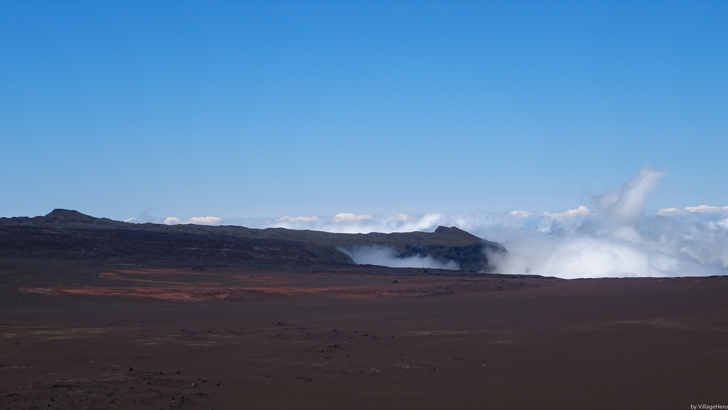
From the Pas des Sables car park at about 2,360 m, a marked path drops over the small step of basaltic scoria and onto the floor of the Plaine des Sables, the wide brown lava-and-cinder plain that occupies the older Plaine des Sables caldera. The walking line follows the GR R2 corridor along the western edge of the gravel road, crossing the central section past the Piton Chisny cinder cone and Piton Rouge before re-ascending to the parking area at the foot of the Bellecombe staircase. The full traverse is around 5-7 km depending on where the line is taken; a popular round-trip variant published by Randopitons stays on the plain itself rather than reaching Pas de Bellecombe.
Why it is essential
The Plaine des Sables is one of the most photographed landscapes in Réunion and the visual gateway to the active volcano. The walk gives the only practical way to stand inside the lunar plain rather than view it from the road, and links the high pastures of the Plaine des Cafres to the Enclos Fouqué as the GR R2 has done since long before the road was built. It pairs well with the Formica Léo loop as the second half of a single day.
Equipment
Standard hiking equipment with mountain additions: sturdy boots, weatherproof shell, warm layer, sun hat and sunscreen (no shade anywhere), 1.5-2 L of water per person, paper map or GPS backup for mist, and a high-visibility layer. Walking poles help on the loose cinder.
Hazards and notes
Although the Plaine des Sables sits outside the Enclos Fouqué, the route forestière du Volcan and its parking can be closed during ORSEC Volcan alerte 2-2 — when an eruption threatens road infrastructure — and at any time when fire or weather risk is raised; the Préfecture de La Réunion and OVPF/IPGP publish the live status. The plain has no shade and no water; sun exposure is extreme. Cloud rolls across the plain very rapidly and cairns are sparse off the GR R2 corridor; navigation becomes serious in mist. Surface temperatures are cold at dawn and frosts have been recorded in austral winter.
GPX / route file
| Source | URL | Format | Licence / terms | Reuse status |
|---|---|---|---|---|
| Randopitons — Tour de la Plaine des Sables au plus plat | randopitons.re | Page with downloadable GPX (round-trip variant) | Randopitons terms; account required for GPX | Not re-hosted |
| Outdooractive — La Plaine des Sables | outdooractive.com | Route page | Outdooractive terms apply | Not re-hosted |
| Waymarked Trails — GR R2 | waymarkedtrails.org | OSM relation viewer for the GR R2 | OSM data, ODbL | Source data |
External links
- Wikipedia — Plaine des Sables
- Île de la Réunion Tourisme — GR R2 (Grande Traversée de l’Île de la Réunion)
- Parc national de La Réunion
4. Piton de Bert overlook from Foc-Foc
Snapshot
Itinerary
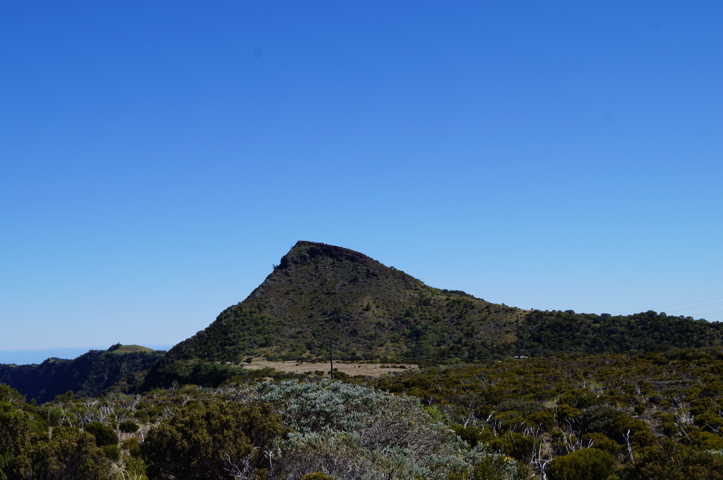
From the Foc-Foc parking on the route forestière du Volcan, just before the Bellecombe car park, the GR R2 leads south along the western rampart of the Enclos Fouqué. The trail is marked in red and white and contours along the rim of the rampart for roughly 6 km on a gentle to moderate gradient, with the Enclos opening up to the east and the Plaine des Sables to the west. The final 200 m climbs onto the summit cone of Piton de Bert, sometimes also called Piton Bois Vert, at 2,274 m. The summit gives a 180-degree view down into the Enclos toward the Cratère Dolomieu shield and across the Puys Ramond to the south. Descent retraces the rampart. Some parties continue south to the Piton de Partage and then to Basse Vallée as part of the GR R2 traverse.
Why it is essential
Piton de Bert is the standard rampart-walk objective on Réunion Fournaise and the easiest way to look down at the full Enclos Fouqué from outside it. Because the route sits on the western rim of the Enclos rather than inside it, it remains a planning option even when the Enclos itself is closed for volcanic alerts — provided the route forestière du Volcan and its parking are still open. The summit is also the standard sunrise / sunset viewing point during eruption phases when the active vents are visible from outside the closure zone.
Equipment
Mountain hiking equipment: sturdy boots, trekking poles, warm layer and weatherproof shell, hat and gloves outside midsummer, full sun protection, 2 L of water per person (no surface water anywhere), high-energy food and a headtorch for a long day or sunrise/sunset variants.
Hazards and notes
Although the summit lies on the rampart of the Enclos rather than inside it, access from the route forestière du Volcan still depends on the ORSEC Volcan alert level — the Préfecture de La Réunion can close the road and the Foc-Foc parking at alerte 2-2 and during weather or fire alerts; OVPF/IPGP bulletins are the official source. Sun exposure is extreme on the rampart with no shade. Sudden cloud and wind are routine; the final summit cone is exposed. No water anywhere on the route.
GPX / route file
| Source | URL | Format | Licence / terms | Reuse status |
|---|---|---|---|---|
| Randopitons — De la Plaine des Sables au Piton de Bert | randopitons.re | Page with downloadable GPX | Randopitons terms; account required for GPX | Not re-hosted |
| Visorando — Le Piton de Bois Vert ou Piton de Bert | visorando.com | Route page with GPX (members) | Visorando terms apply | Not re-hosted |
| AllTrails — Piton de Bert Volcano | alltrails.com | User-uploaded tracks | AllTrails terms apply | Not re-hosted |
External links
- Île de la Réunion Tourisme — Foc-Foc à Piton de Bert
- Wikipedia (French) — Piton de Bert
- Parc national de La Réunion
- Préfecture de La Réunion — ORSEC Volcan bulletins
5. Nez de Bœuf belvedere
Snapshot
Itinerary
From the picnic area on the route forestière du Volcan, a short surfaced trail leads roughly 700 m to a fenced belvedere at the edge of the Rivière des Remparts, the deeply incised valley that drains the southwestern flank of Piton de la Fournaise to Saint-Joseph. The belvedere looks directly down about 1,000 m into the gorge and across to the Piton des Neiges massif on a clear day. A second, slightly rougher path continues around the rim to the small summit of Nez de Bœuf at 2,136 m, with views back over the Plaine des Sables and the central shield of Fournaise. Several picnic kiosks and tent-pitching areas are sited near the trailhead.
Why it is essential
Nez de Bœuf is the standard introduction belvedere to the volcanic area for visitors driving up the route du Volcan, and the only short, accessible walk in the Piton de la Fournaise sector that gives a true wide-canyon view (the Rivière des Remparts is often described as one of the deepest canyons in France). It is also a useful acclimatisation walk for the longer routes higher up, sitting at just over 2,100 m.
Equipment
Standard hiking equipment, scaled to a short walk: comfortable shoes (the belvedere path is surfaced), light wind layer, sun protection, water and snacks. Children’s pushchairs and wheelchairs can use the belvedere path; the summit detour requires footwear with grip on cinder.
Hazards and notes
Although the Nez de Bœuf belvedere itself sits outside the Enclos Fouqué, access along the route forestière du Volcan can be closed when ORSEC Volcan alerte 2-2 is in force (eruption threatening road or populated areas) and during weather and fire alerts; Préfecture de La Réunion and OVPF/IPGP bulletins should be checked the morning of departure. The belvedere is fenced but the cliff drop is immediate and large; small children must be supervised closely. Sun exposure is high at 2,100 m and there is no shade.
GPX / route file
| Source | URL | Format | Licence / terms | Reuse status |
|---|---|---|---|---|
| Randopitons — La source du Nez de Bœuf depuis le parking du Nez de Bœuf | randopitons.re | Page with downloadable GPX (longer variant) | Randopitons terms; account required for GPX | Not re-hosted |
| Visorando — Le Nez de Bœuf | visorando.com | Route page with GPX (members) | Visorando terms apply | Not re-hosted |
| AllTrails — Belvédère du Nez de Boeuf | alltrails.com | User-uploaded tracks | AllTrails terms apply | Not re-hosted |
External links
- Île de la Réunion Tourisme — Nez de Bœuf
- Wikipedia (French) — Nez de Bœuf (massif du Piton de la Fournaise)
- Wikipedia — Rivière des Remparts
- Parc national de La Réunion
Missing data / follow-up work
- No single official Parc national de La Réunion signed-distance table was located for the Pas de Bellecombe to Dolomieu rim hike; distance and elevation gain are cross-checked between Randopitons, tracedetrail, Île de la Réunion Tourisme and Visugpx and converge on roughly 12-13 km and 520-550 m of ascent.
- Piton de Bert round-trip elevation gain figures vary widely across sources (about 200 m on AllTrails, 618 m on Hika); a Parc national or IRT signed-distance figure would resolve this.
- The historical Chapelle de Rosemont waypoint at 2,250 m was buried or destroyed by the 2018 lava flows and is no longer a routing reference; the trail line has been updated by Randopitons but the IRT page still occasionally mentions it.
- The Cratère Commerson belvedere (5 minutes from the road) is widely listed as an essential short stop on the route forestière du Volcan; it is not included as one of the five hikes here because the walk is below 500 m and falls outside the day-hike threshold, but it pairs well with the Plaine des Sables and Nez de Bœuf entries on a single day.
- No GPX file has been re-hosted; all route files remain on Randopitons, Visorando, Visugpx, AllTrails and Wikiloc under their own terms.
- The 2026 eruption sequence (January and February 2026) is ongoing as of publication; current trail status must be checked on the Préfecture de La Réunion and OVPF/IPGP sites the morning of any planned departure.
External links
| Resource | Link |
|---|---|
| Parc national de La Réunion | reunion-parcnational.fr |
| Île de la Réunion Tourisme (IRT) | reunion.fr |
| Observatoire Volcanologique du Piton de la Fournaise (OVPF/IPGP) | ipgp.fr |
| Préfecture de La Réunion — ORSEC Volcan bulletins | reunion.gouv.fr |
| Randopitons | randopitons.re |
| Visorando — Réunion | visorando.com |
| AllTrails — Réunion | alltrails.com |
| Wikipedia — Piton de la Fournaise | en.wikipedia.org |
| Wikipedia — Pas de Bellecombe-Jacob | en.wikipedia.org |
| Wikipedia — Formica Leo | en.wikipedia.org |
| Wikipedia — Plaine des Sables | en.wikipedia.org |
| Wikipedia — Rivière des Remparts | en.wikipedia.org |
| Smithsonian Global Volcanism Program — Piton de la Fournaise | volcano.si.edu |
| Mon GR — GR R2 Grande Traversée | mongr.fr |
| Waymarked Trails — Réunion hiking | waymarkedtrails.org |