.jpg)


Regional overview
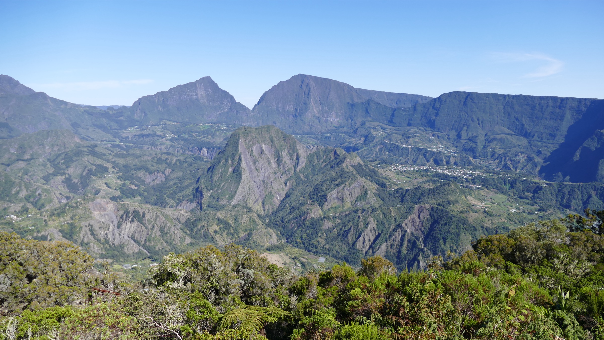
The Cirque de Salazie is the northern and wettest of the three great cirques carved into the eroded flanks of the Piton des Neiges shield volcano, alongside Cilaos to the south and Mafate to the west. The cirque covers roughly 100 km² of collapsed, deeply incised terrain bounded by 1,500-2,200 m ramparts and drained by the Rivière du Mât, which exits the cirque through a narrow gorge guarded by the Voile de la Mariée waterfall. The whole massif sits inside Parc national de La Réunion, inscribed on the UNESCO World Heritage list in 2010 as the Pitons, cirques and remparts of Réunion Island.
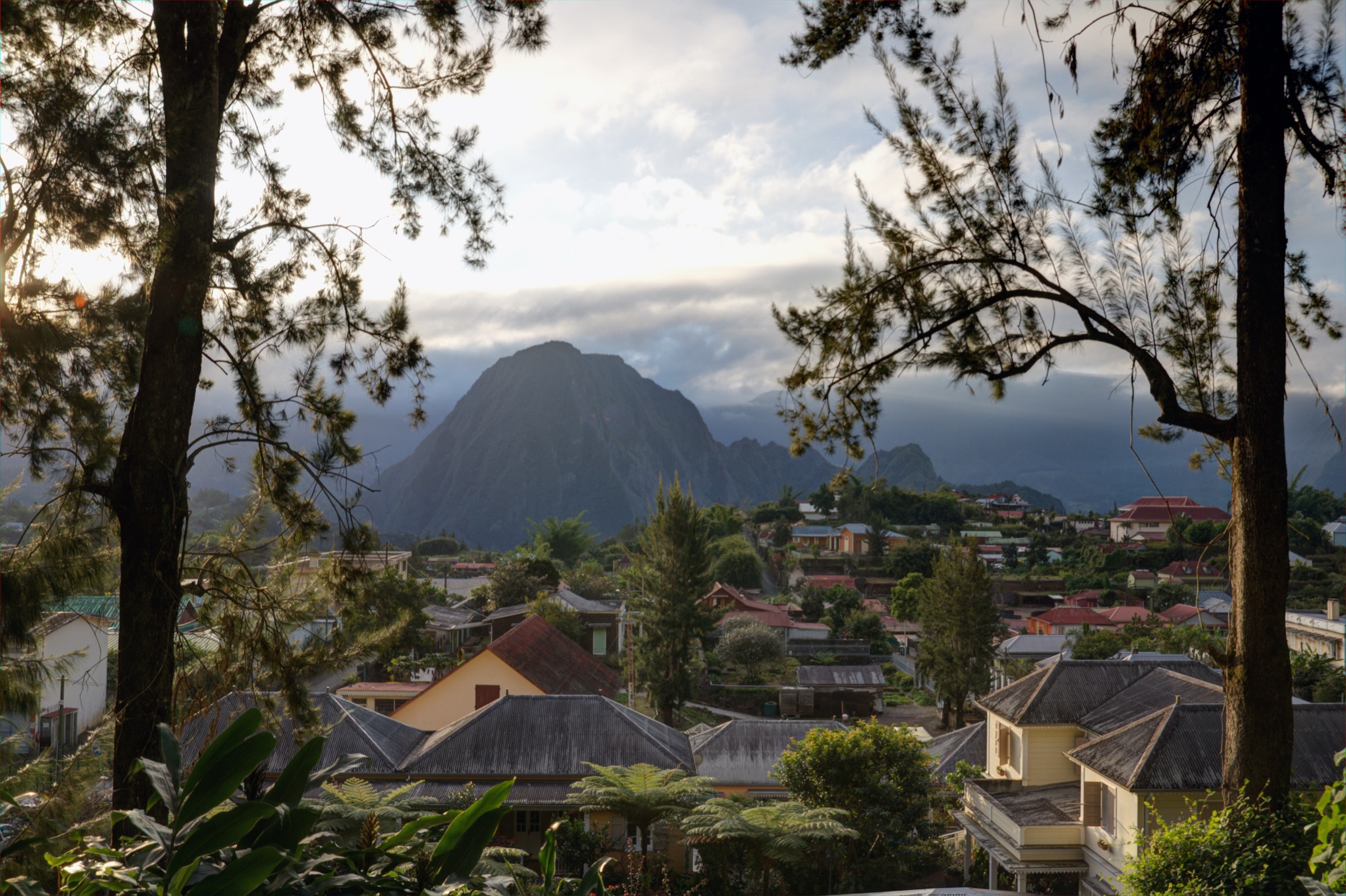
Salazie is greener and damper than its sister cirques: easterly trade winds drive moist air against the ramparts and produce some of the heaviest rainfall on the island, especially on the Bélouve plateau and the eastern wall above the Trou de Fer canyon. The main settlement, Hell-Bourg, sits at about 930 m on a perched plateau in the centre of the cirque and is classified among Les Plus Beaux Villages de France for its preserved Creole architecture and former thermal-spa heritage. Grand Îlet, Mare à Vieille Place and Îlet à Vidot are smaller hamlets that serve as secondary trailheads.
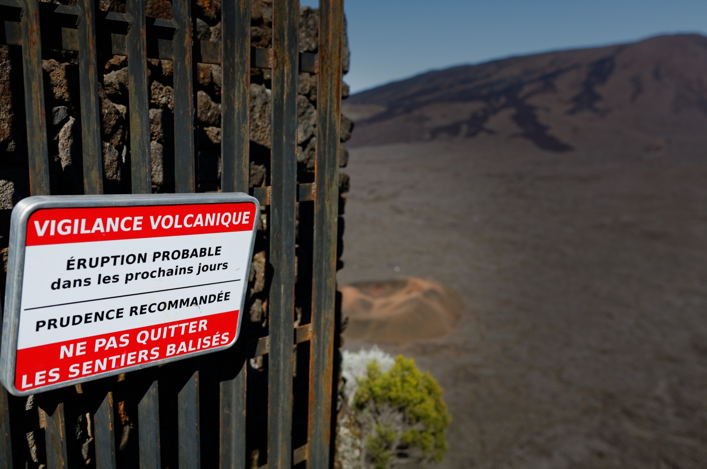
The walking season is the austral winter dry season, roughly May to November, when mornings tend to clear before mid-cloud builds over the ramparts. Cyclone season runs from November to April; trails can be closed without notice after heavy rain or strong winds, and the official cyclone-alert system (Vigilance, Pré-Alerte, Alerte) restricts access during alerts. The Office National des Forêts (ONF) and Parc national de La Réunion publish trail-closure notices that should be consulted before any walk, especially after major rain events.
Access is by car from Saint-Denis or Saint-André via the RN2 and the D48, a long, winding road that climbs into the cirque past Salazie village. The Car Jaune intercity bus runs to Salazie and Hell-Bourg from Saint-André several times daily; the bus does not reach the high-elevation trailheads such as the Gîte de Bélouve, which require private transport from La Plaine-des-Palmistes via the Bébour forest road.
Selection rationale
The five hikes below cover the defining experiences of the cirque: an iconic in-cirque summit (Piton d’Anchaing), the signature waterfall complex (Trou de Fer from the Bélouve plateau), a high ridge / balcony viewpoint linking the cirque to the Piton des Neiges massif (Cap Anglais from Hell-Bourg), a short historic / cultural walk through one of France’s most beautiful villages and its waterfall amphitheatre (Hell-Bourg and Les Trois Cascades), and a gentle family / forest loop at the head of the cirque (Mare à Poule d’Eau). The set ranges from a 1-hour family walk to a hard 6-8 hour summit day.
Summary table
| # | Hike | Country | Route type | Distance | Gain | Max elevation | Difficulty |
|---|---|---|---|---|---|---|---|
| 1 | Piton d’Anchaing from Hell-Bourg | France (Réunion) | Out-and-back summit hike | ~14 km | ~1,000 m | ~1,352 m | Hard |
| 2 | Trou de Fer overlook from Bélouve | France (Réunion) | Out-and-back forest plateau walk | ~8-8.5 km | ~150-200 m | ~1,500 m | Moderate |
| 3 | Cap Anglais from Hell-Bourg | France (Réunion) | Out-and-back balcony / ridge hike | ~13 km | ~1,240 m | ~2,174 m | Hard |
| 4 | Hell-Bourg village and Les Trois Cascades | France (Réunion) | Short out-and-back / village loop | ~1.5-3 km | ~150-200 m | ~1,000 m | Easy |
| 5 | Mare à Poule d’Eau loops | France (Réunion) | Two interlocking loops | ~3.4 km (long loop) | ~110 m | ~900 m | Easy |
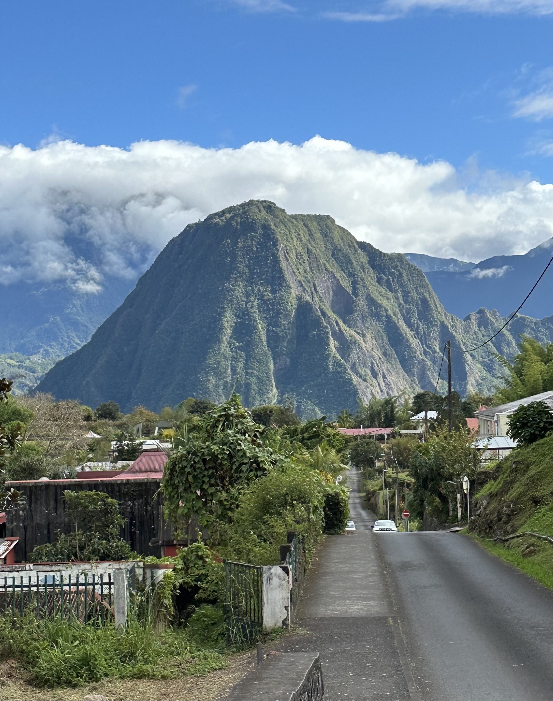
1. Piton d’Anchaing from Hell-Bourg
Snapshot
Itinerary
From the centre of Hell-Bourg the trail drops north into the Bras Sec ravine on a paved lane, crosses the river on a footbridge and climbs steeply into the hamlet of Îlet à Vidot. From the upper edge of the îlet a signed forest path enters tamarind and acacia woodland and zigzags up the south-east shoulder of the piton in steady forest switchbacks. The middle third of the climb is the steepest and includes a few short cabled sections in mossy rock steps. Above about 1,200 m the angle eases and the path emerges onto a flat summit plateau covered in tamarinds and grass, where a short loop circles the high point at roughly 1,352 m with panoramic views over Hell-Bourg, Mare à Poule d’Eau, the Bélouve rampart, the Roche Écrite ridge and the surrounding pitons. Descent retraces the ascent line; some parties extend the day via Plateau de la Caverne Mussard, but the standard option is the same-route return to Hell-Bourg.
Why it is essential
Piton d’Anchaing is the most prominent free-standing peak inside the cirque and the only major in-cirque summit that can be climbed in a day from Hell-Bourg without a road approach. The summit bears the name of Anchaing, an escaped slave who, with his wife Héva, took refuge on the peak in the 18th century; the route is a working part of Réunion’s marronage memory as well as a panoramic objective. It is repeatedly cited by the Île de la Réunion Tourisme (IRT) board and Randopitons as a flagship Salazie day-walk.
Equipment
Mountain hiking equipment: sturdy boots with good grip, weatherproof shell, warm layer for the summit, sun protection, at least 2 L of water, food, and headtorch in case of late descent. Trekking poles are useful on the descent. Cable sections are short and do not require via ferrata kit.
Hazards and notes
The path is slippery and exposed to falls after rain; the cabled sections become more serious in the wet. Mid-cloud builds rapidly over the cirque most afternoons, so an early start is standard. Trail status should be checked with the ONF or Parc national de La Réunion before departure, particularly in cyclone season.
GPX / route file
| Source | URL | Format | Licence / terms | Reuse status |
|---|---|---|---|---|
| Randopitons — Piton d’Anchain par l’Îlet à Vidot depuis Hell Bourg | randopitons.re | GPX download on free account | Personal-use terms; not re-hosted | Not re-hosted |
| Trails-viewer — Piton d’Enchaing Hell-Bourg | trails-viewer.com | Track / map | Site terms apply | Not re-hosted |
| OpenStreetMap — Piton d’Anchaing | openstreetmap.org | Source map / location | OSM data is ODbL | Source data only |
External links
- Île de la Réunion Tourisme — Piton d’Anchaing
- Randopitons — Piton d’Anchain par l’Îlet à Vidot
- Wikipedia (FR) — Piton d’Anchaing
- Parc national de La Réunion
2. Trou de Fer overlook from Bélouve
Snapshot
Itinerary
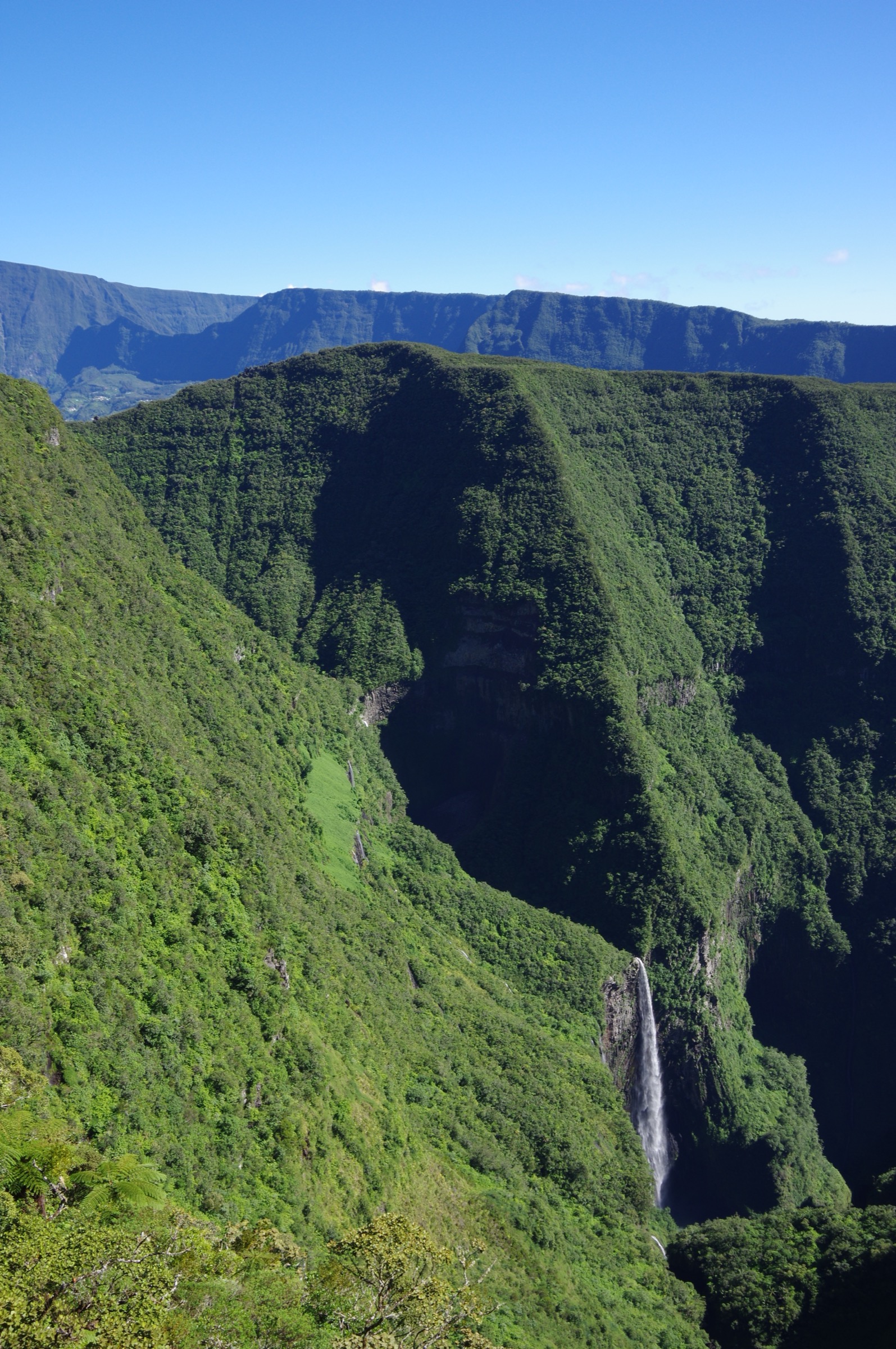
From the Gîte de Bélouve car park at about 1,500 m the trail follows the broad Allée Cavalière, a former horse track through primary tamarind and fanjan forest. The path is mostly flat with mild undulations and is laid with wooden duckboards over the wettest sections. After roughly 3-3.5 km the trail crosses a junction with the Mazerin path and continues to the Belvédère du Trou de Fer, a railed wooden platform on the rim of the canyon. From the belvédère the view drops into a 300 m amphitheatre fed by the Rivière du Bras de Caverne, where multiple ribbon waterfalls plunge over the eastern wall of the cirque. Return is by the same path; an extension to Grande Mare adds about 2 km and is available when conditions allow.
Why it is essential
The Trou de Fer is Réunion’s most photographed waterfall feature and the eastern hydrological frontier of the Cirque de Salazie. The Bélouve overlook is the only legal, non-technical ground-level viewpoint into the chasm; the canyon floor itself is reached only by helicopter or by serious multi-pitch canyoning. The walk passes through one of the best-preserved high-altitude tamarind forests on the island and is the most-cited family-friendly waterfall objective in the cirque.
Equipment
Standard hiking equipment: hiking shoes or boots with good grip, weatherproof layer, warm layer for the plateau, sun protection, water and food. Trekking poles help on the slippery duckboards. A headtorch is sensible if planning to stay for late-afternoon clearings.
Hazards and notes
The duckboards are very slippery when wet. The Eastern Zone of Trou de Fer was reported as temporarily closed in late 2024; ONF and Parc national de La Réunion notices should be checked before travel. Cloud and rain reach the plateau most afternoons, so a morning start gives the best chance of an open view. Drones are not permitted without authorisation inside the national park.
GPX / route file
| Source | URL | Format | Licence / terms | Reuse status |
|---|---|---|---|---|
| Visorando — Le Trou de Fer par le gîte de Bélouve et l’Allée Cavalière | visorando.com | GPX download on free account | Visorando terms; not re-hosted | Not re-hosted |
| Wikiloc — Gite Belouve - Trou de Fer | wikiloc.com | User-uploaded GPS track | Wikiloc terms apply | Not re-hosted |
| OpenStreetMap — Trou de Fer | openstreetmap.org | Source map / location | OSM data is ODbL | Source data only |
External links
- Île de la Réunion Tourisme — Forêts de Bébour-Bélouve
- ONF — Loisirs en forêt, La Réunion
- Visorando — Trou de Fer via Bélouve
- Wikipedia (FR) — Trou de Fer
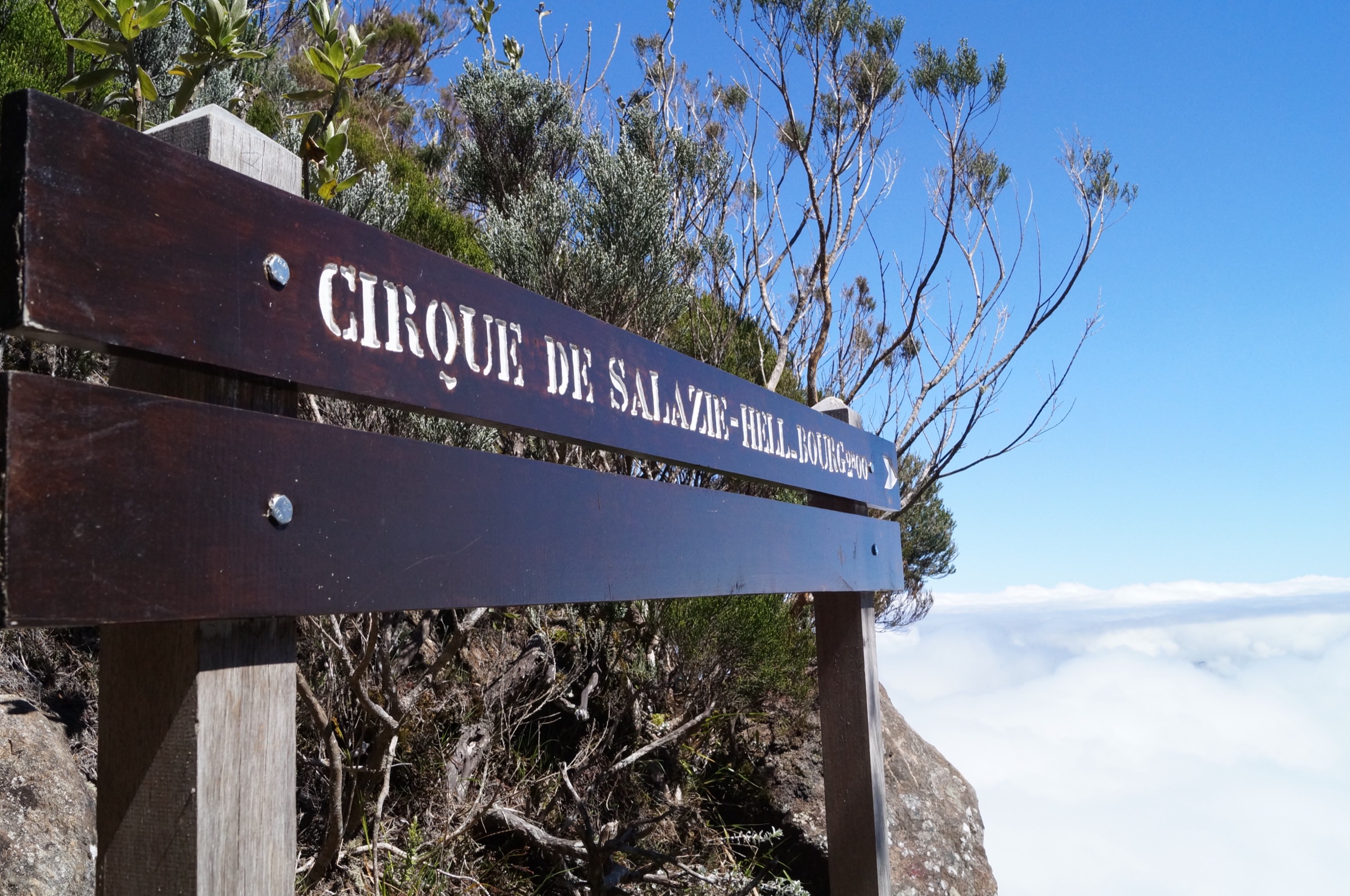
3. Cap Anglais from Hell-Bourg
Snapshot
Itinerary
The route is the lower section of the classic Hell-Bourg-Cap Anglais-Gîte du Piton des Neiges itinerary as published by Île de la Réunion Tourisme. From Hell-Bourg the path climbs steadily south through tamarind forest, swinging up the western shoulder of the cirque rampart. The middle section runs through ferns, heather and stands of fanjan tree ferns. The angle eases briefly through a forest plateau before the final climb to Cap Anglais at about 2,150-2,174 m, where the path crests the rim and reveals the upper Piton des Neiges massif on the southern side and the full Cirque de Salazie to the north. Hikers continuing to the Gîte du Piton des Neiges normally make this a multi-day trip; the day-hike option is to turn around at the cap and descend by the same path.
Why it is essential
Cap Anglais is the standard balcony viewpoint linking the cirque to the high massif and the upper Piton des Neiges peaks; the panorama from the cap takes in Salazie below, Mafate over the ridge, and the Piton des Neiges summit dome above. It is the practical day-hike summit for fit walkers based in Hell-Bourg who do not have the time or fitness for the full Piton des Neiges ascent, and it is part of the GR R1 / GR R2 network.
Equipment
Mountain hiking equipment: sturdy boots, warm and weatherproof layers (the cap is significantly colder than the cirque), hat and gloves outside midsummer, sun protection, navigation backup, at least 2-3 L of water, food, and headtorch. Trekking poles are useful on the descent.
Hazards and notes
The day is long and the elevation gain substantial. Weather changes quickly above 1,800 m and the upper section can be in cloud. The path is well marked but slippery in places, particularly on rooty descents. Drinking water is unreliable between Hell-Bourg and the cap, so a full carry is normal.
GPX / route file
| Source | URL | Format | Licence / terms | Reuse status |
|---|---|---|---|---|
| Île de la Réunion Tourisme — Hell-Bourg / Cap Anglais / Gîte du Piton des Neiges | en.reunion.fr | Official tourism route description | Site terms apply | Source data only |
| GPS-viewer — Cap Anglais track | gps-viewer.com | Track / map | Site terms apply | Not re-hosted |
| OpenStreetMap — Cap Anglais | openstreetmap.org | Source map / location | OSM data is ODbL | Source data only |
External links
- Île de la Réunion Tourisme — Hell-Bourg / Cap Anglais / Gîte du Piton des Neiges
- Fédération Française de la Randonnée — GR R1, tour du Piton des Neiges
- Mon GR — GR R2 La Grande Traversée
- Parc national de La Réunion
4. Hell-Bourg village and Les Trois Cascades
Snapshot
Itinerary
From the centre of Hell-Bourg the walk first follows the main rue du Général de Gaulle past the Hôtel des Salazes, the Maison Folio (a 19th-century Creole town house open as a museum), the parish church and the ruins of the former Thermes d’Hell-Bourg, the 1840s thermal-spa complex that gave the village its short-lived European reputation. From the top of the village a signed concrete lane climbs steeply north-west, then becomes a rough forest path that rises through bamboo, guava and tree ferns to a viewpoint facing three slender waterfalls dropping over the rampart. The cascades themselves are not directly accessible; the marked path ends at the viewpoint. Return is by the same path back to the village.
Why it is essential
Hell-Bourg is the only village in the cirque classified as one of Les Plus Beaux Villages de France, and the Trois Cascades amphitheatre is the closest waterfall feature to the village. The combined walk is the standard half-day introduction to Salazie for visitors who are not climbing a piton, and it covers the cirque’s two non-volcanic signature subjects: Creole architectural heritage and rampart waterfalls.
Equipment
Standard hiking equipment for the cascades section: grippy footwear, rain layer, sun protection, water. For the village portion, ordinary walking shoes are sufficient. Carry a small daypack and water.
Hazards and notes
The cascades path is steep and slippery and is shared with local foot traffic. The viewpoint is at the foot of an active rockfall slope and signs ask walkers not to leave the marked path. Some sections may be closed after major rain; check at the Hell-Bourg tourism office for current status.
GPX / route file
| Source | URL | Format | Licence / terms | Reuse status |
|---|---|---|---|---|
| Randopitons — Les Trois Cascades à Hell Bourg | randopitons.re | GPX download on free account | Personal-use terms; not re-hosted | Not re-hosted |
| Visorando — Hell-Bourg et les trois cascades | visorando.com | GPX download on free account | Visorando terms; not re-hosted | Not re-hosted |
| OpenStreetMap — Hell-Bourg | openstreetmap.org | Source map / location | OSM data is ODbL | Source data only |
External links
- Île de la Réunion Tourisme — Hell-Bourg
- Les Plus Beaux Villages de France — Hell-Bourg
- Randopitons — Les Trois Cascades à Hell Bourg
- Wikipedia — Hell-Bourg
5. Mare à Poule d’Eau loops
Snapshot
Itinerary
A short signed access path drops from the car park to the small Mare à Poule d’Eau, a forested pond named after the moorhens that historically gathered there. The longer loop continues across a footbridge, climbs gently through chouchou (chayote) and watercress plantations, passes the ruins of the first Salazie settlers’ dwellings — a solitary staircase and the footprint of a cottage are still visible — and reaches a wooden belvedere with a view back over the pond toward the Bélouve rampart and Gros Morne. The path then descends through bamboo and re-enters the forest before returning to the picnic area. The short loop omits the upper viewpoint and stays closer to the pond. Both loops are signed and equipped with picnic tables and kiosks.
Why it is essential
The Mare à Poule d’Eau is the most accessible piece of cirque-floor ecology and Creole agricultural landscape in Salazie. The site combines a freshwater pond, chouchou and watercress plantations (Salazie is the national centre of chouchou cultivation), and a viewpoint over the Bélouve rampart in a single short walk. It functions as the cirque’s signature family / forest walk and as a rest-day option between Piton d’Anchaing, Cap Anglais and Trou de Fer.
Equipment
Standard hiking equipment: trainers or light hiking shoes, rain layer, sun protection, water. A picnic is the most common addition. No technical kit is required.
Hazards and notes
Paths can be muddy after rain, but no section is exposed or technical. The ponds are stocked with tilapia and fishing is regulated by local rules; swimming is not the standard use. The site is a popular Sunday picnic spot for Réunionnais families and can be crowded on weekends and public holidays.
GPX / route file
| Source | URL | Format | Licence / terms | Reuse status |
|---|---|---|---|---|
| Randopitons — Deux boucles à la Mare à Poule d’Eau près de Salazie | randopitons.re | GPX download on free account | Personal-use terms; not re-hosted | Not re-hosted |
| Île de la Réunion Tourisme — Mare à Poule d’Eau | en.reunion.fr | Official tourism route description | Site terms apply | Source data only |
| OpenStreetMap — Mare à Poule d’Eau | openstreetmap.org | Source map / location | OSM data is ODbL | Source data only |
External links
- Île de la Réunion Tourisme — Mare à Poule d’Eau
- Randopitons — Deux boucles à la Mare à Poule d’Eau
- Office de Tourisme de l’Est — Mare à Poule d’Eau
- Parc national de La Réunion
Missing data / follow-up work
- Piton d’Anchaing route distance and gain vary by start point (Hell-Bourg vs Îlet à Vidot) and by source between roughly 6.5 km / 750 m and 14 km / 1,100 m; the catalogue uses the longer Hell-Bourg figures, but the shorter Îlet à Vidot loop is a common alternative.
- Trou de Fer from Bélouve was reported as having partial trail closures in late 2024 and early 2025 (Eastern Zone of Trou de Fer); ONF and Parc national de La Réunion notices should be checked before travel.
- Cap Anglais distance and gain figures are from community databases rather than an official ONF data sheet.
- No high-resolution Wikimedia Commons image specifically of the Hell-Bourg-Cap Anglais ridge balcony at peak elevation was located; the inline image shows the descent from the cap toward Hell-Bourg, which is the most representative open-licence photo available.
- The Voile de la Mariée waterfall is visible from the D48 and is a major landmark of the cirque, but its viewing point is a road-side stop rather than a walk and was therefore not selected as one of the five day-hikes.
- All published GPX / KML route files in this catalogue are external; no third-party tracks have been re-hosted.
- Cyclone-season closures (November to April) may affect every route in the cirque; the official Réunion vigilance status should be checked for any wet-season visit.
External links
| Resource | Link |
|---|---|
| Parc national de La Réunion | reunion-parcnational.fr |
| Île de la Réunion Tourisme (IRT) | reunion.fr |
| ONF — Loisirs en forêt, La Réunion | onf.fr |
| Randopitons — Cirque de Salazie | randopitons.re |
| Mon GR — GR R2 La Grande Traversée | mongr.fr |
| Fédération Française de la Randonnée — GR R1 tour du Piton des Neiges | ffrandonnee.fr |
| Île de la Réunion Tourisme — Piton d’Anchaing | en.reunion.fr |
| Île de la Réunion Tourisme — Hell-Bourg / Cap Anglais / Piton des Neiges | en.reunion.fr |
| Île de la Réunion Tourisme — Mare à Poule d’Eau | en.reunion.fr |
| Île de la Réunion Tourisme — Forêts de Bébour-Bélouve | en.reunion.fr |
| Visorando — Trou de Fer via Bélouve | visorando.com |
| Visorando — Hell-Bourg et les trois cascades | visorando.com |
| Wikiloc — Hell Bourg / Bélouve trail | wikiloc.com |
| Les Plus Beaux Villages de France — Hell-Bourg | les-plus-beaux-villages-de-france.org |
| Wikipedia — Hell-Bourg | en.wikipedia.org |
| Wikipedia (FR) — Cirque de Salazie | fr.wikipedia.org |
| Wikipedia (FR) — Piton d’Anchaing | fr.wikipedia.org |
| Wikipedia (FR) — Trou de Fer | fr.wikipedia.org |
| Wikipedia (FR) — Forêt de Bélouve | fr.wikipedia.org |