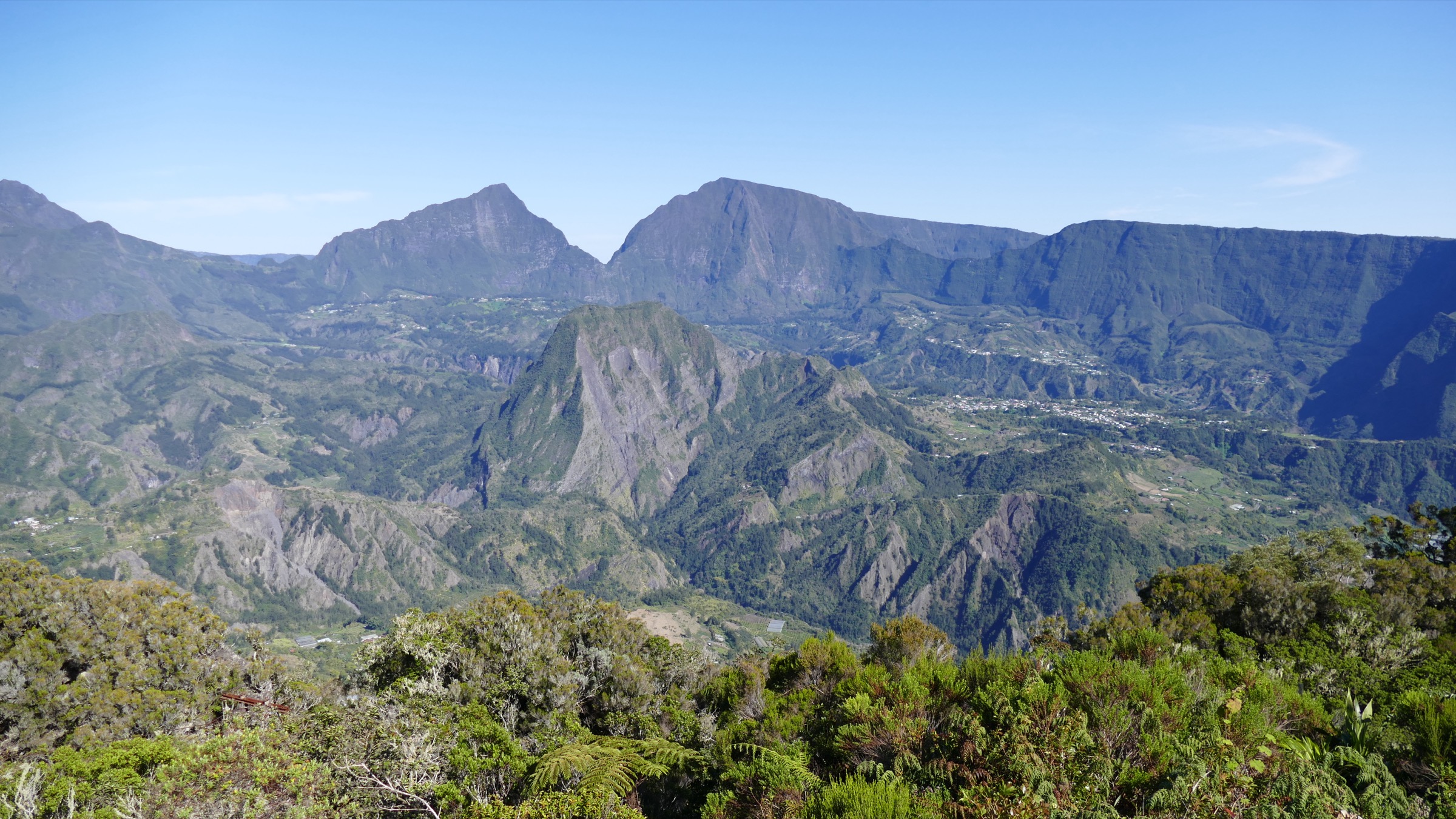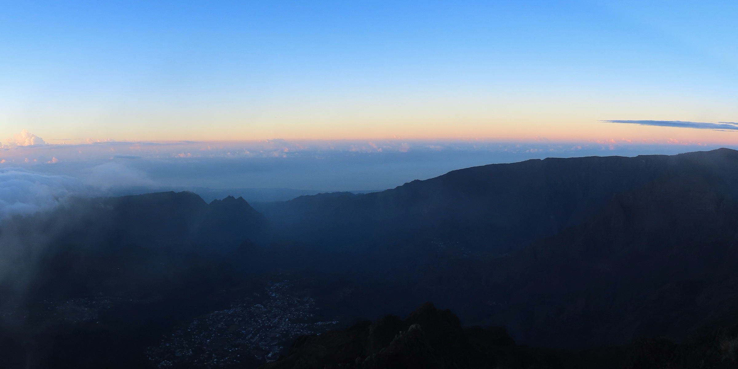
Regional overview
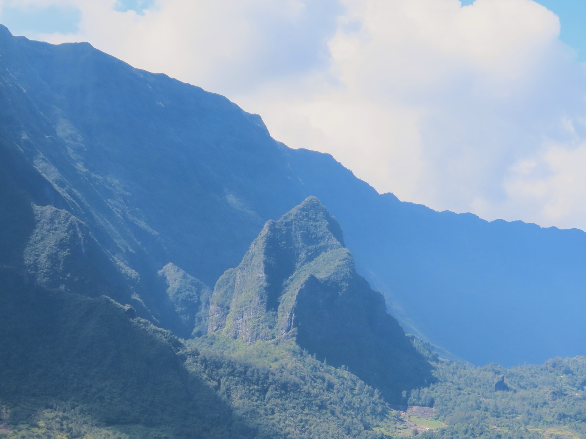
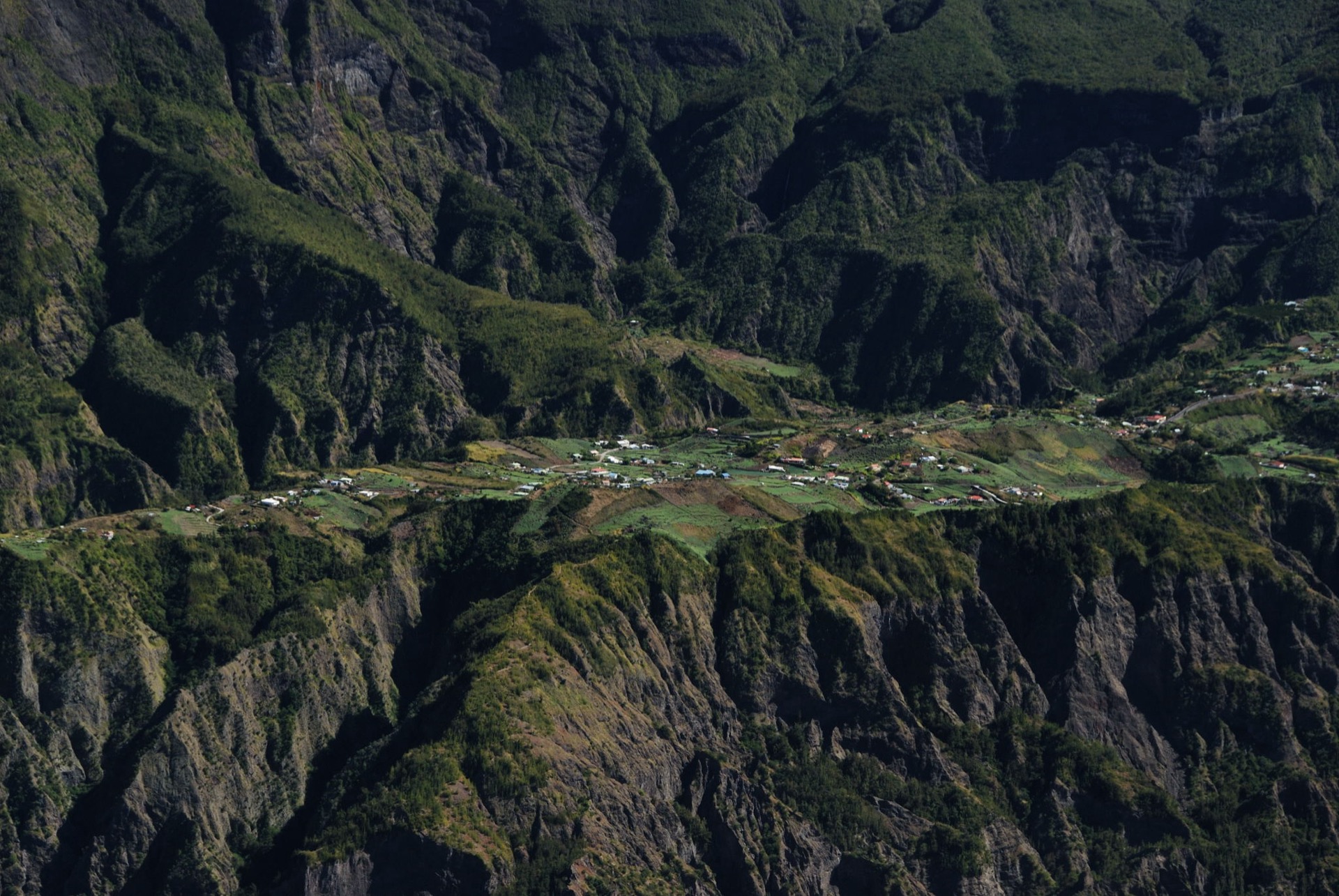
The Cirque de Cilaos is the southern and driest of the three great cirques carved into the eroded flanks of the Piton des Neiges shield volcano, alongside Salazie to the north and the Cirque de Mafate to the west. The cirque centres on Cilaos town (about 1,200 m) and the smaller settlements of Bras Sec to the east and Îlet à Cordes on a perched ridge to the west, all encircled by 1,500–2,800 m ramparts. The whole massif sits inside Parc national de La Réunion, inscribed on the UNESCO World Heritage list in 2010 as the Pitons, cirques and remparts of Réunion Island.
Cilaos is steep, varied and strongly shaped by ravines: dry basalt walls, thermal-water history, forested rempart paths, high viewpoints and narrow routes between isolated settlements. Day hikes often start directly from Cilaos town, the multimedia-hall parking, the Mare à Joseph picnic area near Bras Sec, or from Mare d’Affouches, making this cirque one of the more logistically straightforward highland bases on Réunion.
Access is by the RN5 mountain road from Saint-Louis, famous for its some-four-hundred bends and tight tunnels. The Alternéo bus network (formerly Carsud) runs intercity line 60 from Saint-Louis to Cilaos Ville, and a feeder line 63 climbs from Cilaos to Bras Sec; together they make several of the trailheads reachable without a car.
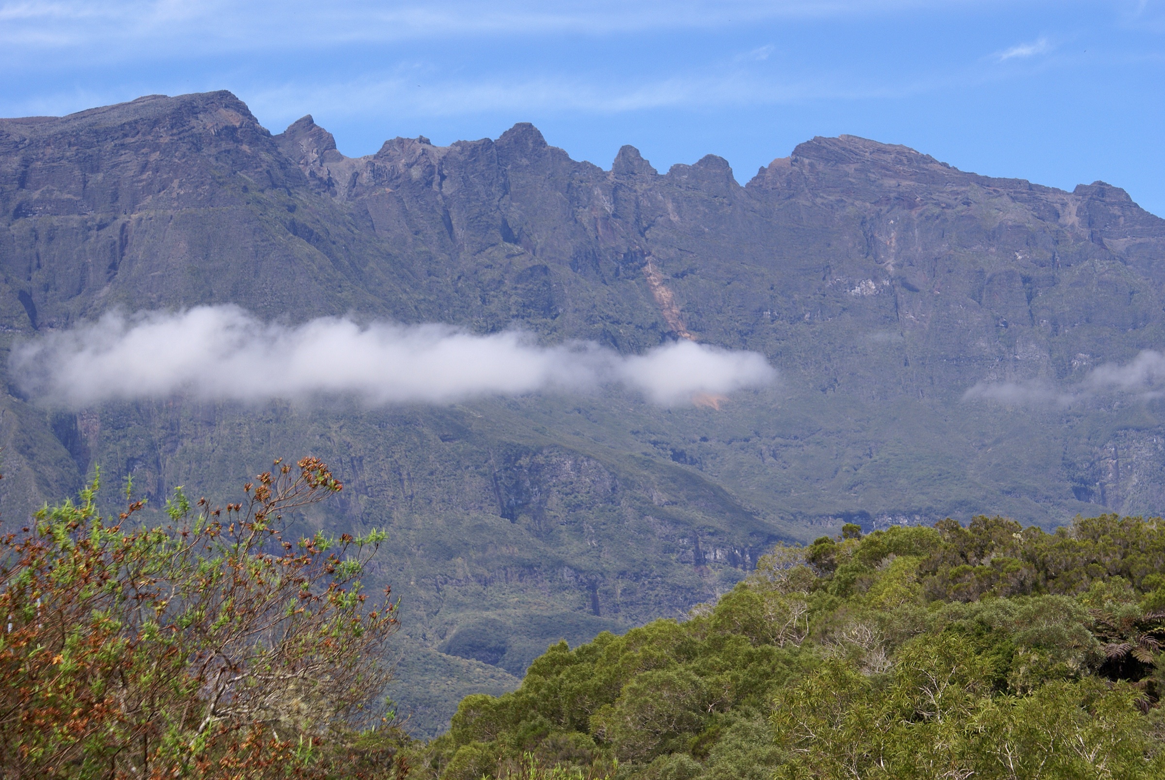
The walking season is the austral winter and shoulder months, roughly May to November, when mornings are usually clear before mid-cloud builds over the ramparts. Cyclone season runs from November to April. Heavy rain is a serious issue on every route here because the paths cross ravines and riverbeds — official Parc national records repeatedly warn against walking during or after rain on the Bras Rouge, Bonnet de Prêtre and Îlet à Cordes routes because of flash-flood and slippery-rock hazards. The Office National des Forêts (ONF) and Parc national de La Réunion publish trail-closure notices that should be consulted before any walk.
Selection rationale
The five hikes below were selected to show the cirque’s range: the geological slot of La Chapelle in the Bras Rouge gorge, the thermal-water and waterfall route to Cascade du Bras Rouge, a short forest and viewpoint loop above Bras Sec on the Sentier des Sources, a loop around the Bonnet de Prêtre landmark, and a village-to-village traverse from Bras Sec to Îlet à Cordes. All five have official route statistics and GPX/KML files published by Rando tec-tec, the Parc national de La Réunion hiking portal. Distances run from a 2.1 km forest loop to a 10.3 km point-to-point, and elevation gains stay under 700 m, but the routes are demanding for their length because of ravine crossings, slippery basalt and exposure to afternoon cloud.
Summary table
| # | Hike | Country | Route type | Distance | Gain | Max elevation | Difficulty |
|---|---|---|---|---|---|---|---|
| 1 | Sentier de la Chapelle | France (Réunion) | Out-and-back | 7.0 km | 674 m | 1,107 m | Moderate |
| 2 | Cascade du Bras Rouge | France (Réunion) | Out-and-back | 6.4 km | 399 m | 1,201 m | Easy |
| 3 | Sentier des Sources (Bras Sec) | France (Réunion) | Loop | 2.1 km | 117 m | 1,497 m | Easy |
| 4 | Tour du Bonnet de Prêtre | France (Réunion) | Loop | 4.3 km | 367 m | 1,403 m | Moderate |
| 5 | Bras Sec to Îlet à Cordes | France (Réunion) | Point-to-point | 10.3 km | 560 m | 1,291 m | Moderate |
1. Sentier de la Chapelle
Snapshot
Itinerary
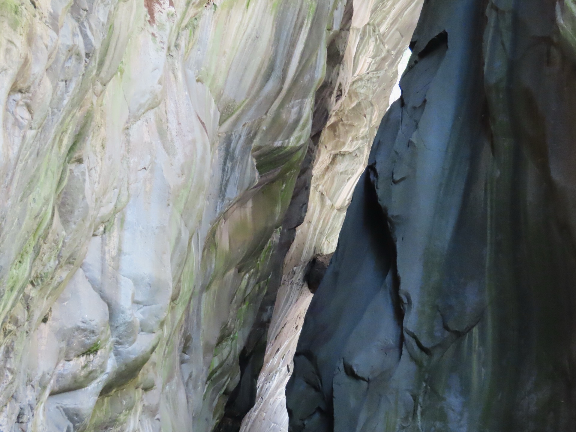
From the Cilaos tourist office in the centre of town, the route drops south-west off the cirque-floor plateau and descends through tamarind forest and broken basalt terraces toward the Bras Rouge ravine. The path threads down to river level and continues into the narrow geological slot known as La Chapelle, an old magmatic chamber-like gorge in coloured basalt with bell-shaped walls and a small inner pool. The return retraces the descent line, climbing the 674 m back out to Cilaos by the same route.
Why it is essential
La Chapelle is the signature geological objective of the Cilaos side: an enclosed slot in coloured basalt that can be reached on foot from the town centre, without a road approach. The route compresses the cirque’s volcanic and ravine character into a single half-day from Cilaos.
Equipment
Mountain hiking equipment: sturdy grippy footwear, rain layer, sun protection, at least 2 L of water, food, and a downloaded offline map. Trekking poles are useful on the climb back out but awkward in the river section. A headtorch in case of late descent.
Hazards and notes
The Parc national record strongly advises against this route in rain: Bras Rouge floods quickly and the slot can become a trap. The riverbed section is slippery and technical at any water level. Check ONF and Parc national trail status, and the local weather, before departure; do not enter the gorge if cloud is already building over the ramparts.
GPX / route file
| Source | URL | Format | Notes |
|---|---|---|---|
| Rando tec-tec — Sentier de la Chapelle | randotectec.reunion-parcnational.fr | GPX | Official Parc national de La Réunion download; reuse terms unresolved |
| Rando tec-tec — Sentier de la Chapelle | randotectec.reunion-parcnational.fr | KML | Official Parc national de La Réunion download; reuse terms unresolved |
Further reading
2. Cascade du Bras Rouge
Snapshot
Itinerary
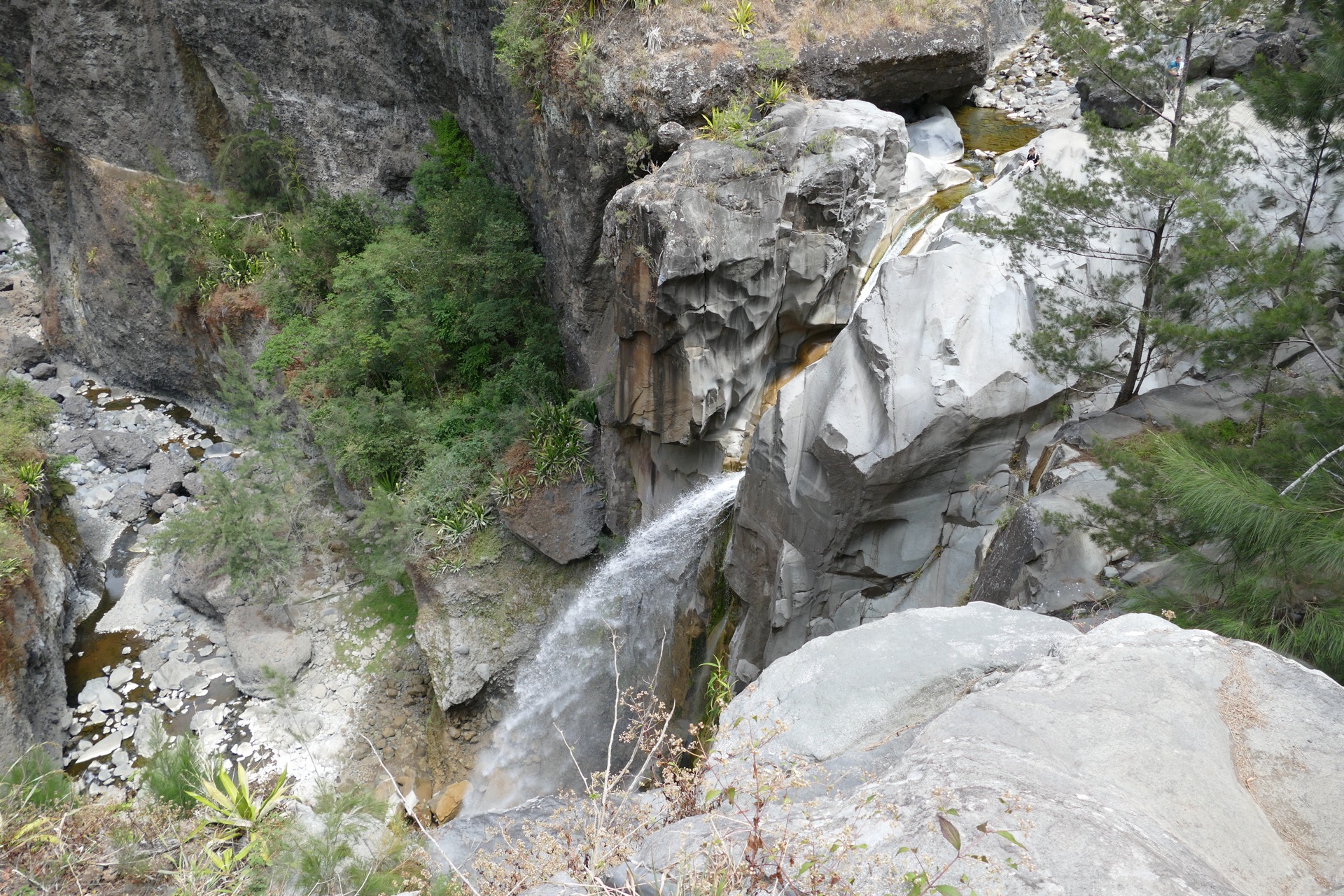
From the multimedia-hall car park on the western edge of Cilaos, the path drops west along the historic thermal-water side of the cirque, traversing through tamarind and acacia woodland with intermittent views down into the Bras Rouge ravine. The trail steepens as it approaches the waterfall, with several short ravine crossings on stone steps before reaching the viewpoint above the cascade. Return is by the same route, with the steeper sections taken in ascent.
Why it is essential
Cascade du Bras Rouge is the compact Cilaos classic — a half-day from a town car park to a dramatic ravine waterfall that captures the cirque’s water-and-basalt character without committing to a full mountain day. It pairs well with the longer Sentier de la Chapelle on a two-day visit.
Equipment
Hiking shoes with good grip, rain layer, sun protection, 1.5 L of water, food, and a downloaded offline map. Trekking poles help on the descent.
Hazards and notes
The Parc national record warns of ravine crossings, flash-flood risk in heavy rain, and very slippery rocks near the waterfall and ravine edges. The “Easy” grade refers to the path itself, not the consequence of a slip — keep well back from the cascade lip. Do not enter the gorge in unstable weather.
GPX / route file
| Source | URL | Format | Notes |
|---|---|---|---|
| Rando tec-tec — Cascade du Bras Rouge | randotectec.reunion-parcnational.fr | GPX | Official Parc national de La Réunion download; reuse terms unresolved |
| Rando tec-tec — Cascade du Bras Rouge | randotectec.reunion-parcnational.fr | KML | Official Parc national de La Réunion download; reuse terms unresolved |
Further reading
3. Sentier des Sources (Bras Sec)
Snapshot
Itinerary
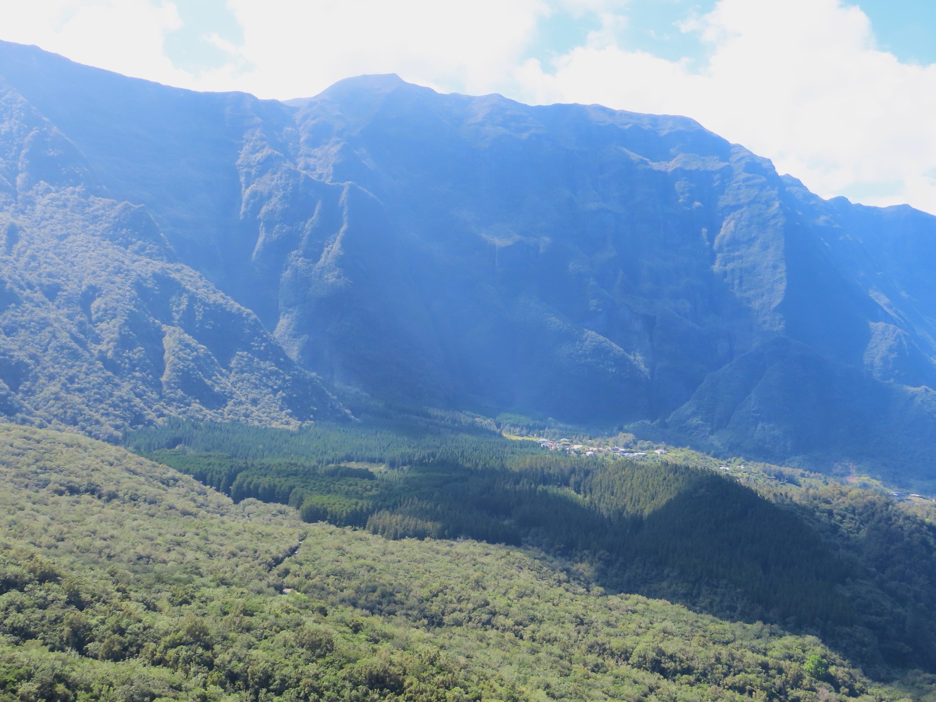
From the Mare à Joseph picnic area on the upper edge of Bras Sec, the short loop climbs gently into mixed tamarind, acacia and cryptomeria forest, with intermittent rempart-side viewpoints down into the cirque toward Cilaos and the Bonnet de Prêtre. The path traces a series of small springs that give the route its name, then returns through forest to the picnic area.
Why it is essential
This is the accessible forest-and-viewpoint counterpoint to Cilaos’ harder ravine and traverse routes. It represents the Bras Sec side of the cirque in a short day-hike format and is the natural choice for a half-day, a family outing, or a recovery walk between bigger days.
Equipment
Hiking shoes, light rain layer, sun protection, water, and basic navigation. Insect repellent is useful in damper months.
Hazards and notes
Short does not mean weather-proof: forest paths can be wet and slippery, and rempart-edge viewpoints have unfenced drops. Check current trail status if combining with other Cilaos walks.
GPX / route file
| Source | URL | Format | Notes |
|---|---|---|---|
| Rando tec-tec — Sentier des Sources | randotectec.reunion-parcnational.fr | GPX | Official Parc national de La Réunion download; reuse terms unresolved |
| Rando tec-tec — Sentier des Sources | randotectec.reunion-parcnational.fr | KML | Official Parc national de La Réunion download; reuse terms unresolved |
Further reading
4. Tour du Bonnet de Prêtre
Snapshot
Itinerary
From Mare d’Affouches above Bras Sec, the loop drops west into a forested ravine and contours around the base of the Bonnet de Prêtre, the prominent helmet-shaped volcanic landmark visible across the cirque. The path passes below the cliffs on the south side with views back toward Cilaos and the Piton des Neiges shoulder, crosses a second small ravine, and climbs through tamarind forest back to the Mare d’Affouches start.
Why it is essential
The Bonnet de Prêtre is one of Cilaos’ defining geological landmarks, recognisable from almost every viewpoint inside the cirque. This loop gives the only compact, place-specific walk around its base, and adds a near-summit feel to the Bras Sec side without committing to a hard summit day.
Equipment
Mountain hiking equipment: sturdy shoes, rain layer, sun protection, water, food, and a downloaded offline map. Headtorch for late descents.
Hazards and notes
The Parc national record advises an early start because cloud often builds against the landmark by midday and obscures the route. Ravine crossings are short but slippery and become serious after heavy rain; avoid the loop in unstable weather.
GPX / route file
| Source | URL | Format | Notes |
|---|---|---|---|
| Rando tec-tec — Tour du Bonnet de Prêtre | randotectec.reunion-parcnational.fr | GPX | Official Parc national de La Réunion download; reuse terms unresolved |
| Rando tec-tec — Tour du Bonnet de Prêtre | randotectec.reunion-parcnational.fr | KML | Official Parc national de La Réunion download; reuse terms unresolved |
Further reading
5. Bras Sec to Îlet à Cordes
Snapshot
Itinerary
The route starts at Bras Sec on the east side of the cirque and traverses westward through tamarind forest, hamlets, ravine crossings and quieter rempart-side paths toward Îlet à Cordes on the far western ridge. The official Parc national record describes it as the second stage of the “Cilaos, d’îlet en îlet” itinerary linking Bras Sec, Cilaos and Îlet à Cordes through villages, ravines and quieter paths away from the main road. The route loses 772 m net to Îlet à Cordes after a mid-traverse high point of about 1,291 m, with the heaviest descent in the final third.
Why it is essential
Îlet à Cordes is one of the cirque’s defining isolated settlements — a perched ridge village on the western edge of Cilaos with a markedly drier microclimate. This traverse adds cultural geography to the Cilaos selection: village-to-village walking, ravine crossings and the transition from humid Bras Sec to the drier western ridge.
Equipment
Mountain hiking equipment: sturdy shoes or boots, rain layer, sun protection, food, 2 L of water, a downloaded offline map and a headtorch. Arrange return transport from Îlet à Cordes before starting.
Hazards and notes
This is a point-to-point walk, not a loop. Confirm finish transport from Îlet à Cordes locally — the perched village has limited bus service and a long road return through Cilaos. Ravines and rough paths are more serious after rain; avoid in unstable weather.
GPX / route file
| Source | URL | Format | Notes |
|---|---|---|---|
| Rando tec-tec — Bras Sec to Îlet à Cordes | randotectec.reunion-parcnational.fr | GPX | Official Parc national de La Réunion download; reuse terms unresolved |
| Rando tec-tec — Bras Sec to Îlet à Cordes | randotectec.reunion-parcnational.fr | KML | Official Parc national de La Réunion download; reuse terms unresolved |
Further reading
Further reading
| Source | URL |
|---|---|
| Rando tec-tec — Parc national de La Réunion hiking portal | randotectec.reunion-parcnational.fr |
| Rando tec-tec — official route GeoJSON dataset | randotectec.reunion-parcnational.fr |
| Parc national de La Réunion | reunion-parcnational.fr |
| UNESCO — Pitons, cirques and remparts of Reunion Island | whc.unesco.org |
| Île de la Réunion Tourisme (IRT) | reunion.fr |
| Office de Tourisme de Cilaos | cilaos.com |
| Wikimedia Commons — Category: Cilaos | commons.wikimedia.org |
| Wikipedia — Cirque de Cilaos | en.wikipedia.org |