.jpg)
Regional overview
The Dabie Mountains (大别山) form the watershed between the Huai River and the Yangtze River, and the Anhui flank carries the range’s true high country. The range’s actual high point — Baima Jian (白马尖, 1,777 m) — sits inside Yuexi County in Lu’an prefecture; its companion peak Duozhijian (多枝尖, 1,721 m) above Yaoluoping National Nature Reserve is the second-highest summit; the Anhui-Hubei border peak Tiantangzhai (1,729 m) at Jinzhai is the third. East of the main range, Tianzhushan (天柱山, 1,488 m) in Qianshan is a separately defined UNESCO Global Geopark and one of the most-photographed granite massifs in central China. The Anhui Dabie spreads across two prefectures — Lu’an (Jinzhai, Huoshan, Jin’an) in the north-west, and Anqing (Yuexi, Qianshan, Taihu, Wangjiang) in the south-east.
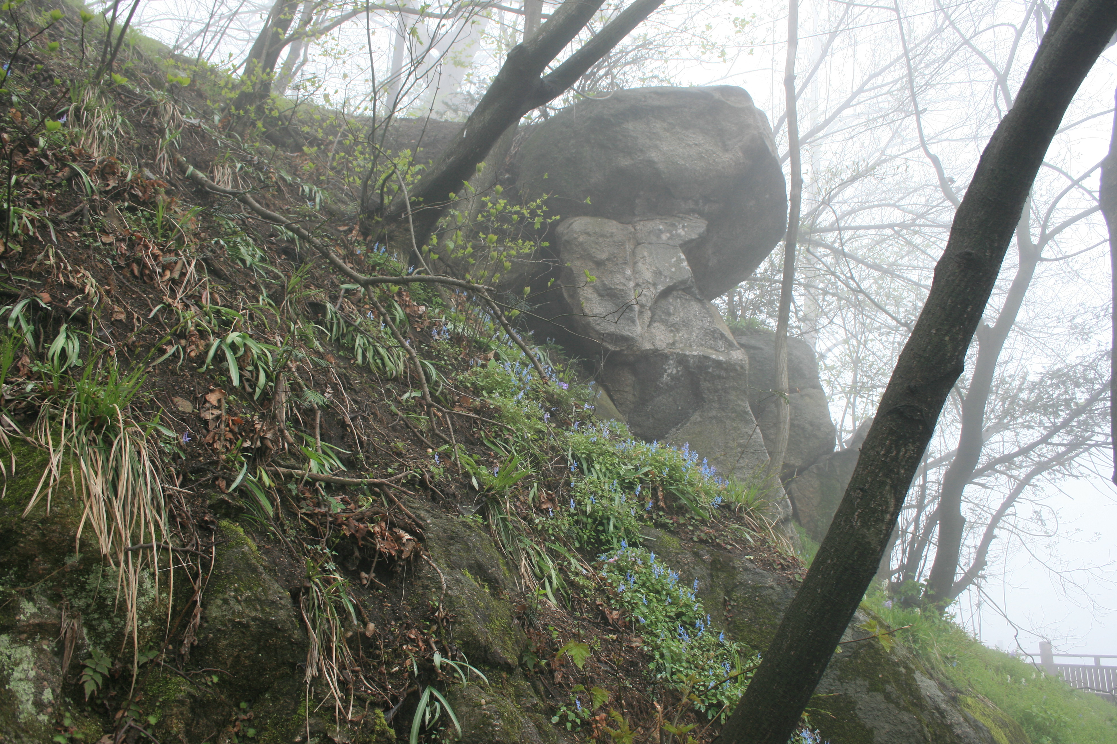
Walking on the Anhui side is dominated by ticketed scenic areas (景区) inside the Huanggang–Dabieshan and Tianzhushan UNESCO Global Geoparks. Most trails are paved stone-step paths with cable cars, in-park sightseeing buses and glass walkways; the wildest hiking — Yaoluoping’s Duozhijian summit ridge and the upper Baima Jian reserve trails — is on rougher forest path. Forest cover is dense subtropical broadleaf with extensive bamboo, rhododendron on the high ridges, and named granite tor outcrops on Tianzhushan and Mingtang Shan.
The walking season runs mid-March to mid-November. April–May is azalea (杜鹃) season on the summit ridges; July–August is hot, humid and crowded; late October to mid-November is the autumn-colour peak. December through February brings cold temperatures, occasional snow above 1,500 m and partial cable-car closures, but Tianzhushan and Mingtang Shan stay open year-round.
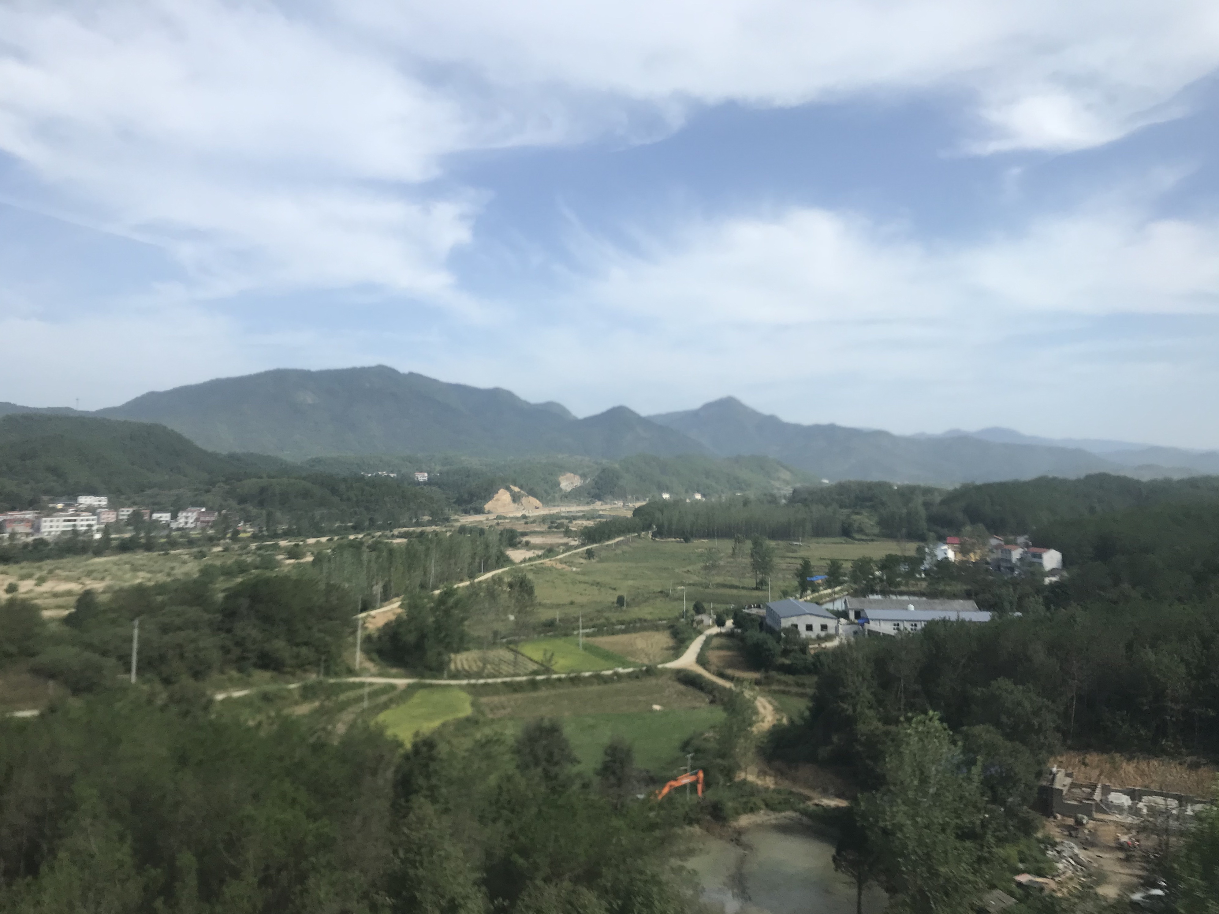
Access is well-served by China’s high-speed rail network. Jinzhai (金寨) and Yuexi (岳西) stations on the Hefei–Wuhan (Hewu) line are the main rail heads for the Lu’an and western Anqing Dabie; Qianshan (潜山) on the Hefei–Anqing line serves Tianzhushan and the eastern Dabie. Mountain trailheads are 30–120 km of county road from the rail stations, served by combinations of intercity bus, county tourist shuttle and taxi. The dense paved-road network across the Anhui interior means most scenic-area gates are reachable by car within 90 minutes of an HSR station.
Selection rationale
Five day-hikes are presented, spanning the geographic range of the Anhui Dabie from Jinzhai in the west to Qianshan in the east. The selection balances the true high summits (Baima Jian, Duozhijian) with the better-known geological showpieces (Tianzhushan, Mingtang Shan) and one wider-valley reservoir circuit (Foziling) that gives context for the engineered Yangtze-tributary landscape that surrounds the range. Tianzhushan is included on the Anhui Dabie side following the consensus of Baidu Baike, the UNESCO Global Geopark designation and Britannica, despite English Wikipedia’s outlier framing.
The cross-border Tiantangzhai summit is selected for the Tiantangzhai and the Hubei side entry rather than here, to avoid duplicating routes that walk the same ridge from both province’s tickets. Routes inside the Tongbai Mountains (桐柏山) to the west are out of scope: Tongbai is a separate range. The Anhui-Henan Tonghuanggang corridor red-tourism circuits are also out of scope as cultural rather than mountain walking.
Summary
| # | Hike | County | Route type | Distance | Gain | Max elevation | Difficulty |
|---|---|---|---|---|---|---|---|
| 1 | Baima Jian summit via Dabieshan Main Peak | Yuexi (Lu’an) | Out-and-back | ~12 km | ~1,100 m | 1,777 m | Hard |
| 2 | Mingtang Shan three-peaks skywalk loop | Yuexi (Anqing) | Lift-assisted loop | 6–9 km | 600–900 m | 1,563 m | Moderate–hard |
| 3 | Tianzhushan — Mystery Valley and Tianchi Peak | Qianshan (Anqing) | Lift-assisted loop | 7–9 km | 600–800 m | 1,426 m | Moderate–hard |
| 4 | Yaoluoping — Duozhijian summit | Yuexi (Anqing) | Out-and-back | 10–14 km | 700–900 m | 1,721 m | Moderate–hard |
| 5 | Foziling Reservoir crest and Qingfeng Ridge | Huoshan (Lu’an) | Loop | 8–11 km | 350–500 m | ~700 m | Moderate |
1. Baima Jian summit via Dabieshan Main Peak Scenic Area
Snapshot
Itinerary
From the visitor centre, the in-park sightseeing bus runs the lower switchback to Longjingguan (龙井关), a saddle at ~1,100 m. From there the marked stone-step trail climbs west through dense bamboo and broadleaf forest, passing the Dragon-Well Spring (龙井) and the small Baima Temple (白马寺) at ~1,400 m. The route gains a sharper east ridge to the Baima Jian summit cairn at 1,777 m, where a stone marker confirms the range’s high point. The upper ridge is rougher than the lower stone-step trail — broken granite, occasional handlines on the steepest sections — but does not require technical equipment in summer conditions. Return is the same line; consider walking out below Longjingguan to skip the sightseeing-bus return.
Why it is essential
Baima Jian is the highest summit in the Dabie Mountains — taller than Tiantangzhai (1,729 m), Duozhijian (1,721 m) and Tianzhushan (1,488 m) — and the only true high-summit day in central China that crosses the 1,700 m line outside the major national parks. The summit ridge gives panoramic views east into the deeper Anhui interior and south to the Yangtze-tributary lowlands. The scenic area is less commercialised than Tianzhushan or Tiantangzhai, with fewer cable cars and a more straightforward up-and-down character.
Equipment
- Sturdy hiking boots; the upper ridge has rough granite and loose scree
- Trekking poles for the long descent
- Wind shell and warm layer (summit temperatures 10–12 °C below trailhead)
- 2.5 L water (limited resupply above Baima Temple)
- Headlamp for shorter winter days
- Microspikes if walking November–March
Hazards and notes
- Long stair descent is the dominant injury vector; pacing is more important than fitness.
- Summit ridge exposed to wind and lightning; descend immediately if thunderstorms develop.
- Mobile coverage is intermittent above Longjingguan.
- Scenic-area opening hours typically 07:30–17:00; late starts are not viable for a summit return.
- Light ice and rime on the summit ridge from late November through February.
2. Mingtang Shan three-peaks skywalk loop
Snapshot
Itinerary
From the visitor centre the cable car climbs to a saddle at ~1,300 m. The walking circuit then follows the summit ridge between Mingtang Shan’s three named summits — Mingtang (明堂, 1,563 m), the principal peak; Lao Ye Ling (老爷岭, 1,540 m), the central peak; and Bald Stone Peak (光石顶), the eastern peak. The connecting ridge carries an engineered timber-and-glass skywalk that hangs over the south face cliffs at ~1,500 m. From Bald Stone Peak, the standard descent drops south through dense forest on a stone-step trail to the lower sightseeing-bus stop; alternatively the cable car retraces the ascent.
Why it is essential
Mingtang Shan is the second-highest single-day summit in the Yuexi Anhui Dabie after Baima Jian and the only Anhui-side hike with a continuous summit-to-summit skywalk. The three-peaks ridge gives the most sustained ridge-walking views in the range and the cliff-edge geology — exposed Sinian-era metamorphic — is striking in the right light. Crowds are lighter than at Tianzhushan; the scenic area is 4A rather than 5A and less heavily marketed.
Equipment
- Hiking shoes for stone steps
- Wind shell on the exposed skywalk
- Sun protection
- Cash for cable car (separate ticket from scenic-area entry)
- Warm layer in shoulder season
- Trekking poles for the foot descent
Hazards and notes
- Skywalk sections close in high wind; the cable car follows.
- Glass walkway requires shoe covers (provided, ~10 RMB).
- Visitors with vertigo can bypass the skywalk via a parallel stone-step alternative.
- Forest descent is long and steep; trekking poles recommended.
- Scenic-area opening hours typically 08:00–17:00.
3. Tianzhushan — Mystery Valley and Tianchi Peak
Snapshot
Itinerary
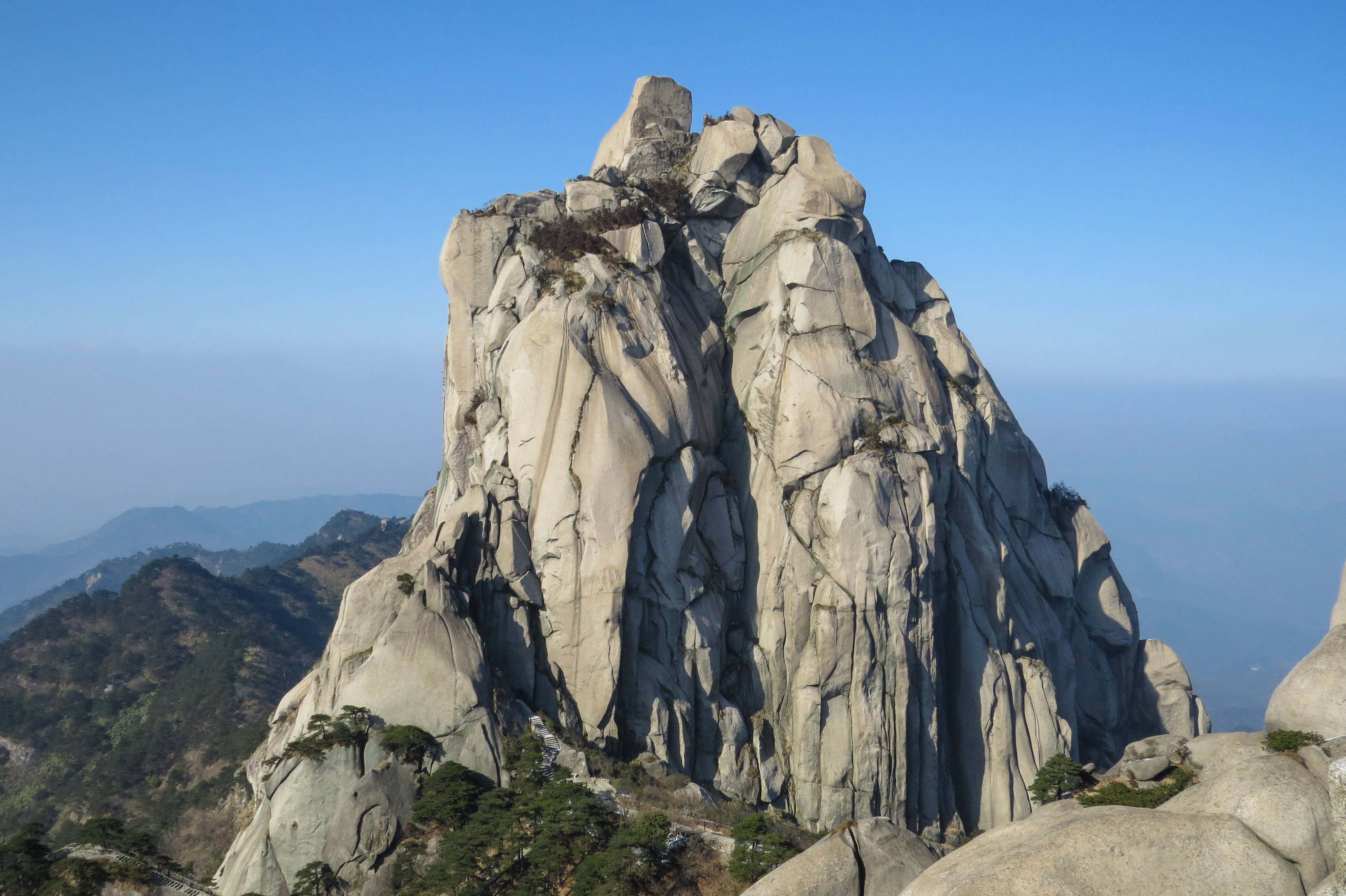
From the west-gate visitor centre, the in-park sightseeing bus climbs to the lower cable-car station at Hechangyu (河长峪). The cable car carries walkers to Zhenfeng Saddle (振风岭) at ~1,200 m. From the upper station, the stone-step trail climbs through granite tor formations to Tianchi Peak (天池峰, 1,426 m), the highest summit accessible to walkers on Tianzhushan; the iconic Tianzhu Peak (天柱峰, 1,488 m) spire is visible from the summit platform but is roped off. Return descends through Mystery Valley (神秘谷, Shenmi Gu) — a labyrinth of granite boulder corridors, cave passages and ladder sections — emerging at Alchemy Lake (炼丹湖, Liandanhu), a small mountain reservoir at ~1,100 m. From Alchemy Lake the lower stone-step trail descends past Wuxin Cave and the East-Slope Tea Garden back to the cable-car station for descent.
Why it is essential
Tianzhushan is the most-photographed granite massif in central China outside Huangshan and the geological showpiece of the Anhui Dabie. The Tianzhu Peak spire is one of the canonical landmarks of central China, the central granite intrusion of an exposed Sinian-era metamorphic core complex, and the anchor of a UNESCO Global Geopark. The Mystery Valley boulder labyrinth is an experience peculiar to this mountain — a rare karst-like passage through a granite massif — and the loop combining cable car, summit, and valley descent is the canonical Tianzhushan day.
Equipment
- Sturdy hiking shoes with grippy soles for slick stone steps
- Headlamp (Mystery Valley caves and tunnels are unlit)
- Light gloves for ladder rails
- Wind shell
- 2 L water (the only resupply is at Alchemy Lake)
- Trekking poles useful on the descent
Hazards and notes
- Mystery Valley narrows to body-width passages in places; large packs catch.
- Wet steps after rain are the main injury vector.
- Cable car queues run 90+ minutes on national holidays.
- Tianzhu Peak summit is roped off; do not attempt the final 10 m of granite.
- Scenic-area opening hours 07:00–17:30 peak season, 08:00–16:30 low season.
4. Yaoluoping — Duozhijian summit
Snapshot
Itinerary
From the Yaoluoping reserve management station, the route follows a forest track north past the Yaoluo Bridge (瑶落桥) and the Tianhe Brook, then turns up a marked trail through dense mixed broadleaf forest. The trail climbs steadily to the Yaoluoping Plateau (瑶落坪) at ~1,400 m — a small high-elevation grassland that gives the reserve its name — and then ascends the secondary ridge to Duozhijian (多枝尖) at 1,721 m. The summit is the second-highest point in the entire Dabie range (after Baima Jian 1,777 m) and gives clean ridge views west toward Tiantangzhai and south to the wider Dabie interior. Return is the same line; an alternative ridge descent toward Tianhe is possible but unmarked.
Why it is essential
Yaoluoping is the wildest day-hike option on the Anhui Dabie, set inside a national nature reserve rather than a ticketed scenic area. The walking is on genuine forest trail, not paved stone steps, and the reserve protects one of the most complete subtropical broadleaf-forest ecosystems in central China — habitat for golden eagle, leopard cat and clouded leopard. Duozhijian is the only second-place Dabie summit reachable by a marked day-hike rather than a ridge traverse, and it is the closest the Anhui Dabie comes to a Western national-park hike.
Equipment
- Sturdy boots; trail surface is forest soil and rock, not stone steps
- Long trousers and long sleeves (dense undergrowth, ticks in summer)
- Insect repellent
- 2.5 L water (no resupply on trail)
- Navigation (offline OSM track and compass); signage is in Chinese only
- Headlamp; the descent is long
- Personal Locator Beacon recommended
Hazards and notes
- Navigation is the main hazard; the upper ridge has multiple braided paths.
- Reserve permit may be required for entry at certain times of year; check at the management station.
- Mobile coverage is patchy on the upper ridge.
- Wildlife — snakes, ticks, occasional macaques — is more present than at the ticketed scenic areas.
- Roar season (March–April) brings reserve patrols and possible access restrictions.
5. Foziling Reservoir crest and Qingfeng Ridge
Snapshot
Itinerary
From the visitor centre, the route walks the crest of Foziling Dam (佛子岭水坝) — a 75 m-high multi-arch concrete dam completed in 1954, one of the first large hydroelectric structures of the People’s Republic and a national heritage industrial monument. The crest gives a 400 m level walk above the reservoir with views west into the lower Dabie. At the far end, a stone-step staircase climbs through pine forest to the Qingfeng Ridge (青风岭) crest at ~700 m, a low forested ridge on the north-east side of the reservoir. The ridge trail follows the crest for ~3 km past several stone pavilions, dropping into a side valley and rejoining the reservoir road back to the dam.
Why it is essential
Foziling is the only Dabie day-walk that combines a major engineered Yangtze-tributary landscape with a low forest ridge. The dam is the regional landmark of the lower Lu’an Dabie and a recognised mid-century industrial heritage site; the reservoir’s seasonally exposed terraces and the surrounding forest give a context that the high-summit days lack. As a hike it is honestly a half-mountain, half-cultural circuit — included as the regional contextual walk rather than as a summit objective.
Equipment
- Light hiking shoes
- Water and snack
- Sun protection (dam crest is exposed)
- Cash for entry to the dam interpretive centre (optional)
Hazards and notes
- Dam crest is fenced but can be windy; high winds occasionally close the crest walk.
- Reservoir-edge sections can flood briefly during summer storms.
- Macaques along the Qingfeng Ridge are present; do not feed.
- The dam museum has limited opening hours; confirm at the visitor centre if interested.
Routes excluded as out of scope
The following sit inside the Anhui Dabie footprint but fall outside a day-hike entry, or duplicate routes covered on neighbouring sub-region pages.
- Tiantangzhai summit (1,729 m). The Anhui-Hubei border peak. The Jinzhai (Anhui) side ascent is covered in the Tiantangzhai and Hubei-side Dabie entry rather than here, to avoid double-listing the same ridge.
- Baima Grand Canyon (白马大峡谷). Sits inside the Jinzhai Tiantangzhai 5A scenic area and is covered in the Tiantangzhai entry.
- Yanzihe Grand Canyon (燕子河大峡谷). Honestly a ticketed sightseeing walk rather than a hike; covered in the Tiantangzhai entry as a contextual route.
- Mount Wugong (武功山). A Jiangxi peak frequently confused with Anhui destinations; out of scope.
- Multi-day Dabieshan National Forest Trail (大别山国家森林步道) sections. The 840 km long-distance trail crosses Anhui but is a multi-stage tramp, not a day-hike.
External links
| Source | URL |
|---|---|
| Anhui Provincial Department of Culture and Tourism | ct.ah.gov.cn |
| Dabieshan Main Peak Scenic Area — Baima Jian | dbszf.com |
| Tianzhushan UNESCO Global Geopark — official | tianzhushan.cn |
| Wikipedia — Tianzhushan (Anhui) | en.wikipedia.org |
| Wikipedia — Dabie Mountains | en.wikipedia.org |
| Britannica — Tianzhu Shan | britannica.com |
| Baidu Baike — Baima Jian (白马尖) | baike.baidu.com |
| Baidu Baike — Mingtang Shan (明堂山) | baike.baidu.com |
| Baidu Baike — Yaoluoping National Nature Reserve | baike.baidu.com |
| Baidu Baike — Foziling Reservoir (佛子岭水库) | baike.baidu.com |
| Yuexi County government | yuexi.gov.cn |
| Qianshan County government | qianshan.gov.cn |
| UNESCO Global Geoparks — Huanggang Dabieshan | unesco.org |
| OpenStreetMap (ODbL 1.0) | openstreetmap.org |