Regional overview
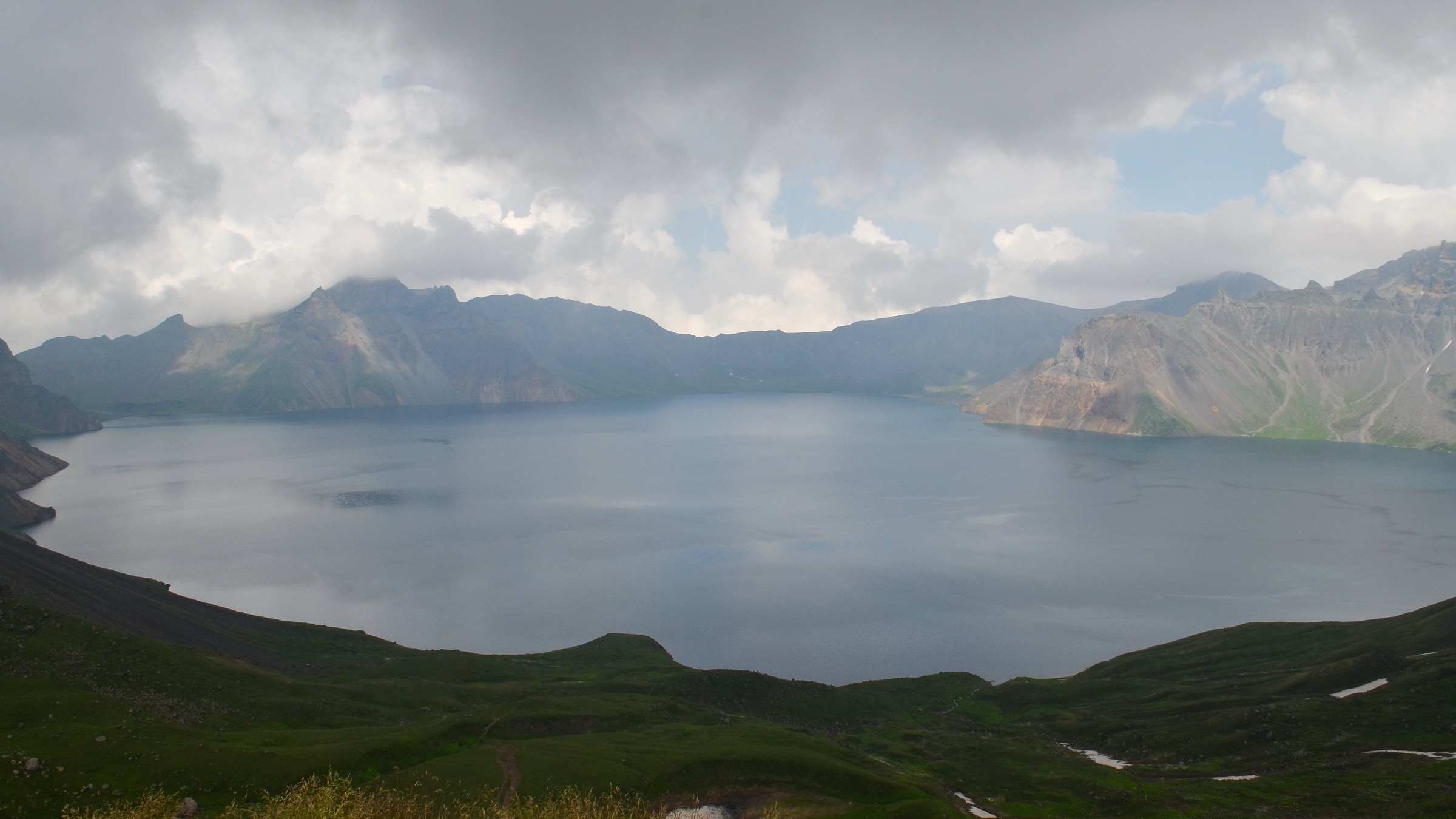
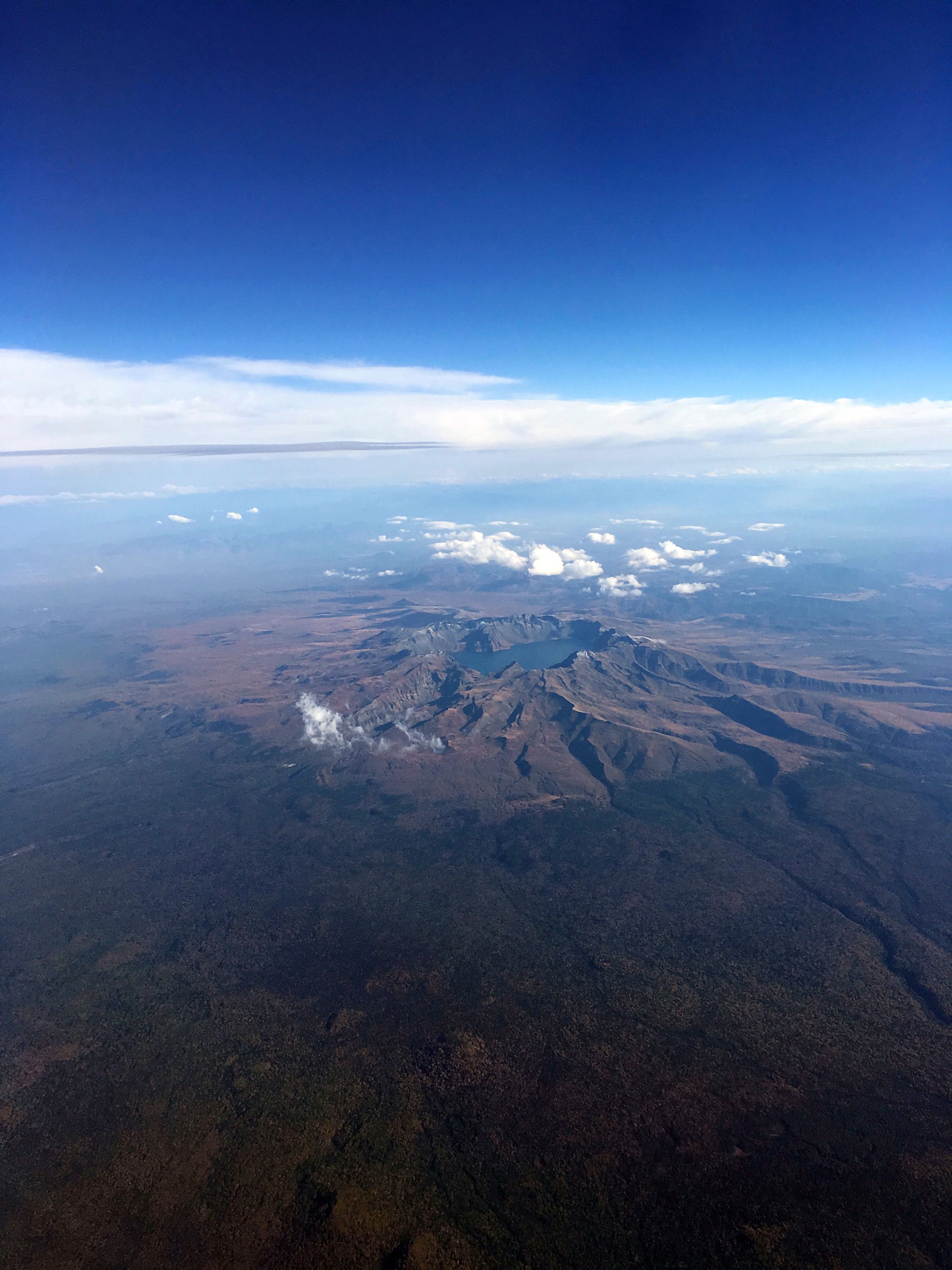
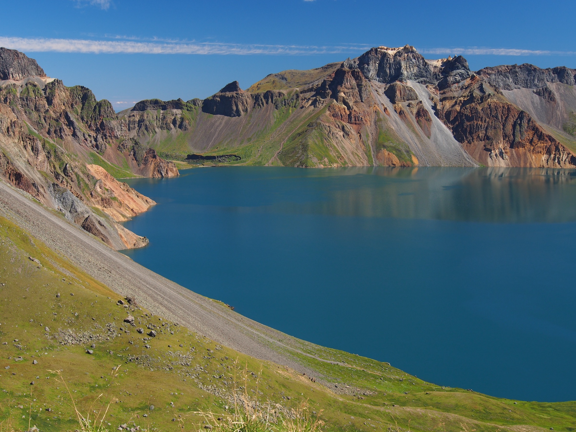
The West Slope (西坡 / West Scenic Area) is the more open, shuttle-and-stair side of Changbai Shan in Jilin province — the volcanic caldera around Tianchi (Heaven Lake) approached from the Fusong side rather than through Erdaobaihe on the North Slope. It is known for the broadest Chinese-side view of Tianchi, wide open volcanic slopes, seasonal alpine flower meadows, the Jinjiang Grand Canyon, the small crater lake at Wangchi, and the Ladder River / Tizihe gorge stop. Compared with the North Slope, the west side offers a wider Tianchi panorama but fewer major waterfall features.
Access follows the same scenic-area model as the North Slope. Visitors buy a park ticket at the West Slope distribution centre and use internal scenic buses to reach the individual walking areas; there is no through-road self-drive access and no verified legal free-hiking above the managed routes. Almost every “hike” in this catalogue is therefore a short walking segment inside a longer bus-based day, and route lengths, stair counts and opening hours can change with scenic-area operations.
Two data limitations shape this entry. First, DOC-style official GPX/KML files do not exist for the West Slope routes in the sources checked; where a route file is referenced it comes from OpenStreetMap ways or nodes and is flagged as source-map only. Second, elevation profiles and full seasonal opening windows are unresolved for several of the short walks (Alpine Garden, Iris Garden, Ladder River). The Tianchi west stair figure of 1,442 steps is widely cited in traveller sources; the west Tianchi rim viewpoint sits around 2,450–2,500 m and needs on-the-ground DEM confirmation. The catalogue reports the numbers it has verified and marks the gaps rather than filling them.
The sibling Changbai / Manchurian Mountains entry covers the North Slope Tianchi, Changbai Waterfall and Julong Hot Spring corridor. This West Slope entry is the paired sub-region article for Jilin’s other main scenic-area gateway.
Selection rationale
The five selections cover the West Slope’s essential accessible features. The 1,442-step Tianchi stair is the defining west-side hike and the reason most parties come. The Jinjiang Grand Canyon boardwalk is the major non-Tianchi landform on the west side. Wangchi is the quieter crater-lake-and-forest counterpoint. The Alpine Garden / Iris Garden meadow walk is the seasonal botanical stop the west side is known for. The Ladder River / Tizihe gorge is a short but standard stop on the west scenic sequence, kept for completeness while route metrics remain unresolved.
Summary
| # | Hike | Trailhead | Route type | Distance | Max elevation | Difficulty |
|---|---|---|---|---|---|---|
| 1 | West Slope Tianchi 1,442-step viewpoint | West Slope Tianchi shuttle drop-off | Stair out-and-back | ~1.5–2 km return | ~2,450–2,500 m (unresolved) | Moderate |
| 2 | Jinjiang Grand Canyon boardwalk | Jinjiang Grand Canyon shuttle stop | Boardwalk loop | ~1.5–1.8 km | Not verified | Easy–Moderate |
| 3 | Wangchi Trail | Wangchi shuttle stop | Lake boardwalk / forest walk | ~1.6 km (OSM) | Not verified | Easy |
| 4 | Alpine Garden and Iris Garden walk | Alpine Garden / Gaoshan Huayuan shuttle stop | Seasonal meadow boardwalk | ~1–2 km (unresolved) | Not verified | Easy |
| 5 | Ladder River / Tizihe walk | Tizihe scenic stop | Short gorge / viewpoint stop | <1 km (unresolved) | Not verified | Easy |
1. West Slope Tianchi 1,442-step viewpoint
Snapshot
Itinerary
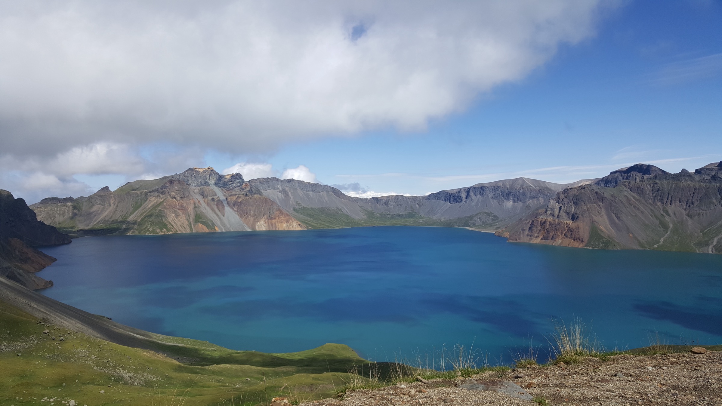
From the West Slope shuttle drop-off, the route climbs the long stairway — widely cited as 1,442 steps — to the west Tianchi viewpoint on the crater rim, then returns the same way. The stair is exposed to weather from the moment it leaves the shuttle stop.
Why it is essential
This is the defining West Slope hike — the classic stair ascent to what is generally described as the broadest Chinese-side panorama of Tianchi.
Equipment
- Sturdy walking shoes
- Windproof shell, warm layer
- Sun protection
- 1.5 L water
- Microspikes if there is any risk of ice on the stairs
Hazards and notes
- Tianchi may be hidden by cloud even in fine weather down at the West Slope entrance
- High wind, lightning risk, snow or crowd-control rules can close the stair route
- Altitude — the top sits around 2,450–2,500 m; pace accordingly
- Route only makes sense within the scenic-area shuttle operating window
2. Jinjiang Grand Canyon boardwalk
Snapshot
Itinerary
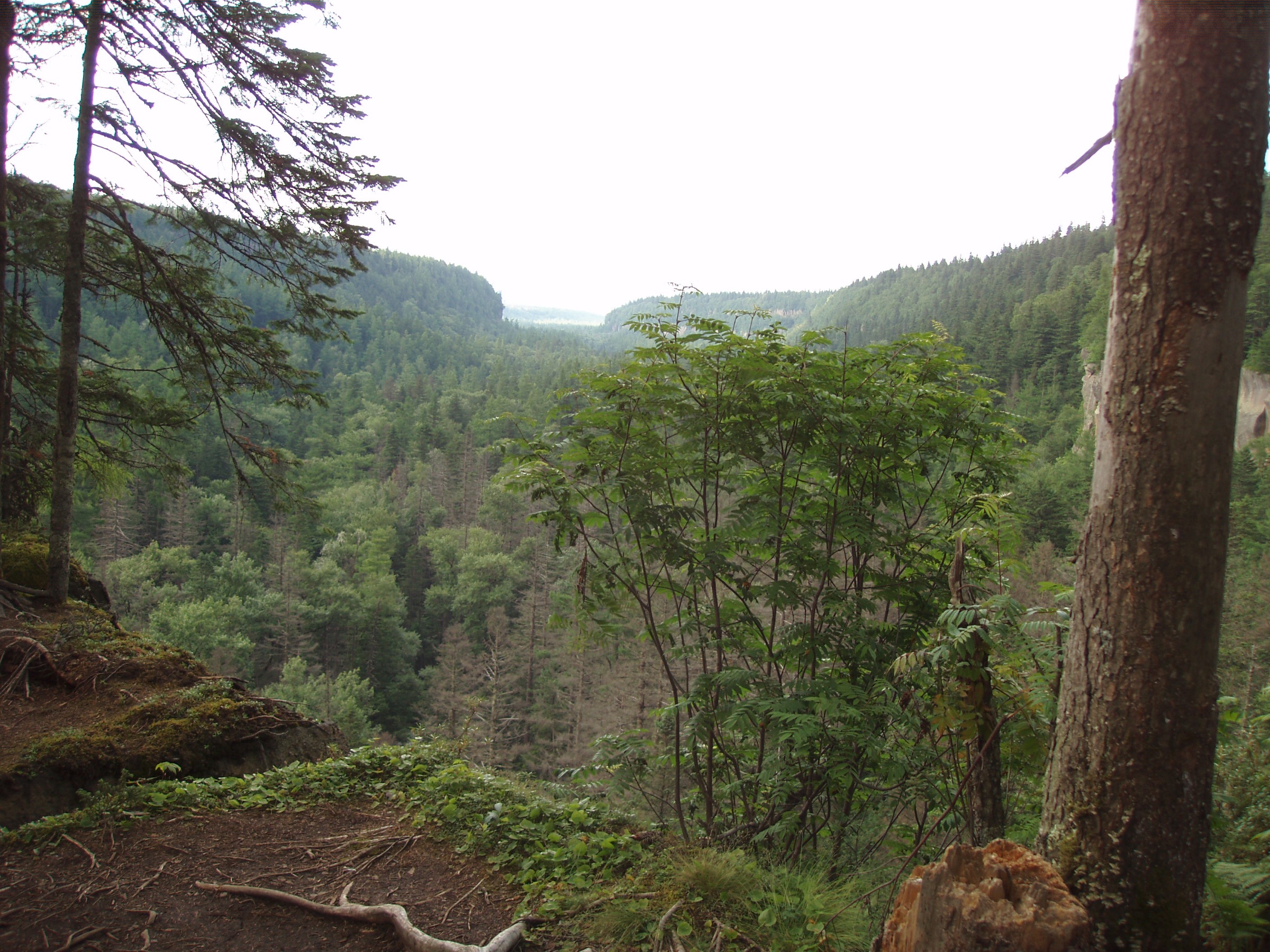
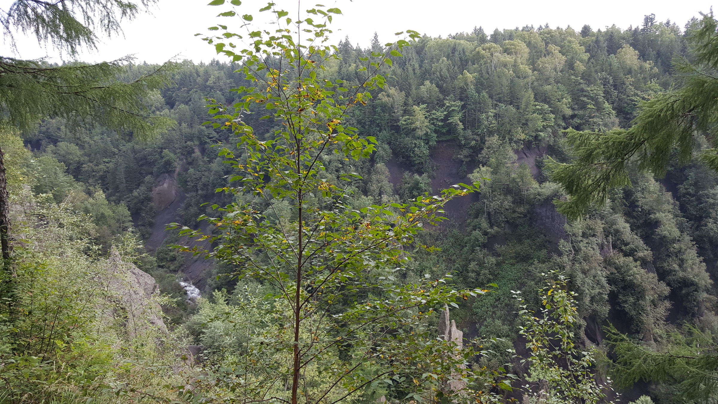
The boardwalk loops through forest to viewpoints over the Jinjiang Grand Canyon — a steep volcanic-ash and lava-eroded canyon on the West Slope — and returns through the managed boardwalk system.
Why it is essential
Jinjiang Grand Canyon is the major non-Tianchi landform on the West Slope and a strong geological contrast to the crater rim: dry volcanic-ash walls, columnar cliffs and steep drop-offs rather than the open caldera view.
Equipment
- Walking shoes with good grip
- Light waterproof layer
- 1 L water and a snack
Hazards and notes
- Canyon edges are protected by boardwalks and railings — stay inside the managed route
- Wet timber can be slippery
- Route sits inside the scenic-area operating window and can be closed for weather or maintenance
3. Wangchi Trail
Snapshot
Itinerary
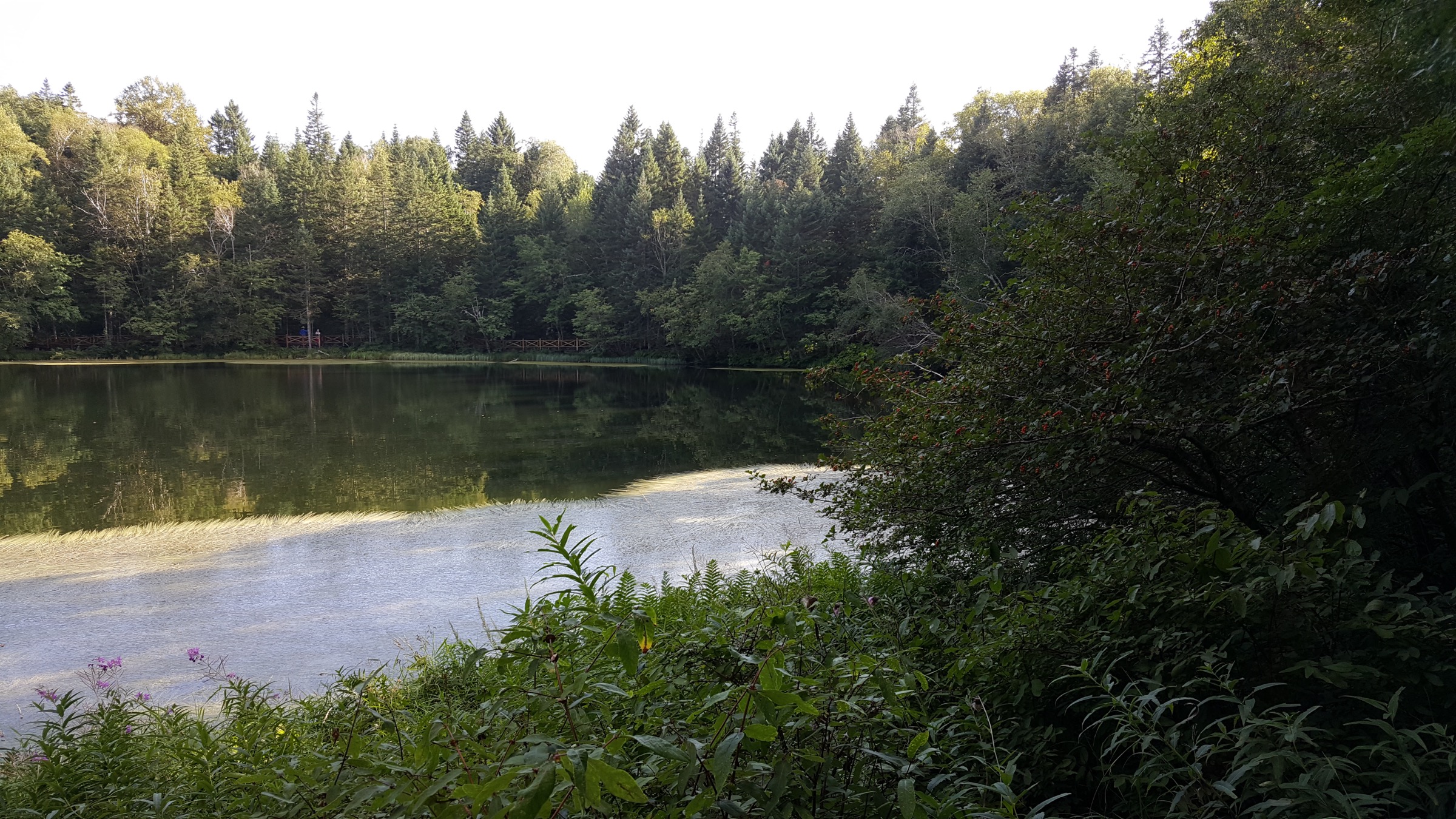
The route follows the Wangchi footway through West Slope forest to the small crater lake and returns through the managed path system.
Why it is essential
Wangchi is the quieter lake-and-forest side of the West Slope — a balance to the exposed Tianchi stair route and the harder-lined Jinjiang Grand Canyon walk.
Equipment
- Walking shoes
- Light waterproof layer
- 1 L water and a snack
Hazards and notes
- May be closed seasonally or in poor weather
- Elevation profile is unverified — treat time budgets as approximate
- Route depends on scenic-area shuttle operations
4. Alpine Garden and Iris Garden walk
Snapshot
Itinerary
The walk uses the managed meadow paths around the Alpine Garden and the nearby Iris Garden when the seasonal flower areas are open. It is primarily a short botanical boardwalk rather than a mountain trail.
Why it is essential
The West Slope is known for its alpine flower displays — the reason many summer visitors come to the west side rather than the north — and this walk is the sector’s seasonal botanical stop, absent from the North Slope catalogue.
Equipment
- Walking shoes
- Sun protection
- Windproof layer
Hazards and notes
- Opening is seasonal and can close once flowering ends or for conservation
- Stay on the boardwalks in meadow areas
- Route metrics remain unresolved — treat time budgets as approximate
5. Ladder River / Tizihe walk
Snapshot
Itinerary
The walk visits the Ladder River / Tizihe scenic stop on the West Slope road system, using short managed paths and viewpoints around the narrow river-and-gorge feature.
Why it is essential
Although very short, Tizihe is part of the standard West Slope scenic sequence and adds a compact fluvial volcanic-landform stop to the region.
Equipment
- Walking shoes
- Light waterproof layer
Hazards and notes
- Route length and elevation profile remain unresolved in the pass sources
- Access depends on scenic-area operations — the stop can be skipped in bad weather or during flow surges
- Stay on marked viewpoints near the gorge edge
Missing data / follow-up work
- No official GPX or KML downloads found for any of the five West Slope routes.
- The West Slope Tianchi stair could not be matched to a clean OpenStreetMap way in this pass; the 1,442-step figure and the ~2,450–2,500 m rim elevation both come from traveller sources and need DEM and on-the-ground confirmation.
- Alpine Garden, Iris Garden and Ladder River / Tizihe need official route lengths, elevation profiles and seasonal opening confirmation.
- Licence-compatible imagery was not found on Wikimedia Commons for the Alpine / Iris Garden meadows or the Ladder River gorge. The Jinjiang Grand Canyon image used here is credited on Commons simply as “Changbai canyon” from the same 2017 West Slope trip that produced the west-Tianchi shots by the same author; the identification as Jinjiang Grand Canyon is an inference and should be verified before publication on a print product.
- Access, ticketing and shuttle rules at the West Slope distribution centre change seasonally and are confirmed locally, not from static maps.
Further reading
| Resource | Link |
|---|---|
| UNESCO — Changbaishan Biosphere Reserve | unesco.org |
| OpenStreetMap — Jinjiang Grand Canyon footway (way 1033437069) | openstreetmap.org |
| OpenStreetMap — Wangchi footway (way 1033437071) | openstreetmap.org |
| OpenStreetMap — Alpine Garden node (9521767689) | openstreetmap.org |
| OpenStreetMap — Iris Garden node (9521292008) | openstreetmap.org |
| OpenStreetMap — Ladder River / Tizihe node (9521767687) | openstreetmap.org |
| OSM copyright / ODbL licence | openstreetmap.org/copyright |
| Trip.com — Jinjiang Valley / West Slope attractions | trip.com |
| Wikipedia — Baekdu Mountain / Changbai | en.wikipedia.org |
| Wikimedia Commons — Changbai Mountains | commons.wikimedia.org |