Regional overview
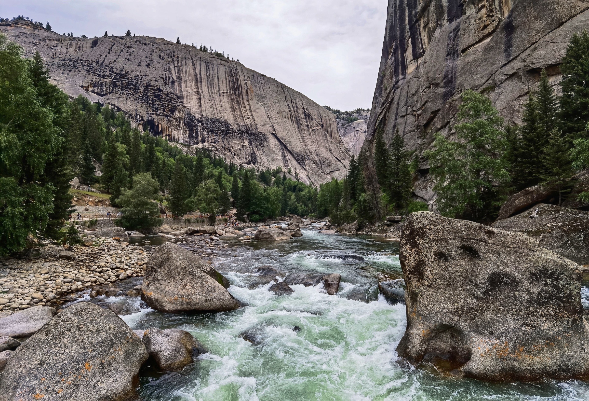
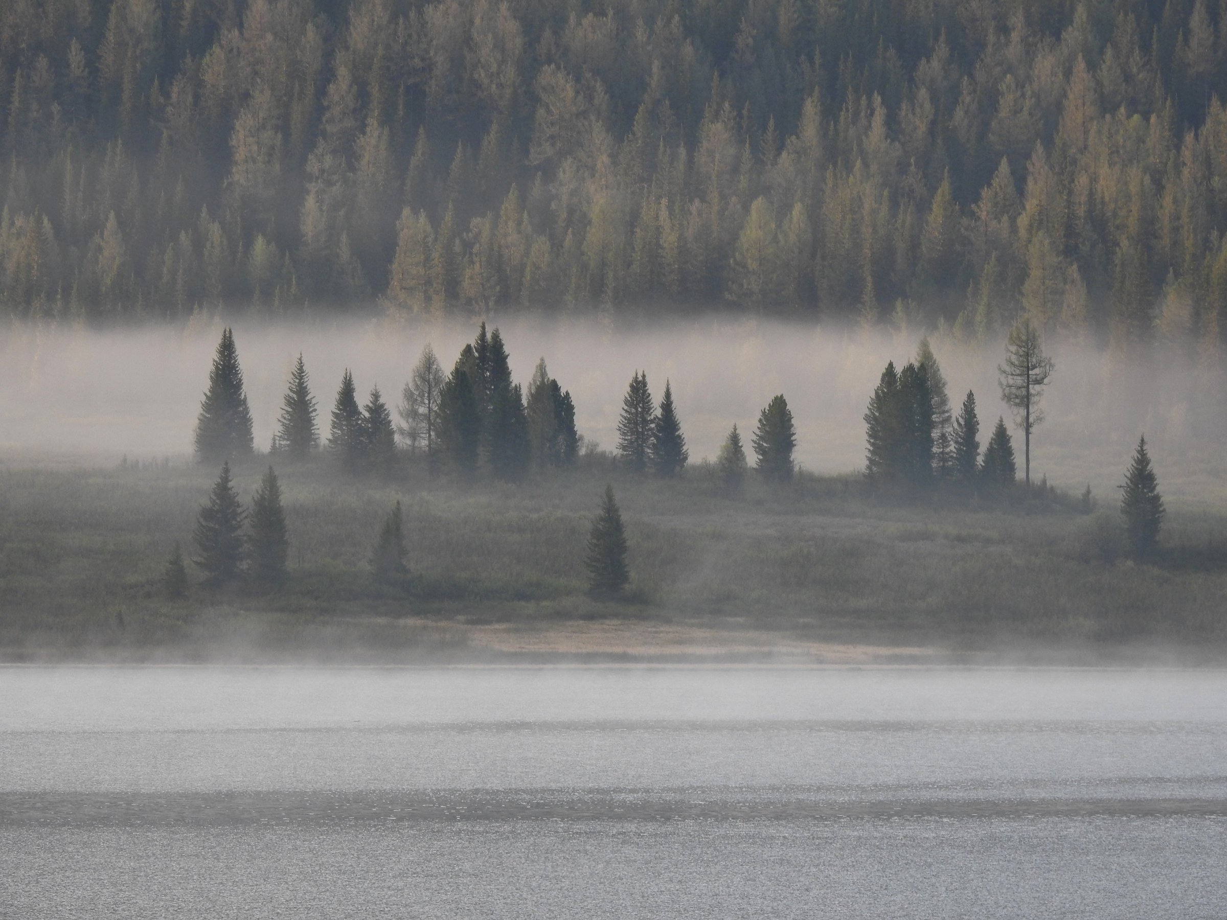
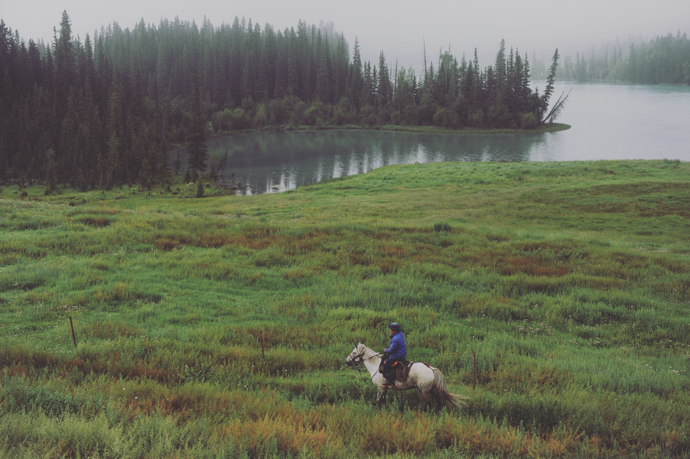
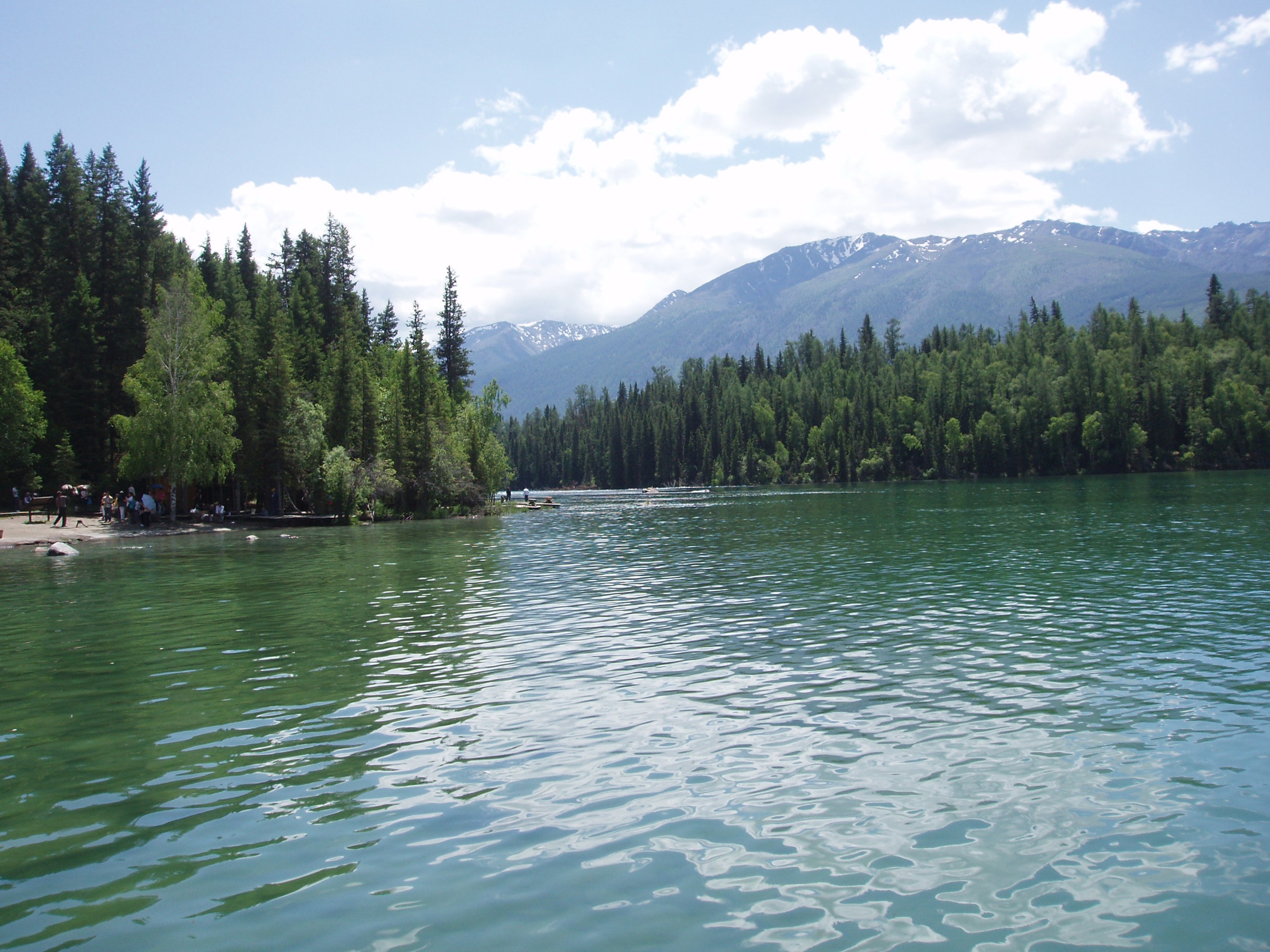
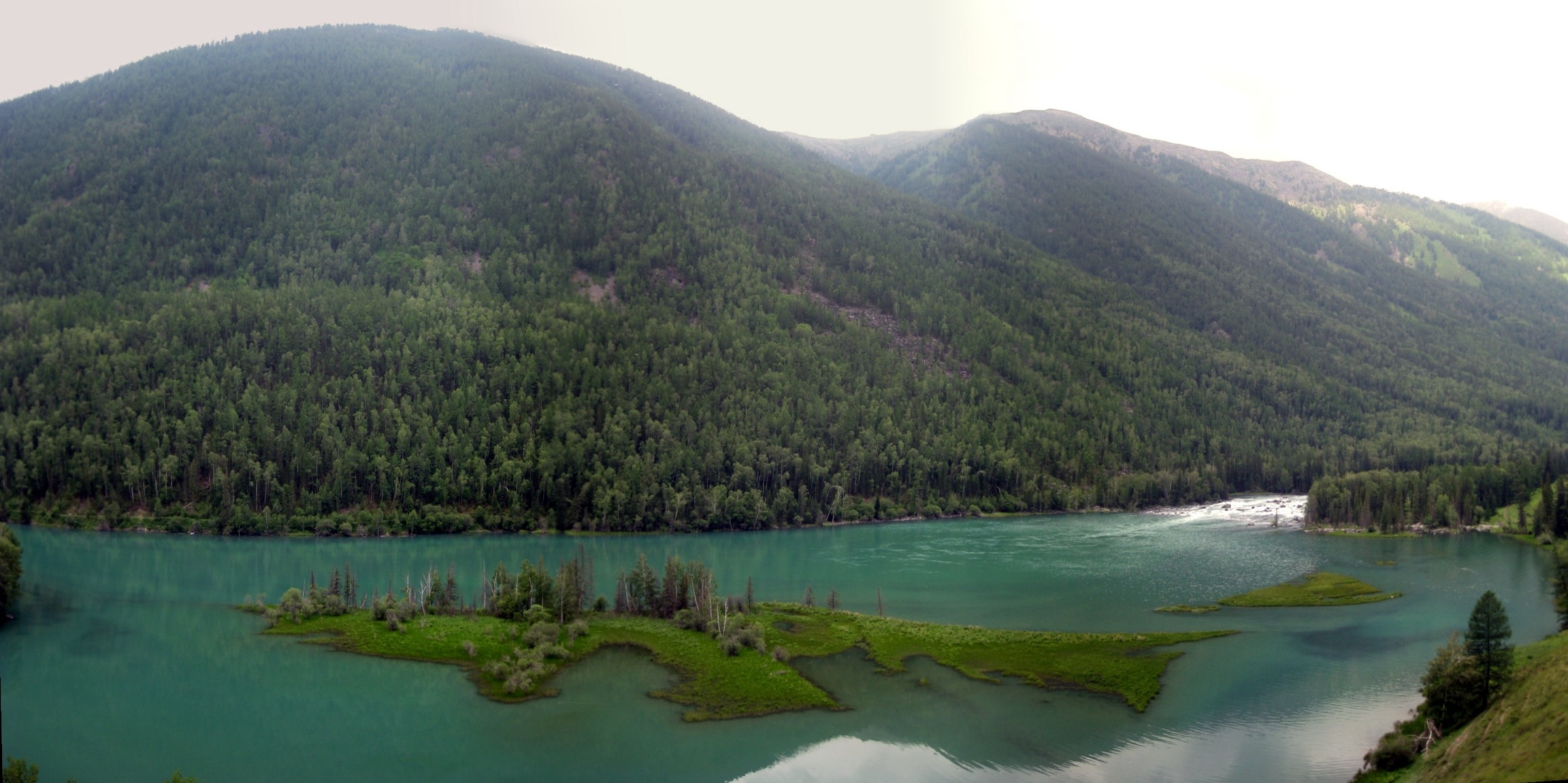
The Kanas region occupies the forested Chinese Altai around Kanas Lake, the Kanas River and the upper Burqin / Irtysh drainage in northern Xinjiang. Walking here is a mix of managed scenic-area paths, lake and river boardwalks, shuttle-assisted viewpoints, taiga forest trails and a small number of rougher guided routes into side valleys and high lakes. The landscape is fundamentally Siberian: spruce-and-larch taiga, glacial trough lakes, peat moorland and grassy river bends, with the Friendship Peak (Youyi Feng) massif rising on the border with Kazakhstan, Russia and Mongolia.
Kanas is not an open-access Alpine trailhead system. The main scenic area is ticketed and usually depends on official shuttle buses between Jiadengyu, Kanas Village, the Three Bays, Kanas Lake and the Fish-watching Tower approach. Private vehicles are generally restricted inside the scenic area during busy periods. Current shuttle stops, opening times, walking permissions and seasonal closures must be checked locally on the day of the walk.
The normal hiking season runs from late spring to autumn. China Discovery describes April to October as suitable for Kanas hiking, while China Xian Tour cites June to August as the official recommended period for some hiking routes and notes that outdoor adventure activities are generally prohibited from November to the following May. Early snow, long winter conditions, icy boardwalks and large day-night temperature swings are important planning factors. Access by road is via Burqin and Jiadengyu, normally reached by long-distance bus or transfer from Altay City and the regional airport. Kanas is the lake-and-taiga end of a wider Altay walking landscape that also includes the Hemu and Baihaba village valleys and the Keketuohai geopark on the Irtysh headwaters.
Selection rationale
Five walks are selected to cover the essential Kanas walking spectrum: the classic Three Bays river-boardwalk, the taiga lake-shore trail to Tulek (Tuluke) rock art, the high Fish-watching Tower panorama, a more demanding Old Village to Black Lake side-valley route, and a short Kanas village and lake-outlet boardwalk for the Tuva settlement landscape. The first three have the strongest source support; the last two are included as essential candidates but require local route confirmation before independent use.
Summary table
| # | Hike | Country | Route type | Distance | Gain | Max elevation | Difficulty |
|---|---|---|---|---|---|---|---|
| 1 | Three Bays plank road: Fairy Bay, Moon Bay and Wolong Bay | China | Shuttle-assisted linear walk | ~4.5–6 km | Minor | unresolved | Easy–moderate |
| 2 | Taiga Trail / Double Lake Pier to Tulek Rock Art | China | Out-and-back | ~5.5–10 km | unresolved | near lake level | Easy–moderate |
| 3 | Fish-watching Tower / Guanyu Pavilion ascent | China | Shuttle-assisted out-and-back | steps + access path | unresolved | ~2,056 m | Moderate |
| 4 | Kanas Old Village to Black Lake | China | Guided out-and-back side-valley route | ~12.5 km one way | unresolved | ~2,000 m | Hard |
| 5 | Kanas Village and lake-outlet boardwalk | China | Short loop / out-and-back | unresolved | Minor | unresolved | Easy |
No official park GPX or KML has been located for any of the five walks. The Kanas Scenic Area administration publishes ticketing and shuttle information but does not release machine-readable route files. OpenStreetMap geometry exists for the principal landmarks and access roads but not for every signed foot line. On-site GPS capture remains the only way to record an accurate route line.
1. Three Bays plank road: Fairy Bay, Moon Bay and Wolong Bay
Snapshot
Itinerary
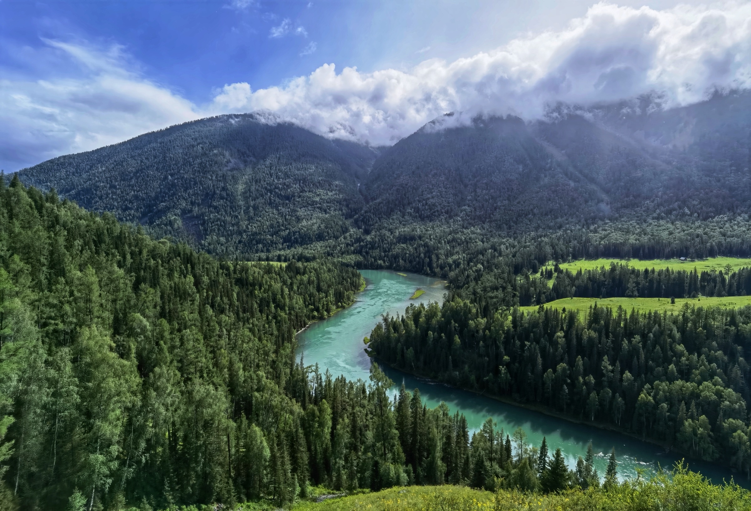
The route follows the Kanas River through the Three Bays area, linking Fairy Bay (神仙湾, Shenxian Wan), Moon Bay (月亮湾, Yueliang Wan) and Wolong Bay (卧龙湾, Wolong Wan, “Sleeping Dragon Bay”) by wooden walkway and riverside path. The walk stays close to the river bends, wetlands and forested banks, with scenic-bus stops at each named bay so that walkers may begin or end at any of them. The defining viewpoint is Moon Bay, where the river turns through a tight S-bend between forested terraces and is overlooked from the eastern plank road.
Published distances are source-dependent. Asia Odyssey describes Fairy Bay to Wolong Bay as about 4.5 km one way; China Discovery and China Xian Tour describe the same Three Bays plank-road section as about 6 km. The discrepancy probably reflects different start points and whether every viewpoint spur is included. The line is best walked north to south so that the river is on the right and the major viewpoints face the walker.
Why it is essential
The Three Bays is the most accessible classic walk in Kanas. The turquoise river, the S-shaped Moon Bay, forest reflections and seasonal colour are all concentrated in a short, manageable day-hike that gives the canonical lower-valley landscape without requiring the full lake or tower itinerary.
Equipment
- Walking shoes or light boots
- Weatherproof shell — wind and rain on the open river bends
- Warm layer
- Water and snacks
- Sun protection
- Phone or paper map for shuttle stops
Hazards and notes
Boardwalks and steps may be slippery after rain, frost or early snow. Crowding is significant in autumn and at peak shuttle times. Stay on constructed paths to protect the river-edge vegetation. Current shuttle schedules and walking permissions should be confirmed on the day; pedestrian sections between bays are sometimes restricted at peak times to manage flow.
Further reading
- Asia Odyssey Travel — Kanas Lake guide
- China Discovery — Kanas hiking tour
- China Xian Tour — Kanas Lake hiking routes
- Wikipedia — Kanas Lake
2. Taiga Trail / Double Lake Pier to Tulek Rock Art
Snapshot
Itinerary
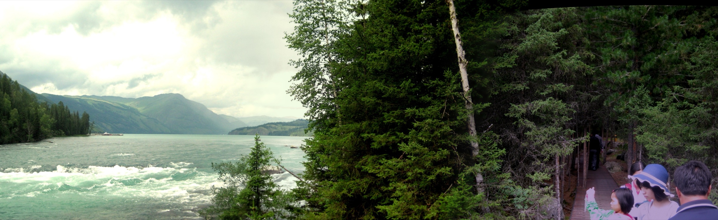
From the Kanas Lake shore or the Double Lake Pier area, the signed Taiga Trail enters the lakeside forest along the eastern shore. China Discovery describes the line as a plank road following the eastern shore through Siberian spruce forest, root-carving scenery and taiga moorland before reaching the Tuluke Rock Painting. The route returns by the same plank road; there is no formal loop.
Published distances are inconsistent. China Xian Tour gives 5.5 km round trip from Double Lake Pier to Tulek Rock Art, while China Discovery describes the plank road itself as about 5 km one way, returning by the same line. Both figures should be retained until the current scenic-area map can be cross-checked on the ground.
Why it is essential
This is the principal forest-and-lake-shore walk at Kanas. It provides close contact with the taiga vegetation, the lake edge and a small set of well-known rock art panels at Tuluke, complementing the lower Three Bays river walk and the high Fish-watching Tower viewpoint.
Equipment
- Grippy walking shoes
- Rain/wind shell
- Warm layer
- Water and food for a full day
- Sun protection
- Navigation backup
- Insect repellent in midsummer
- Gloves and hat for shoulder seasons
Hazards and notes
Wet boardwalks, frost and fallen branches can make the forest path slippery. Mosquitoes and ticks may be present in warmer months. Access to pier areas and shuttle stops may vary by season and visitor volume. Do not approach or touch the rock art panels and follow any roped-off interpretive corridor at the Tuluke site.
Further reading
3. Fish-watching Tower / Guanyu Pavilion ascent
Snapshot
Itinerary
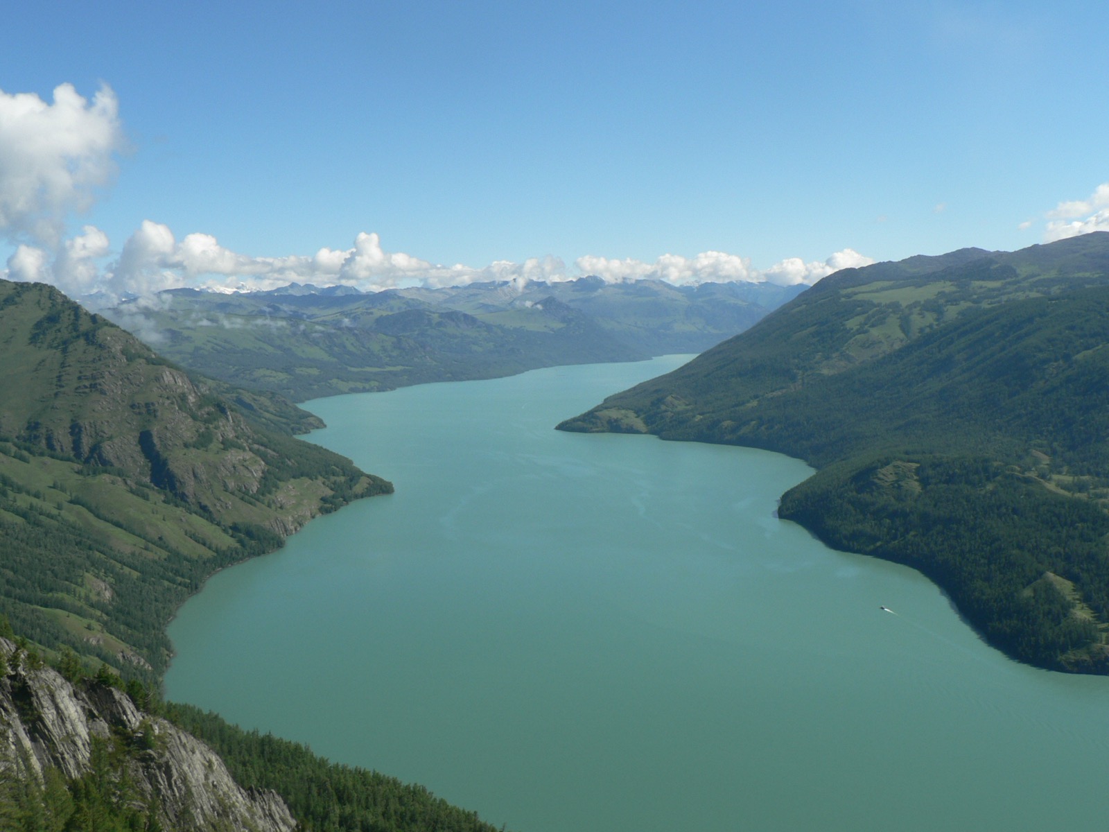
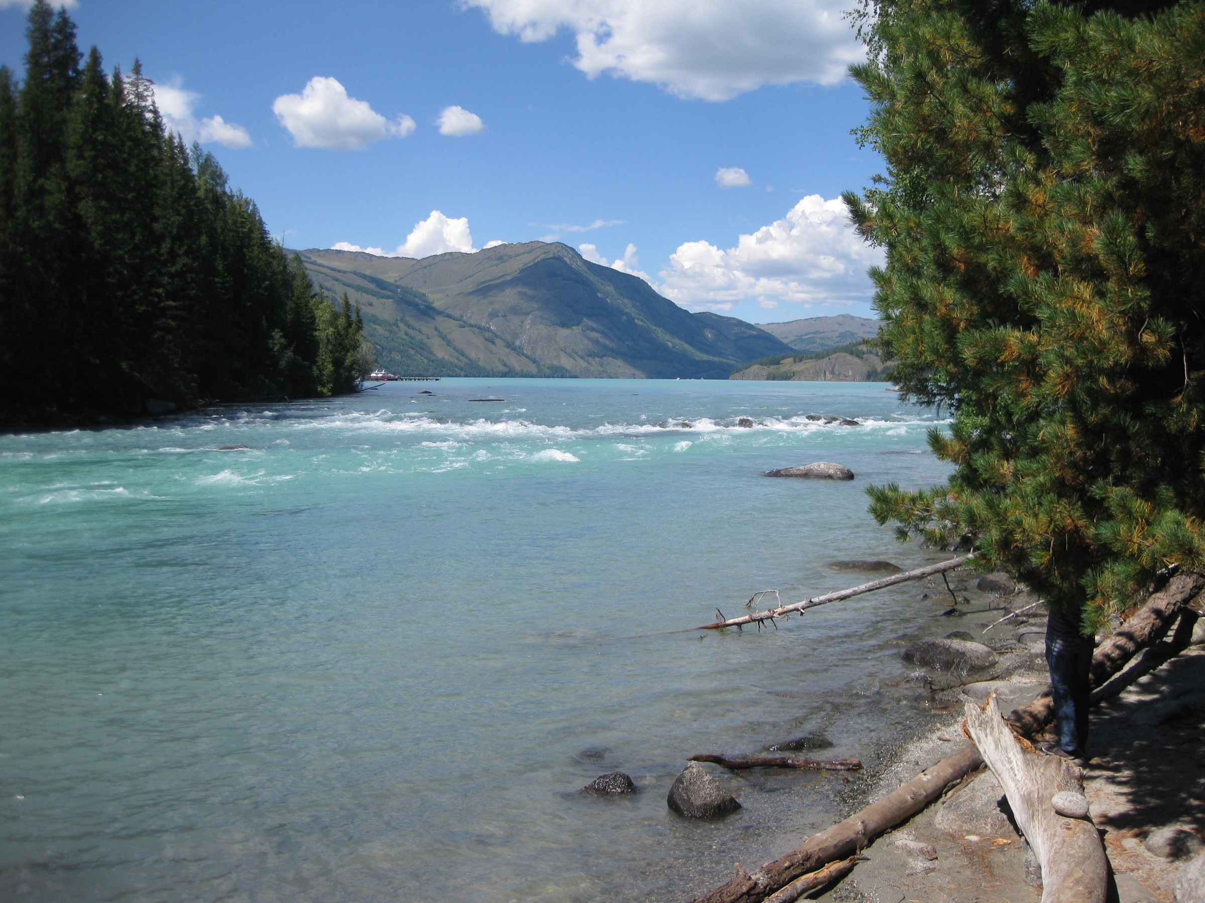
The standard ascent uses official scenic-area transport from the Jiadengyu Transfer Center to the Guanyu Terrace shuttle stop, then climbs the stepped path to the ridge-top viewing platform. China Discovery describes the Fish-watching Tower (观鱼亭, Guanyu Ting) as the highest visitor location in the Kanas Scenic Area, stating that it stands at 2,056 m near the outlet of Kanas Lake and that about 1,000 steps lead to the tower. The platform looks south down the full length of Kanas Lake, with the Friendship Peak massif on the horizon to the north.
A fully pedestrian route from the lakeside has not been confirmed for current access rules. Any longer lower-start walking variant should be checked locally before being substituted for the standard shuttle-assisted ascent.
Why it is essential
The tower provides the defining Kanas panorama: the long glacial trough lake, the forested outlet valley and distant views towards Friendship Peak (Youyi Feng) on the China–Kazakhstan–Russia–Mongolia border. No other viewpoint in the scenic area gives the lake in its full length.
Equipment
- Sturdy walking shoes with good grip — steps are often wet or icy
- Windproof shell — wind on the ridge is constant
- Warm mid-layer regardless of season
- Water and snacks
- Sun protection
- Headlamp if walking near dawn or sunset
Hazards and notes
The stepped ascent is fully exposed to wind and weather. Icy steps can make the route unsuitable outside the main season. Shuttle queues and changing ticket rules are likely in peak periods. Do not use informal shortcuts on the hillside; the slope is fragile and the cordon is enforced.
Further reading
4. Kanas Old Village to Black Lake
Snapshot
Itinerary
The route leaves the more visited Kanas village and lake area for Black Lake, a higher and more remote side-valley objective above the main scenic trail network. China Xian Tour lists Kanas Old Village to Black Lake as a recommended hiking route, giving 12.5 km one way, 4–6 hours of walking, about 2,000 m route altitude, and noting that a local guide is required.
Because available sources describe only the one-way leg and no legal GPX, current trailhead, return transport or permit details have been located, this route should not be treated as ready for independent use. It is retained as an essential candidate because it is one of the few documented rougher day routes in the Kanas sector and represents the more primitive forest-and-side-valley character beyond the boardwalks.
Why it is essential
This route represents the more primitive Kanas walking character beyond the boardwalks and scenic buses: forest, side-valley terrain and higher lake scenery. It adds a serious option for experienced walkers in a region that is otherwise dominated by managed viewpoint paths.
Equipment
- Sturdy boots
- Trekking poles
- Waterproof and windproof shell
- Insulating layer and spare warm top
- At least 2 litres of water plus a full day’s food
- Map, compass and GPS backup
- Headtorch and spare batteries
- First-aid kit
- Locally arranged guide and any required permit paperwork
Hazards and notes
Do not attempt without confirming seasonal opening, guide requirements, route condition and return logistics. Snow, mud, river crossings, poor waymarking and the absence of shops or shelters are all significant factors. A one-way 12.5 km route can become a 25 km day if no legal return transport is available. Mobile signal is unreliable across the side-valley sector.
Further reading
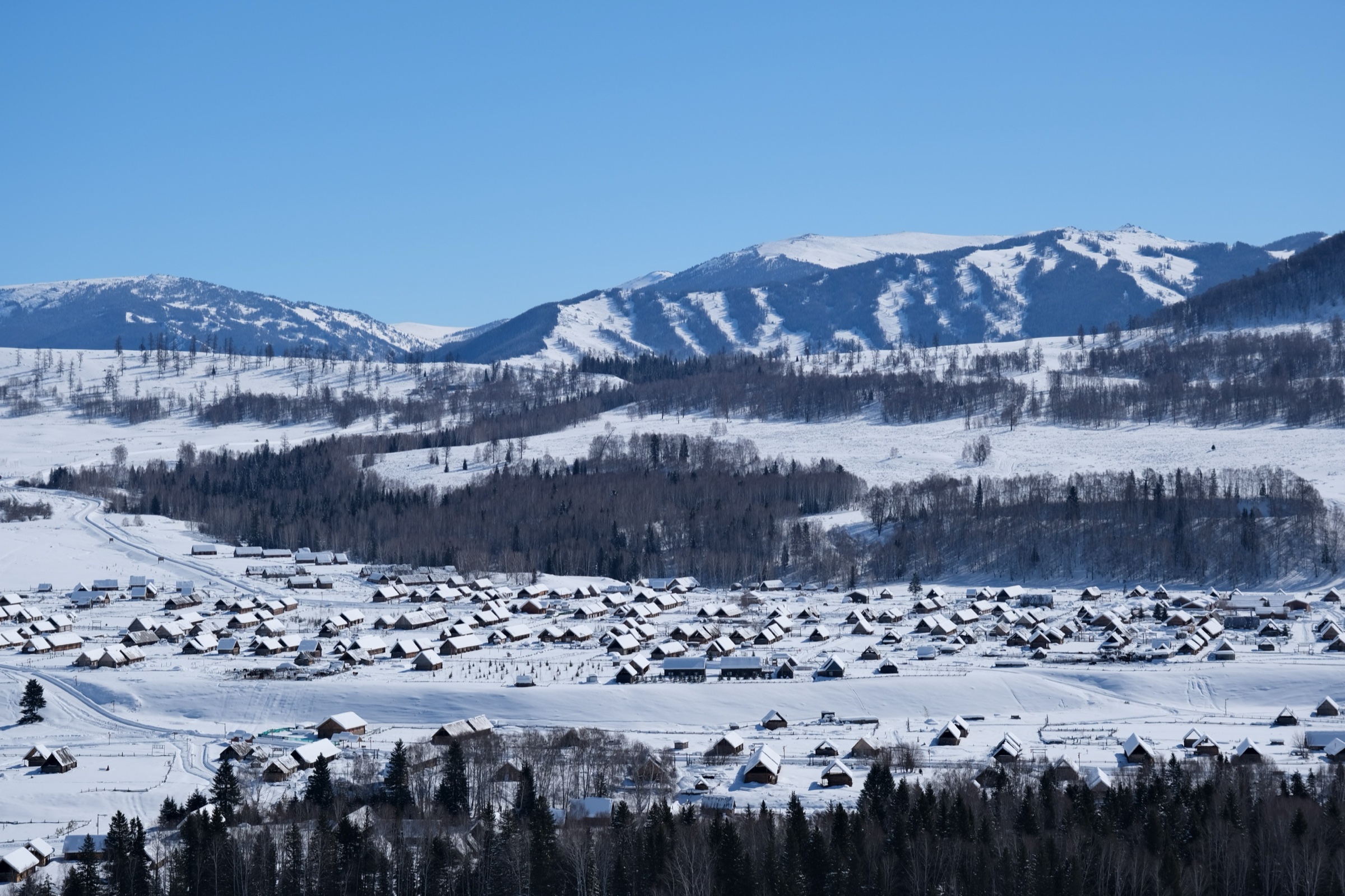
5. Kanas Village and lake-outlet boardwalk
Snapshot
Itinerary
This short cultural walk links the Kanas Village lanes, the lake-outlet and riverbank area and the nearby boardwalk sections. China Xian Tour identifies the Kanas lakeside boardwalks and forest trails as part of the in-park walking experience, while TravelChinaGuide confirms Kanas Village and transfer-centre shuttle access and the small inventory of in-park accommodation.
No official route statistic or downloadable route file has been located. The walk is included as a candidate because it represents the Tuva village and Kanas outlet landscape, but it needs field mapping or a current scenic-area walking map before independent use.
Why it is essential
A Kanas catalogue limited to viewpoints and boardwalks misses the human landscape of the reserve. This short walk covers the everyday settlement area inside the scenic area — village houses, river outlet, forest edge and lake-front — and is the natural complement to the three viewpoint routes above.
Equipment
- Comfortable walking shoes
- Warm layer and rain shell
- Water
- Sun protection
- Headlamp for dawn or evening starts
Hazards and notes
Respect village privacy and use only public paths. Boardwalks may be icy or wet outside summer. Shuttle access and overnight-stay rules inside the scenic area can change; confirm both at the Jiadengyu gate before relying on an early or late departure.
Further reading
Missing data / follow-up work
- No official GPX or KML has been located for any of the five walks. The Kanas Scenic Area administration publishes ticketing and shuttle material only; on-site GPS capture is the only route to reliable route geometry.
- Hike 1 (Three Bays): distances diverge between Asia Odyssey (~4.5 km) and China Discovery / China Xian Tour (~6 km); current scenic-area maps should be checked for exact start/end and permitted pedestrian sections.
- Hike 2 (Taiga Trail / Tulek): distance diverges between China Xian Tour (5.5 km round trip) and China Discovery (~5 km plank road one way, returning by the same line).
- Hike 3 (Fish-watching Tower): the walking distance for the current shuttle-assisted start is not formally published; the 1,000-step ascent is the only confirmed walking element.
- Hike 4 (Old Village to Black Lake): requires local confirmation of guide requirements, legal access, return logistics and seasonal opening.
- Hike 5 (Kanas Village / lake-outlet walk): remains a candidate until field-mapped or matched to a current official scenic-area walking route.
- Elevation gain and loss are unresolved for all routes.
Further reading
| Source | URL |
|---|---|
| China Discovery — Kanas Hemu Village hiking tour | chinadiscovery.com |
| Asia Odyssey Travel — Kanas Lake guide | asiaodysseytravel.com |
| China Xian Tour — Kanas Lake | chinaxiantour.com |
| TravelChinaGuide — Kanas Nature Reserve | travelchinaguide.com |
| Wikipedia — Kanas Lake | en.wikipedia.org |
| Wikipedia — Friendship Peak (Altai) | en.wikipedia.org |
| OpenStreetMap — Kanas Scenic Area | openstreetmap.org |