Regional overview
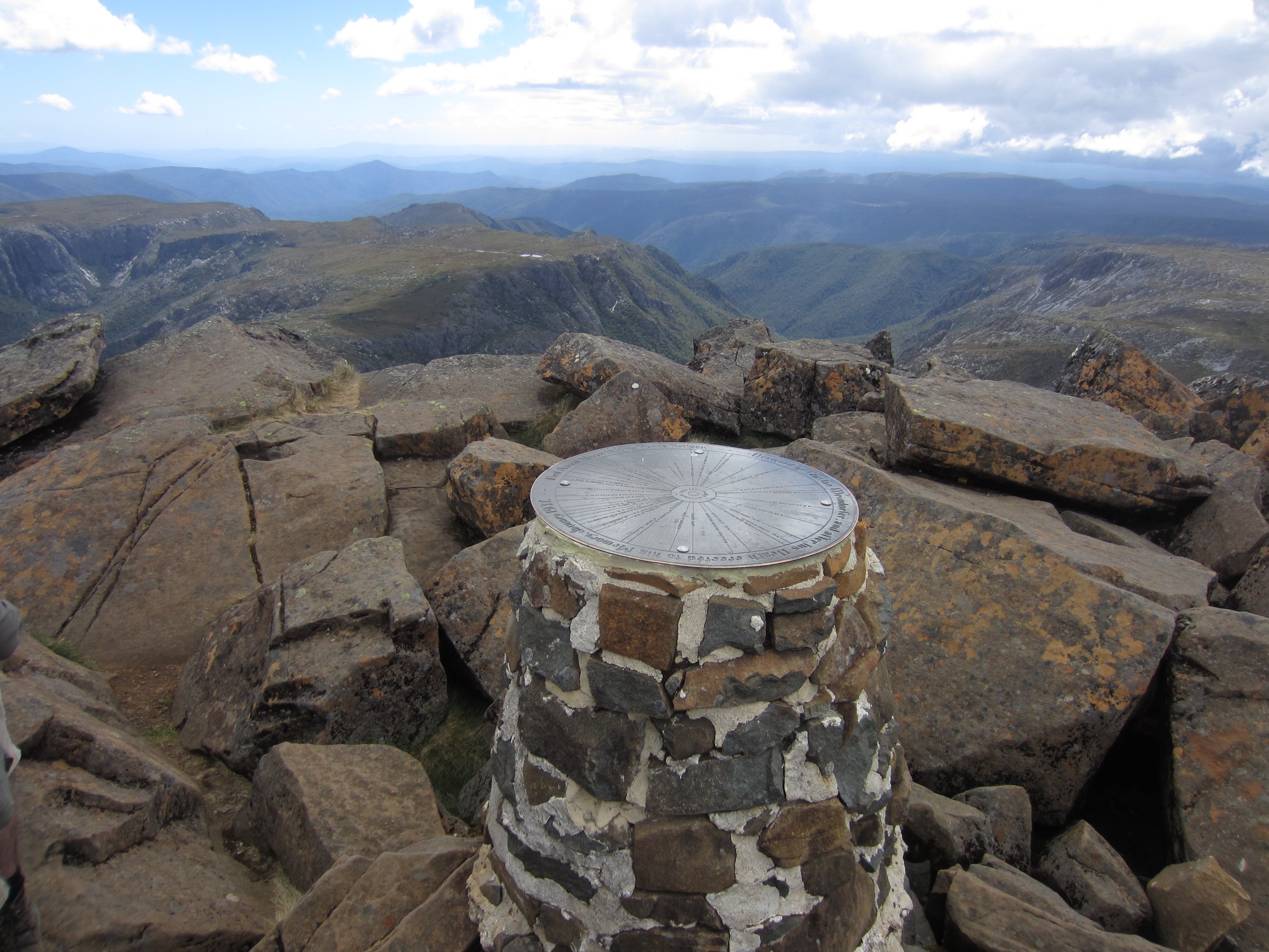
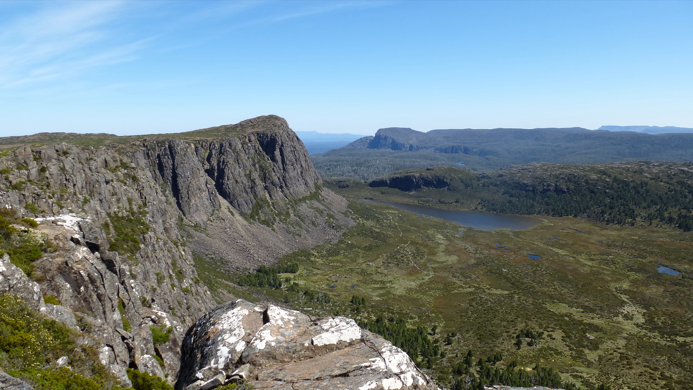
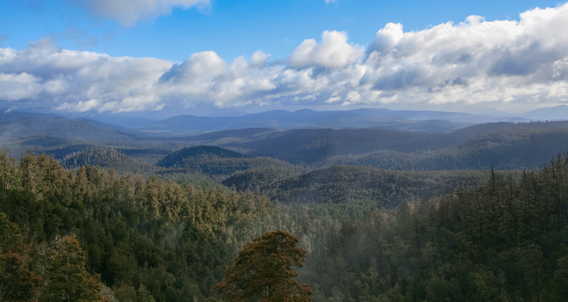
Mount Field National Park sits about 75 km north-west of Hobart in south-central Tasmania, covering roughly 159 km² and rising from cool-temperate rainforest at the Russell Falls precinct (~180 m) to a dolerite highland plateau topped by Mount Field West (1,434 m). The lower park is defined by tall Eucalyptus regnans, myrtle-beech, sassafras and tree-fern gullies drained by Russell, Horseshoe and Lady Barron falls. Above roughly 1,000 m the forest gives way to subalpine woodland dominated by Pandani (Richea pandanifolia) — a giant heath endemic to Tasmania — snow gums, King Billy pine (Athrotaxis selaginoides), and cushion-plant moorland punctuated by Pleistocene glacial cirques and tarns: Lake Seal, Lake Fenton, Lake Dobson, Lake Newdegate, and the Tarn Shelf itself. The upper park sits inside the Tasmanian Wilderness World Heritage Area.
The park is on Big River nation (Palawa) country. Archaeological cave sites in the adjacent Florentine Valley have yielded evidence of Aboriginal occupation reaching back over 35,000 years — among the oldest documented in Australia. Mount Field was proclaimed a national park in 1916 alongside Freycinet, making it one of Tasmania’s two founding national parks. Its combination of accessible waterfalls at the visitor precinct and genuine alpine terrain at Lake Dobson — reached by 16 km of gravel road climbing to 1,033 m — makes it the most compact and versatile day-hiking park in the southern half of Tasmania.
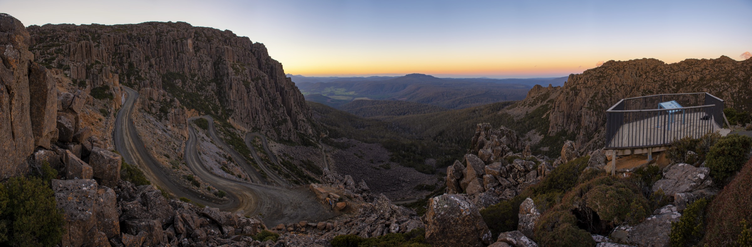
Access from Hobart is via the Lyell Highway and the B62 to the Mount Field Visitor Centre at 66 Lake Dobson Road, National Park — about 1 h 15 min by car. Commercial day tours from Hobart run reliably to the Russell Falls precinct but not to Lake Dobson. Lake Dobson Road climbs 16 km of gravel to the high-country trailhead in about 30 minutes; it is unsuitable for buses and campervans, may require chains, and is subject to snow closures. The winter snowline reliably reaches Lake Dobson and can close the high-country trailhead entirely.
A valid Tasmania Parks Pass is required for all vehicles entering the park; no per-hike booking is required for any of the walks below. Winter turns every high-country walk — Tarn Shelf, Mount Field West, Rodway — into a serious alpine outing with short days, high wind and full snow cover. The low-elevation Three Falls Circuit and the Florentine walks remain year-round. Verify current arrangements at parks.tas.gov.au before travel.
Selection rationale
The five walks were chosen to represent both ends of a genuinely compact park. The Three Falls Circuit is the essential low-elevation walk and one of the most-walked short routes in Tasmania. The Pandani Grove nature walk at Lake Dobson is the essential subalpine short walk and the most efficient way to see mature Pandani. The Tarn Shelf Circuit is the definitive high-country day of the park — deciduous Nothofagus gunnii fagus, glacial tarns and dolerite ridgelines in a single loop. Mount Field West is the park’s summit day, one of the harder day walks in southern Tasmania. The Junee Cave Track in the adjacent Florentine Valley is the essential karst-and-rainforest short walk and the anchor of the low-elevation Florentine landscape.
Summary
| # | Hike | Country | Route type | Distance | Gain | Max elevation | Difficulty |
|---|---|---|---|---|---|---|---|
| 1 | Three Falls Circuit (Russell / Horseshoe / Lady Barron + Tall Trees) | Australia | Loop | 6 km | ~150 m | ~300 m | AWTGS Grade 3 |
| 2 | Pandani Grove nature walk (Lake Dobson) | Australia | Loop | 1.5 km | ~20 m | ~1,050 m | AWTGS Grade 2 |
| 3 | Tarn Shelf Circuit (Lake Newdegate / Twisted Lakes / Twilight Tarn) | Australia | Loop | ~12 km | ~400–450 m | ~1,270 m | AWTGS Grade 3–4 |
| 4 | Mount Field West summit (via Rodway Range and K Col) | Australia | Out-and-back | 17–20 km | ~800–900 m | 1,434 m | AWTGS Grade 5 |
| 5 | Junee Cave Track (Florentine Valley) | Australia | Out-and-back | ~1 km | ~30 m | ~380 m | AWTGS Grade 2 |
1. Three Falls Circuit (Russell / Horseshoe / Lady Barron Falls + Tall Trees)
Snapshot
Itinerary
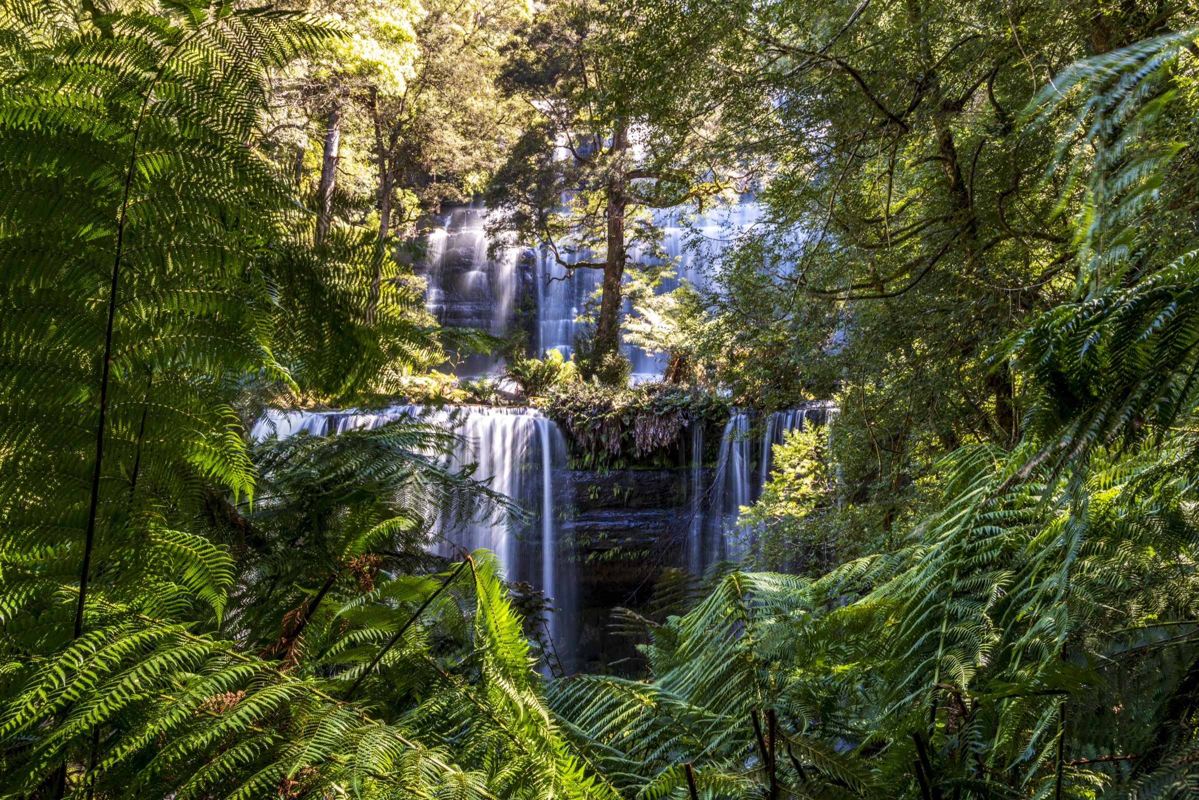
From the Visitor Centre a sealed path follows the Tyenna River south-west to Russell Falls — a three-tiered waterfall dropping around 45 m over sandstone benches, set in tree-fern and myrtle-beech rainforest. A short spur climbs above Russell Falls to Horseshoe Falls, a broad curtain of water at the top of the same drainage. The track then climbs on stone-pitched steps and boardwalk through the Tall Trees precinct, passing mature Eucalyptus regnans — some over 80 m tall.
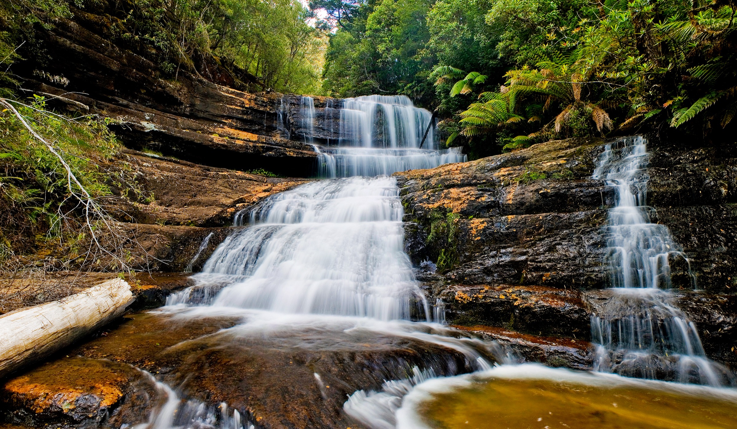
The upper section swings east and drops to Lady Barron Falls on the Broad River, a wider low-angle cascade set in wet eucalypt forest. The return line follows the Lady Barron Falls Track back through open forest to the Visitor Centre. Interpretive signage covers the park’s rainforest ecology, the 1916 gazettal, and the fire history of the Tall Trees stand.
Why it is essential
The Three Falls Circuit is the most-walked short route in Mount Field and is one of the essential low-elevation walks in the southern half of Tasmania. It combines the park’s three signature waterfalls with a Tall Trees precinct in a single manageable loop, and the Russell Falls short walk alone is one of Tasmania’s few genuinely wheelchair-accessible waterfall walks.
Equipment
- Standard hiking shoes or boots
- Weatherproof shell
- Warm layer
- Water: 1 litre per person
- Sun protection
Hazards and notes
Slippery boardwalk after rain. Occasional falling-branch closures in the Tall Trees section — respect any track diversions. Snakes possible in warmer months. Dogs are not permitted. Parks Pass required.
GPX / route file
| Source | URL | Format | Licence / terms | Reuse |
|---|---|---|---|---|
| PWS — Mount Field NP page | parks.tas.gov.au | Web description | Copyright PWS Tasmania | Reference only |
| OpenStreetMap — Three Falls Circuit | osm.org | OSM way data | ODbL | Reusable with attribution |
Sources
- Parks & Wildlife Service Tasmania — Mount Field NP page
- OpenStreetMap — track data
2. Pandani Grove nature walk (Lake Dobson)
Snapshot
Itinerary
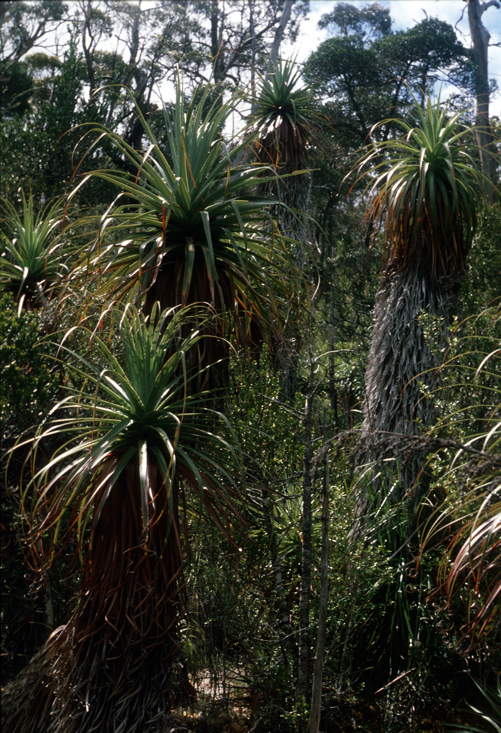
From the Lake Dobson car park the track follows the northern shore of the lake on a well-graded path through subalpine woodland. The dense Pandani grove at the northern end of the lake is the highlight — a stand of mature Richea pandanifolia, a giant heath endemic to Tasmania that resembles a small palm and can reach 12 m in height. The track continues around the lake on boardwalk over cushion-plant moorland with King Billy pine and snow gum, and returns to the car park at the outlet.
Why it is essential
The Pandani Grove nature walk is the essential subalpine short walk of Mount Field and the most efficient way to see mature Pandani. It is the recommended orientation stop for anyone arriving at Lake Dobson, and pairs naturally with the Tarn Shelf Circuit on a longer day.
Equipment
- Standard walking shoes or boots
- Weatherproof shell
- Warm layer — the trailhead is significantly colder than the visitor precinct
- Water and sun protection
Hazards and notes
Boardwalk is icy after frost. Lake Dobson Road may be closed by snow in winter; call the visitor centre for road status. Cushion-plant vegetation is fragile — stay on the marked track. Dogs are not permitted. Parks Pass required.
GPX / route file
| Source | URL | Format | Licence / terms | Reuse |
|---|---|---|---|---|
| PWS — Mount Field NP page | parks.tas.gov.au | Web description | Copyright PWS Tasmania | Reference only |
| OpenStreetMap — Pandani Grove walk | osm.org | OSM way data | ODbL | Reusable with attribution |
Sources
- Parks & Wildlife Service Tasmania — Mount Field NP page
3. Tarn Shelf Circuit
Snapshot
Itinerary
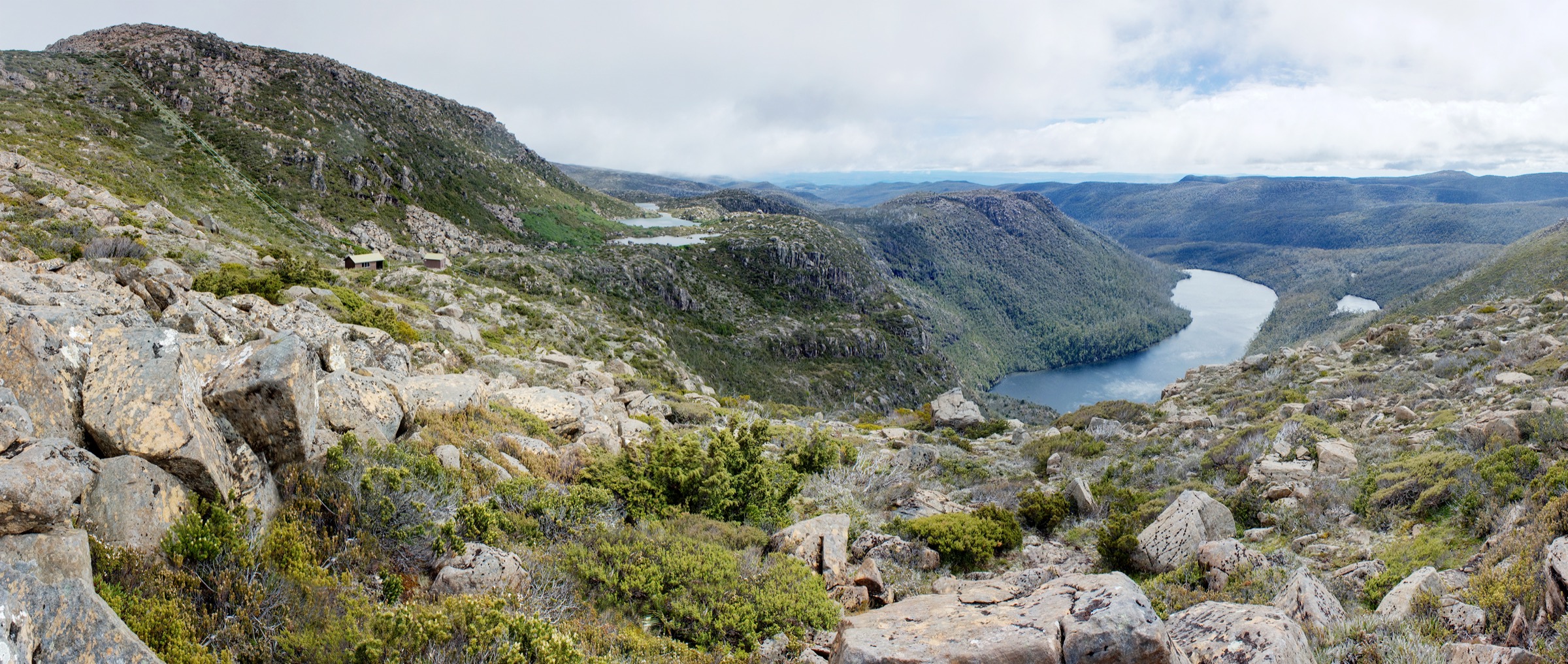
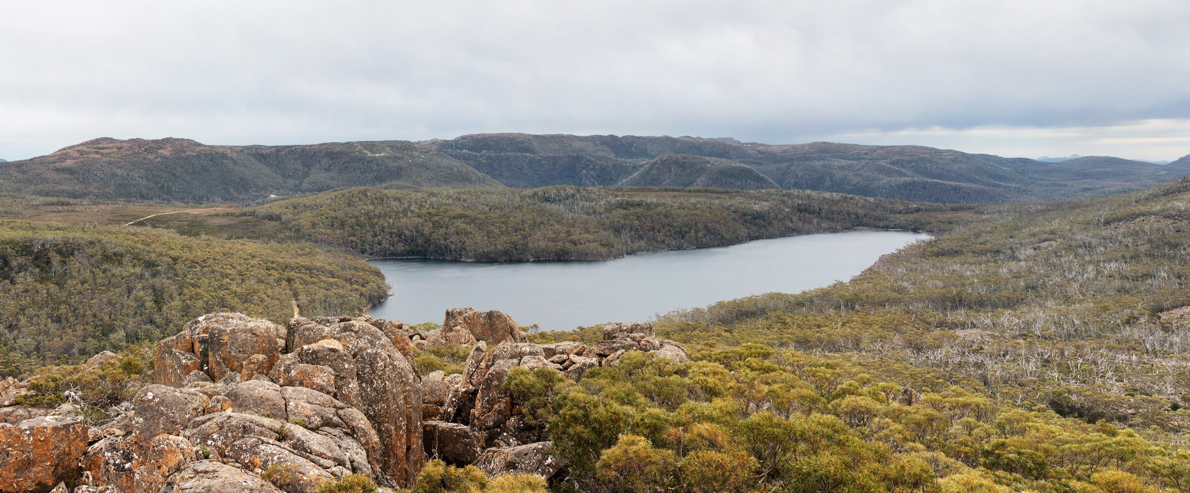
From the Lake Dobson car park the track climbs west on the Urquhart Track and Snowgum Track onto the Tarn Shelf — a broad dolerite bench at ~1,270 m holding a chain of glacial tarns (Robert, Mackenzie, Johnston, James, Backhouse). The shelf is the classic Tasmanian high-country tarn landscape and is particularly celebrated for the deciduous Nothofagus gunnii fagus that turns gold across the tarn margins in late April and early May.
The main loop continues east past Lake Newdegate — a substantial tarn with a small hut — and drops south past Twisted Tarn and Twilight Tarn (site of a historic ski hut) to the Lake Webster Track. The return line follows Eagle Tarn and drops back to Lake Dobson through subalpine woodland. Longer variants via Lake Webster and K Col add 2–3 km and reach into more remote high country.
Why it is essential
The Tarn Shelf Circuit is the definitive high-country day walk of Mount Field and one of the anchor tarn walks of southern Tasmania. It combines glacial dolerite terrain, mature Pandani, King Billy pine and the deciduous Nothofagus gunnii fagus in a single loop, and is the essential day out for anyone visiting the upper park.
Equipment
- Sturdy hiking boots
- Full weatherproof shell
- Two warm layers plus a spare
- Hat and gloves outside midsummer
- Water: 2 litres per person; carry water treatment for tarns
- Food for a long day
- Sun protection
- Trekking poles useful for the descent
- PLB or satellite messenger recommended in shoulder season
Hazards and notes
Winter turns this into a full alpine day: whiteout, snow, sub-zero wind chill. Even in summer weather can turn inside an hour. The dolerite tread is rough and slippery when wet. Cushion-plant vegetation is fragile — stay on the marked track. Fuel-stove-only. Dogs are not permitted. Parks Pass required.
GPX / route file
| Source | URL | Format | Licence / terms | Reuse |
|---|---|---|---|---|
| PWS — Mount Field NP page | parks.tas.gov.au | Web description | Copyright PWS Tasmania | Reference only |
| OpenStreetMap — Tarn Shelf Circuit | osm.org | OSM way data | ODbL | Reusable with attribution |
| trailhiking.com.au — Tarn Shelf Circuit | trailhiking.com.au | Web + GPX | Site-specific terms | Verify before reuse |
Sources
- Parks & Wildlife Service Tasmania — Mount Field NP page
- trailhiking.com.au — Tarn Shelf Circuit entry
- OpenStreetMap — track data
4. Mount Field West summit (via Rodway Range and K Col)
Snapshot
Itinerary
From the Lake Dobson car park the track climbs onto the Rodway Range via the Urquhart Track and the disused ski-tow line. The upper ski-tow lands the walker on the Rodway plateau at ~1,300 m. The route crosses the plateau north-west on rough dolerite talus, descends to K Col at ~1,180 m, then climbs west across broken quartzite and dolerite onto the Mount Field West plateau. The final summit block at 1,434 m is reached by a lightly cairned line across cushion-plant moorland.
Views cover the Overland Track corridor north to Cradle country, the Frankland Range and Federation Peak in the south-west wilderness, and the plateau and Florentine Valley to the east. The optional side-loop over Naturalist Peak adds 2–3 km and a further scramble. Return by the same route; the crossing of K Col is the most committing section and the point of no easy retreat.
Why it is essential
Mount Field West is the summit day of the park and one of the harder day walks in southern Tasmania. It is included as the definitive strenuous option for parties who have completed the Tarn Shelf Circuit and want the higher day.
Equipment
- Full mountain hiking kit: sturdy boots, weatherproof shell, warm layers, gloves, hat
- Navigation: topographic map, compass, GPS with waypoints
- Water: 3 litres per person; no reliable water on the Rodway plateau
- Food for a long day
- Sun protection
- Trekking poles useful across the plateau
- PLB or satellite messenger recommended
- Headtorch mandatory — day is long
Hazards and notes
Whiteout risk on the plateau is the primary hazard. Long committing walk-out — if the party is caught by weather at K Col, retreat is slow. The dolerite tread is rough and slow. Fuel-stove-only. Overnight parties should complete a trip-intentions form. Dogs are not permitted. Parks Pass required.
Photos
Photo status: No licence-compatible image of Mount Field West itself meeting the 2400 px shipping threshold was found in this pass. The Lake Seal / Tarn Shelf and Lake Fenton images above cover the approach terrain.
GPX / route file
| Source | URL | Format | Licence / terms | Reuse |
|---|---|---|---|---|
| PWS — Mount Field NP page | parks.tas.gov.au | Web description | Copyright PWS Tasmania | Reference only |
| OpenStreetMap — Mount Field West | osm.org | OSM way data (partial) | ODbL | Reusable with attribution |
| trailhiking.com.au — Mount Field West | trailhiking.com.au | Web + GPX | Site-specific terms | Verify before reuse |
Sources
- Parks & Wildlife Service Tasmania — Mount Field NP page
5. Junee Cave Track (Florentine Valley)
Snapshot
Itinerary
A short boardwalk from the Junee Road trailhead runs through wet-eucalypt forest and myrtle-beech to a viewing deck at the mouth of Junee Cave — the resurgence of the Junee-Florentine karst system, one of Tasmania’s longest and deepest cave systems. The Junee River flows out of the cave beneath a limestone arch and continues into the Florentine Valley. Cave entry is for specialist cavers only; the walker’s view is limited to the arch and the resurgence pool.
Why it is essential
Junee Cave is the essential karst-and-rainforest short walk of the Florentine Valley and the recommended stop for anyone travelling between Mount Field and the far south-west wilderness. It gives immediate access to a genuine limestone resurgence and a compact rainforest sample. The Styx Big Tree Reserve walk (a 700 m boardwalk to Eucalyptus regnans specimens over 85 m tall, about 45 minutes’ drive from Mount Field via Maydena) is the natural alternative if a tall-tree walk is preferred.
Equipment
- Standard walking shoes
- Weatherproof shell
- Warm layer
- Water and sun protection
Hazards and notes
Slippery boardwalk after rain. The viewing deck is at the cave mouth — do not attempt to enter the cave without a caver’s kit and experience. No Parks Pass required (State Reserve, not the national park). Dogs may be permitted; check current signage.
Photos
Photo status: No licence-compatible image of Junee Cave meeting the 2400 px shipping threshold was found in this pass.
GPX / route file
| Source | URL | Format | Licence / terms | Reuse |
|---|---|---|---|---|
| PWS — Junee Cave State Reserve | parks.tas.gov.au | Web description | Copyright PWS Tasmania | Reference only |
| OpenStreetMap — Junee Cave Track | osm.org | OSM way data | ODbL | Reusable with attribution |
Sources
- Parks & Wildlife Service Tasmania — Junee Cave State Reserve page
Region-level sources
| Source | Type | Notes |
|---|---|---|
| PWS Tasmania — Mount Field NP | Official park authority | Primary source for tracks, grading and Lake Dobson Road status |
| PWS Tasmania — Junee Cave State Reserve | Official reserve manager | Florentine karst walk |
| PWS Tasmania — Styx Tall Trees Conservation Area | Official reserve manager | Alternative tall-tree walk from Maydena |
| trailhiking.com.au — trailhiking.com.au | Independent trail database | Route notes and GPX downloads |
| Tasmanian Aboriginal Centre — palawa kani programme | Cultural authority | Language and place-name reference |
| OpenStreetMap — openstreetmap.org | Community map | Track geometry cross-checking |
| Bureau of Meteorology — bom.gov.au | Federal weather bureau | Frontal timing, snow and lightning risk |
Further reading
Nearby Tasmania Highlands guides on Storm
- Ben Lomond and the Northeast Highlands
- Cradle Mountain and Lake St Clair
- Hartz Mountains
- Southwest Tasmania
-
Storm — Australia | Cradle Mountain and Lake St Clair: Essential Day-Hikes
- Storm — Australia | Walls of Jerusalem and Central Plateau: Essential Day-Hikes
Missing data / follow-up work
- Tarn Shelf Circuit AWTGS grade — PWS lists Grade 3; secondary sources treat as Grade 4 in shoulder season. The article shows both.
- Mount Field West distance varies 17–20 km depending on whether Naturalist Peak is included; PWS-published figure is 17 km.
- Junee Cave trailhead elevation estimated from topographic mapping; no PWS-published elevation was located.
- No licence-compatible image was found for Mount Field West itself, Junee Cave, or the Styx Big Tree Reserve at the 2400 px shipping threshold.
- No official PWS-provided GPX file was found for any Mount Field or Florentine route; OpenStreetMap is the most reliable geometry source.