Regional overview
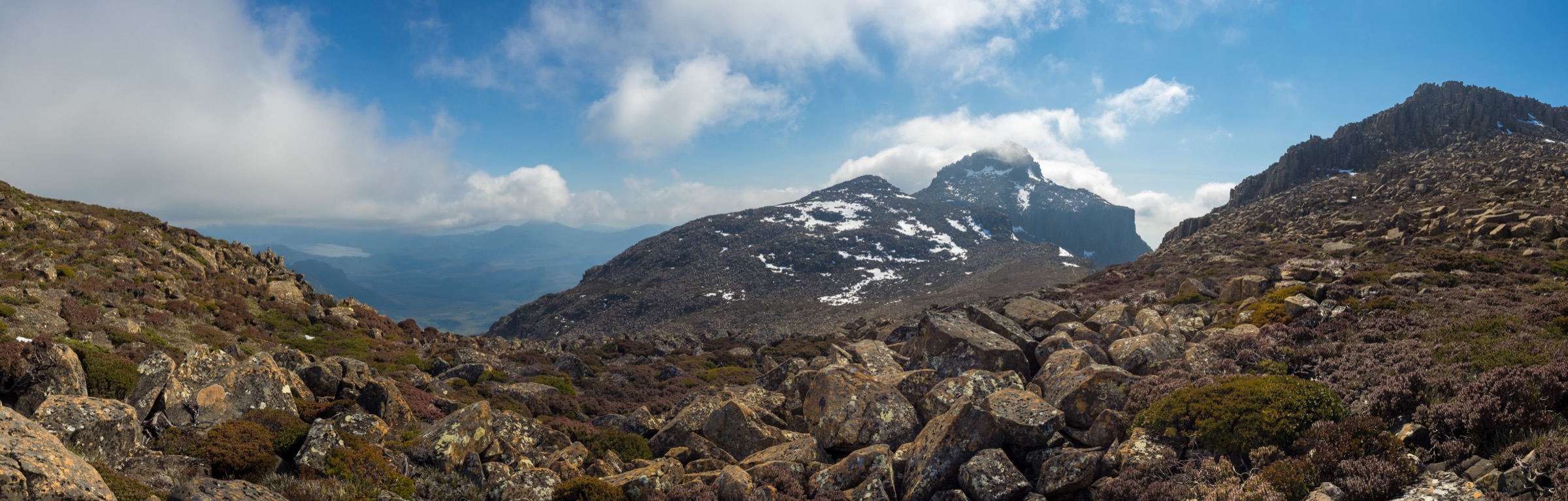
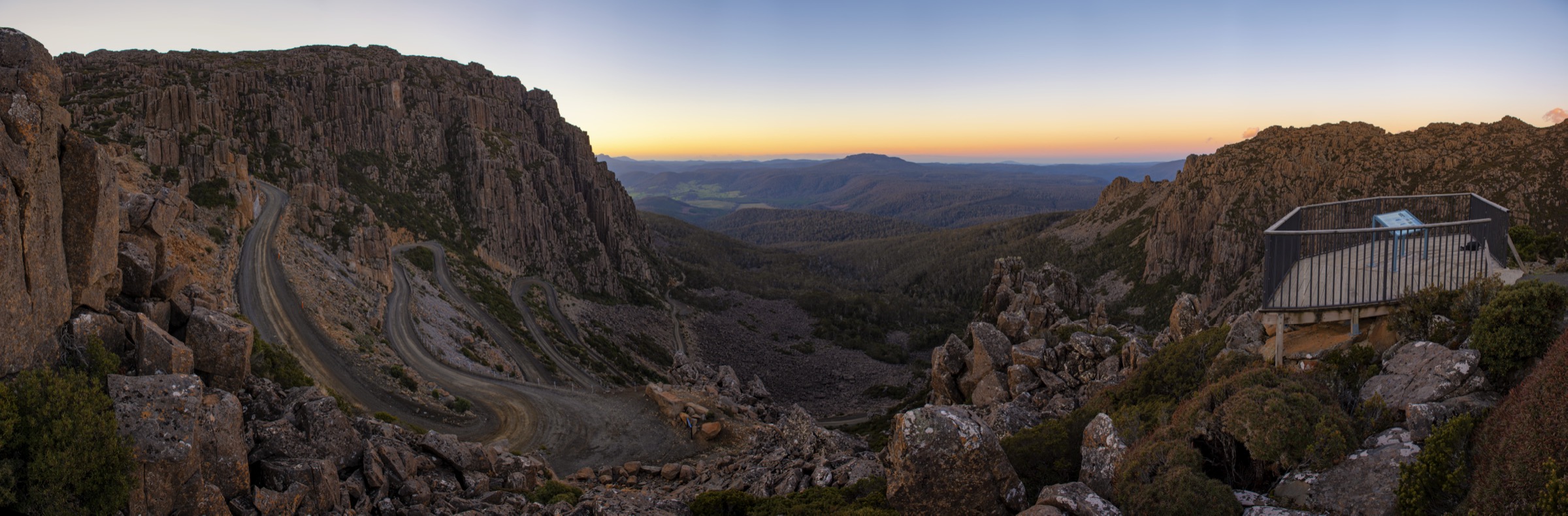
The northeast corner of Tasmania’s central highlands is anchored by Ben Lomond National Park, whose dolerite plateau rises steeply from the Launceston hinterland to an extensive above-treeline tableland reaching 1,572 m at Legges Tor — the second-highest point in Tasmania. The plateau is roughly 14 km long and 6 km wide, sitting almost entirely above 1,300 m, and it supports both Tasmania’s main snow-sports facilities (Ben Lomond Alpine Resort) and a distinctive suite of alpine and sub-alpine walking tracks. Jacob’s Ladder — a narrow, steep, winding unsealed road with 1.5 km of tight switchbacks — is the only vehicle access to the plateau and is one of the more dramatic approach drives in Australia.
Beyond Ben Lomond, the broader northeast highlands include several distinct highland reserves. The Meander Forest Reserve on the southwestern edge of the Great Western Tiers holds one of the region’s signature waterfall walks. The Blue Tier Regional Reserve, accessed from the northeast via Lottah and Poimena, is a remnant rainforest and sub-alpine boulder landscape with a rich tin-mining history. Mount Arthur Regional Reserve, near Lilydale in the Tamar Valley hinterland, offers a substantial ascent to a dolerite summit with panoramic views.
Ben Lomond National Park lies within turapina, the heartland territory of the Ben Lomond Aboriginal nation — one of nine major Aboriginal nations in Tasmania prior to European contact, comprising three to four clans including the Plangermaireener. The palawa kani name for the plateau, turapina, is thought to denote a tableland with precipitous cliff edges, and the nation’s deep connection to this country continues to be recognised by today’s Palawa community. The broader northeast highlands form part of a wider landscape of Pakana significance.
The dominant hazard on the Ben Lomond plateau is rapid weather change. Even in midsummer the plateau can experience near-freezing temperatures, gale-force wind and low cloud with little warning. In winter the plateau is a genuine snow and ice environment, and the Carr Villa and Summit Link tracks require microspikes or crampons in icy conditions. All five walks in this entry require suitable footwear, layered clothing, water, and a map or GPS device. The lower forest walks at Meander and Blue Tier are subject to tick exposure; long sleeves, long trousers and insect repellent are advised in warm months.
Summary table
| # | Hike | Route type | Distance | Estimated time | Difficulty | Verification |
|---|---|---|---|---|---|---|
| 1 | Legges Tor via Carr Villa | Out-and-back (or one-way) | PWS: 5 km one way / 10 km return | PWS: 2–3 h one way; ~5 h return | Grade 3 / moderate | Official route verified (PWS page) |
| 2 | Ben Lomond Summit Link plateau walk | Out-and-back | PWS: 1 km one way | PWS: 30 min | Grade 2 / easy | Official route verified (PWS page) |
| 3 | Meander Falls | Out-and-back | PWS: 10 km return | PWS: 4.5–6 h return | Grade 4 / experienced walkers | Official route verified (PWS 60 Great Short Walks) |
| 4 | Blue Tier — Mount Michael circuit | Return circuit | PWS: 6 km | PWS: 4 h | Grade 4 / experienced walkers | Official route verified (PWS Blue Tier page) |
| 5 | Mount Arthur | Out-and-back | Secondary: ~8.7 km return | Secondary: ~5 h return | Hard / challenging | Partially verified — no PWS page found; secondary sources used |
Before you go
Access
Ben Lomond National Park is approximately 60 km south-east of Launceston. The sealed access road leaves the highway near Blessington, becomes unsealed, and climbs via Jacob’s Ladder to the alpine village. Between June and September all vehicles must carry correctly fitted snow chains, and the road may close at the barrier 4.5 km below the village in severe conditions. A valid Tasmanian Parks Pass is required for entry to the national park; passes can be purchased at the entry booth or online in advance.
Meander Falls is reached via the C167 road from Deloraine, approximately 50 minutes south of Launceston or Devonport. The Blue Tier Regional Reserve is accessed from the Tasman Highway via Anchor Road to Lottah and Poimena (from the north-east), or from St Helens via Lottah Road. Mount Arthur Regional Reserve is near Lilydale; turn onto Mountain Road from Lilydale Road and drive 3.7 km to the trailhead parking bay.
Standard kit
- Ben Lomond plateau (Hikes 1 and 2): Sturdy hiking boots, waterproof and windproof shell, insulating mid-layer even in summer, warm hat and gloves, trekking poles recommended. Microspikes for any late-season ice on the summit tor approach. Carry water — no reliable water source on the upper plateau.
- Meander Falls (Hike 3): Full-day bushwalking kit — boots, waterproof shell, food and at least 2 litres of water, navigation backup, long clothing for tick protection. The track is steep, rocky and occasionally muddy.
- Blue Tier Mount Michael (Hike 4): As for Meander Falls. The upper section involves light rock scrambling.
- Mount Arthur (Hike 5): Hiking boots with good grip, weatherproof layer, water, food, navigation device. The upper dolerite terrain can be loose and slippery.
Common hazards
- Rapid weather deterioration on the Ben Lomond plateau — turn back if cloud descends, wind intensifies or visibility falls significantly.
- Jacob’s Ladder is steep, narrow and unsealed; uphill traffic gives way to descending vehicles. Observe the 30 km/h speed limit.
- Tick exposure in wet forest at Meander Falls, Blue Tier and the lower Carr Villa approach — check and remove ticks carefully after walking.
- Limited mobile phone coverage on the plateau and in the Blue Tier; a personal locator beacon (PLB) is advisable for solo or less experienced walkers.
- Dogs are not permitted in Ben Lomond National Park or Blue Tier Regional Reserve.
1. Legges Tor via Carr Villa
Snapshot
Itinerary
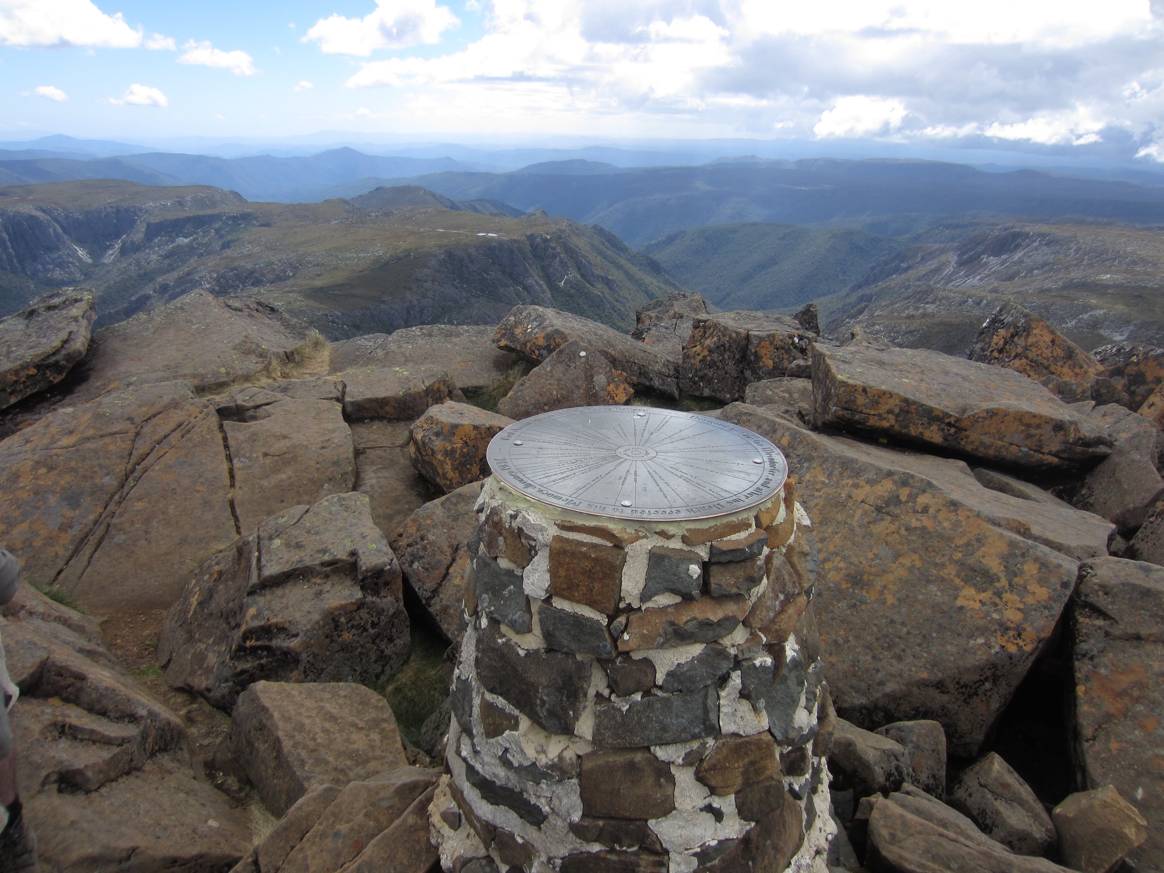
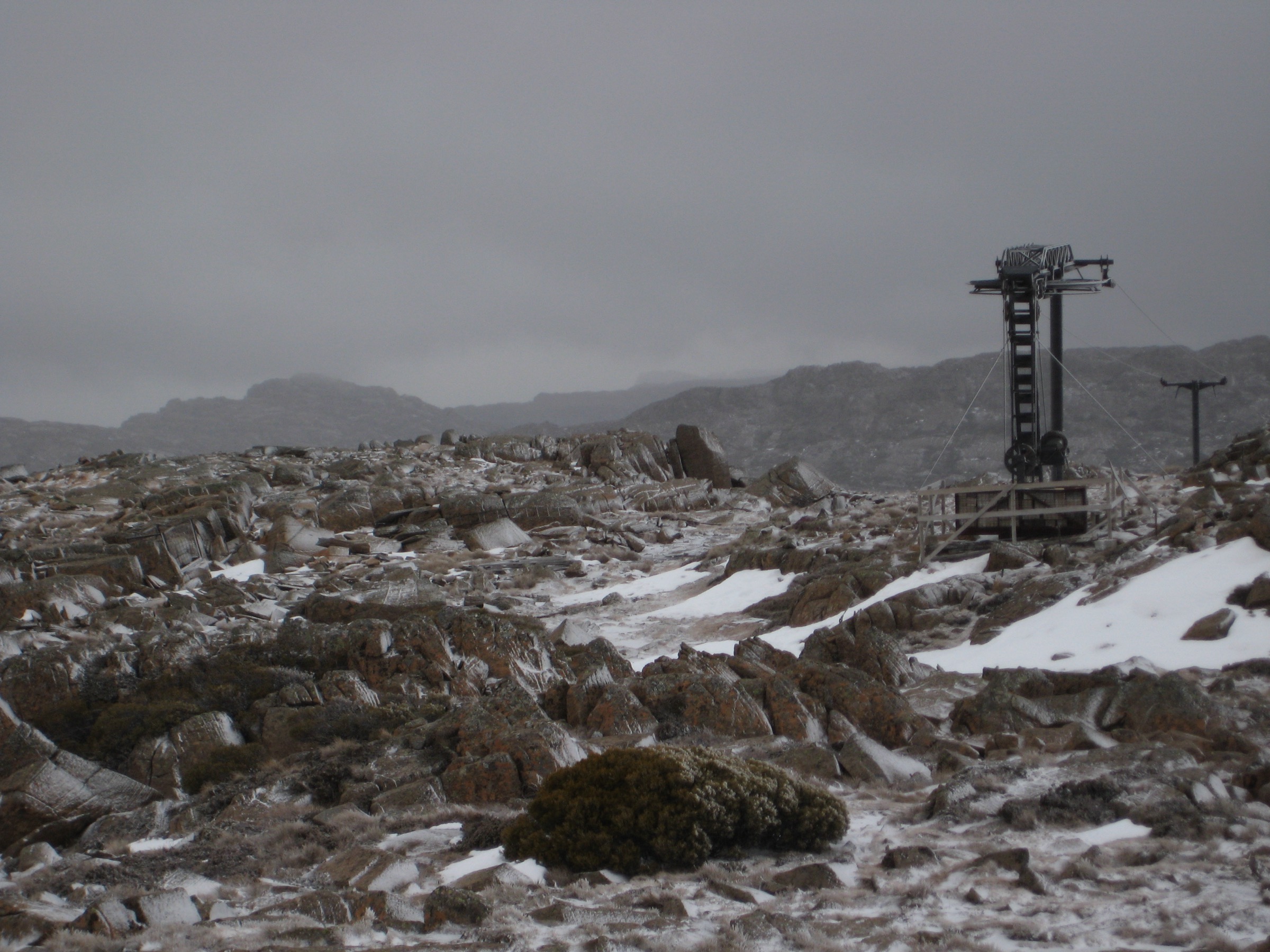
The trailhead sits at Carr Villa hut, signposted off Ben Lomond Road roughly 1 km from the lower car park and accessed via an unsealed spur. The track leaves the hut and immediately enters the last stand of eucalypt forest on the lower escarpment, then climbs steeply onto the plateau via the Summit Pass Track. Most elevation gain is concentrated into the first kilometre, after which the terrain opens to dolerite boulder fields and sub-alpine heath. The well-formed and waymarked track crosses the plateau to a junction where two options present: a direct 50-metre climb over boulders south to the Legges Tor summit cairn, or east along the Summit Link Track towards the Alpine Village. Reaching the very top of Legges Tor requires a short scramble over dolerite blocks. The return follows the same track, or, with vehicle pre-positioning, walkers can continue east to the Alpine Village as a one-way traverse.
Why it is essential
Legges Tor at 1,572 m is Tasmania’s second-highest peak and the highest accessible summit in the northeast of the state. The Carr Villa approach is the most committing ascent route, gaining meaningful elevation through eucalypt forest and onto the open plateau, giving walkers the full transition from lowland forest to genuine alpine terrain. It is the defining day-hike objective of Ben Lomond National Park.
Hazards and notes
- Weather changes rapidly and severely on the plateau. Carry full warm and waterproof gear and be prepared to turn back if conditions deteriorate.
- The track grades from compacted path at lower elevation to open boulder-hop terrain near the summit.
- In winter or after late snowfall, the upper section requires microspikes or crampons and the skills to use them safely.
- The unsealed Ben Lomond Road and Jacob’s Ladder section above Carr Villa require careful driving; chains must be carried June–September.
- A valid Parks Pass is required.
GPX / KML links
| Source | URL | Format | Notes |
|---|---|---|---|
| PWS — Carr Villa to Alpine Village track | parks.tas.gov.au | Official route page | No GPX published on official page |
| TasTrails — Carr Villa to Alpine Village | tastrails.com | Third-party route page with stats | Secondary reference |
| AllTrails — Carr-Villa to Legges Tor via Misery Bluff | alltrails.com | Third-party route page | Secondary statistics only |
Further reading
2. Ben Lomond Summit Link plateau walk
Snapshot
Itinerary
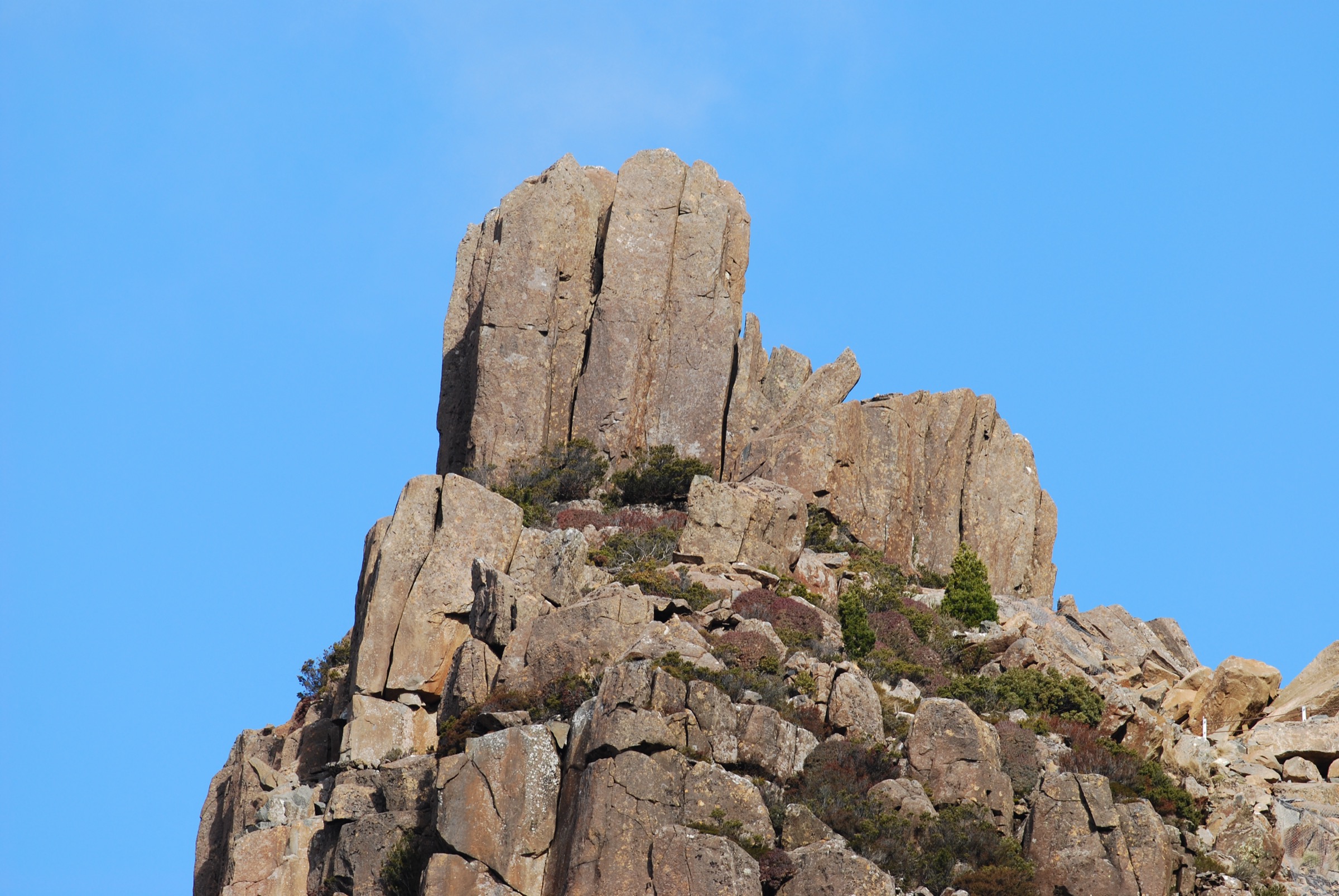
The Summit Link Track begins at the main car park at the top of Ben Lomond Road in the Alpine Village, where the ski lifts and resort facilities are located. The walk follows a well-built track through a mixture of alpine vegetation and dolerite rock scree, traversing the plateau for 1 km to join the steeper Summit Pass Track. The path passes through cushion plants, alpine heath, and patches of exposed dolerite, with views across the plateau to the southern escarpment. From the Summit Pass junction, those with energy and capability can continue directly to Legges Tor (a further 500 m and short boulder scramble). Most day visitors without technical experience turn back at the junction and return to the car park.
Why it is essential
The Summit Link is the accessible introduction to the Ben Lomond plateau environment — the shortest way to step into genuine alpine terrain on the second-highest mountain massif in Tasmania. It is the walk that PWS uses to allow all visitors, regardless of fitness level, to experience the plateau’s distinctive vegetation, open skies, and escarpment views. It also serves as the natural starting point for extending into the Legges Tor summit if conditions permit.
Hazards and notes
- Despite its short distance and easy grade, the plateau is fully exposed to wind and rapid weather changes. Carry a warm and waterproof layer even on fine days.
- Winter visits require full alpine clothing; the track surface can ice over, particularly near exposed sections of dolerite scree.
- The Alpine Village car park is the endpoint of the Jacob’s Ladder road — road conditions in winter should be checked before driving up.
GPX / KML links
| Source | URL | Format | Notes |
|---|---|---|---|
| PWS — Ben Lomond Summit Link Track | parks.tas.gov.au | Official route page | No GPX published on official page |
| AllTrails — Ben Lomond Summit Link Track | alltrails.com | Third-party route page | Secondary reference |
Further reading
3. Meander Falls
Snapshot
Itinerary
The track starts at the Meander Falls car park on the C167 road and follows the Meander River upstream through temperate rainforest. The forest corridor is dominated by myrtle beech, king billy pine, celery top pine and leatherwood, with Tasmanian waratah flowering in spring. The track is steep and rocky throughout, gaining the bulk of its 470–480 m elevation over a 5 km approach. The terrain becomes increasingly rough and occasionally muddy in the upper section. The reward is Meander Falls — a two-tiered cascade that drops approximately 130 m over the lip of the Great Western Tiers escarpment. In cold winters the falls can freeze partially. Return by the same track.
Why it is essential
Meander Falls is one of Tasmania’s tallest waterfalls and is listed by PWS as one of the state’s 60 Great Short Walks. It brings the region’s northeastern highlands entry into genuine tall-forest and escarpment territory, providing essential variety from the dolerite plateau character of Ben Lomond. The walk lies within the Tasmanian Wilderness World Heritage Area, giving it both ecological and landscape significance.
Hazards and notes
- The track is genuinely Grade 4 — rough, steep, rocky and muddy. It is not suitable for walkers without bushwalking experience or in inadequate footwear.
- Limited directional signage — navigation skills and a map or GPS device are advisable.
- Tick exposure along the full length of the track in the warmer months; wear long clothing and use repellent.
- The falls area sits on an exposed escarpment; winds can be strong near the top.
- Winter visits may require gaiters and extra care on the muddy upper section; the frozen falls are a noted attraction but add terrain complexity.
- Dogs are not permitted in the reserve; confirm current regulations on the PWS website before visiting.
GPX / KML links
| Source | URL | Format | Notes |
|---|---|---|---|
| PWS — Meander Falls (60 Great Short Walks) | parks.tas.gov.au | Official route page | No GPX published on official page |
| TasTrails — Meander Falls | tastrails.com | Third-party route page with stats | Secondary reference; elevation and time cited from here |
| AllTrails — Meander Falls Gorge | alltrails.com | Third-party route page | Secondary statistics only |
Further reading
4. Blue Tier — Mount Michael circuit
Snapshot
Itinerary
The circuit begins at the Sun Flats car park on Sun Flats Road within the Blue Tier Regional Reserve. The track winds through recovering rainforest — myrtle beech, sassafras and mossy tree ferns — before climbing steadily through denser forest towards the sub-alpine boulder landscape of Mount Michael’s upper slopes. A short rock scramble leads to the 802 m summit, where clear days offer views extending to Flinders Island, the Bay of Fires coastline, and the forested valleys of Pyengana and Weldborough. The descent passes the remains of the historic Mount Michael Mine, one of the largest tin operations in the Blue Tier’s 19th-century tin rush, before returning to the car park.
Why it is essential
The Blue Tier is northeastern Tasmania’s most intact surviving rainforest plateau landscape and carries significant mining heritage. The Mount Michael circuit is the flagship walk of the reserve — it combines tall-forest immersion, a genuine summit with panoramic views, and interpretive mine-site context in a single loop. It represents a forest and plateau character entirely distinct from the dolerite alpine plateau of Ben Lomond, providing meaningful variety in the regional catalogue.
Hazards and notes
- The track is slippery in wet conditions; robust footwear is essential.
- The summit scramble is light but requires confidence on rough rock.
- Tick exposure in the rainforest section throughout the warmer months.
- No mobile coverage inside the reserve.
- Camping is not permitted within the Blue Tier Regional Reserve.
- The area receives high rainfall; check conditions before departure.
- Dogs are not permitted in the reserve.
GPX / KML links
| Source | URL | Format | Notes |
|---|---|---|---|
| PWS — Blue Tier Regional Reserve | parks.tas.gov.au | Official reserve and walks page | No GPX published on official page |
| AllTrails — Blue Tier (Blue Derby Wilderness Trail) | alltrails.com | Third-party route page | Secondary reference |
Further reading
5. Mount Arthur
Snapshot
Itinerary
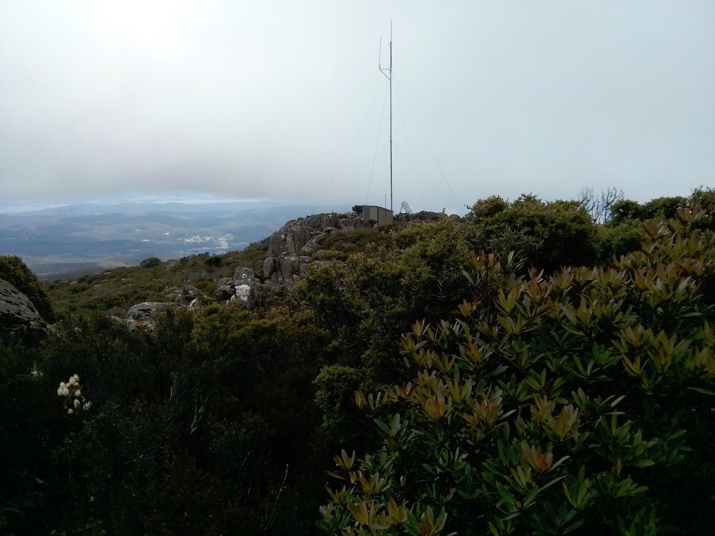
Mountain Road trailhead sits near Lilydale at the point where a gated driveway blocks further vehicle progress. The track follows a fire trail for roughly 2 km before transitioning to an increasingly steep and rough foot track climbing through dense, mossy forest. The character shifts as altitude increases: lower moss-and-fern forest gives way to drier, more open vegetation and then to rocky dolerite formations on the upper mountain — including The Lost World, a dolerite tor described as similar to but smaller than the Organ Pipes on Mount Wellington. The summit at 1,188 m offers clear views across the Tamar Valley, to the northeast coast and, on the clearest days, to Flinders Island.
Why it is essential
Mount Arthur is the most prominent high point in the northeast of the state outside Ben Lomond National Park proper, and the walking track is the only accessible route to the summit. It adds a northern-hills perspective — forest transition, dolerite formations, Tamar Valley views — that complements the plateau character of Ben Lomond and the rainforest character of Blue Tier. The 1,188 m summit is achievable as a day objective by fit walkers.
Hazards and notes
- The track is rated hard; the upper section involves steep, rough terrain and boulder navigation.
- Navigation requires care on the upper mountain where the track is less defined; carry a map or GPS device.
- No water source reliably available on the track; carry sufficient water from the trailhead.
- No published PWS page was found for this reserve in this pass; statistics cited above come from AllTrails and TrailForks as secondary sources and should be treated as approximate.
- Mobile coverage is not reliable on the upper mountain.
GPX / KML links
| Source | URL | Format | Notes |
|---|---|---|---|
| AllTrails — Mount Arthur Walking Track | alltrails.com | Third-party route page | Secondary statistics; no official PWS page found |
| TrailForks — Mount Arthur Track (Via Mountain Road) | trailforks.com | Third-party route page | Secondary statistics; elevation 422 m cited from here |
| Mount Arthur Reserve — Scenic Trails | mtarthurreserve.org.au | Reserve management site | Useful access and trail context |
Further reading
Missing data / follow-up work
- Elevation gain on Hike 1 (Legges Tor via Carr Villa): PWS does not publish elevation gain. AllTrails (348 m) and secondary sources (up to 550 m for Misery Bluff circuit variant) disagree. An OSM or GPS verification pass would resolve this.
- Meander Falls (Hike 3) elevation: PWS publishes distance and time but not ascent. The 470–480 m figure comes from TasTrails as a secondary source.
- No licence-compatible image found for Meander Falls: No photograph of Meander Falls was located on Wikimedia Commons in this pass. The hike entry has no inline figure. A Flickr CC or equivalent search may yield one.
- No licence-compatible image found for Blue Tier / Mount Michael (Hike 4): No Wikimedia Commons image of Mount Michael or the Blue Tier rainforest was found. The figure block references this gap. A search of Flickr CC is recommended.
- Mount Arthur (Hike 5) has no official PWS page: Stats are from AllTrails and TrailForks only. The Mount Arthur Regional Reserve management website (mtarthurreserve.org.au) may carry more authoritative track data; this should be verified.
- Official GPX files: No route files are published by PWS or the reserve managers for any of the five walks. GPX geometry should be drawn from OSM or field-verified GPS traces rather than reused from third-party platforms.
- Dog access rules at Meander Forest Reserve and Mount Arthur Regional Reserve: Not verified in this pass; should be confirmed directly with PWS.
- Ben Lomond seasonal closures and road conditions: The Jacob’s Ladder road can close without notice in winter; current closure policy and snow-chain enforcement should be checked against the live PWS or Ben Lomond Alpine Resort website before winter travel.
Further reading
| Source | URL |
|---|---|
| PWS — Ben Lomond National Park | parks.tas.gov.au |
| PWS — Carr Villa to Alpine Village track | parks.tas.gov.au |
| PWS — Ben Lomond Summit Link Track | parks.tas.gov.au |
| PWS — Meander Falls (60 Great Short Walks) | parks.tas.gov.au |
| PWS — Blue Tier Regional Reserve | parks.tas.gov.au |
| Wikipedia — Ben Lomond (Tasmania) | en.wikipedia.org |
| Wikipedia — Legges Tor | en.wikipedia.org |
| Wikipedia — Mount Arthur (Tasmania) | en.wikipedia.org |
| Discover Tasmania — Ben Lomond National Park | discovertasmania.com.au |
| Great Western Tiers — Meander Falls | greatwesterntiers.net.au |