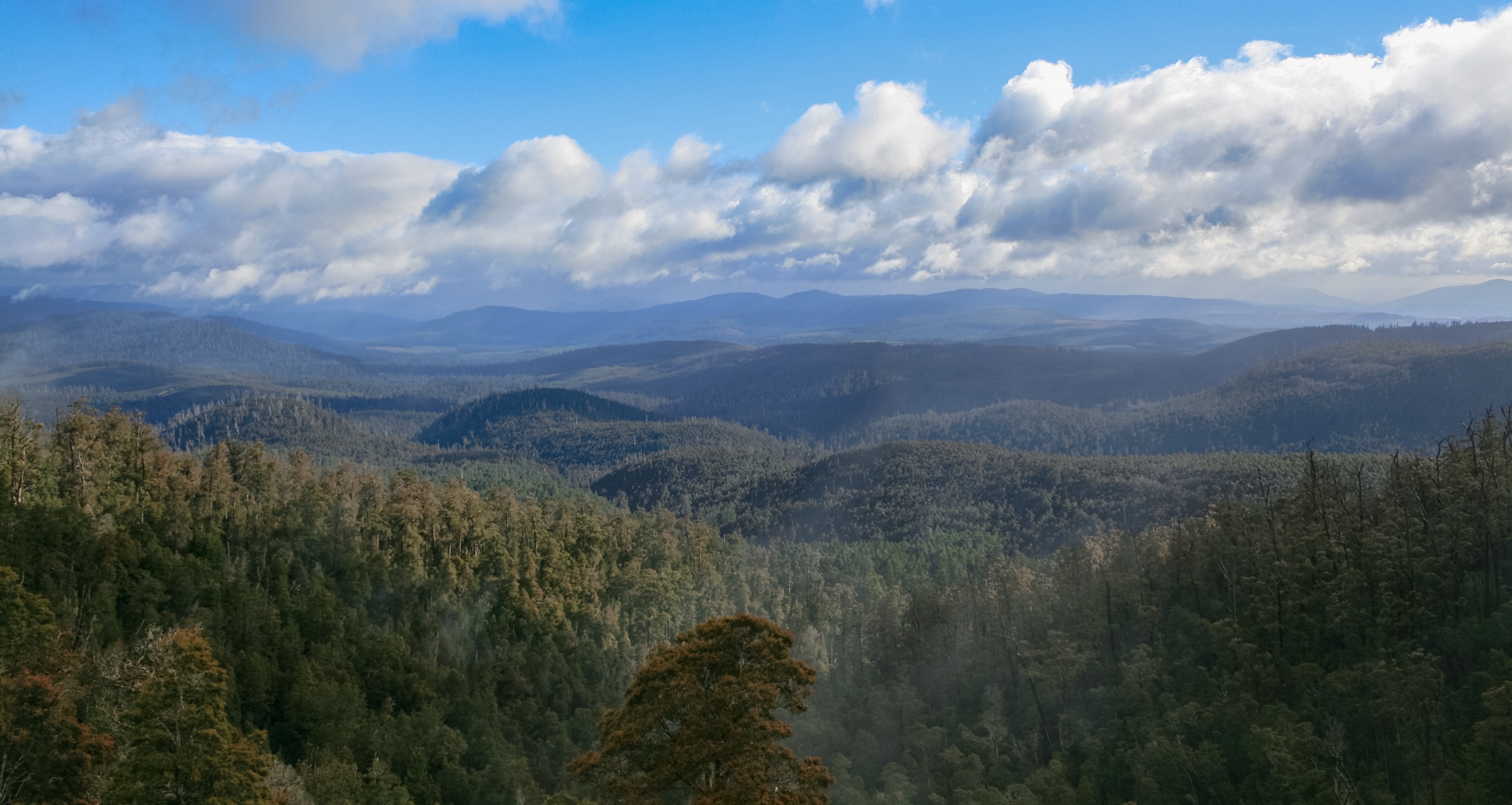
Regional overview
Hartz Mountains National Park sits on the eastern edge of the Tasmanian Wilderness World Heritage Area, roughly 84 km south-west of Hobart on Palawa/Pakana Country. The park protects a compact dolerite plateau — the Hartz Range — rising sharply from the Huon Valley through wet eucalypt forest, King Billy pine and pandani heath, up to a windswept summit ridge of glacial tarns, cushion plants and dolerite scree. Hartz Peak, at 1,255 m, is the range’s high point and dominates the horizon from the main trailheads.
The walking spectrum is unusually concentrated. All five walks in this selection start from the same road — the sealed Hartz Road that ends at the Waratah Lookout / Arve Falls car park at the Hartz Mountains trailhead — and share a single high alpine setting, from a five-minute roadside lookout to a 7 km summit push. That density makes the range one of Tasmania’s most efficient alpine day-walking hubs: three of the five walks can be linked in a single visit, and the whole park can be sampled seriously on a two-day trip out of Geeveston or Hobart.
The dominant hazards are weather and exposure. The plateau catches Southern Ocean fronts head-on: sudden fog, driving rain, snow flurries in any month, and wind chill severe enough to bring on hypothermia are common even in summer. The Tasmania Parks and Wildlife Service (PWS) treats the higher walks as full alpine outings and asks that walkers register at the trailhead log-book. Mobile coverage on the plateau is patchy, water on the summit tracks is limited to tarns, and there is no shelter above the treeline.
Summary table
| # | Hike | Route type | Distance | Estimated time | Difficulty | Verification |
|---|---|---|---|---|---|---|
| 1 | Hartz Peak | Out-and-back | 7.4 km return (PWS); 7.7 km per Trail Hiking Australia | 3–5 h | Grade 4 / hard | Route verified; PWS + Trail Hiking Australia; stats cross-referenced |
| 2 | Lake Esperance | Out-and-back | 3.4 km return | 1.5–2 h | Grade 3 / moderate | Route verified via PWS + Aussie Bushwalking |
| 3 | Lake Osborne | Out-and-back | 2 km return | ~45 min | Grade 2 / easy–moderate | Route verified via PWS |
| 4 | Arve Falls | Out-and-back | 1 km return | ~20 min | Grade 2 / easy | Route verified via PWS |
| 5 | Waratah Lookout | Out-and-back | 300 m return | ~5 min | Grade 2 / access path | Route verified via PWS |
Before you go
Access
All five walks share a single trailhead system. From Geeveston, follow Arve Road west for about 22 km and turn south onto Hartz Road, which climbs 14 km to the Waratah Lookout car park and the main Hartz Mountains trailhead. The road is sealed for most of its length but has a rough final section; two-wheel-drive vehicles reach the trailhead in summer but snow and ice close the upper section in winter. There is no scheduled public transport; visitors self-drive from Hobart (about 1 h 45 min) or Geeveston (about 30 min). The park requires a Tasmanian national parks pass, purchased online or at Geeveston.
Standard kit
- Sturdy walking shoes or light hiking boots — dolerite boardwalk, mud sections and rock steps on the summit approach are the main technical points.
- Full waterproof shell (jacket and trousers) plus a warm mid-layer, hat and gloves — carry these on every walk, not just Hartz Peak.
- Water: 1 litre for the short walks, 2 litres for Lake Esperance and 2–3 litres for Hartz Peak.
- Wide-brim sun hat, sunglasses and high-SPF sunscreen for the exposed plateau.
- Offline map (PWS Hartz Mountains map, or the 1:25,000 Hartz Peak topographic sheet), compass, headtorch and a small first-aid kit.
- Personal Locator Beacon is standard practice above Lake Esperance in poor visibility and any time of year on Hartz Peak; PWS asks all walkers to sign the trailhead log-book.
Common hazards
- Weather change: fronts move in from the Southern Ocean without warning and can drop temperatures 15 °C in an hour.
- Snow, ice and rime on the summit ridge from May to October, and possible in any month.
- Fog on the plateau reduces visibility to a few metres; the summit cairn line is easy to lose off-track.
- Boardwalk is slippery when wet or frosted.
- Phytophthora root-rot is present in Tasmania — clean footwear at the wash-down station at the trailhead.
- Cultural sites: the range sits on Palawa/Pakana Country; treat the landscape as living cultural landscape and stay on marked tracks.
1. Hartz Peak
Snapshot
Itinerary
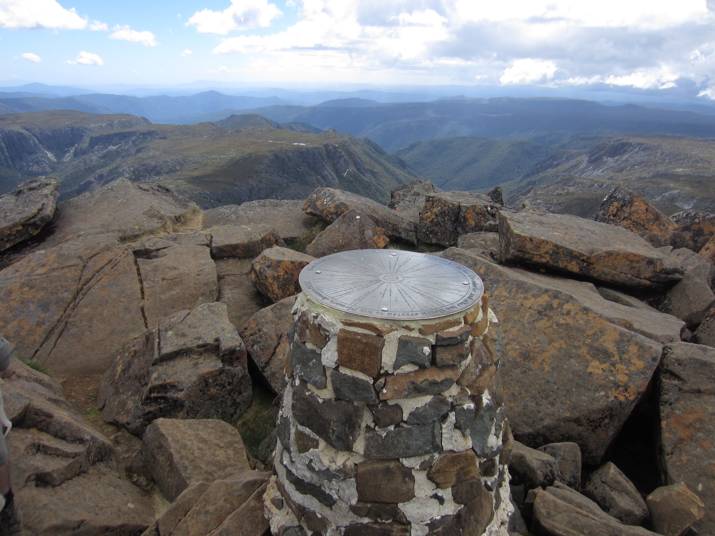
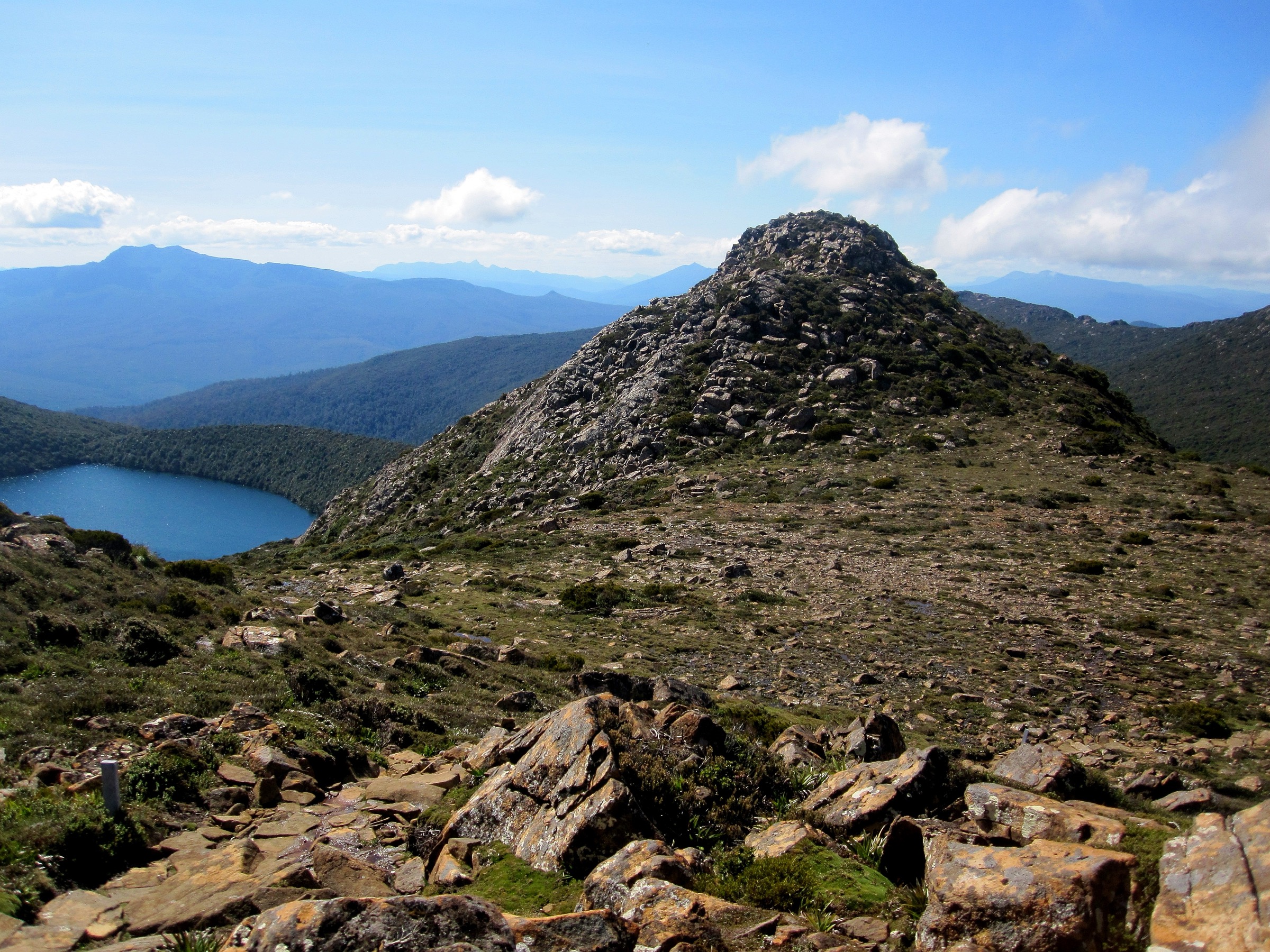
The route leaves the Waratah Lookout car park on boardwalk through pandani heath, passes the Lake Esperance junction after about 1 km, and climbs onto the open plateau above the treeline. From there it follows a marked cairn and boardwalk line north across a run of glacial tarns and cushion-plant flats, drops slightly to the base of the summit block, and then climbs the final 60–80 m of rock steps and a short scramble to the cairn at 1,255 m (PWS). The return is by the same route. In clear weather the summit gives a full arc across Federation Peak, the Arthur Range and the Southern Ocean; on a bad day it is a serious navigation exercise.
Why it is essential
Hartz Peak is the range’s high point, the archetypal southern Tasmanian dolerite summit and the marquee day objective in the park. It is the walk that PWS itself uses as the flagship alpine outing at the trailhead.
Hazards and notes
- Weather is the dominant risk; conditions on the summit ridge can differ sharply from the car park.
- Snow and ice on the summit block can persist late into spring; check PWS conditions.
- Route-finding above Lake Esperance depends on cairns and boardwalk; fog can obscure both.
- Boardwalk sections are slippery when wet or frosted.
- Sign the trailhead log-book and carry a PLB.
GPX / KML links
| Source | URL | Format | Notes |
|---|---|---|---|
| PWS — Hartz Peak Track | parks.tas.gov.au | Official park page | No GPX published on the official page in this pass |
| Trail Hiking Australia — Hartz Peak Track | trailhiking.com.au | Third-party route page with stats | GPX is copyright and not reusable per site notice |
| AllTrails — Hartz Peak Track | alltrails.com | Third-party route page | Secondary reference |
Further reading
- PWS — Hartz Mountains National Park
- PWS — Hartz Peak Track
- Trail Hiking Australia — Hartz Peak Track
2. Lake Esperance
Snapshot
Itinerary
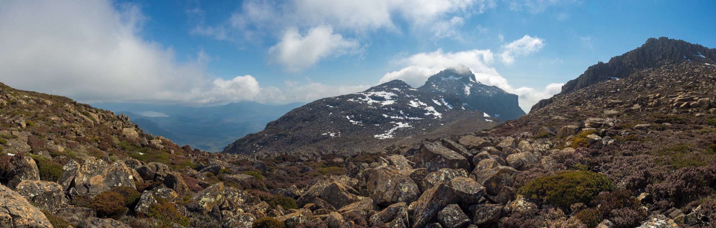
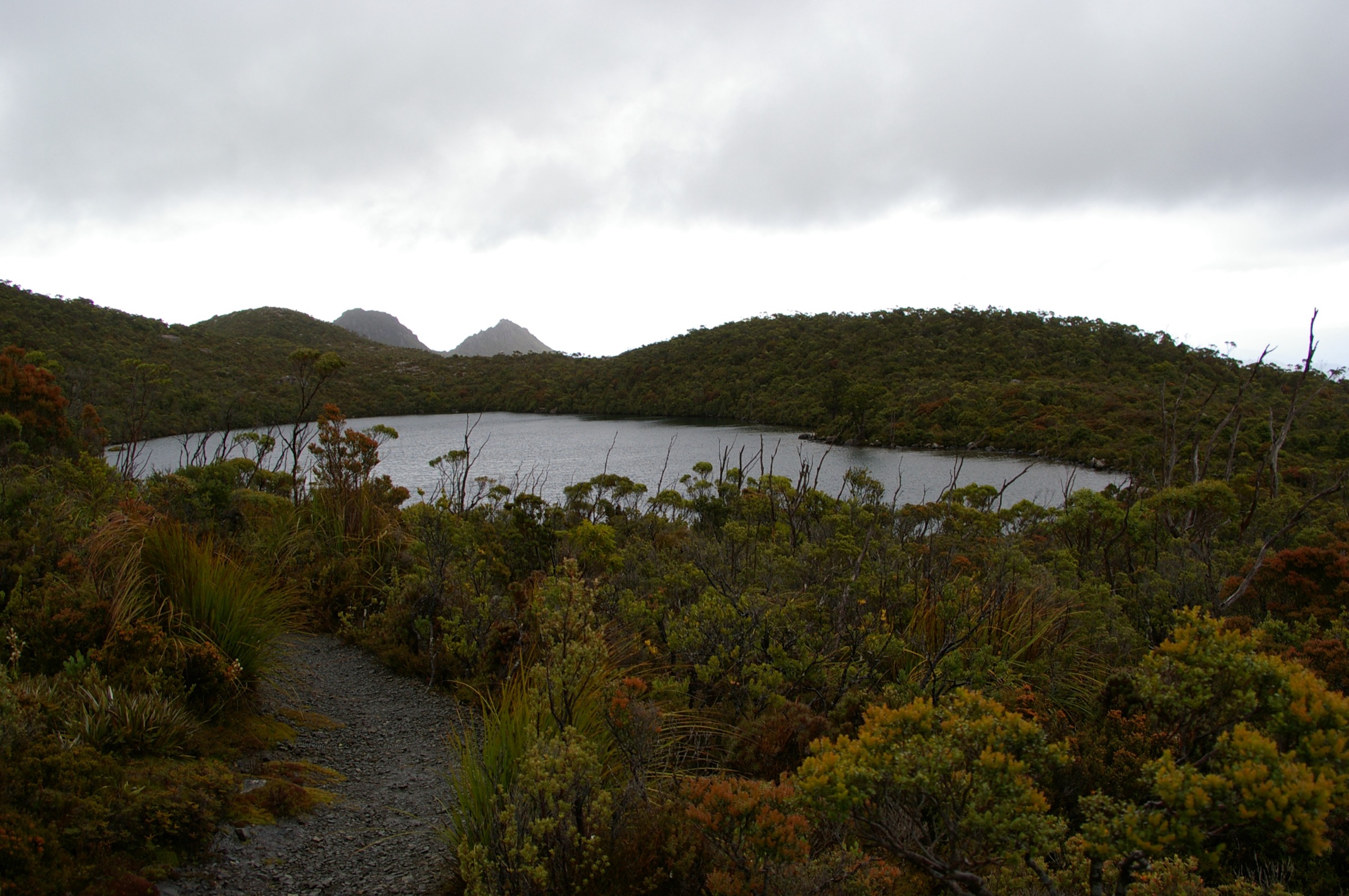
The route shares the first kilometre of the Hartz Peak Track from the Waratah Lookout car park, climbing on boardwalk through pandani heath. About 1 km in, a signposted junction branches left off the summit line and descends gently to the shore of Lake Esperance, a small glacial tarn cupped in a dolerite bowl beneath the summit ridge. Most walkers turn round at the shore; a short side-track continues to a rocky point above the outlet. Return by the same route.
Why it is essential
Lake Esperance is the classic Hartz “shoulder walk”: it delivers a full alpine tarn with the summit ridge as a backdrop without the exposure of the peak itself, and is the natural objective for parties who want the plateau’s atmosphere but not its risk profile.
Hazards and notes
- Weather change on the plateau shelf can be as sudden as on the summit; carry a shell.
- Boardwalk is slippery when wet or frosted.
- Snow patches can linger into November on the shaded south-east aspects.
- Sign the trailhead log-book.
GPX / KML links
| Source | URL | Format | Notes |
|---|---|---|---|
| PWS — Lake Esperance Track | parks.tas.gov.au | Official park page | No GPX published on the official page in this pass |
| Aussie Bushwalking — Lake Esperance | aussiebushwalking.com | Third-party route page | Secondary reference |
Further reading
3. Lake Osborne
Snapshot
Itinerary
The track leaves a small branch car park on Hartz Road just below the main trailhead and descends through King Billy pine and myrtle beech forest to the shore of Lake Osborne, a small dolerite-rimmed tarn set below the eastern face of the range. The track ends at the outlet; there is no shore circuit. Return by the same route.
Why it is essential
Lake Osborne is the shortest of the range’s “true forest tarn” walks and the best short introduction to the wet cool-temperate rainforest character of the Hartz plateau. It complements the higher, more open tarn walks by showing the range’s other habitat.
Hazards and notes
- Roots and mud on the descent; the track is slippery in wet or frosted conditions.
- Cold and dark aspect: bring an extra layer even in summer.
- Leeches after wet weather.
- Sign the trailhead log-book.
GPX / KML links
| Source | URL | Format | Notes |
|---|---|---|---|
| PWS — Lake Osborne Track | parks.tas.gov.au | Official park page | No GPX published on the official page in this pass |
| Aussie Bushwalking — Lake Osborne | aussiebushwalking.com | Third-party route page | Secondary reference |
Further reading
4. Arve Falls
Snapshot
Itinerary
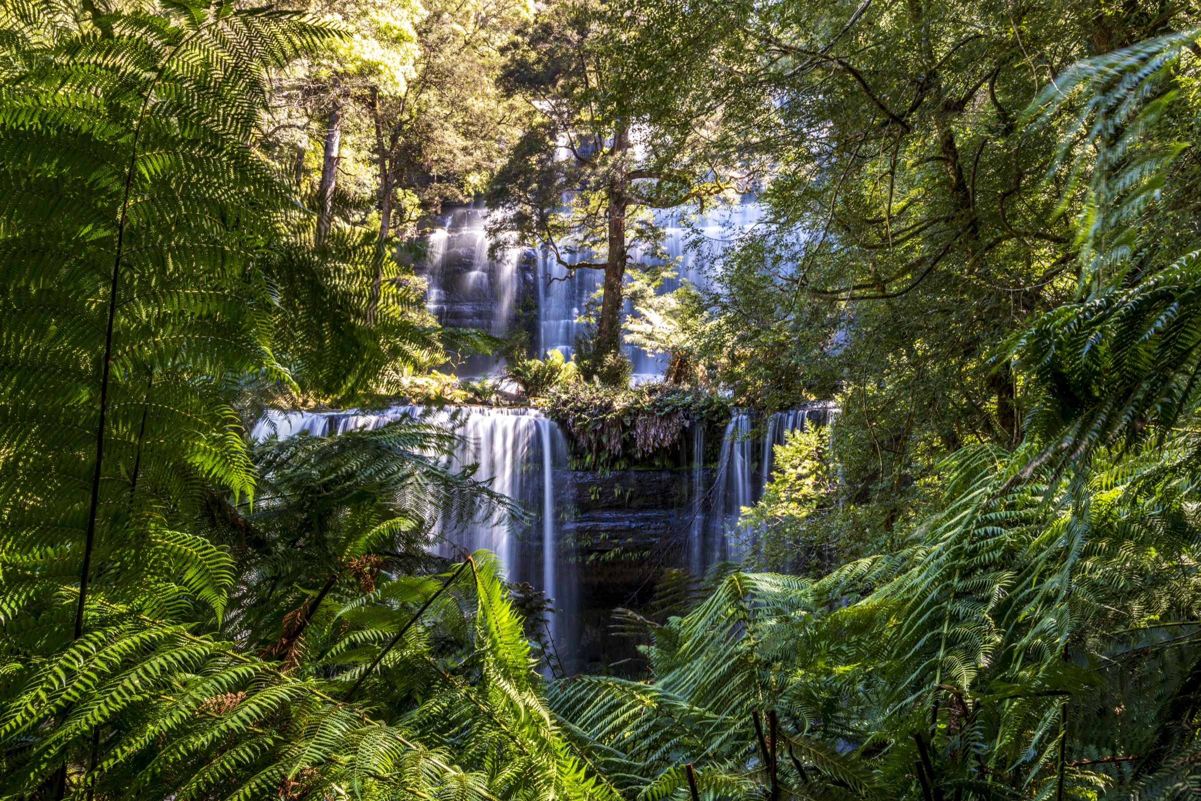
The track leaves the Arve Falls car park on boardwalk across button-grass moor, descends gently to a viewing platform above the falls, and returns by the same route. Arve Falls drops off a dolerite lip into the head of the Arve River gorge; the platform is set back for safety and does not overlook the plunge pool.
Why it is essential
Arve Falls is the shortest signature-feature walk in the park and the natural warm-up for the higher tracks. It also gives the clearest view of the button-grass and dolerite mosaic that characterises the lower Hartz plateau.
Hazards and notes
- Do not scramble beyond the viewing platform — the lip and cliff face are unfenced beyond the boardwalk.
- Boardwalk is slippery when wet or frosted.
- Weather on the button-grass moor can be markedly colder and windier than at the car park.
GPX / KML links
| Source | URL | Format | Notes |
|---|---|---|---|
| PWS — Arve Falls Track | parks.tas.gov.au | Official park page | No GPX published on the official page in this pass |
| Aussie Bushwalking — Arve Falls | aussiebushwalking.com | Third-party route page | Secondary reference |
Further reading
5. Waratah Lookout
Snapshot
Itinerary
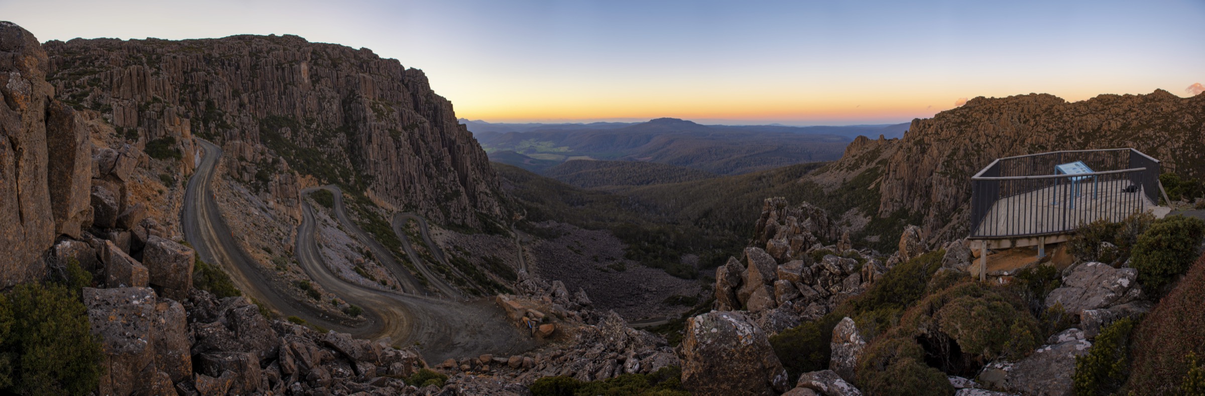
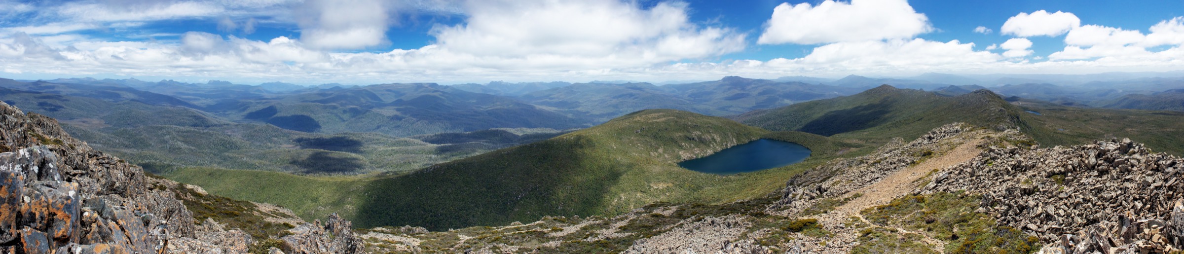
A short formed path leaves the main trailhead car park and reaches the Waratah Lookout platform in about two minutes. The platform sits on the western edge of the plateau and gives a panoramic view west across the Weld and Huon valleys into the Tasmanian Wilderness World Heritage Area, with Federation Peak and the Arthur Range on the horizon in clear conditions. Return by the same path.
Why it is essential
Waratah Lookout is the simplest way to see the range’s headline view — the westward panorama into the Southwest Wilderness — without committing to the summit tracks. For visitors arriving late or in marginal weather, it is the walk that guarantees the view.
Hazards and notes
- Exposed to wind on the plateau edge; carry a shell even for the short walk.
- The platform is a viewing platform, not a scrambling one — stay behind the railing.
- Snow and ice on the boardwalk in winter.
GPX / KML links
| Source | URL | Format | Notes |
|---|---|---|---|
| PWS — Waratah Lookout | parks.tas.gov.au | Official park page | Short access path; no GPX required |
Further reading
Missing data
- Elevation profiles, gain figures and maximum elevations for Lake Esperance, Lake Osborne, Arve Falls and Waratah Lookout are not published by PWS at the time of writing. The values quoted are conservative estimates derived from the 1:25,000 topographic sheet and third-party route pages; treat them as approximate.
- No open-licence GPX/KML files were located for any of the five walks on the official park page in this pass. Third-party GPX files exist on Trail Hiking Australia and AllTrails but are copyright and not reusable here.
- No Wikimedia Commons image at or above the 2000 px source floor was located for Arve Falls itself; the figure block is intentionally omitted from that section rather than shipping a below-floor image.
Verification status
- Hartz Peak — Route verified against PWS and Trail Hiking Australia; media verified via Wikimedia Commons.
- Lake Esperance — Route verified against PWS and Aussie Bushwalking; media verified via Wikimedia Commons.
- Lake Osborne — Route verified against PWS; media verified via Wikimedia Commons.
- Arve Falls — Route verified against PWS; no compliant Commons image located, media pending.
- Waratah Lookout — Route verified against PWS; media substituted with a genuine Hartz westward panorama from the same plateau edge, noted in the figcaption.