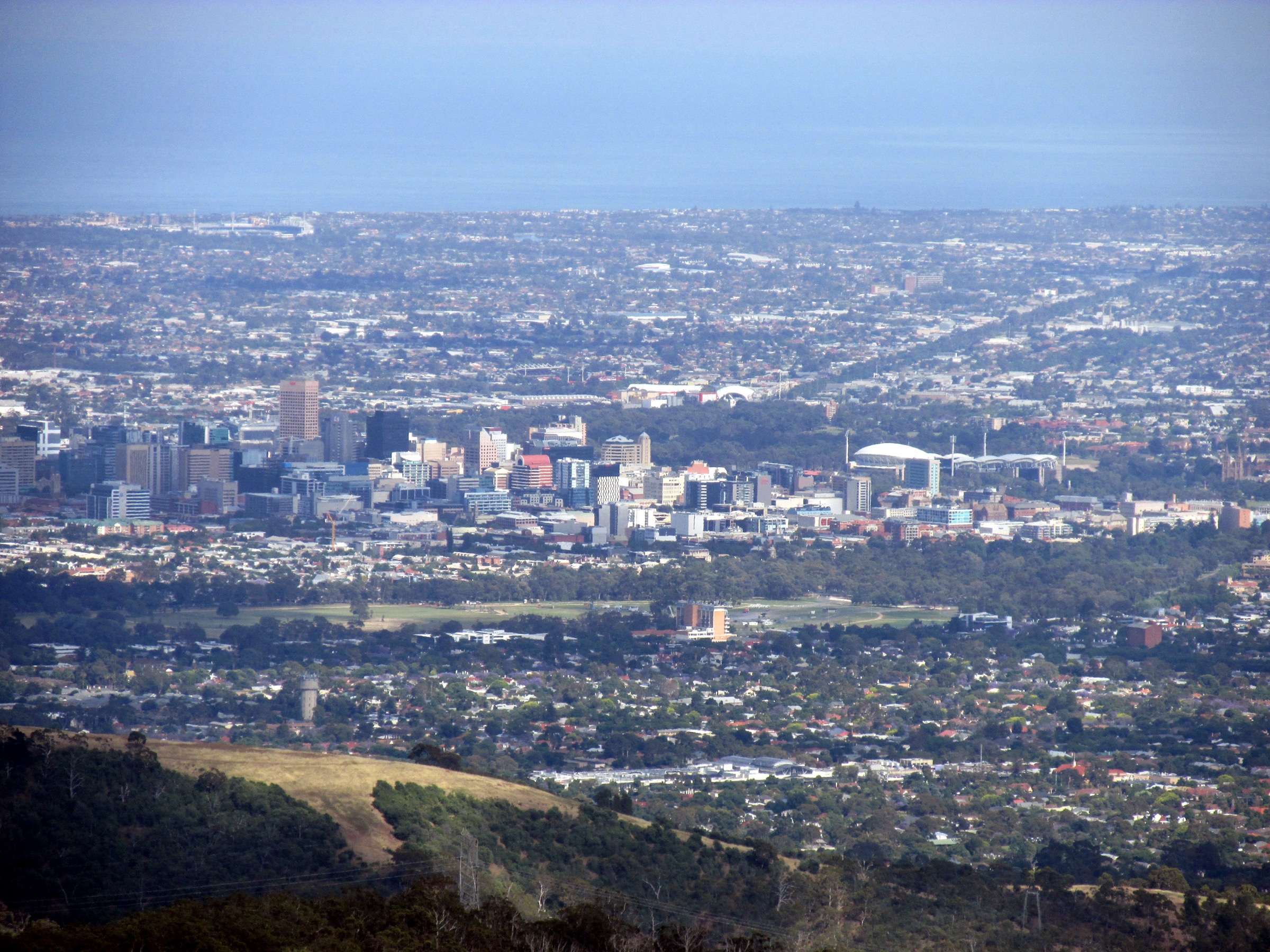
Regional overview
The Mount Lofty Ranges form the low, forested spine that rises immediately east and southeast of Adelaide and extends south along the Fleurieu Peninsula toward Cape Jervis. In the sub-region covered here — the central and southern Mount Lofty Ranges, sometimes grouped locally as the Adelaide Hills — Mount Lofty itself (recorded at 710 m on older signage and Wikipedia, 727 m on more recent parks.sa.gov.au and Cleland National Park summit signage) is the high point and the range’s iconic viewpoint. The uplands are built on Neoproterozoic and Cambrian sediments folded during the Delamerian Orogeny and dissected by short, steep creek gorges that carry seasonal waterfalls out of the range and down onto the Adelaide Plains.
The main walking centres cluster within a short drive of the Adelaide CBD. Cleland National Park (formerly Cleland Conservation Park, reclassified as a national park in 2021) covers the ridge from Waterfall Gully up to Mount Lofty Summit and eastward toward Piccadilly Valley. Morialta Conservation Park sits ten kilometres north-east of the CBD and holds the range’s best-known waterfall gorge. Belair National Park — the second-oldest national park in Australia, proclaimed in 1891 — sits directly above the southern suburbs. The long-distance Heysen Trail, roughly 1,200 km end to end from Cape Jervis to Parachilna Gorge, threads north through the range and provides several of the region’s most walked day sections. Beyond Adelaide, the southern tail of the range reaches Deep Creek National Park on the Fleurieu Peninsula, where the eucalypt forest breaks against 100 m cliffs above Backstairs Passage and Kangaroo Island.
Walking here is mostly temperate: mild wet winters (May to September) with day maxima around 12–15 °C and heavy fog and rain on the tops, and hot dry summers (December to March) with regular days above 35 °C on the Adelaide Plains and elevated fire risk in the ranges. The park network is administered by the National Parks and Wildlife Service South Australia through parks.sa.gov.au, and closures on days of Catastrophic (and often Extreme) Fire Danger are the single most important seasonal constraint — the ranges’ eucalypt canopy carries fire fast, and Cleland, Morialta, Belair and Deep Creek all close automatically when fire-danger ratings peak. Total Fire Ban days are declared through the SA Country Fire Service; the Fire Ban District map should be checked the morning of every summer walk.
Snakes — particularly eastern brown and red-bellied black — are active from about October to April in the ranges, and stick to the paths. Slippery rock at the falls (particularly Waterfall Gully, Morialta and Belair) is a real hazard after winter and spring rain. Cell coverage is generally good near Adelaide but patchy in Deep Creek. Public transport reaches many trailheads: Adelaide Metro bus 823 serves Mount Lofty Summit and Piccadilly, the Belair rail line runs directly to Belair National Park, and buses reach Morialta and Waterfall Gully from the CBD. Deep Creek requires a private vehicle.
Selection rationale
The five hikes were chosen to give a balanced picture of the sub-region across its main landscapes and management contexts: Waterfall Gully to Mount Lofty Summit as the iconic Adelaide summit walk in Cleland National Park; the Morialta Three Falls Grand Hike as the classic Mount Lofty Ranges waterfall gorge circuit; the Belair Waterfall Hike as the second-oldest-national-park classic and the archetypal Adelaide-front-country loop; the Heysen Trail Mt Lofty Circuit as the trail-classic day section on the range’s flagship long-distance trail; and the Deep Creek Cove Hike as the Fleurieu Peninsula coastal-cliff-and-gorge counterpart at the southern tail of the range. Two of the range’s most famous full-day walks — the Deep Creek Circuit (12 km) and the Yurrebilla Trail Section 1 (Belair to Eagle on the Hill, 19 km) — are noted in the Further reading list; the Deep Creek Circuit remains partly re-routed for post-fire recovery as of 2026, and the Cove Hike is currently the accessible Deep Creek essential.
Summary
| # | Hike | Sub-region | Route type | Distance | Gain | Max elevation | Difficulty |
|---|---|---|---|---|---|---|---|
| 1 | Waterfall Gully to Mount Lofty Summit | Cleland National Park | Out-and-back | 7.8–8.8 km | ~450–500 m | 727 m | Hard (Grade 4) |
| 2 | Morialta Three Falls Grand Hike | Morialta Conservation Park | Loop | ~7.3 km | ~380 m | ~377 m | Moderate (Grade 3) |
| 3 | Belair Waterfall Hike Circuit | Belair National Park | Loop | ~6.5 km | ~215 m | ~450 m | Moderate–Hard |
| 4 | Heysen Trail — Mt Lofty Circuit | Cleland NP / Piccadilly Valley | Loop | ~7.5 km | ~360 m | 727 m | Moderate (Grade 3) |
| 5 | Deep Creek Cove Hike | Deep Creek National Park, Fleurieu Peninsula | Out-and-back | ~6.4 km | ~250 m | ~260 m | Moderate–Hard (Grade 3) |
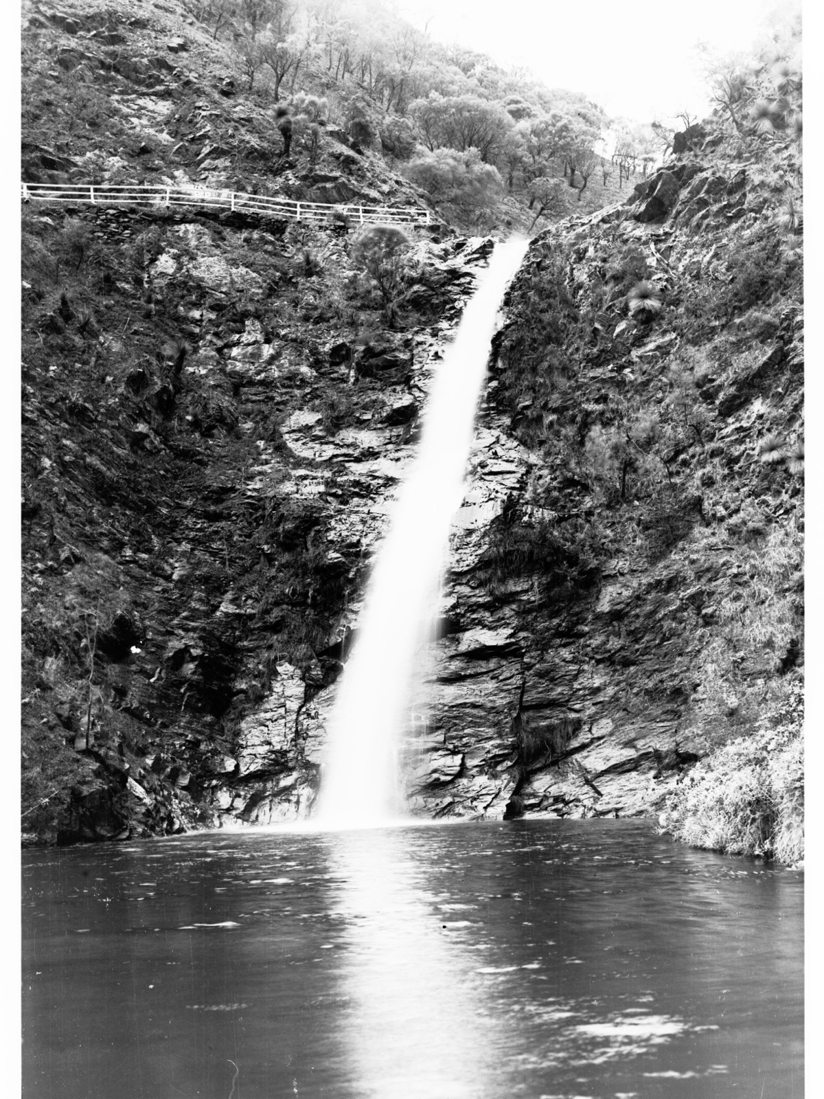
1. Waterfall Gully to Mount Lofty Summit
Snapshot
Itinerary
The trail begins at the First Falls car park at the end of Waterfall Gully Road, about ten kilometres south-east of the Adelaide CBD. From the base of the falls the sealed path climbs briefly to a viewing platform, then joins the main track that follows First Creek upstream through Cleland National Park’s stringybark and messmate forest. The climb is sustained rather than steep — a well-graded former service road for most of its length — and passes several rest benches, a lower dam and the ruins of Chinaman’s Hut before reaching a broad shoulder at about 550 m. The upper section steepens as the track leaves the creek and switchbacks up to Mount Lofty Summit via the summit road and the pedestrian entrance to the summit car park. The Flinders Column obelisk (16.5 m) marks the true high point at 727 m, with a summit café, gift shop, toilets and a 360° lookout platform.
Return is on the same line; a one-way option uses the Adelaide Metro 823 bus back to the city, or the same bus down to Crafers and a connection back into central Adelaide. A short spur from the summit descends to Mount Lofty Botanic Garden if a longer variant is preferred.
Why it is essential
This is Adelaide’s signature hike and the highest peak in the range. More than 600,000 walkers use the track each year — locals treat the round trip as a fitness benchmark, and visitors climb it for the panoramic view over the Adelaide CBD, the Adelaide Plains, Gulf St Vincent and, on clear days, the coastline as far as Kangaroo Island and the Yorke Peninsula. The route captures the essential character of the central Mount Lofty Ranges: a gorge with a permanent waterfall, dense eucalypt forest, and a summit lookout at the top.
Equipment
- Hiking shoes or light boots (formed trail, some rocky steps)
- Weatherproof layer
- Warm layer (top can be 5–8 °C cooler than the plains)
- Water (1.5–2 L; drinking water available at summit café)
- Sun protection — no shade above the tree canopy at the summit lookout
- Head-torch if starting early or descending late
Hazards and notes
- Park closes on Catastrophic Fire Danger days and may close on Extreme Fire Danger days; check the SA CFS Fire Ban District map before summer walks.
- Slippery rock at First Falls and along wet sections in winter.
- Snakes active October–April; stick to the path.
- Trail is very heavily used at weekends; parking at Waterfall Gully fills quickly.
- Dogs are not permitted in Cleland National Park.
- The upper trail crosses the summit road; watch for traffic at road crossings.
Routes and maps
| Source | URL |
|---|---|
| parks.sa.gov.au — Cleland National Park (Waterfall Gully to Mount Lofty Summit) | parks.sa.gov.au |
| parks.sa.gov.au — Waterfall Gully | parks.sa.gov.au |
| Walking SA — Waterfall Gully to Mt Lofty summit hike | walkingsa.org.au |
| South Australian Trails — Waterfall Gully to Mount Lofty Summit | southaustraliantrails.com |
| No official GPX published on parks.sa.gov.au; route is visible on OpenStreetMap | openstreetmap.org |
Further reading
- Good Living (DEW) — Waterfall Gully to Mt Lofty Summit Trail upgrades
- SA Country Fire Service — Fire Danger Ratings and Fire Bans
- Wikipedia — Mount Lofty
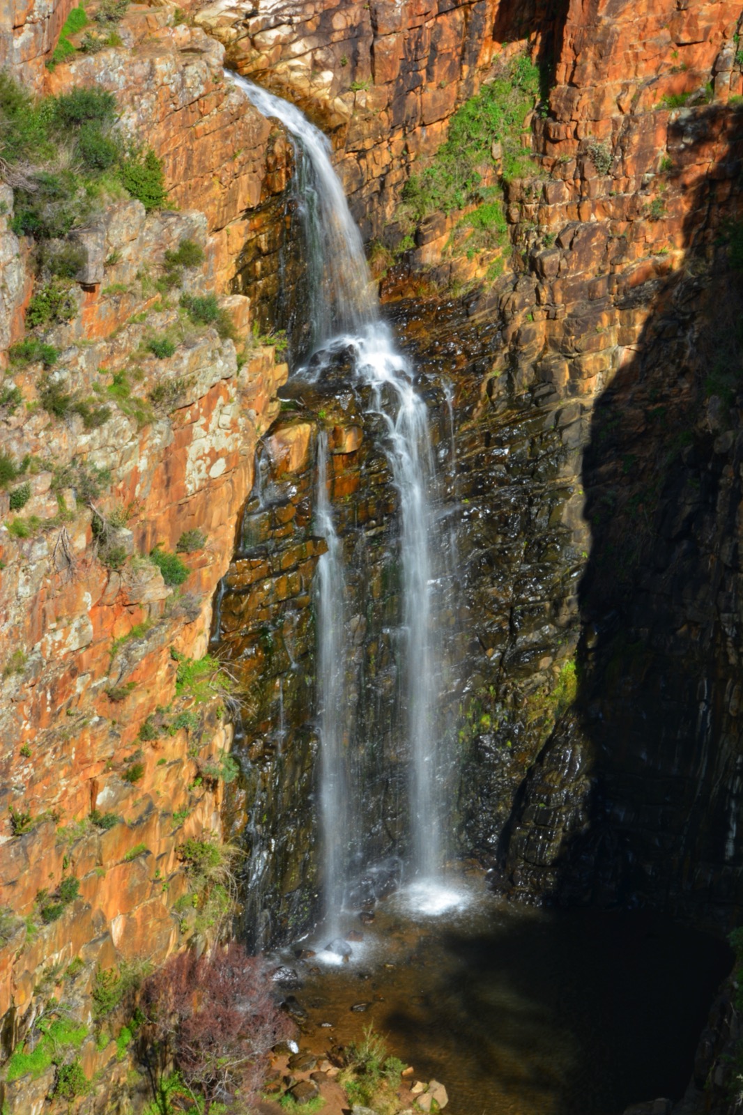
2. Morialta Three Falls Grand Hike
Snapshot
Itinerary
The signposted circuit is best walked anticlockwise from the top (Norton Summit Road) car park, as recommended by rangers. From the trailhead the track skirts the northern rim of Morialta Gorge past Deep View Lookout and Kookaburra Rock Lookout, giving overhead views of the cliffs and the eucalypt canopy in the gorge floor. It descends through open woodland to Third Falls, the highest of the three, then traces Fourth Creek downstream past a short signposted detour to Second Falls before reaching First Falls — the most visited of the three, framed by a stone amphitheatre and reached by a short bridged section from the lower car park. The final leg climbs back to the plateau via the southern rim and returns to the start.
Walkers beginning at the lower Stradbroke Road car park connect to the circuit via the Fourth Creek Walk in the gorge floor.
Why it is essential
Morialta is the range’s classic waterfall-gorge hike, and the Three Falls Grand Hike is the standard way to see all three cascades on a single day. The rim-and-floor combination gives both the plateau perspective of the cliffs and close approaches to the falls themselves. The park is a short drive from central Adelaide and is the most visited protected area in the Adelaide Hills.
Equipment
- Hiking shoes with good grip — rock steps are slippery when wet
- Weatherproof and warm layers in winter
- Water (1.5 L)
- Sun protection outside winter
- Snake gaiters optional in warmer months
Hazards and notes
- Steep rock steps and uneven surfaces; the parks page specifically warns about slipperiness when wet.
- Waterfalls are seasonal — the strongest flow is after winter rain (July–October); by late summer the falls may be dry.
- Park closes on Catastrophic Fire Danger days.
- Snakes active October–April.
- Dogs are not permitted in Morialta Conservation Park.
Routes and maps
| Source | URL |
|---|---|
| parks.sa.gov.au — Morialta Conservation Park | parks.sa.gov.au |
| parks.sa.gov.au — Morialta / Black Hill trail map (PDF) | environment.sa.gov.au |
| Walking SA — Three Falls Grand Hike | walkingsa.org.au |
| Trailforks — Three Falls Grand Hike | trailforks.com |
| No direct GPX published by parks.sa.gov.au; OpenStreetMap coverage is complete | openstreetmap.org |
Further reading
- Good Living (DEW) — 10 things to see and do at Morialta Conservation Park
- Wikipedia — Morialta Conservation Park
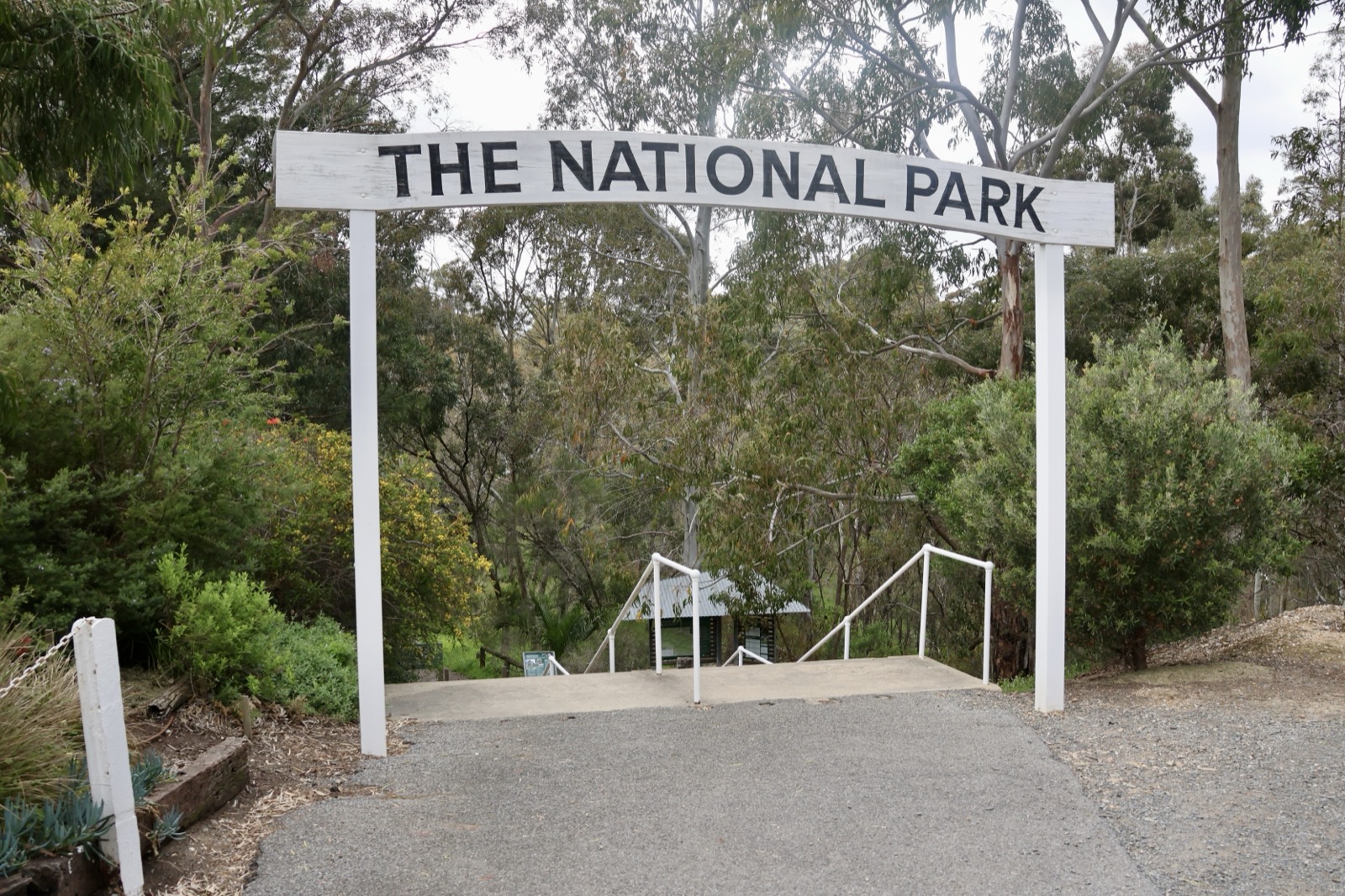
3. Belair Waterfall Hike Circuit
Snapshot
Itinerary
The Waterfall Hike loop starts from the Pines Area car park near the park entrance and heads south through dense eucalypt woodland. Early on the trail passes through the Echo Tunnel — a narrow, unlit stone-lined pedestrian tunnel under the Adelaide–Melbourne railway line — before climbing steadily to the Lower Waterfall lookout. It then continues higher along the rocky escarpment to the Upper Waterfall lookout, both of which are seasonal cascades most reliable after winter rain. The return leg loops back through open woodland along Queens Jubilee Drive and the Yurrebilla Trail before rejoining the outward path near the Pines. Belair has an extensive network of interlocking trails; markers for the Waterfall Hike are white and follow a well-signposted circuit.
Why it is essential
Belair National Park was proclaimed in 1891 — the second national park declared in Australia — and remains the classic front-country walk in the southern Mount Lofty Ranges. The Waterfall Hike is the flagship circuit inside it, combining seasonal waterfalls, the atmospheric Echo Tunnel and open sclerophyll woodland within a 30-minute drive or 30-minute train ride of central Adelaide. It represents both a piece of Australian conservation history and the archetypal Adelaide Hills day-walk.
Equipment
- Hiking shoes with grip; steps around the falls are slippery when wet
- Small torch for the Echo Tunnel
- Weatherproof and warm layers in winter
- Water (1.5 L)
- Sun protection outside winter
Hazards and notes
- Echo Tunnel has a low ceiling and no lighting — mind head-height and use a torch.
- Rocky steps around the upper falls are slippery when wet.
- Vehicle entry fees apply; entry on foot or by bicycle is free.
- Park closes on Catastrophic Fire Danger days and may close on Extreme Fire Danger days.
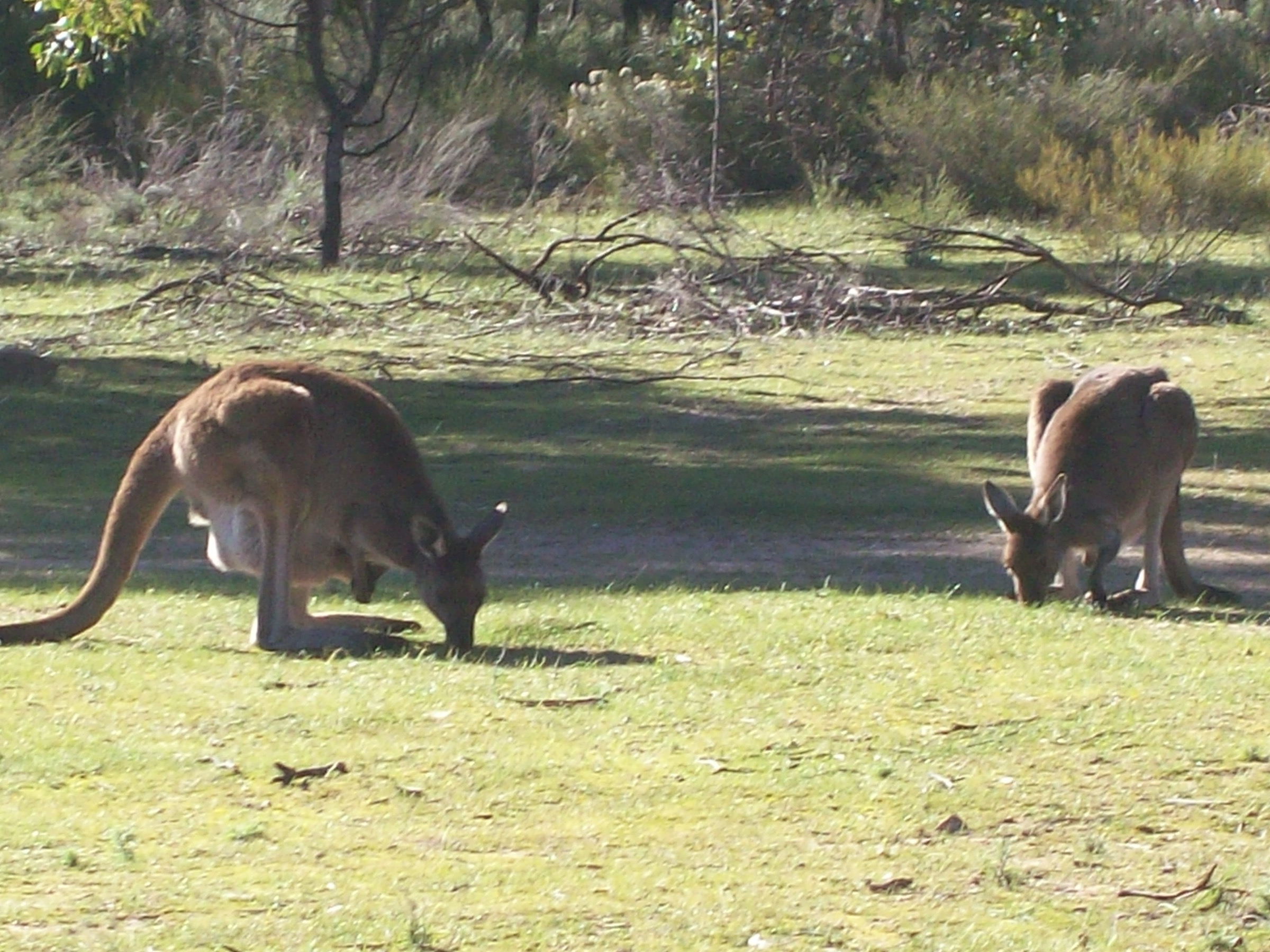
- Snakes active October–April; wallabies frequent the trail edges.
- Dogs are permitted on lead on designated trails only — check current signage.
Routes and maps
| Source | URL |
|---|---|
| parks.sa.gov.au — Belair National Park | parks.sa.gov.au |
| Walking SA — Waterfall Hike, Belair | walkingsa.org.au |
| South Australian Trails — Waterfall Hike Belair | southaustraliantrails.com |
| Trail Hiking Australia — Belair Waterfall Circuit | trailhiking.com.au |
| No direct GPX published by parks.sa.gov.au; OpenStreetMap and AllTrails hold the geometry | openstreetmap.org |
Further reading
- Good Living (DEW) — Take a walk in Belair National Park: the Waterfall Hike
- Wikipedia — Belair National Park
4. Heysen Trail — Mt Lofty Circuit
Snapshot
Itinerary
The circuit starts at Mount Lofty Summit and follows the Heysen Trail east and south off the summit, descending through Cleland National Park’s stringybark forest to the edge of the Piccadilly Valley. The trail crosses Piccadilly Valley on quiet farm roads and lanes between cottages and small-scale market gardens — the section that gives the walk its distinctive open, pastoral character. It then re-enters the Mount Lofty Botanic Garden, climbs through the garden’s cool-climate plantings (sequoias, magnolias and rhododendrons) and rejoins the Heysen Trail through Cleland National Park to close the loop back at the summit car park. Heysen Trail markers (a red-and-white waymark bearing a stylised gum leaf) are present throughout, and the route is easy to follow in good visibility.
An alternative start at the Mount Lofty Botanic Garden car parks reduces the initial descent and reserves the summit climb for the second half of the loop.
Why it is essential
This is the classic day section of the Heysen Trail — the 1,200 km long-distance trail from Cape Jervis to Parachilna Gorge that is South Australia’s flagship walking route — in the immediate vicinity of Mount Lofty Summit. It links the range’s iconic summit, its cool-climate botanic garden and the working pastoral landscape of Piccadilly Valley in a single loop, and is one of the most heavily walked day sections of the trail. Every through-walker on the Heysen crosses this ground; the circuit gives day-walkers the same experience without the multi-week commitment.
Equipment
- Hiking shoes or light boots
- Weatherproof and warm layers (summit weather is cooler and more exposed than the valley)
- Water (1.5–2 L; refill possible at the summit and botanic garden)
- Sun protection
- Botanic Garden opening hours (see below) constrain the start time in winter
Hazards and notes
- Botanic Garden opens 08:30 weekdays / 10:00 weekends, closes 16:00 weekdays / 17:00 weekends (18:00 during daylight saving) — plan the loop to fall within these hours.
- Park closes on Catastrophic Fire Danger days.
- Piccadilly Valley section crosses public roads; watch for traffic.
- Snakes active October–April.
- Dogs are not permitted in Cleland National Park or the Mount Lofty Botanic Garden.
Routes and maps
| Source | URL |
|---|---|
| Walking SA — Heysen Trail Mt Lofty circuit | walkingsa.org.au |
| Friends of the Heysen Trail — trail authority | heysentrail.asn.au |
| Adelaide Hills Council — Heysen Trail (Mt Lofty) | ahc.sa.gov.au |
| parks.sa.gov.au — Cleland National Park | parks.sa.gov.au |
| Trail Hiking Australia — Heysen Trail Mt Lofty Circuit | trailhiking.com.au |
| No direct GPX published by the Friends of the Heysen Trail; sections are available in the Trailmaster PDF map series | heysentrail.asn.au |
Further reading
- Friends of the Heysen Trail — walking the trail
- South Australian Trails — Heysen Trail overview
- Wikipedia — Heysen Trail
5. Deep Creek Cove Hike

Snapshot
Itinerary
The route begins at Trig Picnic Area at the end of Tent Rock Road, in the western side of Deep Creek National Park. From the picnic area the trail heads south-east, descending steadily through mixed eucalypt and stringybark forest toward the Deep Creek valley. It passes the Deep Creek Waterfall — a modest, largely year-round cascade in the gorge floor — and then continues down the western side of Deep Creek to its mouth. The final section reaches Deep Creek Cove, a small rock-strewn beach at the base of dark coastal cliffs where the creek meets Backstairs Passage. Views across the passage take in Kangaroo Island on clear days.
The Cove Hike is currently used as the Wild South Coast Way Heysen Trail re-route between Tent Rock Road and Tapanappa Lookout, following fire recovery works. Return is on the same line, with the climb back to Trig Picnic Area accounting for most of the day’s elevation gain.
Why it is essential
Deep Creek is the range’s essential coastal-and-gorge hike — the southern tail of the Mount Lofty Ranges as it breaks against the Southern Ocean at the tip of the Fleurieu Peninsula. The Cove Hike, currently the recommended entry to the park’s coastal cliffs after 2025–2026 bushfire recovery works, packs the essential elements — cliff-top forest, a gorge waterfall and a wild ocean cove framing Kangaroo Island — into a manageable half-day. It represents the range’s break with the mainland and is very different in character from the Adelaide-front-country walks further north.
Equipment
- Sturdy hiking shoes or boots — rocky, slippery final descent
- Weatherproof layer (exposed to south-westerly weather off the ocean)
- Warm layer
- Water (2 L; no reliable water on route)
- Sun protection
- Tide table for the cove (rock-strewn beach is safer at low to mid tide)
- Insect repellent from spring onwards
Hazards and notes
- The final section into the cove requires scrambling on boulders and can be slippery when wet.
- Do not enter the ocean at the cove — Backstairs Passage has strong currents and cold water.
- Snakes active October–April.
- Park closes on Catastrophic Fire Danger days; walking trails are periodically closed during pest-animal control programmes (typically overnight closures announced on the parks.sa.gov.au closures page).
- Post-fire re-routes and access changes remain in force as of 2026 following the Deep Creek fire; check the parks.sa.gov.au closures page before travel.
- Vehicle entry fees apply within Deep Creek National Park.
- Cell coverage is limited within the park.
Routes and maps
| Source | URL |
|---|---|
| parks.sa.gov.au — Deep Creek National Park | parks.sa.gov.au |
| parks.sa.gov.au — Deep Creek closures and alerts | parks.sa.gov.au |
| parks.sa.gov.au — Wild South Coast Way (Heysen Trail) | parks.sa.gov.au |
| South Australian Trails — Deep Creek Cove Hike from Trig Picnic Area | southaustraliantrails.com |
| Walking SA — Deep Creek Cove Hike from Trig Picnic Area | walkingsa.org.au |
| No direct GPX published by parks.sa.gov.au; the Heysen Trail section is mapped in the Friends of the Heysen Trail Trailmaster series | heysentrail.asn.au |
Further reading
- Good Living (DEW) — camping guide to Deep Creek
- South Australian Trails — Deep Creek Circuit Hike
- Wikipedia — Deep Creek National Park
Missing data / follow-up work
- Waterfall Gully to Mount Lofty Summit — elevation gain: cited variously as 450 m, 480 m and “over 500 m” across sources. parks.sa.gov.au does not publish an official gain figure; the range 450–500 m is used above and should be resolved against an on-the-ground GPS trace.
- Morialta Three Falls Grand Hike — distance: Walking SA cites 7.3 km; some databases give 6.5 km for a shorter Grand Circuit variant. Both figures appear consistent depending on whether the top or lower car park is used.
- Deep Creek Cove Hike — elevation gain and current status: no official parks.sa.gov.au gain figure; the approximate 250 m figure above is derived from third-party sources. Sections of the Wild South Coast Way remain re-routed after 2025–2026 fire recovery, and the parks.sa.gov.au closures page should always be checked before travel.
- Official GPX files: parks.sa.gov.au does not publish direct GPX downloads for these routes. OpenStreetMap has complete coverage for all five routes and the Heysen Trail is available in the Friends of the Heysen Trail Trailmaster PDF map series, but no single official GPX portal exists.
Further reading
Nearby Flinders Mount Lofty Ranges guides on Storm
- Gammon Ranges / Arkaroola
- Ikara-Flinders / Wilpena Pound
-
parks.sa.gov.au — National Parks and Wildlife Service South Australia
- Walking SA — walks in the Adelaide Hills
- South Australian Trails — Mount Lofty Ranges
- Friends of the Heysen Trail
- SA Country Fire Service — fire danger ratings and total fire bans
- Yurrebilla Trail — Belair National Park to Eagle on the Hill (Walking SA)
- Deep Creek Circuit Hike (South Australian Trails)
- Wikipedia — Mount Lofty Ranges