Regional overview
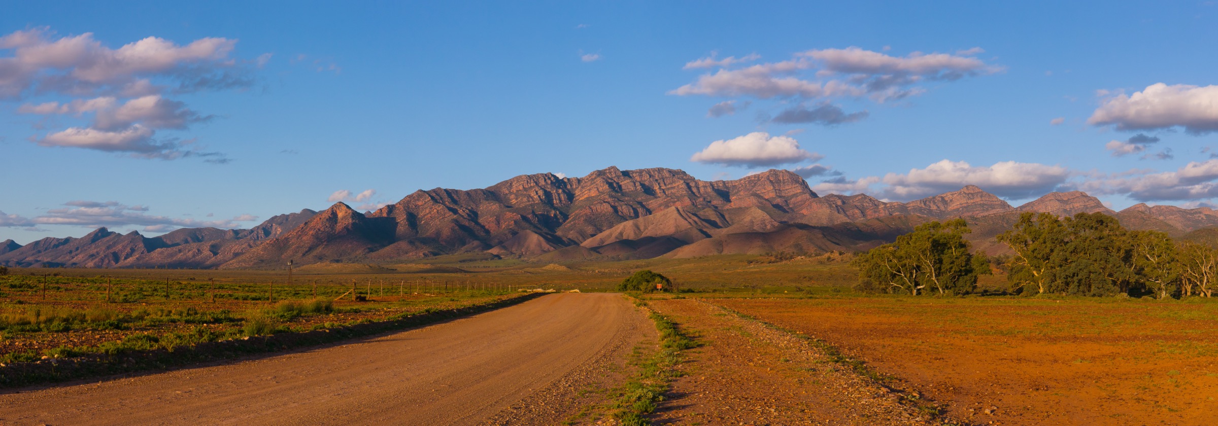
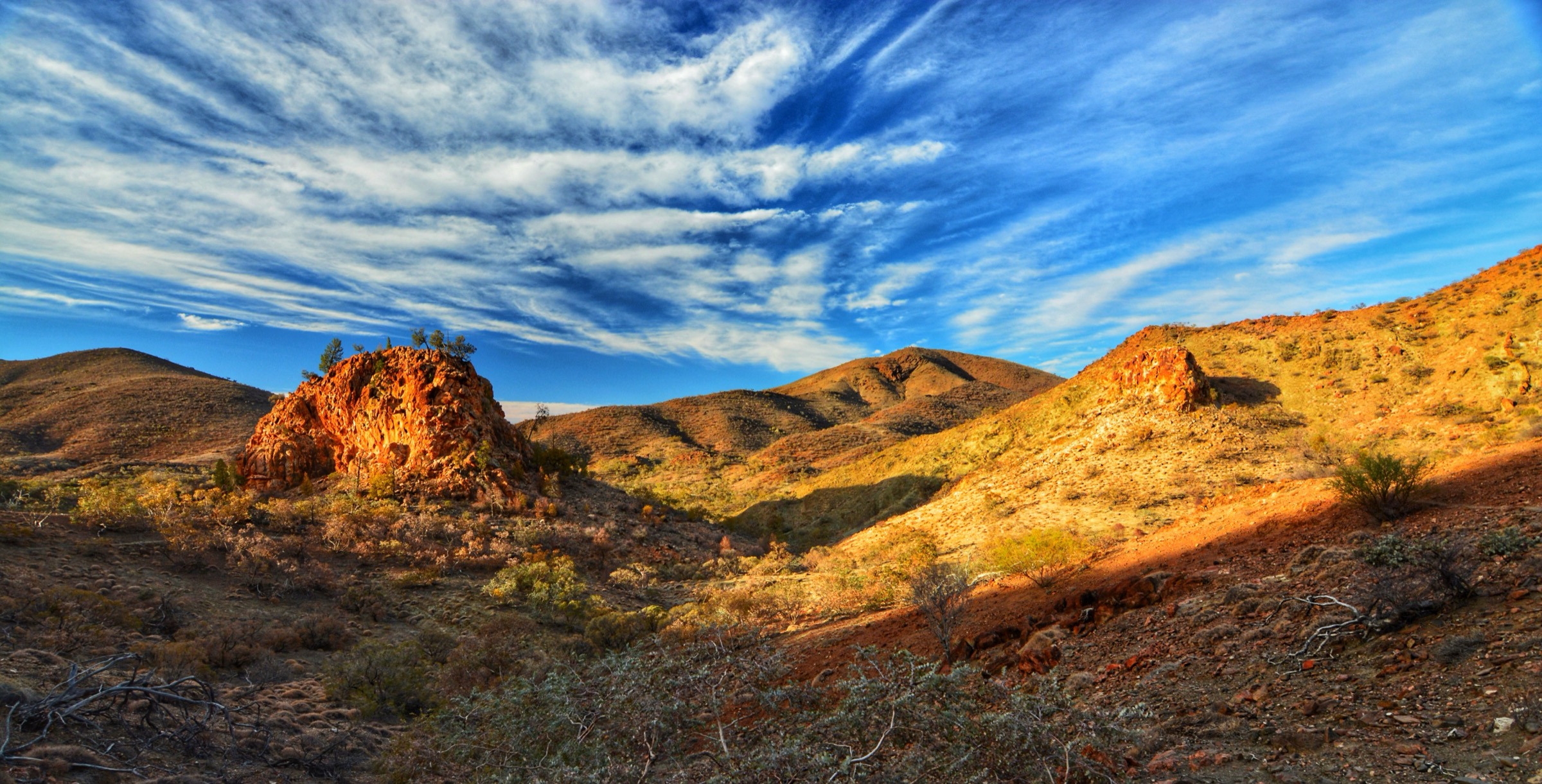
The northern Flinders Ranges form the far end of a folded, glacially eroded uplift that runs south from the arid gibber country toward Wilpena Pound. In this catalogue, “Gammon Ranges / Arkaroola” covers two adjoining land tenures: Vulkathunha-Gammon Ranges National Park, co-managed with the Adnyamathanha Traditional Owners, and the Arkaroola Wilderness Sanctuary immediately to its north-east, a privately held conservation freehold established by the geologist Reg Sprigg and his family in 1968. Together they take in the highest, most rugged and geologically most complex country in the Flinders — the Gammon Plateau proper, the Balcanoona Range, the Yudnamutana and Mount Painter Provinces and the ochre-and-quartzite ranges above Arkaroola Village.
The walking character is arid outback: dry rocky creek beds, quartzite ridges, waterhole-and-gorge routes and open ochre saltbush country. There are few marked and maintained walking tracks: the national park side is essentially a single named trail network based on Balcanoona and the Weetootla Gorge, while the sanctuary side has a small number of registered walks radiating from Arkaroola Village. Off-track walking on the high Gammon Plateau is remote wilderness travel and outside the scope of this list. Nights are cold in winter and days can be very hot; between November and March, daytime temperatures routinely exceed 40 °C and the whole area becomes unsuitable for foot travel by anyone other than experienced desert walkers.
Access is entirely by private vehicle. The park headquarters is at Balcanoona, on the Balcanoona–Copley road; Arkaroola Village lies about 30 km further north-east on the same unsealed road system. The nearest sealed road is the Outback Highway at Copley/Leigh Creek, roughly 100 km west. There is no public transport of any kind, no reliable mobile-phone coverage across most of the area, and no fuel between Copley and Arkaroola. Arkaroola requires all self-guided walkers to sign in at the visitor centre before departure and to sign out on return; the sanctuary uses this register for search and rescue and closes tracks that are unsafe. The whole region is Adnyamathanha Yarta (country), and cultural respect for named sites and rock-art areas is expected.
Selection rationale
The five hikes were chosen to give a balanced picture of the sub-region within the constraint that the number of marked and maintained day walks here is very small. The Weetootla Gorge circuit is the essential national-park walk — the only maintained loop through the Balcanoona Range, a yellow-footed rock-wallaby refuge, and the standard introduction to the Gammon country. Grindells Hut to Italowie Gap (via the Weetootla trailhead) is included as the sub-region’s ridge-and-heritage day out from an accessible 4WD hut. On the Arkaroola side, Acacia Ridge is the standard short ridge-and-panorama walk from Arkaroola Village; the Mawson–Spriggina loop is the sanctuary’s longer ridge-and-valley circuit named for Reg Sprigg’s Ediacaran fossil work; and Bararranna Gorge is the essential geological walk that passes stromatolite outcrops, the Elatina glacial diamictite and Stubbs Waterhole. Longer traverses such as Oppaminda–Nudlamutana across to Mount Warren Hastings are noted below but not selected — they exceed the day-hike frame for most parties and require specific 4WD logistics.
Summary
| # | Hike | Country | Route type | Distance | Gain | Max elevation | Difficulty |
|---|---|---|---|---|---|---|---|
| 1 | Weetootla Gorge Circuit (Balcanoona Creek Hike) | Australia | Loop | ~5.6 km (circuit) up to ~18.4 km via Grindells Hut variant | ~100 m core loop | ~570 m | Moderate |
| 2 | Grindells Hut to Italowie Gap area | Australia | Out-and-back / drive-in ridge walk | Variable; short loops of 2–6 km around the hut | Variable | ~600 m | Easy to moderate on marked short loops |
| 3 | Acacia Ridge Walk (with Griselda Hill option) | Australia | Out-and-back or loop | 6.5 km one way, 10.5 km loop via Arkaroola Road | ~280 m | ~590 m | Moderate |
| 4 | Mawson–Spriggina Walk | Australia | Loop | ~8 km | ~300 m | ~640 m | Moderate |
| 5 | Bararranna Gorge Walk | Australia | Loop | ~6.8 km | ~200 m | ~500 m | Moderate |
Before you go
Access, permits and registration
Vulkathunha-Gammon Ranges National Park is a National Parks and Wildlife Service South Australia (NPWSSA) reserve. Camping requires a booking through the parks.sa.gov.au system; day walking on the marked trails does not require a permit but a park entry fee applies. The Weetootla trailhead is reached from the Balcanoona–Arkaroola road (approximately 7 km from Balcanoona; the final section is 2WD-passable in dry conditions).
Arkaroola Wilderness Sanctuary is privately owned by the Sprigg family and operates a compulsory sign-in / sign-out register at the visitor centre for all bushwalks. Some tracks (in particular Bararranna Gorge and the Mawson–Spriggina loop) are closed on hot-forecast days and after storms. The Ridgetop Track and other 4WD tours are separate paid activities.
Standard outback day-hike kit
For all five walks the local minimum is:
- Sturdy hiking boots with good tread; the ranges are quartzite and shale — sharp rock and loose scree.
- 3–4 L water per person minimum for a half-day walk; none of the marked routes have reliable drinkable water even at the named waterholes.
- Sun hat, long sleeves, sunglasses and high-SPF sunscreen; there is no shade for most of every route.
- Map (Trails SA / NPWSSA brochure for Weetootla; Arkaroola visitor-centre map for the sanctuary walks) and a compass or GPS.
- Personal Locator Beacon (PLB) is strongly recommended across the entire area; mobile coverage is absent through most of the ranges and rescue is many hours away.
- Snake-bite bandage and basic first aid.
Common hazards
Heat, dehydration and remoteness are the dominant hazards. Add loose rock underfoot on all ridge walks; unbridged creek crossings that can flood after summer thunderstorms; snakes (particularly western brown, king brown and death adder); and, in the sanctuary, occasional closures for extreme fire danger. The entire area is Adnyamathanha country, with named cultural sites throughout; walkers should stay on tracks and not disturb rock arrangements, art panels or waterholes.
1. Weetootla Gorge Circuit (Balcanoona Creek Hike)

Snapshot
Itinerary
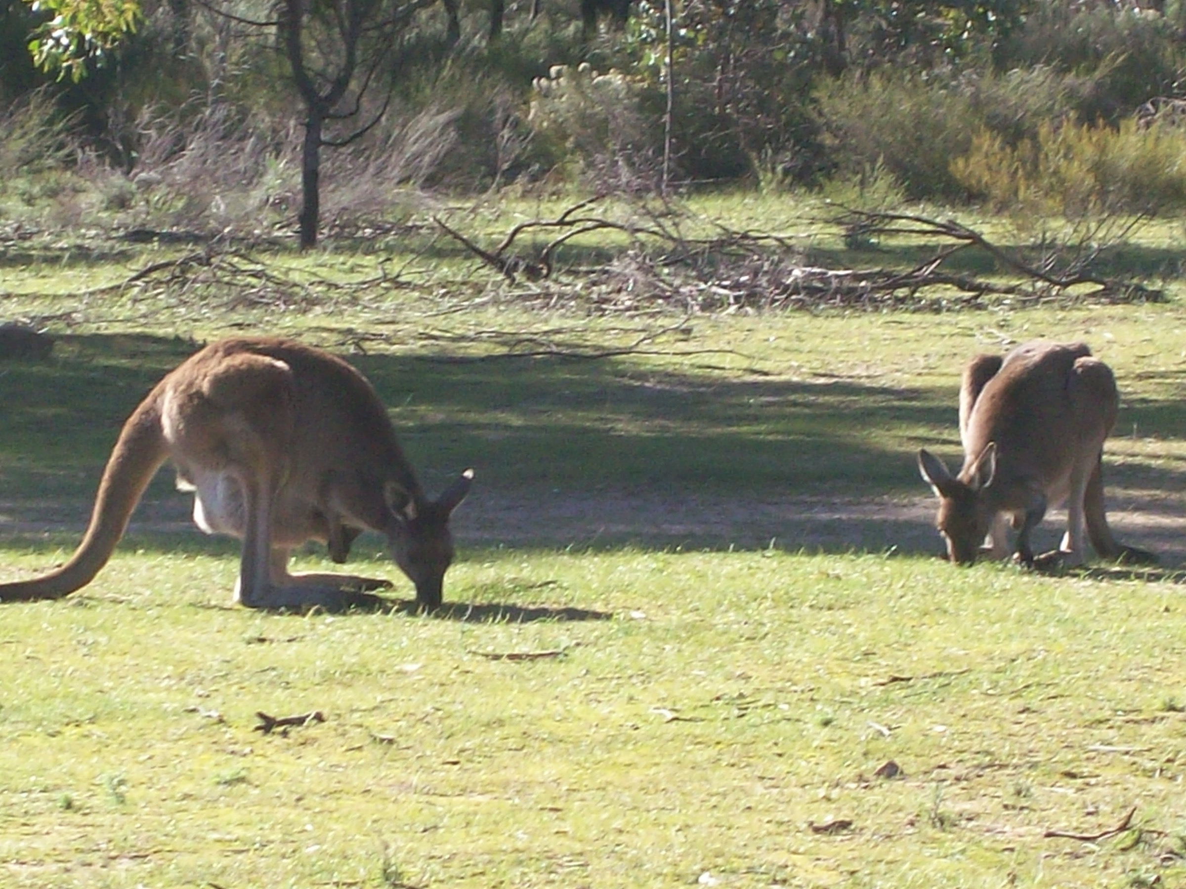
The Weetootla Campground trailhead sits at the end of the signposted spur from the Balcanoona–Arkaroola road, about 7 km from the Balcanoona ranger station. The core walk follows Balcanoona Creek upstream into Weetootla Gorge itself, weaving between towering red quartzite walls and past permanent freshwater springs that support a resident colony of yellow-footed rock-wallabies (andu in Adnyamathanha). At about 2.5 km, the marked trail joins the loop that returns via the northern flanks of Mount McTaggart back to the campground.
Two extensions are commonly walked as full days. The Monarch Mine loop (about 6.6 km, some 150 m of climb) breaks off shortly before the springs and climbs to the remnants of a 19th-century copper mine on the ridge north of the gorge. The full Weetootla–Grindells circuit continues up the gorge, climbs steadily out of the creek onto the ridge north of Mount McTaggart, arrives at Grindells Hut, and returns via the 4WD track and the northern branch of Balcanoona Creek for a total of about 18.4 km — a serious full day in this climate.
Why it is essential
Weetootla Gorge is the only maintained walking route through the eastern rampart of the Gammon Ranges. It combines a permanent-water gorge (rare in this country), reliable rock-wallaby viewing, an accessible geological cross-section of the Balcanoona Range, and, on the extended circuits, the sub-region’s most iconic heritage hut. Every visitor summary of the national park treats it as the essential day walk.
Equipment
- Sturdy hiking boots (rocky creek bed and loose scree on the ridge branches).
- 3 L water per person for the core loop; 4–5 L for the full circuit.
- Sun hat, long sleeves, sunscreen — very little shade even in the gorge proper.
- Map (NPWSSA Weetootla hike brochure) and a compass or GPS.
- Snake-bite bandage; PLB strongly recommended for the extended circuits.
Hazards and notes
- Summer temperatures are dangerous; the walk should not be attempted November to March in a normal forecast.
- Balcanoona Creek can flood rapidly after summer thunderstorms; check with the ranger.
- The rock-wallaby springs are a listed conservation site; keep dogs out (dogs are prohibited in the park) and stay on the marked trail near the water.
- The Grindells extension requires reliable navigation on the ridge; the marked trail is intermittent above the springs.
Routes and maps
| Source | URL |
|---|---|
| NPWSSA — Weetootla Hike Network brochure (PDF) | environment.sa.gov.au |
| NPWSSA — Vulkathunha-Gammon Ranges NP | parks.sa.gov.au |
| Trails SA — Balcanoona Creek Hike | southaustraliantrails.com |
| AllTrails — Vulkathunha-Gammon Ranges NP | alltrails.com |
Further reading
- Adelaide Bushwalkers — Environmental monitoring in Weetootla Gorge
- Wikipedia — Vulkathunha-Gammon Ranges National Park
2. Grindells Hut to Italowie Gap area
Snapshot
Itinerary
Grindells Hut sits on a low ridge in the Balcanoona Range, reached by a 4WD-only track that leaves the Balcanoona–Arkaroola road opposite the Weetootla trailhead. The hut itself is a restored stone dwelling from the pastoral era, used today as a hikers’ shelter and a base for wilderness walking on the Gammon Plateau. Short marked loops from the hut give an accessible sample of the country — the “Grindells Hut Loop” heads north-east into the low creek country before returning via a ridge; a longer walker’s route runs west along the ridge toward the head of Weetootla Gorge.
Italowie Gap, on the western edge of the park near Iga Warta, is a short but characteristic walk into a narrow red quartzite gorge with permanent pools in wet years. It is reached from a separate access on the western park road and is often combined with a visit to the Adnyamathanha cultural centre at Iga Warta rather than driven direct from Balcanoona.
Why it is essential
This entry captures the sub-region’s pastoral-heritage character. Grindells Hut is the visual anchor of park publicity material, and its ridge-top location gives a genuine sense of the Gammon Plateau at low walking commitment. Italowie Gap complements it as a short cultural-and-geological gorge walk in a very different corner of the park.
Equipment
- Hiking shoes or light boots.
- 2 L water per person for short loops.
- Sun protection; there is no shade on the ridge around Grindells.
- Map and compass; the short loops are marked but off-track ground is not.
- 4WD vehicle strongly recommended for the Grindells access track.
Hazards and notes
- The Grindells access track is 4WD-only and can be closed after rain; confirm with Balcanoona.
- Off-track walking onto the Gammon Plateau requires PLB and considerable experience; do not commit to plateau routes as a day walk.
- The hut is unstaffed; carry all water needed for the day.
- Italowie Gap access crosses adjoining Iga Warta / Adnyamathanha land; respect signage and any cultural closures.
Routes and maps
| Source | URL |
|---|---|
| NPWSSA — Vulkathunha-Gammon Ranges NP | parks.sa.gov.au |
| Friends of Vulkathunha-Gammon Ranges NP | friendsofparkssa.org.au |
| Walking Trails Support Group — Italowie Hike | walkingtrailssupportgroup.org.au |
Further reading
3. Acacia Ridge Walk (with Griselda Hill option)
Snapshot
Itinerary
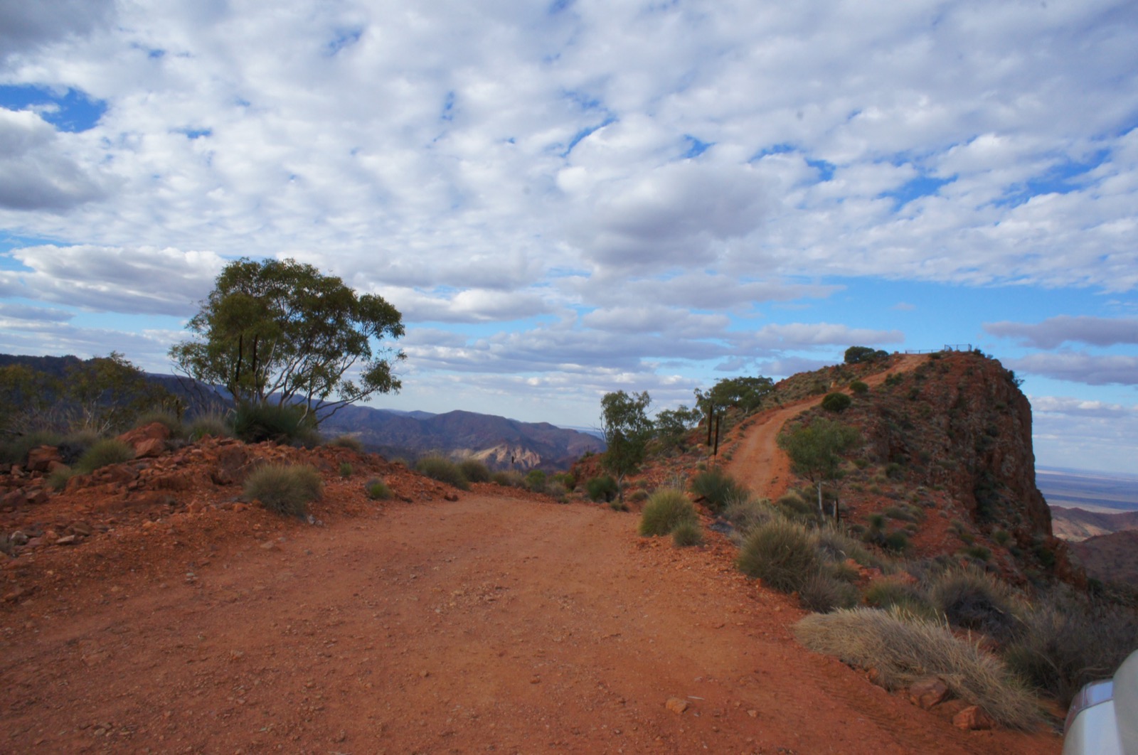
Acacia Ridge starts a short distance from Arkaroola Village on the ridge immediately south of the airstrip. The marked route climbs steadily onto the crest of the ridge, then follows the crest west with panoramic views south into the Yudnamutana Gorge country, north toward Mount Painter, and east across the plains toward Lake Frome. The natural turnaround is at the far end of the ridge, about 6.5 km from the village. Most parties either return along the same line or drop off the ridge to Arkaroola Road for a 10.5 km loop back to the village.
Griselda Hill is a short but steep add-on right at the start of the walk. The path leaves the main track a few hundred metres from the village and climbs about 1 km to a small rocky top with views back over the village and eastward to the Barytes Ridge. The final section requires easy scrambling on quartzite blocks and is often done as a stand-alone sunrise or sunset outing.
Why it is essential
Acacia Ridge is the standard short ridge-and-panorama walk of the sanctuary. It gives the widest accessible view of the Mount Painter Province — the geological centrepiece of Arkaroola — without committing to a longer wilderness walk. Griselda Hill, at the start, is the sub-region’s most compact “first walk” and captures the character of the ranges in an hour.
Equipment
- Sturdy hiking shoes or light boots.
- 3 L water per person.
- Sun hat, sunglasses, sunscreen; there is no shade anywhere on the ridge.
- Map (Arkaroola visitor-centre map); the route is marked but sparsely.
- Sign in at the visitor centre before departure and sign out on return.
Hazards and notes
- Compulsory sign-in / sign-out at the Arkaroola visitor centre.
- Loose rock underfoot on the descent; a slip on Griselda Hill can be serious.
- Full sun exposure; do not attempt in a forecast above about 32 °C.
- Snakes routinely bask on the ridge in cooler weather; watch the trail.
- The whole area is Adnyamathanha country — stay on the marked route.
Routes and maps
| Source | URL |
|---|---|
| Arkaroola Wilderness Sanctuary — official site | arkaroola.com.au |
| Trail Hiking Australia — Acacia Ridge Walk | trailhiking.com.au |
| Walking SA — Arkaroola walking trails | walkingsa.org.au |
| Hiking the World — Acacia Ridge | hikingtheworld.blog |
Further reading
4. Mawson–Spriggina Walk
Snapshot
Itinerary
From the Arkaroola Village trailhead, the walk contours through Mawson Valley, named for the Antarctic geologist Douglas Mawson, before climbing onto Spriggina Ridge — named for Reg Sprigg and the eponymous Ediacaran fossil first described by his colleague Martin Glaessner from Flinders Ranges material. The ridge section runs above 600 m and gives long views across the sanctuary toward Mount Painter and the Yudnamutana Gorge to the north-west. The circuit drops back into Mawson Valley on a broad spur and returns to the village on the outward line for a total of about 8 km and 300 m of climb, typically completed in around four hours.
Why it is essential
This is the sub-region’s essential half-day ridge-and-valley circuit. It captures the geological and cultural narrative of the sanctuary — Mawson’s early expeditions in Antarctica, Sprigg’s Ediacaran fossil work, and the tectonic-and-erosional character of the ranges — in a single loop that is longer and more committing than Acacia Ridge but well within a fit day-walker’s frame.
Equipment
- Sturdy hiking boots (rocky descent).
- 3 L water per person minimum.
- Full sun protection and long sleeves.
- Compass or GPS in addition to the visitor-centre map; the ridge markers are sparse.
- Sign in / sign out at the visitor centre.
Hazards and notes
- Full sun and heat; the ridge section has no shade at all.
- Sanctuary sign-in / sign-out is compulsory.
- Loose rock and quartzite scree on the ridge descent.
- Watch for snakes in the valley section, particularly in early morning and late afternoon.
- The route can be closed on high fire-danger days; check at the visitor centre.
Routes and maps
| Source | URL |
|---|---|
| Arkaroola Wilderness Sanctuary — official site | arkaroola.com.au |
| Trail Hiking Australia — Mawson Spriggina Walk | trailhiking.com.au |
| Walking Trails Support Group — Mawson–Spriggina | walkingtrailssupportgroup.org.au |
| Wikiloc — Arkaroola Mawson Spriggina loop | wikiloc.com |
Further reading
5. Bararranna Gorge Walk
Snapshot
Itinerary
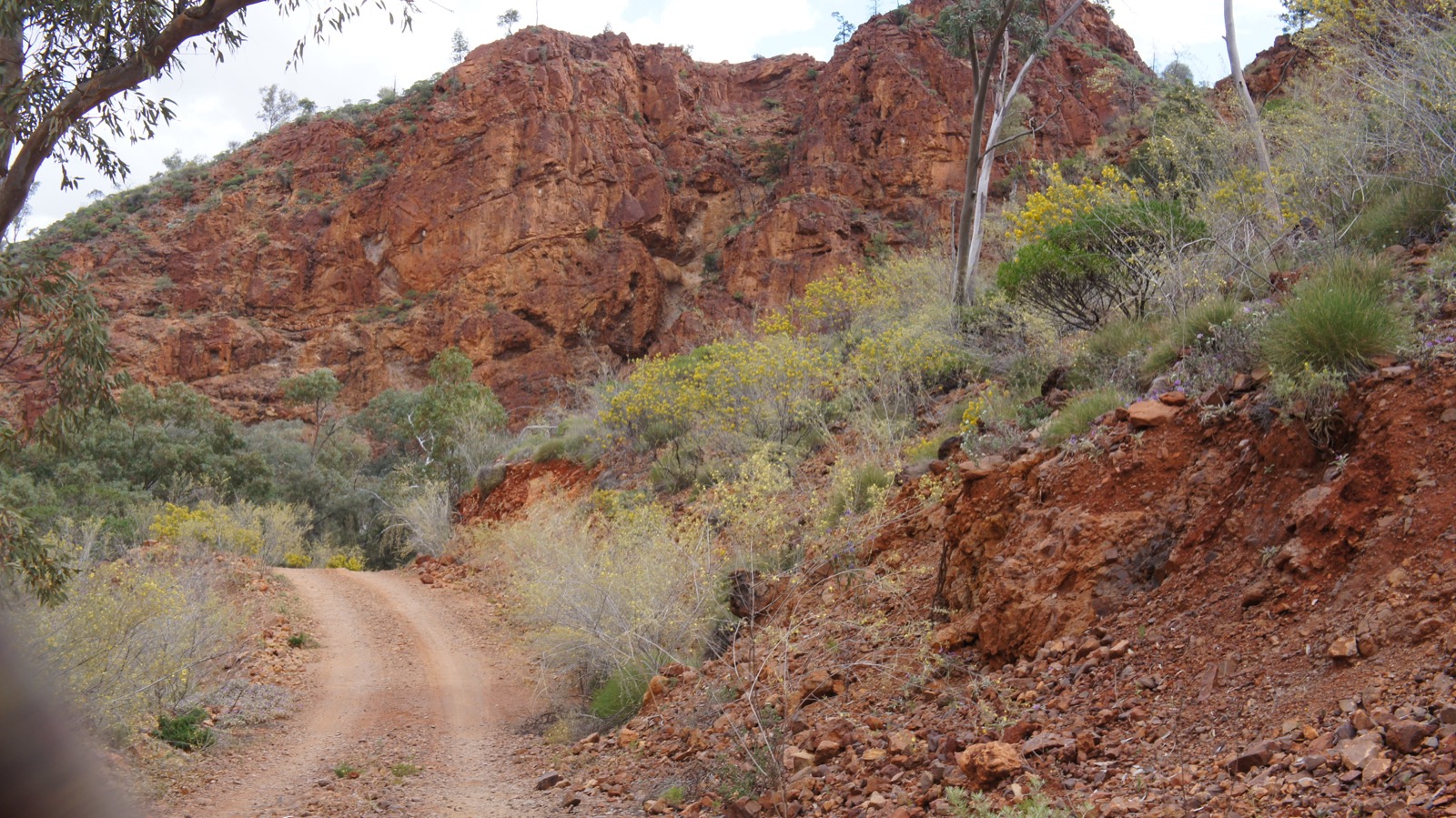
The trailhead is the Welcome Mine, an old copper working on Arkaroola Road a short drive west of the village. The route drops into the creek line, winds between shaly hills and past the vertical fossil-bearing walls of Tellurite Gorge, and enters Bararranna Gorge proper. The most-visited feature is Stubbs Waterhole, a permanent pool at the base of near-vertical walls of Elatina diamictite — the classic tropical-latitude glacial deposit of the late Cryogenian, and one of the sites that make the Flinders Ranges a strong candidate for World Heritage listing on geological grounds. Fossil stromatolite outcrops appear along the walls of the lower gorge. The circuit climbs briefly out of the creek onto a low ridge before returning to the trailhead.
Why it is essential
Bararranna Gorge is the sub-region’s essential geological walk. In under seven kilometres it takes in stromatolite fossils, an Ediacaran-age glacial diamictite outcrop, a permanent waterhole and the tellurite mineralisation that first drew geologists to Arkaroola. It complements the ridge walks with a very different, waterhole-and-strata character.
Equipment
- Sturdy boots (creek-bed rock hopping).
- 3 L water per person.
- Sun protection; the upper ridge section is fully exposed.
- Visitor-centre map; the route is marked with cairns and small posts.
- Sign in / sign out at the Arkaroola visitor centre.
Hazards and notes
- Sanctuary sign-in / sign-out is compulsory; the route is closed on hot-forecast days and after storm damage.
- Creek-bed underfoot: loose cobbles and slippery bedrock at the waterholes.
- Do not enter Stubbs Waterhole; the sanctuary asks walkers to keep out of the permanent pools.
- Snakes routinely bask in the creek bed in cooler months.
- Rock arrangements and stromatolite outcrops are protected; do not disturb.
Routes and maps
| Source | URL |
|---|---|
| Arkaroola — Discover Arkaroola’s Ancient Landscapes | arkaroola.com.au |
| Trail Hiking Australia — Bararranna Gorge Walk | trailhiking.com.au |
| AllTrails — Bararranna Gorge Trail | alltrails.com |
| Bushwalk Australia — Bararranna Gorge Walk | bushwalk.com |
Further reading
- Arkaroola — Written in the Rocks: Geological walk and 4WD tour
- UNESCO — Flinders Ranges tentative list
- Wikipedia — Ediacaran
Missing data / follow-up work
- No official GPX or KML tracks are published by either NPWSSA (for the Weetootla network) or Arkaroola Wilderness Sanctuary (for the sanctuary walks). The park brochure and visitor-centre map are PDF and paper only. All distance and elevation figures in the snapshot panels are cross-checked against Trails SA, Trail Hiking Australia, AllTrails and Wikiloc but should be treated as approximate.
- Grindells Hut short-loop distances and Italowie Gap route statistics are not published in an official form — the entry above uses ranges rather than single figures. Confirm with the Balcanoona ranger before departure.
- Mawson–Spriggina cover photograph shows representative Arkaroola ridge country rather than the exact route line; no licence-compatible image was found on Wikimedia Commons that could be positively attributed to that specific circuit in this pass.
- No open-licence photograph of the Weetootla Gorge trail or its rock-wallabies could be identified in this pass; the illustrated photograph shows Grindells Hut, which is the nearby heritage feature on the extended circuit.
- Seasonal closures at Arkaroola are decided on the day by the visitor centre; walkers should confirm current status before driving in.
- Long traverses such as Oppaminda–Nudlamutana to Mount Warren Hastings (~15 km one way, ridge and 4WD track) may be feasible as a day for very fit parties with a vehicle shuttle, but were excluded here on logistics grounds.
Further reading
Nearby Flinders Mount Lofty Ranges guides on Storm
- Ikara-Flinders / Wilpena Pound
- Mount Lofty Ranges / Adelaide Hills
- NPWSSA — Weetootla Hike Network brochure (PDF)
- Arkaroola Wilderness Sanctuary — official site
- Trails SA — Balcanoona Creek Hike
- Trail Hiking Australia — Arkaroola walks
- Walking SA — Arkaroola walking trails
- UNESCO — Flinders Ranges tentative list
- Wikipedia — Vulkathunha-Gammon Ranges National Park
- Wikipedia — Arkaroola
- Wikipedia — Adnyamathanha people