Regional overview
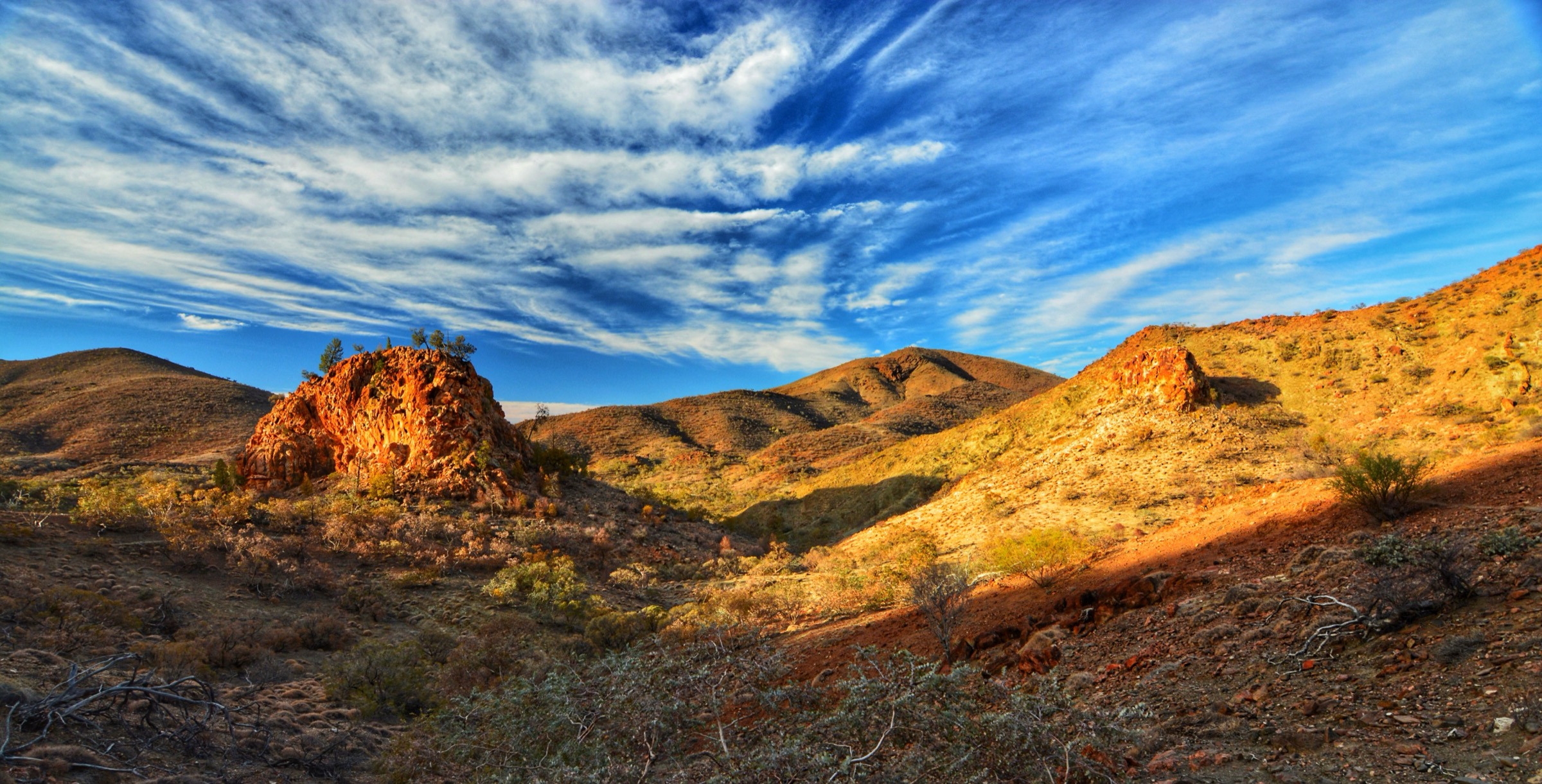
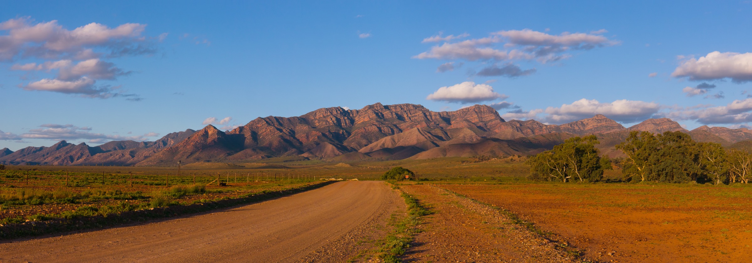
Ikara-Flinders Ranges National Park sits in the central Flinders Ranges of South Australia, about 430 km north of Adelaide. Its centrepiece is Ikara, the Adnyamathanha name for Wilpena Pound: a natural amphitheatre roughly 17 km long and 8 km wide, formed by a synclinal fold in the Ediacaran-age Rawnsley Quartzite. The Pound rim rises to about 900–1,100 m along most of its length and culminates on the north-western corner at Ngarri Mudlanha / St Mary Peak (1,171 m), the highest point in the Flinders Ranges. The park is co-managed with the Adnyamathanha Traditional Owners, whose creation stories are embedded in every major landform inside and around the Pound.
The park’s walking network is compact and centred on the Wilpena Pound Visitor Centre, which sits just outside the Pound’s eastern opening (Wilpena Gap) beside the Wilpena Pound Resort and campground. From that trailhead complex, foot tracks head inside the Pound along Wilpena Creek towards Hills Homestead and Wangara Lookout, and outside the Pound onto the exposed north-eastern rim towards Mount Ohlssen Bagge, Tanderra Saddle and Ngarri Mudlanha / St Mary Peak. Two further essential day-walks lie a short drive away: the Arkaroo Rock cultural walk on the Wilpena–Hawker road, and Rawnsley Bluff at the southern end of the Pound, reached from Rawnsley Park Station just outside the park boundary.
Terrain is dry semi-arid quartzite ridge country. Water on the tracks is unreliable to non-existent; shade is minimal above the creek lines. The reliable season for the longer walks runs from about April to October. Between roughly 1 December and 31 March, National Parks and Wildlife Service South Australia closes several higher-risk trails — including the St Mary Peak Loop, Mount Ohlssen Bagge and Rawnsley Bluff — because of extreme fire and heat risk. On any day of Catastrophic Fire Danger, all park walking trails are closed. Cell coverage is patchy at the Visitor Centre and absent on the rim.
Ngarri Mudlanha / St Mary Peak is central to the Adnyamathanha creation story of Ikara. The Adnyamathanha Traditional Owners have asked that walkers do not stand on the summit itself; the widely used alternative is to turn back at Tanderra Saddle, a short distance below and east of the peak, which gives essentially the same panoramic view. This entry treats Tanderra Saddle as the recommended turnaround and does not describe the final rock scramble to the summit.
Selection rationale
The five walks were chosen to give a balanced picture of the sub-region while respecting the cultural and seasonal constraints. Ngarri Mudlanha / St Mary Peak via the Outside Track to Tanderra Saddle represents the iconic rim circuit. Hills Homestead and Wangara Lookout is the accessible Pound-floor walk and gives the interior view most visitors come for. Mount Ohlssen Bagge is the compact high-effort ridge climb on the eastern rim. Arkaroo Rock is the cultural walk, a short circuit to an Adnyamathanha rock-art shelter. Rawnsley Bluff, starting at Rawnsley Park Station immediately outside the park boundary, is the southern rim viewpoint and the standard counterpart to St Mary Peak on the opposite corner of the Pound. Together they cover an iconic circuit, an accessible Pound-floor walk, a summit ridge, a cultural site and a southern rim panorama.
Summary
| # | Hike | Country | Route type | Distance | Gain | Max elevation | Difficulty |
|---|---|---|---|---|---|---|---|
| 1 | Ngarri Mudlanha / St Mary Peak Loop to Tanderra Saddle | Australia | Loop (turn back at Tanderra Saddle) | ~21.5 km | ~700 m | ~1,090 m at Tanderra Saddle | Hard |
| 2 | Hills Homestead and Wangara Lookout | Australia | Out-and-back | ~7.8 km | ~180 m | ~680 m | Easy–moderate |
| 3 | Mount Ohlssen Bagge | Australia | Out-and-back | ~5.6–6.8 km | ~400 m | 923 m | Hard |
| 4 | Arkaroo Rock cultural walk | Australia | Loop | ~3 km | ~80 m | ~500 m | Moderate |
| 5 | Rawnsley Bluff (and Wilpena Pound Lookout spur) | Australia | Out-and-back | ~11 km | ~480 m | ~943 m | Hard |
1. Ngarri Mudlanha / St Mary Peak Loop to Tanderra Saddle
Snapshot
Itinerary
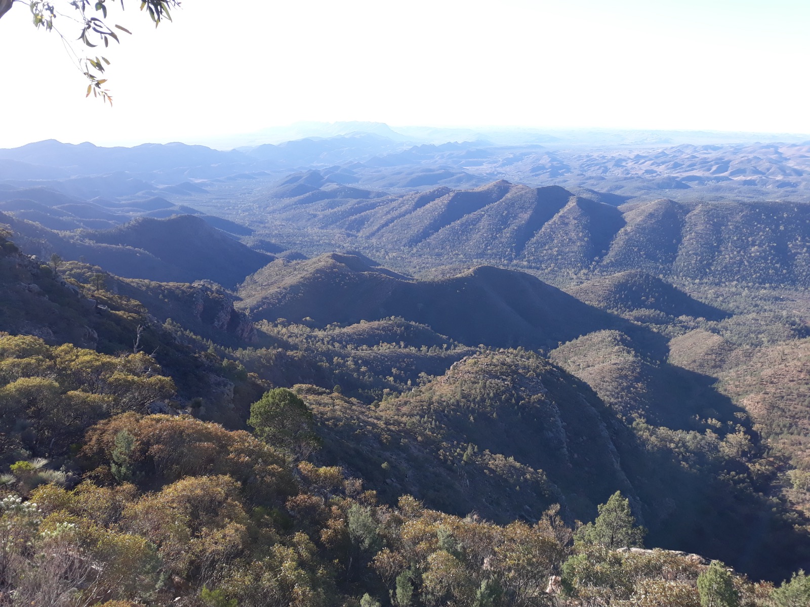
The loop starts from the bushwalker trailhead at the Wilpena Pound Visitor Centre complex. The Outside Track branch heads north-east along the base of the Pound’s outer wall, passing the junction with the Mount Ohlssen Bagge track, and then curves anti-clockwise around the north-eastern corner. It climbs steadily through mallee, native pine and rocky quartzite benches to reach Tanderra Saddle at approximately 1,090 m, a broad col on the Pound rim between Ngarri Mudlanha / St Mary Peak (1,171 m) to the north-west and the wider rim to the south-east. The view from Tanderra Saddle takes in the interior of the Pound to the south, the Heysen Range to the west, and the ABC and Chace Ranges to the north. Adnyamathanha Traditional Owners request that walkers do not continue to the true summit; Tanderra Saddle is treated by park signage and Walking SA as the appropriate turnaround.
From Tanderra Saddle, the loop continues on the Inside Track, dropping into the interior of the Pound and following the Pound-floor gum flats south-west past the junction with the Bridle Gap track. It then joins the Hills Homestead / Wangara Lookout track and returns to the trailhead down the Wilpena Creek line. Parties short on time or in warm weather commonly reverse the loop and treat it as a 14.6 km out-and-back on the Outside Track.
Why it is essential
The circuit is the flagship rim walk of Ikara-Flinders. It combines the highest ground in the Flinders Ranges with a full traverse of the Pound floor and gives, from Tanderra Saddle, the classic north-west corner panorama across the Heysen Range and back into Ikara. No other day walk in the sub-region covers the same range of terrain in a single circuit.
Equipment
- Sturdy boots and gaiters
- Broad-brimmed hat, long sleeves and high-SPF sun protection
- 3–4 L of water minimum (no reliable water on route)
- Weatherproof and warm layer for the rim
- Map and GPS (Ikara-Flinders NP visitor map or LINZ-equivalent 1:50k topo)
- Personal Locator Beacon (PLB) recommended
- Headtorch for a long day
- First-aid kit including snake-bite bandage
Hazards and notes
- The Adnyamathanha Traditional Owners request that walkers not stand on the summit of Ngarri Mudlanha / St Mary Peak. Turn back at Tanderra Saddle. Park signage reflects this request.
- Fully exposed rim; no shade above the creek lines.
- Track closed on Catastrophic Fire Danger days and typically closed by NPWS South Australia across the summer months (December–March) because of fire and heat risk. Check parks.sa.gov.au before travel.
- Rangers recommend departing no later than 09:00 (10:00 during daylight saving) to complete the loop with margin.
- Snake activity from spring through autumn; brown and death adder species occur in the park.
- No cell coverage on the rim.
Photos
Photos not shown in the figure are given as candidates only.
| Image | Source | Author | Licence | Notes |
|---|---|---|---|---|
| Pound floor panorama looking back to St Mary Peak | Wikimedia Commons | Peter Neaum | CC BY 3.0 | Ex-Panoramio, 9250×1278 |
| View north climbing St Mary’s Peak | Wikimedia Commons | Glaucoptera | CC BY-SA 4.0 | Used in the figure above |
GPX / route file
| Source | URL | Format | Notes |
|---|---|---|---|
| NPWS SA — Ikara-Flinders Ranges NP official page | parks.sa.gov.au | Web page | Official route source; no direct GPX download published by NPWS SA |
| Walking SA — St Mary Peak Hike | walkingsa.org.au | Web page | Cross-check for distance and time |
| NPWS SA — Bushwalking brochure (PDF) | cdn.environment.sa.gov.au | Official park bushwalking brochure with route map |
Sources
- NPWS SA — Ikara-Flinders Ranges National Park
- Walking SA — St Mary Peak Hike, Ngarri Mudlanha, Wilpena Pound
- Wikipedia — St Mary Peak
- Wikimedia Commons — View climbing St Mary’s Peak
2. Hills Homestead and Wangara Lookout
Snapshot
Itinerary
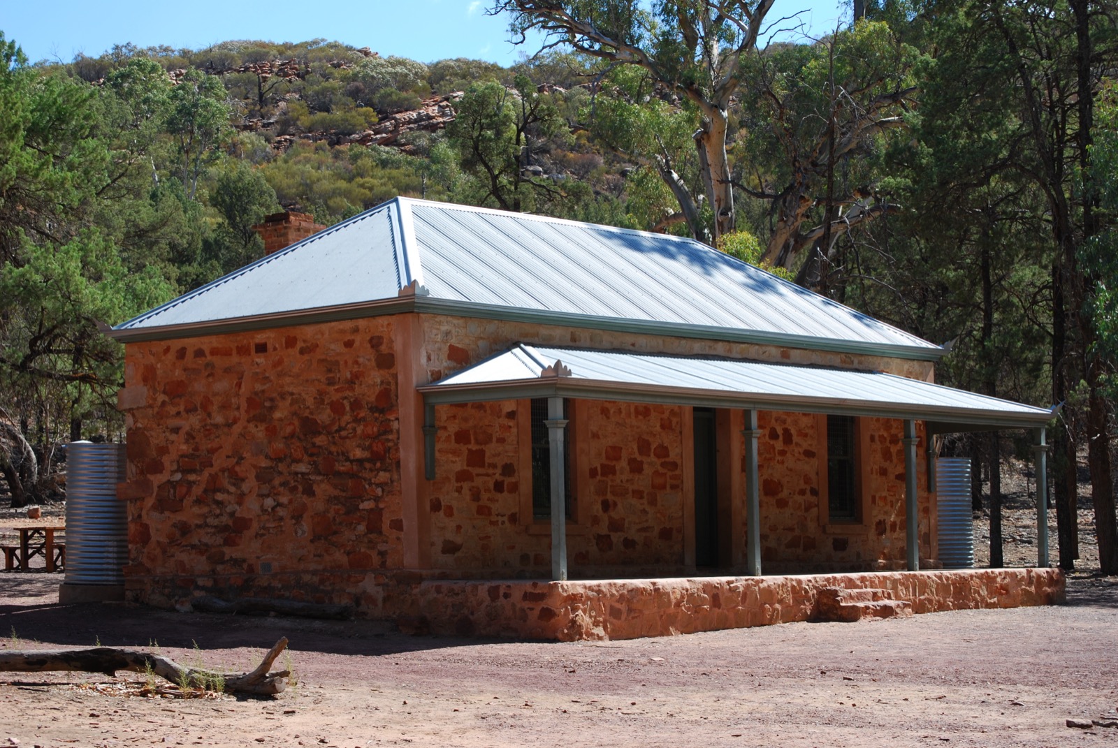
The track leaves the Visitor Centre bushwalker trailhead and follows Wilpena Creek through the Pound Gap, the only natural entrance to Ikara. The lower section runs under tall river red gums and native pine along a sealed and gravelled path, and passes the shuttle drop-off point. Beyond the shuttle stop the path becomes a formed walking track that climbs gently through eucalypt woodland to Hills Homestead, a stone cottage built by the Hill family, who leased and farmed the interior of the Pound between 1899 and 1914 before being flooded out. Interpretive signs and toilets are provided at the homestead.
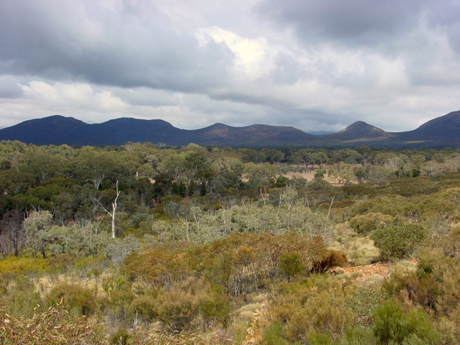
From Hills Homestead a signposted 1.2 km spur climbs steeply through cypress-pine and quartzite outcrop onto the inner face of the Pound rim, reaching the lower Wangara Lookout and then, a short distance higher, the upper Wangara Lookout at approximately 680 m. Both platforms give sweeping panoramas across the interior of Ikara and back to the eastern rim. The return descends the same line to Hills Homestead and back down the creek.
Why it is essential
This is the accessible Pound-floor walk that gives the interior perspective the Pound is famous for. The upper Wangara Lookout is the standard photograph of Ikara looking south along the interior. It is also the only essential walk in the sub-region that can be shortened with the resort shuttle, making it viable for parties with mixed fitness.
Equipment
- Walking shoes or light boots
- Sun protection (broad-brimmed hat, sunscreen, long sleeves)
- 1.5–2 L water; no reliable water on route beyond the Visitor Centre
- Light warm layer
- Camera
Hazards and notes
- Fully exposed above Hills Homestead; the Wangara spur is short but rocky and steep.
- Snake activity possible from spring through autumn.
- Dogs are not permitted on national park walking tracks.
- Track closed on Catastrophic Fire Danger days.
GPX / route file
| Source | URL | Format | Notes |
|---|---|---|---|
| NPWS SA — Ikara-Flinders Ranges NP official page | parks.sa.gov.au | Web page | Official route source; no direct GPX download published |
| Walking SA — Hills Homestead Walk | walkingsa.org.au | Web page | Distance and grade cross-check |
| Walking SA — Wangara Lookout Hike | walkingsa.org.au | Web page | Distance and grade cross-check |
Sources
- NPWS SA — Ikara-Flinders Ranges National Park
- Walking SA — Hills Homestead Walk
- Walking SA — Wangara Lookout Hike
- Environment SA — 7 family-friendly walks in Ikara-Flinders
3. Mount Ohlssen Bagge
Snapshot
Itinerary
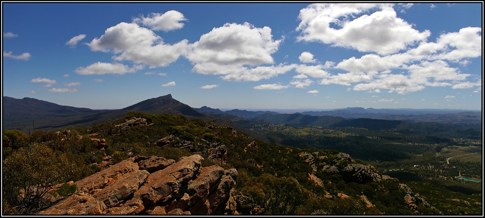
From the bushwalker trailhead, the track follows the Wilpena Creek line for a short distance towards the Pound Gap, then branches south-east and climbs steeply on the outer face of the eastern Pound rim. The route is rocky underfoot throughout and includes several short pitches where hands are useful. It gains height quickly through quartzite blocks and native pine, then rounds a shoulder onto the ridge and continues up to the summit trig at 923 m. The view opens progressively over the eastern rim of Ikara, across the flat Wilpena floor to Ngarri Mudlanha / St Mary Peak on the opposite corner, and — on clear days — out through the Pound Gap to the distant salt pan of Lake Torrens. Return is on the same line.
Why it is essential
Mount Ohlssen Bagge is the highest point that can be reached from the Visitor Centre in a compact half-day. The summit sits directly opposite Ngarri Mudlanha / St Mary Peak and gives the standard photographic answer to what the Pound looks like from its own rim. It is the region’s shortest genuine summit walk.
Equipment
- Sturdy boots — the rocky steps are unforgiving
- Sun protection
- 2–3 L water minimum
- Weatherproof and warm layer for the summit
- Map and GPS
- PLB recommended
- First-aid kit including snake-bite bandage
Hazards and notes
- Continuously steep with several rocky scramble sections. Not suitable in wet conditions or for parties with knee or ankle issues.
- Track typically closed by NPWS SA over summer (December–March) because of heat and fire risk.
- Closed on any day of Catastrophic Fire Danger.
- Snake activity through the warmer months.
- No cell coverage on the ridge.
GPX / route file
| Source | URL | Format | Notes |
|---|---|---|---|
| NPWS SA — Ikara-Flinders Ranges NP official page | parks.sa.gov.au | Web page | Official route source; no direct GPX download published |
| NPWS SA — Mt Ohlssen-Bagge park brochure (PDF) | cdn.environment.sa.gov.au | Official park map with the route marked | |
| Walking SA — Mount Ohlssen Bagge Hike | walkingsa.org.au | Web page | Distance and grade cross-check |
Sources
- NPWS SA — Ikara-Flinders Ranges National Park
- Walking SA — Mount Ohlssen Bagge Hike
- Trailhiking.com.au — Mount Ohlssen Bagge Hike
- Wikimedia Commons — The hike to Mount Ohlssen-Bagge
4. Arkaroo Rock cultural walk
Snapshot
Itinerary
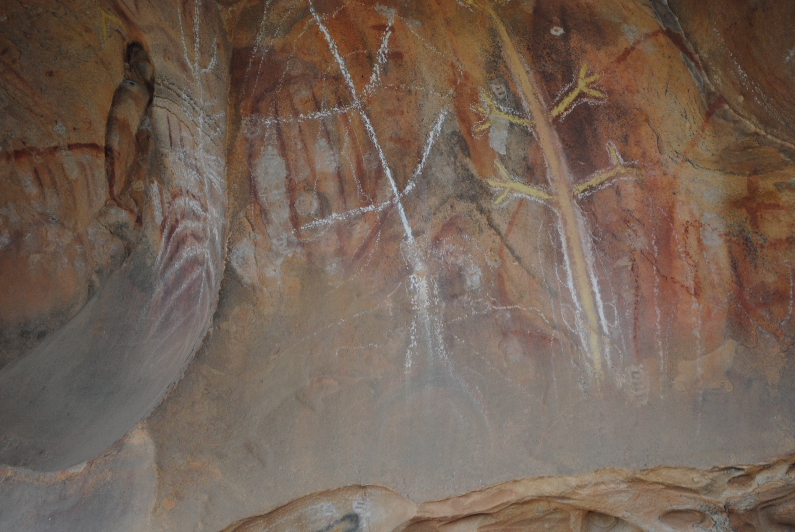
The Arkaroo Rock loop leaves a signposted car park on the Wilpena–Hawker Road, roughly 17 km south of the Wilpena Pound Visitor Centre. The formed path crosses a creek line — recently rebuilt to replace an older timber footbridge — and climbs gently through native pine and mallee onto a low rocky shoulder of the Chace Range. It reaches the Arkaroo Rock shelter, a large overhang whose interior walls are decorated with ochre and charcoal paintings made by Adnyamathanha men over the last six thousand years. A screen and viewing platform, upgraded in 2025, sit at a respectful distance from the paintings. Interpretive signs describe the creation story of Ikara (Wilpena Pound), of which the paintings form part. The loop then continues around the shoulder and returns to the car park by a slightly higher line, with views south-west across the Chace Range.
Why it is essential
Arkaroo Rock (Akurra Adnya) is the only signposted and publicly accessible Aboriginal rock-art site in Ikara-Flinders Ranges National Park, and its paintings are considered one of the best examples of Adnyamathanha rock art. As a cultural counterpart to the rim walks it explains what the surrounding landscape means to its Traditional Owners.
Equipment
- Walking shoes or light boots
- Sun protection
- 1 L water
- Camera; no flash photography at the rock-art shelter
Hazards and notes
- The rock-art shelter is a fenced and screened cultural site — do not touch the paintings and do not enter beyond the viewing platform.
- Uneven rocky path with a short climb; not suitable for wheelchairs or strollers despite the modest length.
- Snake activity through the warmer months.
- Closed on Catastrophic Fire Danger days; check parks.sa.gov.au for any current upgrade closures.
GPX / route file
| Source | URL | Format | Notes |
|---|---|---|---|
| NPWS SA — Ikara-Flinders Ranges NP official page | parks.sa.gov.au | Web page | Official route source; no direct GPX download published |
| Walking SA — Arkaroo Rock Hike | walkingsa.org.au | Web page | Distance and grade cross-check |
| Environment SA — Welcome back to Arkaroo Rock (2025) | environment.sa.gov.au | Article | Confirms 2025 site upgrade and viewing arrangement |
Sources
- NPWS SA — Ikara-Flinders Ranges National Park
- Walking SA — Arkaroo Rock Hike
- Environment SA — Arkaroo Rock reopened (2025)
- Wikimedia Commons — Arkaroo Rock 8
5. Rawnsley Bluff (and Wilpena Pound Lookout spur)
Snapshot
Itinerary
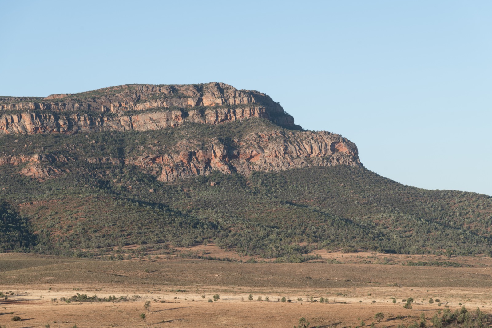
The Rawnsley Bluff walk starts from a signposted trailhead within Rawnsley Park Station, a working sheep station and eco-tourism operation that borders the southern edge of Ikara-Flinders Ranges National Park. The lower section crosses pastoral land through native pine and low mallee, then enters the national park and follows a broad watercourse north-east onto the southern slopes of the Pound rim. The track climbs through quartzite scree, gaining height in one sustained ~800 m rocky pitch that includes some short scrambling steps below the bluff itself. Rawnsley Bluff is reached at approximately 943 m and gives an open panorama south across the Chace Range to Lake Torrens and west across the Elder Range.
A short signposted spur continues north-east along the rim to the Wilpena Pound Lookout, an open platform of quartzite slab that gives the southern-corner view into the interior of Ikara — the mirror image of the view from Tanderra Saddle on the opposite corner. Return is on the same line back down to Rawnsley Park.
Why it is essential
Rawnsley Bluff is the southern rim counterpart to Ngarri Mudlanha / St Mary Peak and gives the classic southward view of Ikara. It is the standard essential Flinders walk for parties basing themselves at Rawnsley Park rather than Wilpena Pound Resort, and it is the only widely used marked route onto the southern rim.
Equipment
- Sturdy boots
- Sun protection (broad-brimmed hat, sunscreen, long sleeves)
- 3 L water minimum
- Weatherproof and warm layer for the bluff
- Map and GPS
- PLB recommended
- Trekking poles useful for the descent
- First-aid kit including snake-bite bandage
Hazards and notes
- Short rock scramble on the final approach to the bluff; not suitable in wet or icy conditions.
- Fully exposed above the creek line; no shade.
- Track typically closed by NPWS SA over summer (December–March) because of heat and fire risk.
- Closed on Catastrophic Fire Danger days.
- Snake activity through the warmer months.
- Lower section crosses Rawnsley Park Station pastoral land; keep to the marked route.
- No cell coverage on the rim.
GPX / route file
| Source | URL | Format | Notes |
|---|---|---|---|
| NPWS SA — Ikara-Flinders Ranges NP official page | parks.sa.gov.au | Web page | Official park page for Ikara-Flinders NP; Rawnsley Bluff trailhead is on adjoining Rawnsley Park Station |
| Walking SA — Rawnsley Bluff Hike and Wilpena Pound Lookout | walkingsa.org.au | Web page | Distance and grade cross-check |
| Trailhiking.com.au — Rawnsley Bluff Hike | trailhiking.com.au | Web page | Additional route notes |
Sources
- NPWS SA — Ikara-Flinders Ranges National Park
- Walking SA — Rawnsley Bluff Hike and Wilpena Pound Lookout
- Wikipedia — Rawnsley Bluff
- Wikimedia Commons — Rawnsley Bluff, Flinders Ranges, South view
Region-level sources
| Source | URL |
|---|---|
| NPWS SA — Ikara-Flinders Ranges National Park | parks.sa.gov.au |
| NPWS SA — Ikara-Flinders bushwalking brochure (PDF) | cdn.environment.sa.gov.au |
| Walking SA — Hikes in Ikara-Flinders Ranges NP | walkingsa.org.au |
| Environment SA — South Australian walking track grade numbers | environment.sa.gov.au |
| Environment SA — Ranger tips: Ikara-Flinders Ranges | environment.sa.gov.au |
| Wilpena Pound Resort | wilpenapound.com.au |
| Rawnsley Park Station | rawnsleypark.com.au |
| Wikipedia — Wilpena Pound | en.wikipedia.org |
| Wikipedia — St Mary Peak | en.wikipedia.org |
| Wikipedia — Rawnsley Bluff | en.wikipedia.org |
Further reading
Nearby Flinders Mount Lofty Ranges guides on Storm
- Gammon Ranges / Arkaroola
- Mount Lofty Ranges / Adelaide Hills
- Environment SA — 7 family-friendly walks in Ikara-Flinders
- Environment SA — Ranger tips for Ikara-Flinders
- Walking SA — hikes around the Flinders Ranges and Outback
- Wikipedia — Adnyamathanha people
Missing data / follow-up work
- NPWS SA does not publish direct GPX or KML downloads for individual walks in Ikara-Flinders. All route files listed above are official web-page sources; a legally reusable GPX would need to be captured on the ground or drawn from OpenStreetMap.
- Total elevation gain for the St Mary Peak Loop is estimated from the trailhead altitude (~380 m) and Tanderra Saddle height (~1,090 m). No official cumulative-gain figure was located.
- Rawnsley Bluff distance and gain vary between secondary sources (11–13.8 km and 481–565 m); no NPWS SA figure is published because the trailhead is on Rawnsley Park Station land.
- Arkaroo Rock maximum elevation (~500 m) is approximate; no official figure was located.
- Summer trail closure dates for the higher-risk routes vary year to year — confirm current status via parks.sa.gov.au before travel.