Regional overview
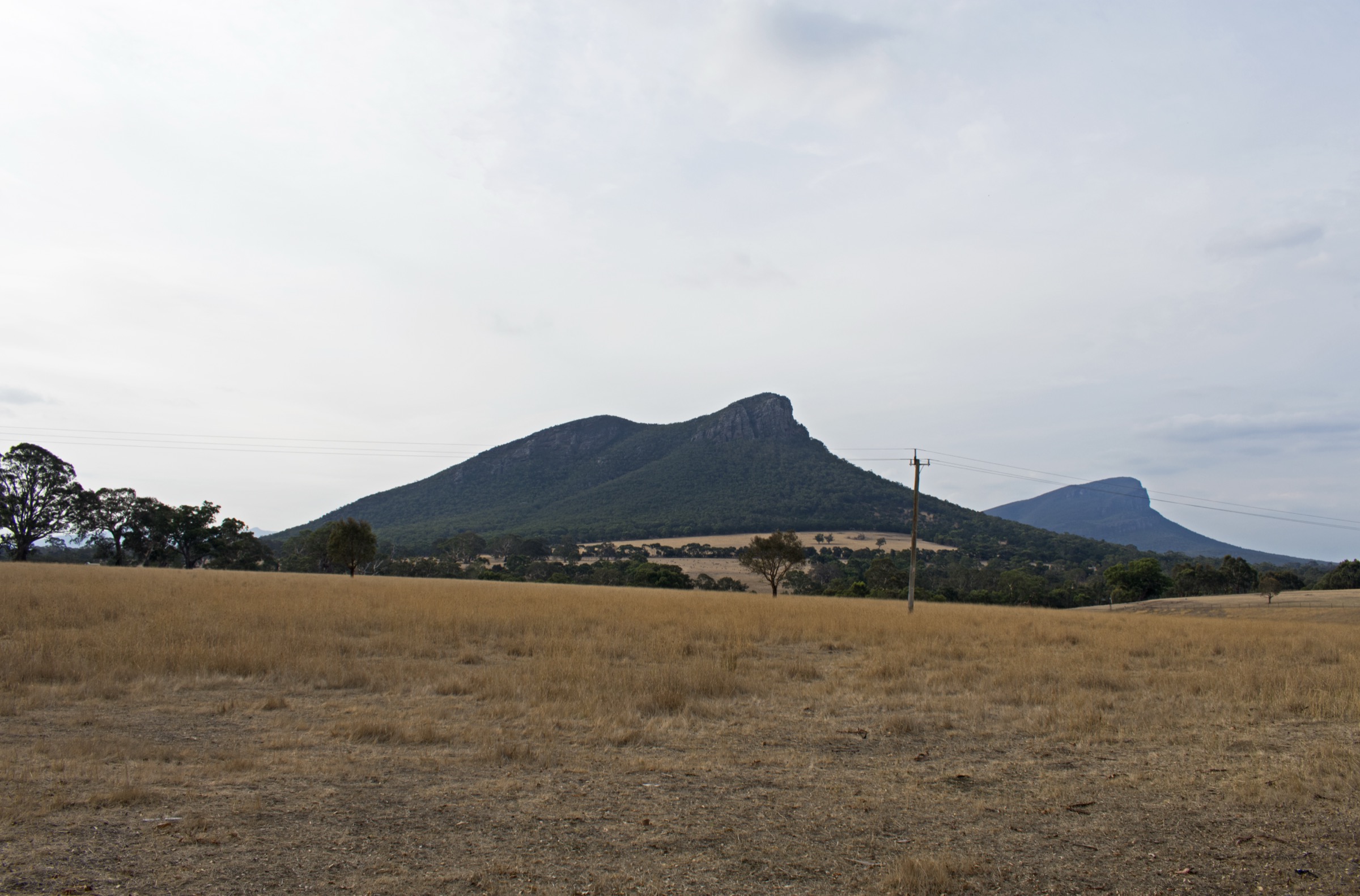
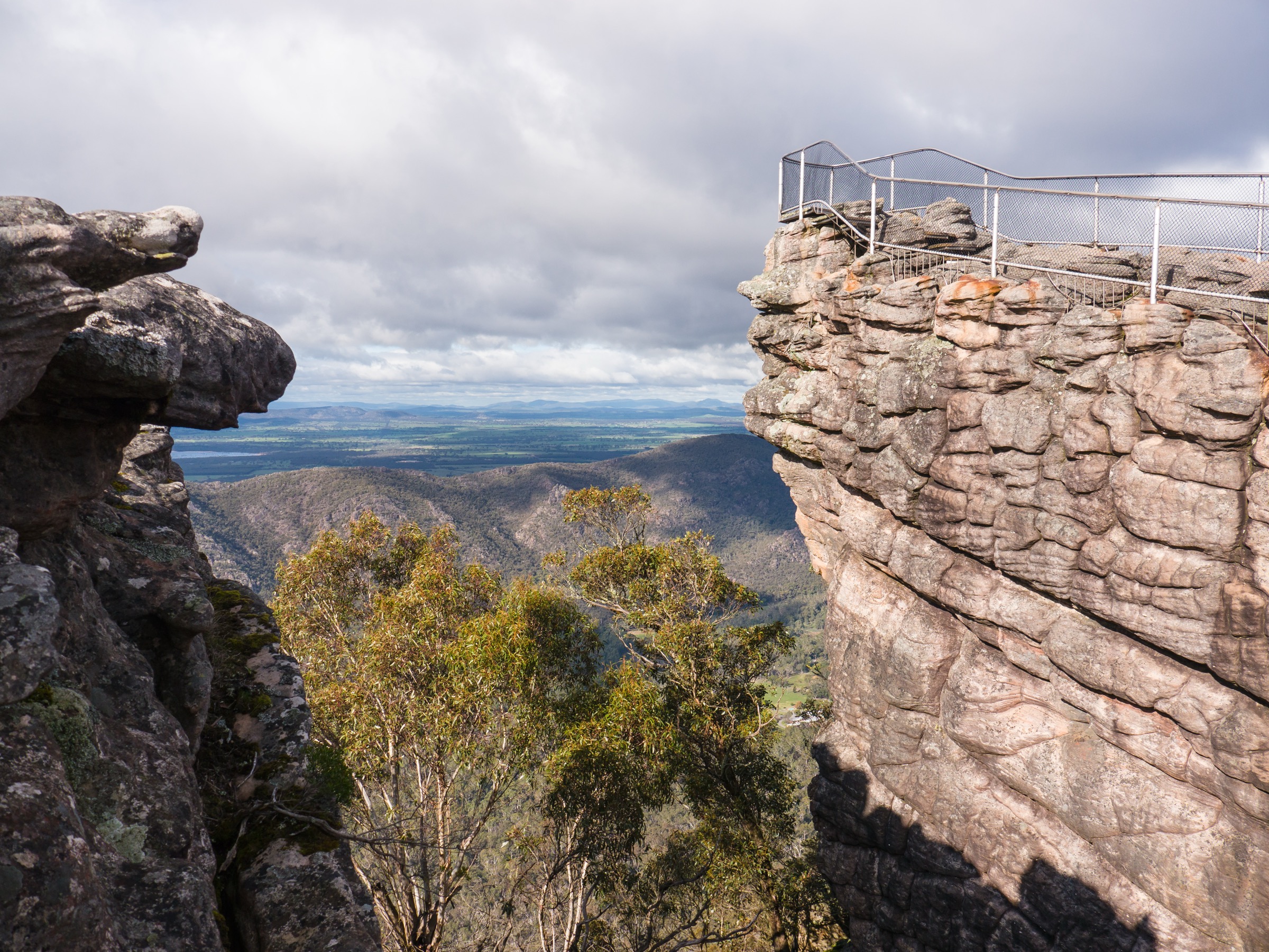
The Central Grampians is the block that most visitors mean when they say “the Grampians” — the Wonderland Range and the Pinnacle, MacKenzie Falls (Migunang wirab), the Reeds Lookout and Balconies escarpment, Boroka Lookout, Mount Rosea (Bugiga Mirgani), Boronia Peak above Halls Gap, and the Mount William (Duwul) Range that carries the range’s highest ground. Halls Gap sits in Fyans Valley at the eastern base of the escarpment and is the practical base for every walk in this shortlist.
The terrain is more forested and better-tracked than the outer Northern Grampians, and Parks Victoria’s route network is denser: the Wonderland labyrinth of Grand Canyon, Silent Street and the Pinnacle summit is the range’s iconic short-day objective, while Boronia Peak walks straight from town. Water is the other central-block signature — MacKenzie Falls is the only year-round waterfall in the park, and Silverband Falls, Venus Baths and the Fyans Creek walks fill out the shorter-day picture.
Djab Wurrung and Jardwadjali names apply throughout: Gariwerd for the range, Duwul for Mount William, Migunang wirab for MacKenzie Falls (used on Parks Victoria’s revitalisation project pages), and Bugiga Mirgani for Mount Rosea (used by Visit Grampians). Parks Victoria’s site pages use the paired names in headings where established.
Currency notes (July 2026): two central-block routes are affected by ongoing works and closures.
- MacKenzie Falls precinct — the car park and precinct tracks (Broken Falls Walk, main falls walk to base, Bluff Lookout Walk, sections of the River Walk) closed from 9 February 2026 for a $7.76 M revitalisation, with base-of-falls access blocked from about May 2026 through late 2026. During the works window the falls can be viewed from above via a longer approach from Zumsteins Picnic Area (approximately 7 km return, top of falls only) while the standard base steps remain closed.
- Mount William Road and the Mount William (Duwul) Summit Walk are closed for post-fire recovery and powerline / radio-tower works. Until the road reopens, Mount Rosea (Bugiga Mirgani) is the working “big summit” alternative in the central block.
Always check the Parks Victoria change-of-conditions page before travel — bushfire and works closures move quickly in Gariwerd.
Selection rationale
Five routes are presented to give balanced central-block coverage without duplicating trailheads. The Pinnacle via Wonderland Car Park is the iconic short summit — Grand Canyon, Silent Street and the Pinnacle rock platform in one route. MacKenzie Falls (Migunang wirab) is the year-round waterfall walk, currently modified by the precinct closure. Mount Rosea (Bugiga Mirgani) is the biggest doable central summit day while Mount William (Duwul) is closed. Boronia Peak is the walkable-from-town moderate summit. Reeds Lookout and The Balconies is the short escarpment classic — sunset over Victoria Valley, and the closest thing the central block has to a viewpoint everyone can reach. Together they cover an iconic viewpoint, a waterfall, a bigger summit, a moderate town-based summit, and a short lookout classic.
Summary
| # | Hike | Trailhead | Route type | Distance | Gain | Max elevation | Difficulty |
|---|---|---|---|---|---|---|---|
| 1 | The Pinnacle via Wonderland Car Park | Wonderland Carpark | Out-and-back | 4.2 km | ~300 m | ~720 m | Grade 4 |
| 2 | MacKenzie Falls (Migunang wirab) | MacKenzie Falls Carpark (closed — see notes) | Out-and-back | 2.0 km (base walk, when open) | ~110 m | Unresolved | Grade 3 |
| 3 | Mount Rosea (Bugiga Mirgani) | Rosea Carpark, Stoney Creek Rd | Out-and-back | ~9 km | ~466 m | 1,009 m | Grade 4 |
| 4 | Boronia Peak | Tandara Rd Carpark, Halls Gap | Out-and-back | 6.6 km | Unresolved | Unresolved | Grade 3 |
| 5 | Reeds Lookout and The Balconies | Reeds Lookout Carpark, Mt Victory Rd | Out-and-back | 2.0 km | ~50 m | Unresolved | Grade 2 |
1. The Pinnacle via Wonderland Car Park
Snapshot
Itinerary
From the Wonderland Carpark the track climbs through open forest into the Grand Canyon, a narrow sandstone slot with terraced walls, then works up through the Cool Chamber and the Silent Street slot before emerging onto the escarpment ridge. The final approach crosses open rock to the Pinnacle — a projecting sandstone platform with a full sweep over Halls Gap, the Wonderland Range, and Lake Bellfield. Return is by the same line, or by looping down toward the Sundial Carpark for parties with shuttle logistics.
Why it is essential
The Pinnacle is the single most iconic viewpoint in the Grampians, and the Wonderland approach makes the walk itself as memorable as the platform: rock steps, water-worn slots and the Silent Street narrows in a route short enough to be attempted by fit walkers of most ages. No central-block shortlist can credibly leave it out.
Equipment
- Sturdy walking shoes or boots
- Sun protection and 1.5–2 L water
- Rain jacket and warm layer
- First-aid kit and headlamp
- Trekking poles help on rock steps and the Silent Street chamber
Hazards and notes
- Rock steps, uneven terrain and rock-hopping through Grand Canyon and Silent Street
- Unfenced cliff edges at the Pinnacle platform
- Loose surfaces after rain — sandstone is greasy when wet
- Snake risk in warm months
- Fire-danger closures likely on Total Fire Ban days — check Parks Victoria and VicEmergency
2. MacKenzie Falls (Migunang wirab)
Snapshot
Itinerary
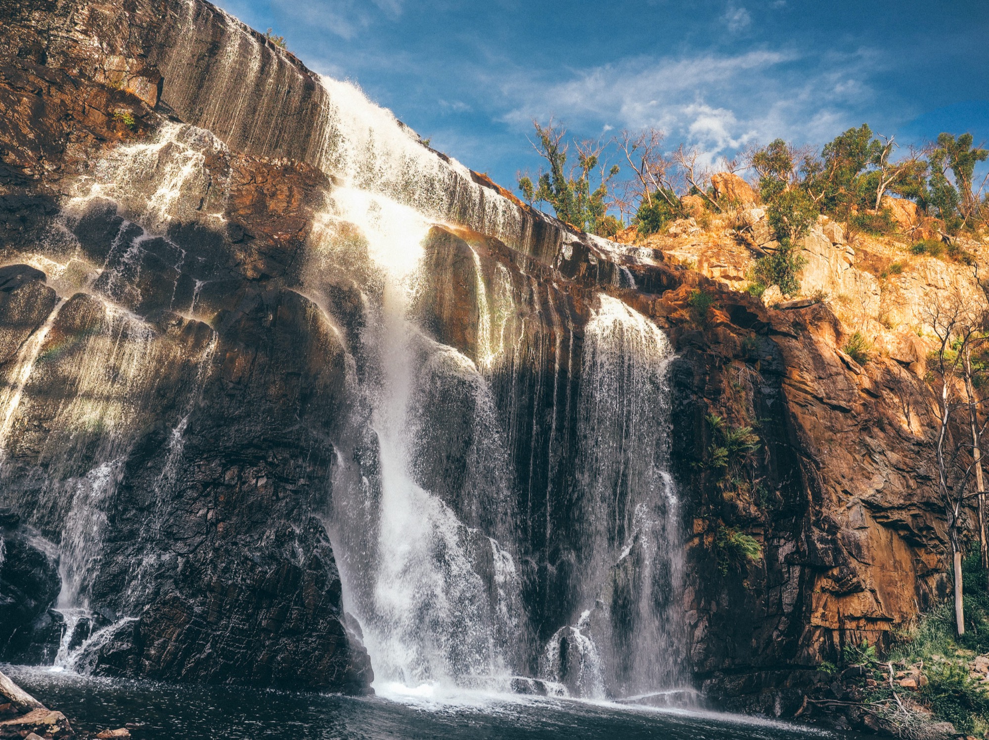
The standard base walk descends a long stone staircase from the MacKenzie Falls Carpark to the pool at the foot of the falls, where the broad plunge drops between sandstone walls. The 9.7 km MacKenzie Falls Circuit links Broken Falls, Bluff Lookout and the River Walk for a longer day.
During the 2026 revitalisation works, base-of-falls access is closed. From about February to May 2026 the top of the falls remained reachable via a longer approach from Zumsteins Picnic Area, and from about May 2026 through late 2026 no base access is expected. Confirm the current access on the Parks Victoria MacKenzie Falls Revitalisation project page before travel.
Why it is essential
MacKenzie Falls is the only year-round waterfall in the Grampians — a broad, plunging basin below sandstone cliffs, and the range’s signature waterfall image. Even during the current precinct works it belongs on the central-block shortlist; the walk simply becomes a longer approach until the base viewing platform reopens.
Equipment
- Sturdy shoes for the stone staircase
- Sun protection and water
- Rain jacket and warm layer
- Camera — spray from the falls means a lens cloth is worth carrying
Hazards and notes
- Precinct closure for revitalisation (from 9 Feb 2026, through late 2026) — plan around the current works stage
- Steep steps to base when open — slippery when wet
- Do not swim or scramble at the base — the falls have a fatal history for people getting into the water
- Snake risk in warm months
3. Mount Rosea (Bugiga Mirgani)
Snapshot
Itinerary
From the Rosea Carpark the track climbs through forest onto the Mount William Range, working through rock-hopping sections and the Gate of the East Wind chasm before topping out on the summit ridge. From the summit at 1,009 m the view runs across the Serra and Mount William ranges and back over Halls Gap. Return is by the same line, or the route can be extended as a point-to-point on the Grampians Peaks Trail toward Borough Huts.
Why it is essential
With Mount William (Duwul) Road currently closed, Mount Rosea is the biggest doable central-block summit day — a full ridge outing with a genuine 1,000 m summit and enough rock character to be a distinct experience from the Wonderland walks. When the Mount William Summit Walk reopens, it becomes the natural alternative essential (~3.5 km return, sealed road to the trailhead, ~1,167 m summit).
Equipment
- Sturdy boots with good grip on rock
- Rain jacket, warm layer and hat
- 2.5–3 L water and food for a long day
- Map, compass and offline GPS
- Headlamp and first-aid kit
- Trekking poles help on rock-hopping sections
Hazards and notes
- Extended rock-hopping and boulder sections — slower travel than the distance suggests
- Exposure on the ridge — weather can change quickly
- No water on route — carry enough
- Snake risk in warm months
- Check the change-of-conditions page — sections of the Grampians Peaks Trail have had rolling closures through 2025–26
4. Boronia Peak
Snapshot
Itinerary
The track leaves the Tandara Rd Carpark, crosses Fyans Creek (Barri yalug) and climbs steadily through forest onto the ridge above Halls Gap. The final ~100 m is a rock scramble to the summit block, with an open outlook over Fyans Valley, Lake Fyans and the Wonderland Range. Return is by the same line.
Why it is essential
Boronia Peak is the walkable-from-town peak of the Central Grampians — the essential moderate summit for anyone based in Halls Gap without vehicle plans for the day. The rocky summit scramble gives it more character than a purely forest walk, and it is the natural counterpart to the Wonderland-based Pinnacle for a Halls Gap-anchored trip.
Equipment
- Sturdy walking shoes
- Sun protection and 1.5–2 L water
- Rain jacket and warm layer
- First-aid kit and headlamp
Hazards and notes
- Summit rock scramble — not suitable for very young children
- Exposure on summit rocks — no barriers
- Snake risk in warm months
- Heat in summer — start early
5. Reeds Lookout and The Balconies
Snapshot
Itinerary
From the large Reeds Lookout Carpark, a short 200 m walk reaches Reeds Lookout on the escarpment edge, with a west-facing panorama across Victoria Valley. The main track then continues about a kilometre through open woodland to The Balconies — a pair of projecting sandstone slabs that reach out from the escarpment above the valley. Return is by the same line.
Why it is essential
Reeds Lookout and The Balconies is the short escarpment classic of the central block — high-quality Grampians view without the Wonderland climb, and one of the few Grampians walks accessible to almost anyone at any age. It is the natural sunset walk for a Halls Gap base.
Equipment
- Standard walking shoes
- Sun protection and water
- Warm layer for evening at the lookout
Hazards and notes
- Cliff edges without barriers at The Balconies — do not climb out onto the projecting slabs; the site has a history of fatal falls
- Loose gravel in places on the main track
- Snake risk in warm months
Further reading
| Resource | Link |
|---|---|
| Parks Victoria — Grampians (Gariwerd) National Park | parks.vic.gov.au |
| Parks Victoria — The Pinnacle walks | parks.vic.gov.au |
| Parks Victoria — MacKenzie Falls | parks.vic.gov.au |
| Parks Victoria — MacKenzie Falls revitalisation | parks.vic.gov.au |
| Parks Victoria — Mount Rosea Walk | parks.vic.gov.au |
| Parks Victoria — Boronia Peak Walk | parks.vic.gov.au |
| Parks Victoria — The Balconies Walk | parks.vic.gov.au |
| Parks Victoria — change of conditions | parks.vic.gov.au |
| Grampians Peaks Trail — day walks | grampianspeakstrail.com.au |
| VicEmergency — fire and closures | emergency.vic.gov.au |
| Wikimedia Commons — Grampians National Park | commons.wikimedia.org |