Regional overview
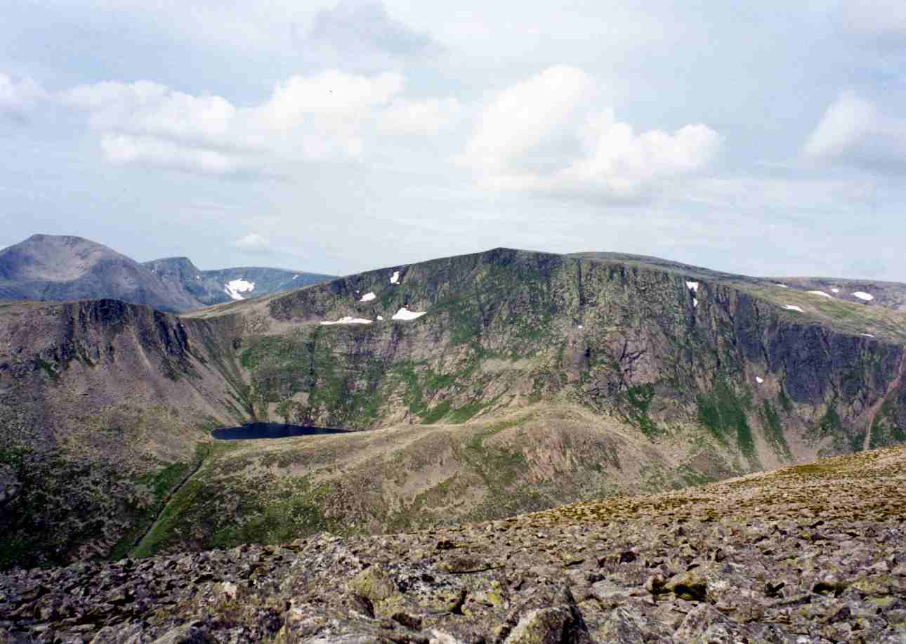
This region combines maritime mountains, high moorland, corrie lakes, rocky ridges and Atlantic-facing summits. Eryri/Snowdonia provides the most alpine-feeling Welsh walking, centred on Yr Wyddfa/Snowdon and its ridges. The Cambrian Mountains are quieter, broader and more remote, with Pumlumon forming a high, boggy watershed. In Ireland, Wicklow offers accessible upland walking close to Dublin, Kerry has the highest mountains on the island, and Connemara combines quartzite hills, bog, coast and lake views.
The normal hillwalking season is late spring to autumn, but these routes remain weather-sensitive. Mist, strong wind, wet rock, boggy ground and short daylight can make otherwise non-technical walks serious.
Access varies sharply. Yr Wyddfa has a dedicated Sherpa’r Wyddfa bus network to Pen y Pass; Glendalough has bus access from Dublin and Wicklow; Pumlumon, Carrauntoohil and some Connemara trailheads remain more car-dependent or require careful public-transport planning.
Selection rationale
The five hikes were selected to give one representative essential route from each named area: an iconic national summit in Eryri, the high watershed of the Cambrian Mountains, Wicklow’s classic lake-and-cliff circuit, Ireland’s highest mountain in Kerry, and Connemara’s best-known national-park summit loop.
Summary table
| # | Hike | Country | Route type | Distance | Gain | Max elevation | Difficulty |
|---|---|---|---|---|---|---|---|
| 1 | Yr Wyddfa/Snowdon via Pyg Track and Miners’ Track | Wales | Loop / lollipop | 12.2–12.3 km | 680–834 m | 1,085 m | Strenuous mountain walk |
| 2 | Pumlumon Fawr from Eisteddfa Gurig | Wales | Out-and-back / short loop | 8.1–9.3 km | 333–438 m | 752 m | Moderate, remote and navigation-sensitive |
| 3 | Glendalough Spinc and Glenealo Valley | Ireland | Loop | 8.8–9.5 km | 370–380 m | c. 506 m | Strenuous hill walk |
| 4 | Carrauntoohil via Devil’s Ladder and Zig Zags | Ireland | Loop / partial loop | 12–13.8 km | 900–971 m | 1,039 m | Strenuous mountain walk |
| 5 | Diamond Hill Loop | Ireland | Figure-of-eight loop | 6.2–7.0 km | 371–400 m | 423–445 m | Moderate to strenuous |
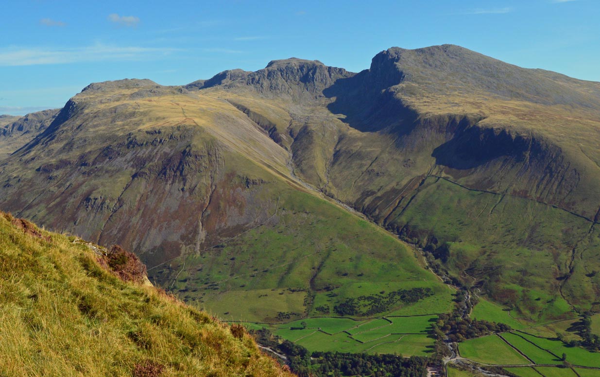
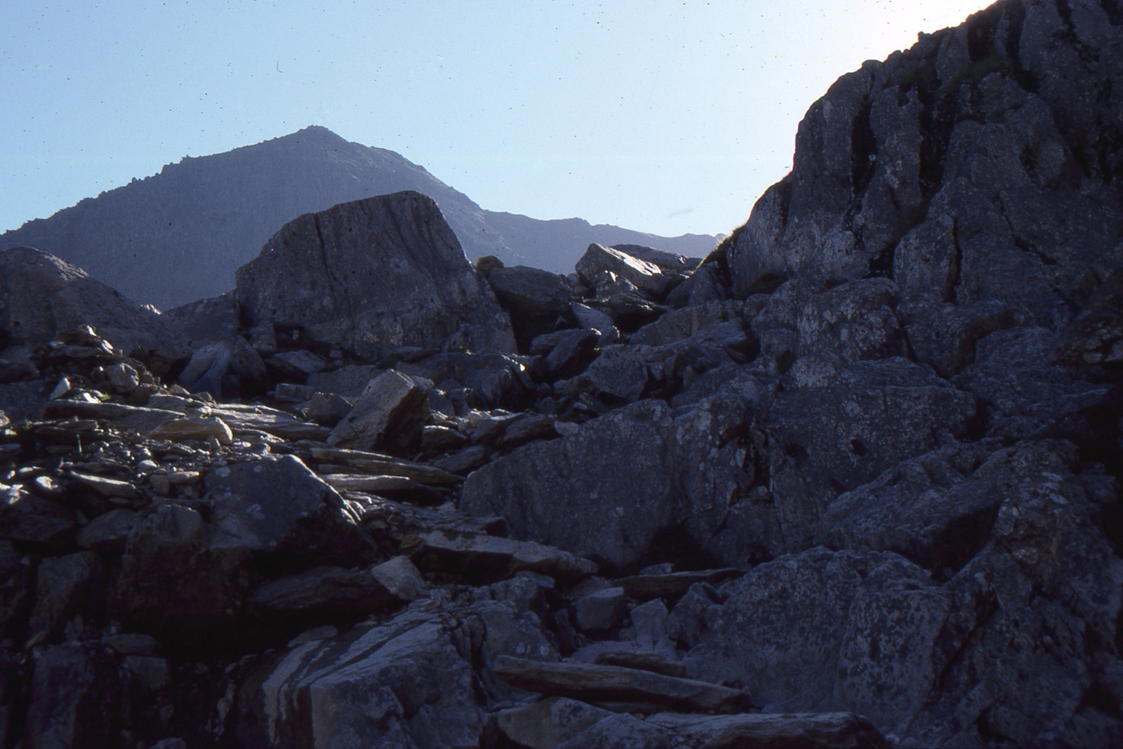
1. Yr Wyddfa/Snowdon via Pyg Track and Miners’ Track
Snapshot
Itinerary
The route starts at Pen y Pass and climbs the Pyg Track towards Bwlch y Moch, with views towards Llyn Llydaw, Crib Goch and the upper cwms of Yr Wyddfa. The path traverses above the lakes before joining the upper mountain path towards the summit ridge. The descent commonly follows the Miners’ Track, passing Glaslyn and Llyn Llydaw before returning to Pen y Pass.
Why it is essential
Yr Wyddfa is the highest mountain in Wales, and the Pyg/Miners combination is one of the most recognised non-technical summit days in Eryri. It combines a major national summit, glacial lakes, views into the Snowdon Horseshoe and a practical return to the same trailhead.
Equipment
- Sturdy boots
- Waterproof and windproof layers
- Warm layer
- Food and water
- Map/GPS
- Navigation backup
- Hat and gloves outside warm settled weather
- Headtorch for late finishes
- Microspikes or winter equipment may be needed when snow or ice is present
Hazards and notes
- Pen y Pass parking is limited and should be planned in advance.
- Sherpa’r Wyddfa bus is the preferred access option in busy periods.
- The upper mountain is exposed to rapid weather changes, low cloud and high wind.
- This route does not include Crib Goch, which is a separate exposed scramble.
GPX / KML links
| Source | URL | Format | Notes |
|---|---|---|---|
| Eryri National Park — Pyg Track | eryri.gov.wales | GPX | Terms not fully resolved; keep link for now; replace with new route geometry later. Source page: eryri.gov.wales/walk/pyg-track |
| Walking Britain — Snowdon Pyg Track and Miners’ Track | walkingbritain.co.uk | GPX source page | Site terms not fully resolved; keep link for now; replace with new route geometry later |
| OS Maps — Snowdon Pyg Track / Miners’ Track | explore.osmaps.com | Source map | OS Maps terms apply; source-map verification only |
Sources
- Eryri National Park — Pyg Track
- Eryri National Park — Getting to Yr Wyddfa
- Visit Wales — Walking Yr Wyddfa
- Walking Britain — Snowdon Pyg Track and Miners’ Track
- OS Maps — Snowdon Pyg Track / Miners’ Track
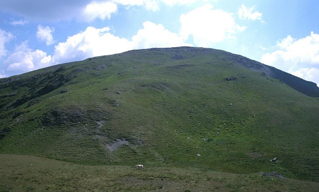
2. Pumlumon Fawr from Eisteddfa Gurig
Snapshot
Itinerary
The walk begins near Eisteddfa Gurig and climbs open Cambrian ground towards Pumlumon Fach and Pumlumon Fawr. The route reaches the broad summit area of Pumlumon Fawr, the highest point in the Cambrian Mountains, before returning by the same general approach or by a short loop variant.
Why it is essential
Pumlumon is the defining summit of the Cambrian Mountains and a major watershed. It represents the quieter, broader and more remote character of the Cambrian uplands.
Equipment
- Sturdy boots
- Waterproof and windproof layers
- Warm layer
- Map/GPS
- Compass
- Food and water
- Navigation backup
- Trekking poles recommended on wet or boggy ground
Hazards and notes
- This is a less engineered and more remote upland walk than the other routes in this catalogue entry.
- Mist, boggy ground and poor path definition can complicate navigation.
- Weather can change quickly; walkers should be prepared to turn back.
GPX / KML links
| Source | URL | Format | Notes |
|---|---|---|---|
| Bergfex — Eisteddfa Gurig, Pumlumon Fach, Pumlumon Fawr | bergfex.com | GPX | Terms not resolved; keep link for now; replace with new route geometry later. Source page: bergfex.com route |
| Bergfex — Eisteddfa Gurig, Pumlumon Fach, Pumlumon Fawr | bergfex.com | KML | Terms not resolved; keep link for now; replace with new route geometry later |
| Walking Britain — Plynlimon from Eisteddfa Gurig | walkingbritain.co.uk | GPX | Listed for private use; copyright restrictions indicated; keep link for now; replace with new route geometry later. Source page: walkingbritain.co.uk/walk-1304-gps |
Sources
- Ceredigion County Council — Pumlumon Trails
- Bergfex — Eisteddfa Gurig, Pumlumon Fach, Pumlumon Fawr
- Walking Britain — Plynlimon from Eisteddfa Gurig
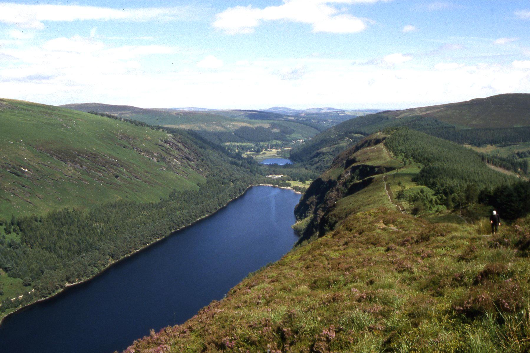
3. Glendalough Spinc and Glenealo Valley
Snapshot
Itinerary
The signed White Route climbs from the Glendalough valley past Poulanass Waterfall, then ascends a long stepped and boardwalked section to the Spinc viewpoint above the Upper Lake. The route follows the clifftop boardwalk before descending through blanket bog and heath into the Glenealo Valley, returning by rough track towards the lake and visitor area.
Why it is essential
This is the classic Wicklow day circuit. It combines Glendalough’s monastic valley, waterfall, lake views, cliff-edge boardwalk and open upland terrain in a single signed route.
Equipment
- Hiking boots
- Waterproof layer
- Warm layer
- Food and water
- Map/GPS
- Sun protection
- Full mountain navigation equipment in poor weather
Hazards and notes
- The route includes cliffs, steep ground, many steps and boardwalk sections that may be slippery when wet.
- Avoid cliff edges, crags and waterfalls.
- Check weather and daylight before starting.
- Dogs should be kept under control.
- Large groups and organised events may need to contact the park in advance.
GPX / KML links
| Source | URL | Format | Notes |
|---|---|---|---|
| National Parks of Ireland — Glendalough walking trails leaflet | nationalparks.ie | PDF map | Reuse terms not checked; official source map; no official GPX found |
| Outdooractive — The Spinc and Glenealo Valley White Route | outdooractive.com | GPX/KML source page | Outdooractive platform terms apply; keep link for now; replace with new route geometry later |
Sources
- National Parks of Ireland — Glendalough walking trails leaflet
- Sport Ireland — Glendalough Spinc and Glenealo Valley
- Outdooractive — The Spinc and Glenealo Valley White Route
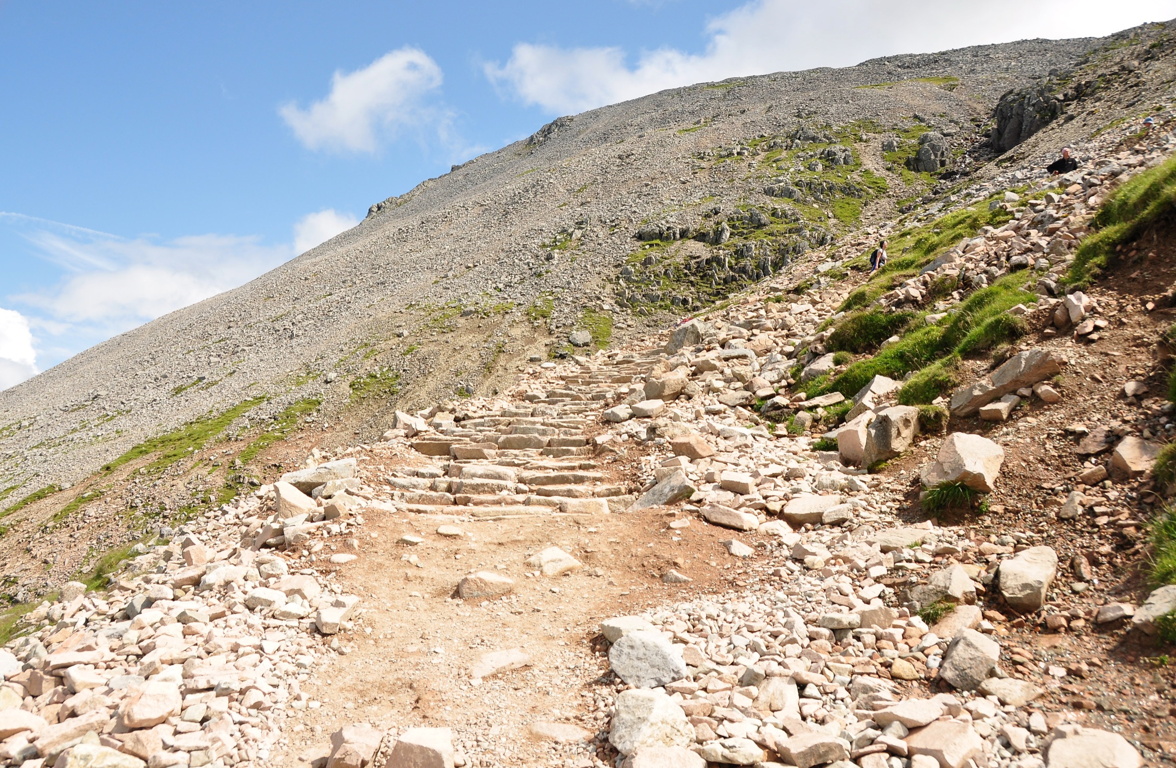
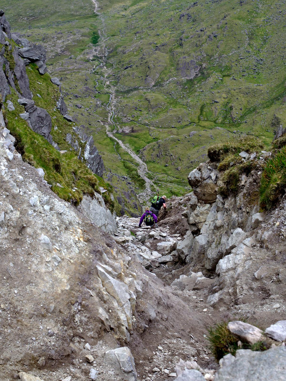
4. Carrauntoohil via Devil’s Ladder and Zig Zags
Snapshot
Itinerary
The route leaves the Cronin’s Yard / Hag’s Glen area and follows the valley approach towards the foot of the Devil’s Ladder. The climb up the Devil’s Ladder is steep and loose, gaining the col below Carrauntoohil before the final summit slope. Many current descriptions recommend descending by the Zig Zags rather than returning down the Devil’s Ladder, reducing rockfall risk and erosion pressure.
Why it is essential
Carrauntoohil is Ireland’s highest mountain and the central summit of the MacGillycuddy’s Reeks. The Hag’s Glen, Devil’s Ladder and Zig Zags combination is the most recognised non-technical day route to the summit, though it remains a serious mountain day rather than a casual walk.
Equipment
- Sturdy boots
- Waterproof and windproof layers
- Warm layer
- Map/GPS
- Compass
- Food and water
- Emergency layer
- Headtorch
- Helmet may be considered for groups using the Devil’s Ladder because of loose rock and rockfall risk
Hazards and notes
- The Devil’s Ladder is steep, loose and eroded.
- Loose stones and rockfall are possible.
- River crossings can become problematic during or after rain.
- Poor visibility near the summit can make route-finding difficult.
- The route requires mountain experience and should not be navigated solely from a phone trace.
GPX / KML links
| Source | URL | Format | Notes |
|---|---|---|---|
| ActiveME — Carrauntoohil via Devil’s Ladder | activeme.ie | KML/GPX source page | Terms not resolved; keep link for now; replace with new route geometry later |
| HiiKER — Carrauntoohil via Devil’s Ladder and Zig Zags | hiiker.app | Download source | HiiKER platform terms apply; keep link for now; replace with new route geometry later |
Sources
- Dingle Hillwalking Club — Carrauntoohil
- ActiveME — Carrauntoohil via Devil’s Ladder
- HiiKER — Carrauntoohil via Devil’s Ladder and Zig Zags
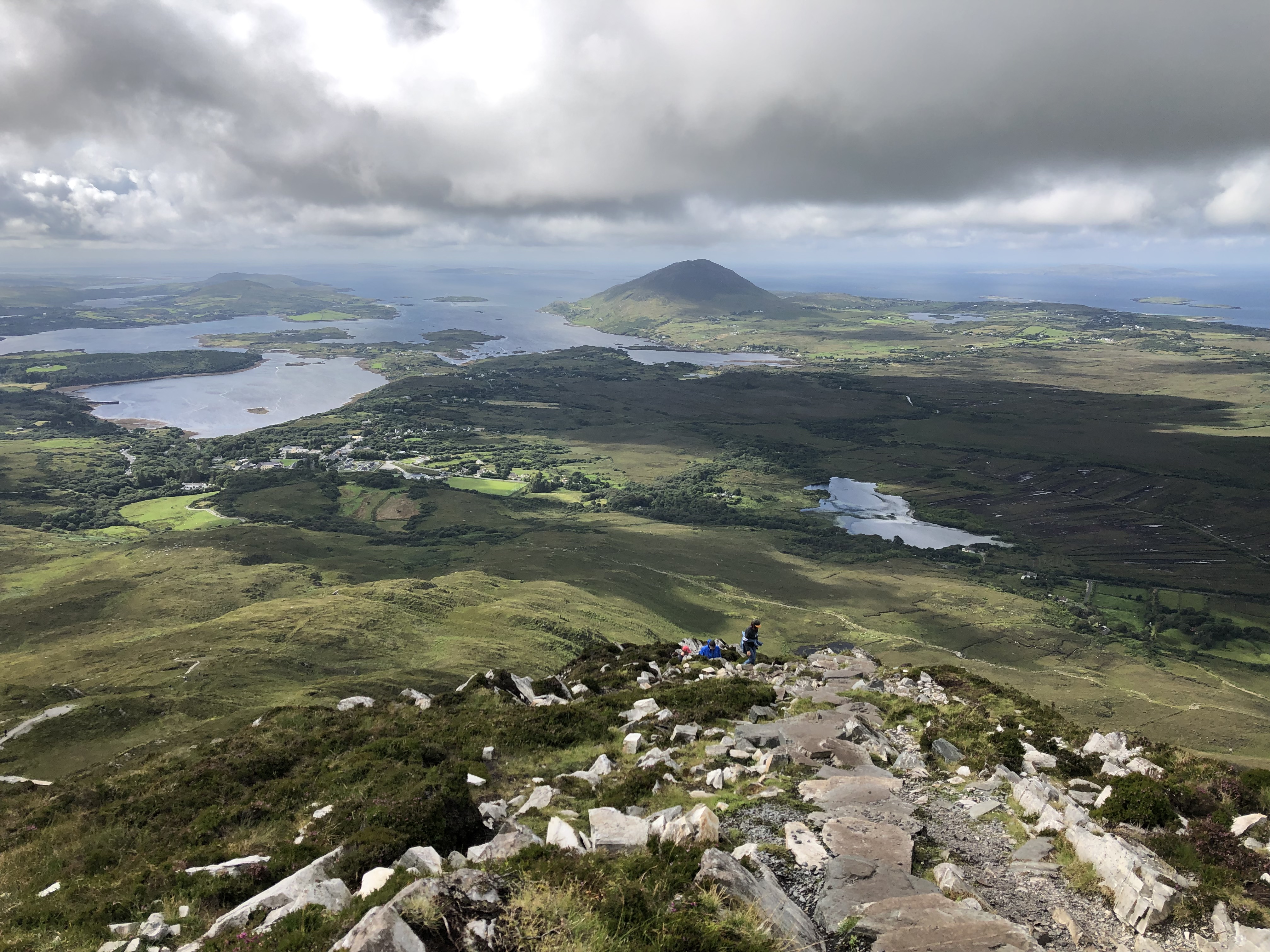
5. Diamond Hill Loop
Snapshot
Itinerary
The route starts beside the Connemara National Park Visitor Centre at Letterfrack and follows the waymarked Lower Diamond Trail before continuing onto the Upper Diamond Trail. The walk forms a figure-of-eight loop, climbing through open national-park terrain to the summit area of Diamond Hill before descending to rejoin the lower loop and return to the visitor centre.
Why it is essential
Diamond Hill is one of Connemara National Park’s signature walks. It gives a compact but varied hill circuit with panoramic views towards Tully Mountain, Kylemore Abbey and the Twelve Bens.
Equipment
- Hiking boots or grippy hiking shoes
- Waterproof layer
- Warm layer
- Water
- Navigation backup
- Standard hiking equipment in good weather
- Mountain hiking equipment in wind, rain or poor visibility
Hazards and notes
- The path is waymarked, but the upper section is exposed to Atlantic weather.
- Check the weather before starting.
- Dogs are welcome but must stay on the lead.
- Marked trails should be followed to protect habitats.
GPX / KML links
| Source | URL | Format | Notes |
|---|---|---|---|
| VisuGPX — Diamond Hill, Connemara National Park | visugpx.com | GPX/trace download source | Terms not resolved; keep link for now; replace with new route geometry later |
| Topo GPS — Diamond Hill route | topo-gps.com | GPX/ZIP source | Terms not resolved; keep link for now; replace with new route geometry later |
| Wikiloc — Diamond Hill Loop Trail | wikiloc.com | GPX source page | Wikiloc platform terms apply; keep link for now; replace with new route geometry later |
Sources
- Discover Ireland — Diamond Hill
- National Parks of Ireland — Connemara
- Outdooractive
- VisuGPX — Diamond Hill, Connemara National Park
- Topo GPS — Diamond Hill route
- Wikiloc — Diamond Hill Loop Trail
Region-level sources
| Source | Use | URL |
|---|---|---|
| Eryri National Park — Pyg Track | Snowdon official route | eryri.gov.wales |
| Eryri National Park — Getting to Yr Wyddfa | Snowdon access | eryri.gov.wales |
| Visit Wales — Walking Yr Wyddfa | Snowdon guide | visitwales.com |
| Ceredigion County Council — Pumlumon Trails | Pumlumon official trails | ceredigion.gov.uk |
| Bergfex — Pumlumon Fawr route | Pumlumon route source | bergfex.com |
| National Parks of Ireland — Glendalough walking trails leaflet | Glendalough official route | nationalparks.ie |
| Sport Ireland — Glendalough Spinc and Glenealo Valley | Glendalough White Route | sportireland.ie |
| Dingle Hillwalking Club — Carrauntoohil | Carrauntoohil club guide | dinglehillwalkingclub.com |
| ActiveME — Carrauntoohil via Devil’s Ladder | Carrauntoohil route source | activeme.ie |
| Discover Ireland — Diamond Hill | Diamond Hill official page | discoverireland.ie |
| National Parks of Ireland — Connemara | Connemara National Park | nationalparks.ie |