Regional overview
The Cairngorms and Eastern Highlands form one of Britain’s most serious hillwalking regions: high granite plateaux, glacial corries, long passes, pinewoods, moorland ridges and exposed Munro summits. Cairngorms National Park is the UK’s largest national park at 4,528 sq km, includes 55 Munros and nine National Nature Reserves, and contains a large share of the UK’s rare and endangered species.
The main hiking centres are Aviemore and Glenmore on the north-west side of the Cairngorms, Braemar and Ballater on Deeside, Glen Muick on the Balmoral side, Glen Doll and Glen Clova in the Angus Glens, and Highland Perthshire for Schiehallion. The park includes five of the UK’s six highest mountains, together with forest paths, rivers, lochs and wildlife areas.
The normal summer hillwalking season is roughly late May to October, but conditions are highly variable. Mountain weather changes quickly and “four seasons in one day” is realistic; winter snow can persist, and January to April conditions may require winter equipment.
The Cairngorm plateau and Lochnagar in particular require strong navigation. Mist, wind, snow, boulder fields and corniced corrie rims can make otherwise straightforward summer routes serious.
Selection rationale
These five routes were selected to represent the region’s essential walking character: the high Cairngorm plateau, a famous Royal Deeside corrie summit, an Angus Glens glacial corrie and Munro round, the classic high pass of the Lairig Ghru, and Schiehallion as the eastern/southern Highlands’ iconic isolated mountain.
The Lairig Ghru is longer than the normal catalogue range, but is retained because it is one of Scotland’s defining non-technical mountain traverses.
Summary table
| # | Hike | Country | Route type | Distance | Gain | Max elevation | Difficulty |
|---|---|---|---|---|---|---|---|
| 1 | Ben Macdui and Cairn Gorm | Scotland | Loop / high plateau circuit | 17.5 km | 932 m | 1,309 m | Hard mountain walk |
| 2 | Lochnagar Circuit, Glen Muick | Scotland | Loop | 19 km | 930 m | 1,155 m | Hard mountain walk |
| 3 | Mayar and Driesh via Corrie Fee | Scotland | Loop | 14.5 km | 835 m | 947 m | Moderate-hard mountain walk |
| 4 | Lairig Ghru Traverse | Scotland | Point-to-point | 30.5–31 km | 810 m | 835 m | Very long remote mountain pass |
| 5 | Schiehallion from Braes of Foss | Scotland | Out-and-back | 10 km | 731 m | 1,083 m | Moderate mountain walk |
1. Ben Macdui and Cairn Gorm
Snapshot
Itinerary
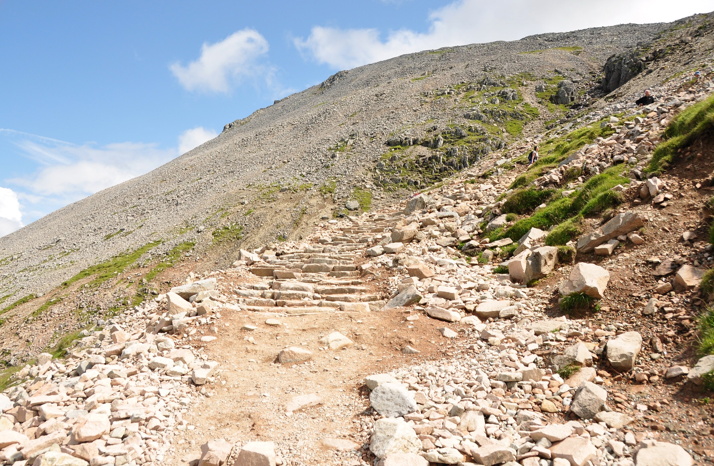
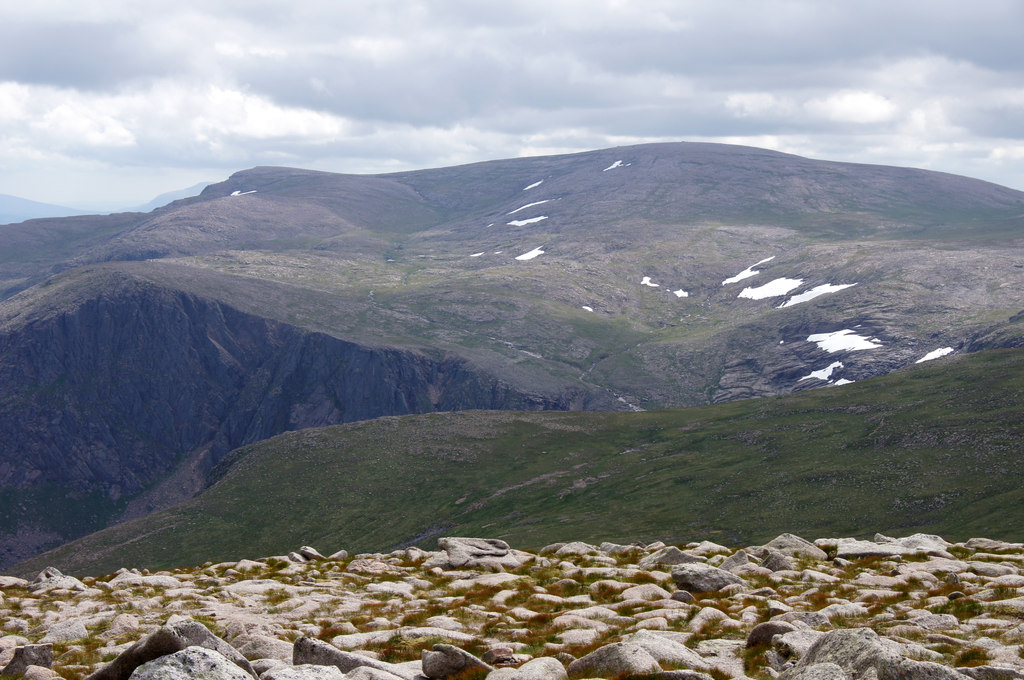
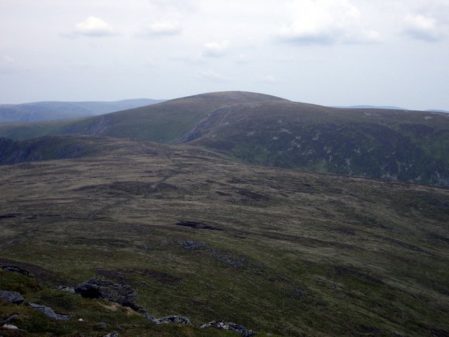
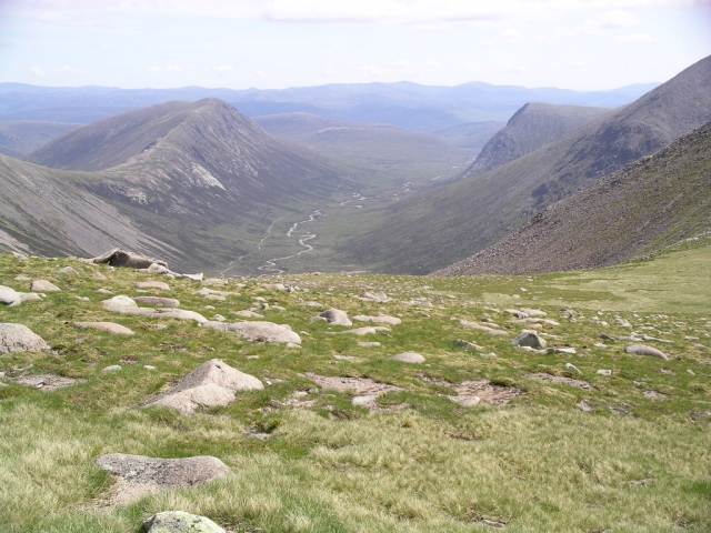
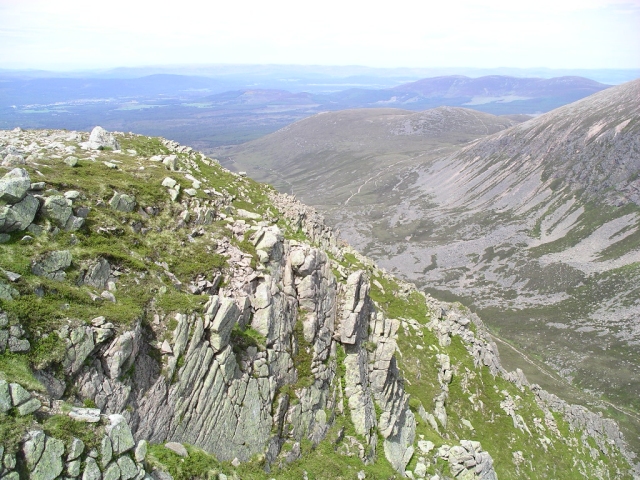
The route begins at Cairngorm Mountain car park and crosses below the Northern Corries before gaining the broad ridge of Miadan Creag an Leth-choin. The path then traverses above Coire an Lochain and reaches the high Cairngorm plateau, where ground becomes open, stony and less defined. The line continues past Lochan Buidhe and climbs steadily to Ben Macdui, the second-highest mountain in Britain.
The return crosses the plateau towards the Northern Corries, passing near Stob Coire an t-Sneachda before continuing to Cairn Gorm. From Cairn Gorm the route descends past the Ptarmigan station and follows the Sròn an Aonaich / Windy Ridge path back towards the ski-centre car park.
Why it is essential
This is the classic northern approach to the Cairngorm plateau and reaches Ben Macdui, the UK’s second-highest summit. It gives a representative experience of the Cairngorms’ arctic-like plateau terrain, granite boulder fields, corrie rims and long-range views over the Lairig Ghru.
Equipment
- Sturdy boots
- Waterproof and windproof layers
- Warm layer
- Gloves and hat outside high summer
- Map and compass
- GPS backup
- Headtorch
- Food and water
- Winter boots, crampons and ice axe may be required in snow or verglas
- Microspikes are not a substitute for proper winter equipment on serious steep snow
Hazards and notes
- The Cairngorm plateau is broad, high, stony and difficult to navigate in cloud or snow.
- The plateau is extremely exposed and particularly serious under snow.
- The route also passes near corrie rims and boulder fields.
- In winter, check SAIS Northern Cairngorms avalanche information and current mountain forecasts.
GPX / KML links
| Source | URL | Format | Notes |
|---|---|---|---|
| Walkhighlands — Ben Macdui and Cairn Gorm GPX | walkhighlands.co.uk | GPX | Replace later with own route file |
| Walkhighlands — Ben Macdui and Cairn Gorm KMZ | walkhighlands.co.uk | KMZ | Replace later with own route file |
| Walkhighlands source route page | walkhighlands.co.uk | Route page / map | Primary source route page |
Sources
- Walkhighlands — Ben Macdui and Cairn Gorm
- Walkhighlands GPX download
- Walkhighlands KMZ download
- SAIS Northern Cairngorms
- Cairngorms National Park — Staying safe in the mountains
2. Lochnagar Circuit, Glen Muick
Snapshot
Itinerary
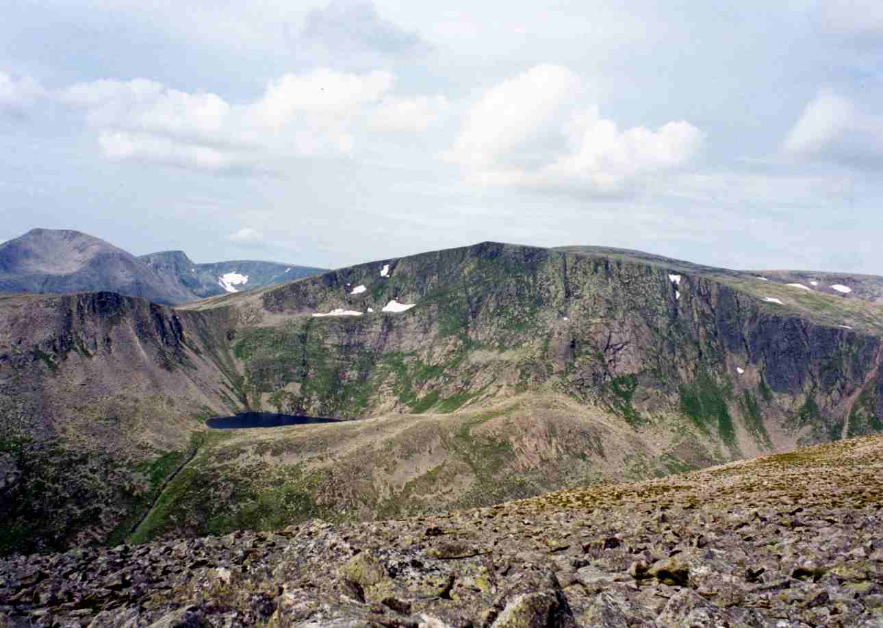
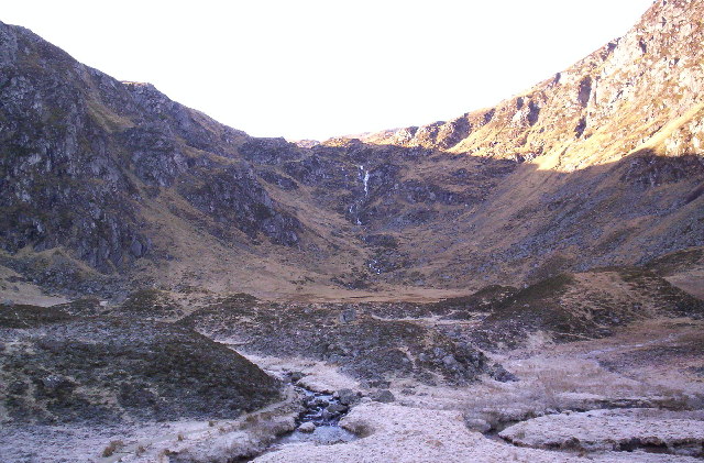
The circuit starts from the Spittal of Glen Muick car park and follows tracks across Glen Muick before climbing beside the Allt na Guibhsaich. The route then branches onto the main Lochnagar path, gaining the bealach between Lochnagar and Meikle Pap, where the northern corrie and lochan come into view.
The ascent continues via the Ladder, a steep boulder-field section with a summer path, then follows the cliff edge at a safe distance towards Cac Càrn Mòr and Cac Càrn Beag, the true summit. The descent leaves the corrie rim and drops into the Glas Allt glen, passing the Glas Allt falls and Glas-allt-Shiel before returning along Loch Muick to the Spittal.
Why it is essential
Lochnagar is one of the defining mountains of the eastern Cairngorms, combining a famous dark corrie, granite cliffs, a historic Royal Deeside setting and a satisfying mountain circuit. It is one of the most celebrated Munros in the Cairngorms.
Equipment
- Sturdy boots
- Waterproofs
- Warm layer
- Gloves and hat outside midsummer
- Map and compass
- GPS backup
- Headtorch for short days
- Food and water
- In winter or lingering snow, crampons and ice axe may be required
- The Ladder and corrie rim become significantly more serious in winter
Hazards and notes
- The Ladder is steep and bouldery. In winter this slope is known for avalanche risk.
- The corrie rim should not be followed too closely.
- Mist can make the plateau descent difficult, and the high corrie edge may hold cornices in winter or spring.
- There is no public transport to the start according to Walkhighlands.
GPX / KML links
| Source | URL | Format | Notes |
|---|---|---|---|
| Walkhighlands — Lochnagar Circuit GPX | walkhighlands.co.uk | GPX | Replace later with own route file |
| Walkhighlands — Lochnagar Circuit source route page | walkhighlands.co.uk | Route page / map / GPX / KMZ links | Primary source route page |
Sources
3. Mayar and Driesh via Corrie Fee
Snapshot
Itinerary
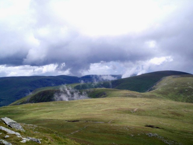
The route starts at Glen Doll car park and follows forest tracks towards Corrie Fee. After leaving the main track, the path reaches the entrance to Corrie Fee National Nature Reserve, where the glacial amphitheatre and waterfall are revealed. The path crosses the corrie floor, passes glacial debris, and climbs steeply beside the waterfall to reach the plateau.
From the plateau the route climbs gently to Mayar, then follows an informal path and fence-post line eastwards towards Driesh. After reaching Driesh’s trig point and shelter cairn, the route returns to the col and descends by the Shank of Drumfollow / Kilbo path into the forest, then follows tracks back to Glen Doll.
Why it is essential
This route gives one of the most complete eastern Cairngorms day hikes: native woodland, a classic glacial corrie, rare alpine flora habitat, waterfall ascent, open Mounth plateau and two Munro summits. Corrie Fee National Nature Reserve is a major natural feature of the Angus Glens.
Equipment
- Sturdy boots
- Waterproofs
- Warm layer
- Navigation backup
- Food and water
- Trekking poles recommended
- In winter, plateau navigation can become serious
- Winter boots, crampons and ice axe may be needed depending on conditions
Hazards and notes
- The path through Corrie Fee is good, but the plateau section has pathless or rough stretches and can be confusing in poor visibility.
- Fence posts assist navigation in places.
- Corrie Fee is ecologically sensitive, with rare arctic-alpine plants. Stay on established paths where available and avoid trampling sensitive vegetation.
GPX / KML links
| Source | URL | Format | Notes |
|---|---|---|---|
| Walkhighlands — Mayar and Driesh GPX | walkhighlands.co.uk | GPX | Replace later with own route file |
| Walkhighlands — Mayar and Driesh source route page | walkhighlands.co.uk | Route page / map / GPX / KMZ links | Primary source route page |
Sources
- Walkhighlands — Mayar and Driesh
- Walkhighlands GPX download
- NatureScot — Corrie Fee National Nature Reserve
- NatureScot — Corrie Fee NNR visiting reserve leaflet
4. Lairig Ghru Traverse
Snapshot
Itinerary
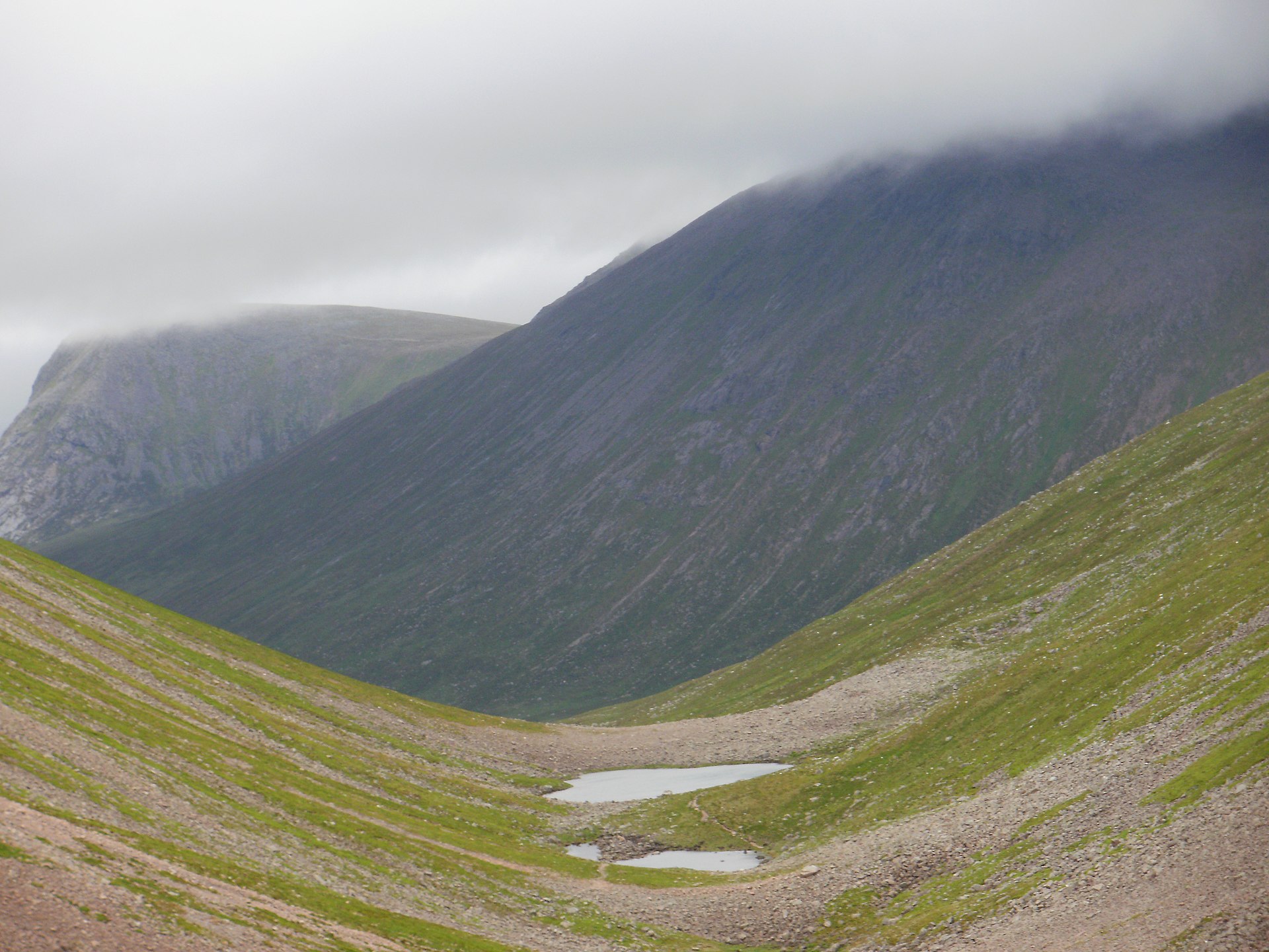
The classic traverse starts at Coylumbridge and enters Rothiemurchus Forest, following signed paths towards the Lairig Ghru. The route passes the Iron Bridge / Cairngorm Club Bridge and Piccadilly before leaving the forest and climbing towards the pass. The northern approach narrows between Lurcher’s Crag and Sròn na Lairig, then enters the high trench of the Lairig Ghru.
The roughest section lies near the pass, where moraines and stones interrupt the path around the high point of roughly 835 m. The route passes the Pools of Dee, then continues south towards Clach nan Taillear, the Corrour bothy junction, Glen Luibeg, Derry Lodge and finally the track system to Linn of Dee.
Why it is essential
The Lairig Ghru is one of Scotland’s great mountain passes. It is the best-known hill pass in Scotland and a classic walk through one of the wildest areas of the Cairngorms. ScotWays lists it as a heritage path, classifying it as a drove road and smugglers’ path.
Equipment
- Sturdy boots
- Waterproofs
- Warm layers
- Gloves and hat
- Map and compass
- GPS backup
- Headtorch
- Emergency shelter
- Substantial food and water
- Transport plan
- In winter, full winter mountain equipment may be required, including ice axe and crampons depending on conditions
Hazards and notes
- This is a long and remote traverse with no quick exit once committed to the central section.
- The route is remote, exposed, often snowbound in winter and rough on the highest section.
- The Rothiemurchus section is sensitive capercaillie habitat. Dogs should be kept on a short lead during the breeding season from 1 April to 15 August.
- Transport is a major constraint because the route is point-to-point and the return bus journey is limited and time-consuming.
GPX / KML links
| Source | URL | Format | Notes |
|---|---|---|---|
| Walkhighlands — Lairig Ghru GPX | walkhighlands.co.uk | GPX | Replace later with own route file |
| Walkhighlands — Lairig Ghru source route page | walkhighlands.co.uk | Route page / map / GPX / KMZ links | Primary source route page |
| ScotWays — Lairig Ghru heritage path | scotways.com | Source map / heritage-path record | Useful historic/source-route reference |
Sources
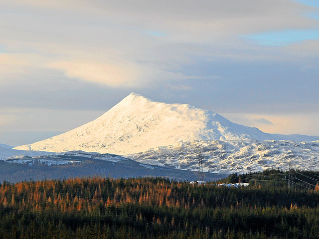
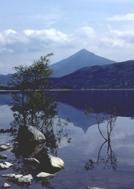
5. Schiehallion from Braes of Foss
Snapshot
Itinerary
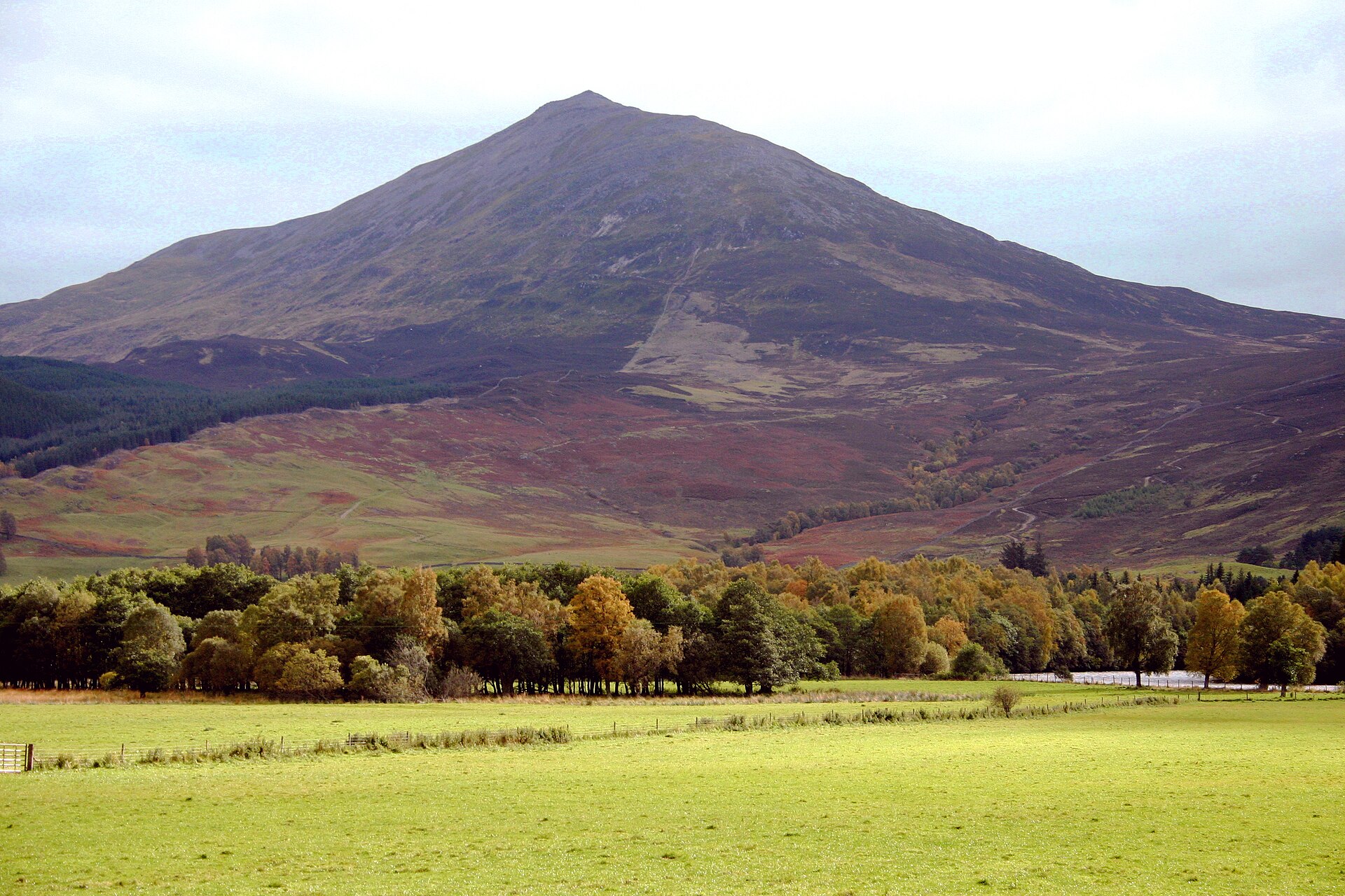
The route begins at Braes of Foss car park and follows the maintained path through woodland and onto the lower east ridge. The path was built on a more sustainable line after erosion damaged the older direct route. It climbs by stone steps and zigzags onto the ridge, with views opening across Loch Tummel and towards Beinn a’ Ghlò.
Higher up, the going becomes rougher as quartzite boulders cover the broad ridge. Cairns mark the line, but the true summit lies farther west along the ridge than the first high points suggest. The return is normally by the same route to protect the restored hillside and avoid renewed erosion.
Why it is essential
Schiehallion is one of Scotland’s most recognisable mountains, famous for its apparent cone shape from Loch Rannoch and for its role in the eighteenth-century experiment to measure the mass of the Earth, during which contour lines were developed. It is one of Scotland’s best-known hills.
Equipment
- Sturdy hiking shoes or boots
- Waterproof layer
- Warm layer
- Map/GPS
- Food and water
- Boots are strongly preferable because the summit ridge crosses awkward boulders
- In winter or icy conditions, treat the hill as a winter mountain route
Hazards and notes
- The lower and middle route is well constructed, but the final summit ridge is bouldery, pathless in places and slower than the distance suggests.
- Avoid short-cutting the old eroded line.
- The return should normally be by the same path to prevent further erosion.
GPX / KML links
| Source | URL | Format | Notes |
|---|---|---|---|
| Walkhighlands — Schiehallion GPX | walkhighlands.co.uk | GPX | Replace later with own route file |
| Walkhighlands — Schiehallion source route page | walkhighlands.co.uk | Route page / map / GPX / KMZ links | Primary source route page |
Sources
Region-level sources
| Source | Use | URL |
|---|---|---|
| Cairngorms National Park Authority | Park-wide context, access and conservation | cairngorms.co.uk |
| Cairngorms National Park safety guidance | Mountain safety guidance | cairngorms.co.uk |
| VisitScotland — Cairngorms National Park | Visitor and access context | visitscotland.com |
| VisitCairngorms — weather and climate | Climate and weather context | visitcairngorms.com |
| Walkhighlands — Ben Macdui and Cairn Gorm | Route source | walkhighlands.co.uk |
| Walkhighlands — Lochnagar | Route source | walkhighlands.co.uk |
| Walkhighlands — Mayar and Driesh | Route source | walkhighlands.co.uk |
| Walkhighlands — Lairig Ghru | Route source | walkhighlands.co.uk |
| Walkhighlands — Schiehallion | Route source | walkhighlands.co.uk |
| SAIS Northern Cairngorms | Winter avalanche information | sais.gov.uk |
| NatureScot — Corrie Fee NNR | National Nature Reserve context | nature.scot |
| NatureScot — Corrie Fee leaflet | Reserve visiting leaflet | nature.scot |
| ScotWays — Lairig Ghru heritage path | Heritage path record | scotways.com |