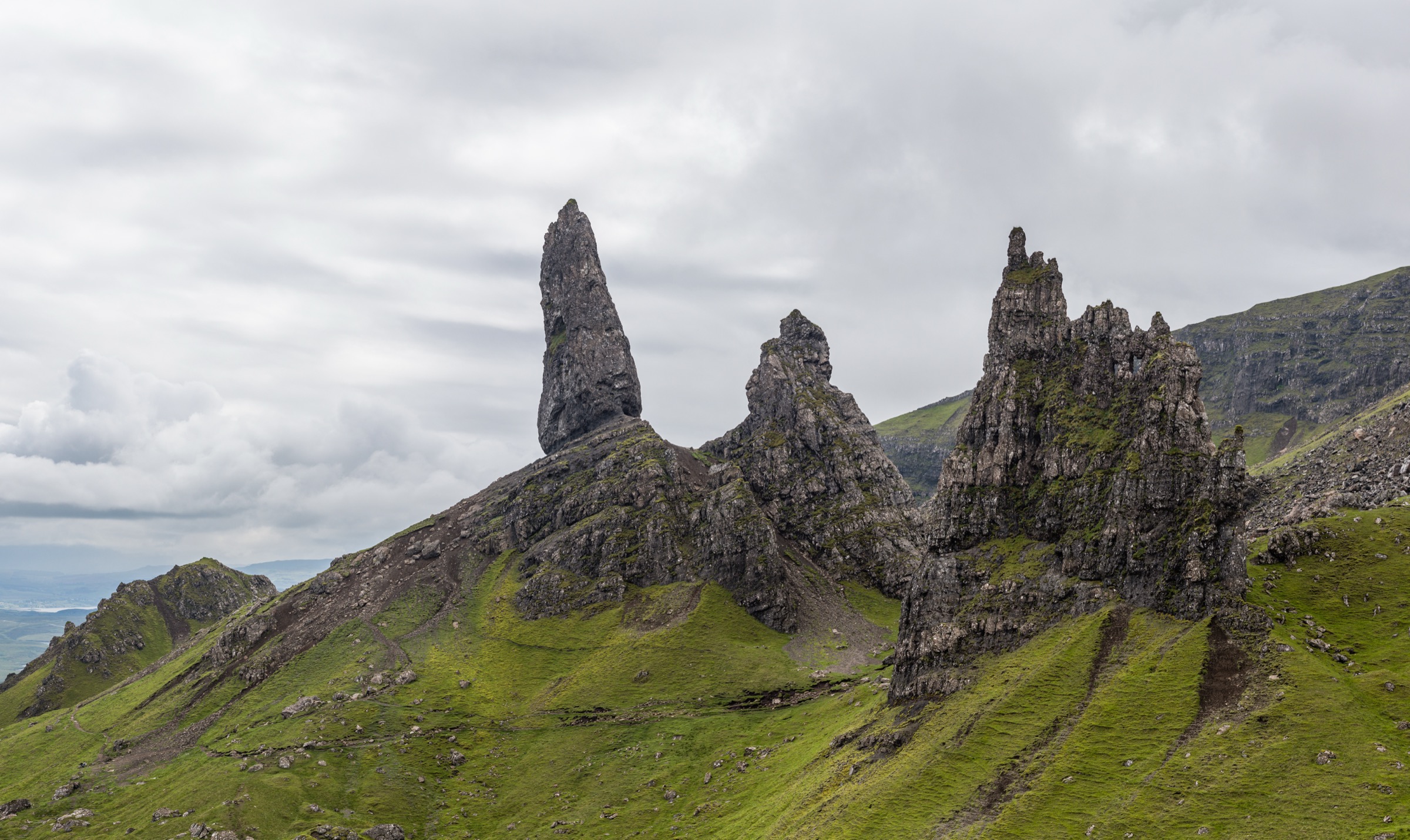
Regional overview
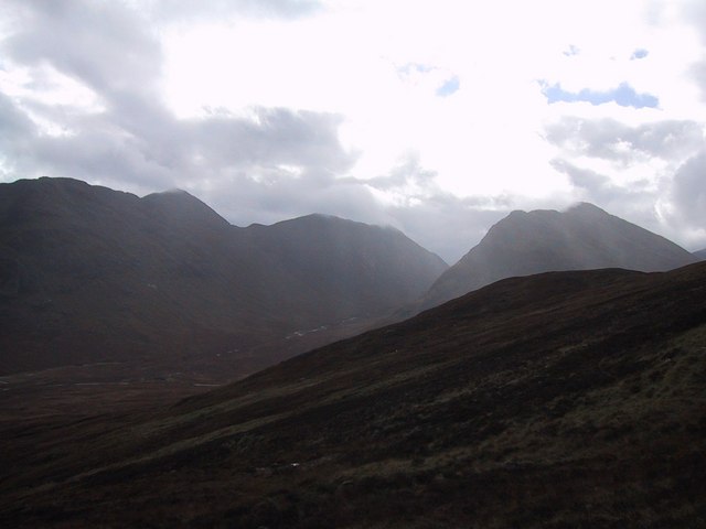
Lochaber and Glen Coe form one of Scotland’s most concentrated mountain-walking areas: Ben Nevis and the Mamores above Glen Nevis, the volcanic and glacial scenery of Glen Coe, the West Highland Way crossing the Devil’s Staircase, and a dense cluster of Munros, corries, ridges and historic passes. The terrain is generally rougher, wetter and more navigation-sensitive than many continental European hiking areas of similar altitude.
The main walking bases are Fort William, Glen Nevis, Glencoe village, Ballachulish, Kingshouse and Kinlochleven. Glencoe is a National Nature Reserve with dramatic mountains, history, wildlife, eight Munros and more than 37 miles / about 60 km of maintained footpaths. The Ben Nevis estate includes Britain’s highest summit, rugged ridges and Steall Gorge.
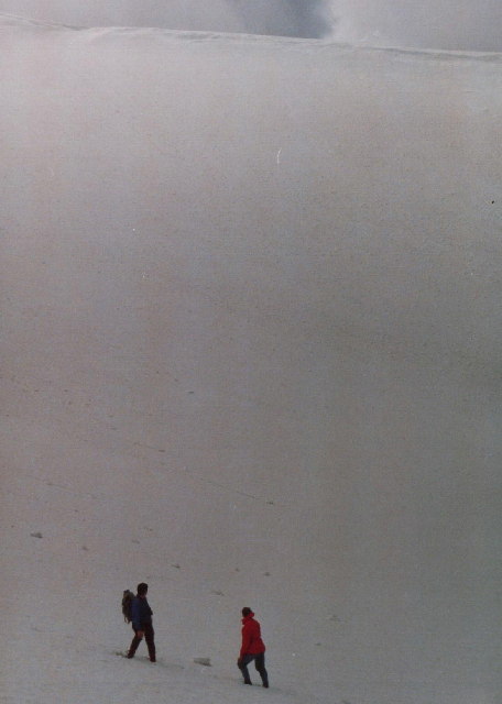
The normal hillwalking season is roughly late spring to early autumn, but conditions vary sharply. Snow, cornices, poor visibility and short daylight make winter and early-season ascents much more serious. Scottish winter routes require ice axe, crampons and the skills to use them, and winter conditions can make route-finding and timing much harder.
Access is a mixture of car parks, bus-served A82 trailheads, Fort William/Glen Nevis services and point-to-point stages requiring bus or taxi planning. The Scottish Outdoor Access Code applies; outdoor access depends on respecting others, caring for the environment and taking responsibility for actions, while dog owners must keep dogs under proper control around livestock and wildlife.
Selection rationale
These five hikes were selected to represent the region’s core walking character: Britain’s highest mountain, the classic Mamores ridge circuit, an accessible Glen Coe Munro ridge, the historic and dramatic Lost Valley, and the West Highland Way crossing of the Devil’s Staircase.
The Aonach Eagach was deliberately excluded because it is primarily a serious scrambling traverse rather than a standard non-technical day-hike.
Summary table
| # | Hike | Route type | Distance | Gain | Max elevation | Difficulty |
|---|---|---|---|---|---|---|
| 1 | Ben Nevis by the Mountain Track | Out-and-back | 16–17 km | 1,352 m | 1,345 m | Strenuous mountain walk |
| 2 | Ring of Steall, Mamores | Mountain loop | 16 km | 1,676 m | 1,032 m | Very strenuous; exposed scrambling |
| 3 | Buachaille Etive Beag | Out-and-back ridge route | 8 km | 900 m | 956 m | Strenuous mountain walk |
| 4 | Lost Valley / Coire Gabhail | Out-and-back | 4 km | 335 m | Approx. 390 m | Moderate; rough path and mild scrambling |
| 5 | West Highland Way: Kingshouse to Kinlochleven via Devil’s Staircase | Point-to-point | 14–14.5 km | 430 m | 550–551 m | Moderate hill pass walk |
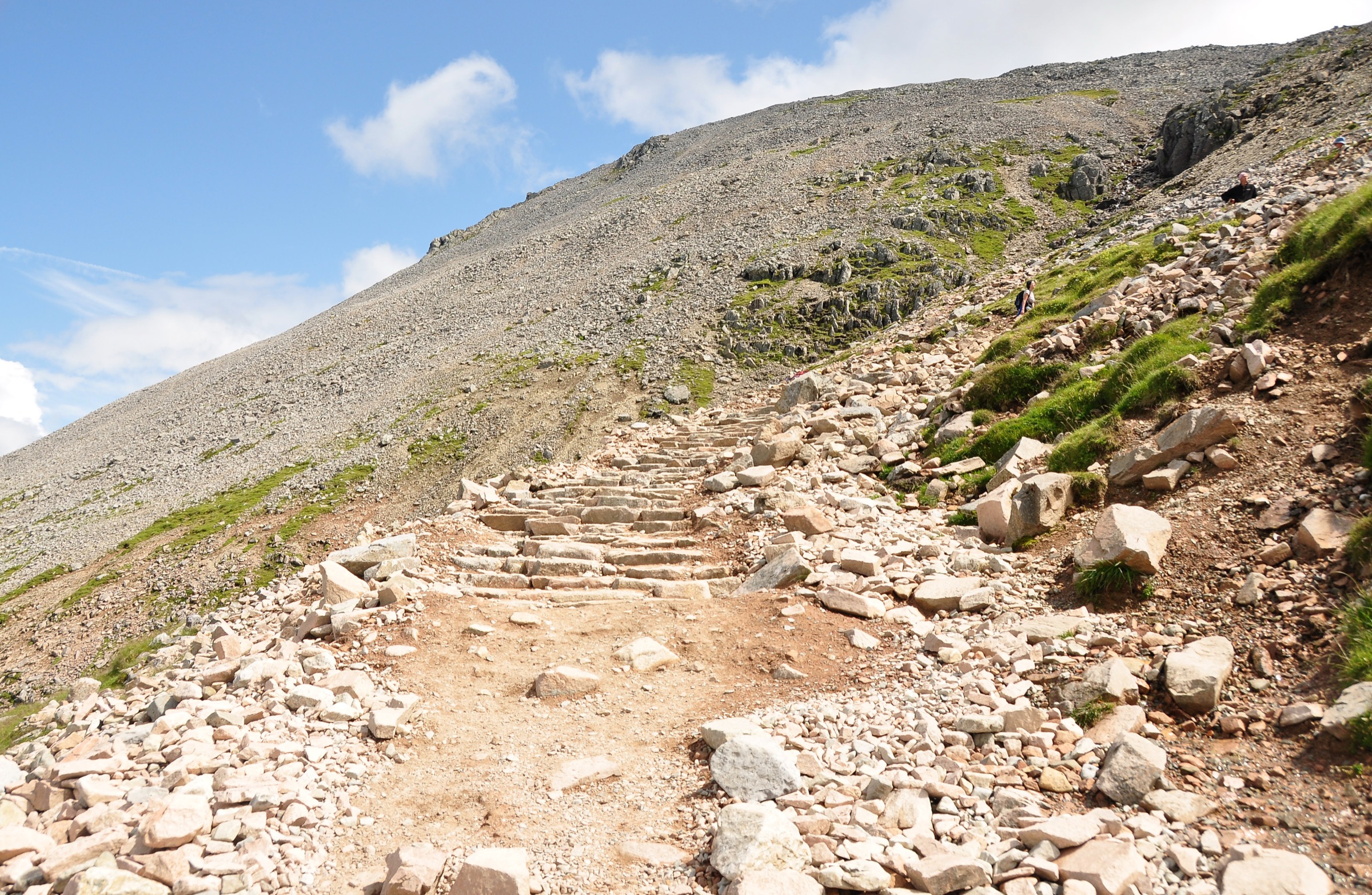
1. Ben Nevis by the Mountain Track
Snapshot
Itinerary
The route starts at the Glen Nevis Visitor Centre, crosses the River Nevis and joins the main Mountain Track. The lower section climbs steadily above Glen Nevis before meeting the older start from Achintee / Ben Nevis Inn. The path then rises in broad zigzags towards the Red Burn and the upper mountain.
Higher up, the surface becomes rough, stony and more exposed to weather. In poor visibility, the summit plateau requires accurate navigation to avoid the North Face cliffs and Five Finger Gully.
The descent normally follows the same Mountain Track. Care is needed on tired legs; many accidents occur during descent and the descent can be as arduous as the ascent.
Why it is essential
Ben Nevis is Britain’s highest mountain, and the Mountain Track is the standard hillwalking route to its summit. It is not technically difficult in summer conditions, but its height, weather exposure, stony upper slopes and summit navigation make it a serious mountain day.
Equipment
Mountain hiking equipment:
- Sturdy hiking boots
- Waterproof jacket and trousers
- Warm layers, hat and gloves
- Map and compass, plus GPS backup
- Headtorch
- Food and at least 1 litre of water
- First aid kit and emergency shelter
Conditional equipment:
- Ice axe and crampons when snow or ice is present
- Winter skills if the path is snow-covered
Hazards and notes
The official Ben Nevis safety leaflet warns of 600 m cliffs on the North Face, the danger of Five Finger Gully, cornices in snow, poor visibility, and the need to take a correct compass bearing when leaving the summit. Mobile phone reception should not be relied on.
The upper section is rough, stony and often snow-covered. Losing the line of the path can lead onto dangerous terrain.
GPX / KML links
| Source | URL | Format | Notes |
|---|---|---|---|
| Walkhighlands route page | walkhighlands.co.uk | Source route/map | Walkhighlands terms; source route checked |
| Walkhighlands GPX | download.php?w=160 | GPX | Walkhighlands route data; include as found; will be replaced later |
| Walkhighlands KMZ | download-ge.php?w=160 | KMZ | Walkhighlands route data; include as found; will be replaced later |
Further reading
- Walkhighlands — Ben Nevis
- Nevis Landscape — Ben Nevis safety leaflet (PDF)
- John Muir Trust — Ben Nevis estate
2. Ring of Steall, Mamores
Snapshot
Itinerary
The route begins at the upper Glen Nevis road-end car park and follows the popular path into the Steall Gorge and Steall Meadows. From the valley floor it climbs steeply towards An Gearanach, then follows the ridge over An Garbhanach, Stob Coire a’ Chàirn, Am Bodach, Sgùrr an Iubhair and the Devil’s Ridge to Sgùrr a’ Mhàim. The descent returns towards Glen Nevis, completing the circuit.
The route has a defined path for almost all of its length, but includes easy scrambling on rough rocks with exposure and is a long, exhausting day. The traverse of An Garbhanach is airy and exposed; the Devil’s Ridge section also includes narrow, exposed ground and minor rocky obstacles.
Why it is essential
This is the strongest representative ridge circuit in the Mamores: a full high-level loop, four Munros, views towards Ben Nevis and Glen Nevis, and a memorable combination of long ascent, airy ridges and enclosed glens.
Equipment
Mountain hiking equipment:
- Sturdy boots
- Waterproof and windproof layers
- Warm spare layer, hat and gloves
- Map, compass and GPS backup
- Headtorch because of the route length
- Food and sufficient water
- Emergency shelter
Conditional equipment:
- Ice axe and crampons in snow or ice
- Helmet only if parties judge rockfall risk significant on the day; not a standard summer requirement
Hazards and notes
This is not a casual Glen Nevis walk. The route is long, committing and exposed, with multiple scrambling sections and limited easy escape once on the main ridge. It should be reserved for clear, settled weather and competent mountain walkers.
In winter, the route becomes a serious mountaineering outing requiring winter equipment, route-finding and avalanche awareness.
GPX / KML links
| Source | URL | Format | Notes |
|---|---|---|---|
| Walkhighlands route page | walkhighlands.co.uk | Source route/map | Walkhighlands terms; source route checked |
| Walkhighlands GPX | download.php?w=159 | GPX | Walkhighlands route data; include as found; will be replaced later |
| Walkhighlands KMZ | download-ge.php?w=159 | KMZ | Walkhighlands route data; include as found; will be replaced later |
Further reading
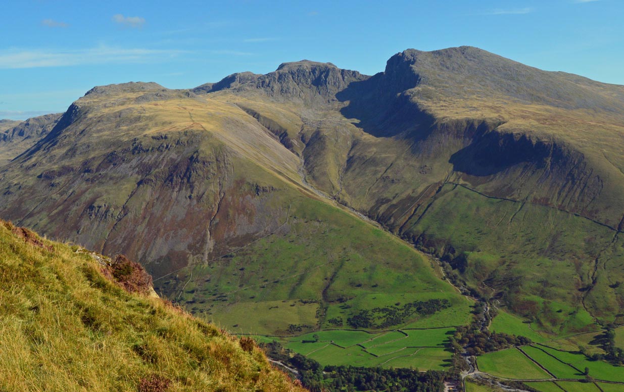
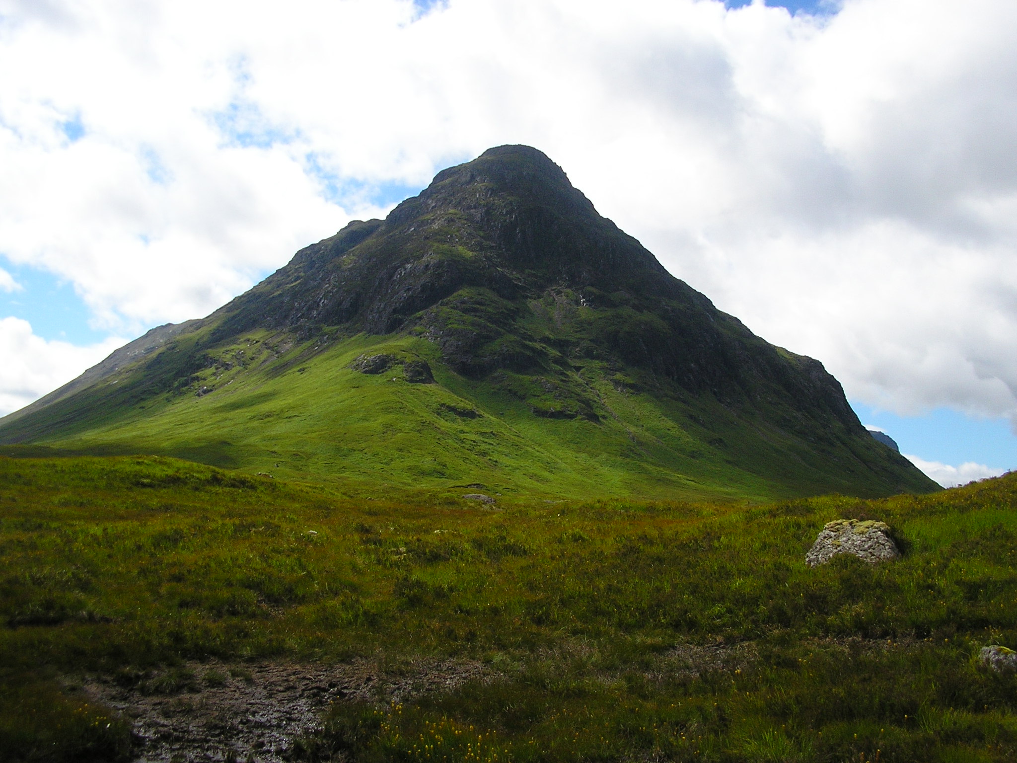
3. Buachaille Etive Beag
Snapshot
Itinerary
The route starts from the small A82 car park opposite the Beehive cairn. A path joins the Lairig Èilde right of way before branching left towards the ridge. The constructed path climbs to Mam Buidhe, the bealach between Stob Dubh and Stob Coire Raineach.
The usual route first heads south-west to Stob Dubh, with views into Glen Etive, then returns to the bealach and climbs north-east to Stob Coire Raineach before descending by the ascent route.
The terrain is a well-constructed rocky path to the bealach, followed by fairly straightforward rocky ridge-walking in good conditions.
Why it is essential
Buachaille Etive Beag is one of the most approachable Munro ridge walks in Glen Coe. It gives a high mountain experience, views to Bidean nam Bian, the Aonach Eagach and Glen Etive, and a compact two-Munro itinerary without the seriousness of the Aonach Eagach or Bidean’s harder approaches.
Equipment
Mountain hiking equipment:
- Sturdy boots
- Waterproof layer
- Warm layer, hat and gloves outside warm settled weather
- Map, compass and GPS backup
- Trekking poles useful on descent
- Food and water
Conditional equipment:
- Ice axe and crampons when snow or ice is present
Hazards and notes
The ridge is comparatively straightforward in summer conditions, but still reaches nearly 1,000 m and is exposed to wind, low cloud and rain. Navigation from the bealach and on the ridge can be problematic in mist.
Early or late-season snow can make the ridge and descent significantly more serious. Dogs should be kept under proper control around livestock and wildlife, consistent with Scottish Outdoor Access Code guidance.
GPX / KML links
| Source | URL | Format | Notes |
|---|---|---|---|
| Walkhighlands route page | walkhighlands.co.uk | Source route/map | Walkhighlands terms; source route checked |
| Walkhighlands GPX | download.php?w=121 | GPX | Walkhighlands route data; include as found; will be replaced later |
| Walkhighlands KMZ | download-ge.php?w=121 | KMZ | Walkhighlands route data; include as found; will be replaced later |
Further reading
- Walkhighlands — Buachaille Etive Beag
- Walkhighlands — Stob Dubh summit page
- Scottish Outdoor Access Code — dog guidance
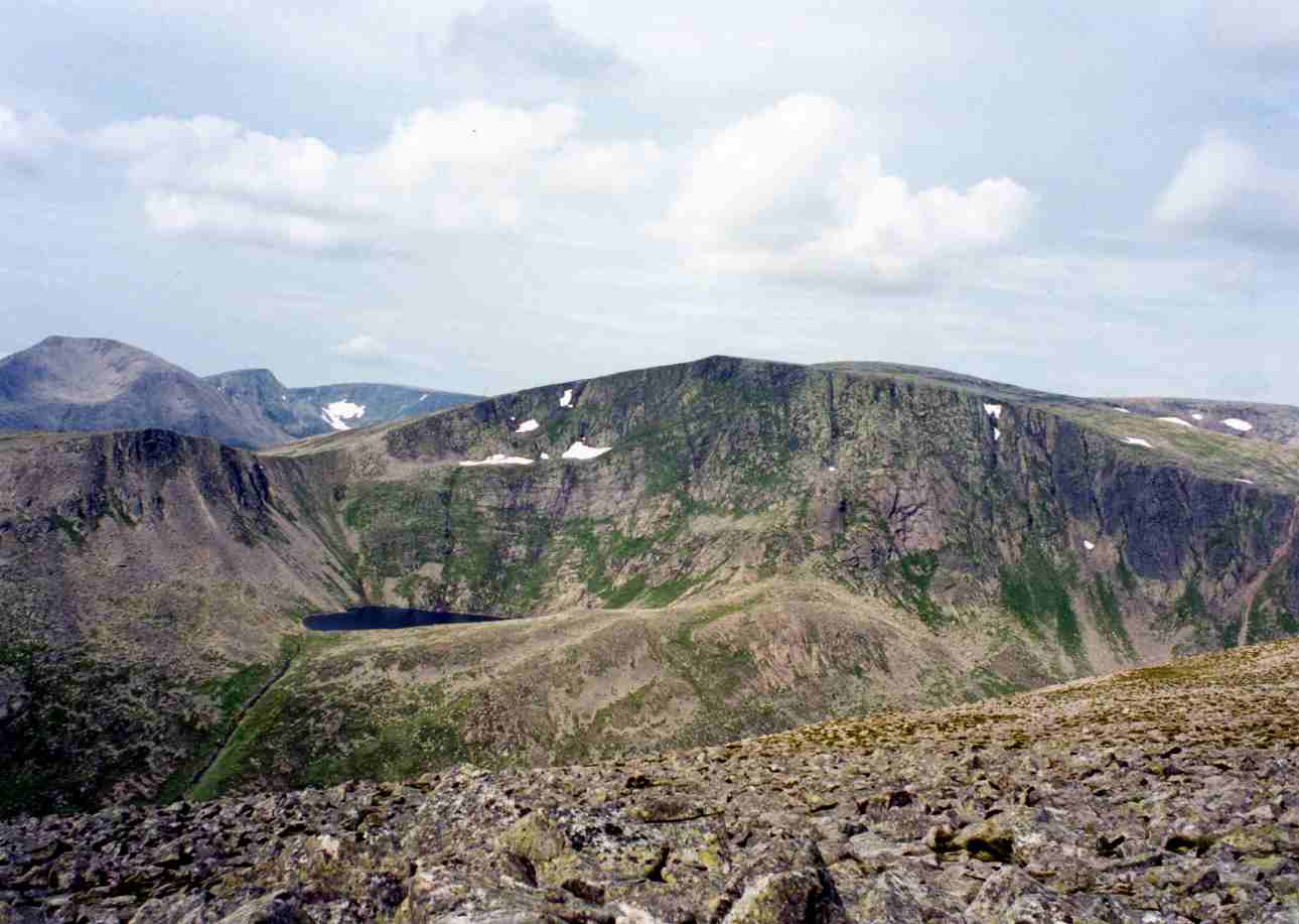
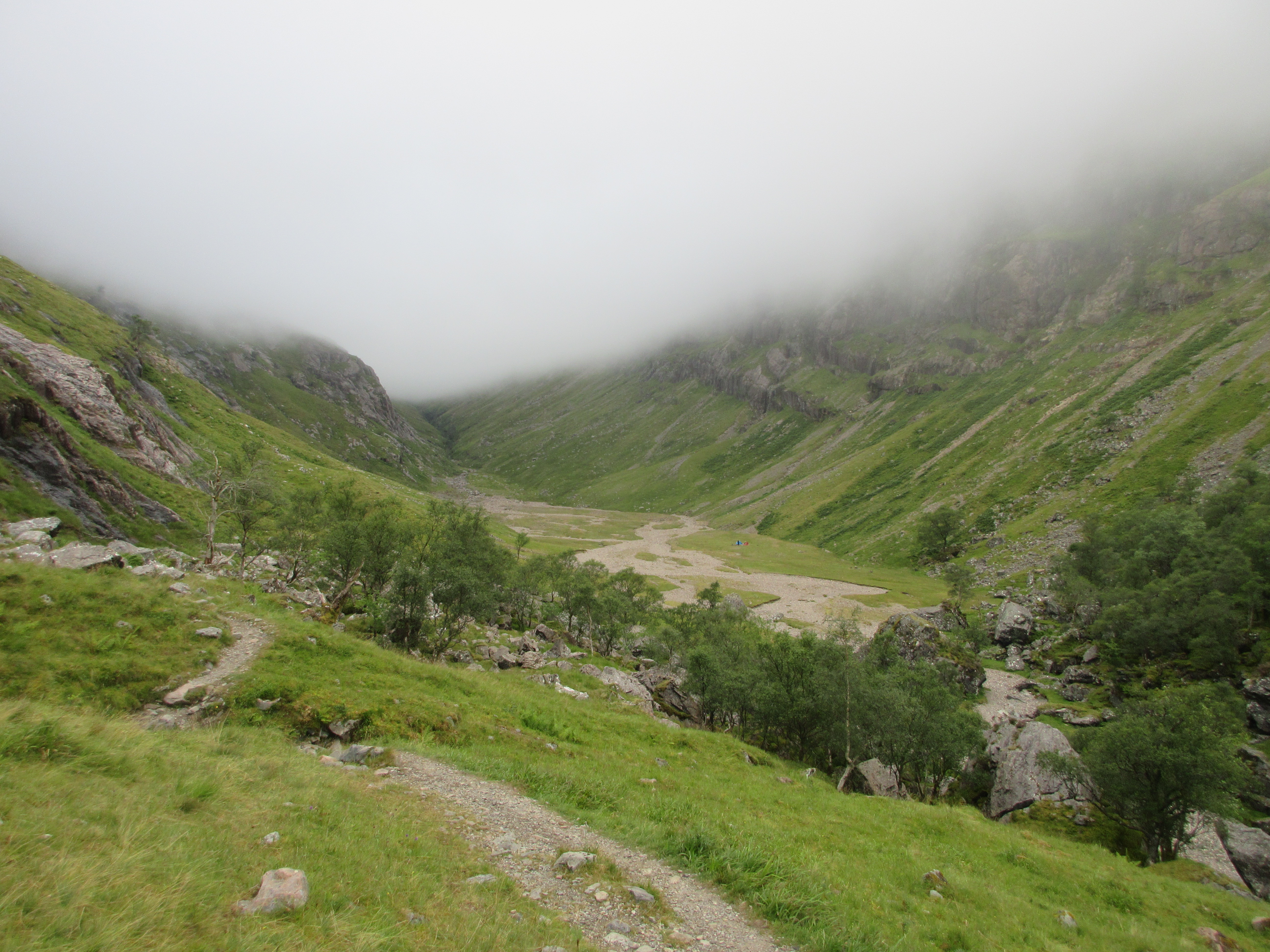
4. Lost Valley / Coire Gabhail
Snapshot
Itinerary
The path descends from the Glen Coe car park to the old glen track, then crosses the River Coe by a bridge below the road. Beyond the bridge, the route becomes rough and rocky, with a handrail in one section and short, easy scrambling.
It climbs through birch woodland and past the base of Gearr Aonach before reaching the more enclosed upper section. A burn crossing and a polished rocky rake require care, especially in wet conditions. The route then enters the flat stony floor of Coire Gabhail, enclosed by the ridges of the Three Sisters.
The return is by the same route.
Why it is essential
The Lost Valley is one of Glen Coe’s defining short mountain walks. It combines gorge scenery, the Three Sisters, a historically important hidden corrie, and a manageable half-day route. The valley is associated with the MacDonalds, cattle concealment and the aftermath of the 1692 massacre.
Equipment
Standard to mountain hiking equipment:
- Hiking boots or sturdy shoes with good grip
- Waterproof layer
- Warm layer
- Map/GPS
- Food and water
- Trekking poles optional but may be awkward on scrambling sections
Conditional equipment:
- Microspikes or winter equipment if icy, but the route should not be treated as a simple summer walk when snow or ice is present
Hazards and notes
The route is short but not easy ground. It includes a steep rocky path, mild scrambling and sections requiring care. The rocky rake has a steep drop and can be slippery when wet. Burn crossings may be unsafe after heavy rain.
Wild camping pressure is noted in the area, so leave-no-trace behaviour is important in the corrie.
GPX / KML links
| Source | URL | Format | Notes |
|---|---|---|---|
| Walkhighlands route page | walkhighlands.co.uk | Source route/map | Walkhighlands terms; source route checked |
| Walkhighlands GPX | download.php?w=129 | GPX | Walkhighlands route data; include as found; will be replaced later |
| Walkhighlands KMZ | download-ge.php?w=129 | KMZ | Walkhighlands route data; include as found; will be replaced later |
| Wikiloc | wikiloc.com | Track source | Wikiloc terms; include as secondary reference only |
Further reading
- Walkhighlands — Lost Valley
- National Trust for Scotland — Glencoe outdoor adventures
- Wikiloc — Coire Gabhail / Lost Valley (high-point cross-check only)
5. West Highland Way — Kingshouse to Kinlochleven via Devil’s Staircase
Snapshot
Itinerary
From Kingshouse, the route crosses the River Etive and follows the line of the old military road towards Altnafeadh, with Buachaille Etive Mòr ahead. Near Altnafeadh it turns north and climbs the Devil’s Staircase in zigzags to the highest point of the West Highland Way, marked by cairns at about 550 m.
The path then crosses open moorland before descending on stony tracks towards Kinlochleven.
Why it is essential
This is the classic pass crossing of the region’s long-distance walking network. It gives a non-Munro way to experience Glen Coe’s mountain setting, the historic military-road line, views back to Buachaille Etive Mòr, and a descent into the industrial and mountain village of Kinlochleven.
Equipment
Standard hiking equipment, upgraded for weather:
- Hiking boots or robust trail shoes
- Waterproof and windproof layers
- Warm layer
- Map/GPS
- Food and water
- Headtorch outside long summer days
Conditional equipment:
- Microspikes, crampons or ice axe only in winter conditions where appropriate skills are present
Hazards and notes
The path is generally clear and non-technical, but it can be exposed in poor weather, especially on the moorland section before Kinlochleven. The route includes stony and rough sections, a steep climb from Glen Coe and a long descent to Kinlochleven.
The route is point-to-point, so transport planning matters. Citylink buses serve the A82 near Kingshouse and local buses serve Kinlochleven.
GPX / KML links
| Source | URL | Format | Notes |
|---|---|---|---|
| Official West Highland Way — Kingshouse to Kinlochleven | westhighlandway.org | Source route/map | Official route page; source route checked |
| Walkhighlands route page | walkhighlands.co.uk | Source route/map | Walkhighlands terms; source route checked |
| Walkhighlands GPX | download.php?w=734 | GPX | Walkhighlands route data; include as found; will be replaced later |
| Walkhighlands KMZ | download-ge.php?w=734 | KMZ | Walkhighlands route data; include as found; will be replaced later |
| OpenStreetMap / Waymarked Trails | OSM relation ID 16287 for the West Highland Way | OSM route relation | ODbL / OSM attribution requirements; potential source for later section extraction — Needs follow-up |
Further reading
Further reading
| Source | URL |
|---|---|
| National Trust for Scotland — Glencoe National Nature Reserve | nts.org.uk |
| National Trust for Scotland — Glencoe planning/access notes | nts.org.uk |
| National Trust for Scotland — Glencoe outdoor adventures | nts.org.uk |
| John Muir Trust — Ben Nevis estate | johnmuirtrust.org |
| Nevis Landscape — Ben Nevis safety leaflet (PDF) | nevislandscape.co.uk |
| Walkhighlands — Ben Nevis | walkhighlands.co.uk |
| Walkhighlands — Ring of Steall | walkhighlands.co.uk |
| Walkhighlands — Buachaille Etive Beag | walkhighlands.co.uk |
| Walkhighlands — Lost Valley | walkhighlands.co.uk |
| Walkhighlands — Kingshouse to Kinlochleven | walkhighlands.co.uk |
| Official West Highland Way — Kingshouse to Kinlochleven | westhighlandway.org |
| Walkhighlands — winter skills guidance | walkhighlands.co.uk |
| Scottish Outdoor Access Code | mygov.scot |
| Scottish Outdoor Access Code — dog guidance | outdooraccess-scotland.scot |