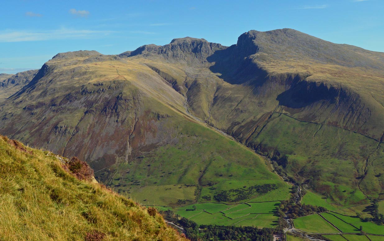
Regional overview
Skye, the Cuillin, Assynt, Coigach and Wester Ross combine some of Scotland’s most distinctive mountain walking: basalt landslip scenery on Trotternish, dark gabbro corries below the Black Cuillin, Torridonian sandstone ridges, quartzite slopes and loch-studded northwest Highland terrain. Main walking bases include Portree, Staffin and Uig for Trotternish; Glen Brittle and Sligachan for the Cuillin; Ullapool, Lochinver and Achiltibuie for Assynt and Coigach; and Kinlochewe, Gairloch and Torridon for Wester Ross.
Distances are often modest, but many routes start near sea level and climb quickly onto rocky, exposed ground. Skye hills are steep and can involve rock, scree and loose debris from low elevations; the Cuillin ridge itself is better treated as scrambling or climbing terrain, not ordinary hillwalking.
The normal hillwalking season is late spring to early autumn, but Atlantic weather, mist, wind, bog, wet rock and short winter daylight can make even short routes serious. Outside summer, snow and ice may require winter mountaineering judgement and equipment.
Dogs should be kept under close control, especially around livestock and ground-nesting birds, in line with Scottish Outdoor Access Code guidance.
Selection rationale
These five routes balance Skye’s two defining landscapes, Trotternish and the Cuillin, with two classic Northwest Highlands mountain walks. The selection includes an iconic viewpoint, a landslip circuit, a Cuillin corrie walk, a short but dramatic sandstone ridge, and an official nature-reserve mountain trail.
Summary table
| # | Hike | Route type | Distance | Gain | Max elevation | Difficulty |
|---|---|---|---|---|---|---|
| 1 | Old Man of Storr / Storr viewpoints | Viewpoint loop / out-and-back variant | 5.0 km | 340 m | approx. 360 m; not stated by primary source | Moderate; rocky and eroded higher up |
| 2 | Quiraing hill circuit | Loop | 6.5–6.8 km | 374 m | c.543 m if including Meall na Suiramach high ground / detour | Moderate to strenuous; minor scramble, exposed return |
| 3 | Coire Lagan from Glen Brittle | Loop | 7.5–9.1 km | 570–590 m | approx. 575 m | Mountain hike; rough ground and simple scrambling |
| 4 | Stac Pollaidh ridge and circuit | Loop with ridge out-and-back | 4.5 km | 510 m | approx. 551 m on walkers’ east top; true summit 612/613 m excluded | Steep mountain hike; easy scrambling only on east top |
| 5 | Beinn Eighe Mountain Trail | Waymarked loop | 6.5 km | 586 m | approx. 560 m | Steep, rocky waymarked mountain trail |
Note on route files. Route links are source references and may be replaced with project-owned GPX/KML files later.
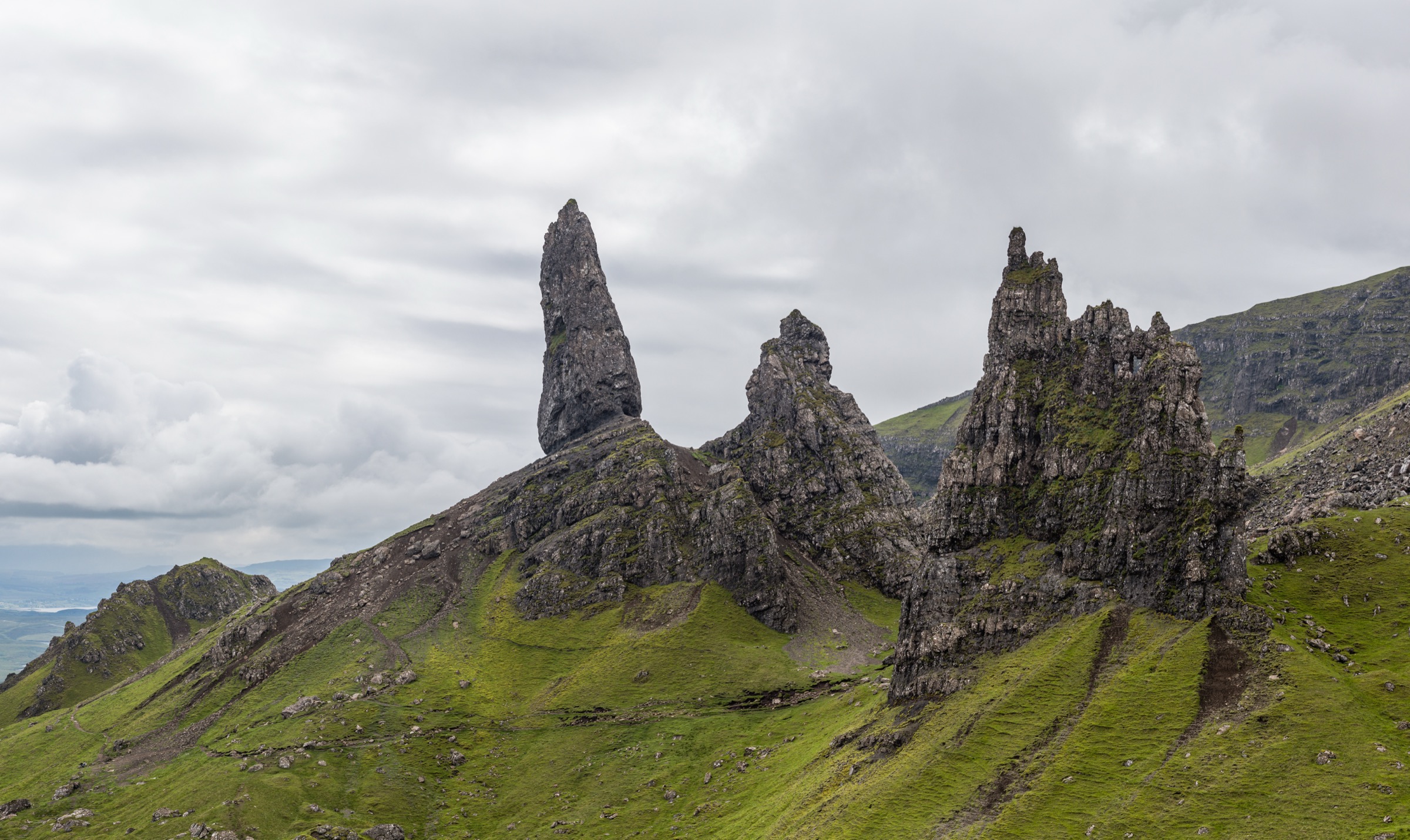
1. Old Man of Storr / Storr Viewpoints
Snapshot
Itinerary
The route starts from the Storr car park on the A855 and climbs through the lower slopes towards the Storr landslip. The main path gains height steadily, with widening views across the Sound of Raasay, Applecross and the Cuillin. Higher up, the route branches towards viewpoints around the Old Man of Storr and the rock pinnacles of the Sanctuary. The standard walk returns to the car park by the same general hill path or by the published viewpoint loop, depending on the route variant followed. The higher ground around the pinnacles is rocky, eroded and exposed to weather; the pinnacles themselves are not part of a walking route.
Why it is essential
The Old Man of Storr is one of the defining landscapes of Skye and a nationally recognisable Scottish viewpoint. It provides a compact introduction to Trotternish landslip terrain, sea views, rock pinnacles and steep, weather-exposed island walking.
Equipment
- Hiking shoes or boots
- Waterproof layer
- Warm layer
- Food and water
- Map/GPS
- Sun protection
- Midge and tick protection in summer
Hazards and notes
- Rockfall hazard around the Old Man and surrounding pinnacles, especially after heavy rain or freeze-thaw.
- Upper path is eroded and can be slippery.
- Mist can make the descent confusing.
- Car park is very busy in peak season.
GPX / KML links
| Source | URL | Format | Notes |
|---|---|---|---|
| Walkhighlands GPX confirmation page | walkhighlands.co.uk · direct GPX | GPX | Walkhighlands states GPX data is for personal use and should not be made available for download from other websites. Use as source/reference only; replace with project-owned GPX later. |
| Walkhighlands KMZ confirmation page | walkhighlands.co.uk · direct KMZ | KMZ | Walkhighlands states route-file data is for personal use and should not be made available for download from other websites. Use as source/reference only; replace with project-owned KML/KMZ later. |
| Walkhighlands route page | walkhighlands.co.uk | Source route page | Copyrighted route description and route data. Use for verification only. |
Further reading
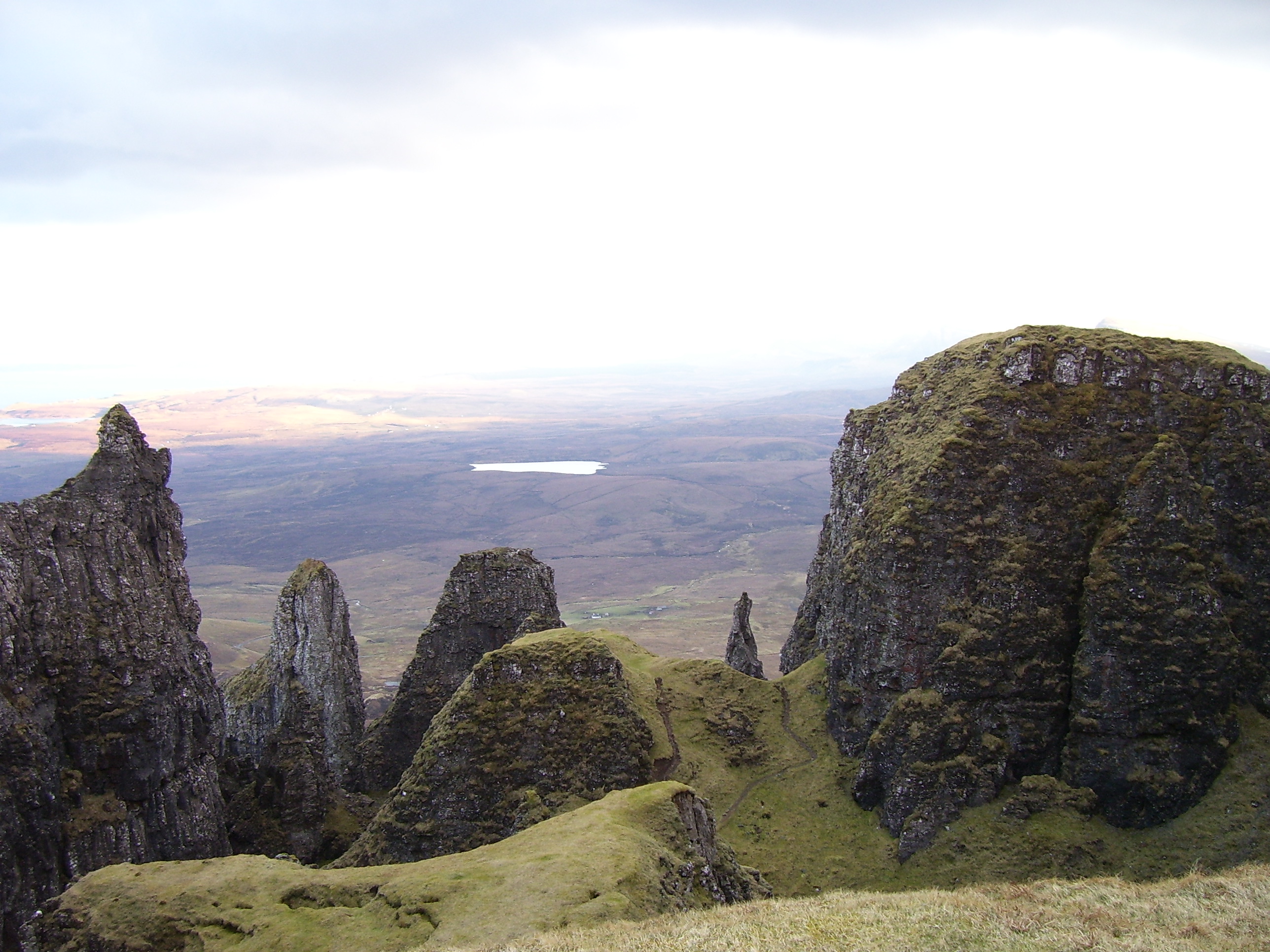
2. Quiraing Hill Circuit
Snapshot
Itinerary
The route begins at the high road pass between Staffin and Uig and follows the path north across the steep slopes below the Quiraing escarpment. It traverses rough, rocky ground below the cliffs, passes the Prison and the Needle, and crosses a short rocky gully with minor scrambling. The circuit then climbs to the upper return line above the escarpment, where navigation is more exposed in mist or bad weather. The Table is a celebrated feature, but Walkhighlands advises against the steep loose detour to it for ordinary walkers.
Why it is essential
The Quiraing is one of Scotland’s most distinctive landslip landscapes, combining cliffs, pinnacles, grassy ledges and sea views. It represents the wilder, more complex side of Trotternish and is a natural counterpart to the Old Man of Storr.
Equipment
- Sturdy boots
- Waterproof and windproof layers
- Warm layer
- Food and water
- Map/GPS
- Navigation backup
- Hat and gloves outside midsummer
Hazards and notes
- Exposed to wind, mist and rain.
- Short rocky gully requires easy scrambling and can be slippery.
- Upper return can be difficult to follow in poor visibility.
- Cliff edges and steep ground are present throughout.
- The Table detour is steep and loose and should be treated as optional specialist terrain.
GPX / KML links
| Source | URL | Format | Notes |
|---|---|---|---|
| Walkhighlands GPX confirmation page | walkhighlands.co.uk · direct GPX | GPX | Walkhighlands states GPX data is for personal use and should not be made available for download from other websites. Use as source/reference only; replace with project-owned GPX later. |
| Walkhighlands KMZ confirmation page | walkhighlands.co.uk · direct KMZ | KMZ | Walkhighlands states route-file data is for personal use and should not be made available for download from other websites. Use as source/reference only; replace with project-owned KML/KMZ later. |
| Walkhighlands route page | walkhighlands.co.uk | Source route page | Copyrighted route description and route data. Use for verification only. |
Further reading
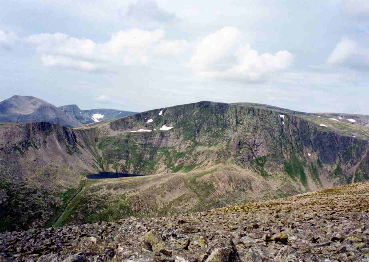
3. Coire Lagan from Glen Brittle
Snapshot
Itinerary
The route leaves the Glen Brittle car park above the beach and follows the path inland towards the Cuillin. It climbs on a built and pitched path before the terrain becomes rougher. The path continues towards Coire Lagan, with the upper approach involving rocky ground and a simple scramble up the gully between slabs near the corrie mouth. The walk reaches Loch Coire Lagan, a small lochan enclosed by dark Cuillin slabs, precipices and stone chutes. The route described here remains a corrie walk; continuation onto the surrounding ridges, gullies or the Inaccessible Pinnacle belongs to scrambling or climbing terrain.
Why it is essential
Coire Lagan gives fit walkers access to the atmosphere of the Black Cuillin without committing to the main ridge. The walk includes sea-level start, rough gabbro terrain, a mountain lochan, and close views into one of Britain’s most serious mountain groups.
Equipment
- Sturdy boots with good grip
- Waterproof and windproof layers
- Warm layer
- Food and water
- Map/GPS
- Navigation backup
- Trekking poles useful on the lower approach but should be stowed on scrambling ground
- Winter equipment and skills if snow or ice is present
Hazards and notes
- Wet gabbro, slabs, boulders and loose stone can make the upper approach awkward.
- Simple scramble should not be underestimated in poor conditions.
- Do not extend into Cuillin gullies, ridges or summits without scrambling or climbing competence.
- No public transport to the start according to Walkhighlands.
GPX / KML links
| Source | URL | Format | Notes |
|---|---|---|---|
| Walkhighlands GPX confirmation page | walkhighlands.co.uk · direct GPX | GPX | Walkhighlands states GPX data is for personal use and should not be made available for download from other websites. Use as source/reference only; replace with project-owned GPX later. |
| Walkhighlands KMZ confirmation page | walkhighlands.co.uk · direct KMZ | KMZ | Walkhighlands states route-file data is for personal use and should not be made available for download from other websites. Use as source/reference only; replace with project-owned KML/KMZ later. |
| Walking Britain GPX page | walkingbritain.co.uk · direct GPX | GPX | Walking Britain states GPX file is for private use only and subject to copyright. Use as source/reference only; replace with project-owned GPX later. |
| Walkhighlands route page | walkhighlands.co.uk | Source route page | Copyrighted route description and route data. Use for verification only. |
| Walking Britain route page | walkingbritain.co.uk | Source route page | Copyrighted route description and route data. Use for secondary verification only. |
Further reading
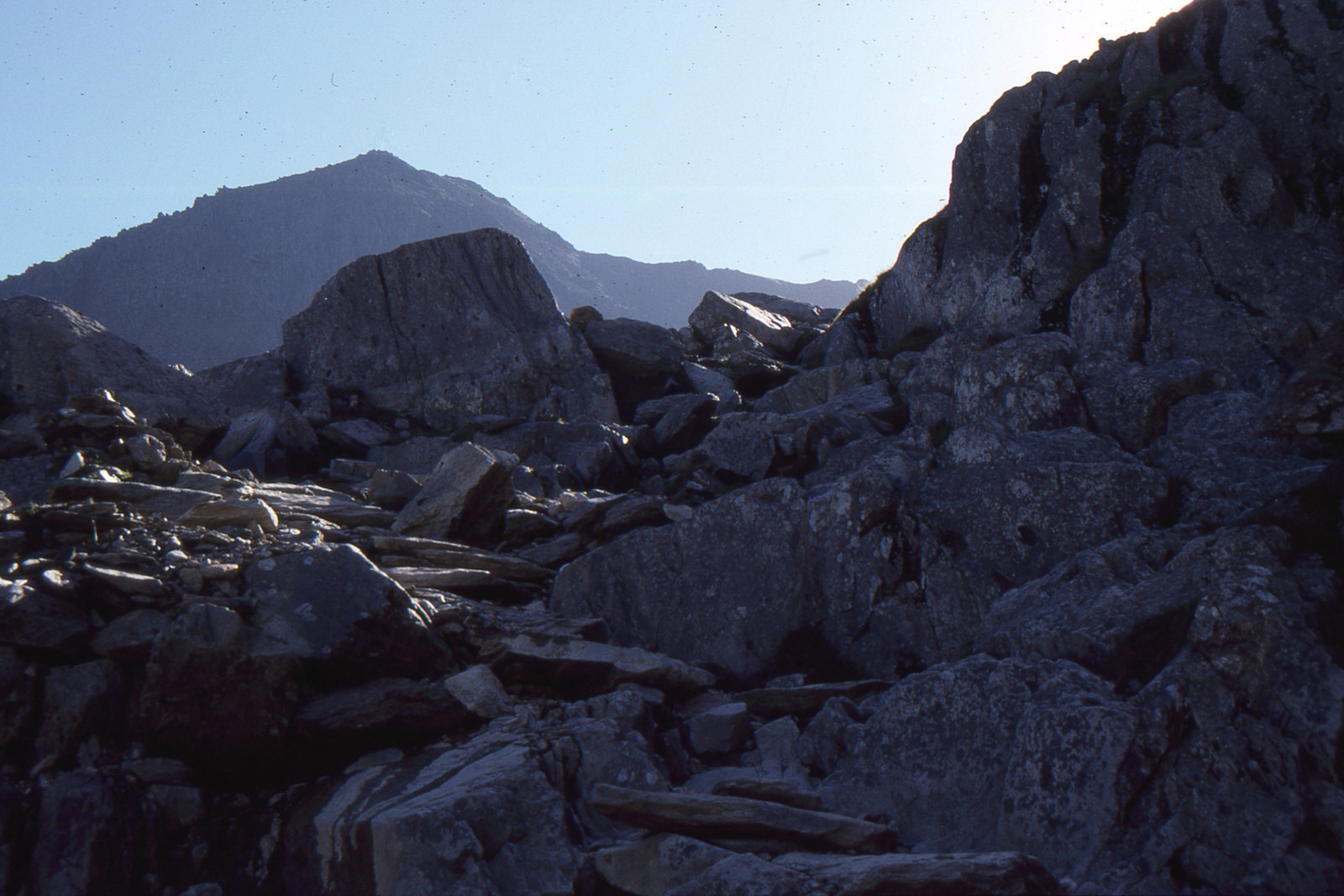
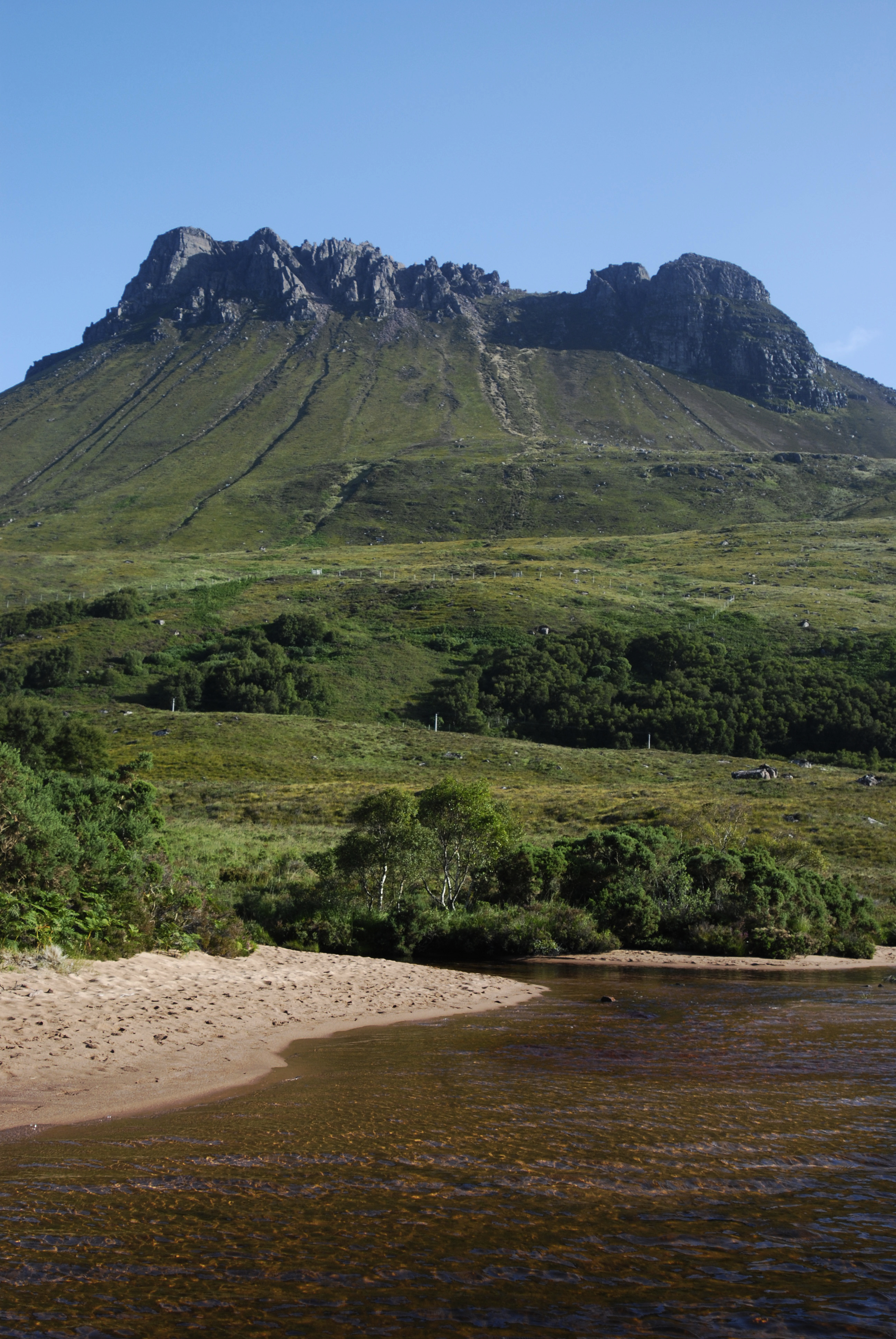
4. Stac Pollaidh Ridge and Circuit
Snapshot
Itinerary
The route starts from the Stac Pollaidh car park and crosses the road to a constructed path. The path climbs through young woodland and open moorland before contouring around the back of the mountain, a line designed to reduce erosion on the older direct ascent. A steeper path rises to the ridge. The eastern high point can be reached by a short, easy scramble, giving broad views over Assynt, Coigach, Suilven, Cul Mor, Cul Beag and the Summer Isles. The western true summit is a different proposition: it is a difficult scramble above a large drop and is not part of the normal walking route. The descent returns by the ridge path and lower circuit.
Why it is essential
Stac Pollaidh is one of the most recognisable mountains in the Northwest Highlands. Its short approach, dramatic sandstone crest and wide views make it a classic example of Assynt and Coigach mountain walking, while the route also illustrates the boundary between walking terrain and serious scrambling.
Equipment
- Sturdy boots
- Waterproof and windproof layers
- Warm layer
- Food and water
- Map/GPS
- Navigation backup
- Hands free for the easy scramble to the eastern ridge top
Hazards and notes
- Do not confuse the accessible eastern ridge high point with the true western summit.
- The true summit is exposed and technically much harder.
- Lower western return can be boggy and eroded.
- The route is very exposed to wind despite its short distance.
- Public transport exists but is infrequent, so timetables need checking.
GPX / KML links
| Source | URL | Format | Notes |
|---|---|---|---|
| Walkhighlands GPX confirmation page | walkhighlands.co.uk · direct GPX | GPX | Walkhighlands states GPX data is for personal use and should not be made available for download from other websites. Use as source/reference only; replace with project-owned GPX later. |
| Walkhighlands KMZ confirmation page | walkhighlands.co.uk · direct KMZ | KMZ | Walkhighlands states route-file data is for personal use and should not be made available for download from other websites. Use as source/reference only; replace with project-owned KML/KMZ later. |
| Walkhighlands route page | walkhighlands.co.uk | Source route page | Copyrighted route description and route data. Use for verification only. |
Further reading
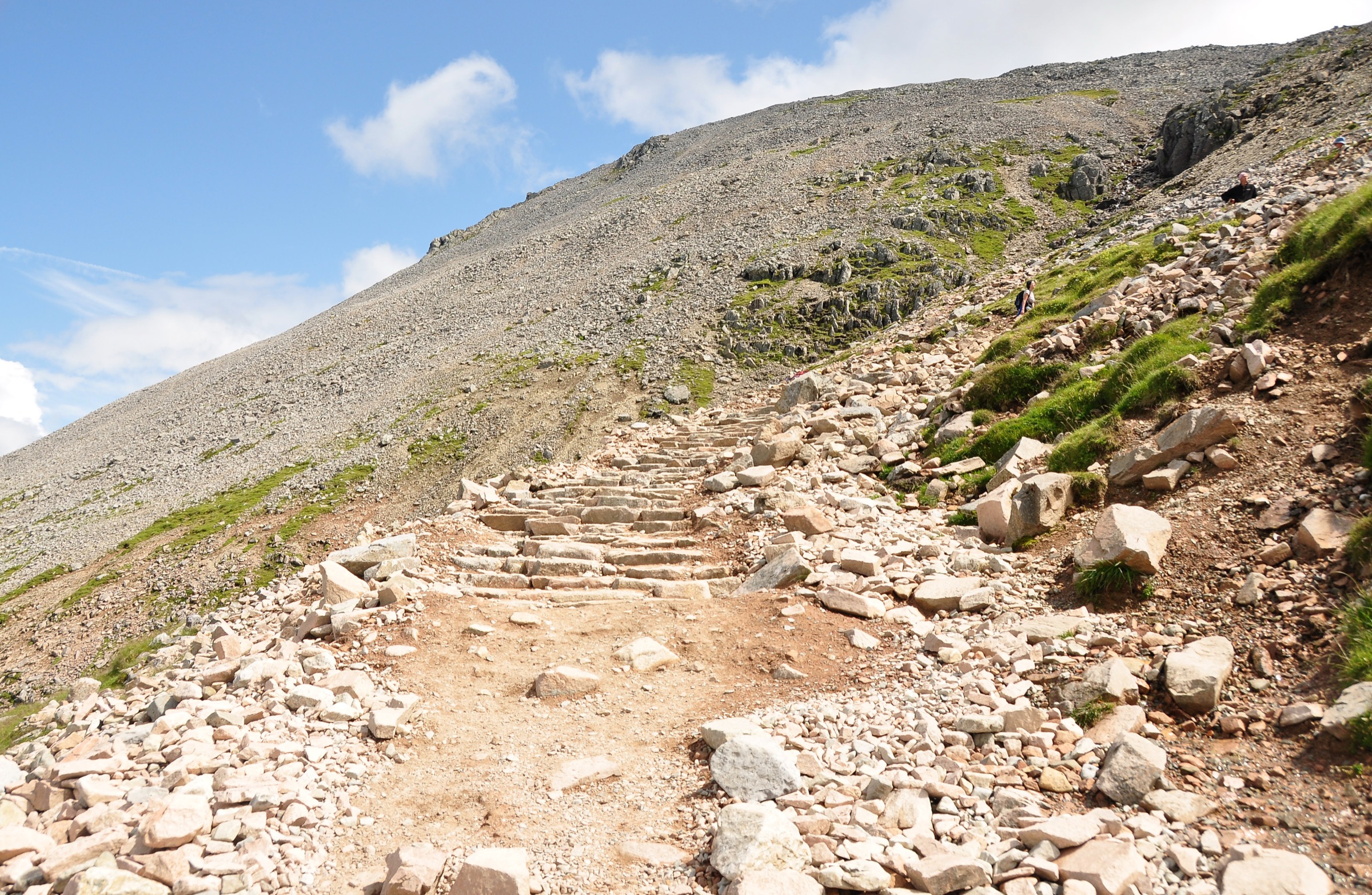
5. Beinn Eighe Mountain Trail
Snapshot
Itinerary
The Beinn Eighe Mountain Trail starts at the Coille na Glas Letire Trails car park and uses an underpass below the A832. It climbs through birch and pine woodland, then leaves the trees for open, rocky ground. The waymarking uses special cairns, but the upper route is steep, rough and exposed to weather. The trail reaches high ground around the Conservation Cairn, with views over Loch Maree, Slioch and the Beinn Eighe massif, before descending back towards the woodland and car park.
Why it is essential
This is the most structured mountain route in the selection, but not the easiest. It combines Caledonian pinewood, loch views, quartzite terrain and official reserve interpretation within Britain’s first National Nature Reserve.
Equipment
- Sturdy hillwalking boots
- Windproof and waterproof clothing
- Warm layer
- Food and water
- Map/GPS
- Navigation backup
- Trekking poles useful on descent
Hazards and notes
- Waymarks do not remove the need for mountain judgement.
- Upper trail is steep, rocky and exposed to wind, rain and mist.
- Snow or verglas can make the route significantly more serious.
- Nature reserve guidance and local notices should be checked before departure.
GPX / KML links
| Source | URL | Format | Notes |
|---|---|---|---|
| Walkhighlands GPX confirmation page | walkhighlands.co.uk · direct GPX | GPX | Walkhighlands states GPX data is for personal use and should not be made available for download from other websites. Use as source/reference only; replace with project-owned GPX later. |
| Walkhighlands KMZ confirmation page | walkhighlands.co.uk · direct KMZ | KMZ | Walkhighlands states route-file data is for personal use and should not be made available for download from other websites. Use as source/reference only; replace with project-owned KML/KMZ later. |
| Walkhighlands route page | walkhighlands.co.uk | Source route page | Copyrighted route description and route data. Use for verification only. |
| NatureScot Beinn Eighe NNR information | nature.scot | Official reserve / trail source | Route geometry reuse not checked. Use for official trail context. |
Further reading
Further reading
| Source | URL |
|---|---|
| Walkhighlands — Old Man of Storr | walkhighlands.co.uk |
| Walkhighlands — Quiraing | walkhighlands.co.uk |
| Walkhighlands — Coire Lagan | walkhighlands.co.uk |
| Walkhighlands — Stac Pollaidh | walkhighlands.co.uk |
| Walkhighlands — Beinn Eighe Mountain Trail | walkhighlands.co.uk |
| NatureScot — Beinn Eighe and Loch Maree Islands NNR | nature.scot |
| Skye Mountain Rescue Team — mountain safety | skyemrt.org |
| Scottish Outdoor Access Code — dog walkers | outdooraccess-scotland.scot |