Regional overview
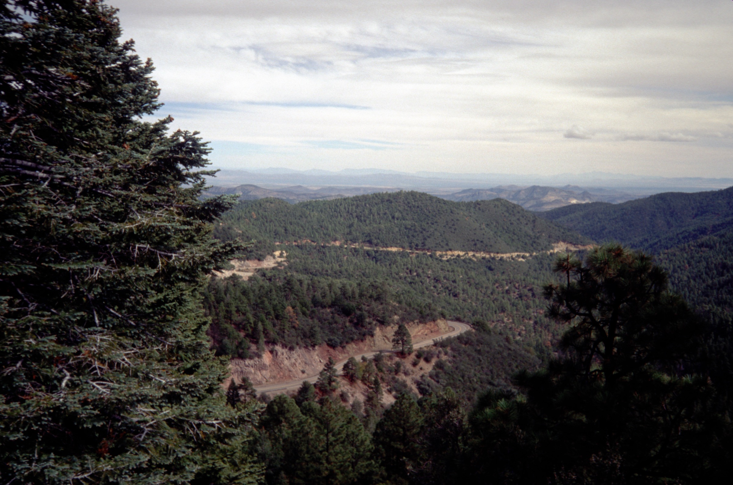
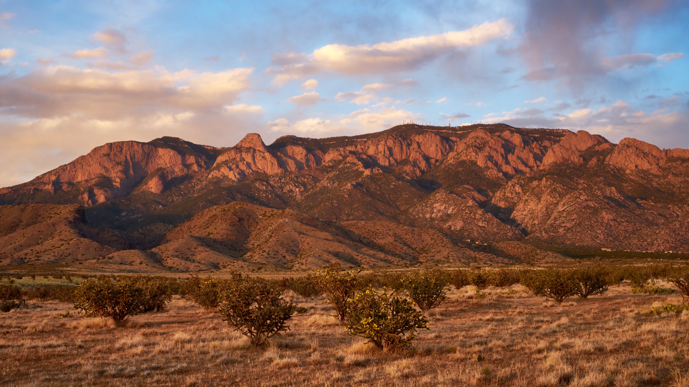
The Sandia and Manzano Mountains form the high east wall of the Albuquerque Basin, with the more developed Sandias immediately above the city and the quieter Manzanos extending south beyond Tijeras Canyon and the intervening Manzanita Mountains. The hiking character is classic central New Mexico sky-island: hot, dry western foothills; steep west-facing granite and limestone slopes; cool conifer forest near the crest; and remote, less maintained trails in the Manzano Wilderness. The two ranges together offer the region’s best contrast between road-accessible high-country walking and quiet backcountry summit routes within an hour of Albuquerque.
The Sandias have the densest trail system and the easiest high-elevation access, including NM 536 (the Sandia Crest Scenic Byway), the Sandia Crest itself, the upper Sandia Peak Tram area, and the Elena Gallegos and La Luz trailheads on the west side. The Manzanos are less visited, with important access points at Fourth of July Canyon, the Albuquerque Trailhead, Red Canyon, Ox Canyon and Pine Shadow. Both ranges sit within the Cibola National Forest, split between the Sandia and Mountainair Ranger Districts. Current Cibola pages listed very high fire danger for both districts and active area/fire-restriction alerts during this verification pass; conditions should be re-checked on the Cibola National Forest home / alerts page before travel.
Water is scarce on almost every route. The exposed west-side Sandia trails can be dangerously hot from late spring through early autumn, while the high crest routes can hold snow or ice from late autumn through spring. Manzano routes require more self-reliance: road access, current trail condition and any temporary closures at Red Canyon or Fourth of July should be confirmed before committing to a long day. Black bears and rattlesnakes are both present.
For neighbouring southern New Mexico sky-island ranges and the west Texas mountains beyond, see the sister catalogues on the Sacramento Mountains, the Black Range, and the Franklin Mountains above El Paso.
See also: Sacramento Mountains, New Mexico · Jemez Mountains, New Mexico.
Selection rationale
The five routes below cover the essential Sandia–Manzano themes: the iconic La Luz desert-to-crest ascent, a long Sandia foothill-to-crest climb from Elena Gallegos, a road-accessible crest high-country link off NM 536, the signature Fourth of July Canyon bigtooth-maple hike in the Manzanos, and the Manzano Peak high summit from Red Canyon. Official U.S. Forest Service Cibola pages and trailhead descriptions were used first; where official cumulative gain or downloadable route files were not published, the values are flagged as unresolved rather than fabricated.
Summary
| # | Hike | Trailhead | Route type | Distance | Gain | Max elevation | Difficulty |
|---|---|---|---|---|---|---|---|
| 1 | La Luz Trail #137 to Sandia Peak | La Luz Trailhead | Point-to-point (tram return) or out-and-back | ~12.1 km one-way | ~975 m | ~3,164–3,255 m | Difficult |
| 2 | Pino Trail #140 to Crest Trail | Elena Gallegos / Pino Trailhead | Out-and-back | ~15.1 km | Unresolved | ~3,000 m | Difficult |
| 3 | Tree Spring / South Crest / 10K link | Tree Spring or 10K Trailhead, NM 536 | Out-and-back / short linkup | ~6.4–9.7 km | ~180 m for 10K component | ~3,050–3,130 m | Moderate |
| 4 | Fourth of July / Albuquerque Trail link | Fourth of July or Albuquerque Trailhead | Loop / out-and-back | ~5.8–10.1 km | Unresolved | Unresolved | Moderate |
| 5 | Manzano Peak via Red Canyon | Red Canyon / lower Red Canyon access | Out-and-back summit hike | ~11.3 km | Unresolved | 3,078 m | Difficult |
1. La Luz Trail #137 to Sandia Peak
Snapshot
Itinerary
From the La Luz Trailhead on the west side of the Sandias, Trail #137 climbs east through Chihuahuan Desert foothill vegetation onto progressively cooler oak, pine and mixed-conifer slopes. The route links with the Tramway, Piedra Lisa–La Luz connector, Chimney Canyon and La Luz 137B alternates, and reaches Crest Trail #130 near the upper terminal of the Sandia Peak Tram. The optional Crest Spur Trail #84 turns north to Sandia Crest. Most parties descend by tram; walking down doubles the day and the descent is harder on knees than the climb.
Why it is essential
La Luz is the best-known Sandia ascent and the most complete single expression of the range’s desert-to-crest elevation change directly above Albuquerque. It is the walk that most cleanly delivers the Sandias’ full vertical structure — foothill, cliff line, mid-mountain forest, and crest.
Equipment
- Sturdy hiking boots with good ankle support
- Trekking poles for the steep switchbacks
- Sun hat, high-SPF sunscreen and sunglasses
- Wind and warm layer for the crest
- Minimum 3 L water in warm conditions
- Real food for a long effort
- Offline map and GPS
- Headtorch for a late finish
- Microspikes for winter or spring ice on the upper trail
Hazards and notes
- Extreme heat and dehydration risk on the lower trail from May through September; morning starts are essential.
- Snow and ice on the upper trail from late autumn through spring.
- Steep, rocky switchbacks with limited shade.
- Afternoon lightning on the crest during the summer monsoon.
- No reliable water on the route.
- USFS specifically warns that lost hikers are searched for and rescued on La Luz — carry the ten essentials and turn around early if you are behind schedule.
- Confirm current tram operating hours and one-way ticket availability before committing to a tram-assisted descent.
GPX / route file
| Source | URL | Format | Notes |
|---|---|---|---|
| USFS — La Luz Trailhead and La Luz Trail #137 | fs.usda.gov | Official trailhead / trail page | Official length, gain, warnings and connections; no GPX exposed |
| USFS — Cibola National Forest trails | fs.usda.gov | Official trail table | Sandia Mountain trail map links; source-map basis for manual GPX |
Sources
2. Pino Trail #140 to Crest Trail from Elena Gallegos
Snapshot
Itinerary
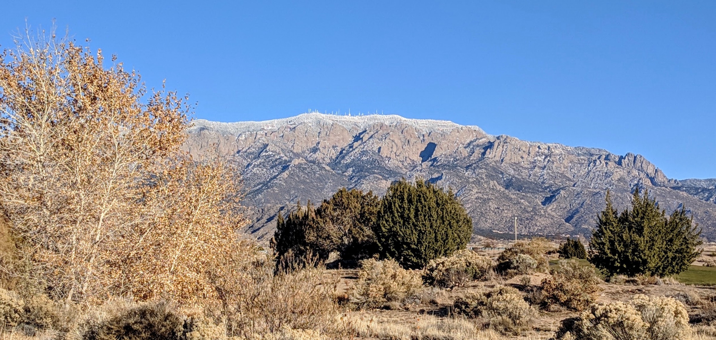
From the Pino / Elena Gallegos Trailhead on the northeast side of Albuquerque, Pino Trail #140 climbs east from the open foothill environment through pinyon-juniper, oak and mixed-conifer zones to meet Crest Trail #130 on the Sandia crest. The default day returns the same way; fit parties can extend by turning onto Crest Trail #130 for a longer traverse, but the exit logistics are more complex than they look on the map.
Why it is essential
Pino is the classic long eastward climb from Albuquerque’s northeast foothills to the Sandia crest. It gives a quieter alternative to La Luz while still showing the full vertical structure of the range and is the standard fit-hiker training day for anyone preparing for larger New Mexico summits.
Equipment
- Sturdy hiking boots
- Trekking poles
- Sun hat, high-SPF sunscreen and sunglasses
- Wind and warm layer for the crest junction
- Minimum 3 L water in warm weather
- Real food for a long day
- Offline map and GPS — junction identification matters at the top
- Traction for lingering snow or ice at the higher elevations
Hazards and notes
- Long, sustained climb with limited shade in the middle sections.
- Scarce water on the entire route.
- Summer monsoon lightning on the upper trail and crest.
- Winter and spring snow or ice at the top.
- Navigation at the Crest Trail junction — return by the same trail if any doubt.
- Cell coverage is unreliable on the mid- and upper trail.
GPX / route file
| Source | URL | Format | Notes |
|---|---|---|---|
| USFS — Cibola National Forest trails | fs.usda.gov | Official trail table | Pino Trail length and Elena Gallegos trailhead context; no GPX exposed |
| City of Albuquerque — Elena Gallegos Open Space | cabq.gov | Municipal open-space page | Trailhead operating hours and fee context |
Sources
3. Tree Spring / South Crest / 10K high-country link
Snapshot
Itinerary
From Tree Spring Trailhead on NM 536, Tree Spring Trail #147 climbs the short east slope to a junction with South Crest Trail #130 and 10K Trail #200. A short high-country outing returns the same way. A longer mapped variant uses the 10K trail system and crest paths to make a forested loop or linkup near NM 536 — the loop-precise geometry should be finalised from the current Sandia Mountain Trails map before travel.
Why it is essential
This is the most accessible Sandia high-country forest hike, offering crest ecology and long views over Estancia Basin without the major ascent of La Luz or Pino. It is the natural first day for a visitor who has driven the Sandia Crest Scenic Byway.
Equipment
- Walking shoes or light hiking boots in summer; boots and traction in winter
- Wind and warm layer — the crest is 10 °C or more colder than the city
- Sun hat, sunscreen and sunglasses
- Minimum 1.5–2 L water; no potable water at 10K Trailhead
- Map for junction identification
- Microspikes or snowshoes in winter
Hazards and notes
- Snow and ice can linger into early summer and return in autumn.
- Weather changes fast near 10,000 ft — carry the wind layer even on a warm day.
- Mountain bikes are restricted where the 10K route enters the Sandia Mountain Wilderness between Ellis Trail and Del Agua Overlook.
- No potable water at 10K Trailhead.
- Summer monsoon lightning risk on the crest.
GPX / route file
| Source | URL | Format | Notes |
|---|---|---|---|
| USFS — 10K Trailhead and 10K Trail #200 | fs.usda.gov | Official trailhead / trail page | Access, restrictions, fee and 10K gain; no GPX exposed |
| USFS — Cibola National Forest trails | fs.usda.gov | Official trail table | Tree Spring and 10K component facts and map links |
Sources
4. Fourth of July Canyon / Albuquerque Trail link
Snapshot
Itinerary
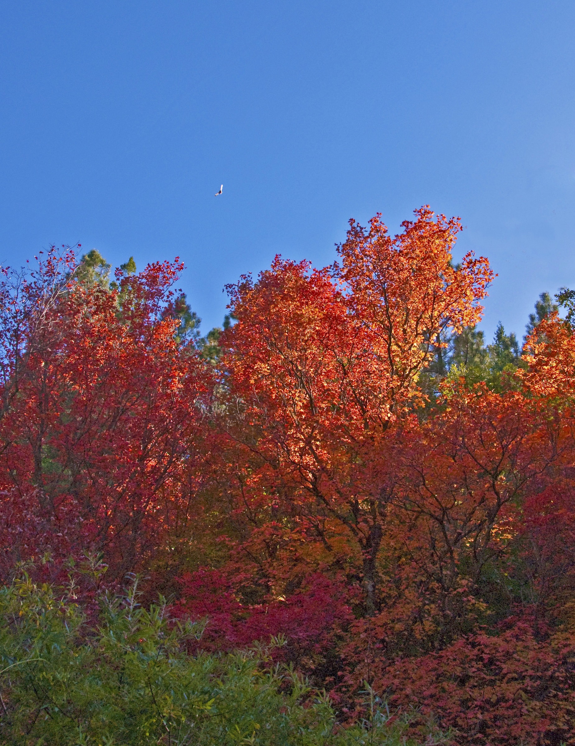
From the Fourth of July Trailhead near Tajique, the canyon trail follows the well-known bigtooth-maple stands on the east side of the Manzanos toward the Cerro Blanco and Manzano Wilderness connections. A longer route can incorporate the Fourth of July Spur and the Albuquerque Trail from FR 55 for a linkup. Exact loop geometry should be finalised from the current Cibola Manzano trail map before travel.
Why it is essential
Fourth of July Canyon is the signature Manzano foliage hike and the range’s most culturally familiar route. It gives the catalogue a seasonal canyon walk rather than only crest climbs, and it is the closest hike in the Sandia–Manzano set to a walk aimed at scenery rather than fitness.
Equipment
- Hiking shoes or boots
- Sun hat, sunscreen and sunglasses
- Warm layer in autumn and shoulder seasons
- Minimum 2 L water
- Map or GPS for junction identification if linking trails
- Small binoculars for the maple stands are a nice extra
Hazards and notes
- Weekend and holiday crowding during peak autumn colour.
- Dry conditions and possible fire restrictions; check current Cibola alerts.
- Limited water on the trail.
- Navigation matters if extending toward the crest — signage is intermittent.
- Stay on the marked trail through the maple stands to protect canyon vegetation.
GPX / route file
| Source | URL | Format | Notes |
|---|---|---|---|
| USFS — Albuquerque Trailhead | fs.usda.gov | Official trailhead page | Access, fee, no-water status, and Albuquerque Trail length |
| USFS — Cibola National Forest trails | fs.usda.gov | Official trail table | Fourth of July and Fourth of July Spur trail lengths |
Sources
5. Manzano Peak via Red Canyon
Snapshot
Itinerary
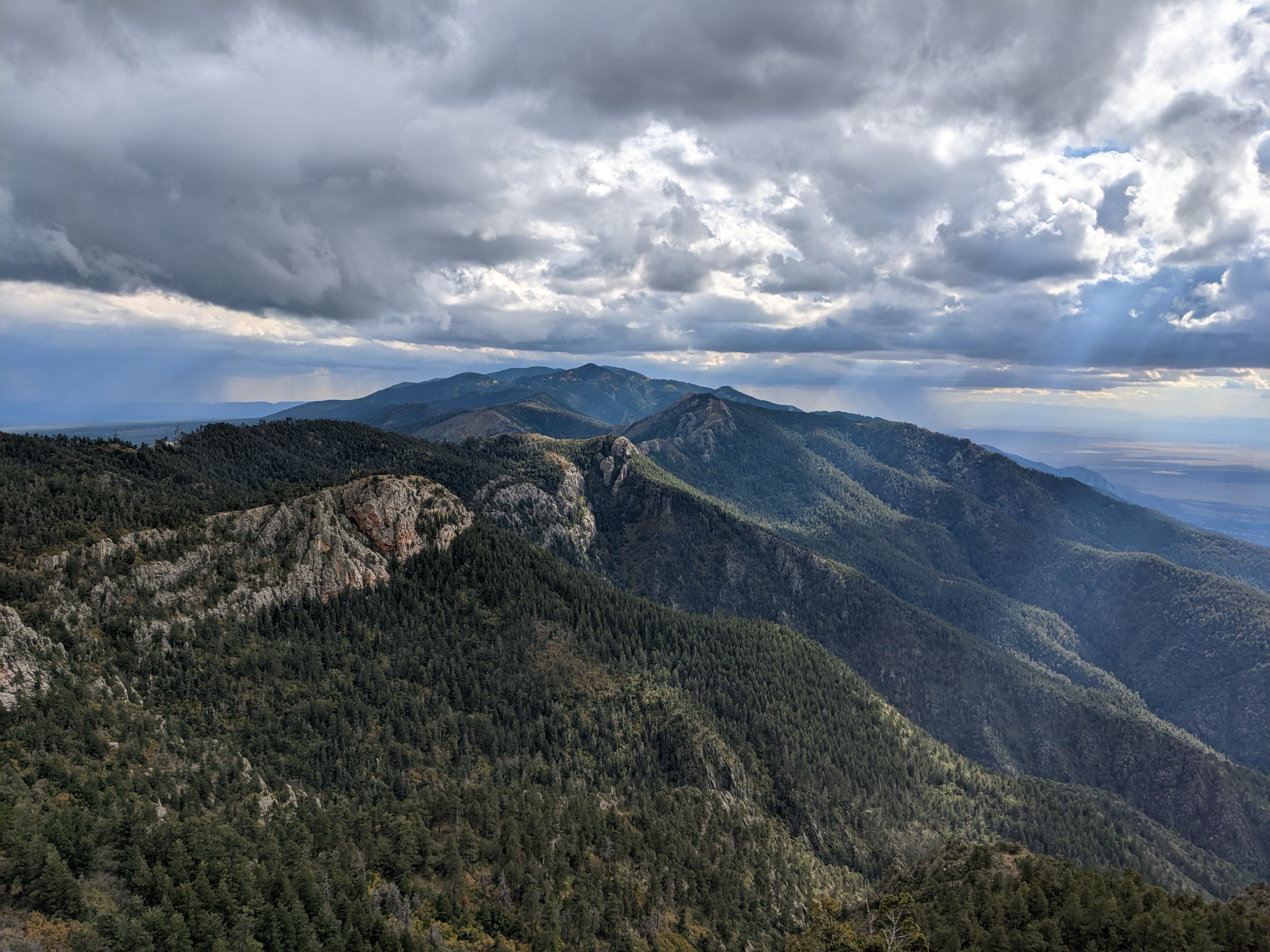
From the Red Canyon side, climb toward the Manzano Crest using whichever legally accessible approach is confirmed open on the current USFS Cibola alerts page. Join the Manzano Crest Trail and continue south to Manzano Peak, the range high point at ~3,078 m, then return the same way. The route sits inside the Manzano Mountain Wilderness; expect long stretches without maintained tread and no cell coverage.
Why it is essential
Manzano Peak is the high point of the Manzano Mountains and gives the set its remote wilderness summit route. It closes the catalogue with the range’s biggest summit and its clearest contrast to the town-side Sandia hikes.
Equipment
- Sturdy hiking boots with good ankle support
- Trekking poles for the sustained climb
- Sun hat, high-SPF sunscreen and sunglasses
- Wind and warm layer for the summit
- Storm shell for afternoon monsoon build-ups
- Minimum 3–4 L water plus treatment for any spring water
- Real food for a long day
- Offline map and GPS with route pre-loaded
- Headtorch, first-aid kit, and small emergency layer
- Traction for lingering snow at the crest
Hazards and notes
- Remote wilderness route — self-rescue expectations apply, and cell coverage is largely absent.
- Temporary closures at Upper Red Canyon were in effect during this verification pass; confirm the legal trailhead before travel.
- Scarce water; treat any spring water.
- Summer monsoon lightning on the crest, particularly in the afternoon.
- Burned-area deadfall or erosion may affect the tread after wildfires or major storms.
- Black bears are present throughout the range.
GPX / route file
| Source | URL | Format | Notes |
|---|---|---|---|
| USFS — Cibola National Forest trails | fs.usda.gov | Official trail table | Official component trail names, lengths and closure caveats |
| Wikipedia — Manzano Mountain Wilderness | en.wikipedia.org | Secondary summary | Summit elevation and 7-mile round-trip claim; treat as approximate until replaced by official / topographic verification |
Sources
- USFS — Cibola National Forest trails
- USFS — Cibola National Forest home / alerts
- Wikipedia — Manzano Mountain Wilderness
Region-level sources
| Source | URL |
|---|---|
| USFS — Cibola National Forest home / alerts | fs.usda.gov |
| USFS — Cibola National Forest recreation | fs.usda.gov |
| USFS — Cibola National Forest trails | fs.usda.gov |
| USFS — La Luz Trailhead and La Luz Trail #137 | fs.usda.gov |
| USFS — 10K Trailhead and 10K Trail #200 | fs.usda.gov |
| USFS — Albuquerque Trailhead | fs.usda.gov |
| City of Albuquerque — Elena Gallegos Open Space | cabq.gov |
| Wikipedia — Manzano Mountain Wilderness | en.wikipedia.org |
Further reading
- Sacramento Mountains — essential day-hikes — the southern-New-Mexico sky-island range above Alamogordo and White Sands
- Black Range — essential day-hikes — the remote southwestern-New-Mexico range around the Aldo Leopold Wilderness
- Franklin Mountains — essential day-hikes — the arid urban range above El Paso, four hours south
Missing data / follow-up work
- Elevation gain is not consistently published by USFS for Sandia and Manzano trails; the snapshots above mark this as unresolved rather than quoting unverified secondary numbers.
- No official downloadable GPX or KML was retrieved for any of the five routes; route geometry can be reconstructed from OpenStreetMap or CalTopo against the Sandia Mountain Trails and Manzano trail maps.
- Fourth of July / Albuquerque Trail loop geometry should be finalised from the current Manzano trail map before publication as a specific outing.
- Red Canyon / Upper Red Canyon Campground carried a temporary closure notice at the time of writing; the Manzano Peak route should not be treated as an operational trailhead choice until the alert is lifted or an alternate lower Red Canyon / Ox Canyon approach is confirmed.
- La Luz tram-assisted return requires current Sandia Peak Tram operating schedule and one-way fare confirmation; the walk-down alternative doubles the day and is significantly harder than the ascent.
- Fire restrictions were active on both Sandia and Mountainair Ranger Districts during this verification pass; recheck the Cibola alerts page before any summer trip.