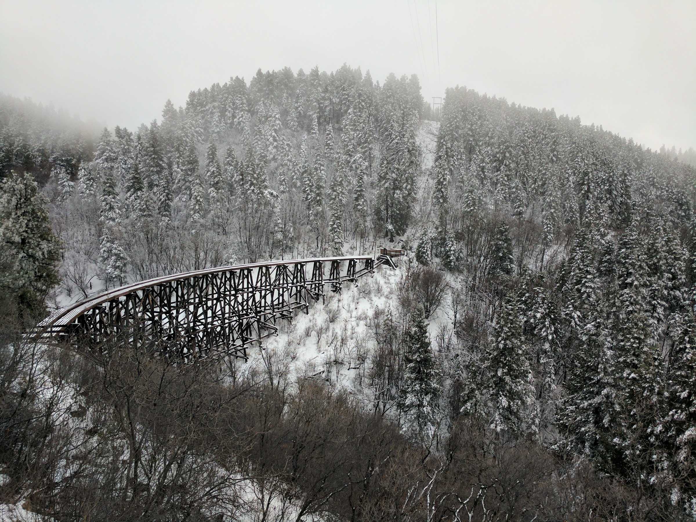
Regional overview
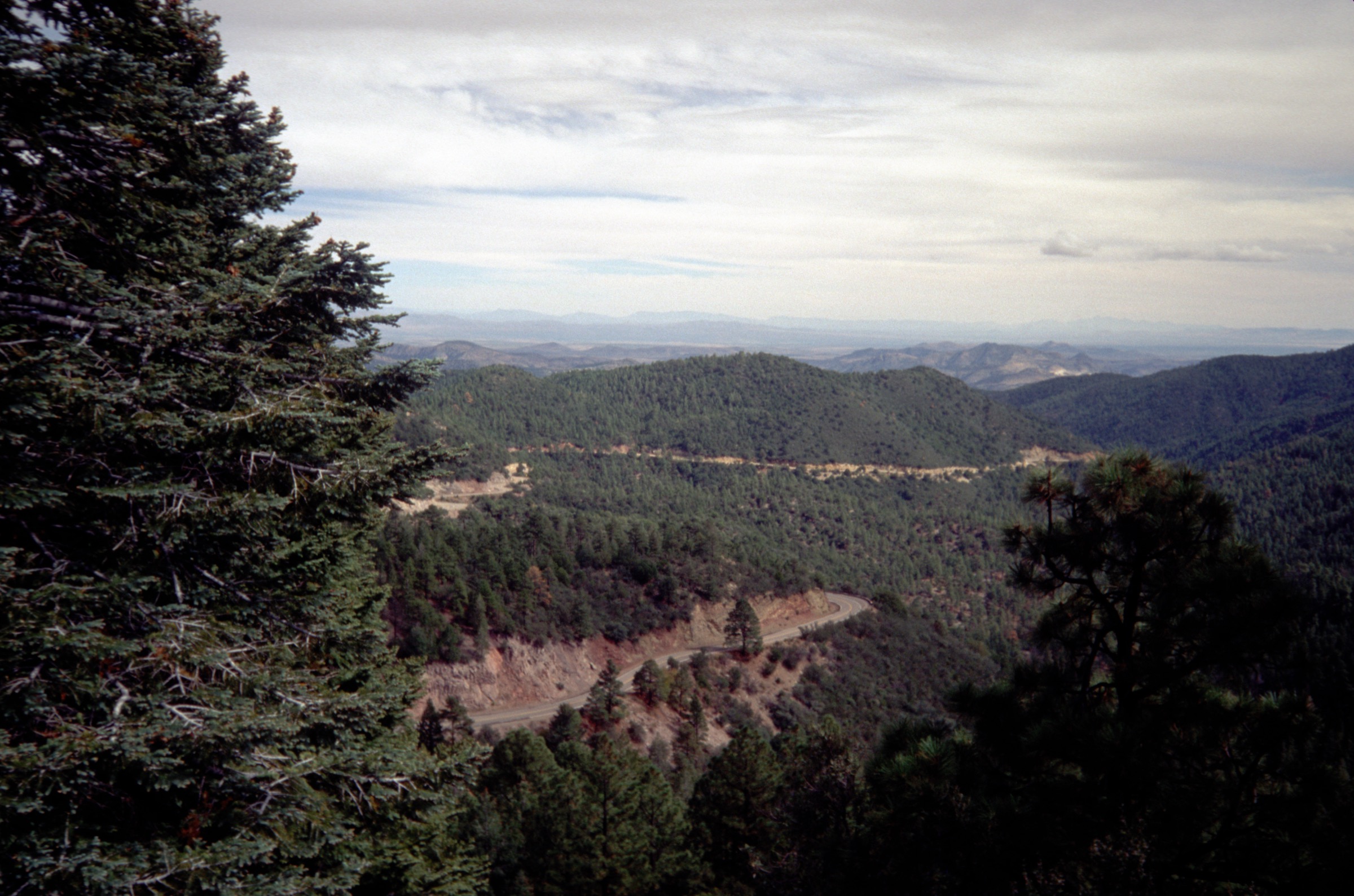
The Sacramento Mountains are the high, forested southern New Mexico sky-island block that rises abruptly above Alamogordo, White Sands National Park and the Tularosa Basin. The range runs roughly north–south for about 85 miles (137 km) with a dramatic west-facing escarpment on the desert side and a long gentle east slope toward the plains beyond Artesia. The highest named point is Cathey Peak at 2,940 m (9,645 ft); two unnamed high points near Sunspot and on Benson Ridge exceed 9,690 ft. The range is a wide east-dipping fault block of limestone, and its gypsum deposits — washed west into the Tularosa Basin — are the source of the dunes at White Sands.
Almost all of the public hiking sits inside the Sacramento Ranger District of the Lincoln National Forest, administered by the U.S. Forest Service and centred on Cloudcroft, High Rolls, Sunspot and the Bluff Springs / Rio Peñasco country. The USFS describes the Lincoln National Forest as covering the Sacramento, Guadalupe and Capitan ranges, with elevations from about 4,000 ft to 11,500 ft. The single most important lower-elevation access is at Oliver Lee Memorial State Park on the western escarpment, administered by New Mexico State Parks, from which the Dog Canyon National Recreation Trail climbs into the Lincoln NF above. Walking character shifts fast with elevation: cool, high-elevation Cloudcroft loops through mixed conifer, historic railroad-grade rail-trails linking Cloudcroft with High Rolls, and hot, dry canyon routes that climb from Chihuahuan Desert foothills into pine and mixed-conifer country.
The current Forest Service pages listed active alerts and fire restrictions during this verification pass, including a Bluff Springs temporary closure notice. Fire danger in the Sacramentos is a serious operational constraint through most summers — the range’s forests have a long history of large fires and the district frequently posts Stage 1 or Stage 2 restrictions. Current closures, fire restrictions and road conditions should be checked on the Lincoln National Forest home / alerts page before travel.
Seasonality splits by elevation. Cloudcroft-based high routes (Osha, Cloud-Climbing Trestle, Bluff Springs / Wills Canyon) are usable late spring through autumn, with winter turning them into snowshoe and cross-country ski terrain. Lower-elevation routes on the western escarpment (Dog Canyon) are the reverse: unpleasantly hot from May through September and best walked between October and April. Monsoon thunderstorms from July into September bring the year’s dominant lightning and flash-flood hazard on both the crest and the canyons. Black bears are present throughout the range, and rattlesnakes are common on the lower west-side routes.
For neighbouring New Mexico and West Texas sky-island ranges in the same broader region, see the sister catalogues on the Black Range, the Franklin Mountains above El Paso, and the Chisos Mountains of Big Bend.
See also: Sandia and Manzano Mountains · Jemez Mountains, New Mexico.
Selection rationale
The five routes below cover the main Sacramento day-hike types: a short Cloudcroft acclimatisation and view loop, a historic railroad / trestle route, the major desert-to-mountain escarpment climb from Oliver Lee, a lower-elevation rail-trail and waterfall network near High Rolls, and a representative forested canyon loop near Bluff Springs. Osha Trail T10 is the compact Cloudcroft classic. The Cloud-Climbing Trestle Trail T5001 and the Mexican Canyon Trestle deliver the range’s strongest hiking link to its logging-railroad history. Dog Canyon National Recreation Trail T106 is the dramatic desert-to-mountain climb from Oliver Lee Memorial State Park. The Grandview / Bridal Veil Falls / Salado Canyon network on FR 162C at High Rolls combines viewpoints, canyon scenery and the Salado Canyon trestle in a low-elevation package. The Willie White / Wills Canyon loop at Bluff Springs closes the selection with a deeper forested canyon linkup away from the town-centred routes.
Official U.S. Forest Service and New Mexico State Parks sources were prioritised. Several route statistics remain unresolved because the official pages identify trails and provide length but do not consistently publish elevation gain or downloadable route files; those fields are flagged in the snapshots below and in the closing Missing data / follow-up work section.
Summary
| # | Hike | Trailhead | Route type | Distance | Gain | Max elevation | Difficulty |
|---|---|---|---|---|---|---|---|
| 1 | Osha Trail T10 | US 82 / Muchachita St, Cloudcroft | Loop | ~3.4 km | Unresolved | ~2,620 m | Easy–moderate |
| 2 | Cloud-Climbing Trestle Trail T5001 | Cloudcroft west end / Trestle Recreation Area | Out-and-back | ~2.1–2.4 km one-way | Unresolved | ~2,560–2,650 m | Easy–moderate |
| 3 | Dog Canyon National Recreation Trail T106 | Oliver Lee Memorial State Park | Out-and-back or one-way | ~8.9 km one-way | > 610 m (secondary source: ~958 m) | Unresolved | Difficult |
| 4 | Grandview / Bridal Veil Falls / Salado Canyon | FR 162C near High Rolls | Linked network | ~7.2 km total | Unresolved | ~1,950 m | Easy |
| 5 | Willie White / Wills Canyon loop | Bluff Springs / Rio Peñasco Road | Loop / linkup | ~16.4 km | Unresolved | Unresolved | Moderate–difficult |
1. Osha Trail T10
Snapshot
Itinerary
From the signed Osha Trail Trailhead on the west edge of Cloudcroft, the loop climbs gently through mixed conifer forest and short shrub-and-grass openings. Benches and viewpoints on the west side of the loop give long views out over the Tularosa Basin and toward White Sands — the whole gypsum-dune expanse spread out 1,800 m below. The eastern side of the loop drops back through denser forest to the trailhead.
Why it is essential
Osha is the classic short Cloudcroft route: close to town, high enough to express the range’s cool sky-island climate, and short enough to work as an altitude-acclimatisation walk before a bigger day or as an easy family outing. It is the walk that most cleanly delivers the Sacramento crest character in an hour.
Equipment
- Trail shoes or light hiking boots
- Sun hat, high-SPF sunscreen and sunglasses
- Wind and rain layer for the high altitude
- Minimum 1 quart of water plus a snack (per USFS)
- Extra light jacket in cool seasons
- Microspikes or snowshoes in winter
Hazards and notes
- Altitude effects at 8,500–8,600 ft; walk slowly for the first hour if arriving from lower ground.
- Ice or snow on the tread in winter and shoulder seasons.
- No water sources or restrooms on the trail.
- Afternoon monsoon thunderstorms from July through September.
- Black bear country; keep food secure at the trailhead.
GPX / route file
| Source | URL | Format | Notes |
|---|---|---|---|
| USFS — Osha Trail PDF | fs.usda.gov | Official PDF | Route sheet with length, access, season and facilities; no GPX exposed |
| USFS — Sacramento District trails overview | fs.usda.gov | Official PDF trail table | Trail number, length and difficulty cross-check |
Sources
2. Cloud-Climbing Trestle Trail and the Mexican Canyon Trestle
Snapshot
Itinerary
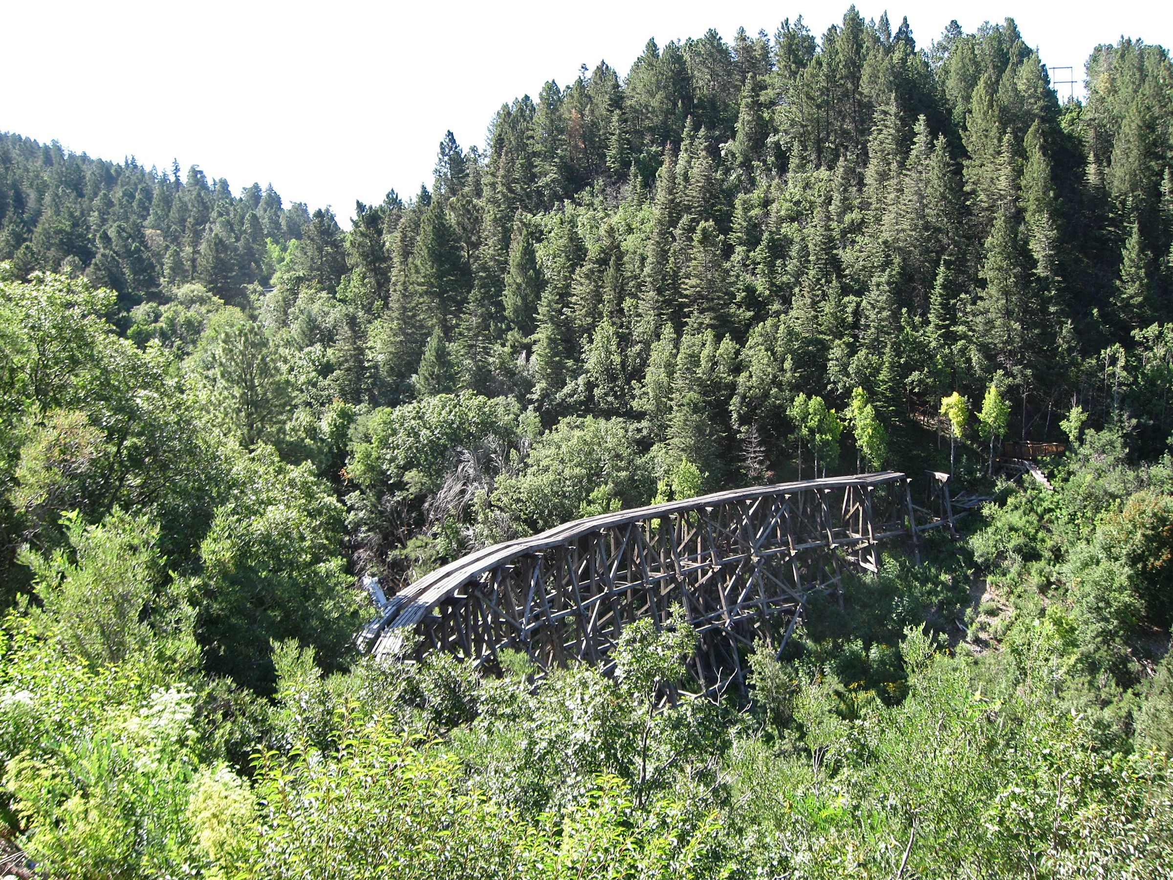
The Cloud-Climbing Trestle Trail T5001 follows a historic railroad grade from the west end of Cloudcroft to the southern viewing area for the Mexican Canyon Trestle, a wooden trestle built in 1899 for the Alamogordo and Sacramento Mountain Railroad and now on the National Register of Historic Places. If current access permits, extend the day by linking the Village Spur T5001A, the Old Cloudcroft Highway Trail T5002, the Crossover Trail and the Switchback Trail T5004 into a longer rail-history circuit that samples several sections of the old grade. The trestle itself is fenced and unsafe to enter; the viewing area is the sanctioned photo point.
Why it is essential
The Mexican Canyon Trestle is the most visible remnant of the Cloud-Climbing Railroad and this trail is the range’s strongest hiking connection to the region’s logging-and-railroad history. It is the walk that most cleanly delivers a piece of southern-New-Mexico industrial history in a short, family-workable outing.
Equipment
- Walking shoes; light hiking boots for winter
- Sun and rain layer
- Minimum 1–1.5 L water
- Map for the linked rail-trail options
- Microspikes in winter
Hazards and notes
- Do not climb on or enter unsafe trestle structures — the historic timbers are not maintained for load.
- Current-access changes and temporary closures do affect the Trestle Recreation Area; check USFS before travel.
- Icy tread in winter.
- Afternoon monsoon thunderstorms from July through September.
GPX / route file
| Source | URL | Format | Notes |
|---|---|---|---|
| USFS — Lincoln NF trails | fs.usda.gov | Web page | Trail descriptions for T5001, T5001A, T5002 and T5004 |
| USFS — Trestle Recreation Area Trails map | fs.usda.gov | Official PDF | Source map linked from the Lincoln maps and guides page |
| NPS / NRHP — Mexican Canyon Trestle record | npgallery.nps.gov | Historic record | Trestle history and location context |
Sources
- USFS — Lincoln National Forest trails
- USFS — Lincoln National Forest maps and guides
- NPS / NRHP — Mexican Canyon Trestle record
3. Dog Canyon National Recreation Trail T106
Snapshot
Itinerary
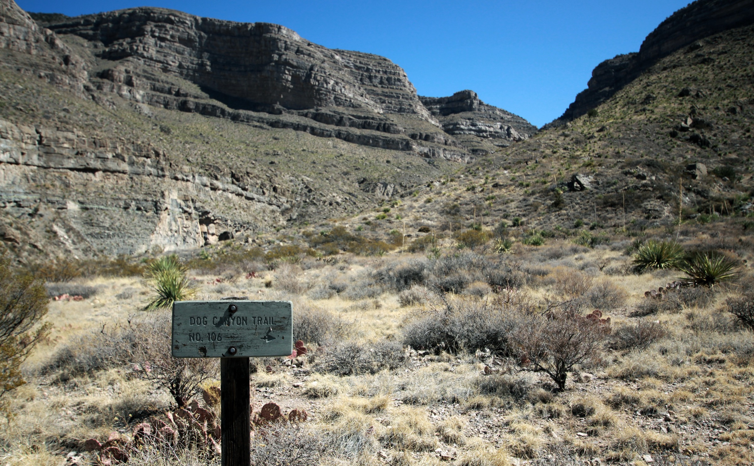
From Oliver Lee Memorial State Park at the base of the western escarpment, the Dog Canyon National Recreation Trail T106 climbs east directly into the mouth of Dog Canyon and then up the canyon’s north side on a series of steep, exposed switchbacks. The route leaves the Chihuahuan Desert foothill environment behind within the first hour, gains a shelf inside the canyon with the cliffs closing overhead, and continues up onto the Sacramento escarpment, eventually reaching Lincoln National Forest near FR 90B at the trail’s upper terminus. Most day hikers should treat it as an out-and-back to a sensible turnaround — the shelf inside the canyon or the first shoulder above it — rather than committing to the full one-way climb without a shuttle at FR 90B.
Why it is essential
Dog Canyon is the range’s most dramatic desert-to-mountain route, climbing directly from Chihuahuan Desert foothills through the escarpment cliff line into the forested Sacramento uplands. From the shelf inside the canyon and from the switchbacks above, the panorama takes in the Tularosa Basin, the White Sands dune field, and the San Andres Mountains across the basin — a section of the range’s classic geological line-of-sight.
Equipment
- Sturdy hiking boots with good ankle support and traction
- Trekking poles for the steep descent
- Sun hat, high-SPF sunscreen and sunglasses — desert exposure throughout
- Long sleeves and sun-protective layers
- Minimum 3–4 L water; do not rely on natural water sources in the canyon
- Salty snacks and real food for the effort
- Offline map and GPS with route loaded
- Wind or rain layer for the upper canyon and shoulder
- Headtorch for a slow party
Hazards and notes
- Extreme heat on the desert lower section from May through September; morning starts and cool-season travel are the sensible answers.
- Sustained steep climb with limited shade on the switchbacks.
- Rattlesnakes are present on the lower canyon and shelf.
- Monsoon flash-flood risk in the canyon from July through September — do not enter the canyon if storms are building.
- No reliable water; carry more than seems reasonable.
- Remote upper exit at FR 90B; treat any one-way plan as a shuttled trip.
- Cell service is intermittent and largely absent inside the canyon.
GPX / route file
| Source | URL | Format | Notes |
|---|---|---|---|
| USFS — Lincoln NF trails | fs.usda.gov | Web page | Official T106 description, length, endpoints and difficulty |
| NM State Parks — Oliver Lee Memorial State Park map | emnrd.nm.gov | Official PDF | Trailhead and lower-canyon map |
| NM State Parks — Oliver Lee Memorial State Park page | emnrd.nm.gov | Web page | Access, hours and fees |
Sources
- USFS — Lincoln National Forest trails
- NM State Parks — Oliver Lee Memorial State Park
- NM State Parks — Oliver Lee Memorial State Park map
4. Grandview, Bridal Veil Falls and Salado Canyon network
Snapshot
Itinerary
From the FR 162C trailhead on the north side of High Rolls, the network combines three short signed trails on the old Cloud-Climbing Railroad corridor. Grandview T130 climbs a short ridge to viewpoints north over Fresnal Canyon and toward the Sacramento crest. Bridal Veil Falls T129 drops into the canyon to a seasonal waterfall on Fresnal Creek. Salado Canyon T128 follows the old rail grade past the restored Salado Canyon trestle and into a quiet side canyon. The three link at the trailhead and small connectors, and can be walked as a single ~7 km network day or as any subset.
Why it is essential
This is the best lower-Sacramento day-hike for combining railroad history, canyon scenery and a manageable distance below the Cloudcroft high country. It is the natural companion to the Cloud-Climbing Trestle Trail — a second, quieter window onto the same rail corridor at a lower elevation and, for much of the year, a warmer walking climate.
Equipment
- Walking shoes or light hiking boots
- Sun hat, sunscreen and sunglasses
- Minimum 1.5–2 L water
- Light layer in cool seasons
- Camera; the network is short and image-rich
Hazards and notes
- Lower-elevation heat from May through September.
- Loose tread and unstable canyon edges near the falls.
- Seasonal water around Fresnal Canyon; treat crossings as slippery after storms.
- Post-storm erosion can reroute short sections; follow signage.
- Do not enter unsafe trestle structures.
GPX / route file
| Source | URL | Format | Notes |
|---|---|---|---|
| USFS — Grandview Trails PDF | fs.usda.gov | Official PDF | Access, history, total mileage, elevation range and difficulty |
| USFS — Sacramento District trail overview | fs.usda.gov | Official PDF | Individual trail lengths |
Sources
5. Willie White / Wills Canyon loop from Bluff Springs
Snapshot
Itinerary
From the Bluff Springs / Rio Peñasco Road area, the day starts on the short Willie White Spur T112 into the trail system, links onto the Willie White Trail T113 for the main forested canyon leg and returns via the Wills Canyon Trail T5008 and connecting road or track back to the start. Exact routing should be finalised from the official Benson Ridge / Willie White area map and against the current Sacramento District alerts before travel — the district’s Bluff Springs area carried a temporary closure at the time of writing.
Why it is essential
This route represents the deeper, less town-centred Sacramento Mountains — forested canyon walking, spring / waterfall-area access and longer trail mileage than the Cloudcroft short loops. It is the walk that most cleanly delivers the range’s crest-and-canyon character without any of the roadside signage of the town-based routes.
Equipment
- Sturdy hiking boots
- Offline map and GPS with route loaded — navigation matters at unsigned junctions
- Sun and rain layers
- Minimum 3 L water plus treatment
- Food for a long day
- Bear spray or bear-aware handling
- Extra layer and headtorch for a late-finishing party
Hazards and notes
- Bluff Springs temporary closure was in effect at the time of writing; recheck USFS alerts before travel.
- Navigation at trail junctions with limited signage.
- Seasonal road conditions on the Rio Peñasco / Bluff Springs access roads.
- Possible blowdown and post-storm erosion on the longer legs.
- Afternoon monsoon lightning risk from July through September.
- Black bear country; store food carefully and hike with noise on blind corners.
GPX / route file
| Source | URL | Format | Notes |
|---|---|---|---|
| USFS — Lincoln NF trails | fs.usda.gov | Web page | Official T112, T113 and T5008 descriptions |
| USFS — Willie White Area Trails map | fs.usda.gov | Official PDF | Source map linked from the Lincoln maps and guides page |
| USFS — Lincoln NF home / alerts | fs.usda.gov | Web page | Live closure / fire context — check before travel |
Sources
- USFS — Lincoln National Forest trails
- USFS — Lincoln National Forest maps and guides
- USFS — Lincoln National Forest home / alerts
Region-level sources
| Source | URL |
|---|---|
| USFS — Lincoln National Forest home / alerts | fs.usda.gov |
| USFS — Lincoln NF trails | fs.usda.gov |
| USFS — Lincoln NF maps and guides | fs.usda.gov |
| USFS — Sacramento District trail overview PDF | fs.usda.gov |
| NM State Parks — Oliver Lee Memorial State Park | emnrd.nm.gov |
| NPS / NRHP — Mexican Canyon Trestle | npgallery.nps.gov |
| Wikipedia — Sacramento Mountains (New Mexico) | en.wikipedia.org |
| Wikipedia — Cloud-Climbing Railroad | en.wikipedia.org |
Further reading
- Black Range — essential day-hikes — the sister New-Mexico range four hours west, centred on the Aldo Leopold Wilderness and the Continental Divide
- Franklin Mountains — essential day-hikes — the arid urban range above El Paso, three hours south
- Chisos Mountains — essential day-hikes — the volcanic core of Big Bend, further south into West Texas
Missing data / follow-up work
- Elevation gain is not published by USFS for most Sacramento District trails; the snapshots above mark this as unresolved rather than quoting unverified secondary numbers.
- Dog Canyon T106 total gain is quoted at “>610 m (2,000 ft)” by USFS and at 958 m (3,144 ft) by an NM State Parks / Wikipedia-derived summary; the discrepancy is unresolved and both are noted.
- No official downloadable GPX or KML was retrieved for any of the five routes; route geometry can be reconstructed from OpenStreetMap or CalTopo.
- Bluff Springs / Willie White area was under a temporary closure notice at the time of writing; the loop should not be treated as an operational route until the alert is lifted.
- Trestle Recreation Area access can change season-to-season; recheck the USFS Lincoln alerts page before planning the Cloud-Climbing Trestle Trail as a specific outing.
- Osha Trail, Grandview / Bridal Veil Falls / Salado Canyon, and Bluff Springs all lacked licence-compatible trail-specific images at the required resolution; the article uses the Mexican Canyon Trestle winter hero for the whole region and a separate Dog Canyon figure.