Regional overview
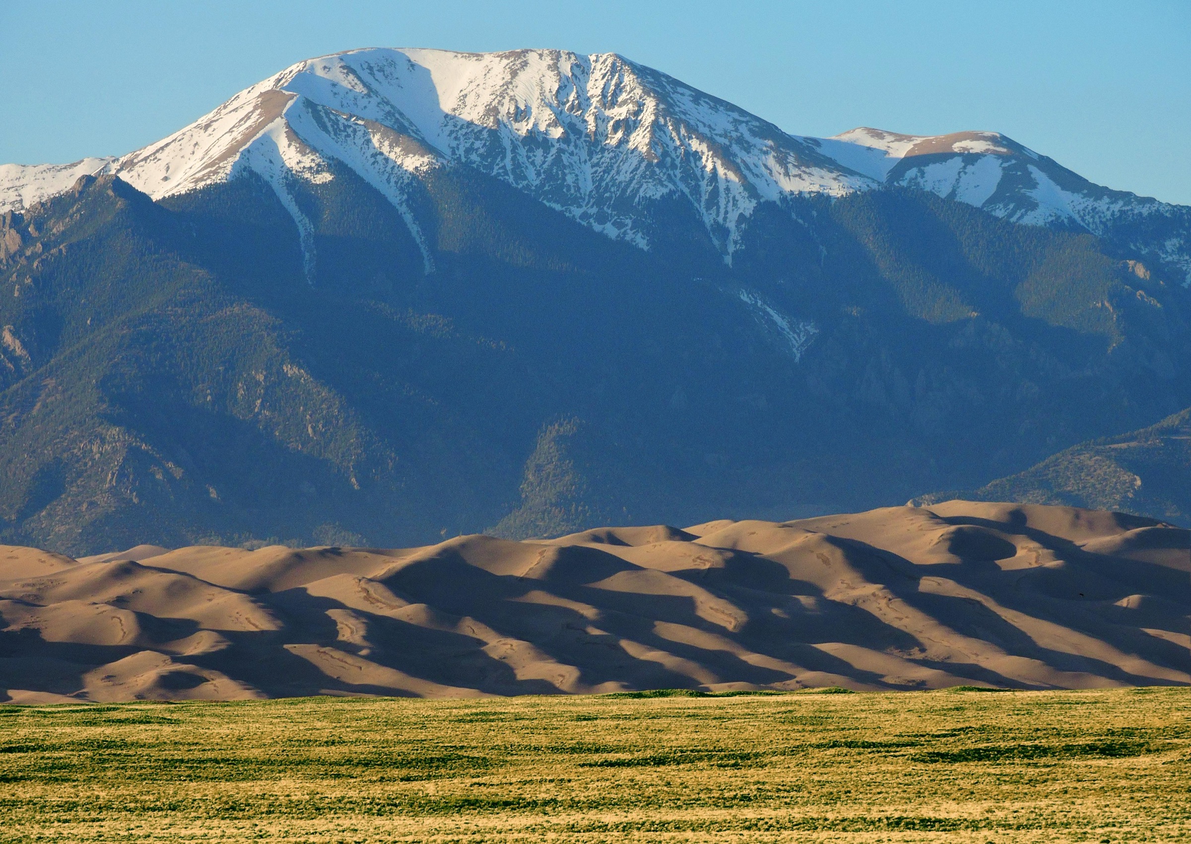
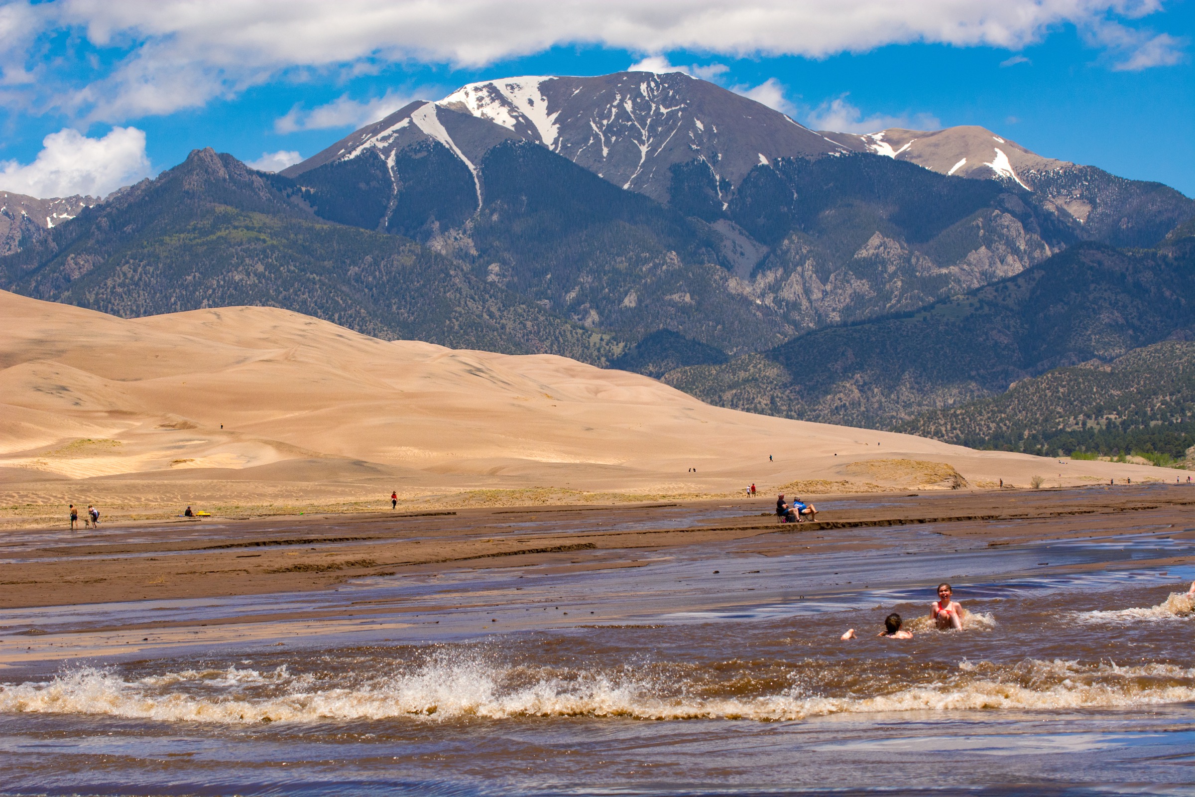
Great Sand Dunes National Park and Preserve protects the tallest dune field in North America, a roughly 30-square-mile (78 km²) sea of sand that sits against the abrupt western wall of the Sangre de Cristo Mountains in the San Luis Valley of southern Colorado. The dune field itself covers about 12,140 hectares of the park’s 60,300-hectare (149,028-acre) footprint. Wind, sediment from the surrounding valley floor, and a partial trap formed by Medano and Sand creeks and the Sangres above them are the mechanism that keeps the dunes piled where they are. Star Dune and Hidden Dune are currently tied by the National Park Service as the tallest in North America, both measured at 741 ft (225 m) from base to summit; Hidden Dune was confirmed at the same height as Star Dune following recent NPS measurements, so the traditional “Star Dune is the tallest” line no longer stands on its own.
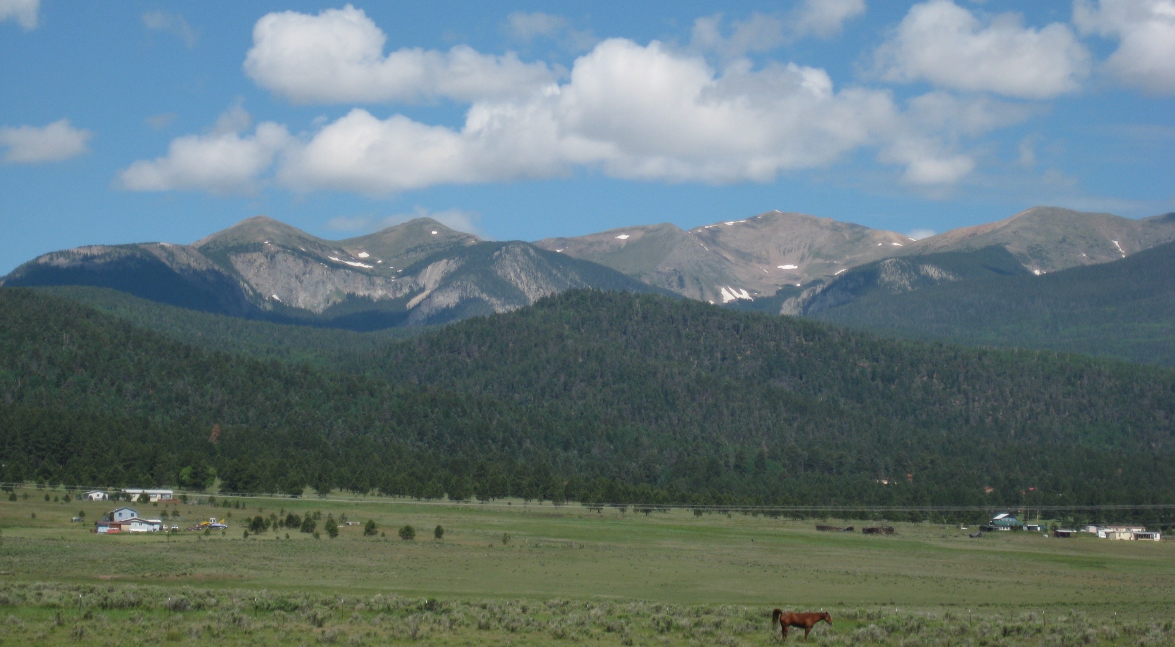
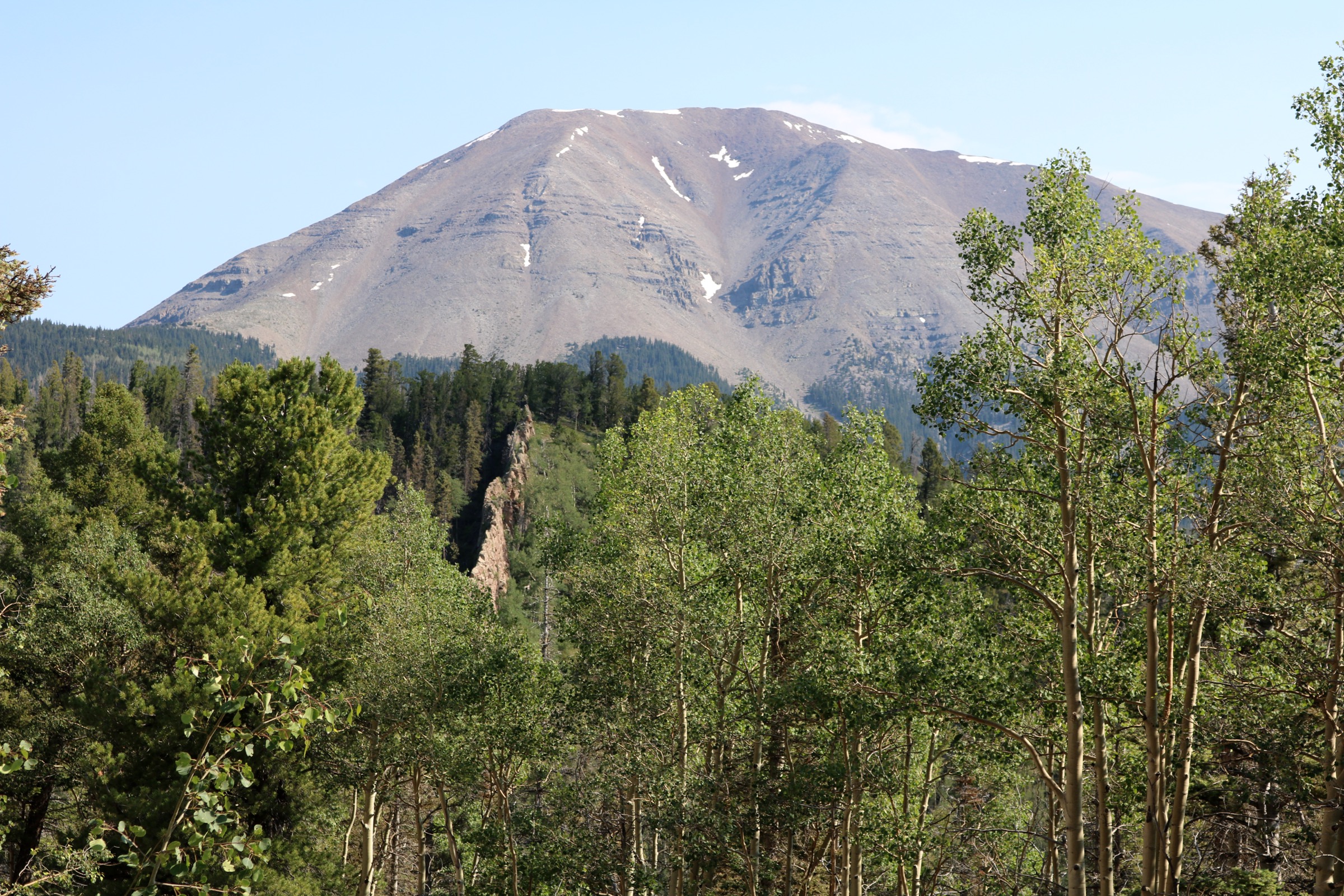
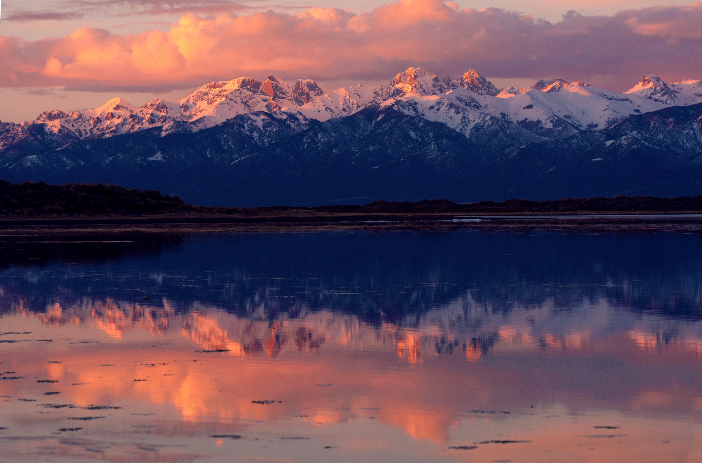
Behind the sand, the Sangre de Cristo forelands climb through spruce-fir forest and open subalpine basins to a crest of 13,000 ft peaks — Mount Herard (13,297 ft / 4,053 m), Music Mountain, Marble Mountain, Milwaukee Peak — with Music Pass and Medano Pass as the two named crossings of the range from the San Luis Valley into the Wet Mountain Valley on the east side. This side of the range is managed jointly by the National Park Service (as the Great Sand Dunes National Preserve) and the U.S. Forest Service (as the Sangre de Cristo Wilderness in the Rio Grande and San Isabel national forests), and the trailhead access reflects the split: Mosca Pass and the dune-field walks start from paved roads on the park’s front side, Medano Lake sits at the top of a demanding four-wheel-drive road, and the Music Pass trailhead is reached from the Wet Mountain Valley to the east.
The walking season is unusual for a Colorado range. The dune-field routes are technically open year-round, but the controlling factor from late May to early September is sand-surface temperature: the National Park Service records summer afternoon readings up to 150°F (65°C) on the sand, hot enough to burn skin through thin footwear and to cause heat exhaustion within a short walk. The standard practice on any dune-field route in summer is to be on the sand at first light or in the last two hours before dark, and off the sand entirely by mid-morning. Afternoon thunderstorms build over the Sangres and drift across the open dune field with no shelter available. On the alpine trails behind the range, snow lingers well into July at Music Pass and Medano Lake, and the same afternoon-storm pattern shortens the safe walking window to early morning starts.
Access is a mix of paved and rough. The dune-field trailheads, Mosca Pass and the Sand Ramp are reached from paved Colorado 150 and the park entrance road. The Medano Lake trailhead sits at the top end of the Medano Pass Primitive Road, a 22-mile route requiring high-clearance four-wheel drive, aired-down tires and sand-driving skill. The Music Pass upper trailhead in the San Isabel National Forest also requires 4WD; 2WD vehicles have to park at the Rainbow Trail crossing on Music Pass Road, adding 2.5 miles (4 km) each way. Federal park regulations apply throughout: dogs on the dune field are limited to the main day-use area (day-use only, must be leashed), drones are prohibited, and camping in the dune field requires a permit. Companion entries in this catalogue cover the northern New Mexico Sangres and the Spanish Peaks.
See also: Spanish Peaks, southern Colorado day-hikes · Northern New Mexico Sangres day-hikes (Wheeler Peak, Pecos, Latir).
Selection rationale
The five hikes below cover the region’s three distinct terrain types. Three are dune-field walks — High Dune on First Ridge as the accessible viewpoint, Star Dune as the traditional “tallest” objective, and Hidden Dune as the deeper, longer variant now recognised at the same height as Star Dune. Mosca Pass adds the classic forested route across the low southern shoulder of the Sangres, historically used as a wagon toll road. Medano Lake represents the alpine forelands, with an optional continuation to the summit of Mount Herard for parties willing to add the extra distance and altitude. Music Pass to Lower Sand Creek Lake is included as the east-side approach into the Sangre de Cristo Wilderness above the dune field, and stands in for the deeper Sand Creek basin as a whole. Dune-field walks are all trailless in the strict sense — the routes are described using the standard lines used by the National Park Service, not by any signed trail.
Summary table
| # | Hike | Country | Route type | Distance | Gain | Max elevation | Difficulty |
|---|---|---|---|---|---|---|---|
| 1 | High Dune on First Ridge | USA | Out-and-back (trailless) | 4.0 km | 210 m | Approx. 2,590 m | Moderate |
| 2 | Star Dune | USA | Out-and-back (trailless) | 9.7 km | 224 m | 2,626 m | Hard |
| 3 | Mosca Pass Trail | USA | Out-and-back | 11.3 km | 428 m | 2,880 m | Moderate |
| 4 | Medano Lake (option: Mount Herard) | USA | Out-and-back | 11.9 km (14.5 km to Herard) | 610 m (1,027 m to Herard) | 3,570 m (4,053 m at Herard) | Hard |
| 5 | Music Pass to Lower Sand Creek Lake | USA | Out-and-back | 12.9 km | 610 m | 3,490 m at Music Pass | Hard |
1. High Dune on First Ridge
Snapshot
Itinerary
From the dunes parking lot the route crosses the bed of Medano Creek (dry outside the spring snowmelt window) and begins climbing the first dune wall on any convenient line. The standard practice is to follow the crest of the ridge that rises to High Dune on First Ridge rather than fighting straight up the loose faces. Ridge-following keeps the walker on firmer sand where the wind has packed the crest, and gives the shortest overall climb. There is no marked trail — the route is line-of-sight, and the top of the first ridge is the objective. The National Park Service records the round trip as 2.5 miles (4.0 km) with 688 ft (210 m) of gain, and estimates 2–4 hours depending on acclimatisation.
High Dune on First Ridge is not the tallest dune in the park (that title is held jointly by Star Dune and Hidden Dune further into the field), but it is the highest point on the leading edge of the dune field and gives the classic view down onto the interior sand sea with the Sangre de Cristo crest behind.
Why it is essential
This is the standard first walk on the dune field for any visitor. It compresses the entire dune-field experience — creek crossing, ridge-climbing on loose sand, the summit view over the interior — into a short trailless route from the main parking lot.
Equipment
Closed footwear that can be emptied of sand, gaiters or long socks, sun hat, sunglasses, high-SPF sunscreen, at least 2 L of water per person, and food. A wind layer even on warm days. Do not walk barefoot in summer under any circumstances. A downloaded offline map or GPS point for the parking lot is useful in blowing sand and low light.
Hazards and notes
The National Park Service records summer afternoon sand-surface temperatures up to 150°F (65°C), hot enough to cause serious burns through thin footwear and to trigger heat exhaustion very rapidly. The standard mitigation is to walk before 09:00 or after 18:00 in summer, and to turn back if the sand becomes uncomfortably hot. Afternoon thunderstorms with lightning are frequent on the exposed dune field in July and August. Wind can be severe, especially in spring. Dogs are allowed on the main day-use dune-field area on leash only, and are at very high risk of paw burns in summer.
GPX / route file
| Source | URL | Format / access | Reuse status |
|---|---|---|---|
| NPS — Great Sand Dunes hiking page | nps.gov | Official hiking overview; no marked trail | No GPX published; the route is trailless on open sand |
| AllTrails — High Dune | alltrails.com | Source map / downloadable route via AllTrails account | AllTrails terms apply; direct GPX not retrieved |
Further reading
2. Star Dune
Snapshot
Itinerary
From the dunes parking lot the standard NPS route follows the sand sheet south along the west bank of the dry Medano Creek bed for roughly 2 miles (3.2 km) until the distinctive four-armed pyramid of Star Dune becomes obvious ahead. From that point the route turns east onto the dune field and picks the connecting ridges up onto the Star Dune summit. Ridge-following is again the standard practice — the crests are firmer and the climb is more direct than a straight-line push up a slip face. The National Park Service records the round trip as 6 miles (9.7 km) with 736 ft (224 m) of gain from the base to the summit, and estimates 6–9 hours depending on acclimatisation and heat.
Star Dune has traditionally been cited as the tallest dune in North America. Following updated NPS measurements the park now records Star Dune and Hidden Dune as tied at 741 ft (225 m) from base to summit; both dunes carry that status today. The route described here remains the Star Dune line as documented by the NPS.
Why it is essential
Star Dune is the traditional “tallest dune” objective and is the longest fully trailless day on soft sand in the catalogue. It puts the walker deep into the interior of the dune field, well beyond the sight lines from the main parking lot, and gives the fullest sense of the scale of the sand sea against the Sangres.
Equipment
Full sun and sand kit: closed footwear (some walkers prefer to walk barefoot in the cool of very early morning, but this cannot be recommended once the sand is warm), gaiters, sun hat, sunglasses, high-SPF sunscreen, at least 3 L of water per person, salty snacks and food, headlamp for a pre-dawn start, and a downloaded offline map or GPS point for the parking lot.
Hazards and notes
Sand-surface heat is the controlling hazard. The NPS explicitly recommends starting Star Dune in early morning to avoid extreme surface heat and afternoon thunderstorms. Any summer plan that puts the walker on the open sand after mid-morning should be dropped or restarted the following day. Lightning on the exposed dunes has no available shelter — turn back immediately at the first sign of building cells. Navigation in blowing sand or after dark relies on GPS; landmarks vanish quickly. No shade or water source exists on the dune field.
GPX / route file
| Source | URL | Format / access | Reuse status |
|---|---|---|---|
| NPS — Star Dune | nps.gov | Official page; no marked trail | No GPX published; the route is trailless on open sand |
| AllTrails — Star Dune | alltrails.com | Source map / downloadable route via AllTrails account | AllTrails terms apply; direct GPX not retrieved |
Further reading
3. Mosca Pass Trail
Snapshot
Itinerary
The trail leaves the Montville trailhead near the visitor centre and climbs east up the drainage of Mosca Creek, staying in aspen and mixed-conifer forest for the whole route. The grade is steady rather than sustained, with the trail switching sides of the creek several times. Old wagon-road benching is still visible in places; Mosca Pass was used as a toll road across the southern Sangres in the late nineteenth century. The pass itself sits at 2,880 m (9,447 ft) on the boundary between the national park and the Sangre de Cristo Wilderness, and marks the crossover from the San Luis Valley to the Wet Mountain Valley side of the range. AllTrails and NPS sources describe the round trip as roughly 7 miles (11.3 km) with about 1,400 ft (428 m) of gain.
Why it is essential
Mosca Pass rounds out the dune-field selection with a forested, moderate-grade climb into the Sangres from a paved trailhead, and adds a piece of route history — this is the historical wagon crossing of the southern Sangres, and the only one of the five routes here that spends its whole day in shaded forest.
Equipment
Standard hiking equipment: boots or trail shoes, waterproof layer, warm layer for the pass, sun protection, at least 2 L of water with treatment where refilling from Mosca Creek, food, and a downloaded offline map. Trekking poles help on the descent.
Hazards and notes
The trail is well-defined and easy to follow, but afternoon thunderstorms can hit the pass with limited shelter — turn back from the pass if cells are building. Deadfall from windstorms and past fire activity can slow travel; the NPS notes hunting is permitted on the wilderness side in fall, and hikers should wear high-visibility clothing then. Bear awareness is standard.
GPX / route file
| Source | URL | Format / access | Reuse status |
|---|---|---|---|
| NPS — Great Sand Dunes hiking | nps.gov | Official hiking overview | No GPX published; official route context |
| AllTrails — Mosca Pass Trail | alltrails.com | Source map / downloadable route via AllTrails account | AllTrails terms apply; direct GPX not retrieved |
Further reading
4. Medano Lake (option: Mount Herard)
Snapshot
Itinerary
From the upper Medano Lake trailhead the trail climbs north-east along Medano Creek through spruce-fir forest, then breaks out above treeline into a subalpine cirque under Mount Herard. Medano Lake sits at approximately 11,700 ft (3,570 m) in a rocky basin below the summit. The National Park Service records the walk to the lake at roughly 3.7 miles one-way with about 2,000 ft of elevation gain; parties continuing to the summit of Mount Herard climb an additional steep 1.5 miles on faint trail and unstable rock, for a full round trip of 9 miles (14.5 km) and 3,370 ft (1,027 m) of gain to the 13,297 ft (4,053 m) summit.
The lake is a legitimate day-hike objective on its own and is the standard turnaround for parties who are not comfortable on the loose off-trail terrain above. The Herard extension puts the walker on a Colorado 13,000-ft summit with the most dramatic overhead view of the dune field available anywhere in the range, but adds significant altitude, exposure and route-finding.
Why it is essential
This is the alpine face of the Great Sand Dunes region — the day-hike that shows the Sangre de Cristo crest as a Colorado mountain range in its own right rather than as a backdrop for the dune field. The Herard summit view over the dunes is the classic aerial-style photograph of the park taken from the ground.
Equipment
Full mountain day kit: sturdy boots, rain shell, warm insulating layer, hat and gloves for above-treeline weather, sun protection, at least 2.5 L of water with treatment, food for a long day, headlamp, trekking poles, and a downloaded offline map. Microspikes may be useful on early-season snowfields in the upper cirque.
Hazards and notes
Afternoon lightning is the headline hazard once above treeline; an early start and a hard turnaround time are essential, particularly for parties continuing to Herard. The upper Herard climb is on unstable rock and a faint route — off-trail scrambling in windy or wet conditions carries a real slip risk. The four-wheel-drive access on the Medano Pass Primitive Road is the other controlling factor: sand sections require aired-down tires, and vehicle recovery from the sand ramp is at the driver’s cost. Dogs are permitted on the trail on leash in the national preserve, but must not enter the wilderness portion; check current NPS/USFS boundary rules before travel.
GPX / route file
| Source | URL | Format / access | Reuse status |
|---|---|---|---|
| NPS — Hike Medano Lake and Mount Herard | nps.gov | Official route summary | No GPX published; official route context |
| AllTrails — Medano Lake Trail | alltrails.com | Source map / downloadable route via AllTrails account | AllTrails terms apply; direct GPX not retrieved |
| AllTrails — Mount Herard via Medano Lake | alltrails.com | Source map / downloadable route via AllTrails account | AllTrails terms apply; direct GPX not retrieved |
Further reading
5. Music Pass to Lower Sand Creek Lake
Snapshot
Itinerary
The trail climbs steadily from the Music Pass upper trailhead through spruce-fir forest to the open notch of Music Pass at approximately 11,450 ft (3,490 m), on the Sangre de Cristo crest. From the pass the view drops west into the Sand Creek basin, with Milwaukee Peak, Music Mountain and Marble Mountain forming the surrounding cirque wall and Lower Sand Creek Lake visible below in its glacial pocket. The trail descends about 500 ft (150 m) from the pass on switchbacks, then contours through forest to the lakeshore. The National Park Service records the round trip from the upper trailhead as 8 miles (12.9 km) with 2,000 ft (610 m) of gain — noting that the descent to the lake means the return climb goes up to Music Pass first before descending back to the trailhead. Two-wheel-drive vehicles must park where the Rainbow Trail crosses Music Pass Road, adding 2.5 miles (4 km) each way and pushing the day significantly.
Why it is essential
Music Pass is the east-side approach into the Sand Creek basin of the Sangre de Cristo Wilderness — the deep alpine backyard of the dune field, largely invisible from the San Luis Valley. Lower Sand Creek Lake gives a full day above 10,000 ft in a cirque of 13,000 ft peaks, with a much wilder feel than the front-side dune-field routes.
Equipment
Full mountain day kit: sturdy boots, rain shell, warm layer, hat and gloves, sun protection, 2.5 L of water with treatment, food, headlamp, trekking poles, and a downloaded offline map. Microspikes may be useful on early-season snowfields near the pass.
Hazards and notes
Afternoon thunderstorms over Music Pass are the standard headline risk — the pass and the open descent to the lake have limited shelter. The controlling access variable is the Music Pass Road: vehicles without high-clearance 4WD add a serious 4 km each way on foot, turning the day into a long one. The area is designated wilderness — no mechanised or motorised travel beyond the trailhead — and is bear country; standard food-storage practice applies even on day trips. Dogs must be under control at all times.
GPX / route file
| Source | URL | Format / access | Reuse status |
|---|---|---|---|
| NPS — Hike Sand Creek Lakes | nps.gov | Official route summary | No GPX published; official route context |
| AllTrails — Lower Sand Creek Lake Trail | alltrails.com | Source map / downloadable route via AllTrails account | AllTrails terms apply; direct GPX not retrieved |
Further reading
Further reading
| Source | URL |
|---|---|
| NPS — Great Sand Dunes National Park and Preserve | nps.gov/grsa |
| NPS — Great Sand Dunes hiking | nps.gov |
| NPS — Star Dune | nps.gov |
| NPS — Hidden Dune | nps.gov |
| NPS — Hike Medano Lake and Mount Herard | nps.gov |
| NPS — Hike Sand Creek Lakes | nps.gov |
| USDA Forest Service — Sangre de Cristo Wilderness (Rio Grande NF) | fs.usda.gov |
| USDA Forest Service — Sangre de Cristo Wilderness (San Isabel NF) | fs.usda.gov |
| Wikipedia — Great Sand Dunes National Park and Preserve | en.wikipedia.org |
| Wikimedia Commons — Great Sand Dunes National Park and Preserve | commons.wikimedia.org |