Regional overview
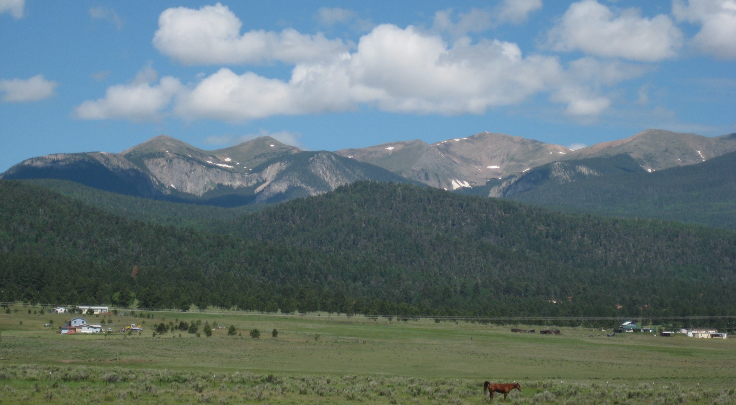
The Spanish Peaks are a pair of prominent, near-symmetrical volcanic-origin summits rising abruptly from the high plains of southern Colorado in Huerfano and Las Animas counties, roughly 100 km south of Pueblo and 30 km north of Trinidad. West Spanish Peak (4,155 m) and East Spanish Peak (3,867 m) form the eastern outlier of the Sangre de Cristo Range, standing free of the main Culebra Range to the west. Both are erosional remnants of Late-Oligocene igneous stocks: West Spanish Peak is a quartz syenite intruded about 24.6 million years ago; East Spanish Peak is a granodiorite porphyry set within a granite porphyry envelope. West Spanish Peak has a topographic prominence of 1,123 m — the twelfth most prominent peak in Colorado, and the easternmost 13,000 ft summit in the contiguous United States.
The range’s signature landscape feature is the radial dike system: more than 500 vertical igneous walls fan out from the two peaks like the spokes of a wheel, together with an older set of parallel dikes trending roughly ENE–WSW that pre-date the peaks and formed during the Sangre de Cristo Uplift. Several dikes extend more than 20 km. The peaks and their dike sets were designated the Spanish Peaks National Natural Landmark in 1976, covering roughly 37,678 acres, and the peaks themselves lie within the 19,226-acre Spanish Peaks Wilderness, established by Congress in 2000 and managed by the San Carlos Ranger District of the Pike–San Isabel National Forest. The Comanche name Wahatoya (also transliterated Huajatolla) is variously translated as “double mountain” or “breasts of the earth”; the peaks were sacred to the Comanche, Ute and other regional peoples and served as navigation landmarks for indigenous trade routes and later Spanish and American travellers alike.
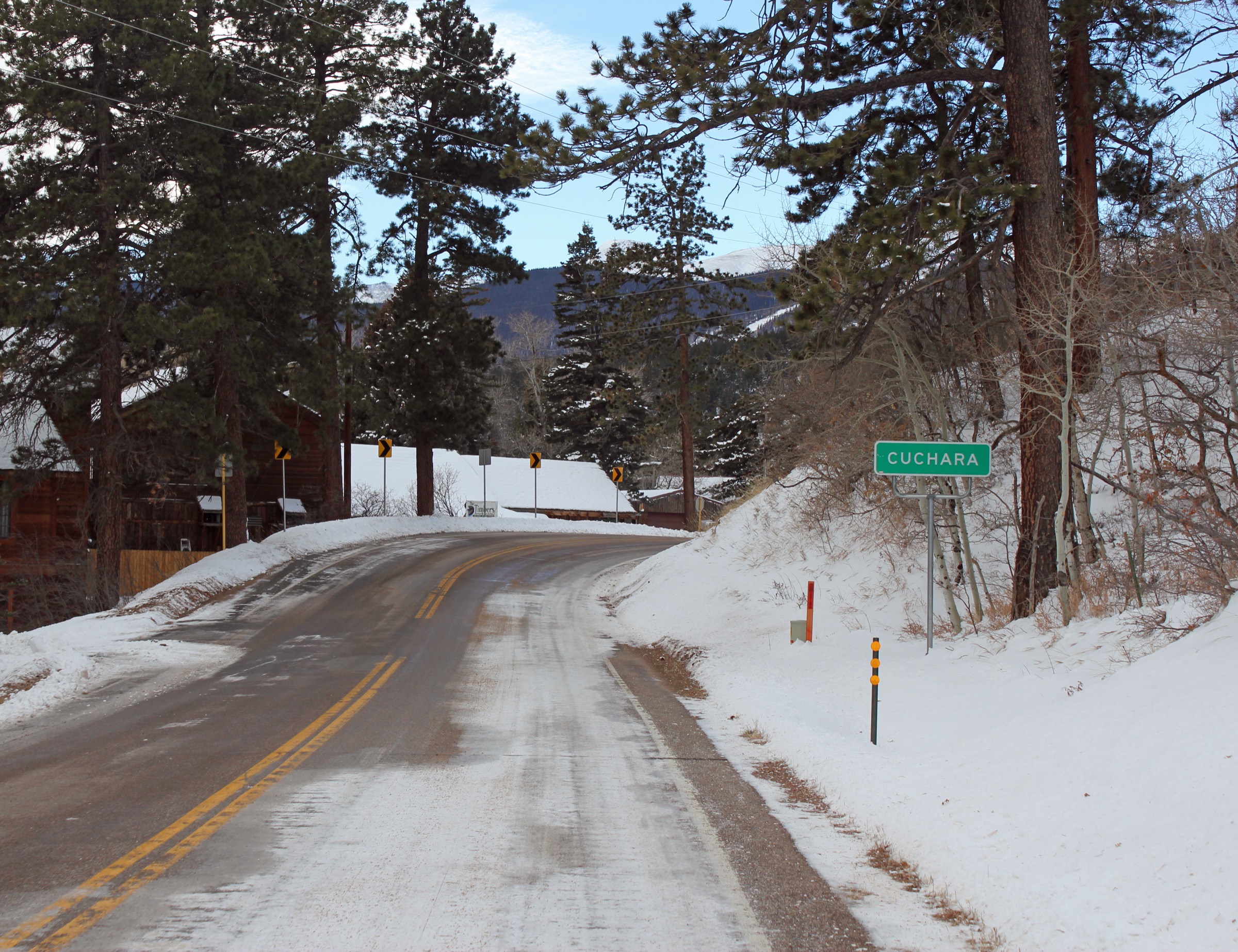
Main hiking centres are La Veta (a small town on the north-west side, roughly 2,225 m, on Colorado State Highway 12) and the smaller village of Cuchara, 25 km south along the same road. Highway 12 itself is the Highway of Legends National Scenic Byway. Cordova Pass (3,432 m), reached by unpaved but passenger-car-accessible Huerfano/Las Animas County Road 46, is the primary high trailhead for West Spanish Peak. Bear Lake and Blue Lake campgrounds on FSR 422 just north of Cucharas Pass are the standard base for hikes on the Cuchara side, including Trinchera Peak (4,120 m). Access to the north-east side from the Wahatoya Trailhead requires a high-clearance vehicle on FSR 442. The best hiking window runs late June to late September; snow can linger on north-facing slopes into early July on the higher summits, and October storms can end the season abruptly. Cordova Pass and its access road are typically closed from mid-November until late May.
Safety issues on the range are typical of Colorado’s higher country. Afternoon thunderstorms are frequent from July through mid-September, with lightning a serious hazard on the exposed summits, ridges and dike-top viewpoints; parties should aim to be off summits by noon. Loose scree and Class 2 talus dominate the final approach to both West Spanish Peak and Trinchera Peak. Wilderness regulations apply within the Spanish Peaks Wilderness (no mechanised transport, no drones, group size limit 15 people or 25 combined people and stock). Black bears are present; food storage discipline is expected. Cell coverage is unreliable throughout the range.
Selection rationale
The five hikes below cover the range’s principal landscape types and the two main access sides. West Spanish Peak from Cordova Pass is the signature summit day and the natural top pick. Apishapa Trail #1324 is the essential dike-country walk, threading between prominent radial dikes on the south-west approach to the peak. Wahatoya Trail #1304 to the Saddle is the classic pass and valley route between the twin peaks and the way to a rarely visited but geologically striking col. Trinchera Peak from Blue Lake is the highest accessible summit on the Cuchara side and the range’s high-altitude tundra experience, contrasting with the Cordova Pass approach. The Bear Lake–Blue Lake–Indian Creek loop provides the short, family-friendly lake and old-Cuchara Ski Area circuit that most visitors combine with a stay in Cuchara. Together the five span iconic summit, dike-country walk, ridge and pass route, cirque high summit, and lake-and-cultural route.
Summary
| # | Hike | Trailhead | Route type | Distance | Gain | Max elevation | Difficulty |
|---|---|---|---|---|---|---|---|
| 1 | West Spanish Peak from Cordova Pass | Cordova Pass (CR 46) | Out-and-back | 12.0 km | 725 m | 4,155 m | Hard |
| 2 | Apishapa Trail #1324 — Great Dikes approach | Apishapa (CR 46) | Out-and-back | 11.3 km | 430 m | 3,170 m | Moderate |
| 3 | Wahatoya Trail #1304 to the Saddle | Wahatoya (FSR 442, 4WD) | Out-and-back | 20.0 km | 975 m | 3,505 m | Hard |
| 4 | Trinchera Peak from Blue Lake | Blue Lake Campground (FSR 422) | Out-and-back | 13.0 km | 915 m | 4,120 m | Hard |
| 5 | Bear Lake–Blue Lake–Indian Creek Overlook | Blue Lake day-use area (FSR 422) | Loop and spur | 7.0 km | 275 m | 3,140 m | Easy–Moderate |
1. West Spanish Peak from Cordova Pass
Snapshot
Itinerary
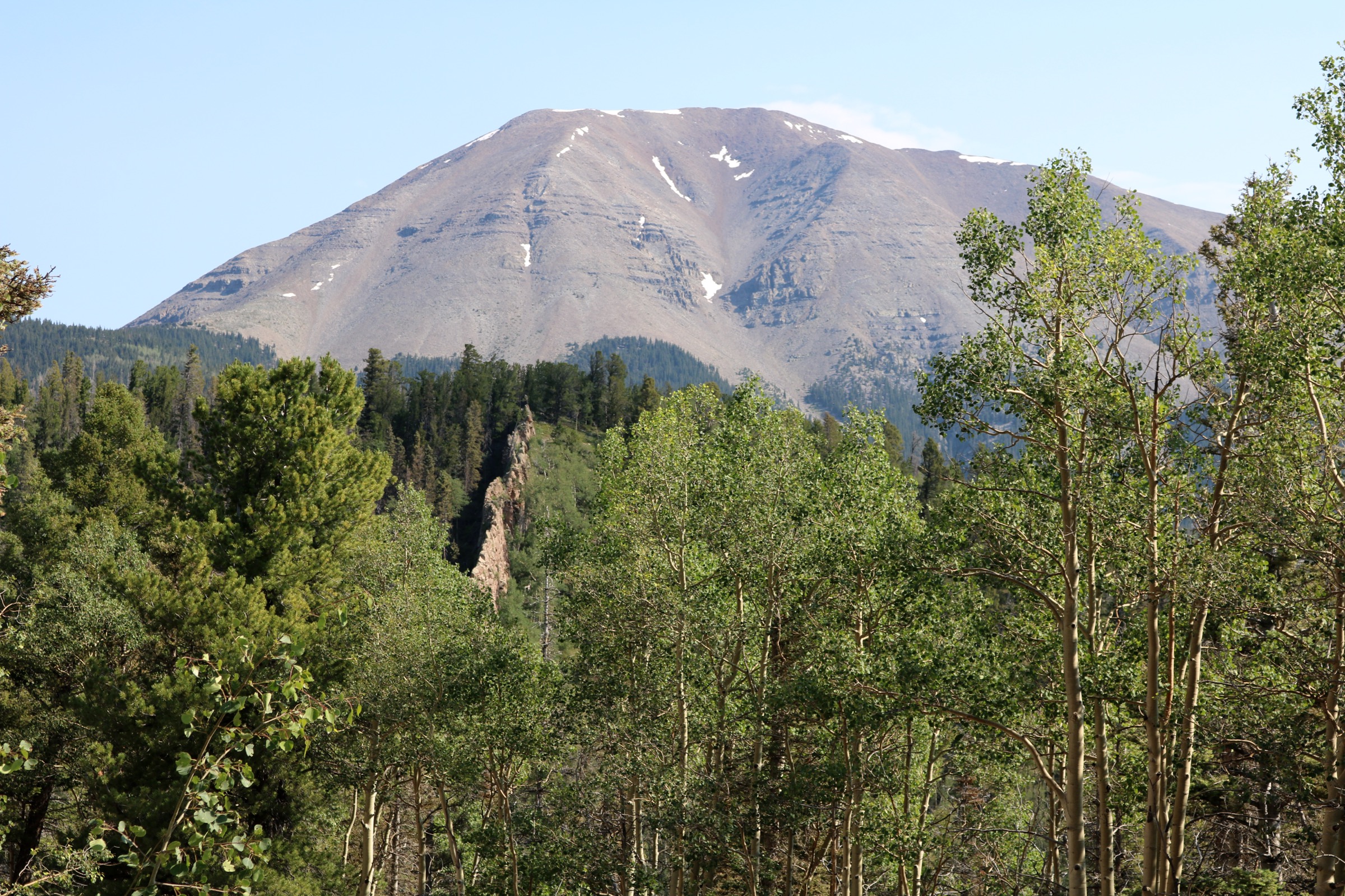
From the Cordova Pass Trailhead at ~3,432 m, West Peak Trail #1390 heads east-north-east along a broad forested ridge of mixed spruce–fir and bristlecone pine. The tread is well-graded and undulates gently for roughly 3 km, crossing a broad meadow with intermittent overlooks north over Cuchara Valley toward the Wet Mountains. The trail rises steadily but easily to just below treeline at ~3,780 m, where a large cairn marks the point at which the route leaves the wilderness-boundary forest and turns directly up the peak’s south-west ridge.
From the cairn the character changes abruptly. The upper ridge is sustained, loose Class 2 talus and scree, gaining roughly 400 m over less than 1.5 km. Faint use-trails weave between larger blocks; the aggregate line is unmistakable but no engineered tread exists above treeline. The final approach to the summit at 4,155 m crosses the broad, rounded quartz-syenite crown to a wooden register and a small windbreak. On clear days the panorama includes East Spanish Peak immediately to the north-east, Trinchera Peak and the Culebra Range to the west and south-west, the Wet Mountains, Greenhorn Mountain, and — under exceptional visibility — the plains extending east into Kansas. The radial dike system is best appreciated on the descent, when the northward view opens over Goemmer Butte and the long dark walls fanning out below La Veta. Return is by the outbound route; there is no viable loop.
Why it is essential
West Spanish Peak is the signature summit of the range and one of the most prominent, geologically distinct peaks in Colorado. As the easternmost 13,000 ft peak in the contiguous United States and the sacred Wahatoya of Comanche tradition, it combines summit stature, cultural weight and the best available in-range view of the radial dike system. No selection of essential Spanish Peaks day-hikes could omit it.
Equipment
- Sturdy boots with ankle support for the sustained Class 2 talus
- Trekking poles strongly recommended for the descent
- Extra warm layer — summit temperatures are often 15 °C cooler than La Veta, and afternoon thunderstorm winds can be severe
- 3 L water per person minimum; there is no reliable water above the trailhead
- Sun protection — limited shade above treeline
- Offline map and GPS backup; cell coverage is essentially absent
- Headtorch for shoulder-season starts
Hazards and notes
- Sustained loose talus and scree on the upper ridge; rockfall between parties is a recognised hazard on busy summer weekends.
- Afternoon lightning is a serious risk from mid-June through early September — most local guides advise starting from Cordova Pass no later than 06:00 to be off the summit by noon.
- Snow can linger on the north-east flank into late June and can return in early October.
- Cordova Pass road (CR 46) is closed and unmaintained from mid-November to late May, and is often muddy for a week or more after storms.
- Cordova Pass Campground and trailhead are a fee area with a self-service pay station.
- Wilderness regulations apply above the Spanish Peaks Wilderness boundary at ~1 km from the trailhead: no drones, no mechanised transport, group-size limit 15 or 25 combined.
- Dogs must be leashed or under strict voice control.
2. Apishapa Trail #1324 — Great Dikes approach
Snapshot
Itinerary
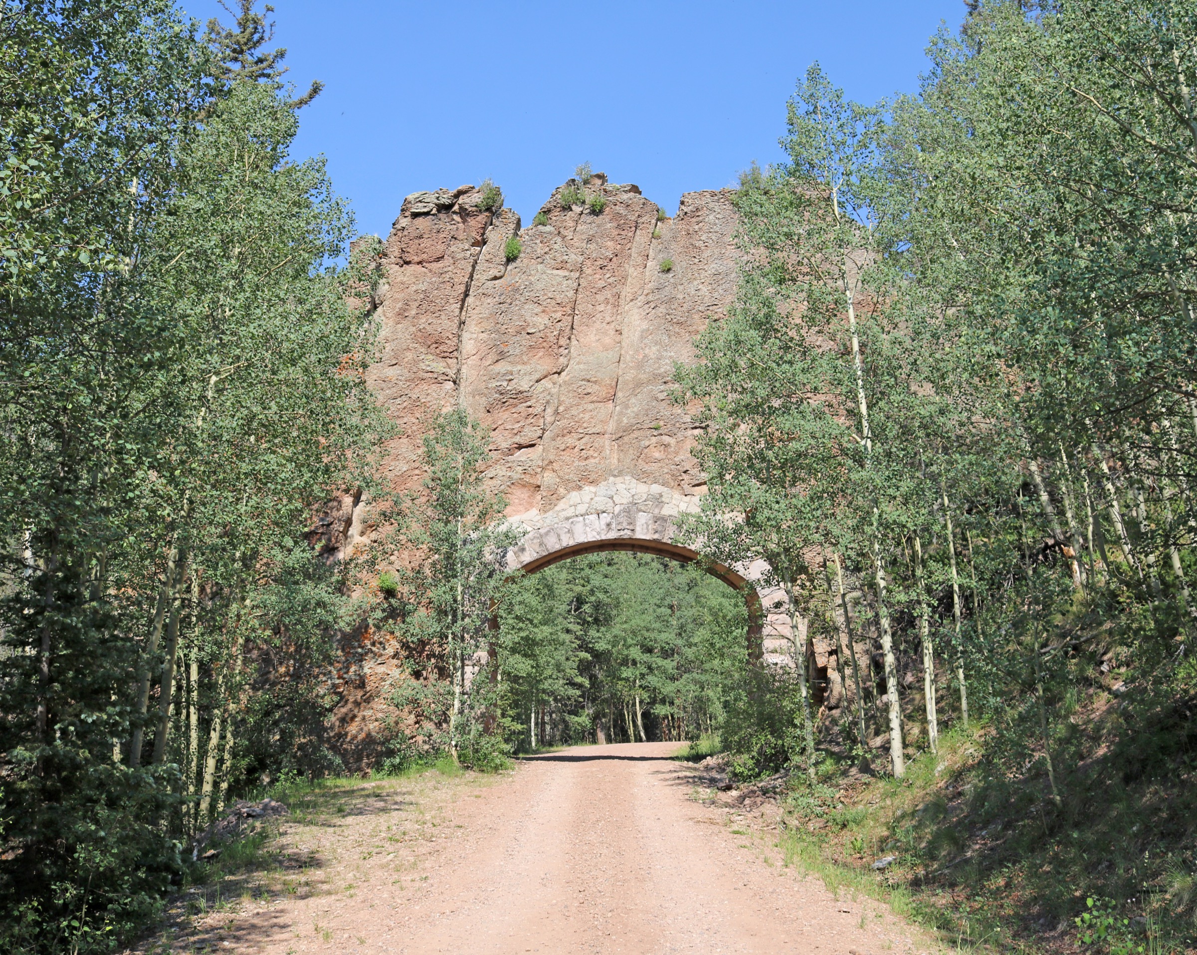
The Apishapa Trailhead lies on the south-west side of West Spanish Peak, roughly 16 km up County Road 46 from its junction with Highway 12 at Cucharas Pass. The trail begins in mixed conifer forest just inside the Spanish Peaks Wilderness boundary and climbs steadily north-east up the drainage of the Apishapa River. Within the first kilometre the tread passes close to the base of the first of several large radial dikes; the wall-like exposures of quartz syenite are best seen where the trail crosses open meadows and drainages that expose the geometry of the intrusions.
The trail continues on a moderate gradient for roughly 3 km, gaining about 300 m through spruce–fir and small aspen groves, before contouring across the south-west shoulder of West Spanish Peak. At ~2.4 km from the trailhead the Apishapa Trail intersects Wahatoya Trail #1304; parties whose objective is a dike-country walk usually turn round here. The extended variant continues on Apishapa Trail #1324 for a further ~3.2 km to its junction with West Peak Trail #1390, gaining approximately another 200 m and providing progressively more open views of the parallel dikes running south-west from the peak. Return is by the outbound route in both cases.
Note that Apishapa Arch, the CCC-cut tunnel through a magmatic dike, is a drive-through highlight roughly 3 km before the trailhead on County Road 46 — not a feature of the hike itself, but the single most photographed dike in the area and a natural stop en route.
Why it is essential
The Apishapa Trail is the closest sustained-walking exposure to the radial dike system that defines the range’s National Natural Landmark status, and the standard on-foot introduction to its unique volcanic geology. It is also comparatively gentle and offers a moderate day suitable for parties not committing to the summit of West Spanish Peak, while still passing through wilderness terrain characteristic of the range.
Equipment
- Sturdy trail shoes or light boots
- 2 L water per person; on-trail sources are limited
- Sun protection for open meadow sections
- Extra warm layer — afternoon storm sensitivity at 3,000 m and above
- Offline map; several trail junctions are signed but the tread through burn or blowdown areas can be faint
- Bear-aware food storage
Hazards and notes
- Afternoon lightning is the dominant hazard from July through early September; the trail is largely below treeline but exposed on ridge sections.
- Blowdown and occasional faint tread through spruce–fir; verify a downloaded map before departure.
- Wilderness regulations apply throughout: no drones, no mechanised transport, group-size limit 15 or 25 combined.
- County Road 46 to the trailhead is graded gravel and generally suitable for passenger vehicles when dry, but may be rutted after storms.
- Dogs must be leashed or under strict voice control.
3. Wahatoya Trail #1304 to the Saddle
Snapshot
Itinerary
From the Wahatoya Trailhead, reached only by high-clearance 4WD via County Road 360 and FSR 442, the trail climbs south-east through mixed conifer forest on the north-east side of the range. The first 5–6 km gain elevation steadily along a well-defined tread through spruce–fir with occasional aspen groves and open meadows. Views open north to the Wet Mountains and Greenhorn Mountain.
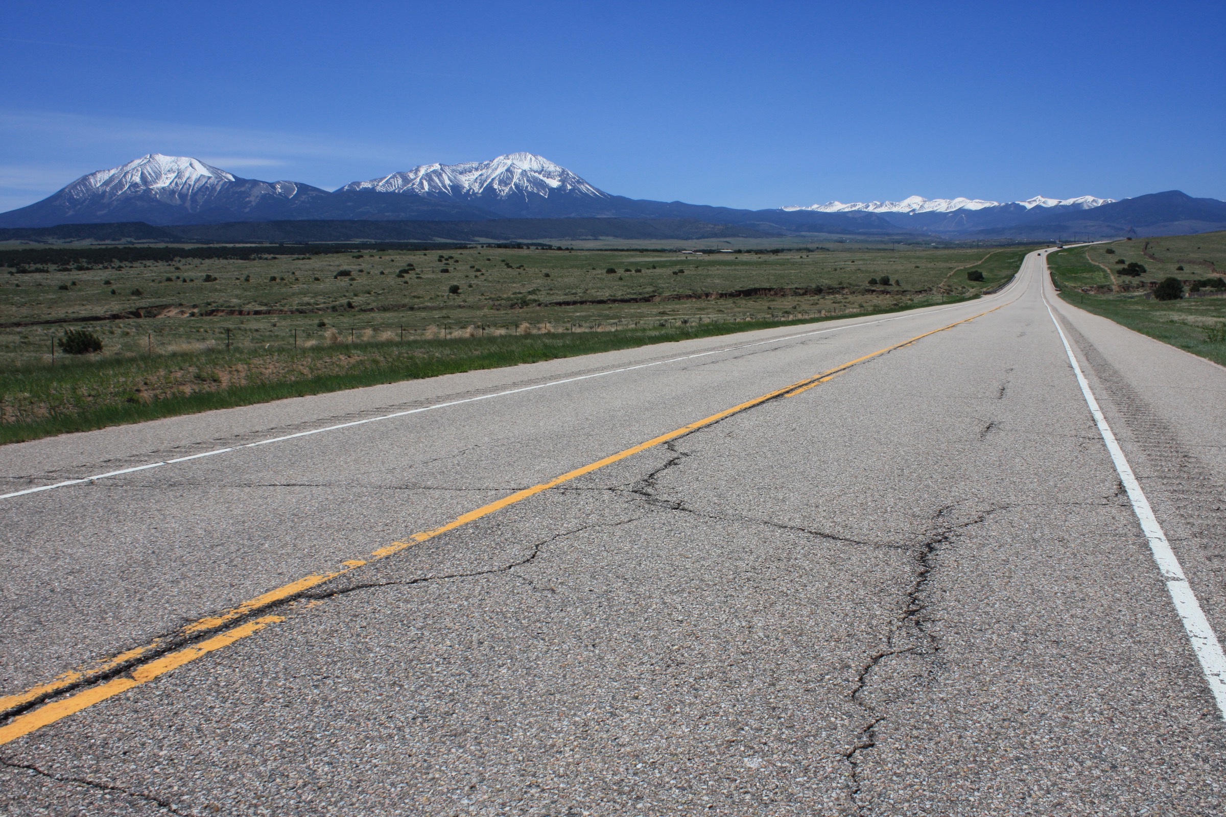
The trail then swings south to climb toward the saddle between West and East Spanish Peaks. Total distance from the trailhead to the saddle is approximately 9–11 km one-way. The upper section leaves dense forest and passes through krummholz and low willow before topping out at the col between the two summits, where the character of the range’s twin geology is most apparent: quartz-syenite blocks of West Spanish Peak on one side, granodiorite and granite porphyry of East Spanish Peak on the other. From the saddle the trail continues west to its terminus at the junction with Apishapa Trail #1324.
Most parties turn round at the saddle. Continuing to the summit of West Spanish Peak from the saddle is possible but adds significant Class 2 talus and lengthens the day beyond a typical day-hike. East Spanish Peak’s summit is off-trail through forest and blockfield from the same area and is a separate objective. Route statistics vary substantially between sources: USFS lists the full Wahatoya Trail as 12 mi and La Veta Trails 14 mi. The figures given here are compiled from cross-checked sources and topographic estimates; treat all as approximate.
Why it is essential
The Wahatoya Trail is the classic north-east-side route into the wilderness and the only maintained trail that reaches the col directly between the two peaks. It offers the range’s essential pass and valley experience, an intimate look at the twin-peak geology from below, and the least-visited approach into the wilderness core. It contrasts strongly with the Cordova Pass side and is the natural counterpart to the summit day.
Equipment
- Sturdy boots for a long, forested approach with rocky upper sections
- Trekking poles recommended
- 3 L water per person; on-trail water is limited, verify current sources
- Extra warm layer for the saddle
- Offline map and GPS backup; cell coverage is essentially absent and tread can be faint through blowdown
- Bear-aware food storage
- Headtorch for a long summer day
Hazards and notes
- FSR 442 access is a genuine constraint: without high-clearance 4WD the trailhead cannot be reached and parties would face a substantial road walk.
- Afternoon lightning at the saddle is a serious risk during monsoon (July to early September); an early start is essential.
- Wilderness regulations apply throughout: group-size limit 15 or 25 combined, no mechanised transport, no drones.
- Black bear are present; food storage discipline is expected.
- Cell service is essentially absent.
- Confirm current road status with the San Carlos Ranger District (La Veta Work Center 719-742-3681) before departure.
4. Trinchera Peak from Blue Lake
Snapshot
Itinerary
From Blue Lake Campground, walk (or drive with high-clearance 4WD) FSR 436, a steep and rough forest road that ascends the drainage above the lakes. The road climbs through spruce–fir for approximately 3–4 km, gaining roughly 340 m to reach treeline at ~3,555 m. Two switchbacks above treeline mark the standard leaving point for the NE Ridge of Trinchera Peak.
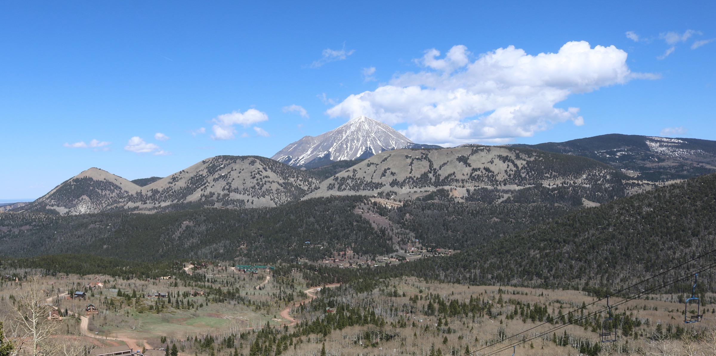
Above the switchbacks the route climbs the broad NE ridge on tundra with embedded stones. The gradient is moderate for most of the ascent, with only the upper 100 m steepening to a rockier finish; a short Class 3 step is present near the summit block on the strict NE Ridge line, but most parties avoid it by staying on the tundra south of the ridge crest. From the 4,120 m summit the view spans the San Luis Valley to the west, the Culebra Range to the south (Cuatro Peak, Leaning South Peak), and East and West Spanish Peaks to the north-east. Return is by the outbound route.
Blue Lake and Bear Lake campgrounds lie 1.5 km apart within the Cuchara Recreation Area, and both are standard bases for this ascent. FSR 436 branches from FSR 422 immediately above Blue Lake Campground and is a genuinely rough 4WD road; parties without capable vehicles typically walk it. Trinchera Peak is the northernmost 13er of the Culebra Range.
Why it is essential
Trinchera Peak is the highest accessible summit on the Cuchara side of the range and the essential high-altitude tundra hike of the region. It complements West Spanish Peak by providing a completely different summit character — open alpine tundra rather than syenite talus — and offers the range’s best summit-to-summit view of the two Spanish Peaks. It is the only 13er in the immediate area that is reasonably realistic as a day-hike without demanding technical terrain.
Equipment
- Sturdy boots for FSR 436 and the summit tundra and rock
- Trekking poles strongly recommended for the descent
- 3 L water per person minimum
- Extra warm layer — summit temperatures are frequently 15 °C colder than the campground, and strong wind is common
- Sun protection; there is no shade above treeline
- Microspikes may be useful for lingering snow on the summit face into early July
- Offline map and GPS backup; cell coverage is absent
Hazards and notes
- Afternoon lightning is a serious risk on the exposed summit and ridge — aim to be off the summit by noon during monsoon season (July to early September).
- The optional Class 3 step on the NE Ridge can be bypassed but the alternative is loose Class 2 terrain requiring careful line choice.
- FSR 436 is a genuine 4WD road; parties without capable vehicles must plan for the additional ~4 km one-way road walk.
- Blue Lake and Bear Lake day-use areas are fee sites for non-campers.
- Wilderness regulations do not apply on this route (the peak is outside the Spanish Peaks Wilderness), but Leave No Trace practice is expected.
- Dogs must be leashed or under voice control.
- Confirm current road status with the San Carlos Ranger District before departure.
5. Bear Lake–Blue Lake–Indian Creek Overlook
Snapshot
Itinerary
From the Blue Lake Day-use Area on FSR 422, the marked Blue and Bear Lake Loop threads through Engelmann spruce and aspen between the two small subalpine lakes, both stocked with trout and set beneath the cliff-walled slopes of the north Culebra Range. The short loop is about 2.3 km with modest elevation change and passes both lakes within an hour of walking; it is the standard family-friendly introduction to the area and to the recreation-area character of the Cuchara side.
For a fuller day, from the Bear Lake trailhead Indian Creek Trail #1300 (accessed from the Bear Lake day-use area, listed as the South Trailhead in USFS materials) climbs east through mixed conifer and open ridge for roughly 2 km to a high point with views across Cuchara Valley toward the old Cuchara Ski Area and the White Peaks. This spur adds approximately 4–5 km round trip and roughly 220 m of additional gain. Indian Creek Trail #1300 continues considerably further as part of the multi-day loop network with Baker Trail #1301 and Dodgeton Trail #1302, but the overlook makes a natural day-hike turnaround.
The full Indian Creek Trail #1300 is 21 km one-way with a 573 m gain from Bear Lake to the North Trailhead near La Veta; the day-hike overlook figures above represent an out-and-back to a viewpoint, not the full trail.
Why it is essential
This is the range’s essential short and accessible walk, and its cultural and recreational counterpart to the demanding summit and dike routes. The Blue Lake–Bear Lake loop introduces the Cuchara side’s subalpine lake character, and the Indian Creek spur brings the walker to a viewpoint over the historic Cuchara Ski Area (opened 1963, closed 2000, now the community-owned Cuchara Mountain Park) that anchors the valley’s twentieth-century history. Every visitor to the Cuchara side does at least the short loop; the extended overlook variant gives a genuine half-day option.
Equipment
- Trail shoes for the short loop; light boots for the extended spur
- 1.5 L water per person for the spur; less for the loop
- Sun protection at the overlook
- Weatherproof outer layer
- Warm mid-layer in shoulder seasons
- Insect repellent in July
- Bear-aware picnicking practice at the lakes
Hazards and notes
- Afternoon storms can develop rapidly in July and August.
- The lakes are heavily visited on summer weekends and parking may fill by mid-morning at Blue Lake.
- Day-use fees apply for non-campers at both Blue Lake and Bear Lake.
- Wilderness regulations do not apply here — the loop is within the Cuchara River Recreation Area, not the Spanish Peaks Wilderness.
- Dogs must be leashed or under voice control.
- The overlook spur is on a multi-use trail (Indian Creek #1300 is open to foot, horse, mountain bike, motorbike and ATV) — walkers should stay alert to motorised users, especially on summer weekends.
Routes excluded as out of scope
The following sit inside or adjacent to the Spanish Peaks catalogue but fall outside a day-hike entry, are too duplicative of the five above, or are better understood as overnight or technical trips.
- East Spanish Peak summit. The summit is off-trail through forest and blockfield from the Wahatoya area and is a distinct objective from the pass day; better as a standalone dedicated ascent than an add-on.
- Trinchera Peak eastern approaches. Longer eastern and southern approaches to Trinchera Peak from the North Fork or from Purgatoire drainages are technically feasible but far less efficient than the Blue Lake / FSR 436 line covered in entry 4.
- Devil’s Stairsteps standalone. The prominent set of parallel dikes on the Cuchara side is a striking drive-by feature but does not carry a maintained walking route of its own; better appreciated in combination with the Bear Lake–Blue Lake loop.
- Mount Baldy Cuchara. A shorter Cuchara-side summit above the old ski area, but editorially redundant with the Cuchara-side coverage already provided by entries 4 and 5.
- Cucharas Pass short walks. Several short interpretive walks off Highway 12 at Cucharas Pass make useful stops but fall below the day-hike threshold used in this catalogue.
- Apishapa Arch as a standalone stop. The CCC-cut tunnel is best treated as a drive-by en route to the Apishapa trailhead rather than as a walking objective in its own right — it is covered as part of entry 2.
Further reading
| Source | URL |
|---|---|
| USFS Pike-San Isabel NF — Spanish Peaks Wilderness | fs.usda.gov |
| USFS Pike-San Isabel NF — San Carlos Ranger District | fs.usda.gov |
| USFS Pike-San Isabel NF — West Peak Trail #1390 | fs.usda.gov |
| USFS Pike-San Isabel NF — Apishapa Trail #1324 | fs.usda.gov |
| USFS Pike-San Isabel NF — Wahatoya Trail #1304 | fs.usda.gov |
| USFS Pike-San Isabel NF — Blue Lake Campground | fs.usda.gov |
| USFS Pike-San Isabel NF — Highway of Legends | fs.usda.gov |
| La Veta Trails — Spanish Peaks Wilderness Area | lavetatrails.org |
| La Veta Trails — West Peak Trail #1390 | lavetatrails.org |
| La Veta Trails — Apishapa Trail #1324 | lavetatrails.org |
| La Veta Trails — Wahatoya Trail #1304 | lavetatrails.org |
| La Veta Trails — Indian Creek Trail #1300 | lavetatrails.org |
| Spanish Peaks Country — The Great Dikes | spanishpeakscountry.com |
| Spanish Peaks Country — Cordova Pass | spanishpeakscountry.com |
| Spanish Peaks Country — Trinchera Peak | spanishpeakscountry.com |
| 14ers.com — West Spanish Peak | 14ers.com |
| Colorado 13ers — West Spanish Peak SW Ridge | climb13ers.com |
| Colorado 13ers — Trinchera Peak NE Ridge | climb13ers.com |
| SummitPost — Trinchera Peak via FR 436 | summitpost.org |
| AllTrails — West Spanish Peak Trail | alltrails.com |
| AllTrails — Blue and Bear Lake Loop | alltrails.com |
| 5280 Magazine — Hike We Like: West Spanish Peak | 5280.com |
| Wikipedia — Spanish Peaks | en.wikipedia.org |
| Wikipedia — Spanish Peaks Wilderness | en.wikipedia.org |
| Wikipedia — West Spanish Peak | en.wikipedia.org |
| Wikipedia — East Spanish Peak | en.wikipedia.org |
| Wikipedia — Trinchera Peak | en.wikipedia.org |
| Wikimedia Commons — Category: Spanish Peaks | commons.wikimedia.org |
| Wikimedia Commons — Category: West Spanish Peak | commons.wikimedia.org |
| OpenStreetMap (ODbL 1.0) | openstreetmap.org |