Regional overview
The Uncompahgre Wilderness covers roughly 102,721 acres (416 km²) in the northern San Juan Mountains of south-western Colorado, jointly administered by the Grand Mesa, Uncompahgre and Gunnison (GMUG) National Forests. It is one of the highest and most concentrated alpine areas in the state — two of Colorado’s fifty-eight Fourteeners, Uncompahgre Peak (4,365 m / 14,321 ft) and Wetterhorn Peak (4,275 m / 14,021 ft), sit inside the wilderness, alongside the broad volcanic ridgelines of Wildhorse, Coxcomb and Redcloud’s northern outliers, the cliffs and pinnacles of Courthouse Mountain, and the wild upper drainages of the Cimarron River. Access is from Lake City to the south-east, Matterhorn Creek above the Henson Creek road, and the Cimarron corridors entered from the north over rough forest roads on the Ridgway / Cimarron side.
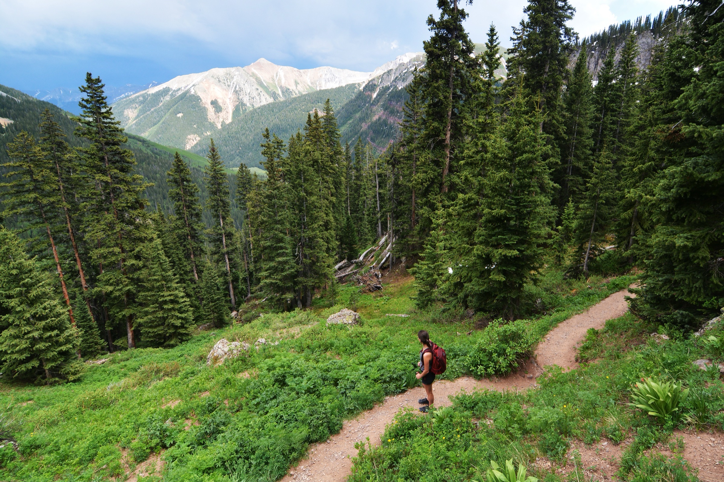
The hiking character is strenuous and high-altitude throughout. Every featured route in this entry tops out above 3,700 m (12,140 ft) and several finish well above 4,200 m (13,780 ft). Trailheads are reached by gravel forest roads that range from passenger-car drivable in dry conditions (lower Matterhorn Creek, West Fork Cimarron) to rough, steep, high-clearance / 4WD only (Nellie Creek above Lake City, the upper Henson Creek shelf, the inner Middle Fork). Several of the classic objectives involve sustained scrambling, route-finding on volcanic talus, or short sections of exposed Class-3 terrain — Wetterhorn Peak in particular is a scramble rather than a walk-up.
The walking season runs July to September, with August generally the most settled month. June can still hold deep snow on the north couloirs of Uncompahgre and Wetterhorn and on the upper Cimarron benches; the Forest Service explicitly lists July, August and September as the usual months for high-country wilderness visits. Mosquito pressure peaks in mid-July, eases by mid-August, and effectively ends with the first frosts. Afternoon monsoon thunderstorms are the single biggest summer hazard above treeline — gates of clear morning weather typically close by 12:00–13:00 from late July through August, and the alpine summits and basins offer no shelter. Lightning, rockfall, road washouts and rapidly developing weather are the dominant planning constraints.
Designated wilderness rules apply throughout. Mechanised travel including bicycles, e-bikes and drones is prohibited; group-size limits, dispersed-camping setbacks and stock regulations are posted at every major trailhead. Mobile signal is absent or unreliable across most of the wilderness — carry an offline map, paper backup and a hard plan shared with someone outside the area. For the wider San Juan context, see the companion entries on the Weminuche Wilderness day-hikes (the Needles, Grenadiers and Chicago Basin to the south) and the Ouray, Silverton and Telluride day-hikes (Mount Sneffels, Ice Lake Basin and the Million Dollar Highway country immediately west).
Selection rationale
Five day-hikes are presented, balancing the wilderness’s two iconic Fourteener summits, its two great Cimarron-side basin walks, and one short but distinctively scenic non-Fourteener objective. Uncompahgre Peak via Nellie Creek Road and Wetterhorn Peak via the Ridge Stock Driveway Trail are the canonical high-summit days from the Lake City and Matterhorn Creek sides. Wetterhorn Basin via the West Fork Trail offers the alpine basin under the same Wetterhorn–Coxcomb skyline without the exposed scrambling. Middle Fork Cimarron River carries a quieter Cimarron-side valley day with water, forest and high meadows. West Fork to Courthouse Mountain closes the set with a short, steep, photogenic volcanic summit at the wilderness boundary.
Wetterhorn Peak is included despite exposed Class-3 scrambling near the summit because it is one of the defining Uncompahgre Wilderness objectives; the technical seriousness is marked clearly in the snapshot and the equipment notes. Distance, ascent and elevation figures for each route are taken from AllTrails source maps and the official Forest Service trail listings on the GMUG Uncompahgre Wilderness page; verification status is flagged per hike where a direct GPX or current Forest Service trail-detail page is unresolved. Multi-day backpacks, road-based 4WD trips and approach scrambles of Wildhorse, Coxcomb and Redcliff are out of scope as day-hikes.
Summary
| # | Hike | Trailhead | Route type | Distance | Gain | Max elevation | Difficulty |
|---|---|---|---|---|---|---|---|
| 1 | Uncompahgre Peak via Nellie Creek Road | Nellie Creek 4WD trailhead | Out-and-back | 12.1 km | 878 m | 4,362 m | Hard |
| 2 | Wetterhorn Peak via Ridge Stock Driveway Trail | Matterhorn Creek | Out-and-back | 15.0 km | 1,105 m | 4,272 m | Very hard, exposed Class 3 |
| 3 | Wetterhorn Basin via West Fork Trail | West Fork Cimarron | Out-and-back | 16.1 km | 876 m | 3,814 m | Hard |
| 4 | Middle Fork Cimarron River | Middle Fork trailhead | Out-and-back | 16.7 km | 698 m | 3,745 m | Hard |
| 5 | West Fork to Courthouse Mountain | West Fork Cimarron | Out-and-back | 5.5 km | 526 m | 3,700 m | Hard (steep) |
1. Uncompahgre Peak via Nellie Creek Road
Snapshot
Itinerary
From the Nellie Creek 4WD trailhead the trail climbs gently through subalpine spruce-fir into the open alpine basin south-west of the peak, where the volcanic shoulders of Uncompahgre become visible end-on. The route swings around the west and north-west flanks of the summit block, then turns up the loose tundra-and-talus slope to a short scrambling step in the upper gully — the only section that demands hands and care. From there the broad summit plateau leads in a few hundred metres to the high point. AllTrails records 12.1 km out-and-back with 878 m of gain and the summit at the canonical Fourteener elevation. Return is by the same route — the gully step is the crux on descent in either direction.
Why it is essential
Uncompahgre Peak is the highest summit in the San Juan Mountains and the signature objective of the wilderness. Its broad volcanic prow is visible from across the northern San Juans and from much of the Cimarron country to the north, and the route is the most accessible Fourteener day in the wilderness — non-technical in dry conditions, with one of the longest summit-plateau views in Colorado.
Equipment
- Sturdy mountain footwear with grippy soles
- Waterproof shell and warm insulation layer
- Gloves and hat (the summit plateau is exposed even in August)
- Sun protection — sunscreen, lip balm, brimmed hat or buff, UV sunglasses
- 2+ litres of water (no reliable refill above the trailhead)
- Food for the full day plus reserves
- Offline map / GPS and a paper backup
- Headlamp (dawn-start days finish late if the gully is wet)
- Trekking poles for the talus descent
Hazards and notes
- Afternoon thunderstorms — turn around by 11:00–12:00 if the morning sky is unstable.
- The upper gully step is straightforward when dry but icy or snow-loaded into July in heavier years; this changes the difficulty significantly.
- Road access is the crux — Nellie Creek Road above Henson Creek washes out periodically; check current conditions with the Lake City Forest Service desk before committing to the upper drive.
- Altitude — sleep at Lake City (2,650 m) for at least one night before attempting the summit; symptoms above 4,000 m can escalate quickly.
- Camp where designated, pack out everything including human waste from the upper basin in line with current WAG-bag norms above treeline.
2. Wetterhorn Peak via Ridge Stock Driveway Trail
Snapshot
Itinerary
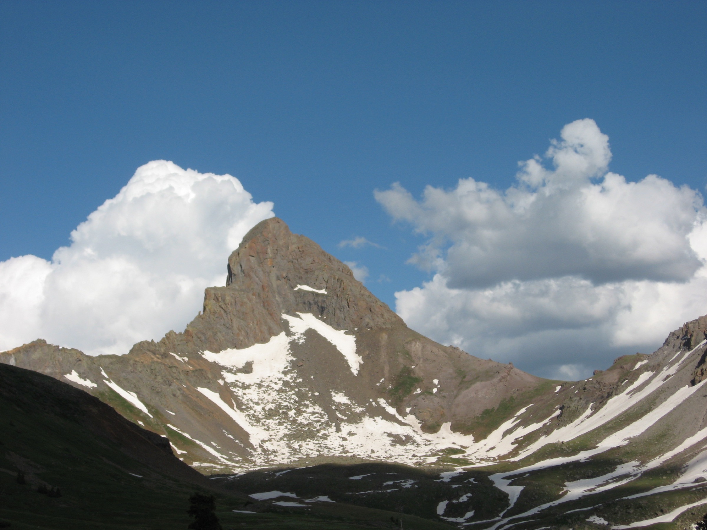
The Matterhorn Creek approach climbs through old spruce-fir into a long open basin under the linked Matterhorn–Wetterhorn skyline. The Ridge Stock Driveway Trail #233 contours west across the basin, then turns up to the saddle south-east of Wetterhorn before traversing onto the south-west ridge. The walking ends at the base of the Yellow Dirt Couloir below the summit pyramid. From there the route is no longer ordinary hiking: a short, loose scramble in the couloir gives way to a 30–50 m exposed Class-3 step known as the “Ship’s Prow”, traversed on the south side, with sustained exposure off the east face. AllTrails records 15.0 km out-and-back with 1,105 m of gain and the summit at the canonical Fourteener elevation.
Why it is essential
Wetterhorn is one of the great San Juan Fourteeners — a sharp, instantly recognisable horn that anchors the northern wilderness skyline from Uncompahgre Peak, Wildhorse and the Cimarron benches. The route is a defining Uncompahgre Wilderness objective and one of Colorado’s classic Class-3 Fourteeners, but it should be treated as a scramble, not a walk-up: helmets, fair-weather windows and honest self-assessment matter more than fitness alone.
Equipment
- Sturdy approach footwear with sticky soles
- Helmet — strongly recommended for the upper mountain (rockfall + scrambling)
- Light gloves for hand-holds on cold rock
- Waterproof shell and insulation
- Sun protection
- 2.5+ litres of water
- Food for the full day plus reserves
- Offline map / GPS, paper backup
- Headlamp
- Trekking poles for the long approach (stow on the scramble)
Hazards and notes
- Do not attempt the summit block in snow, ice, wet rock, building thunderstorms or if uncomfortable with exposure — the consequences of a slip from the Ship’s Prow are severe.
- Rockfall in the Yellow Dirt Couloir is significant on busy weekends; helmet up below the couloir, space yourself from parties above and below.
- Lightning — get off the summit ridge by 12:00 in monsoon season; this generally means a 03:00–04:00 start from the trailhead.
- Altitude — acclimatise as for Uncompahgre Peak; the final scramble is unforgiving of bad decision-making at altitude.
- Not a recommended first or solo Fourteener for hikers without prior Class-3 experience on exposed terrain.
3. Wetterhorn Basin via West Fork Trail
Snapshot
Itinerary
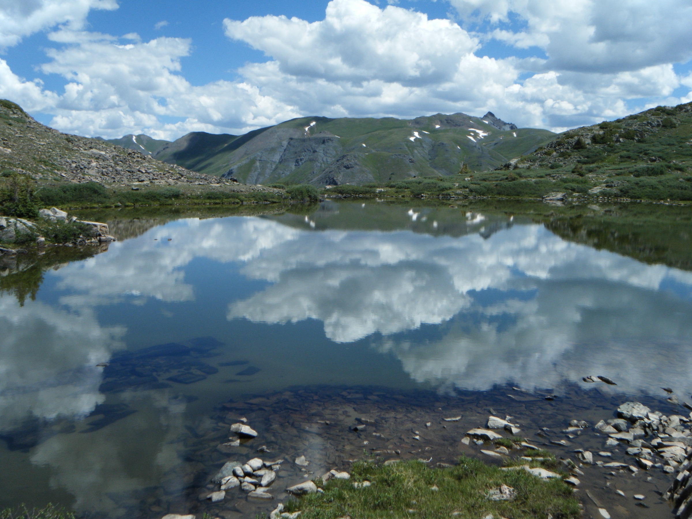
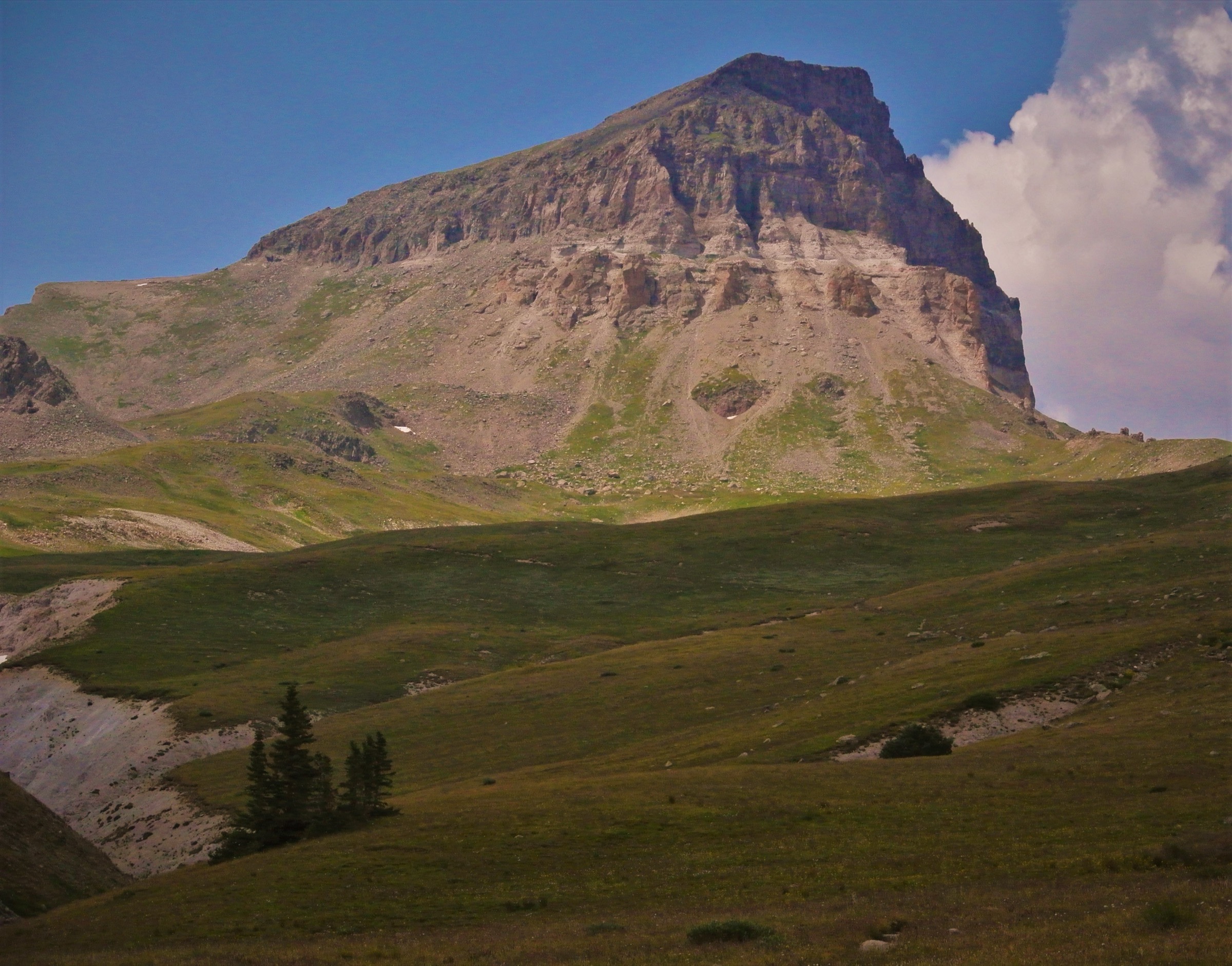
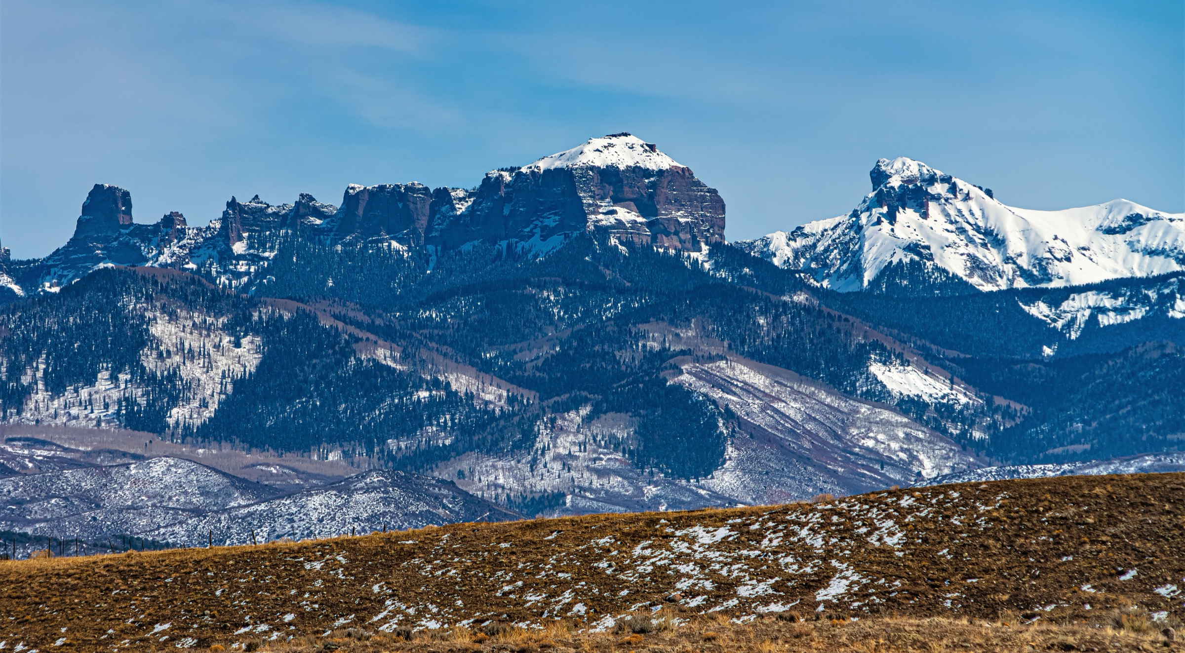
The West Fork Trail leaves the Cimarron-side trailhead and climbs gently through aspen and mixed conifer, with the cliff line of Coxcomb Peak rising on the right almost from the first kilometre. Above treeline the trail opens into a broad alpine valley with seasonal wildflower meadows, intermittent stream crossings and long views back down the West Fork. Beyond a steeper benched section the route enters the upper Wetterhorn Basin itself — a glacial cirque under the Wetterhorn–Coxcomb–Redcliff skyline that gives the wilderness its most-photographed amphitheatre. The turnaround used here is the upper-basin objective at ~3,814 m before the steeper continuation toward the saddle. AllTrails records 16.1 km out-and-back with 876 m of gain.
Why it is essential
Wetterhorn Basin gives the full Uncompahgre Wilderness experience — alpine valley, wildflowers, waterfalls, mountain wildlife, and the great Wetterhorn–Coxcomb skyline overhead — without the exposed Class-3 summit of Wetterhorn Peak. It is the canonical Cimarron-side day-hike: long, scenic, demanding in distance and altitude but never technical.
Equipment
- Mountain footwear with grippy soles
- Waterproof shell and insulation
- Sun protection
- 2+ litres of water and treatment for refills
- Food for a long day
- Offline map / GPS, paper backup
- Headlamp
- Trekking poles
- Insect repellent in July and early August
Hazards and notes
- Afternoon thunderstorms develop fast over the basin headwall; the upper meadows offer no shelter.
- Stream crossings are routine but can run high in early July; check before committing in a heavy snow year.
- Bear and elk country — store food and scented items appropriately, especially on overnight extensions.
- Limited or no mobile signal; treat the basin as fully self-rescue terrain.
- Rough access road (FSR 860) — confirm with the Ouray Ranger District before driving in, especially after summer storms.
4. Middle Fork Cimarron River
Snapshot
Itinerary
Middle Fork Trail #227 follows the Middle Fork Cimarron drainage into a quieter section of the wilderness — denser conifer forest, more stream-edge walking and fewer parties than either the Lake City Fourteener trails or the West Fork basin. The trail climbs gradually for several kilometres, opens into intermittent meadows with views up to the central wilderness skyline, and continues toward the upper valley head. AllTrails records 16.7 km out-and-back with 698 m of gain and a maximum elevation of 3,745 m. The Forest Service identifies Middle Fork #227 as an official trail access into the Uncompahgre Wilderness.
Why it is essential
The Middle Fork adds a less summit-focused, more valley-focused wilderness day to the catalogue. It is the route to take when the Fourteeners are storm-bound, when the West Fork basin is full, or when the priority is forest, water and quiet rather than alpine cirque scenery. It represents the wilder, less-trafficked Cimarron face of the wilderness.
Equipment
- Mountain footwear with grippy soles
- Waterproof shell and warm layer
- Sun protection
- 2+ litres of water and treatment
- Food for a long day
- Offline map / GPS, paper backup
- Headlamp
- Trekking poles
- Insect repellent in July
Hazards and notes
- Rough access to the Middle Fork trailhead — confirm road and trailhead status with the GMUG Ouray Ranger District before driving in.
- Deadfall and muddy stretches are common in lower-traffic seasons.
- Storms build quickly even over the lower forested mileage; the upper valley offers no shelter.
- Treat all surface water before drinking — beaver and grazing presence throughout the drainage.
- Remote feel — limited or no mobile signal; longer self-rescue times than the Lake City-side trails.
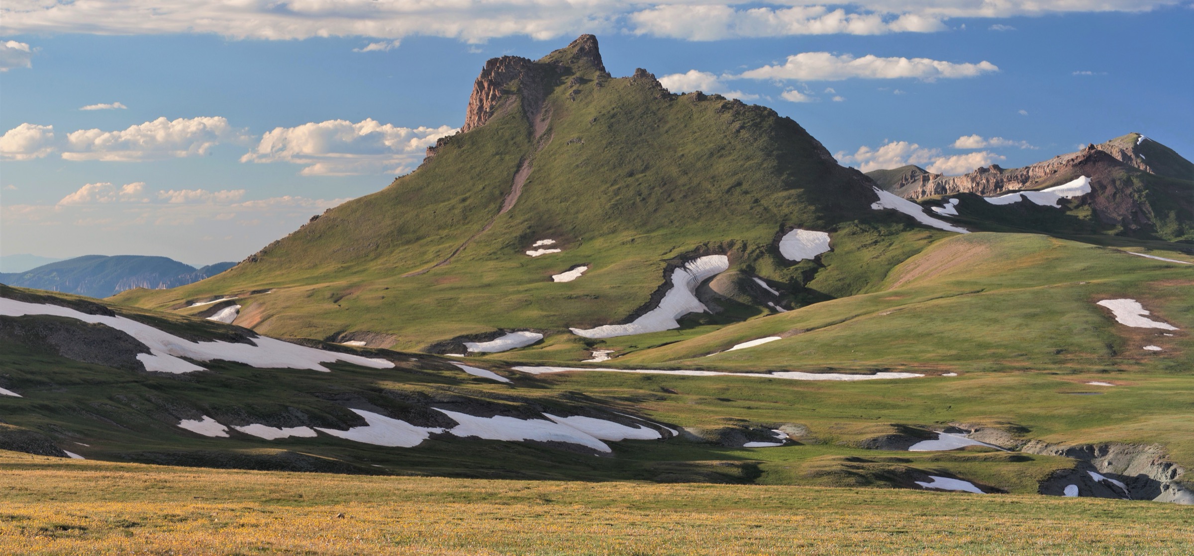
5. West Fork to Courthouse Mountain
Snapshot
Itinerary
The trail climbs steeply from the West Fork / Courthouse access through dark spruce-fir, then breaks out onto the open south slopes of the Courthouse block. The grade is sustained — Courthouse gives 526 m of ascent in just 2.75 km of climbing — and the upper section crosses loose volcanic talus and grass benches under the cliff line. The summit plateau gives long views down the Cimarron, west to Mount Sneffels and south to the high Uncompahgre Wilderness interior. AllTrails records 5.5 km out-and-back with 526 m of gain and a maximum elevation of 3,700 m.
Why it is essential
Courthouse is the compact scenic counterpoint to the longer Fourteener and basin days — shorter, sharper, and visually tied to the Chimney Rock / Precipice Peak skyline that defines the northern wilderness edge. It is one of the most recognisable non-Fourteener summits in the Uncompahgre hiking area and gives the cleanest panorama of the Cimarron country from a half-day effort.
Equipment
- Mountain footwear with grippy soles
- Waterproof shell and warm layer
- Sun protection
- 1.5–2 litres of water
- Snack and lunch
- Offline map / GPS, paper backup
- Trekking poles for the steep descent
- Headlamp (in case of late finish)
Hazards and notes
- Loose volcanic rock on the upper slopes — careful footing required, especially on descent.
- Lightning exposure on the summit plateau — turn around early if storms build, this is not a peak to linger on.
- Snow patches can persist on the upper north-facing benches into mid-July in heavier years.
- Route-finding near the upper viewpoint requires attention; the cairned line is easy to lose in low cloud.
- Short distance does not mean easy day — treat as a high-altitude mountain objective, not a stroll.
Routes excluded as out of scope
The following sit inside or adjacent to the Uncompahgre Wilderness but fall outside this day-hike entry, or duplicate routes covered in companion San Juan articles.
- Wildhorse, Coxcomb and Redcliff Peak summit days. Long approaches with sustained Class-3 or harder scrambling; better treated as scrambling-skills objectives than as day hikes.
- El Paso Creek / East Fork Cimarron approaches. Predominantly backpacking access for combined-summit expeditions or stock-supported trips.
- Bear Creek / American Flats traverse. A high traverse better done as a thru-hike or backpack from Engineer Pass; not a clean day from a single trailhead.
- Owl Creek Pass scenic drive. A 4WD scenic road through the same skyline; out of scope as a non-hiking route.
- Mount Sneffels, Blue Lakes and Ice Lake Basin. Adjacent to the west in the Mount Sneffels Wilderness — see the Ouray, Silverton and Telluride day-hikes entry.
- Chicago Basin, the Needle Mountains and Highland Mary Lakes. Covered in the Weminuche Wilderness day-hikes entry to the south.
Further reading
| Source | URL |
|---|---|
| US Forest Service — Uncompahgre Wilderness (GMUG) | fs.usda.gov |
| US Forest Service — Middle Fork Trail #227 | fs.usda.gov |
| US Forest Service — GMUG National Forests | fs.usda.gov |
| Wikipedia — Uncompahgre Wilderness | en.wikipedia.org |
| Wikipedia — Uncompahgre Peak | en.wikipedia.org |
| Wikipedia — Wetterhorn Peak (Colorado) | en.wikipedia.org |
| Wikipedia — Courthouse Mountain | en.wikipedia.org |
| Wikipedia — Cimarron River (Colorado) | en.wikipedia.org |
| AllTrails — Uncompahgre Peak via Nellie Creek Road | alltrails.com |
| AllTrails — Wetterhorn Peak via Ridge Stock Driveway Trail | alltrails.com |
| AllTrails — Wetterhorn Basin via West Fork Trail | alltrails.com |
| AllTrails — Middle Fork Cimarron River | alltrails.com |
| AllTrails — West Fork to Courthouse Mountain | alltrails.com |
| 14ers.com — Uncompahgre Peak | 14ers.com |
| 14ers.com — Wetterhorn Peak | 14ers.com |