Regional overview
The Ouray / Silverton / Telluride triangle is one of the most concentrated high-mountain hiking areas in the Colorado San Juans. It combines mining towns, 4WD roads, glacial basins, turquoise alpine lakes, waterfall walks, and sharp volcanic peaks around the Million Dollar Highway, South Mineral Creek, Ophir Pass, Telluride’s Bear Creek, and the Mount Sneffels side of the range.
The walking character is steep and high. Even moderate-length routes often start above 2,600 m and climb rapidly into exposed alpine basins. July through September is the core season for the highest lake routes; June can still involve snow, avalanche debris, wet crossings, or closed roads, while autumn brings shorter days and early storms. Afternoon thunderstorms are a major summer hazard. Trailheads near town are easier to reach, but several of the classic basins have limited parking and heavy peak-season pressure. The wilder San Juan interior east of Silverton — including the Needle and Grenadier mountains and Chicago Basin — is covered separately in the Weminuche Wilderness day-hikes entry.
Selection rationale
The five hikes balance the region’s iconic alpine lakes (Ice Lake Basin, Blue Lakes, Columbine Lake), one essential Telluride waterfall walk (Bear Creek Falls), and the classic Ouray town-circling route (Ouray Perimeter Trail). Mount Sneffels summit routes are excluded because the standard summit routes are more scrambling-oriented than ordinary day hiking; Blue Lakes gives the Mount Sneffels Wilderness experience without requiring a class-3 summit.
Summary table
| # | Hike | Country | Route type | Distance | Gain | Max elevation | Difficulty |
|---|---|---|---|---|---|---|---|
| 1 | Ice Lake Basin Trail | USA | Out-and-back | 13.8 km | 875 m | 3,839 m | Hard |
| 2 | Lower, Middle and Upper Blue Lakes | USA | Out-and-back | 13.8 km | 769 m | 3,585 m | Hard |
| 3 | Columbine Lake Trail #509 | USA | Out-and-back | 11.1 km | 775 m | 3,874 m | Hard |
| 4 | Bear Creek Falls via Bear Creek Trail | USA | Out-and-back | 7.6 km | 334 m | 3,022 m | Moderate |
| 5 | Ouray Perimeter Trail | USA | Loop | 9.0 km | 454 m | 2,590 m | Moderate |
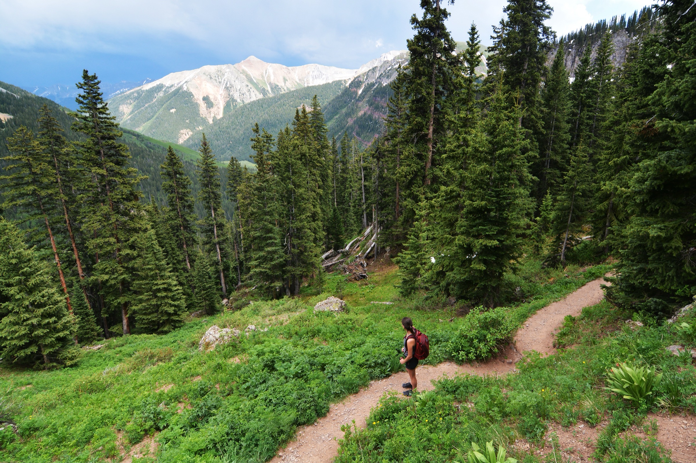
1. Ice Lake Basin Trail
Snapshot
Itinerary
The trail starts near South Mineral Campground and climbs steeply through forest, aspen, and conifer zones into lower and upper Ice Lake Basin. The Forest Service identifies Ice Lake Trail #505 as a heavily used route that climbs almost 3,000 ft in 3.75 miles one way, with the upper basin exposed above timberline. AllTrails records a longer 13.8 km out-and-back route with 875 m of gain, reflecting the common basin objective and route variants. The basin can be extended toward Island Lake or Fuller Lake, but this entry treats Ice Lake Basin itself as the essential day-hike target.
Why it is essential
Ice Lake Basin is one of the signature alpine-lake hikes of the San Juan Mountains: turquoise water, bright mineral colours, waterfalls, wildflower meadows, and a cirque of high volcanic summits.
Equipment
Mountain hiking equipment: waterproof shell, warm layers, sun protection, water treatment, food, offline map/GPS, and trekking poles.
Hazards and notes
The Forest Service notes post-2020 Ice Fire hazards such as snags and loose material during rain or wind. Above timberline there is little shelter from lightning, hail, or fast weather changes. Plan to be off exposed ground by early afternoon.
GPX / KML links
| Source | URL | Format / access | Reuse status |
|---|---|---|---|
| AllTrails — Ice Lake Basin Trail | alltrails.com | Interactive source map | AllTrails terms; GPX reuse not verified; source/check only |
| Forest Service — Ice Lake Trail | fs.usda.gov | Official trail page | No GPX file; official context and access source |
Further reading
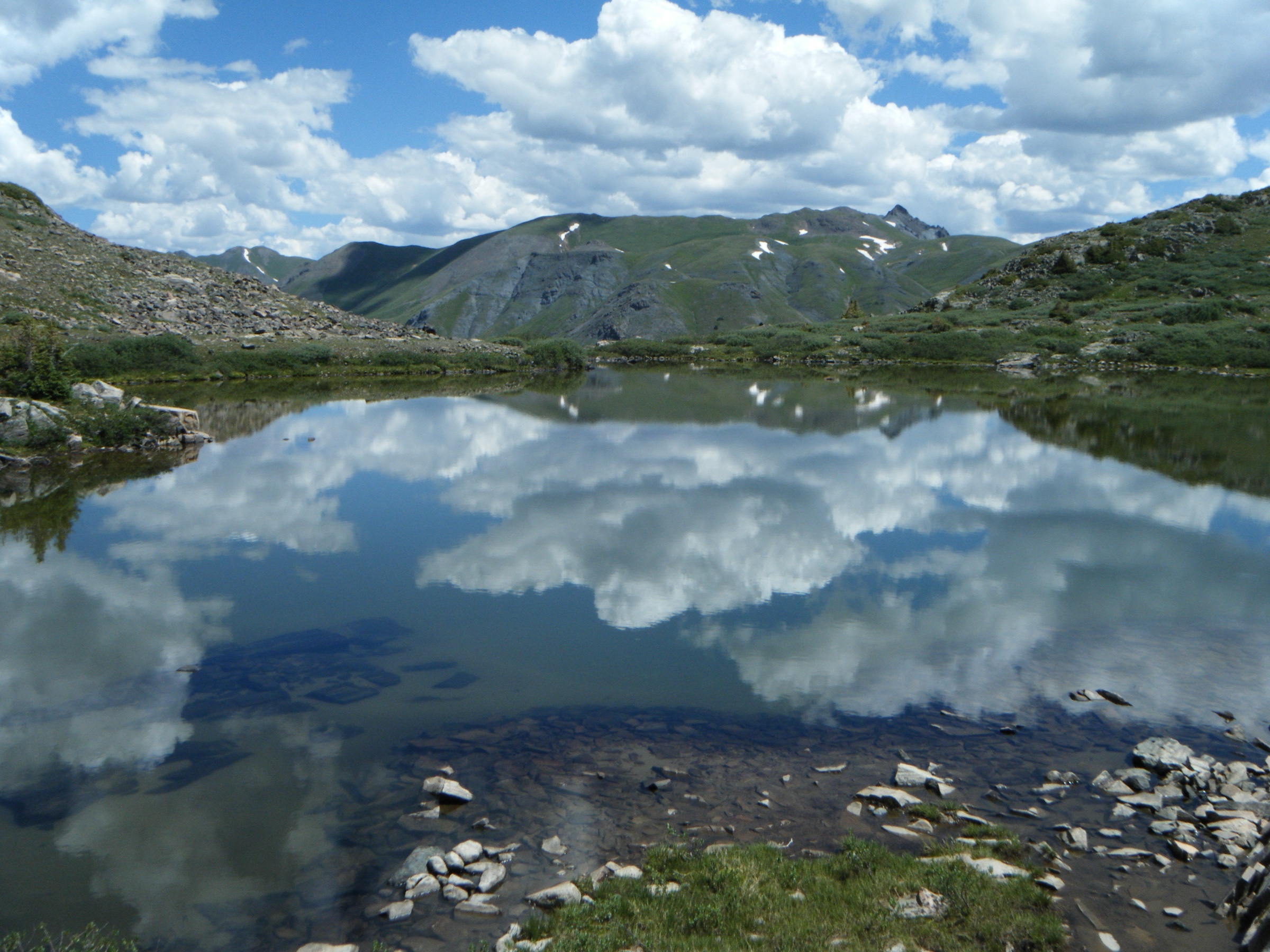
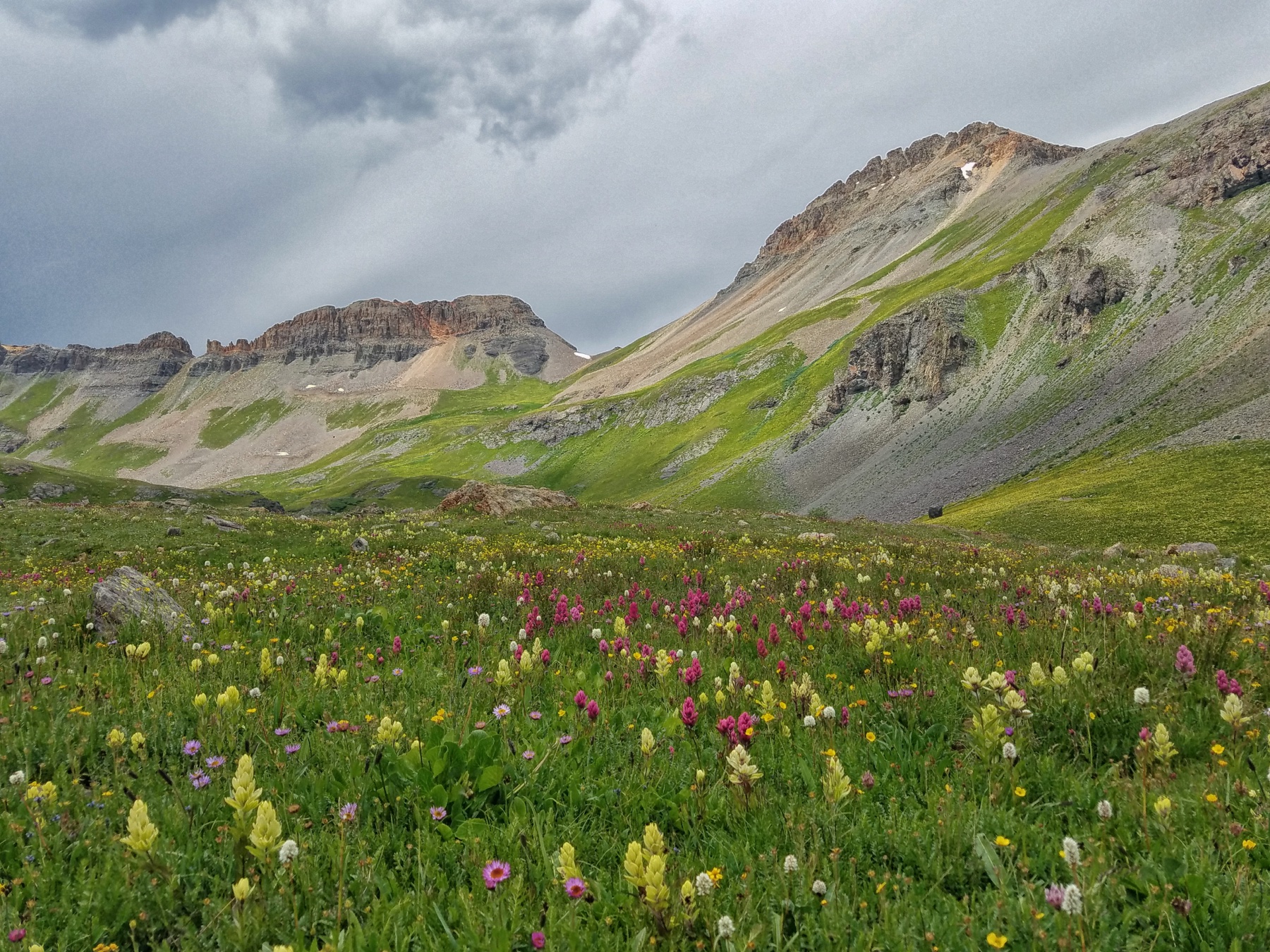
2. Lower, Middle and Upper Blue Lakes via Blue Lakes Trail
Snapshot
Itinerary
The Blue Lakes Trail climbs from the East Dallas Creek drainage into the Mount Sneffels Wilderness, passing Lower Blue Lake before continuing toward Middle and Upper Blue Lakes below the Mount Sneffels massif. AllTrails records 13.8 km out-and-back with 769 m of ascent.
This is a high-demand, fragile alpine basin. AllTrails currently points hikers to Forest Service GMUG alerts and notices for East Dallas Creek / Blue Lakes restrictions, including restoration areas, camping limits, human-waste packing rules, bear-resistant food storage, and no-campfire restrictions. Day hikers should still check those notices because restoration closures can affect where people may travel or stop if plans change.
Why it is essential
Blue Lakes is the classic non-summit Mount Sneffels Wilderness hike: blue-green lake basins, wildflowers, and big views toward one of Colorado’s most photographed fourteeners.
Equipment
Mountain hiking equipment: full day kit with water treatment, sun protection, rain shell, warm layer, map/GPS, and trekking poles.
Hazards and notes
The route is exposed to thunderstorms above treeline. Stay out of restoration areas, use durable surfaces, and do not camp at Middle or Upper Blue Lakes if converting the trip to an overnight without confirming current rules.
GPX / KML links
| Source | URL | Format / access | Reuse status |
|---|---|---|---|
| AllTrails — Lower, Middle and Upper Blue Lakes | alltrails.com | Interactive source map | AllTrails terms; GPX reuse not verified; source/check only |
| Forest Service GMUG alerts and notices | fs.usda.gov | Official current alerts / restrictions | Rule-checking source only |
Further reading
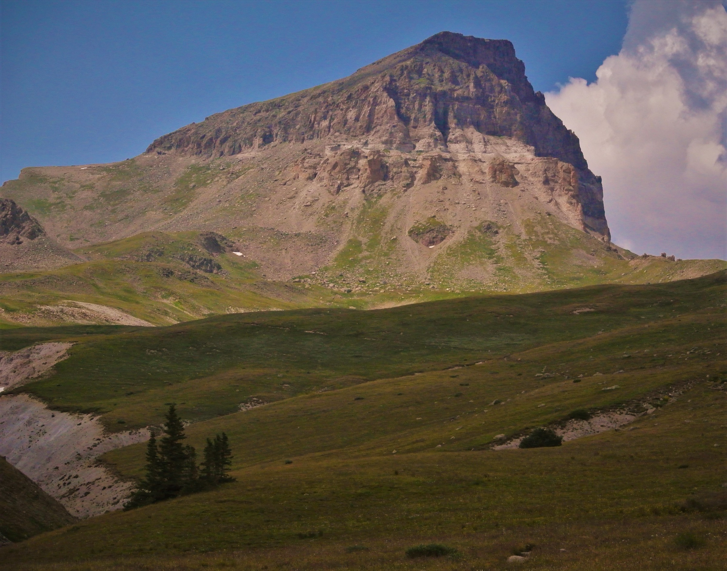
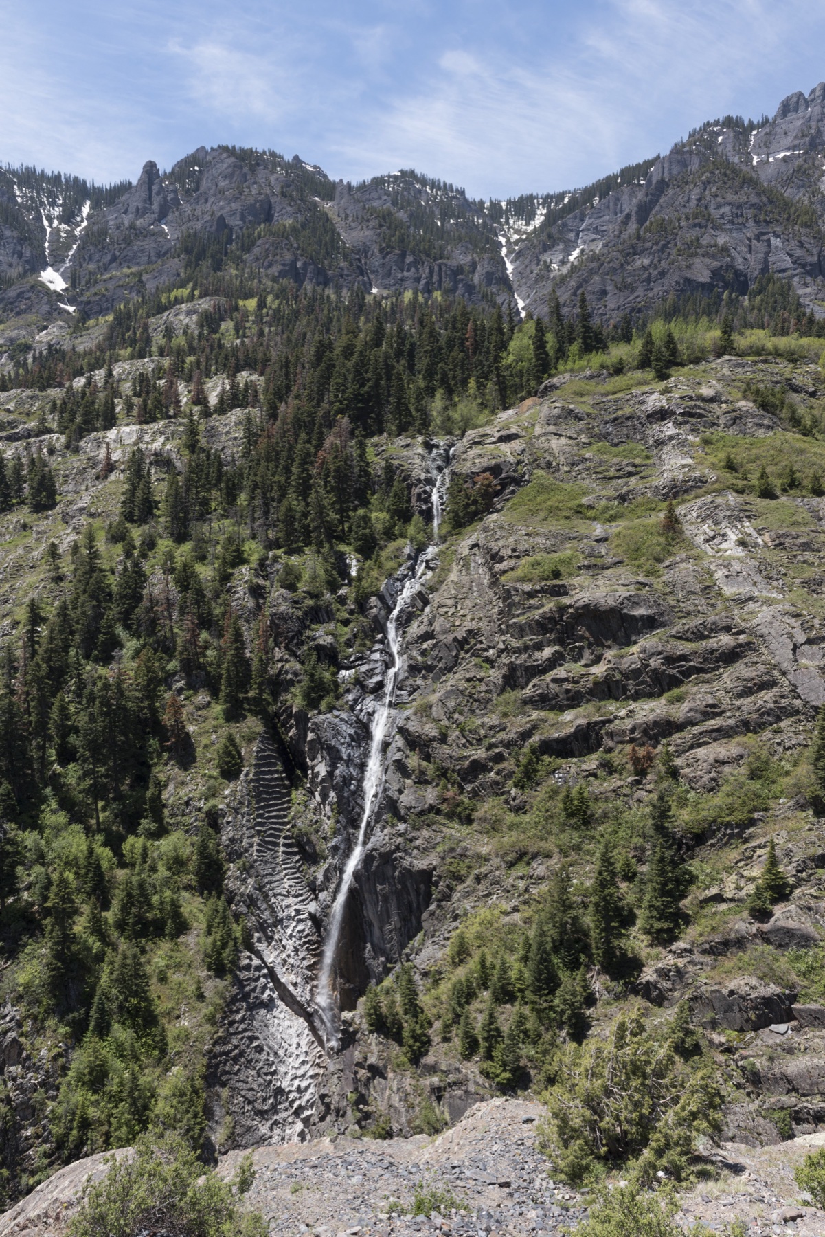
3. Columbine Lake Trail #509
Snapshot
Itinerary
Columbine Lake Trail #509 starts steeply with numerous switchbacks, then eases into the basin below the lake before reaching the high alpine lake itself. The Forest Service describes the trail as steep and strenuous, with scarce water on the ascent but water at the lake and creek, and lists a one-way distance of 3.2 miles. AllTrails records 11.1 km out-and-back with 775 m of gain.
Why it is essential
Columbine Lake is one of the finest high alpine lake hikes near Silverton and Ophir: shorter than Ice Lake but steeper and more direct, with a classic turquoise lake in a fragile tundra basin.
Equipment
Mountain hiking equipment: full alpine day kit with water treatment, rain shell, warm insulation, sun protection, map/GPS, and trekking poles.
Hazards and notes
The basin is fragile; avoid shortcutting switchbacks and stay off wet tundra. The Forest Service notes that only experienced mountaineers should climb surrounding peaks.
GPX / KML links
| Source | URL | Format / access | Reuse status |
|---|---|---|---|
| AllTrails — Columbine Lake Trail #509 | alltrails.com | Interactive source map | AllTrails terms; GPX reuse not verified; source/check only |
| Forest Service — Columbine Lake Trail | fs.usda.gov | Official trail page | No GPX file; official context and access source |
Further reading
4. Bear Creek Falls via Bear Creek Trail
Snapshot
Itinerary
From downtown Telluride, the trail climbs south up Bear Creek through forested open space toward Bear Creek Falls. AllTrails records a 7.6 km out-and-back route with 334 m of gain. The route is popular, direct, and much less logistically complicated than the high lake routes near Silverton and Ouray.
Why it is essential
Bear Creek Falls is Telluride’s classic on-foot-from-town hike. It represents the Telluride side of the region: steep canyon walls, waterfall scenery, aspen and conifer forest, and immediate access from a historic mountain town.
Equipment
Standard hiking equipment: hiking shoes, water, sun/rain layers, and traction in icy conditions.
Hazards and notes
The trail can be crowded. Winter and shoulder-season ice can make even this moderate route slippery. Dogs are commonly reported as allowed on leash; verify current local rules.
GPX / KML links
| Source | URL | Format / access | Reuse status |
|---|---|---|---|
| AllTrails — Bear Creek Falls via Bear Creek Trail | alltrails.com | Interactive source map | AllTrails terms; GPX reuse not verified; source/check only |
Further reading
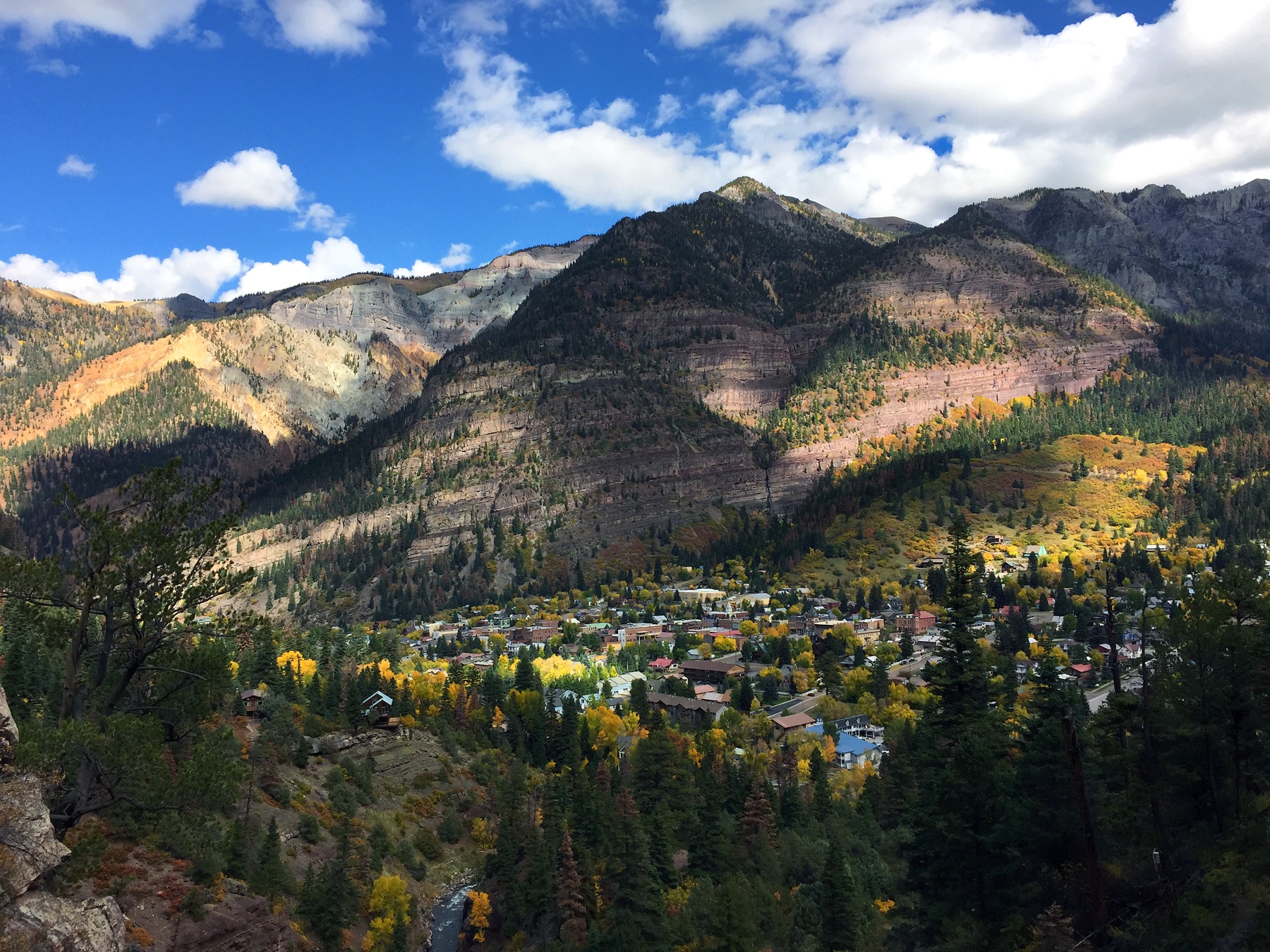
5. Ouray Perimeter Trail
Snapshot
Itinerary
The Ouray Perimeter Trail makes a rugged loop around the town, linking viewpoints, historic traces, drainages, bridges, and access points above the valley. AllTrails records 9.0 km with 454 m of gain. The route is not just a sidewalk stroll: it includes rocky, narrow, and potentially slippery sections above town.
Why it is essential
The defining Ouray walk: a compact circuit around one of the San Juans’ most dramatic historic towns, with constant views into the amphitheatre of peaks and the Uncompahgre Gorge.
Equipment
Standard hiking equipment: grippy shoes, water, sun/rain layers, and traction in icy periods.
Hazards and notes
The trail has multiple access points, so route-finding through town segments matters. Stay on the signed perimeter route and respect private property.
GPX / KML links
| Source | URL | Format / access | Reuse status |
|---|---|---|---|
| AllTrails — Ouray Perimeter Trail | alltrails.com | Interactive source map | AllTrails terms; GPX reuse not verified; source/check only |
Further reading
Missing data / follow-up work
- Direct official GPX/KML downloads were not found for these hikes in this pass.
- Blue Lakes has current-use and restoration restrictions; confirm the latest Forest Service GMUG notices before publication.
- The official Blue Lakes trail page, Bear Creek Preserve page, and Ouray Perimeter local trail page were not cleanly retrievable in this pass; the entries therefore mark those official details as unresolved where appropriate.
- Route-specific licence-compatible photos remain unresolved for Blue Lakes, Columbine Lake, and the Ouray Perimeter Trail; contextual range / town photos have been used in their place.
Further reading
| Resource | Link |
|---|---|
| Forest Service — San Juan National Forest recreation | fs.usda.gov |
| Forest Service — Ice Lake Trail | fs.usda.gov |
| Forest Service — Columbine Lake Trail | fs.usda.gov |
| Forest Service — GMUG alerts and notices | fs.usda.gov |
| AllTrails — Ice Lake Basin Trail | alltrails.com |
| AllTrails — Lower, Middle and Upper Blue Lakes | alltrails.com |
| AllTrails — Columbine Lake Trail #509 | alltrails.com |
| AllTrails — Bear Creek Falls via Bear Creek Trail | alltrails.com |
| AllTrails — Ouray Perimeter Trail | alltrails.com |