Regional overview
The Taurus Mountains form the long southern mountain wall of Turkey, running behind the Mediterranean coast and rising inland into the high limestone and volcanic country of the Aladaglar. For day hikers, the most practical catalogue core is split between two different Taurus characters: the sea-facing Lycian coast, where waymarked paths climb through pine forest, ancient sites, and limestone ridges above bays, and the Central Taurus, where Aladaglar valleys give a more alpine, colder, and less waymarked experience.
The Lycian Way is the region’s best documented walking spine. Culture Routes Society describes it as Turkey’s first long-distance walking route, a 760 km waymarked coastal path from the Fethiye area to the Antalya side, using Roman roads, old footpaths, and mule tracks between coast and mountains. The Aladaglar National Park source from GoTurkiye verifies the Central Taurus setting, high 3,000 m-plus peaks, strong day-night temperature swings, and a main walking season of June to September.
Selection rationale
The five hikes below balance the Taurus’ most publishable day-hiking identities: the celebrated Ovacik-Faralya opening stage above Oludeniz, the Chimaera/Yanartas cultural loop, the Adrasan-Cirali coastal mountain traverse, the Cirali-Beycik climb towards the Tahtali Dagi forests, and a Central Taurus Aladaglar valley candidate around Cimbar and Demirkazik. The first four have source-map statistics from AllTrails; the Aladaglar route remains a candidate because public GPX-grade data was not confirmed in this pass.
Summary table
| # | Hike | Country | Route type | Distance | Gain | Max elevation | Difficulty |
|---|---|---|---|---|---|---|---|
| 1 | Lycian Way: Ovacik to Faralya | Turkey | Point to point | 12.7 km | 615 m | Not resolved | Moderate |
| 2 | Lycian Way: Chimaera Circuit | Turkey | Loop | 18.8 km | 583 m | Not resolved | Hard |
| 3 | Lycian Way: Adrasan to Cirali | Turkey | Point to point | 15.9 km | 795 m | Not resolved | Hard |
| 4 | Lycian Way: Cirali to Beycik | Turkey | Point to point | 17.1 km | 1,138 m | Not resolved | Hard |
| 5 | Cimbar Valley from Demirkazik | Turkey | Out and back / valley variant | 6-12 km candidate variants | Not resolved | Valley below 3,000 m peaks | Moderate-hard |
1. Lycian Way: Ovacik to Faralya
Snapshot
Itinerary
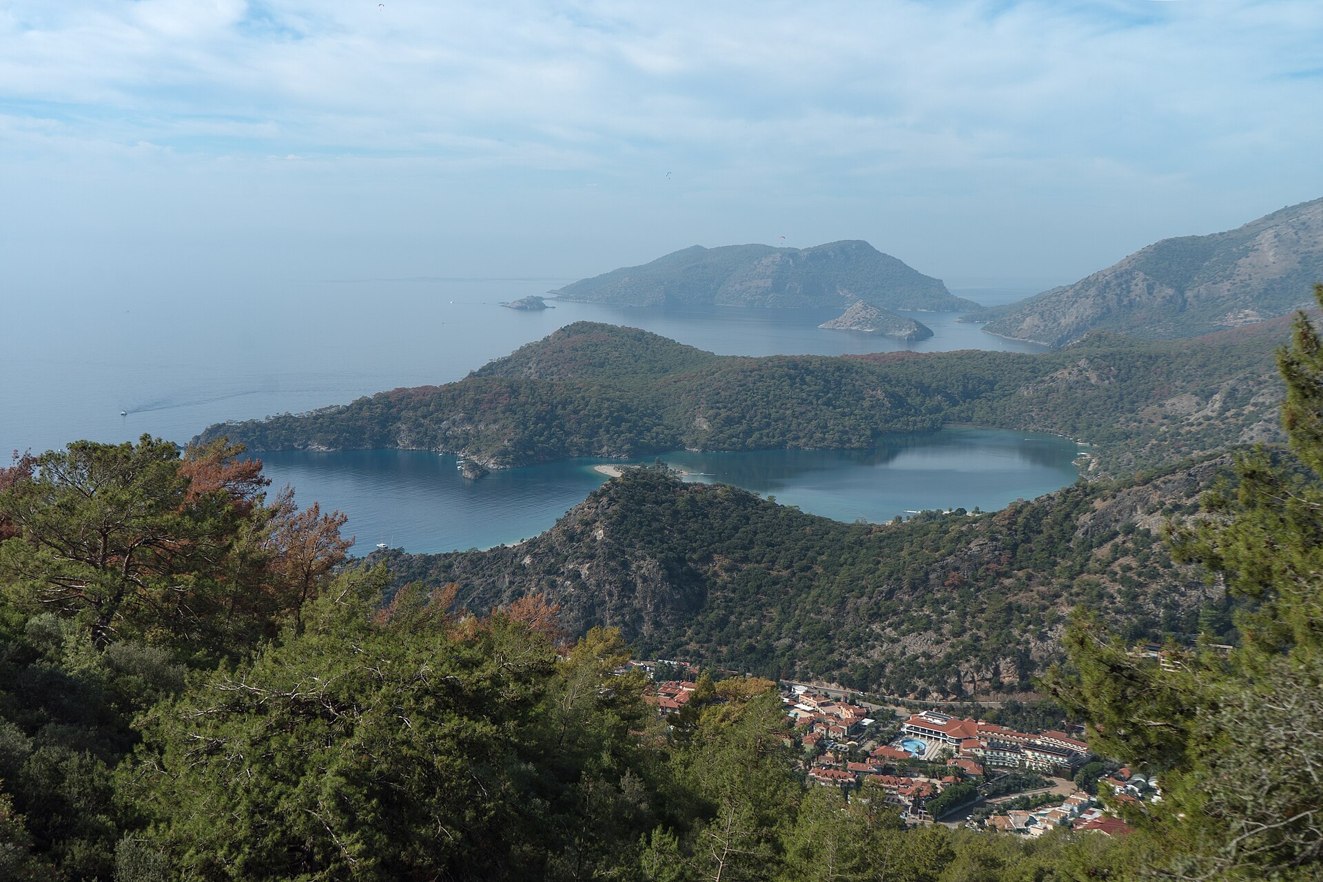
The opening Lycian Way stage leaves the resort edge at Ovacik and climbs onto open slopes with immediate views over Oludeniz, Babadag, and the western Lycian coast. The line then contours and descends towards Faralya, with stony old-track sections, pine, scrub, and exposed coastal viewpoints.
This is best treated as a point-to-point walk with a planned return transfer. In hot weather, start early from Ovacik, carry more water than the distance suggests, and do not rely on seasonal cafes or fountains without current local confirmation.
Why it is essential
This is the Taurus coast’s signature first-day walk: high above a world-famous bay, on a waymarked cultural route that immediately explains why the Lycian Way became Turkey’s best-known long-distance trail.
Equipment
Trail shoes or boots with grip, sun hat, 2-3 litres of water in warm weather, offline map/GPS, headlamp backup, and clothing for exposed wind if walking outside summer.
Hazards and notes
Heat, loose limestone, cliff edges above side valleys, fading waymarks, and traffic/road walking near settlements are the main practical hazards. Check recent Lycian Way route updates before publication because local reroutes and access changes occur.
GPX / KML links
| Source | URL | Format / access | Reuse status |
|---|---|---|---|
| AllTrails: The Lycian Way: Ovacik - Faralya | alltrails.com | Source map / app route | AllTrails terms apply; GPX reuse not verified; statistics and source-map only |
| OpenStreetMap search | openstreetmap.org | Map/search | OSM data is ODbL; geometry cross-check only |
External links
2. Lycian Way: Chimaera Circuit
Snapshot
Itinerary
The circuit links the Cirali coast with the Yanartas / Chimaera fire vents and surrounding Lycian Way paths. Expect a mix of old stone tracks, forest paths, short paved sections, and cultural-site access paths. The exact loop should be checked against current waymarks and access rules at the Yanartas archaeological/natural site.
The most logical day starts from Cirali, climbs to Yanartas before the hottest part of the day, then uses Lycian Way connections to close the loop back towards the coast.
Why it is essential
Few Taurus day hikes combine a protected beach, ancient-route walking, pine forest, and a geological fire site so tightly. It is one of the clearest examples of the Lycian Way’s blend of landscape and cultural history.
Equipment
Grippy footwear, sun protection, water, cash/card for any site entry, headlamp if visiting the flames near dusk, and offline mapping.
Hazards and notes
The loop is long for a coastal route and can become serious in summer heat. Site access, fire risk, and waymark condition should be checked locally. If visiting at dusk, plan the descent with a headlamp and conservative timing.
GPX / KML links
| Source | URL | Format / access | Reuse status |
|---|---|---|---|
| AllTrails: The Lycian Way: Chimaera Circuit | alltrails.com | Source map / app route | AllTrails terms apply; GPX reuse not verified; statistics and source-map only |
| OpenStreetMap search | openstreetmap.org | Map/search | OSM data is ODbL; geometry cross-check only |
External links
3. Lycian Way: Adrasan to Cirali
Snapshot
Itinerary
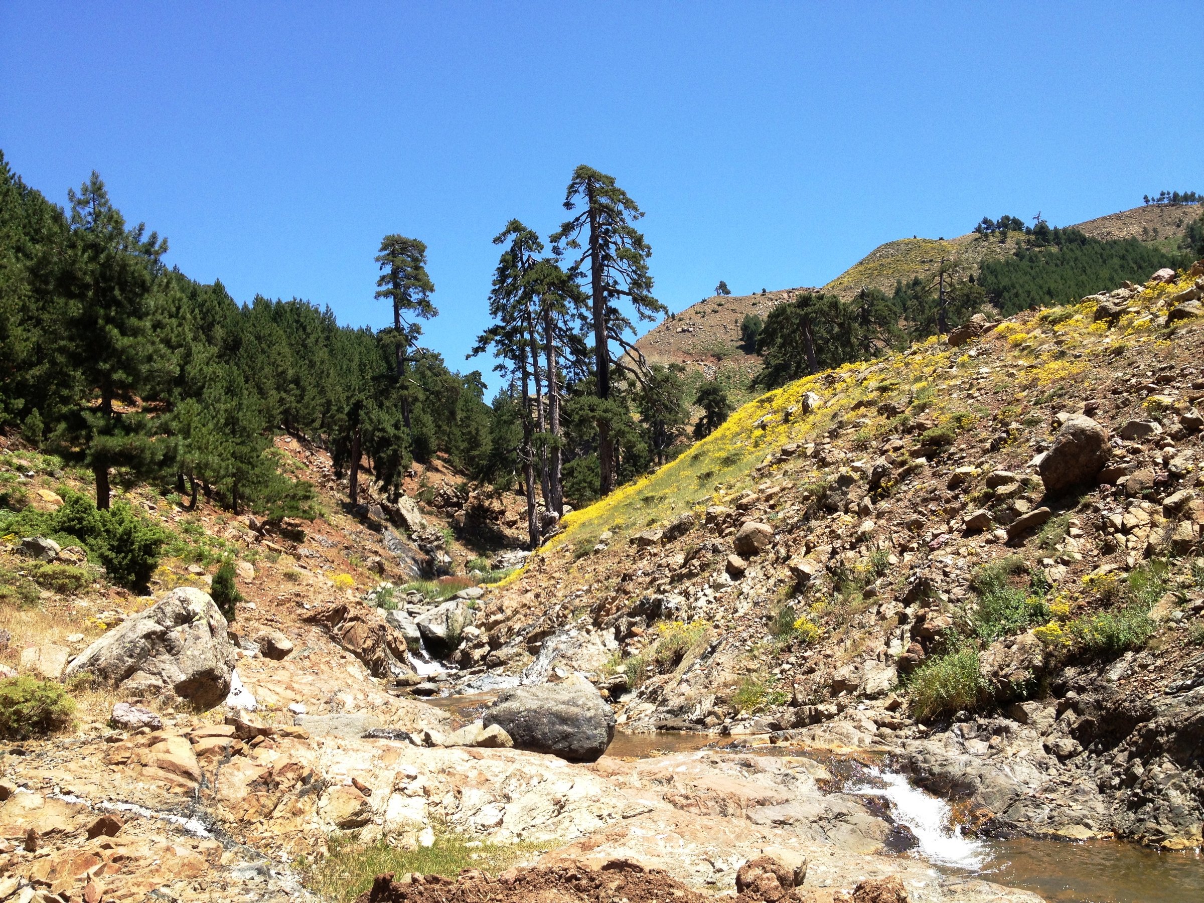
This point-to-point Lycian Way stage crosses the coastal mountain country between Adrasan and Cirali. It is a substantial day with forested climbing, rough limestone underfoot, coastal views, and a descent towards the Olympos-Cirali basin.
The day works best with a pre-arranged pickup or overnight stop at the finish. Treat the route as a mountain crossing, not a beach stroll, because the gain and underfoot conditions are demanding.
Why it is essential
The stage shows the Lycian coast at its most complete: Mediterranean water below, wooded Taurus slopes above, old route lines between villages, and a finish near one of the region’s key archaeological/coastal landscapes.
Equipment
Boots or robust trail shoes, offline route line, water, food, sun protection, first-aid kit, and a phone battery reserve.
Hazards and notes
Heat, scarce water, rough stony paths, possible waymark ambiguity, and fire-season closures are the main concerns. The route should be avoided in extreme heat or after major storm damage until local conditions are checked.
GPX / KML links
| Source | URL | Format / access | Reuse status |
|---|---|---|---|
| AllTrails: Lycian Way: Adrasan - Cirali | alltrails.com | Source map / app route | AllTrails terms apply; GPX reuse not verified; statistics and source-map only |
| OpenStreetMap search | openstreetmap.org | Map/search | OSM data is ODbL; geometry cross-check only |
External links
4. Lycian Way: Cirali to Beycik
Snapshot
Itinerary
From the Cirali coast the route climbs inland on the Lycian Way towards Beycik, moving from sea-level warmth into pine and cedar-scented mountain slopes below Tahtali Dagi. It is a sustained ascent day and feels more mountainous than the lower coastal stages.
Because this is a point-to-point climb, plan the logistics first: accommodation, pickup, or a continuation on the Lycian Way from Beycik.
Why it is essential
This walk captures the vertical drama of the Taurus coast: a single day from beach settlement to upland village, with the Tahtali Dagi massif pulling the Lycian Way out of the purely coastal zone.
Equipment
Mountain walking footwear, warm layer for the higher finish, wind/rain shell, sun protection, 2-3 litres of water, food, and navigation independent of painted waymarks.
Hazards and notes
The gain is large and the finish is not at the start. Heat at the lower end and cold/wind higher up can both matter on the same day. Check fire closures, forestry work, and local route updates.
GPX / KML links
| Source | URL | Format / access | Reuse status |
|---|---|---|---|
| AllTrails: Lycian Way: Cirali - Beycik | alltrails.com | Source map / app route | AllTrails terms apply; GPX reuse not verified; statistics and source-map only |
| OpenStreetMap search | openstreetmap.org | Map/search | OSM data is ODbL; geometry cross-check only |
External links
5. Cimbar Valley from Demirkazik
Snapshot
Itinerary
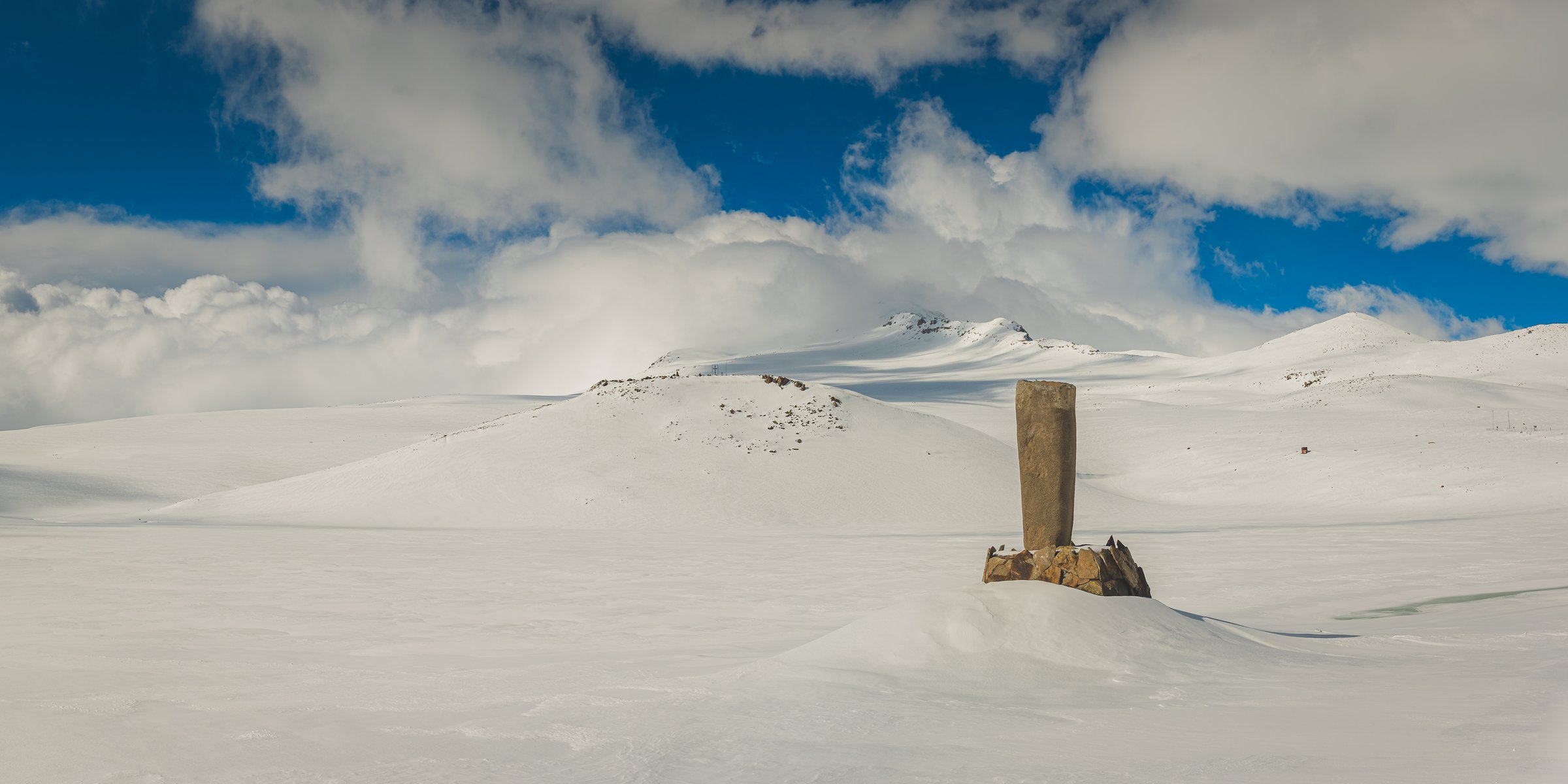
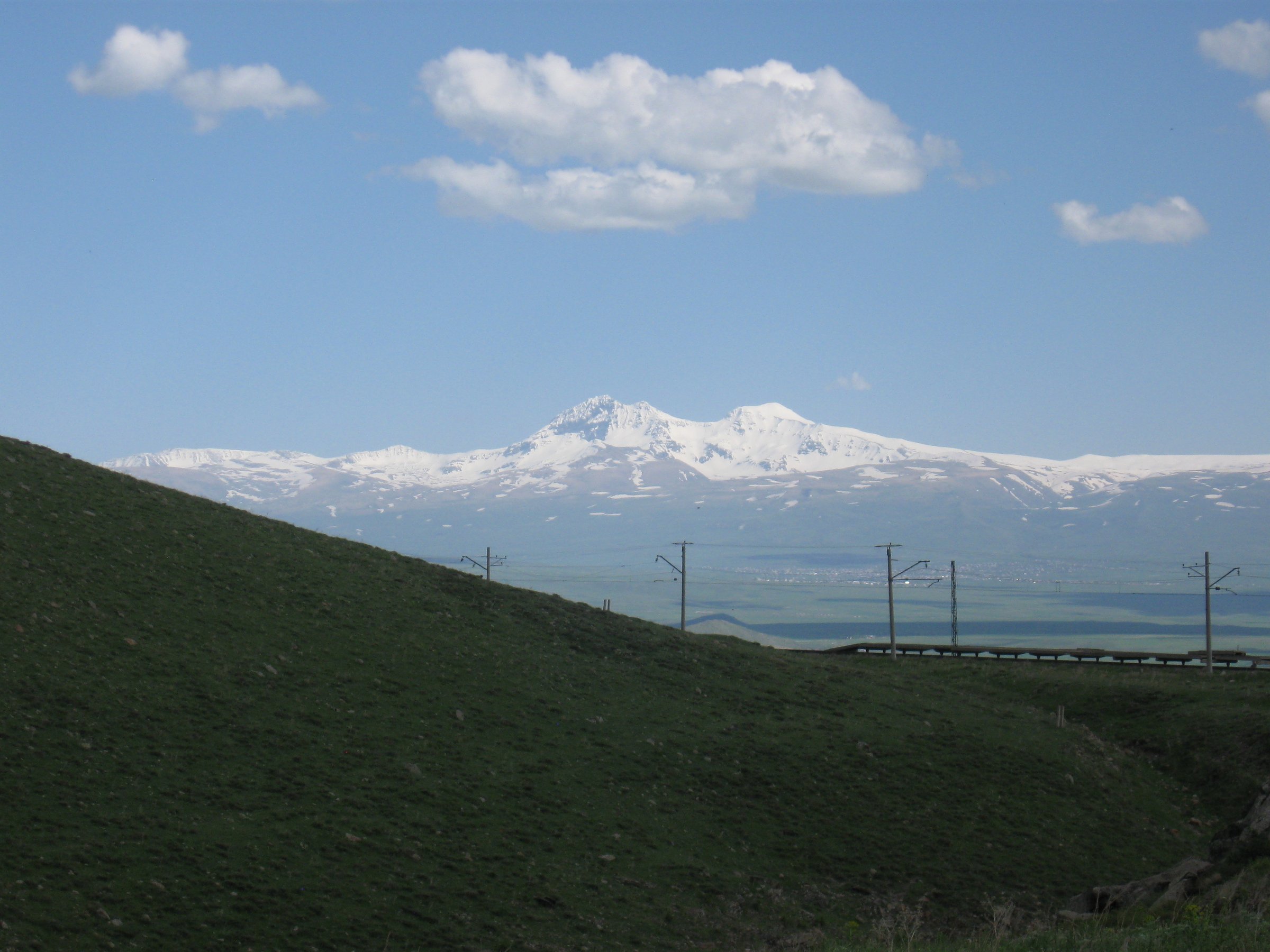
The Cimbar Valley candidate starts from the Demirkazik side of Aladaglar and follows the dramatic limestone valley into the central massif. The route can be shortened as a scenic gorge walk or extended towards higher basins by experienced parties with current local information.
Because no publication-grade public GPX was confirmed, this should be written as a route family rather than a fixed line until checked against a local guide, park map, or legally reusable route file.
Why it is essential
This is the catalogue’s bridge from the famous Lycian coast to the high Taurus proper. Aladaglar gives the region its alpine identity: big limestone walls, cold nights, summer-only walking windows, and serious mountain weather.
Equipment
Mountain boots, warm layer, waterproof/windproof shell, sun protection, water purification or enough carried water, detailed map/GPS, and helmet if entering rockfall-prone narrow sections under unstable conditions.
Hazards and notes
Rockfall, snow patches, sudden storms, poor mobile coverage, route-finding, and large day-night temperature swings are central hazards. GoTurkiye notes that Aladaglar can have a temperature difference between day and night exceeding 30 degrees C.
GPX / KML links
| Source | URL | Format / access | Reuse status |
|---|---|---|---|
| OpenStreetMap search | openstreetmap.org | Map/search | OSM data is ODbL; orientation only, no route relation selected |
| GoTurkiye: Aladaglar National Park | walking.goturkiye.com | Official regional walking page | Site terms apply; regional context only, no GPX found |