The Lycian Way is Turkey’s first long-distance trekking route, following the coast of ancient Lycia in southern Turkey. The Culture Routes Society describes the current route as a 760 km, approximately 35-day waymarked footpath from the Fethiye area to Antalya, ending at Geyikbayırı.
The route follows a mixture of Roman roads, old footpaths and mule tracks. Many sections are rough, stony and steep. It is a walking route rather than a mountain-bike route.
Route at a glance
Overview
The Lycian Way is Turkey’s first long-distance trekking route. The Culture Routes Society describes the current route as a 760 km, approximately 35-day waymarked footpath from the Fethiye area to Antalya, ending at Geyikbayırı.
The route uses Roman roads, old footpaths, and mule tracks. Many sections are rough, stony, and steep. It is a walking route rather than a mountain-bike route.
Background
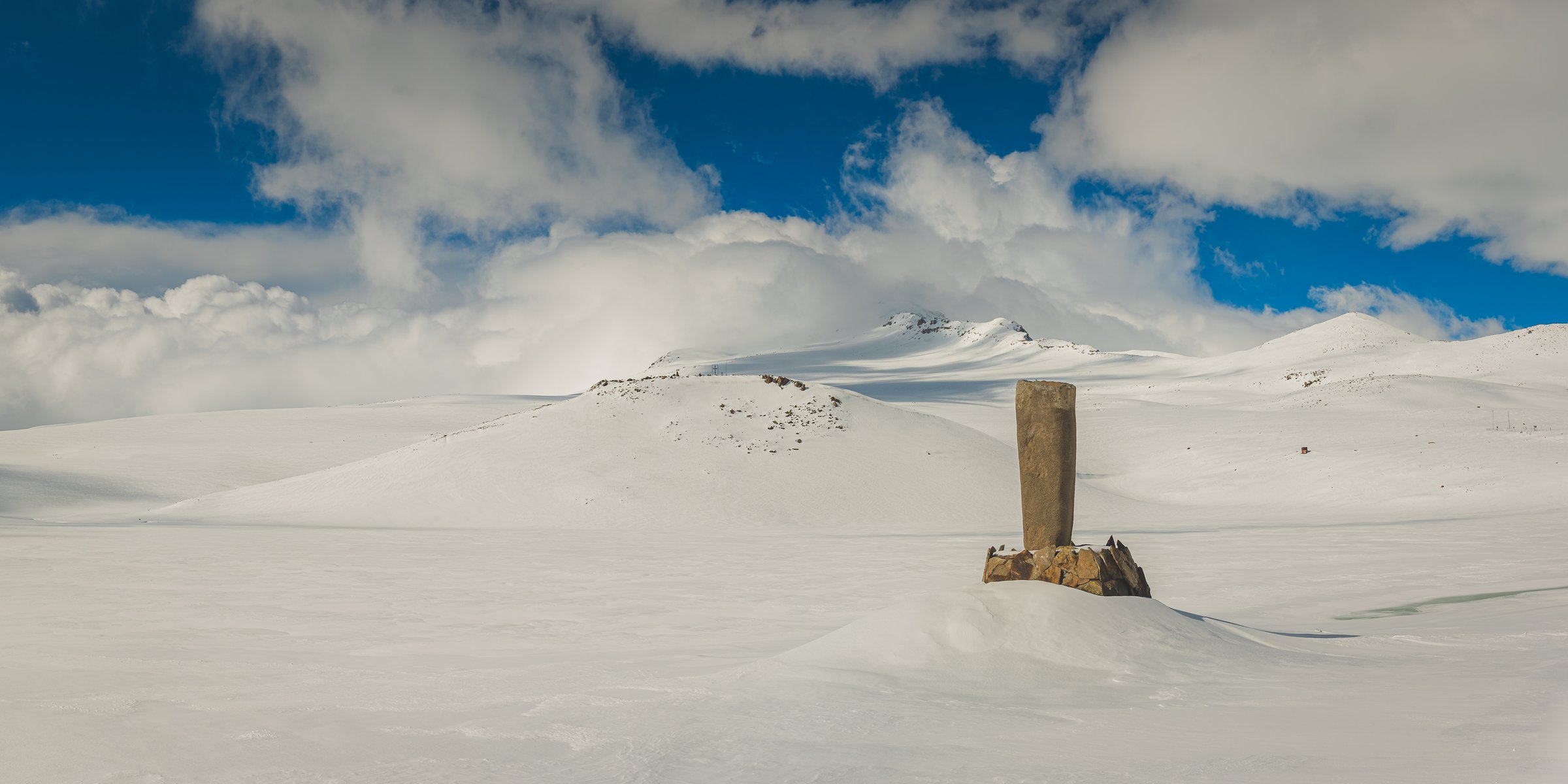
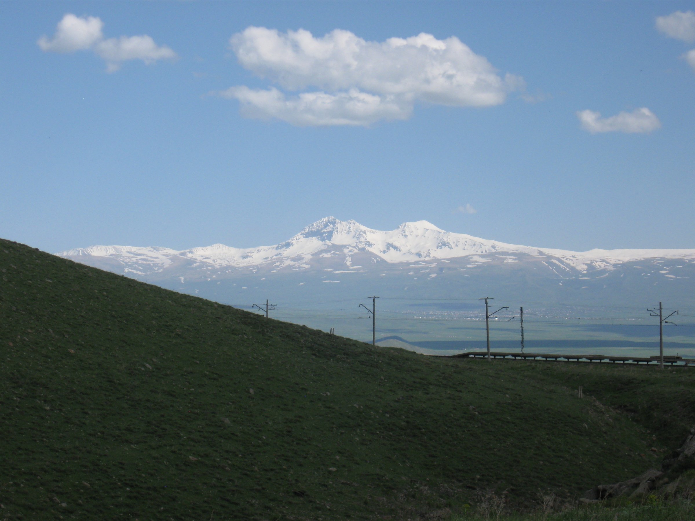
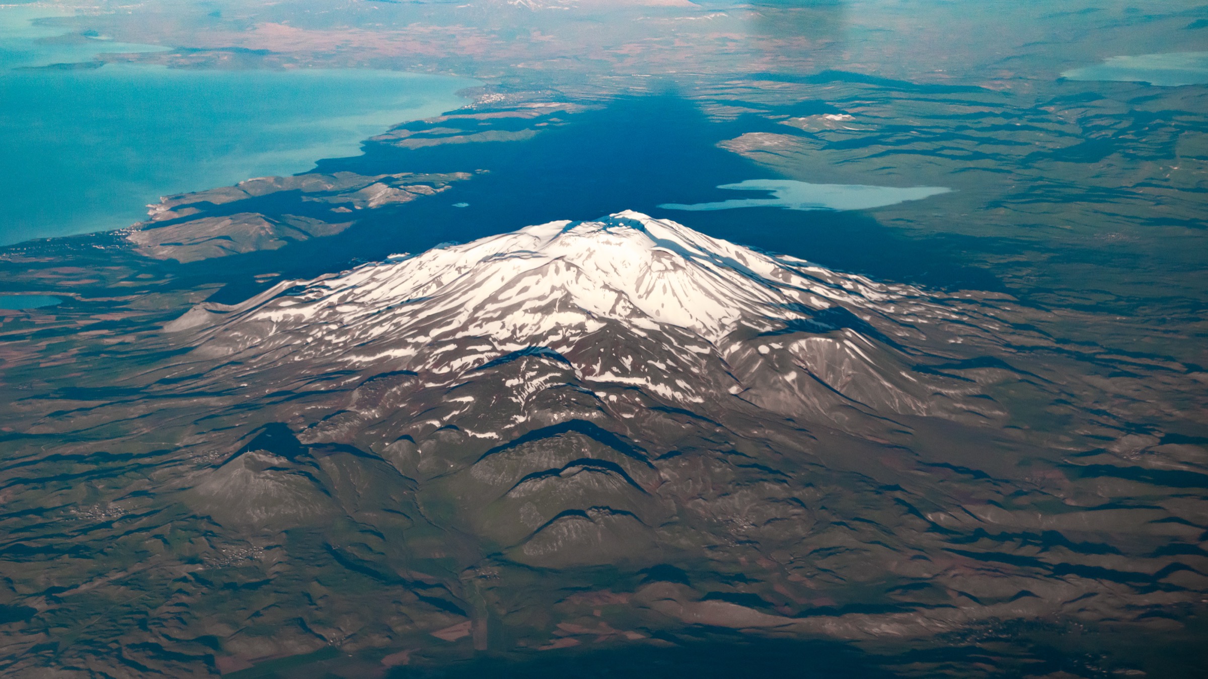
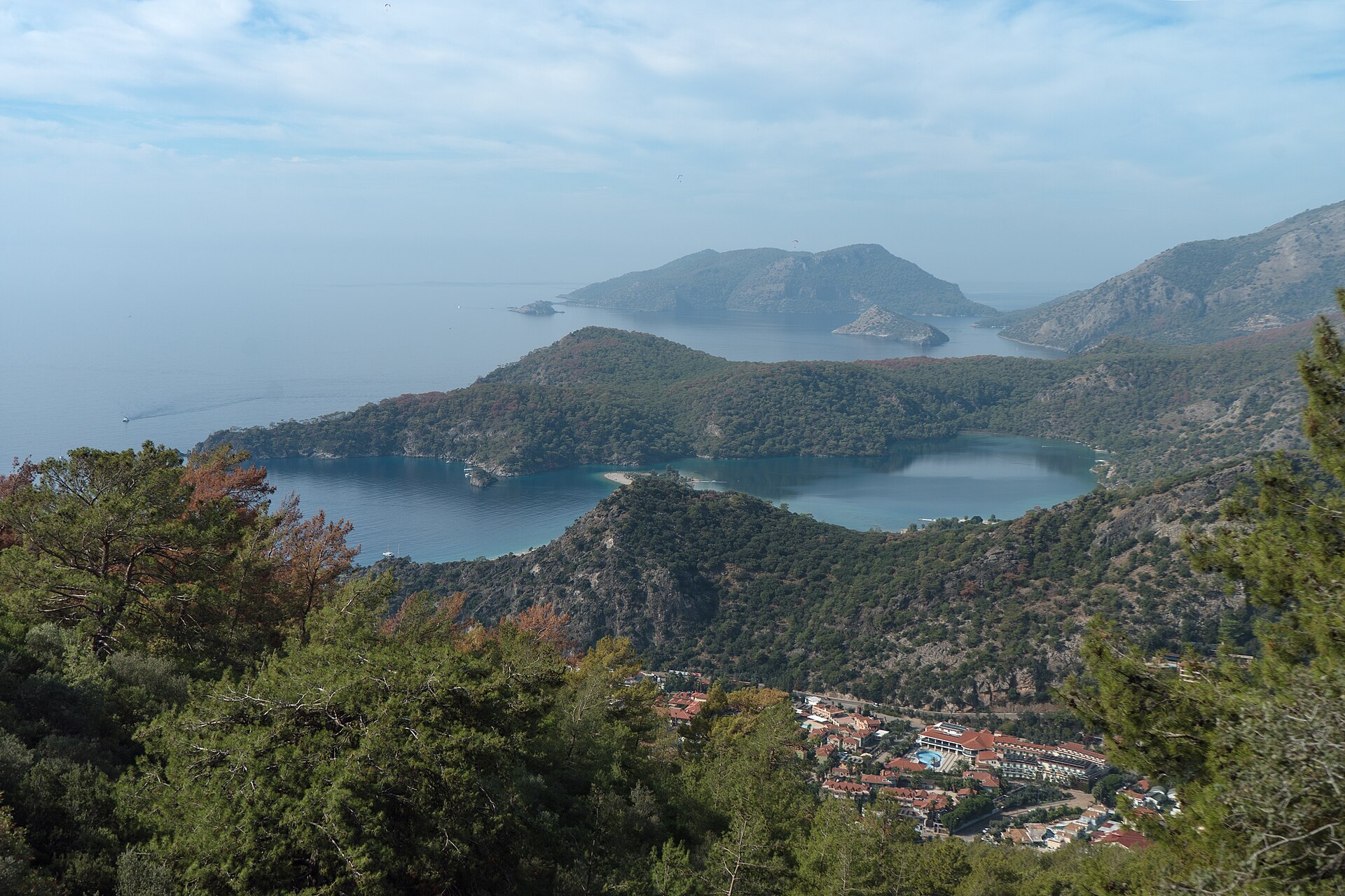
Lycia is the historic name for the Tekke Peninsula, the mountainous coastal region projecting into the Mediterranean on Turkey’s southern coast. The landscape combines rocky shoreline, steep mountains, pine forest, strawberry trees, carob, and higher-elevation juniper and cedar.
Coastal tourism and intensive agriculture occupy the flatter deltas, while the walking route often stays between the coast and the mountains.
The route crosses a region with a dense archaeological record. Lycian, Greek, Roman, Byzantine and early Christian remains are found throughout the peninsula. The Lycian Way passes around 25 remote historical sites, including tombs, ruins, Roman roads, ancient ports, Byzantine monastic remains and hill settlements.
Route character
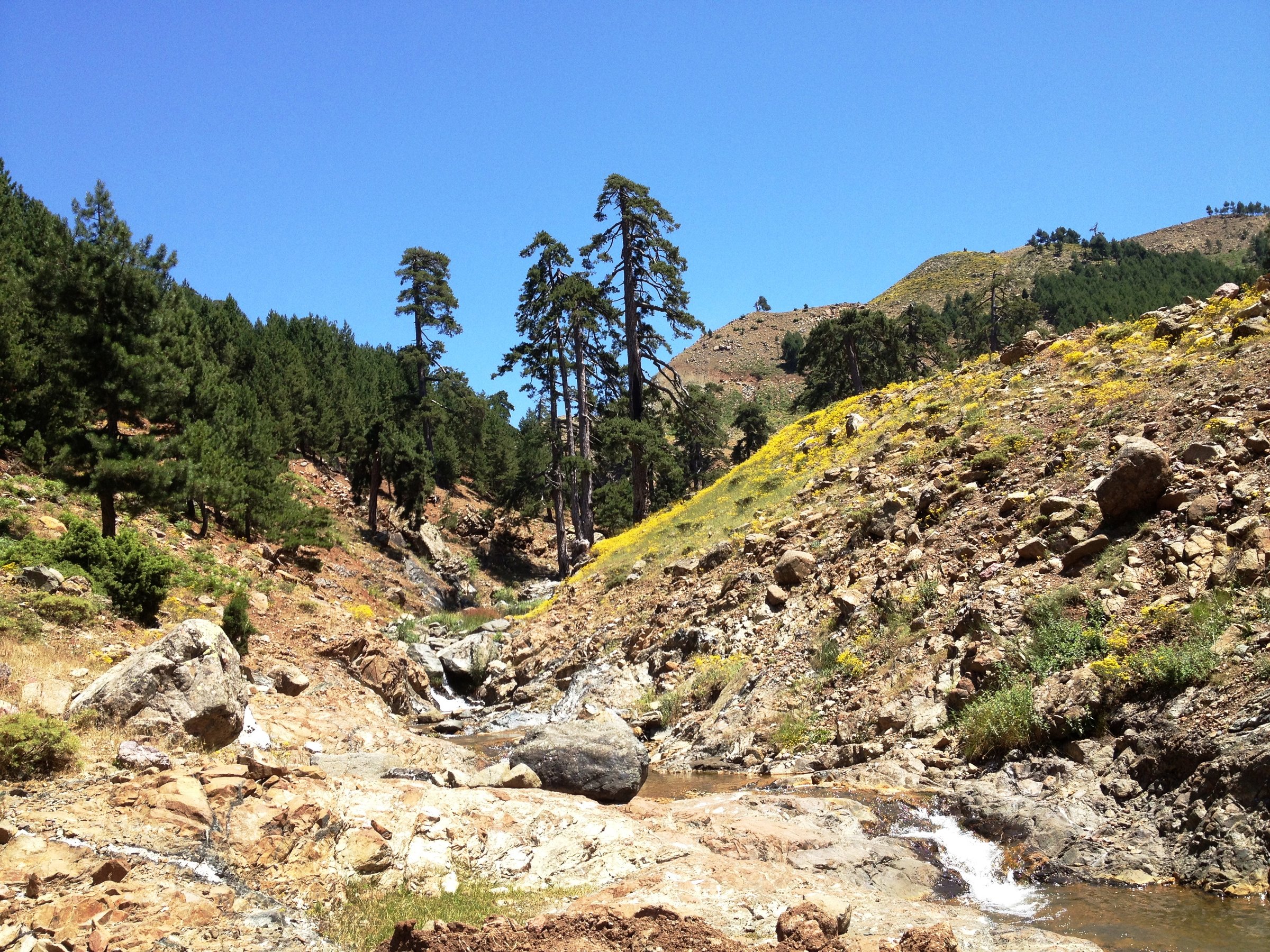
The Lycian Way is a demanding coastal-and-mountain trek rather than a simple seaside path. Much of the route is rough underfoot, with stony tracks, old mule routes and steep gradients.
Walkers should expect frequent ascent and descent, exposed limestone, thorny scrub, and sections where water and accommodation need to be planned carefully.
The route was researched, designed and waymarked by Kate Clow in 1999. Its purpose was partly recreational and partly conservation-focused: to identify, protect and promote historic routes in Turkey.
The trail has since expanded and altered, and now includes links with St Nicholas Ways around Demre, plus local walking networks near Fethiye, Kemer and Konyaaltı.
Start and finish
The western start is in the Ölüdeniz / Fethiye area, roughly two hours from Dalaman Airport. The eastern end is now given as Geyikbayırı, with onward public transport connections towards Antalya.
The route can be walked in either direction, but many walkers begin in the west, near Fethiye and Ölüdeniz, then continue eastwards through Faralya, Kabak, Patara, Kaş, Demre, Finike, Olympos, Çıralı, Adrasan and the mountain sections towards Antalya.
Best time to walk
The recommended trekking seasons are spring and autumn: February to May and September to November. February is often warmer and sunnier than March.
Summer is not recommended for long-distance walking because of the heat.
High mountain sections can still be cold, wet or affected by poor visibility outside the main season. Weather forecasts should be checked carefully. GPS is recommended in mountain areas, and walkers should avoid exposed or complex terrain in mist or blinding rain.
Navigation and waymarking
The Lycian Way is waymarked, but route changes occur because of roads, quarries, building, landslides, land access and vegetation.
The most up-to-date version of the route is maintained on OpenStreetMap and can be viewed through Waymarked Trails. Apps using current OSM data are therefore preferred. OSMand is specifically recommended by the Culture Routes Society, while several commercial apps are described as unreliable or out of date for this route.
Waymarking can vary by section and age of maintenance. GPS or a reliable route app is recommended where certainty is needed, particularly on newer or less-used sections.
If waymarks disappear, the advised method is to return to the last known mark, check the map or GPS, and search carefully before continuing.
Accommodation and camping
The route has a mixture of village houses, pensions, small hotels and guesthouses. Accommodation is usually available each night except for three high-level sections.
Independent trekkers can also find wild-camping places, often with nearby water, though water sources can dry up in late summer.
The official accommodation page provides a downloadable accommodation spreadsheet with locations, contact details, facilities and guidebook-stage references.
Food, water and supplies
Villages normally have some form of water source, such as a spring, trough, mosque tap or well. Some wells and springs may dry up from August onwards, especially on dry routes including the Lycian Way.
Well water may need purification, particularly around the animal migration season.
Food resupply should be planned stage by stage. The longest food carry on the routes is generally two days. In villages without shops, basic food may sometimes be obtained locally, but walkers should pay and avoid assuming availability.
Transport access
The Lycian Way is well served by public transport compared with many long-distance trails.
Dalaman Airport is the main access point for the Fethiye / Ölüdeniz start. Antalya Airport and Antalya bus station serve the eastern end and the Antalya-side trailheads.
Local buses and minibuses serve many coastal towns and villages along the route, including Fethiye, Kaş, Kumluca, Olympos / Çıralı, Adrasan and Geyikbayırı.
This makes it practical to walk selected sections, skip road sections, or exit the route in poor weather.
Route updates and cautions
The official Route Updates page should be checked before setting out. It records changes and warnings including renewed waymarks on the Çıralı – Tekirova section, an alternative end-stage route via Üçsöğüt Plateau, Gedeller and Sarısu, changes around Üçağız – Demre, and route adjustments around Elmayanı – Çitdibi. The same page warns of misleading or unofficial waymarks in some areas, including between Kaş and Boğazcık and around Beycik. It also advises against relying on higher campsites above Yukarı Beycik on the slopes of Tahtalı, where water and suitable camping options are limited.
Books, maps and apps
The Culture Routes Society points walkers towards the official guidebook, three paper walking maps at about 1:70,000 scale, and OSM-based digital mapping.
The English guidebook was released in December 2022, and the three paper maps cover the western, central and eastern Lycian Way areas.
The latest route is maintained on OpenStreetMap. GPX or KML tracks are supplied to people who have bought the guidebook. The Lycian Way GPX/KML files are not given out generally; purchasers should contact the Society, specify the required sections, and say where the guidebook was bought.
Self-guided and organised options
Self-guided walking holidays are available through agencies listed by the Culture Routes Society. These typically include route notes, maps, accommodation booking, luggage transfers, local transfers and sometimes GPS tracks.
Listed itineraries include western Lycian Way sections around Kayaköy, Faralya, Kabak and Patara; eastern sections around Çıralı, Kekova, Olympos, Adrasan and Gelidonya; and shorter Kaş-based or 4-day programmes.
Route and resource links
- Official Official Lycian Way page Main Culture Routes Society page for the Lycian Way.
- Official Books, maps and apps Guidebook, paper maps, and recommended navigation apps.
- Official Route updates Current changes, diversions, warnings and unofficial waymark notices.
- Official Transport Public transport notes for access points and trailheads.
- Official Accommodation Downloadable accommodation spreadsheet with stage references.
- Map image Conservation-area route map Overview map image of the Lycian Way in its conservation-area context.
GPX / KML / PDF route files
Public GPX/KML/PDF route files are not provided directly on the official Lycian Way pages. The Culture Routes Society states that GPX/KML tracks are supplied on request to people who have purchased the guidebook.