Regional overview
The Lesser Caucasus is a broad volcanic, forested, and plateau mountain system running through Armenia, western Azerbaijan, southern Georgia, and north-eastern Turkey. Its hiking character varies sharply by country: Armenia has high volcanic summits and crater lakes; Georgia has well-managed forest and ridge trails in Borjomi-Kharagauli National Park; Azerbaijan has newly promoted marked routes in the Goygol/Dashkasan highlands; Turkey’s Kars-Sarikamis edge has forest, ski-centre, and heritage trekking routes rather than many internationally documented GPX day hikes.
The main season for high Armenian summits is June to October, with snow and storms possible outside midsummer. Borjomi-Kharagauli has year-round lower trails but mud, snow, and registration requirements may apply. Azerbaijan and Turkey route access should be checked locally because border-zone, national-park, and village-road rules can change.
Selection rationale
The five hikes balance the region across the supplied countries: Aragats South Summit and Azhdahak for Armenia’s high volcanic core; Borjomi-Kharagauli Footprint Trail for Georgia’s managed Lesser Caucasus forests; Chiragli-Azgilli for Azerbaijan’s Goygol / Murov views; and Sarikamis-Cibiltepe for the Turkish north-east transition to Caucasia. The Turkey entry is less well documented than the others and is marked accordingly.
Summary
| # | Hike | Country | Route type | Distance | Gain | Max elevation | Difficulty | GPX status | Photo status |
|---|---|---|---|---|---|---|---|---|---|
| 1 | Mount Aragats South Summit from Kari Lake | Armenia | Out-and-back | Approx. 8 km | Approx. 680 m | 3,879–3,888 m depending source | Moderate–hard at altitude | User GPX/source route links | Commons image verified |
| 2 | Mount Azhdahak Crater Summit from 4WD High Start | Armenia | Out-and-back | 10–12 km from high 4WD start; 18–20 km from Geghadir | Approx. 600–1,000 m from high start; up to 1,900 m from Geghadir | 3,597 m | Moderate–hard to hard | HikingProject / source route links | Commons image verified |
| 3 | Borjomi-Kharagauli Footprint Trail | Georgia | Point-to-point | 13 km | Unresolved | Unresolved | Easy–moderate / average | Official/source-map links | Commons image verified |
| 4 | Chiragli-Azgilli Trail | Azerbaijan | Point-to-point | 9.3 km | 564 m gain / 434 m loss | 1,880 m | Moderate | Official map/PDF source; no reusable GPX verified | Commons image verified |
| 5 | Sarikamis-Cibiltepe Forest and Allahuekber View Walk | Turkey | Out-and-back / local loop | Unresolved | Unresolved | Up to approx. 2,634 m at Cibiltepe / Bayraktepe ski area | Moderate; candidate only | Source-map links only | Commons image verified |
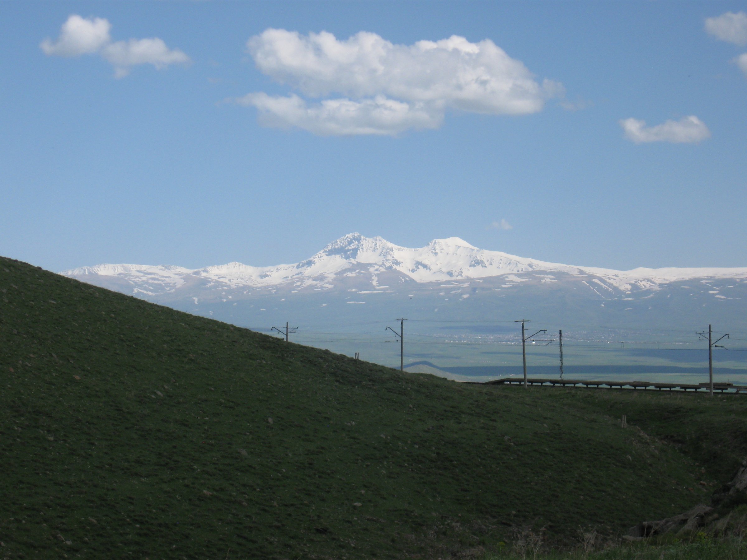
Hike 1: Mount Aragats South Summit from Kari Lake
Snapshot
Itinerary
From Kari Lake, follow the broad, well-used path north-west up the volcanic slopes of Aragats towards the south summit. The route climbs steadily over stony alpine terrain, with widening views over Kari Lake, the Armenian plateau, and the other Aragats summits. Return by the same route.
This entry covers only the south summit. The north summit and full four-summit traverse are mountaineering objectives with more exposure, route-finding, and snow-season hazards.
Why it is essential
Aragats is Armenia’s highest mountain massif, and the south summit is the classic accessible high-altitude day hike in the Lesser Caucasus.
Equipment
Mountain day kit: boots, warm layer, waterproof/windproof shell, hat/gloves, sun protection, sunglasses, food, water, map/GPS, and headtorch. Early season may require traction.
Hazards and notes
Altitude, fast weather changes, fog, snow patches, loose rock, and lightning are the main hazards. Do not continue to the north summit without appropriate experience and conditions.
GPX / route file
| Source | URL | Format | Licence / terms | Reuse status |
|---|---|---|---|---|
| Wikiloc — Aragats Southern Peak / Classic Ascent | wikiloc.com | User GPX/source route | Wikiloc terms apply | Candidate route-file source only; reuse rights not verified |
| AllTrails — Southern Peak of Aragats | alltrails.com | Trail map/source route | AllTrails terms apply | Secondary verification only |
| OpenStreetMap search — Kari Lake Aragats South Summit | openstreetmap.org | Map/search | OSM data is ODbL | Geometry cross-check only |
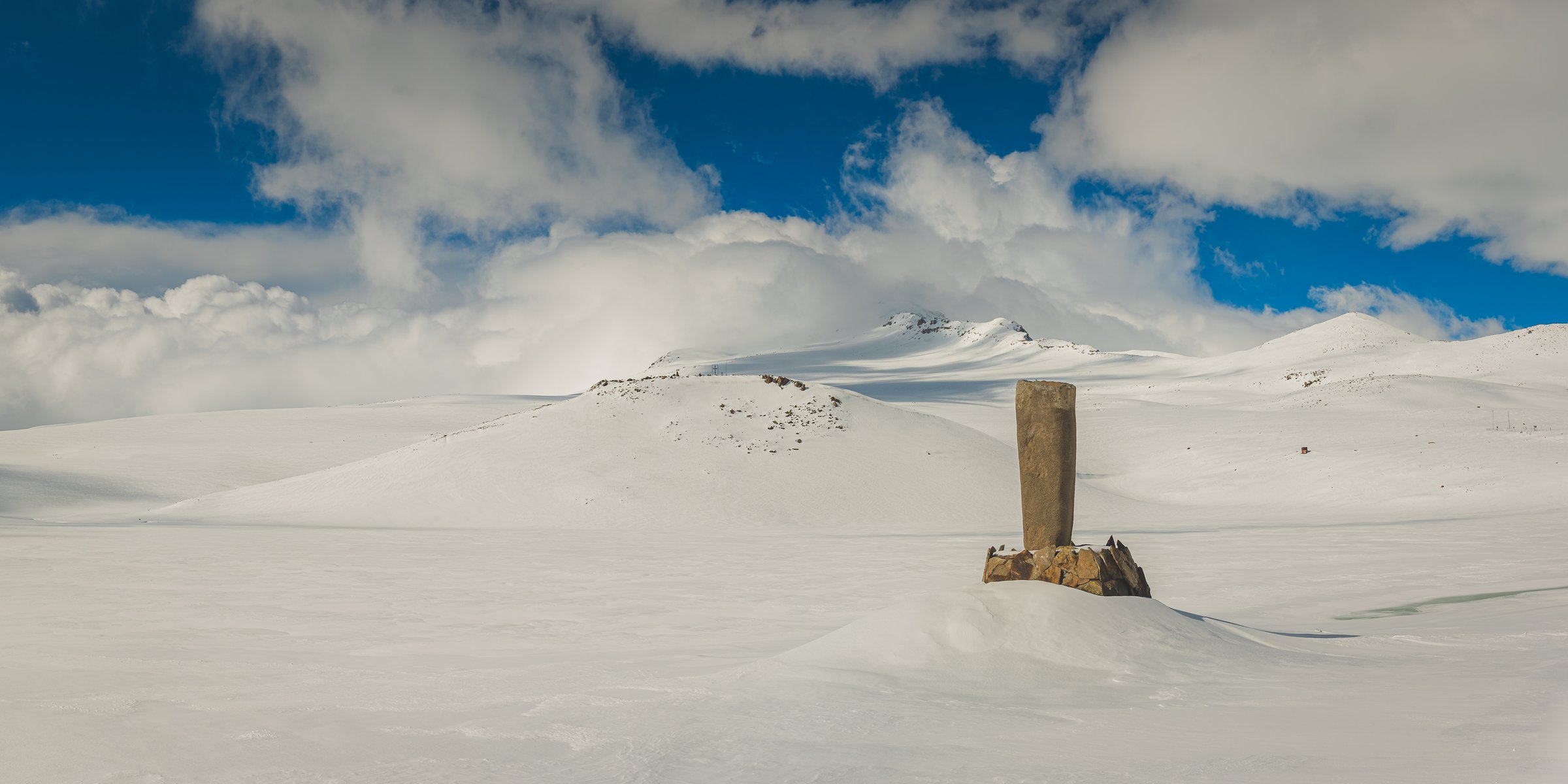
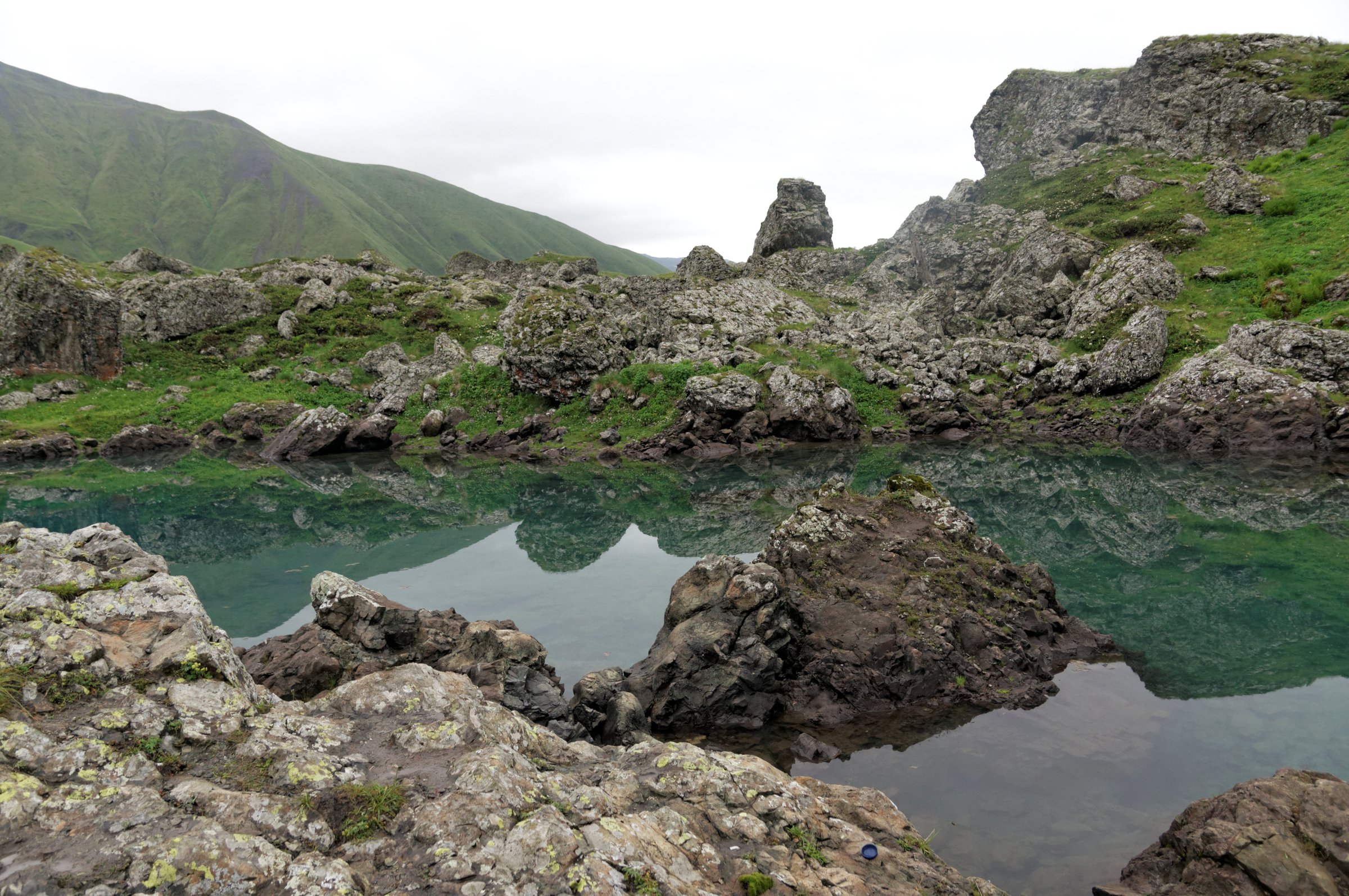
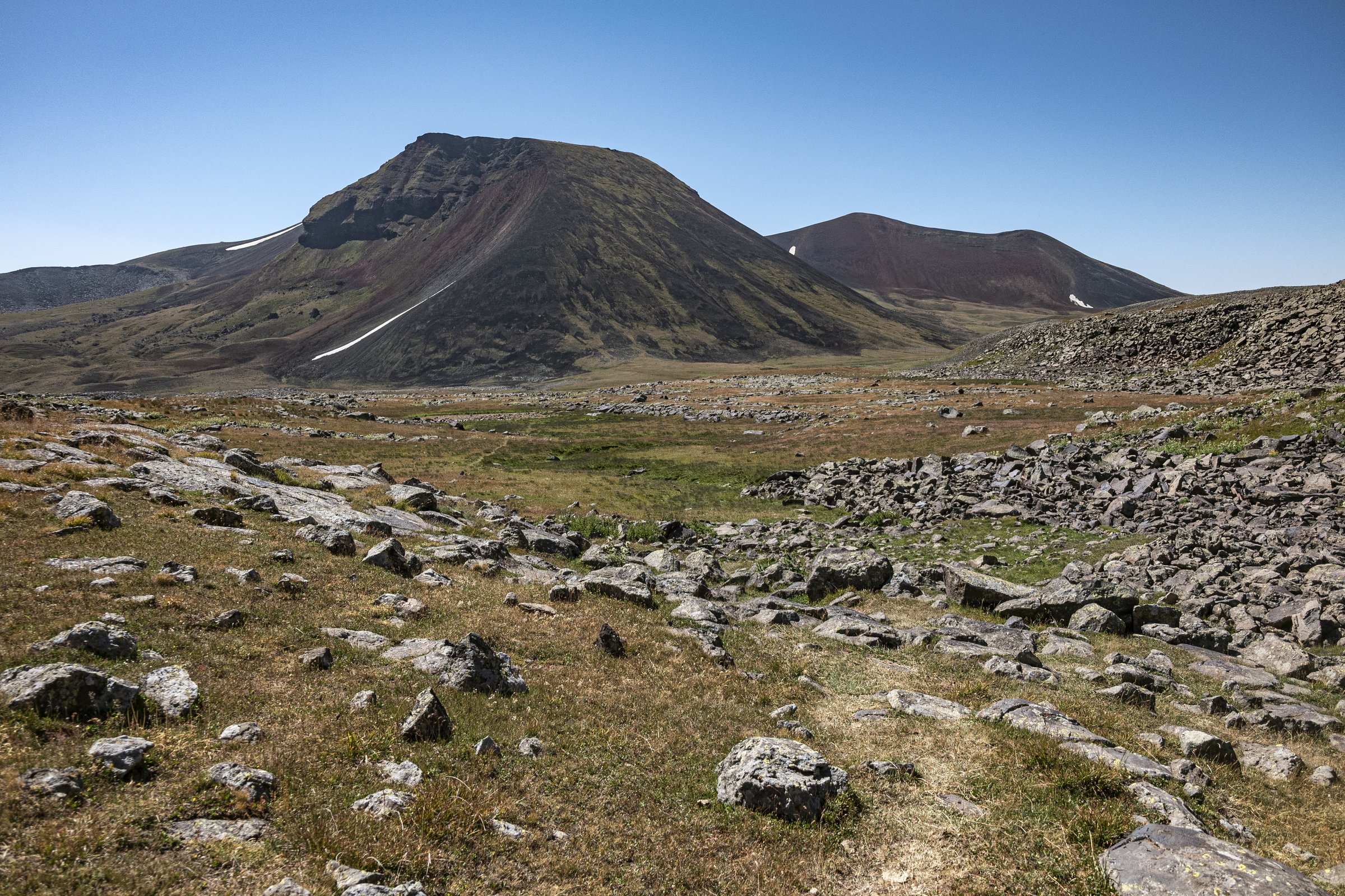
Hike 2: Mount Azhdahak Crater Summit from 4WD High Start
Snapshot
Itinerary
From the high 4WD start on the Geghama plateau, walk across open volcanic ground with scattered basalt boulders and petroglyph areas, then climb the steeper cone of Azhdahak to the crater rim. The crater lake appears below the rim, and the summit gives views towards Lake Sevan, Ararat, Aragats, and the Geghama range. Return by the same route.
Why it is essential
Azhdahak is the highest summit of the Geghama Mountains and one of Armenia’s defining volcanic day hikes: crater lake, petroglyph country, high plateau, and broad Lesser Caucasus views.
Equipment
Boots, warm/windproof layers, waterproof shell, sun protection, water, food, map/GPS, headtorch, and trekking poles. Early-season snow can require traction.
Hazards and notes
Navigation can be difficult in cloud on the open plateau. The road approach is rough and often the limiting factor. Avoid damaging petroglyphs and do not rely on phone coverage.
GPX / route file
| Source | URL | Format | Licence / terms | Reuse status |
|---|---|---|---|---|
| Hiking Project — Mount Azhdahak Trail | hikingproject.com | Trail page with GPX download option | Hiking Project terms apply | Candidate route-file source; reuse rights not verified |
| Wikiloc search — Azhdahak trail | wikiloc.com | User GPX/source routes | Wikiloc terms apply | Candidate route-file source only |
| OpenStreetMap search — Azhdahak Armenia | openstreetmap.org | Map/search | OSM data is ODbL | Geometry cross-check only |
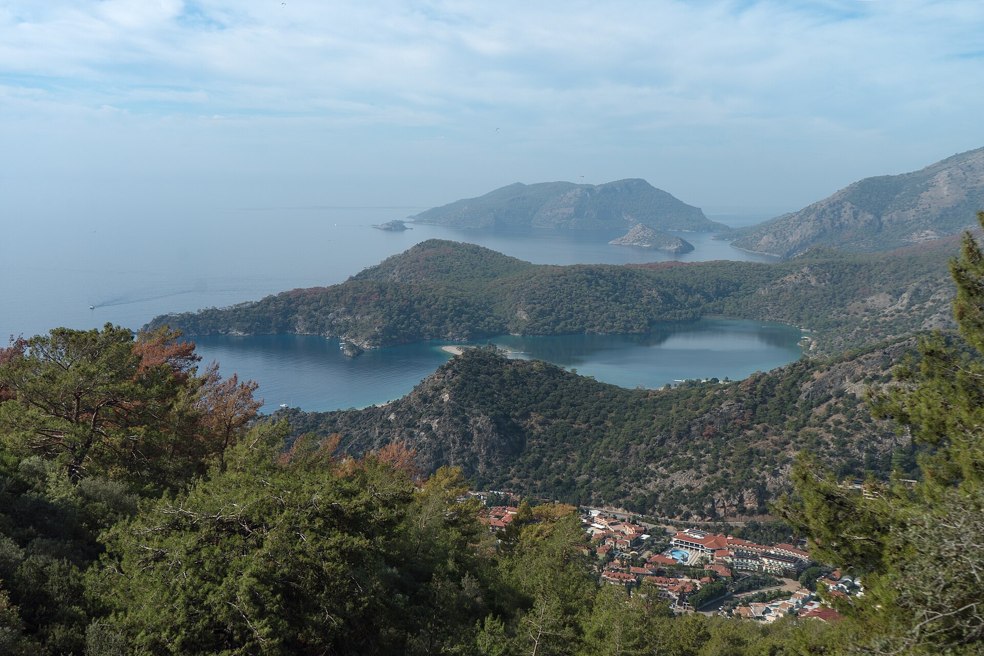
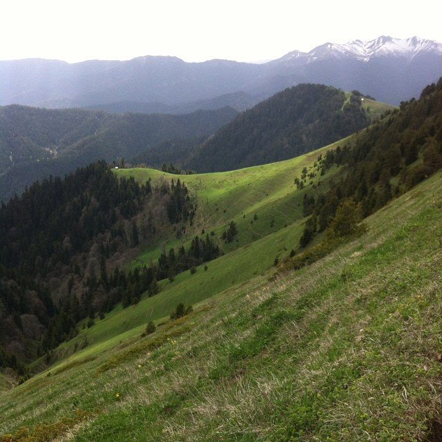
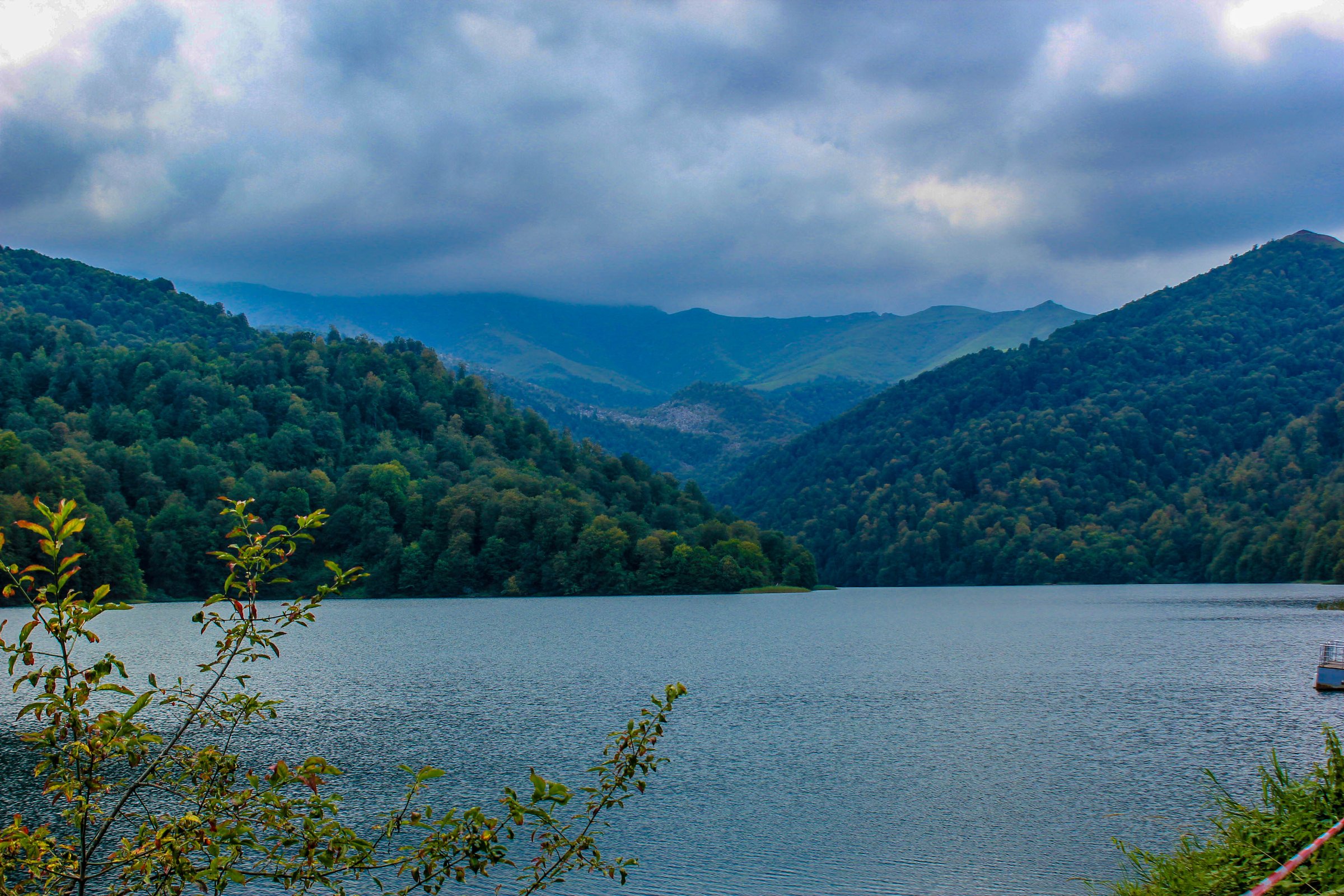
Hike 3: Borjomi-Kharagauli Footprint Trail
Snapshot
Itinerary
From the Likani ranger station, the Footprint Trail follows the Likani River valley, crosses a footbridge, then climbs through forest towards panoramic views of the Kvabiskhevi Gorge and Mariamtsminda Church. It finishes in the Kvabiskhevi valley, where return transport to Borjomi should be arranged.
Why it is essential
Borjomi-Kharagauli is one of the flagship protected areas of the Lesser Caucasus, and the Footprint Trail is a managed, day-length route through its forest and gorge landscape.
Equipment
Boots, waterproof layer, water, food, map/GPS, and park registration documents if required. Trekking poles are useful on the descent.
Hazards and notes
Registration, fees, and trail conditions should be checked with the visitor centre. The descent can be slippery and is not recommended in wet conditions by local route descriptions.
GPX / route file
| Source | URL | Format | Licence / terms | Reuse status |
|---|---|---|---|---|
| Agency of Protected Areas of Georgia — Borjomi-Kharagauli tourist trails | apa.gov.ge | Official trail listing | Government/agency site terms apply; no GPX licence found | Official route verification only |
| Georgian Travel Guide — Footprint Trail | georgiantravelguide.com | Map/source route | Site terms apply | Secondary map/stat verification only |
| OpenStreetMap search — Footprint Trail Borjomi | openstreetmap.org | Map/search | OSM data is ODbL | Geometry cross-check only |
Hike 4: Chiragli-Azgilli Trail
Snapshot
Itinerary
From Azgilli, follow the signed dirt-road route towards Chiragli. The first 4.6 km is mostly uphill, passing sparse forest and bare hills. After the ascent, the route turns near a cemetery, traverses flatter ground, then descends towards Chiragli. Views include Mount Kapaz, Mount Goshgar, and the Murov range.
Why it is essential
This is one of Azerbaijan’s best-documented Lesser Caucasus day hikes, with official statistics, a marked village-to-village route, and views into the Goygol / Murov mountain landscape.
Equipment
Walking shoes or boots, water, sun protection, wind/rain layer, snacks, and offline map. Carry supplies because Azerbaijan Travel notes no shops in Chiragli or along the route.
Hazards and notes
The route is on a dirt road suitable only for off-road vehicles. Check current local access, weather, and any regional restrictions before travel.
GPX / route file
| Source | URL | Format | Licence / terms | Reuse status |
|---|---|---|---|---|
| Azerbaijan Travel — Chiragli-Azgilli trail | azerbaijan.travel | Official route page/map; PDF option shown on site | Azerbaijan Travel terms apply; no reusable GPX licence found | Official route statistics and map source |
| Wikiloc search — Azgilli Chiragli | wikiloc.com | User GPX/source routes | Wikiloc terms apply | Candidate route-file source only |
| OpenStreetMap search — Chiragli Azgilli | openstreetmap.org | Map/search | OSM data is ODbL | Geometry cross-check only |
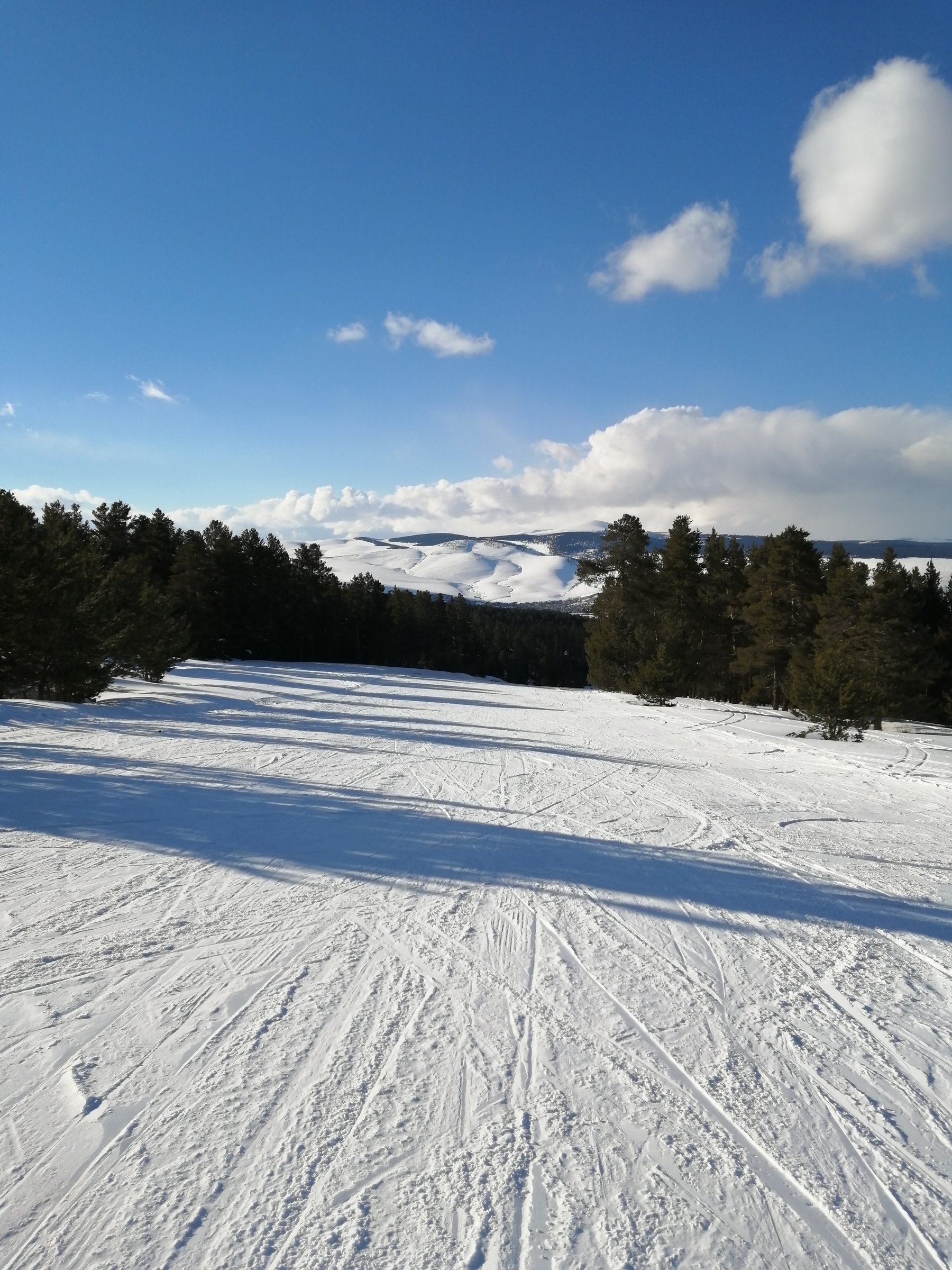
Hike 5: Sarikamis-Cibiltepe Forest and Allahuekber View Walk
Snapshot
Itinerary
Culture Routes Society identifies Sarikamis as a trail area at the transition from Anatolia to Caucasia, with routes concentrated around Sarikamis and Susuz Valley. The SERKA Sarikamis trekking-routes booklet documents the wider trekking network and the Cibiltepe / Bayraktepe ski-centre mountain setting. A practical catalogue route should use a locally confirmed forest trail from Sarikamis or the Cibiltepe access area to a pine-forest viewpoint, then return by the same line or a marked local loop.
Why it is essential
The supplied region includes Turkey’s Lesser Caucasus edge. Sarikamis is the best-supported walking network found in that north-east Turkey / Caucasia transition zone, combining Scots-pine forest, Allahuekber mountain scenery, and historical memory.
Equipment
Boots, water, wind/rain layer, sun protection, map/GPS, and seasonal snow equipment if outside the hiking season.
Hazards and notes
Exact route statistics and GPX were not verified. Avoid using ski pistes or forest roads without checking local rules. Winter conditions are serious and should be treated as snow travel.
GPX / route file
| Source | URL | Format | Licence / terms | Reuse status |
|---|---|---|---|---|
| Culture Routes Society — Sarikamis Trails | cultureroutesinturkey.com | Route-network source | Site terms apply; no GPX found in this pass | Network and access context only |
| SERKA — Sarikamis Trekking Routes PDF | serka.gov.tr | PDF route booklet | Reuse terms not found | Route-network source; exact selected route still unresolved |
| OpenStreetMap search — Sarikamis Cibiltepe | openstreetmap.org | Map/search | OSM data is ODbL | Geometry cross-check only |
External links
| Source | URL |
|---|---|
| Armenia Spirit — Mount Aragats four peaks guide | armenia-spirit.com |
| Armenia Spirit — Aragats southern summit | armenia-spirit.com |
| Armenia Spirit — Azhdahak volcano hike | armenia-spirit.com |
| Armenian Explorer — Climbing Mount Azhdahak | armenianexplorer.com |
| ArmGeo — Climbing Azhdahak | armgeo.am |
| AllTrails — Southern Peak of Aragats | alltrails.com |
| Hiking Project — Mount Azhdahak Trail | hikingproject.com |
| Wikiloc — Aragats Southern Peak | wikiloc.com |
| Wikiloc search — Azhdahak | wikiloc.com |
| Agency of Protected Areas of Georgia — Borjomi-Kharagauli tourist trails | apa.gov.ge |
| Borjomi-Kharagauli National Park | borjomi-kharagauli-np.ge |
| Samtskhe-Javakheti App — Footprint Trail | beyondarts.at |
| Georgian Travel Guide — Footprint Trail | georgiantravelguide.com |
| Azerbaijan Travel — Chiragli-Azgilli trail | azerbaijan.travel |
| Azerbaijan Travel — Hiking in Azerbaijan | azerbaijan.travel |
| Culture Routes Society — Sarikamis Trails | cultureroutesinturkey.com |
| SERKA — Sarikamis Trekking Routes PDF | serka.gov.tr |
| KBA Turkey — Allahuekber Daglari | kbaturkiye.org |