_(2024-06-20).jpg)
Regional overview
This entry is conservative: the Pontic Mountains stretch for hundreds of kilometres along Turkey’s Black Sea side, from humid western forest/canyon country to the alpine Kaçkar. Route marking and public GPX availability are uneven; check national-park, road, snow, and yayla access conditions before use.
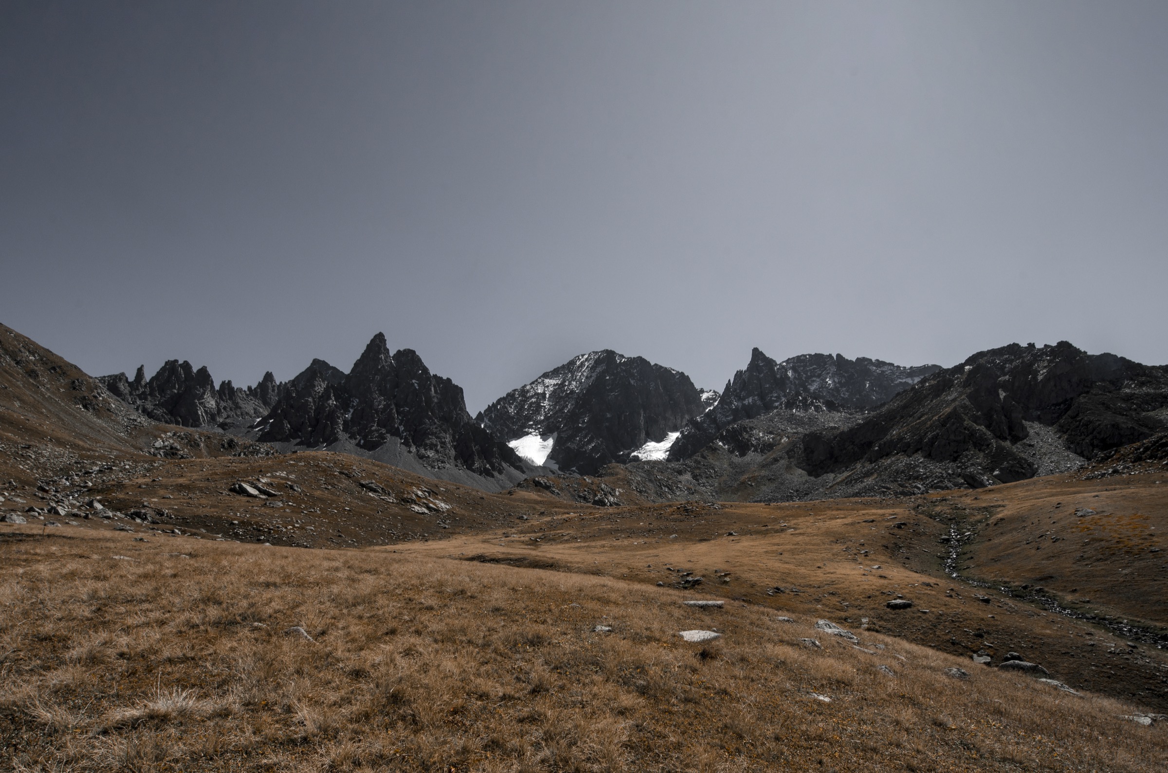
The Pontic Mountains are Turkey’s Black Sea mountain wall: wet beech-fir forests, tea-country valleys, yayla pastures, glaciated Kaçkar peaks, high lakes, cliff monasteries, and canyoned western ranges. Day hiking is strongest in the Kaçkar-Rize-Artvin core, but a representative catalogue should also include the cultural cliff landscape of Sümela/Altındere and the western forest-canyon character of Küre.
Selection rationale
The five hikes below balance alpine, yayla, forest, cultural, and canyon identities. Kaçkar Dağı itself is included with a warning: it is a famous strenuous summit route and often better as part of a multi-day trek, but fit parties sometimes treat it as a very long day from high access.
Summary table
| # | Hike | Country | Route type | Distance | Gain | Max elevation | Difficulty |
|---|---|---|---|---|---|---|---|
| 1 | Kaçkar Dağı summit from Olgunlar/Yaylalar side | Turkey | Out-and-back | 26.6 km | 1,908 m | 3,937 m | Very hard |
| 2 | Kaçkar Mountains Traverse day section | Turkey | Point-to-point | 12.6 km | 1,140 m | High pass; unresolved | Hard |
| 3 | Samistal Plateau to Ayder | Turkey | Point-to-point | 17.7 km | 931 m | Not resolved | Hard |
| 4 | Pokut-Sal Plateau balcony walk | Turkey | Out-and-back / loop variant | approx. 5-12 km | Unresolved | approx. 2,000-2,100 m plateau | Moderate |
| 5 | Küre Mountains: Horma Canyon / Valla Canyon viewpoint day | Turkey | Out-and-back / walkway-and-viewpoint | approx. 3-10 km | Unresolved | Low-mid mountain | Easy-hard depending variant |
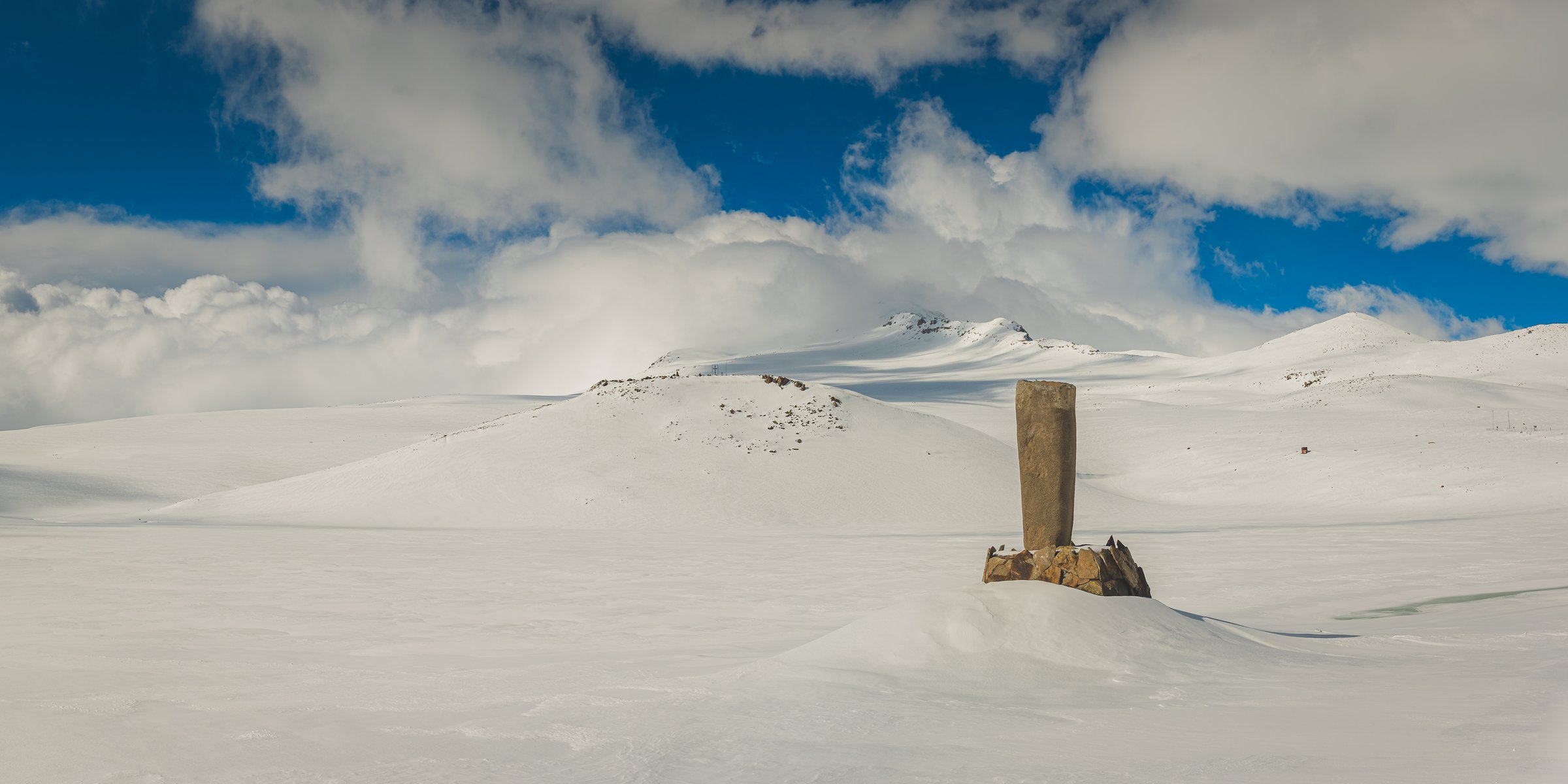
1. Kaçkar Dağı summit from Olgunlar/Yaylalar side

Snapshot
Itinerary
Ascend from the southern approach through high valleys and lake/scree terrain toward Kaçkar Dağı, the highest summit of the Pontic Mountains. The day version is very long and should not be promoted for casual walkers; many parties use camps or huts as part of a multi-day trek.
Why it is essential
Kaçkar Dağı is the range high point and the defining alpine objective of the Pontic Mountains.
Equipment
- Boots, poles, warm/waterproof layers, headlamp, emergency layer.
- Offline GPS, water/food, and snow gear if early season.
Hazards and notes
- Altitude, lingering snow, boulder/scree, fog, storms.
- River crossings and a very long return.
GPX / KML links
| Source | URL | Format / access | Reuse status |
|---|---|---|---|
| AllTrails: Kaçkar Dağı | alltrails.com | Source route page / app track | AllTrails terms apply; GPX reuse unresolved |
| OpenStreetMap search | openstreetmap.org | Map / search | OSM data is ODbL; route relation not selected |
External links
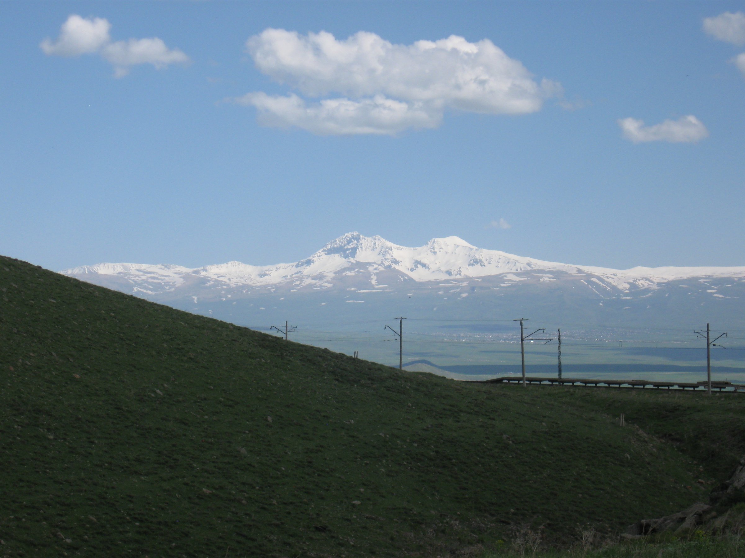
2. Kaçkar Mountains Traverse day section

Snapshot
Itinerary
Use a one-day section of the classic Kaçkar traverse, crossing high pastures, valley tracks, and pass terrain between Black Sea-side and inland-side mountain settlements. The exact AllTrails source-map title is broad, so the route line should be checked before final publication.
Why it is essential
A traverse day represents the Kaçkar better than a single viewpoint: yayla culture, alpine lakes/streams, and the old cross-range movement between Black Sea valleys and inland slopes.
Equipment
- Boots, rain/wind layers, offline GPS, water/food, poles.
- Transport plan for both ends.
Hazards and notes
- Route-finding, stream crossings, fog, dogs/livestock.
- Snow patches and one-way logistics.
GPX / KML links
| Source | URL | Format / access | Reuse status |
|---|---|---|---|
| AllTrails: Kaçkar Mountains Traverse | alltrails.com | Source route page / app track | AllTrails terms apply; GPX reuse unresolved |
| OpenStreetMap search | openstreetmap.org | Map / search | OSM data is ODbL; route relation not selected |
External links
3. Samistal Plateau to Ayder

Snapshot
Itinerary
Descend or traverse from Samistal Plateau through high pasture, forest-edge, and valley terrain toward Ayder. Direction matters: finishing in Ayder is logistically easier, but ascent/descent totals vary.
Why it is essential
This is a classic Black Sea yayla-to-valley experience: high summer pasture, mist, forest, water, and the cultural landscape around Ayder.
Equipment
- Boots, rain shell, warm layer, offline GPS, water/food.
- Reliable transport at start/end.
Hazards and notes
- Fog, slick trail, livestock dogs, stream crossings.
- Rough/seasonal vehicle access.
GPX / KML links
| Source | URL | Format / access | Reuse status |
|---|---|---|---|
| AllTrails: Kaçkar Mountains via the Samistal Plateau to Ayder | alltrails.com | Source route page / app track | AllTrails terms apply; GPX reuse unresolved |
| OpenStreetMap search | openstreetmap.org | Map / search | OSM data is ODbL; route relation not selected |
External links
4. Pokut-Sal Plateau balcony walk

Snapshot
Itinerary
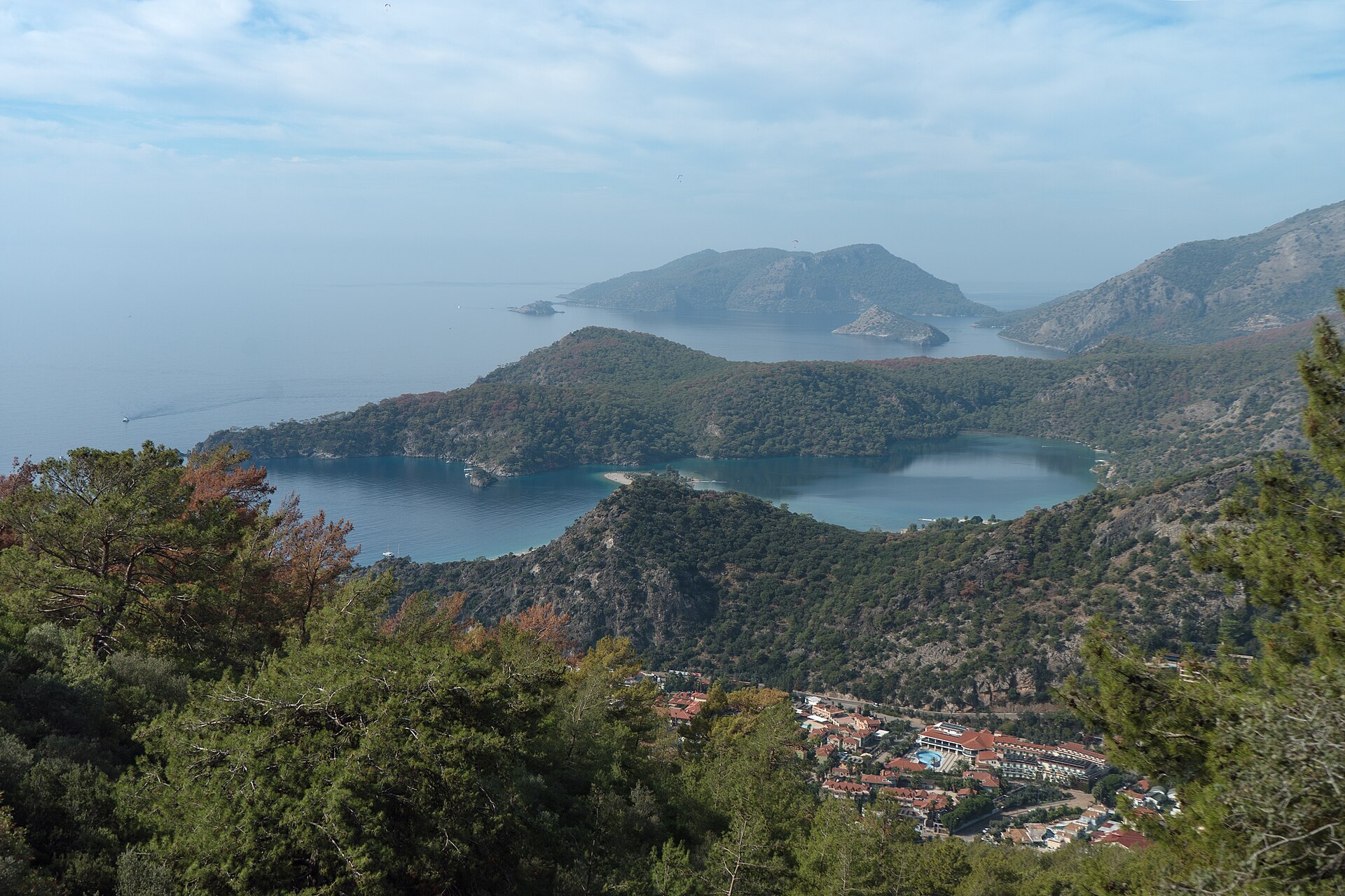
Walk between or above the Pokut and Sal plateaus on pasture tracks and ridge viewpoints, with views over the Fırtına valleys, cloud inversions, wooden yayla houses, and forested Black Sea slopes.
Why it is essential
Pokut-Sal is the Pontic yayla landscape in miniature: vernacular houses, cloud seas, rhododendron/forest edges, and high-pasture walking without a technical alpine objective.
Equipment
- Trail shoes/boots, rain jacket, warm layer, offline map, water.
- Local road/access confirmation.
Hazards and notes
- Fog, slippery pasture tracks, livestock dogs.
- Rough access roads, and navigation between informal tracks.
GPX / KML links
| Source | URL | Format / access | Reuse status |
|---|---|---|---|
| OpenStreetMap search | openstreetmap.org | Map / search | OSM data is ODbL; no reusable GPX/KML verified |
| Wikiloc search: Rize | wikiloc.com | Search / user tracks | No reusable GPX/KML verified |
External links
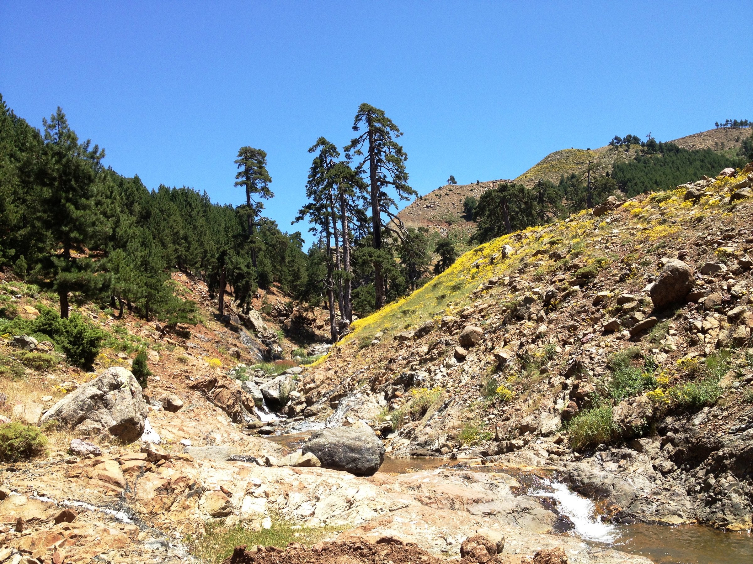
5. Küre Mountains: Horma Canyon / Valla Canyon viewpoint day

Snapshot
Itinerary
Use the maintained canyon walkway/viewpoint infrastructure around Horma Canyon or a short Valla Canyon viewpoint route for a western-Pontic forest-and-canyon day. Do not substitute technical canyoning for the walking route unless guided and equipped.
Why it is essential
The Pontic Mountains are not only Kaçkar alpine terrain; Küre represents the western Black Sea’s humid forests, deep canyons, caves, and protected-area biodiversity.
Equipment
- Walking shoes, rain layer, water.
- Helmet only if doing guided canyon activity, and current park/local access confirmation.
Hazards and notes
- Slippery boardwalk/rocks, flash-flood risk in canyon environments.
- Cliff edges at viewpoints, and closure of facilities.
GPX / KML links
| Source | URL | Format / access | Reuse status |
|---|---|---|---|
| OpenStreetMap search | openstreetmap.org | Map / search | OSM data is ODbL; no reusable GPX/KML verified |
| Küre Mountains National Park context (DKMP) | tarimorman.gov.tr/DKMP | Official park authority | No reusable GPX/KML verified |
External links
Missing data / follow-up work
- AllTrails route-file reuse is unresolved for all four routes with AllTrails sources; no reusable GPX/KML was confirmed.
- Maximum elevations for the Kaçkar Traverse day section and the Samistal-to-Ayder route remain unresolved.
- Samistal-specific licence-compatible imagery was not found; the entry uses a broader Kaçkar yayla photo as visual context.
- Pokut-Sal and Horma/Valla Canyon route statistics still need GIS / manual track creation before publication.
- Current national-park, road, snow, and yayla access conditions should be checked immediately before use.
External links
| Source | URL |
|---|---|
| Doğa Koruma ve Milli Parklar (DKMP) | tarimorman.gov.tr/DKMP |
| AllTrails — Kaçkar Dağı | alltrails.com |
| AllTrails — Kaçkar Mountains Traverse | alltrails.com |
| AllTrails — Kaçkar Mountains via Samistal Plateau to Ayder | alltrails.com |
| OpenStreetMap | openstreetmap.org |
| Waymarked Trails — Hiking | hiking.waymarkedtrails.org |