Regional overview
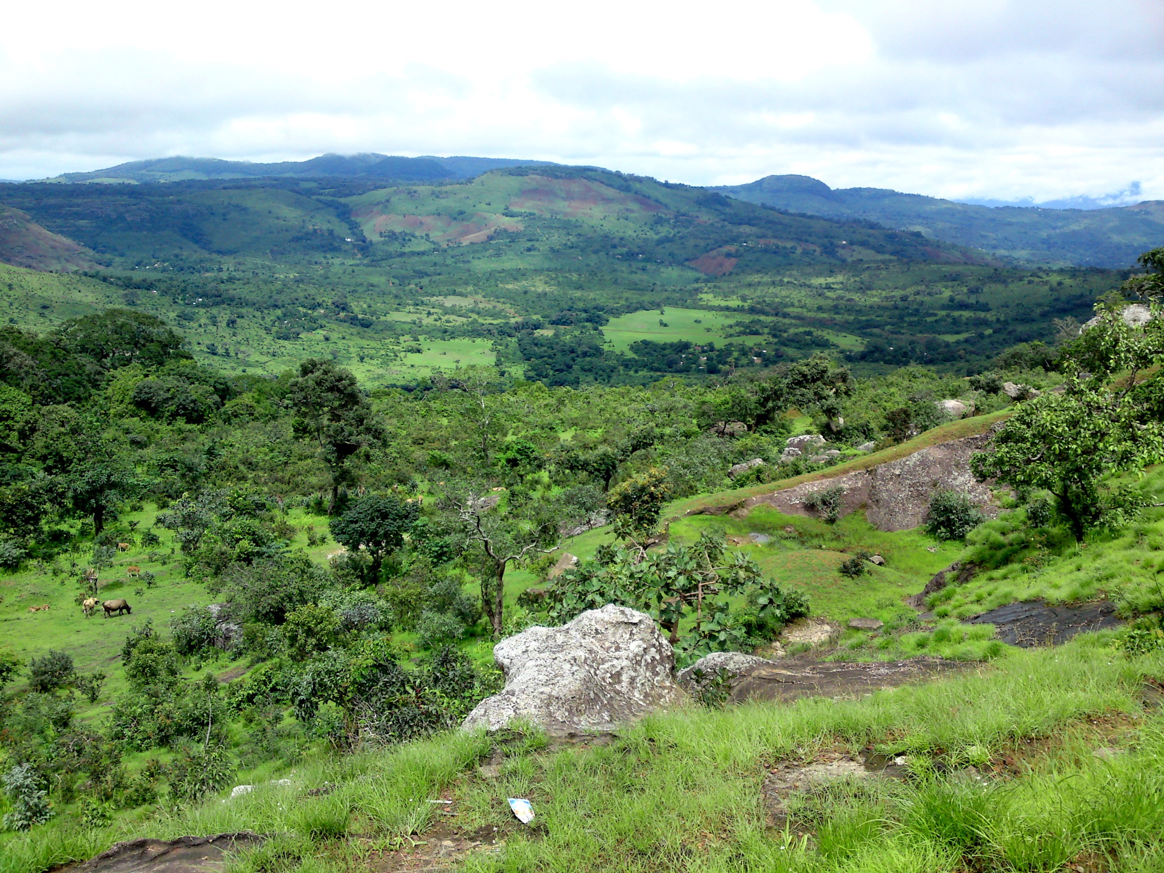
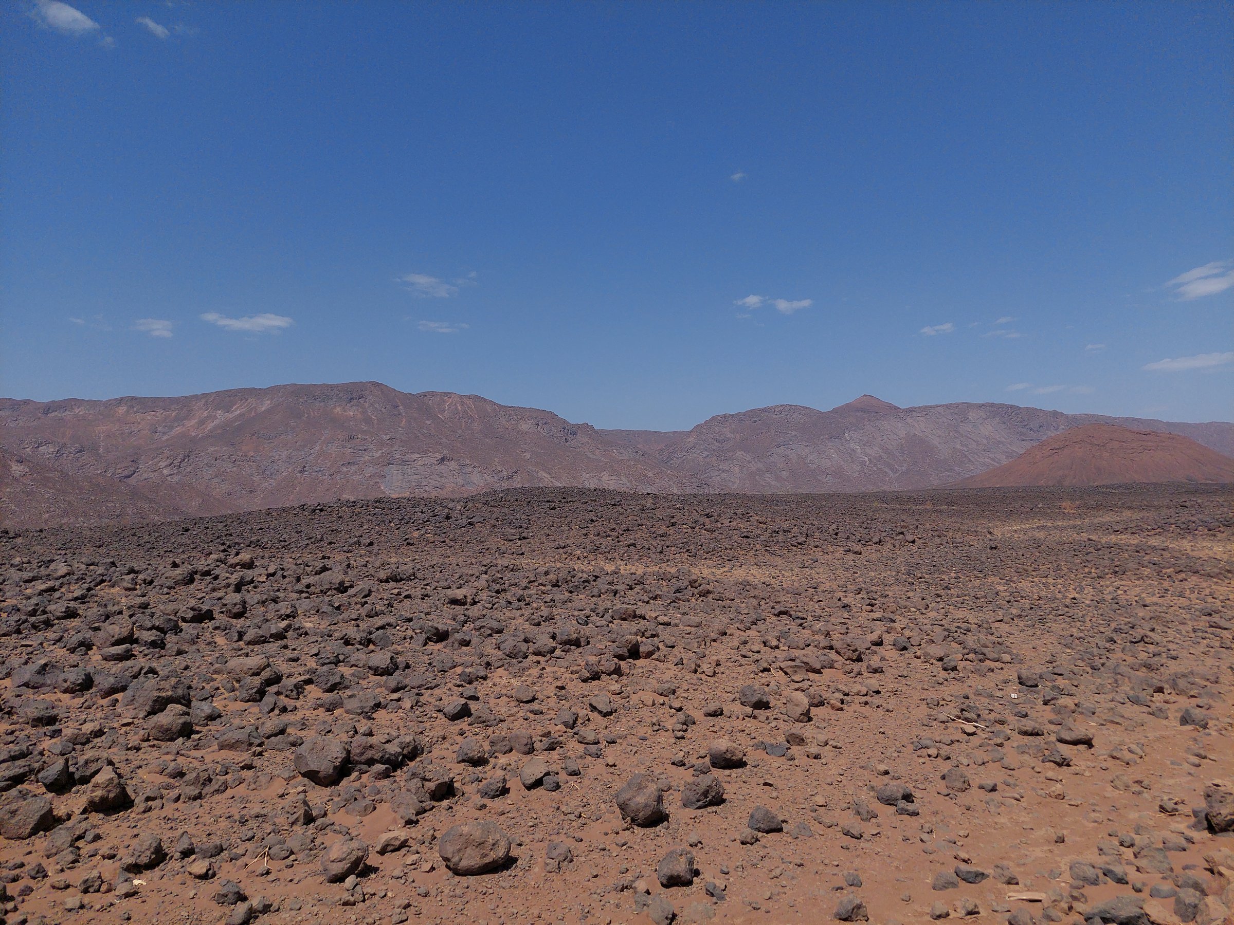
The Aïr Mountains are a remote Saharan massif in northern Niger, rising from desert plains into granite massifs, volcanic hills, high plateaux, dry valleys, gueltas, oases, rock-art areas, and old Tuareg settlement sites. The walking character is expedition-based rather than waymarked: short objectives from 4x4 camps or oases, high heat and water management, local guides, and long desert approaches.
The most important documented landscape units are the Aïr and Ténéré Natural Reserves, the Bagzane highlands around Niger’s highest point, the Timia oasis and waterfall, Iférouane, the Tamgak massif, and the Assodé ruins. Published GPS walking tracks are scarce. Several routes below are therefore candidate-only research entries rather than publication-ready hikes.
Current access is a major constraint. As of 2026, major government travel advisories warn against travel to Niger or large parts of it, with northern Agadez specifically highlighted in some advice. Any field use would require current official security checks, local permits, guides, and logistics.
Selection rationale
The five entries represent the essential Aïr themes: a high-point massif, the Timia oasis/waterfall, Iférouane/Tuareg access landscape, Assodé cultural ruins, and the Tamgak guelta/massif environment. Only Timia has a reasonably specific attraction distance from an official tourism source; the rest remain candidate-only until route geometry is sourced.
Summary table
| # | Hike | Route type | Distance | Elevation gain | Max elevation | Difficulty |
|---|---|---|---|---|---|---|
| 1 | Timia waterfall and oasis walk | Out-and-back from Timia, approximate | ca. 10 km return if starting in Timia | ca. 1,000 m oasis elevation; waterfall elevation unresolved | Moderate desert walk | |
| 2 | Mont Bagzane / Idoukal-n-Taghès highland route | Candidate summit/highland route | 2,022 m | Candidate only | ||
| 3 | Iférouane granite-and-oasis viewpoint walk | Candidate local walk | Candidate only | |||
| 4 | Assodé ruins cultural walk | Candidate cultural walk | Candidate only | |||
| 5 | Tamgak guelta / massif viewpoint route | Candidate guelta/massif route | ca. 1,988 m for Adrar Tamgak region in secondary sources; exact route unresolved | Candidate only |
Before you go
Permits, security, and access
As of 2026, major government travel advisories warn against travel to Niger or large parts of it, with northern Agadez specifically highlighted in some advice. Any field use of these routes would require current official security checks, local permits, guides, and logistics. Hiking the Aïr is expedition-style rather than a self-drive day-trip context: routes start from 4x4 camps or oases, and most candidate entries below remain research targets rather than publication-ready hikes.
Standard Aïr desert-hiking kit
For all five entries, plan around:
- Desert hiking kit: sturdy shoes, sun hat, sunglasses, sun protection, long sleeves, and large water carry.
- Navigation backup, headtorch, first-aid kit, emergency layer, and local guide.
- 4x4 support, satellite communication, and current security/access clearance.
Common hazards
Travel-advisory and security status is the primary unresolved constraint across the whole catalogue. On the ground, expect heat, dehydration, lack of waymarking, flash-flood risk around watercourses, and a remote rescue context. Cool-season-only windows apply to every route.
1. Timia waterfall and oasis walk
Snapshot
Itinerary
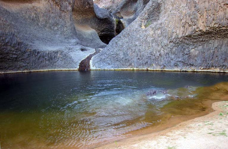
From Timia, the route would follow local paths or vehicle tracks toward the seasonal waterfall and pool described by Niger’s tourism-promotion site. The same source places the cascade about 5 km from Timia and describes the oasis, gardens, former fort, and mountain setting.
The actual foot route, ascent, water status, and legal/community access were not verified. The entry should be treated as a research target until a local guide track or official walking map is found.
Why it is essential
Timia is one of the best-known oasis bases in the Aïr. The waterfall and gardens show the rare green, water-fed side of a largely arid mountain region.
Hazards and notes
- Waterfall flow is seasonal and may not be present year-round.
- Flash-flood risk applies around watercourses after rare rain events.
GPX / KML links
| Source | URL | Format | Notes |
|---|---|---|---|
| Visit Niger: Chutte de Timia | visit-niger.com | Official attraction page | Confirms attraction and approximate 5 km distance; no GPX |
| OpenStreetMap search: Timia waterfall | openstreetmap.org | Map search | OSM data is ODbL; candidate geometry cross-check only |
External links
- Visit Niger, “Chutte de Timia”
- UNESCO, Aïr and Ténéré Natural Reserves
- NASA Science, “Air Mountains, Niger”
- U.S. Department of State, Niger travel advisory
- UK FCDO, Niger travel advice
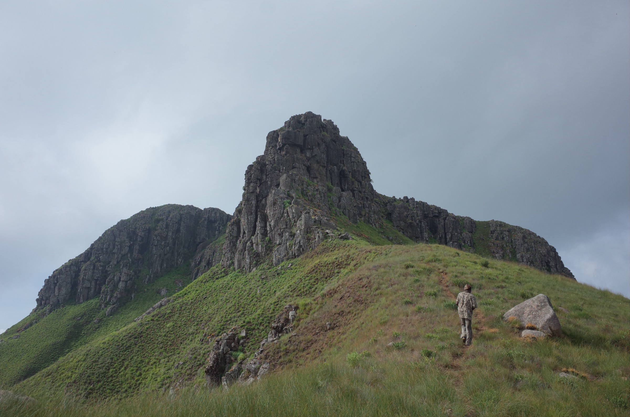
2. Mont Bagzane / Idoukal-n-Taghès highland route
Snapshot
Itinerary
The Bagzane highlands include Niger’s highest point, Mont Idoukal-n-Taghès, and a broad volcanic/granitic plateau within the Aïr. No reliable day-hike line, trailhead, or ascent statistics were verified. The candidate should be researched with local guide records, OSM/terrain data, and any official protected-area access rules before publication.
Why it is essential
The Bagzane / Idoukal-n-Taghès objective represents the high-point and high-plateau side of the Aïr, making it a necessary research target even though the route is not yet publishable.
Hazards and notes
- No route statistics or GPX found.
- Heat, lack of water, route-finding, and remote rescue context are significant.
GPX / KML links
| Source | URL | Format | Notes |
|---|---|---|---|
| Wikimedia Commons / Wikidata Bagzane category | commons.wikimedia.org | Media / geographic source | Useful for waypoint research only; not a route file |
| OpenStreetMap search: Mont Bagzane | openstreetmap.org | Map search | OSM data is ODbL; candidate geometry cross-check only |
External links
3. Iférouane granite-and-oasis viewpoint walk
Snapshot
Itinerary
Iférouane is an Aïr oasis town and gateway to nearby cultural and natural sites. A day-hike catalogue route could be a local granite viewpoint, rock-art, or oasis-edge walk, but no route statistics or legal walking line were found.
Why it is essential
Iférouane is one of the key named settlements of the Aïr and gives access to the northern side of the massif. It remains a candidate until local route data is obtained.
Hazards and notes
- Security/access constraints and route geometry unresolved.
- Heat, lack of water, and no reliable waymarking.
GPX / KML links
| Source | URL | Format | Notes |
|---|---|---|---|
| Agence Nigérienne de Presse: Iférouane tourism sites | anp.ne | Local news / tourism context | Context only; no route file |
| OpenStreetMap search: Iférouane | openstreetmap.org | Map search | OSM data is ODbL; candidate geometry cross-check only |
External links
4. Assodé ruins cultural walk
Snapshot
Itinerary
Assodé is repeatedly mentioned as a ruined settlement near Timia, but no reliable walking route, GPX, distance, or visitor rule set was verified. A short guided cultural walk may be possible if local access permits, but the route should remain a research candidate.
Why it is essential
The Aïr catalogue needs a cultural/historical route as well as summit and oasis objectives. Assodé is the most obvious candidate, but it is not ready for publication.
Hazards and notes
- Do not disturb ruins, artefacts, or archaeological deposits.
- No route statistics found.
GPX / KML links
| Source | URL | Format | Notes |
|---|---|---|---|
| Visit Niger: Chutte de Timia | visit-niger.com | Official attraction page mentioning regional context | Context only; no route file |
| OpenStreetMap search: Assodé | openstreetmap.org | Map search | OSM data is ODbL; candidate geometry cross-check only |
External links
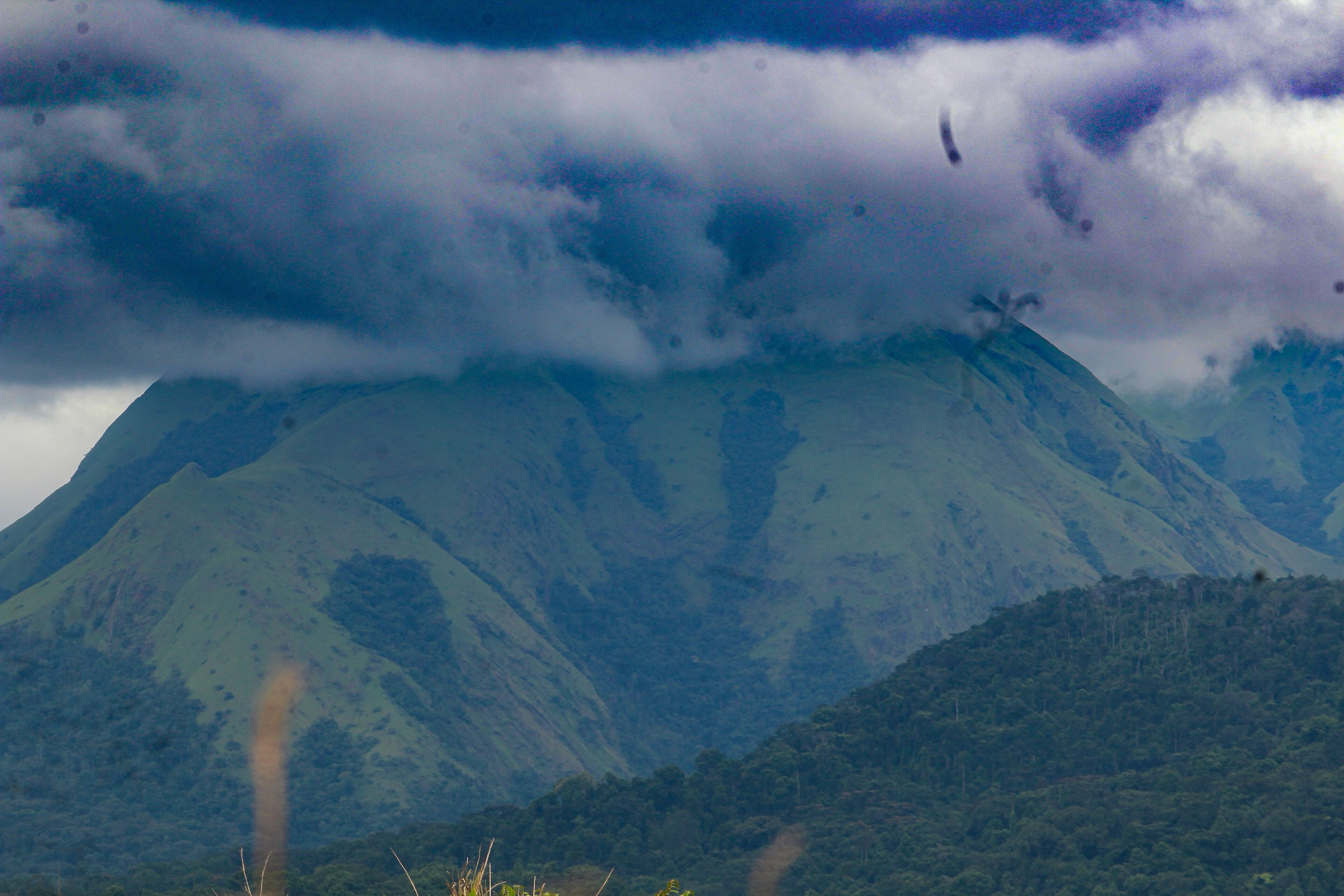
5. Tamgak guelta / massif viewpoint route
Snapshot
Itinerary
The Tamgak massif is one of the major mountain environments of the Aïr and is associated with gueltas and distinctive biodiversity. No walkable day-route line, trailhead, statistics, or permissions were verified in this pass.
Why it is essential
Tamgak represents the wetter guelta/refuge side of the Aïr mountain ecology and broadens the selection beyond Timia and Bagzane.
Hazards and notes
- Candidate only; no route data found.
- Sensitive water and wildlife habitats may have restrictions.
GPX / KML links
| Source | URL | Format | Notes |
|---|---|---|---|
| OpenStreetMap search: Tamgak Niger | openstreetmap.org | Map search | OSM data is ODbL; candidate geometry cross-check only |
External links
- UNESCO, Aïr and Ténéré Natural Reserves
- Natural World Heritage Sites, Aïr and Ténéré overview
- NASA Science, “Air Mountains, Niger”
External links
| Source | URL |
|---|---|
| UNESCO, Aïr and Ténéré Natural Reserves | whc.unesco.org |
| Visit Niger, “Chutte de Timia” | visit-niger.com |
| NASA Science, “Air Mountains, Niger” | science.nasa.gov |
| U.S. Department of State, Niger travel advisory | travel.state.gov |
| UK FCDO, Niger travel advice | gov.uk |