Regional overview
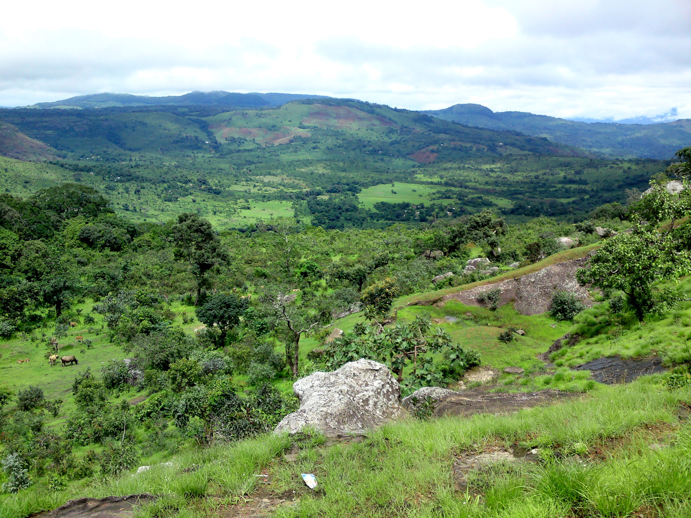
The Fouta Djallon is the main walking region of Middle Guinea: a high sandstone and lateritic plateau cut by rivers, wooded gullies, escarpments, villages, bamboo groves, natural bridges, and waterfalls. It is often described as one of West Africa’s major water towers because important regional rivers rise in or near these highlands.
The most useful hiking bases are Dalaba, Douki, Ditinn, Pita, Labé, and the smaller villages around the waterfall sites. Published hiking information is patchy, but several usable Wikiloc tracks exist for Dalaba, Douki, Kambadaga, and Ditinn. Official/local tourism pages help confirm the importance of Pont de Dieu, Kambadaga, Saala, and other Fouta sights, but route geometry is still mostly community-sourced.
The best walking season is normally the cooler dry season after the rains, when waterfalls still hold water and roads are more passable. Wet-season travel brings fuller rivers and greener scenery but can make dirt-road access, river crossings, and steep clay paths difficult. Local guides remain strongly recommended because waymarking is limited and many paths pass through village land.
Selection rationale
These five hikes prioritise day routes that represent the core Fouta Djallon walking character: major waterfalls, Douki escarpment scenery, Dalaba’s natural bridge, and the iconic Mont Loura / Dame de Mali highland objective. Chutes de Saala and the Douki gorge remain important follow-up candidates, but reliable route statistics were not found for them in this pass.
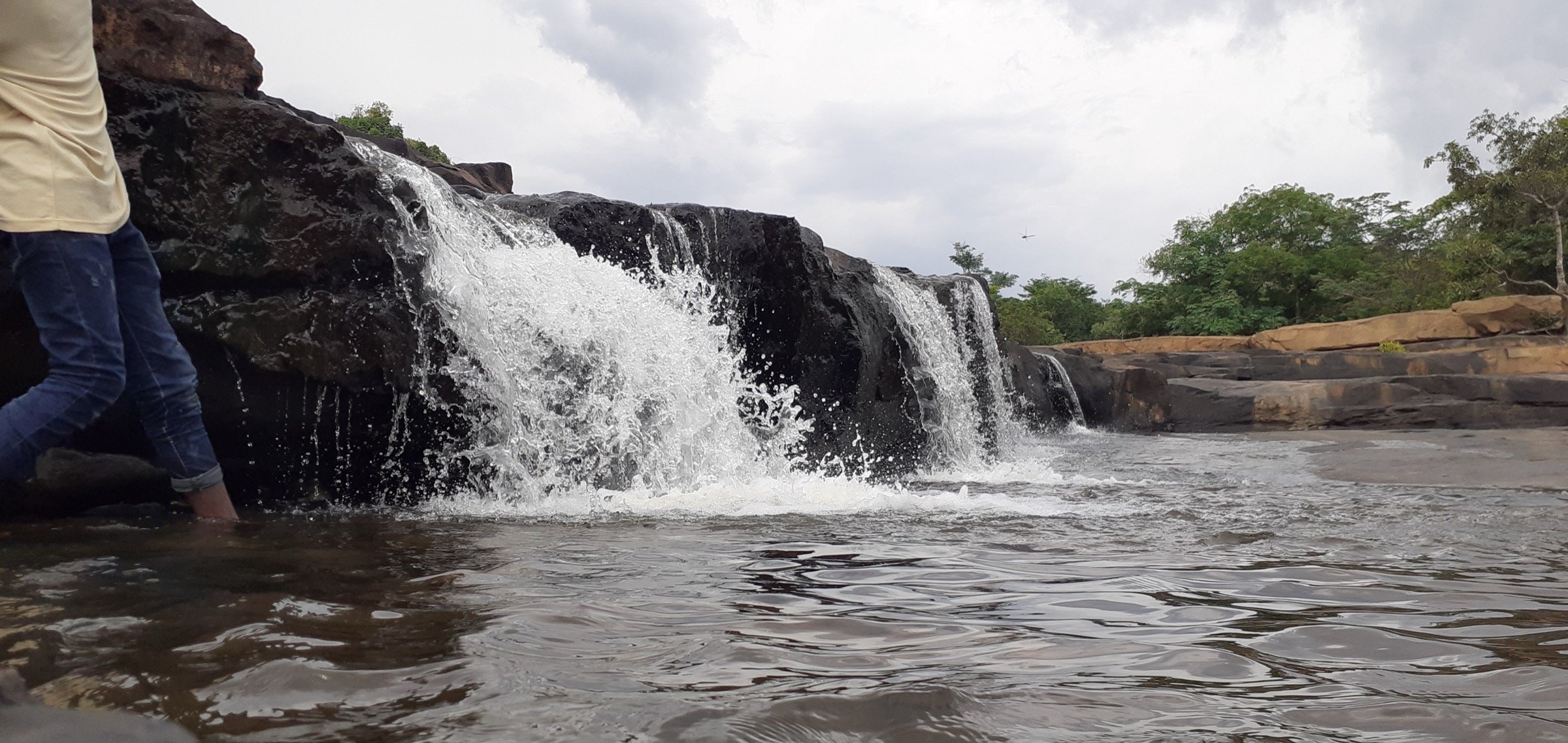
- Kambadaga Falls walk — a short waterfall walk near Sarang in the Pita area.
- Ditinn Falls route — a Ditinn-village waterfall route via an abandoned campement and river crossing.
- Pont de Dieu from Dalaba — Dalaba’s natural rock-bridge walk through pine and bamboo forest.
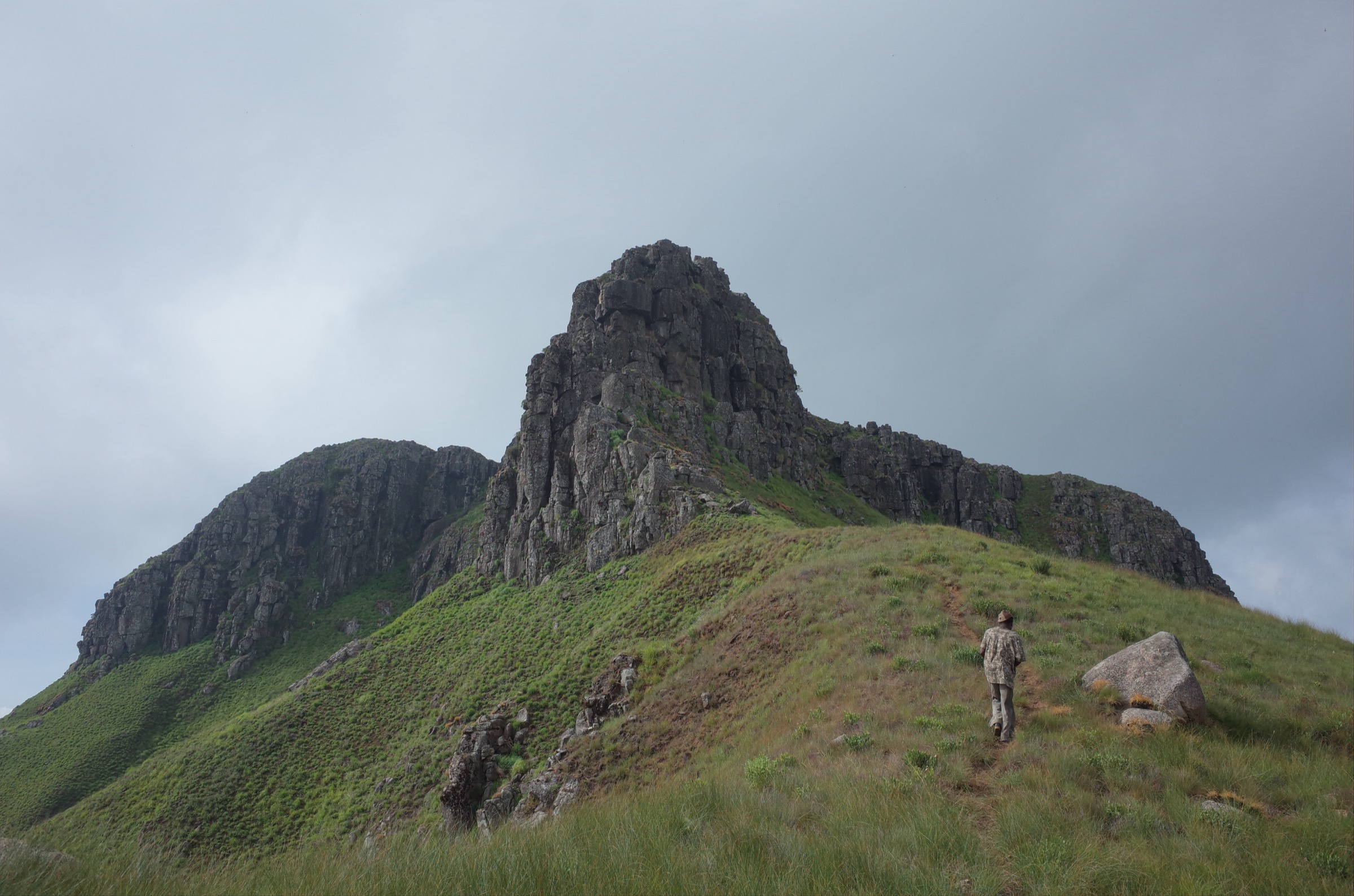
- Douki Fouta Cliffs loop — a classic Douki escarpment loop.
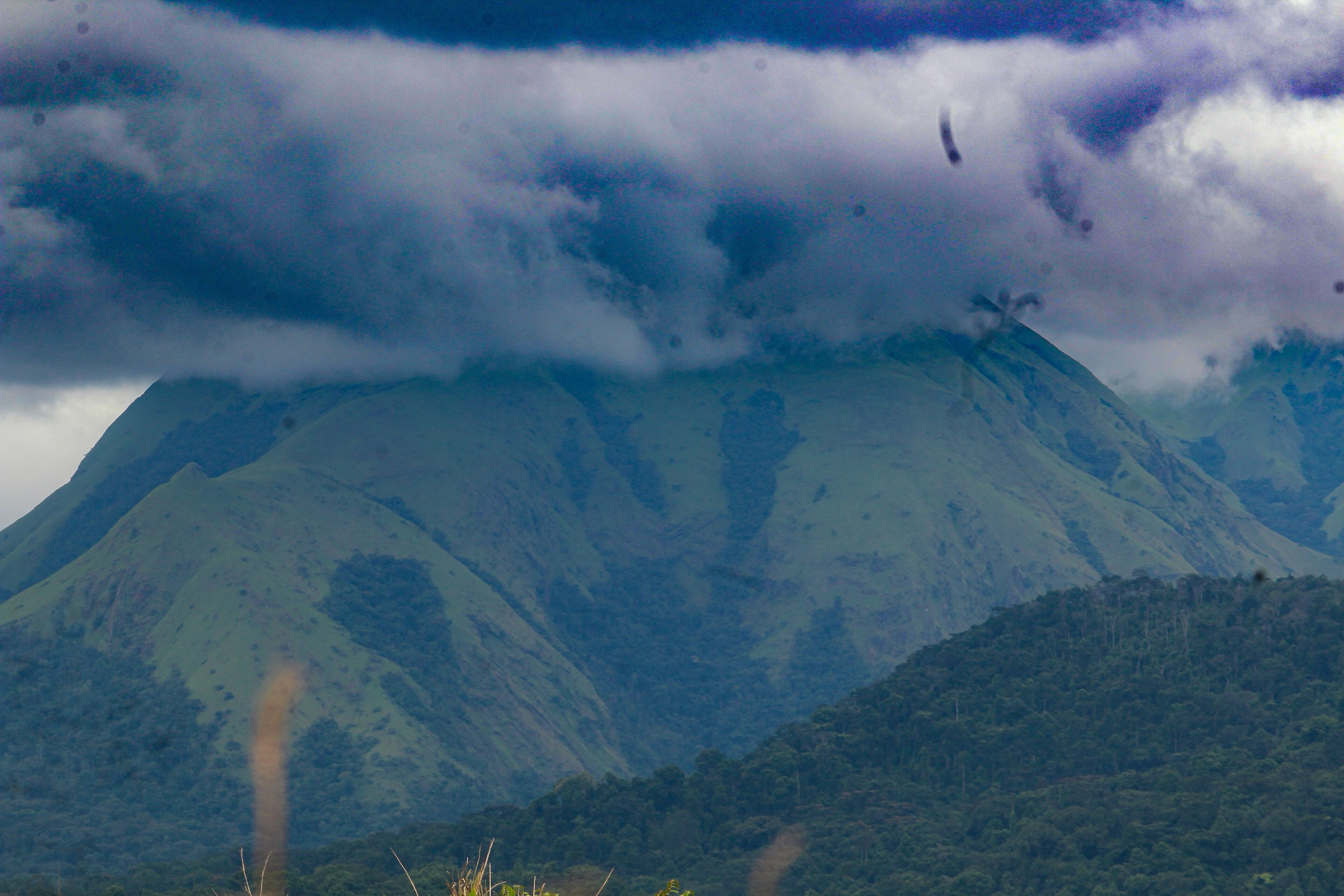
- Mont Loura / Dame de Mali escarpment walk — northern Fouta Djallon’s highland landmark, candidate-only.
Summary table
| # | Hike | Route type | Distance | Gain | Max elevation | Difficulty |
|---|---|---|---|---|---|---|
| 1 | Kambadaga Falls walk | One-way source track; return/loop variant unresolved | 5.1 km | 173 m | 863 m | Easy–moderate |
| 2 | Ditinn Falls route | One-way source track; usually walked out-and-back | 9.0 km | 261 m | 808 m | Easy–moderate |
| 3 | Pont de Dieu from Dalaba | One-way source track; out-and-back/loop possible | 7.9 km | 80 m | 1,254 m | Easy |
| 4 | Douki Fouta Cliffs loop | Loop | 12.9 km | 336 m | 1,136 m | Moderate |
| 5 | Mont Loura / Dame de Mali escarpment walk | Candidate summit/escarpment walk | 1,538 m–1,573 m, depending on source | Candidate only |
Before you go
Required equipment
The Fouta Djallon mixes village paths, escarpment edges, waterfall pools and river crossings. The same baseline equipment applies across all five walks, with extras noted per hike:
- Hiking shoes or boots with good grip; trekking poles useful on wet or eroded paths.
- Water, food, sun protection and a rain layer; waterproof bag protection in wet season.
- Map/GPS and a navigation backup; waymarking is limited.
- Wind layer and headtorch for higher escarpment days (especially Mont Loura).
- Local guide strongly recommended on every walk; paths cross village land and community arrangements matter.
Current access and safety notes
- Local guide arrangements, visitor fees, road conditions and community permissions need local confirmation.
- Waterfall edges, plunge pools and wet rock require conservative judgement.
- Wikiloc tracks are mostly one-way recordings; return distance, ascent and route variants need to be checked before field use.
- River crossings and flash-flood risk should be treated seriously after rain.
- Cliff-edge exposure on Douki and Mont Loura; avoid in poor visibility.
- Mont Loura / Dame de Mali is candidate-only: trailhead, route line and access rules are not verified, and published elevation figures conflict (1,538 m in Britannica, 1,573 m in Commons/Wikidata data).
1. Kambadaga Falls walk
Snapshot
Itinerary
The route follows the published Kambadaga waterfalls track near Sarang to the waterfall area. The Wikiloc source gives a short one-way walking line with modest ascent, so a catalogue-ready outing should either arrange a return on the same line or verify a safe continuation/loop before publication.
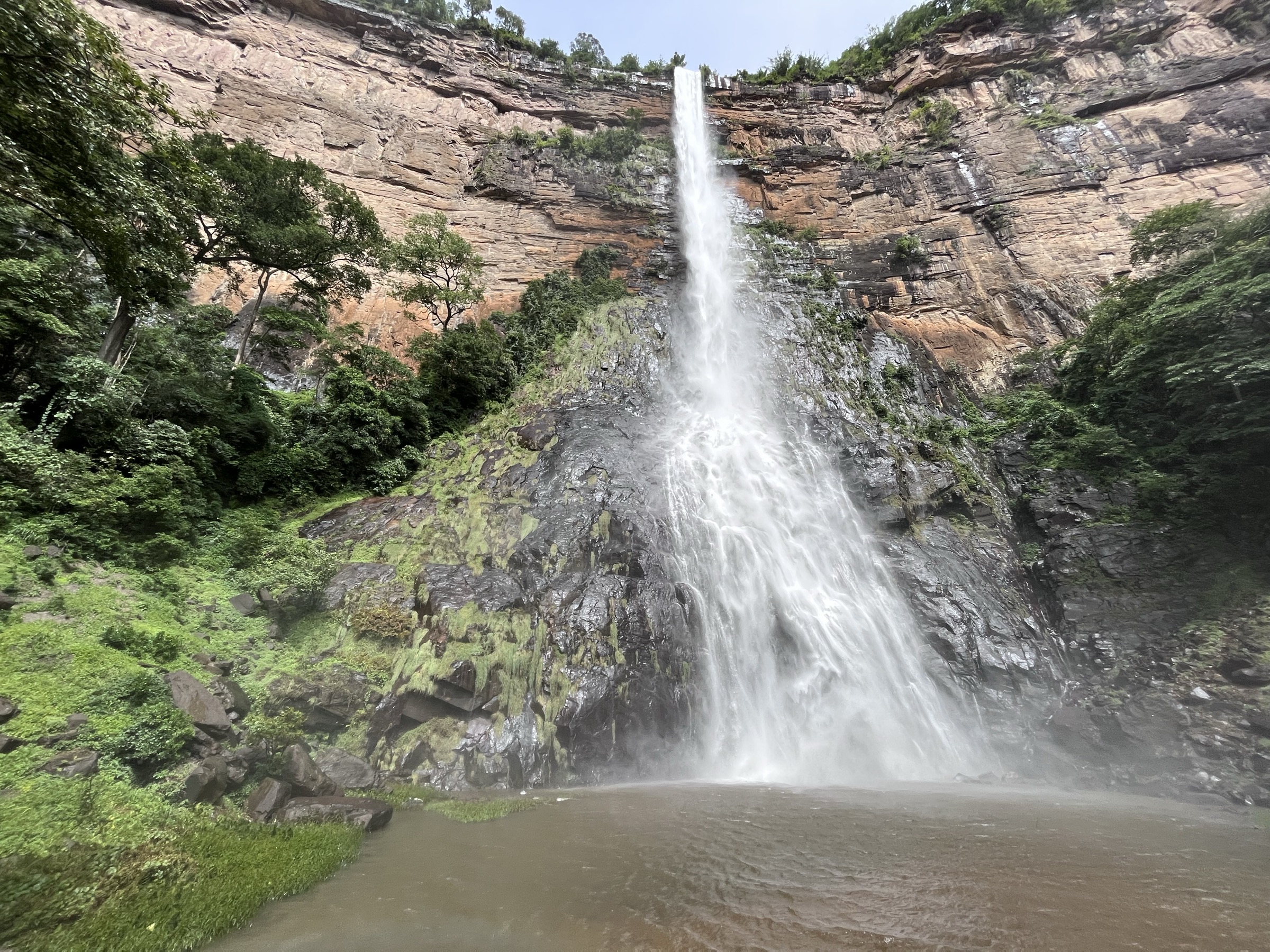
The walking objective is the Kambadaga waterfall system, a major Fouta Djallon sight in the Pita area. Expect rough local paths, wet rock around viewpoints and pools, and variable river levels after rain.
Why it is essential
Kambadaga is one of the best-known waterfall sites in the Fouta Djallon and gives a compact introduction to the plateau’s river-cut scenery. It is a stronger catalogue choice than less documented waterfalls because both a public route source and an open-licence Commons image were found.
Hazards and notes
- Wet rock, slippery viewpoints, sudden changes in water level, and poor road access after rain.
- Do not assume a one-way Wikiloc track is a complete return hike.
- Waterfall edges and plunge pools require conservative judgement.
- Local permissions, guide arrangements, and any visitor fees should be checked in Pita/Sarang before walking.
GPX / KML links
| Source | URL | Format / access | Reuse status |
|---|---|---|---|
| Wikiloc: Kambadaga waterfalls | wikiloc.com | Source route page / GPX via Wikiloc | Route statistics checked; GPX reuse not confirmed under Wikiloc terms |
External links
2. Ditinn Falls route
Snapshot
Itinerary
The source route starts in Ditinn, leaves town by road, continues to an abandoned campement, crosses a river, and climbs a path toward the waterfall. The route finishes at the waterfall pool. For a catalogue day hike, the practical return should be treated as the same route back unless a verified alternative track is selected.
The route combines village access, farm and forest margins, a river crossing, and a waterfall basin. Water and transport logistics matter more than the technical walking grade.
Why it is essential
Ditinn Falls is one of the named waterfall objectives most associated with Fouta Djallon trekking. It is included because a detailed public route source gives statistics, a start description, and waypoints.
Hazards and notes
- The source mentions a river crossing and a waterfall pool; flash-flood and slippery-rock risk should be treated seriously.
- Return transport from Ditinn can be limited; the source used market-day timing, which may not apply on other days.
- The source track is one-way; total return distance and ascent need a follow-up GPX check.
GPX / KML links
| Source | URL | Format / access | Reuse status |
|---|---|---|---|
| Wikiloc: Ditinn waterfalls | wikiloc.com | Source route page / GPX via Wikiloc | Route statistics checked; GPX reuse not confirmed under Wikiloc terms |
External links
3. Pont de Dieu from Dalaba
Snapshot
Itinerary
The route leaves Dalaba, passes through town margins, a sand quarry area, pine forest, farms, and bamboo forest, and reaches Pont de Dieu, a natural rock bridge with a stream passing through it. The source route is one-way, but an out-and-back or mixed return using an alternative Wikiloc/Dalaba path may be possible after map comparison.
Why it is essential
Pont de Dieu is one of the most accessible walking objectives from Dalaba and adds a cultural/geological counterpoint to the waterfall-heavy Fouta selection. It also has a verified route source with distance, elevation and time.
Hazards and notes
- Village paths and informal tracks may change or pass through private/community land.
- Route variants should be checked before publication because two Wikiloc versions differ in distance.
- A local guide helps avoid route-finding errors and awkward passage through compounds or working land.
GPX / KML links
| Source | URL | Format / access | Reuse status |
|---|---|---|---|
| Wikiloc: Pont de dieu | wikiloc.com | Source route page / GPX via Wikiloc | Route statistics checked; GPX reuse not confirmed under Wikiloc terms |
| Fouta Tourisme: Le Pont de Dieu | foutatourisme.com | Local tourism page | Confirms attraction/access context; route file not provided; site terms unresolved |
External links
4. Douki Fouta Cliffs loop
Snapshot
Itinerary
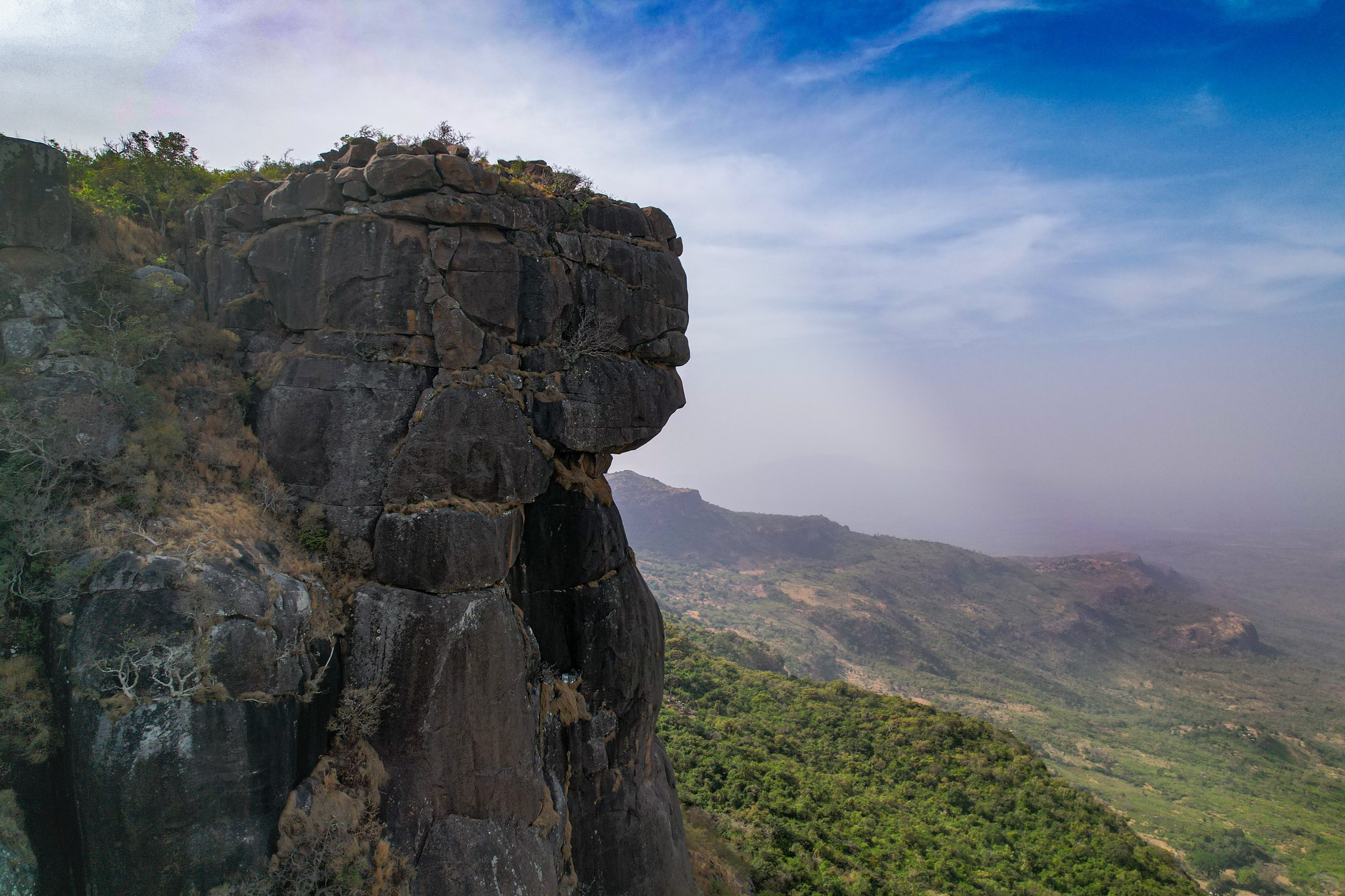
The route starts around Douki and makes a loop to the edge of the Fouta cliffs. It passes through village/family areas and bush paths before reaching the escarpment viewpoints. The Wikiloc source warns that route-finding around compounds can be socially awkward without local guidance, so a guided approach is preferred.
Why it is essential
Douki is one of the classic trekking names in the Fouta Djallon. This loop provides the catalogue’s main escarpment and viewpoint route, balancing the waterfall and natural-bridge walks.
Hazards and notes
- Cliff-edge exposure and wet grass/rock can increase seriousness.
- Village land and campement access need respectful local arrangements.
- Navigation is not a maintained national-park trail system.
GPX / KML links
| Source | URL | Format / access | Reuse status |
|---|---|---|---|
| Wikiloc: Fouta — Cliffs | wikiloc.com | Source route page / GPX via Wikiloc | Route statistics checked; GPX reuse not confirmed under Wikiloc terms |
External links
5. Mont Loura / Dame de Mali escarpment walk
Snapshot
Itinerary
Mont Loura, also known in sources as Tamgué, is the northern high point of the Fouta Djallon near the town of Mali. The best-known walking objective is the Dame de Mali rock form and escarpment viewpoint area. No complete route line, trailhead, distance, ascent, or access rule set was verified in this pass, so this entry should be treated as a high-priority candidate rather than a publishable itinerary.
A practical catalogue route would probably start from Mali or a nearby village/trackhead, climb or traverse toward the Dame de Mali viewpoint, and return by the same line or a locally guided loop. That route needs field confirmation, OSM/GPS reconciliation, and local permission checks before use.
Why it is essential
Mont Loura / Dame de Mali is too important to leave out merely because open route data is thin: it is one of the signature highland landmarks of northern Fouta Djallon and anchors the catalogue beyond the Dalaba–Douki–Pita waterfall circuit. Its inclusion is explicitly candidate-only until route geometry is verified.
Hazards and notes
- Route geometry, safe viewpoints, and any exposed escarpment sections are unresolved.
- Published elevation figures conflict: Britannica gives 1,538 m for Mount Loura/Tamgué, while Commons/Wikidata-derived category data gives 1,573 m.
- Avoid cliff edges, wet rock, and poor visibility.
- Do not publish a derived route until a guide track or official/local itinerary is obtained.
GPX / KML links
| Source | URL | Format / access | Reuse status |
|---|---|---|---|
| Britannica: Mount Loura | britannica.com | Geographic reference | Confirms high-point context/elevation; no route geometry; Britannica terms apply |
| Wikimedia Commons: Mont Loura category | commons.wikimedia.org | Media/geographic source | Confirms location/media context; no route geometry |
| OpenStreetMap search: Mont Loura | openstreetmap.org | Map search | OSM data is ODbL; no selected route relation; candidate geometry cross-check only |
External links
External links
| Source | URL |
|---|---|
| Wikiloc — Guinea hiking routes | wikiloc.com |
| Wikiloc — Dalaba hiking listings | wikiloc.com |
| Wikiloc — Douki hiking listings | wikiloc.com |
| Wikiloc — Kambadaga waterfalls | wikiloc.com |
| Wikiloc — Ditinn waterfalls | wikiloc.com |
| Wikiloc — Pont de dieu | wikiloc.com |
| Wikiloc — Fouta Cliffs | wikiloc.com |
| Fouta Tourisme — Pont de Dieu | foutatourisme.com |
| Britannica — Mount Loura | britannica.com |
| Lonely Planet — Chutes de Saala context | lonelyplanet.com |