Regional overview
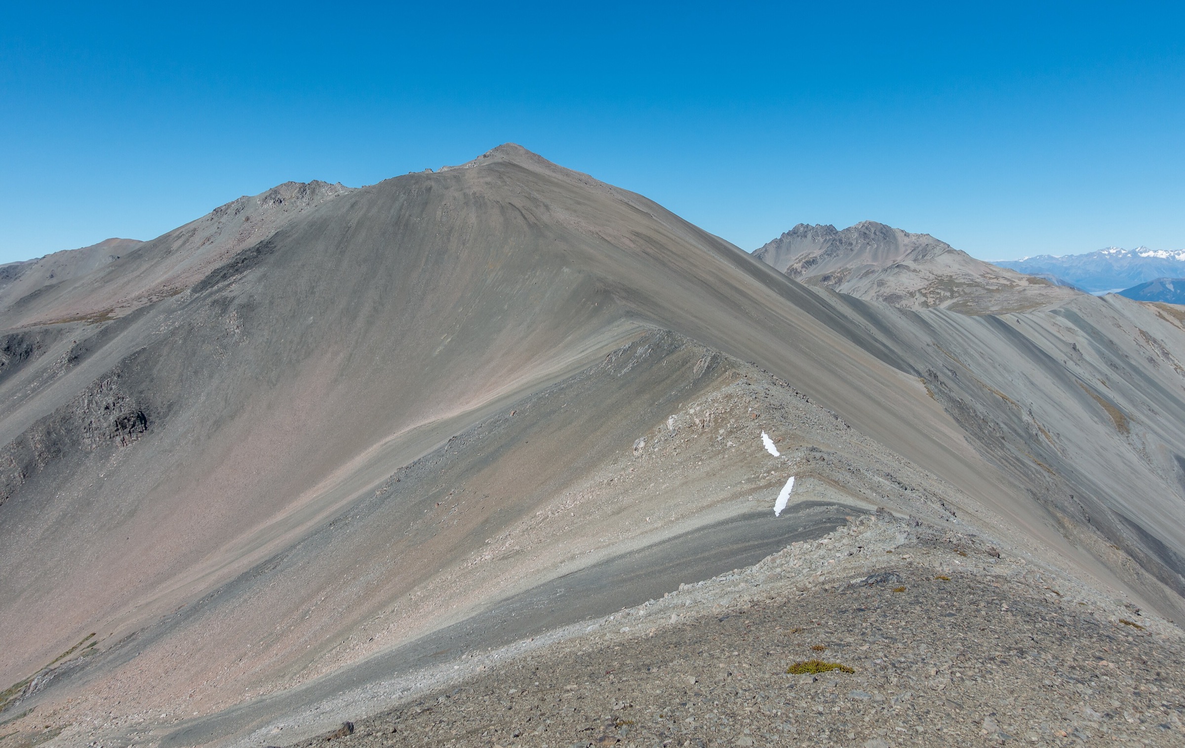
The Livingstone Mountains form the eastern wall of Fiordland National Park, running north–south between the Eglinton / Te Anau–Milford Road on the west and the Mararoa River and Mavora Lakes on the east. The range begins at South Mavora Lake in the south and terminates at The Divide in the north, where it abuts the Routeburn Track and the Darran Mountains. The Southern Livingstones — the sector covered by this catalogue — are the lower-tops country between South Mavora Lake and the Boundary Hut / Forks Hut latitude, including Mt Cerberus (1,568 m) and Mt Eldon as the principal named summits.
A geographic note matters here, because the Southern Livingstones are often confused with adjoining ranges. The Livingstone Mountains do not extend south to Borland, Lake Manapouri, or the Princhester area. Princhester sits in the Takitimu Mountains, a separate range further south accessed off Princhester Road from State Highway 94; the Borland Saddle country lies between the Hunter Mountains and the eastern arm of Fiordland, again unrelated to the Livingstones. The Waiau / Manapouri basin is separated from the Livingstones by the Snowdon Forest, the Takitimus, and the lower Waiau plain. The operative southern boundary of the range is South Mavora Lake, and that is where this catalogue stops.
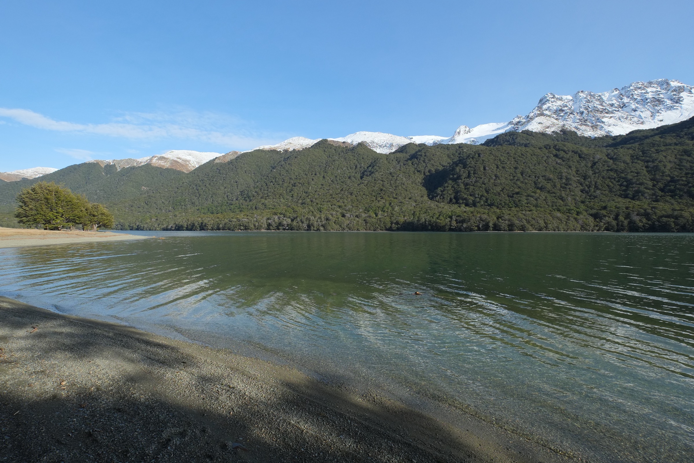
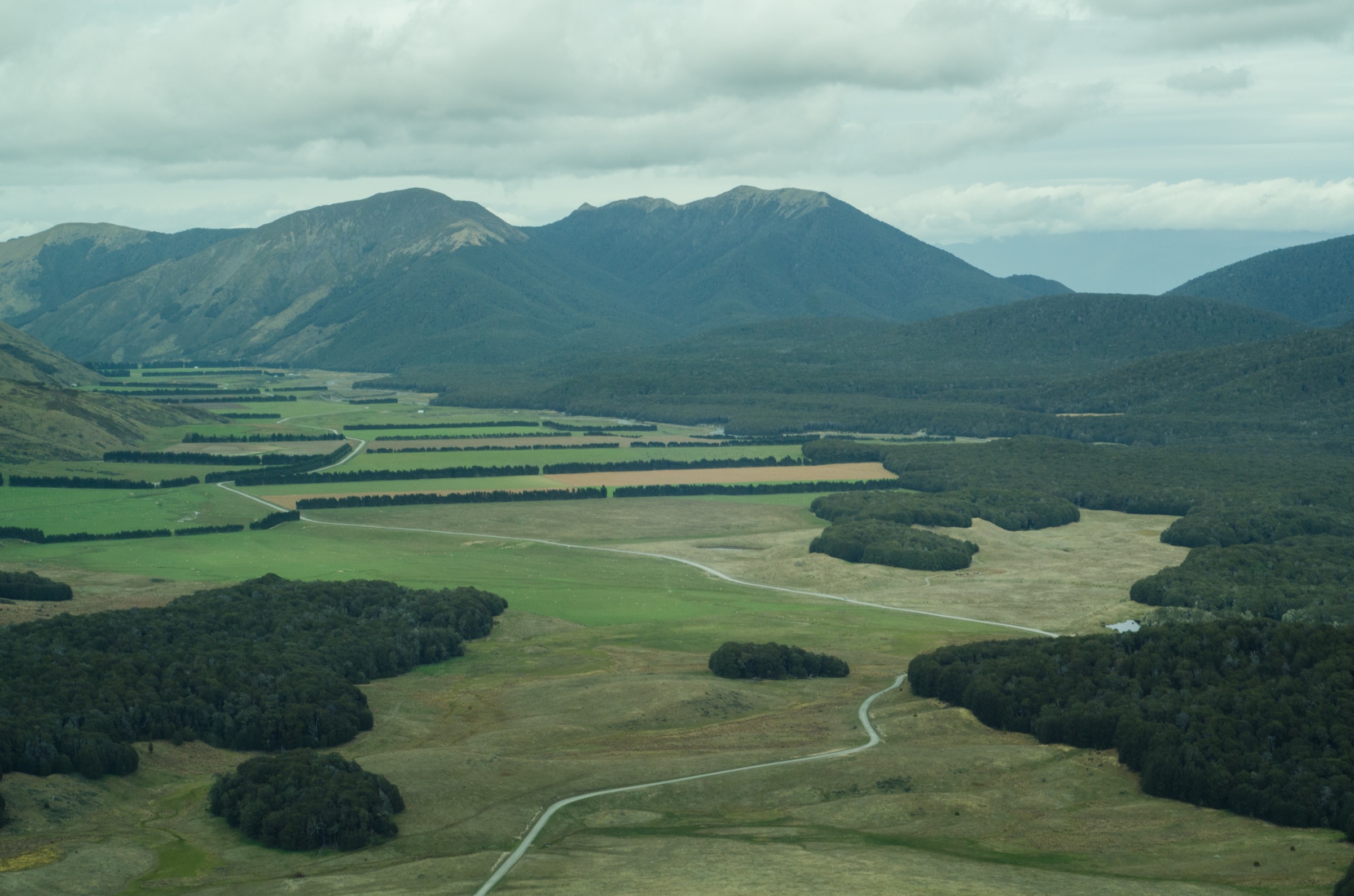
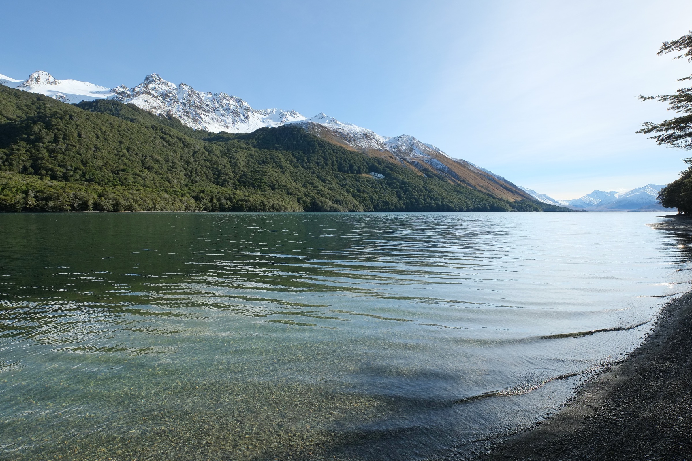
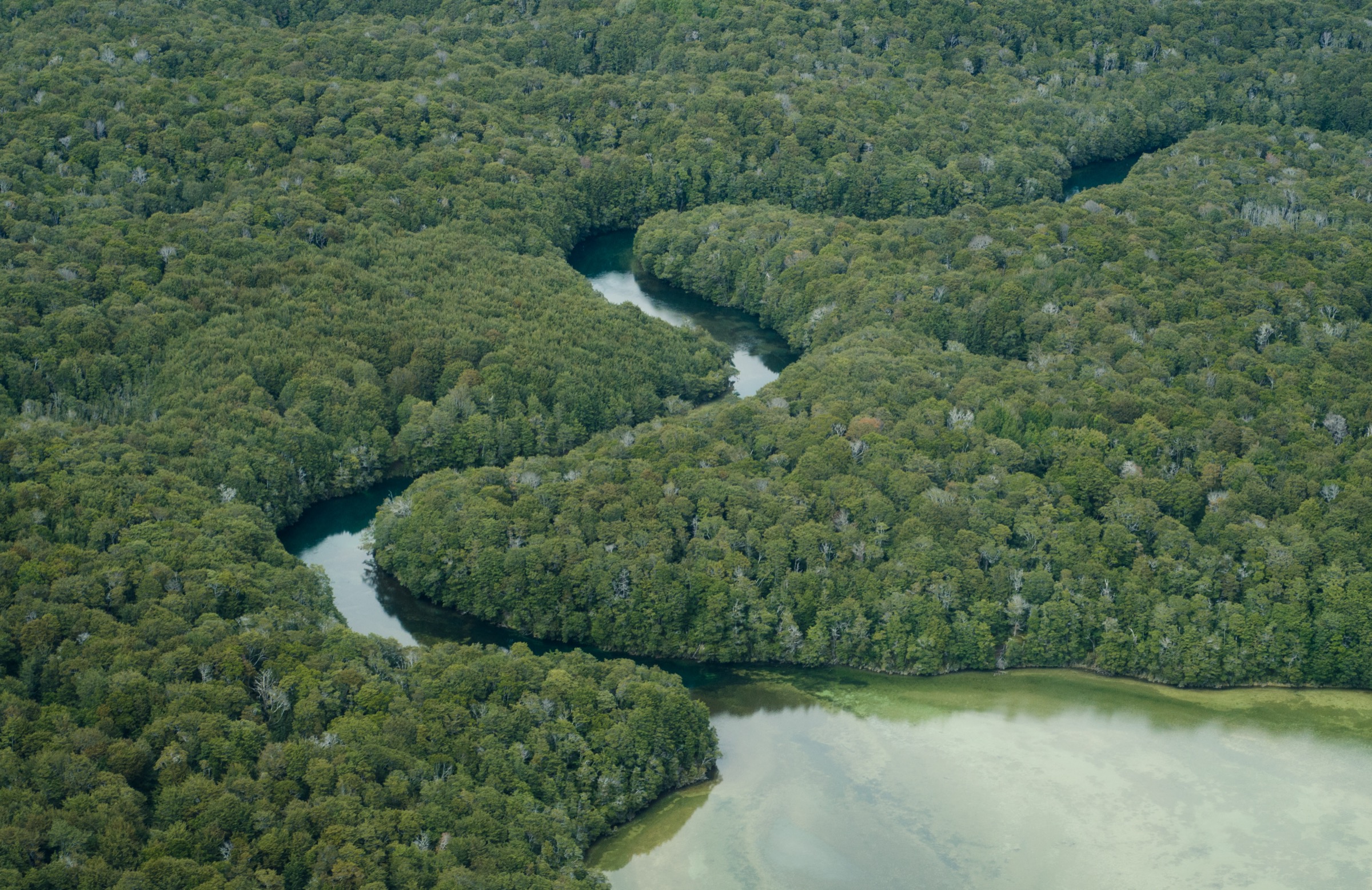
The valley between the Livingstones (west) and the Thomson Mountains (east) contains North Mavora Lake and South Mavora Lake, together forming the spine of Mavora Lakes Conservation Park. With the adjoining Snowdon Forest Conservation Area to the south-west, the basin lies inside the Te Wāhipounamu / South-West New Zealand World Heritage Area. The valley floor is open tussock grassland threaded with the Mararoa River and red beech forest on the lower slopes; the western escarpment of the southern Livingstones, formed along the Livingstone Fault, rises abruptly to roughly 1,600 m straight out of the lake shore.
Access is from State Highway 94 between Mossburn and Te Anau, with signposted turn-offs at Centre Hill or Burwood Station. From either turn-off it is approximately 39 km of gravel road (Mavora Lakes Road) to the Mavora Lakes campsite at the head of South Mavora Lake — Te Anau is around 90 minutes’ drive away. There is no public transport to the lakes; the nearest scheduled buses run on SH 94. The basin is served by the Mavora Lakes Conservation Campsite (self-registration), Careys Hut, Boundary Hut, Taipo Hut and Kiwi Burn Hut, with no commercial accommodation.
The hike-friendly season is December to April. The southern Livingstones receive less precipitation than the Fiordland interior immediately to the west, but the Mararoa, Whitestone and Upukerora can rise quickly after rain and the tops carry residual snow into early summer. Mobile phone coverage is intermittent from the campsite and effectively absent in the side-valleys; a Personal Locator Beacon is the regional norm. Dogs are permitted on lead in the lakeside camping area and along the Mavora Walkway as far as Boundary Hut, but not beyond. The basin has a secondary identity as a Lord of the Rings filming location, with the lakes doubling for Nen Hithoel, Fangorn, the Silverlode and the River Anduin — a profile that drives tourism unrelated to the tramping value of the range.
For the higher tops and the multi-day routes onto the Livingstone main divide, see the companion catalogue Northern Livingstone Mountains: Essential Day-Hikes.
Selection rationale
The brief asked for routes that are iconic, representative of the landscape, scenically important, widely recognised by DOC and local clubs, and feasible as a day hike for fit walkers in normal summer conditions. The honest answer for the Southern Livingstones is that the sector does not support five essential day-hikes: there are no DOC-published or guidebook-published summit day-walks at this end of the range. Mt Cerberus, Mt Eldon and Mt Richmond are described uniformly by Wilderness Magazine, NZ Route Guides and trip-report sources as multi-day route-grade objectives across exposed, unmarked alpine terrain, with hut bases and overnight camps.
The published day-walks at South Mavora are instead valley-floor and lake-margin routes that move along the foot of the Livingstone escarpment rather than into it. They are short and easy, and represent the only walking that DOC publishes for the southern end of the range. The four entries below cover (1) the South Mavora Lake circuit with Mararoa swing-bridge crossings — the canonical southern-Livingstones walk and a section of Te Araroa; (2) the Kiwi Burn Hut Loop in the foothill forest under the range’s western flank; (3) the walk from the Mavora campsite up the western shore of North Mavora Lake to Careys Hut, traversing the foot of the Livingstones at lake level; and (4) a shorter family-grade variant to Kiwi Burn Hut and back. Routes that would otherwise belong on a “5 essentials” list — the Cerberus / Eldon / Richmond traverse, the Windon Burn → Livingstone tops crossing, the Mavora–Greenstone Walkway full traverse — are explicitly excluded as multi-day, route-grade or unmaintained.
Summary table
| # | Hike | Country | Route type | Distance | Gain | Max elevation | Difficulty |
|---|---|---|---|---|---|---|---|
| 1 | South Mavora Lake circuit (Mararoa River loop) | New Zealand | Loop | ~11–12 km | ~150–170 m | ~640 m | Easy |
| 2 | Kiwi Burn Hut Loop | New Zealand | Loop | ~12 km | ~250–300 m | ~700 m | Easy tramping |
| 3 | Mavora campsite → Careys Hut return | New Zealand | Out-and-back | ~20 km | ~50 m | ~620 m | Easy |
| 4 | Mavora Road carpark → Kiwi Burn Hut return | New Zealand | Out-and-back | ~9 km | ~100 m | ~700 m | Easy |
1. South Mavora Lake circuit (Mararoa River loop)
Snapshot
Itinerary
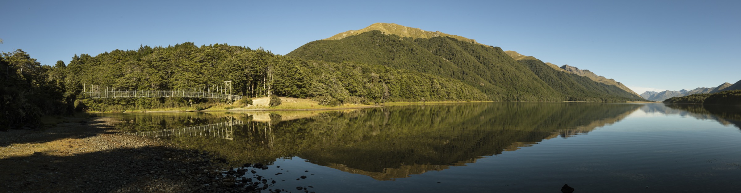
The walk starts at the Mavora Lakes Conservation Campsite at the head of South Mavora Lake, approximately 39 km of gravel road from SH 94 between Mossburn and Te Anau. From the campsite a swing bridge crosses the Mararoa River near the camping area, and the track then follows the true left of the Mararoa River along the eastern shore of South Mavora Lake. Beyond the foot of the lake the track continues downstream along the Mararoa to a second swing bridge that crosses the river to its true right. Returning upstream on the western bank, the track follows the foot of the eastern slopes of the Livingstone Mountains, with the open tops visible to the west, closing the loop at the lake-outlet swing bridge near the campsite. Both swing bridges are marked DOC structures. The route follows part of the Te Araroa Trail between the Mavora campsite and the Kiwi Burn / Mararoa confluence.
Why it is essential
It is the only formal walking circuit at the southern end of the Livingstone Mountains. It traces the foot of the range’s eastern escarpment at lake level, gives uninterrupted views west to the southern Livingstone tops and east to Mt Campbell and the Thomson Mountains, crosses the Mararoa River — the principal southern drainage — twice on swing bridges, and is a section of Te Araroa, which gives it national recognition. It is the canonical southern-Livingstones day walk identified by DOC, AllTrails, Visit Fiordland and the Wilderness Magazine listings.
Equipment
Standard hiking equipment. Sturdy walking shoes or boots (the track is muddy in places after rain); weatherproof shell; warm layer; sun protection (the lake-side and river-flat sections are exposed); 1.5–2 L water; insect repellent — sandflies are intense at the lake margin. LINZ Topo50 sheets CD09 (South Mavora Lake) or CC09 (North Mavora Lake) are the relevant map sheets.
Hazards and notes
The Mararoa River swing bridges are the only safe crossings; do not ford the river except in known-low conditions. Sandflies are persistent at the lake shore. The track shares part of its alignment with the Te Araroa Trail between Boundary Hut / Kiwi Burn and the Mavora campsite, and Te Araroa walkers may be encountered in season. Dogs are permitted on lead at the campsite but are not allowed beyond Boundary Hut. The Mavora Lakes campsite has self-registration fees; no booking is required. There is no mobile phone reception at the lakes — carry a PLB for longer extensions.
GPX / KML links
| Source | URL |
|---|---|
| OpenStreetMap: South Mavora Lake area | openstreetmap.org |
| Te Araroa Trust: official maps and notes download | teararoa.org.nz |
| AllTrails: South Mavora Lake Loop Walk | alltrails.com |
2. Kiwi Burn Hut Loop
Snapshot
Itinerary
From the Kiwi Burn carpark on Mavora Lakes Road, the track drops to and crosses the Mararoa River swing bridge. On the true right of the Mararoa, the route follows the river downstream through a fringe of beech forest before turning west and ascending the Kiwi Burn through alternating bush and tussock clearings. The Kiwi Burn Hut (12 bunks, wood-burning stove, NZTM2000 E1215432 N4965896) is reached after approximately 1 h 30 min via the family-friendly arm or 2 h via the longer “advanced” arm. To close the loop, the route continues upstream along the Kiwi Burn over a low ridge, then drops back through forest and tussock clearings to rejoin the Mararoa side of the loop near the carpark. The full circuit takes 3 h 30 min to 6 h depending on conditions and pace.
Why it is essential
This is the only formal day-loop on the western (Snowdon Forest) flank of the southern Livingstones, and the best family-grade introduction to the area’s beech-and-tussock landscape. The hut itself is a useful turn-around point or short overnight; the loop covers river, beech forest, wetland and open tussock clearings within a single walk. It is the only Snowdon Forest track that DOC keeps cleared annually, which makes it the most reliable choice in the sector.
Equipment
Standard hiking equipment. Sturdy boots (mud and stream sections); weatherproof shell; warm layer; 1.5–2 L water; insect repellent for sandflies. LINZ Topo50 sheet CD09 (South Mavora Lake) and/or CC09 (North Mavora Lake). No specialist equipment is required.
Hazards and notes
The Mararoa River must be crossed on the swing bridge — do not ford. Sections of the loop can be wet underfoot; gaiters are useful. Sandflies are persistent at lower altitudes. Hunting is permitted in Snowdon Forest (deer permit required from DOC); the area is most popular for hunting in the Roar (late March – April). Open fires require a DOC Te Anau permit; portable stoves are encouraged. There is no mobile phone reception — carry a PLB for any extension into the Whitestone or onto the Livingstone tops.
GPX / KML links
| Source | URL |
|---|---|
| OpenStreetMap: Kiwi Burn Hut | openstreetmap.org |
| NZ Route Guides: Kiwi Burn Hut to Kiwi Burn Swing Bridge | routeguides.co.nz |
| AllTrails: Kiwi Burn Loop | alltrails.com |
| Trailforks: Kiwi Burn Hut Track | trailforks.com |
3. Mavora campsite → Careys Hut return
Snapshot
Itinerary
From the Mavora Lakes Conservation Campsite at the head of South Mavora Lake, the route follows a 4WD track around the eastern shore of South Mavora and along the western shore of North Mavora Lake, with the Livingstone Mountains rising abruptly to the west and the open water of the lakes to the east. After approximately 10 km the track reaches Careys Hut, a standard six-bunk DOC hut at the head of North Mavora Lake (NZTopo50 CC10, NZTM2000 E1220148 N4984758). Return is along the same track. Vehicle access is permitted to Careys Hut by 4WD with a registered gate code; on foot, the walk is gentle and runs at lake level the whole way. The track is shared with mountain bikers and occasional 4WD vehicles in season, and is also part of Te Araroa.
Why it is essential
It is the only walking route in the sector that follows the entire length of the Livingstone Mountains’ western escarpment at lake level — the most representative view of the southern Livingstones, with the Livingstone Fault rising abruptly out of North Mavora Lake. It is the only published day-hike that reaches and returns from a DOC hut at the head of the lake under foot power, and it is on the Te Araroa Trail. As a walk it is gentle and lake-level; it is on this list specifically for landscape and view value, not technical interest.
Equipment
Standard hiking equipment. Walking shoes or boots; weatherproof shell; warm layer; sun protection; 1.5–2 L water; insect repellent. The track is well graded; no specialist equipment is required.
Hazards and notes
The 4WD track is shared with vehicles between the campsite and Careys Hut; walkers should expect occasional vehicles in season. The lake shore is exposed to strong westerly winds funnelling down off the Livingstones, and afternoon nor-west fronts can arrive rapidly. No vehicles or bikes are allowed beyond Boundary Hut (a further ~6 km north of Careys), which is not a concern for a day return to Careys. Dogs are permitted on lead at the campsite and on the Mavora Walkway as far as Boundary Hut, but not beyond. There is no mobile phone reception. Careys Hut is first-come first-served ($10 adult per night to 30 June 2026); not needed for a day return.
GPX / KML links
| Source | URL |
|---|---|
| OpenStreetMap: North Mavora Lake / Mavora Walkway | openstreetmap.org |
| Te Araroa Trust: official maps and notes download | teararoa.org.nz |
| AllTrails: Mavora Lakes Campsite to Careys Hut | alltrails.com |
| Herenga ā Nuku Aotearoa: Mavora Walkway | herengaanuku.govt.nz |
4. Mavora Road carpark → Kiwi Burn Hut return
Snapshot
Itinerary
This is the shorter, out-and-back variant of the Kiwi Burn Hut Loop. From the Kiwi Burn carpark on Mavora Lakes Road, the family-friendly arm drops to the Mararoa River swing bridge, crosses onto the true right, then follows the river briefly downstream before turning west to ascend the Kiwi Burn through alternating tussock clearings and beech forest. The track reaches Kiwi Burn Hut (12 bunks, wood-burning stove) in approximately 1 h 30 min. The hut sits in a large clearing on the bush edge with views back east towards the southern Livingstones. Return is by the same route, giving a 3 h day on a graded track.
Why it is essential
This is the easiest walk into a backcountry DOC hut in the southern Livingstones sector. It is the standard introduction for families and new trampers, sees the Mararoa swing bridge and the Kiwi Burn beech-forest landscape, and turns around at a useful hut. It is included on this list to give the catalogue a true entry-level option, since the other three routes are 11–20 km. It is essentially a sub-segment of Hike 2’s full loop, kept distinct because it is the way most visitors actually do this walk.
Equipment
Standard hiking equipment. Walking shoes or trail-running shoes (the track is graded); weatherproof shell; warm layer; 1–1.5 L water; insect repellent. No specialist gear is required.
Hazards and notes
The Mararoa River must be crossed on the swing bridge — do not ford. Wet sections are common, and gaiters are useful in the shoulder season. Sandflies are persistent. There is no mobile phone reception. Permits are required to use open fires (portable stoves encouraged); not relevant for a day return.
GPX / KML links
| Source | URL |
|---|---|
| OpenStreetMap: Kiwi Burn Hut track | openstreetmap.org |
| NZ Route Guides: Kiwi Burn Hut to Kiwi Burn Swing Bridge | routeguides.co.nz |
| AllTrails: Kiwi Burn Hut Track | alltrails.com |
Notes and follow-up
This catalogue renders four hikes rather than five. The Southern Livingstones genuinely do not support a fifth essential day-hike: a “Boundary Hut day extension” requires an overnight at Boundary Hut, and the “Boyd Creek tops” option is on unmaintained tracks across private land needing Te Anau Downs Station permission, so neither has been included. The principal southern summits — Mt Cerberus (1,568 m), Mt Eldon and Mt Richmond — are described uniformly by Wilderness Magazine, NZ Route Guides and trip-report sources as multi-day route-grade objectives, not day-hikes; an attempt on Mt Cerberus from the Kiwi Burn swing bridge in a single push would exceed the day-hike envelope on ascent (over 1,000 m gain, no marked track, river fords). DOC does not publish official GPX files for any of the routes above; OpenStreetMap (ODbL) is the most usable open-licence geometry source. Track-condition seasonality matters: DOC checks Snowdon Forest tracks beyond the Kiwi Burn / Whitestone / South Mavora trio for markers annually but clears them only every three years, and some are no longer maintained — confirm local conditions via the DOC Te Anau Visitor Centre before extending beyond the routes above. The 39 km Mavora Lakes Road is normally 2WD-passable but can become difficult after rain or snow.
External links
| Source | URL |
|---|---|
| DOC — Mavora Lakes Conservation Park | doc.govt.nz |
| DOC — South Mavora Lake walking tracks | doc.govt.nz |
| DOC — Mavora–Greenstone Walkway | doc.govt.nz |
| DOC — Careys Hut | doc.govt.nz |
| DOC — Mavora Lakes conservation campsite | doc.govt.nz |
| DOC — Snowdon Forest Conservation Area | doc.govt.nz |
| DOC — Snowdon Forest tramping tracks | doc.govt.nz |
| DOC — Kiwi Burn Hut | doc.govt.nz |
| Te Araroa Trust — official maps and notes download | teararoa.org.nz |
| Te Araroa Southland trail notes (Mavora Walkway) | portal.teararoa.org.nz |
| Herenga ā Nuku Aotearoa — Mavora Walkway | herengaanuku.govt.nz |
| Wilderness Magazine — 10 trips in the Livingstone Mountains | wildernessmag.co.nz |
| Wilderness Magazine — Kiwi Burn Hut Loop | wildernessmag.co.nz |
| Wilderness Magazine — Mavora Walkway | wildernessmag.co.nz |
| Wilderlife — Forgotten Lands: Mavora and Livingstone Ranges, Southland | wilderlife.nz |
| NZ Route Guides — Livingston Loop Windon Mararoa | routeguides.co.nz |
| Visit Fiordland — Day walks at Mavora Lakes | fiordland.org.nz |
| Southland NZ — Kiwi Burn Loop Track | southlandnz.com |
| Wikipedia — Mavora Lakes | en.wikipedia.org |
| Wikipedia — Mararoa River | en.wikipedia.org |
| Wikimedia Commons — Mavora Lakes category | commons.wikimedia.org |