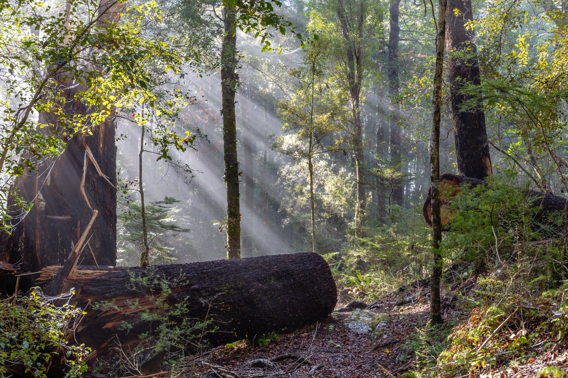
Regional overview
The central Bryant Range sits between the Maitai Valley on the Nelson side, the Whangamoa Valley to the north and the Pelorus catchment to the south. It is the mineral-belt spine that carries Maungatapu, Saddle Hill and the Doubles — the high country the historic Nelson–Pelorus pack route crossed, and the ridge system that Nelson’s Maitai and Fringed Hill trails climb into. Access is from forestry roads, the Maitai Dam road end, the Maungatapu Road on the Pelorus side, and various Maitai / Fringed Hill trailheads.
The walking character here is rougher than the polished Pelorus Bridge and Nelson city-edge walks. Routes use forestry-road access, old 4WD tracks, mineral-belt ridges, historic saddle alignments and long ridge traverses. Several are only partly maintained by DOC — Nelson Trails is the most detailed public source for route statistics, and DOC’s Mount Richmond Forest Park page carries the wider access and safety context but does not publish complete day-walk figures for every route.
Access constraints matter more here than most South Island ranges. The Maitai Dam gate closes in the evening (recorded as 5 PM in the July 2026 research pass) and defines the safe finish time for any route starting from the caretaker’s house. The Mt Duppa forestry-road approach is graded 4WD by Nelson Trails. The Maungatapu Track is open to public vehicles on the Pelorus side only. Point-to-point routes therefore need private shuttle logistics arranged in advance.
The best season is late spring to autumn, with the driest ridge conditions in summer and early autumn. Tracks can be muddy, rutted, overgrown, slippery or hard to follow after rain, and elevation gain is not published by any authoritative source for most routes. The figures below use Nelson Trails as primary and note where DOC or GeoJSON segment measurements supply the rest.
Selection rationale
Five day-scale routes are presented across the central Bryant Range. Mt Duppa Track is the compact northern summit walk from the Whangamoa side. The Maungatapu Circuit via Rush Pool and Dew Lakes is the long mineral-belt loop from Maitai Dam. The Maungatapu Saddle to Pelorus historic traverse carries the range’s most important pack-route history from Nelson to Havelock. Saddle Hill and the Doubles is the high-ridge circuit over North Double (1,217 m) and South Double (1,168 m). The Black Diamond Ridge and Sunrise Ridge link samples the central Bryant’s Maitai/Fringed Hill edge where Nelson’s shorter trail network meets the wilder ridge country. Multi-day objectives beyond Rocks Hut and the Pelorus tramping network sit outside this day-hike catalogue.
Summary
| # | Hike | Trailhead | Route type | Distance | Gain | Max elevation | Difficulty |
|---|---|---|---|---|---|---|---|
| 1 | Mt Duppa Track | Hippolite / Bladebone Road, Whangamoa Valley | Out-and-back | 4.2 km | Unresolved | 1,143 m | Moderate |
| 2 | Maungatapu Circuit via Rush Pool and Dew Lakes | Maitai Dam area | Circuit | 18.6 km | Unresolved | 1,014 m | Hard |
| 3 | Maungatapu Saddle to Pelorus historic traverse | Maitai Dam or Pelorus side | Point-to-point | ~15.4 km | Unresolved | ~750 m at saddle | Moderate–Hard |
| 4 | Saddle Hill and The Doubles | Maitai Dam caretaker’s house or Maungatapu Saddle | Circuit or out-and-back | ~19.9 km (full circuit) | Unresolved | 1,217 m (North Double) | Hard |
| 5 | Black Diamond Ridge and Sunrise Ridge link | Variable — Maitai or Fringed Hill | Ridge link | 6.0 km core | Unresolved | 839 m (Black Diamond) | Moderate–Hard |
1. Mt Duppa Track
Snapshot
Itinerary
Access the start via the Whangamoa Valley and the Hippolite / Bladebone forestry-road network, then follow the orange-marked Mt Duppa route toward the summit. The track is sometimes not obvious, with limestone formations near the high point. Return by the same line.
Because the approach road is part of the commitment, confirm current forestry access and vehicle suitability before departure — the walking distance is short, but the driving side of the day is not.
Why it is essential
Mt Duppa is the compact central-north Bryant summit walk: short on paper, but remote-feeling, high at 1,143 m, and characteristic of the range’s less manicured routes. It gives the northern end of the range a discrete day objective without needing to commit to the long Maungatapu circuits further south.
Equipment
- Sturdy boots with good grip
- Rain jacket and warm layer
- Water, food and first-aid kit
- Map, compass and offline GPS — the marked route is not always obvious
- Headlamp with spare batteries
- Vehicle suitable for the forestry-road access
Hazards and notes
- 4WD access recommended by Nelson Trails on the approach road
- Route hard to follow in places — carry navigation backup
- Limited help nearby — no mobile coverage assumed
- Steep and slippery sections in wet weather
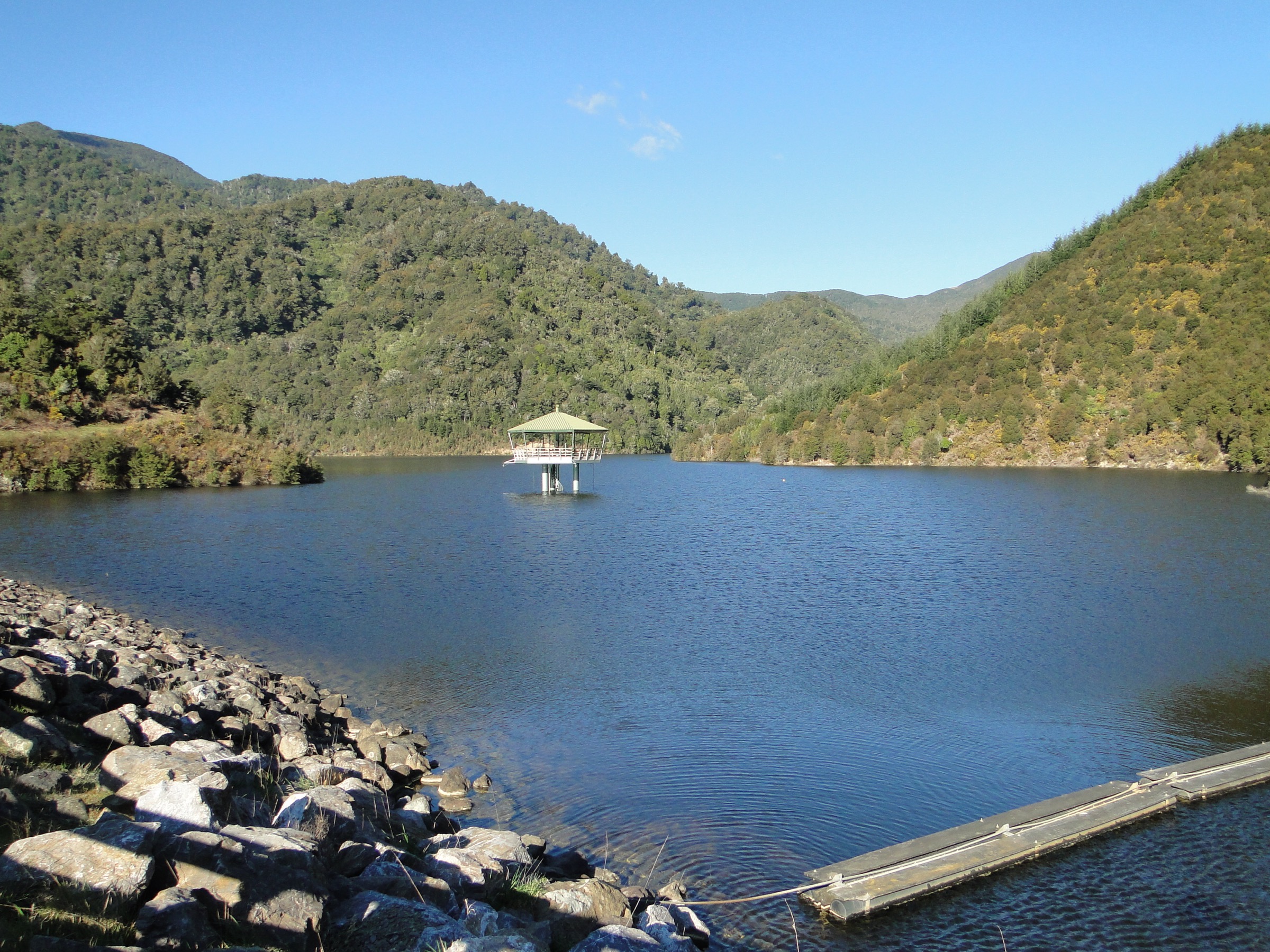
2. Maungatapu Circuit via Rush Pool and Dew Lakes
Snapshot
Itinerary
From Maitai Dam, climb into the mineral-belt country via the Rush Pool Track, continue toward Dew Lakes, and complete the circuit through the Maungatapu Saddle side of the network back to the dam. Nelson Trails also lists shorter objectives inside the same trail set — Rush Pool as a 6.3 km / 2 h 30 min return is the natural half-day fallback — but the full loop is a long outing.
The route combines old 4WD road, rougher track, rutted sections and sometimes creek-bed walking. Start early and keep a conservative turnaround plan if water levels, weather or navigation are worse than expected.
Why it is essential
The Maungatapu Circuit is the central Bryant Range’s classic long mineral-belt day: Maitai Dam, Rush Pool, Dew Lakes and the Maungatapu high country linked in one substantial loop. It is the fullest single-day expression of the range’s distinctive geology and route character.
Equipment
- Sturdy boots
- Waterproof shell and warm layer
- Map, compass and offline GPS
- Headlamp with spare batteries
- 2.5 L water and food for a long day
- First-aid kit and emergency shelter
- Personal Locator Beacon
- Extra water for exposed sections
Hazards and notes
- Rutted track and creek-bed sections — Nelson Trails calls these out explicitly
- Maitai Dam gate closes early — recorded at 5 PM in the July 2026 pass; check current times and plan the finish accordingly
- Exposed to rain, wind and heat — no dependable cover on the ridge sections
- Long day — 6–9 h Nelson Trails estimate covers a wide fitness range
3. Maungatapu Saddle to Pelorus historic traverse
Snapshot
Itinerary
The traverse uses the historic Maungatapu route between the Maitai and Pelorus sides. From the Maitai Dam side, climb toward Maungatapu Saddle on the old road/track alignment, then descend the Pelorus Valley side. The route can also be walked in the opposite direction if transport and access are arranged.
For a safer day-hike version, treat the saddle as an out-and-back objective from one side unless transport and road access on both ends are confirmed on the day.
Why it is essential
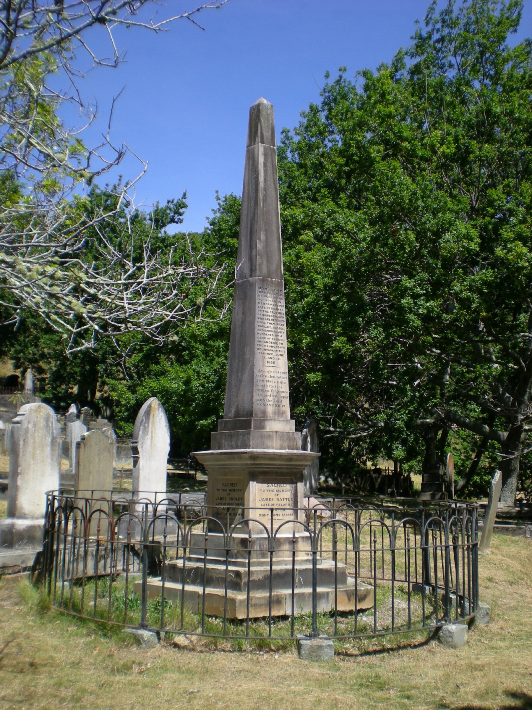
Maungatapu Saddle is the central Bryant Range’s historic crossing — the pack route between Nelson and the Pelorus, and the site of the infamous 1866 Burgess Gang murders commemorated by the monument on the saddle. A day traverse links Nelson and the Pelorus and gives the clearest sense of the range as a real barrier between valleys.
Equipment
- Sturdy boots
- Waterproof shell and warm layer
- Map, compass and offline GPS
- Headlamp with spare batteries
- Food and 2 L water
- First-aid kit and emergency shelter
- Personal Locator Beacon
- Communication backup for shuttle logistics
Hazards and notes
- Vehicle access differs by side — Nelson Trails notes Maungatapu Track is open to public vehicles on the Pelorus side only; the Nelson side is normally approached from Maitai Dam
- Maitai Dam gate closing time applies to Nelson-side shuttle logistics
- Shuttle failure = out-and-back day — plan a return option if the pickup end falls through
- Weather exposure on the saddle — carry warm and waterproof kit even in summer
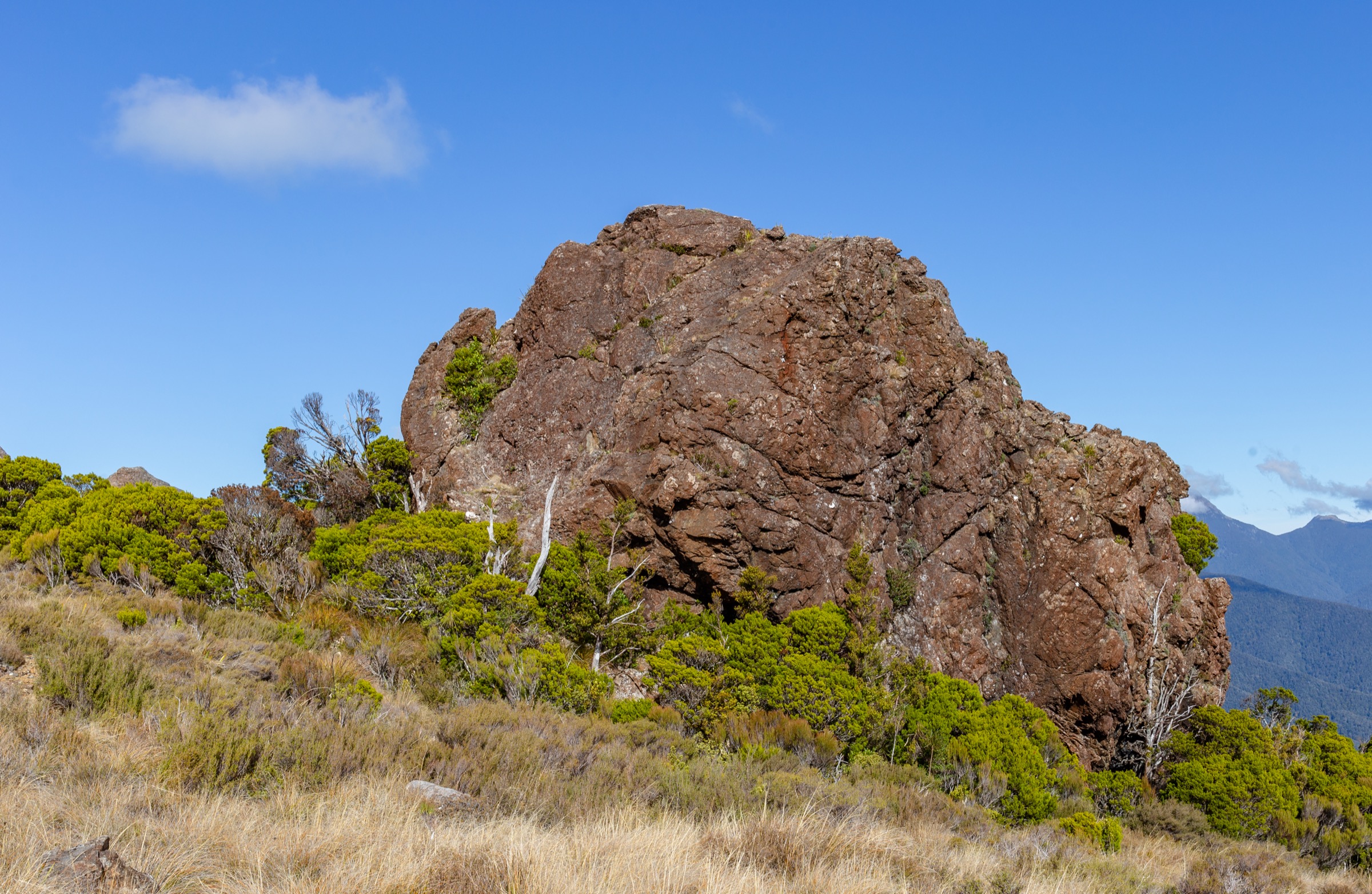
4. Saddle Hill and The Doubles
Snapshot
Itinerary
Nelson Trails describes several linked segments: caretaker’s house to Maungatapu Saddle, Maungatapu Saddle to South Double, South Double to North Double, and the return toward the caretaker’s house via Zig Zag Track and Teal Saddle. Combined, these make a long and rough day circuit.
Parties can shorten the day by treating South Double or the saddle as the objective. The full loop is best reserved for experienced, fit walkers who are comfortable with vague or unmaintained sections.
Why it is essential
The Doubles give one of the central Bryant Range’s strongest high-ridge objectives — 1,217 m at North Double is the highest point in this catalogue by a clear margin, and the sense of remoteness on the ridge is very different from the friendlier Maungatapu Circuit. It is the range’s closest thing to a serious alpine day.
Equipment
- Sturdy boots with good grip
- Waterproof and windproof layers, warm layer
- Map, compass and offline GPS
- Headlamp with spare batteries
- 2.5–3 L water and food for a long day
- First-aid kit and emergency shelter
- Personal Locator Beacon
Hazards and notes
- Only the Maungatapu Saddle to South Double section is DOC-maintained — other sections are rough, vague or unmaintained
- Navigation difficulty and slow travel on unmaintained ground
- Exposure and limited escape options — a bad-weather retreat is not fast
- Maitai Dam gate closing time applies to the caretaker’s-house end
5. Black Diamond Ridge and Sunrise Ridge link
Snapshot
Itinerary
Use the Black Diamond Ridge and Sunrise Ridge tracks as the core ridge link, choosing access from the Maitai or Fringed Hill side according to current signage and conditions. Nelson Trails treats the two ridges as named route components rather than a single official hiking circuit, so the full day depends on how you enter and exit.
For a conservative walking day, plan the access and exit before leaving, and avoid descending technical mountain-bike lines unless they are clearly open to walkers and suitable underfoot.
Why it is essential
This ridge link represents the central Bryant Range’s Maitai/Fringed Hill edge: narrow ridge travel, forested high points, and a strong connection between Nelson’s local trail network and the wilder Maungatapu country. It is the day-hike version of “how the city connects to the range.”
Equipment
- Grippy shoes or boots
- Rain jacket and warm layer
- Water, food and first-aid kit
- Map, compass and offline GPS
- Headlamp with spare batteries
- Trekking poles help on rooty or slippery descents
Hazards and notes
- Narrow ridge with rocky drops — Nelson Trails flags this specifically
- Slippery roots — avoid after heavy rain
- Expert technical MTB character on some sections — stay alert for riders where bikes are permitted
- Access and exit vary — not a single official loop; plan the day before leaving
Further reading
| Resource | Link |
|---|---|
| DOC — Mount Richmond Forest Park | doc.govt.nz |
| Nelson Trails — Mt Duppa | nelsontrails.co.nz |
| Nelson Trails — Maungatapu Circuit | nelsontrails.co.nz |
| Nelson Trails — Saddle Hill | nelsontrails.co.nz |
| Nelson Trails — Black Diamond Ridge | nelsontrails.co.nz |
| Nelson Trails — Sunrise Ridge | nelsontrails.co.nz |
| Nelson Trails — walking tracks GeoJSON | nelsontrails.co.nz |
| MetService — Nelson regional forecast | metservice.com |
| Wikipedia — Bryant Range | en.wikipedia.org |
| Wikipedia — Maungatapu murders | en.wikipedia.org |
| Wikimedia Commons — Bryant Range | commons.wikimedia.org |