Regional overview
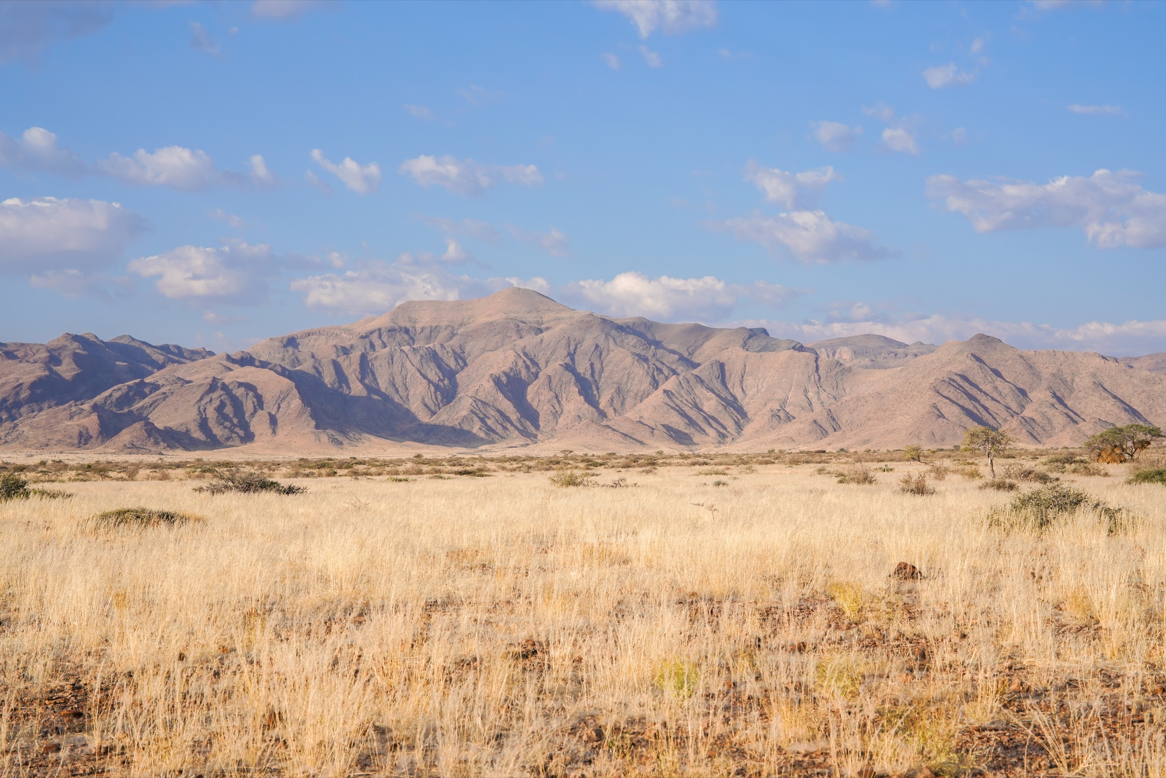
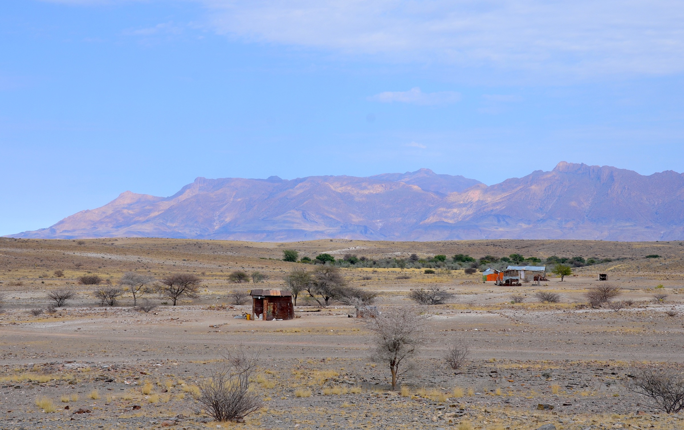
The Brandberg Massif is Namibia’s highest and most isolated granite mountain block, rising from the north-western Namib margin near Uis. It is known locally for its red evening light, its dry granite gorges, and its exceptional concentration of San rock art. The high point, Konigstein, reaches 2,573 m, but the massif is not a normal marked-trail hiking area: access is controlled, the terrain is remote, and the reliable public trail information is concentrated around the White Lady / Maack Shelter approach in Tsisab Ravine.
The day-hiking character is therefore unusual. The standard visitor walk is a guided heritage-site route into lower Tsisab Ravine. Other ravines and upper-mountain routes are culturally and scenically important, but most public sources treat them as guided, permit-only expeditions or research/rock-art objectives rather than signed day hikes. Heat, scarce water, vague route lines, boulder terrain, and fragile heritage sites are the dominant safety and access issues.
The normal walking season is the cooler dry period, roughly May to September, with early starts strongly recommended. Summer and shoulder-season heat can be severe even on short walks. A National Heritage Council permit and guide are required for Brandberg hiking beyond casual roadside viewing; the White Lady site is also guide-controlled.
Selection rationale
Only one Brandberg day walk was found with enough public route detail for a publication-ready entry: the White Lady / Maack Shelter walk. The other four entries are retained as candidate research objectives because public sources identify them as recognised Brandberg ravines, rock-art clusters, or approach lines, but route statistics and legally reusable route geometry are incomplete. This file deliberately does not pretend that Brandberg has five fully verified public day-hikes.
Summary table
| # | Hike | Country | Route type | Distance | Gain | Max elevation | Difficulty | Photo status |
|---|---|---|---|---|---|---|---|---|
| 1 | White Lady / Maack Shelter Walk | Namibia | Out-and-back / short loop variant | 5.1-5.3 km | 86-131 m | 637-655 m | Moderate | Licence-compatible images found |
| 2 | Lower Tsisab Ravine Rock-Art Extension | Namibia | Out-and-back extension | Candidate only | Context images only | |||
| 3 | Numas Ravine Paintings and Spring | Namibia | Out-and-back | Candidate only | Context images only | |||
| 4 | Amis Gorge Lower Rock-Art Approach | Namibia | Out-and-back | Candidate only | Context images only | |||
| 5 | Ga’aseb Gorge Lower Brandberg Approach | Namibia | Out-and-back day-section candidate | Candidate only | Context images only |
1. White Lady / Maack Shelter Walk
Snapshot
Itinerary
The route starts at the managed White Lady / Brandberg heritage-site entrance and follows the Tsisab riverbed into the lower gorge with an official local guide. The walking is mostly on sandy and stony ground, with small boulder steps and short rough sections in the dry watercourse. The path reaches Maack Shelter, where the famous White Lady panel forms part of a larger painted procession.
The return normally follows the same gorge line to the visitor area. AllTrails records the route as a 3.3 mi out-and-back with 429 ft of ascent, while Wikiloc records a 3.19 mi loop/return variant with 282 ft of ascent. Official and heritage sources confirm the controlled-guide requirement; route statistics are therefore treated as trail-database figures rather than official survey values.
Why it is essential
This is the standard Brandberg day walk and the only route in the massif that is consistently documented for ordinary visitors. It combines the massif’s defining elements: granite gorge scenery, dryland walking, San rock art, and controlled heritage access.
Equipment
Mountain hiking equipment is recommended despite the short distance: sturdy footwear, sun hat, high-factor sun protection, weatherproof layer in winter, 2-3 litres of water per person, food or snacks, and a small first-aid kit. Bags and bottles may be restricted near the painted panel; follow guide instructions at the site.
Hazards and notes
Guide access is required. Heat and reflected radiation from rock can be significant even on a short walk. There is no reliable water on the trail. The shelter is a protected heritage site; touching the paintings, leaving the path, and bringing restricted items to the final viewing area can damage the site. Early morning is preferable in warm conditions. Dog access was not verified and should be assumed restricted until confirmed locally.
Photos
| Image | Source | Author | Licence | Reuse notes | Attribution |
|---|---|---|---|---|---|
| White Lady Brandberg photo | commons.wikimedia.org | Heribert Bechen | CC BY-SA 2.0 | Commercial reuse appears allowed; modification allowed under share-alike terms | “DSC06188 Namibia L4 White Lady Brandberg” by Heribert Bechen, CC BY-SA 2.0 |
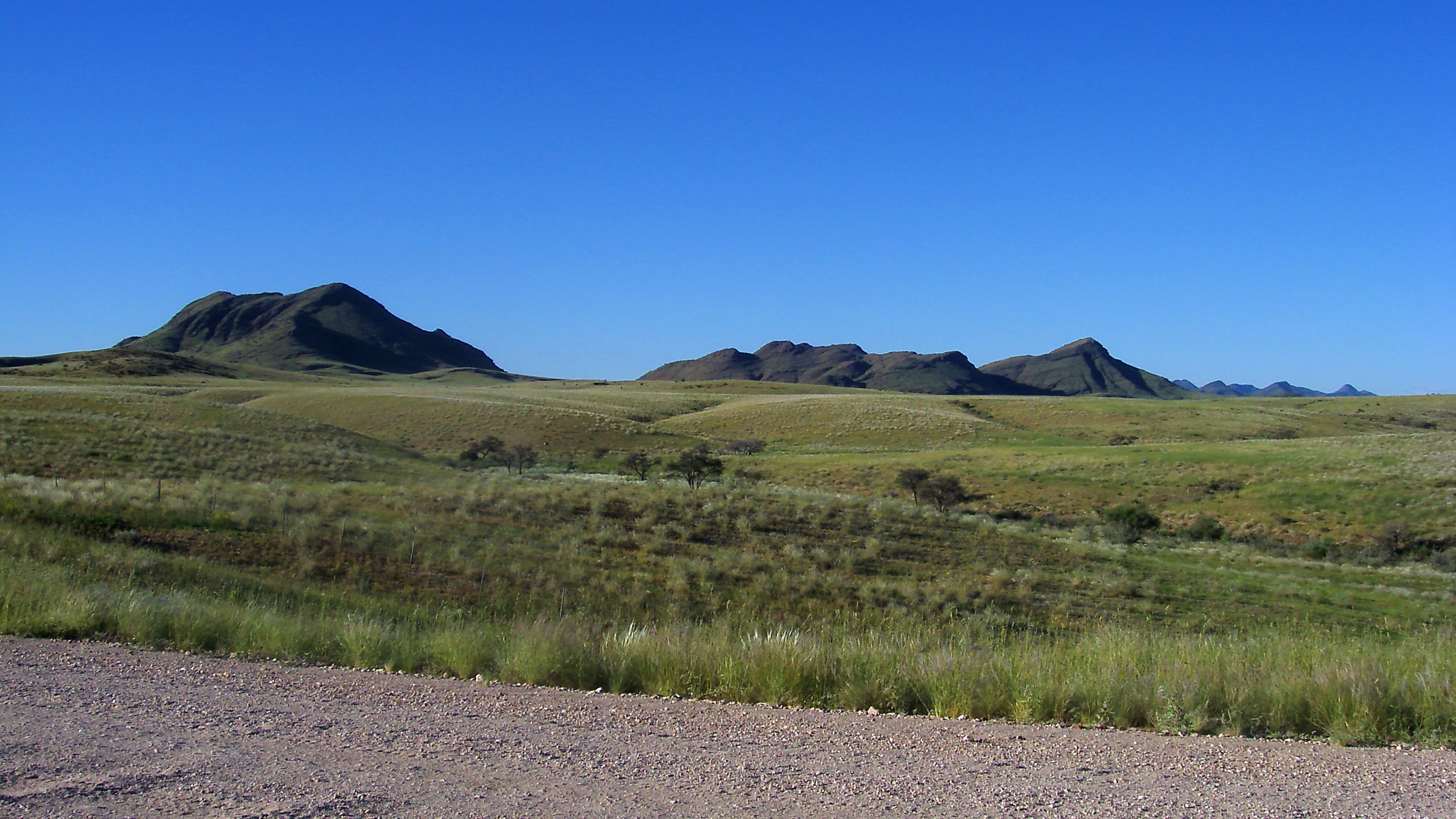
| Brandberg Massif panorama | commons.wikimedia.org | Joel Holdsworth | CC BY-SA 3.0 / GFDL | Commercial reuse appears allowed; modification allowed under selected licence terms | “Brandberg Mountain Panorama” by Joel Holdsworth, CC BY-SA 3.0 |
| Brandberg Massif ASTER view | commons.wikimedia.org | NASA/JPL/ASTER | Public domain (NASA) | Commercial reuse and modification appear allowed; avoid implying NASA endorsement | “Brandberg massif (ASTER)” by NASA/JPL/ASTER, public domain |
GPX / KML links
| Source | URL | Format | Licence / terms | Reuse status |
|---|---|---|---|---|
| Wikiloc - White Lady Trail - Brandberg - Namibia | wikiloc.com | Route page with downloadable GPS option | Wikiloc terms apply; user-generated track | Route source found; direct reuse of user track requires licence/terms review |
| Wikiloc - Namibie, Brandberg, the White Lady | wikiloc.com | Route page with downloadable GPS option | Wikiloc terms apply; user-generated track | Secondary route source found; stats vary slightly |
| AllTrails - White Lady Rock and Brandberg Mountain | alltrails.com | Map/trail page | AllTrails terms apply; GPX download may require account | Source-map page found; no directly reusable GPX licence confirmed |
External links
- National Heritage Council / Travel Namibia — heritage-site fees and Brandberg permit notes
- National Heritage Council — entrance-fee PDF
- AllTrails — White Lady Rock and Brandberg Mountain
- Wikiloc — White Lady Trail Brandberg Namibia
- Bradshaw Foundation — White Lady / Brandberg
- Namibweb — Brandberg mountain-guide access notes
2. Lower Tsisab Ravine Rock-Art Extension
Snapshot
Itinerary
This candidate begins on the managed White Lady trail, then continues with a guide beyond Maack Shelter to additional lower Tsisab rock-art sites such as White Giraffe Shelter, Jochmann Shelter, White Ostrich Shelter, and Tiara Cave. Expedition accounts describe a built path continuing beyond the White Lady area and smaller paths to upstream rock-art clusters.
The route should not be published as a normal independent walk until the current National Heritage Council and local guide arrangements are confirmed. Exact route line, distance, gain, visitor limits, and whether all named shelters are available to ordinary visitors remain unresolved.
Why it is essential
Lower Tsisab is the most accessible part of Brandberg’s rock-art landscape. This extension would give a fuller representation of the ravine than the White Lady panel alone, including historically important shelters that are close to the standard visitor route but much less visited.
Equipment
Mountain hiking equipment, sturdy footwear, sun protection, 2-3 litres of water per person for a half-day extension, and a navigation backup carried by the guide. A camera policy and bag restrictions should be checked at the visitor site before departure.
Hazards and notes
This is a protected heritage landscape. A guide and permission are required. Heat, route-finding, boulders, and fragile painted surfaces are the main issues. The line should remain candidate-only until the NHC or appointed local guides confirm whether the extension is available to catalogue users.
Photos
| Image | Source | Author | Licence | Reuse notes | Attribution |
|---|---|---|---|---|---|
| Brandberg Massif panorama | commons.wikimedia.org | Joel Holdsworth | CC BY-SA 3.0 / GFDL | Context image only, not specific to the extension; commercial reuse appears allowed | “Brandberg Mountain Panorama” by Joel Holdsworth, CC BY-SA 3.0 |
| White Lady Brandberg photo | commons.wikimedia.org | Heribert Bechen | CC BY-SA 2.0 | Nearby route context; modification allowed under share-alike terms | “DSC06188 Namibia L4 White Lady Brandberg” by Heribert Bechen, CC BY-SA 2.0 |
GPX / KML links
| Source | URL | Format | Licence / terms | Reuse status |
|---|---|---|---|---|
| No specific route file found | Unresolved | Unresolved | Unresolved | Route geometry not publishable from current sources |
| OpenStreetMap search | openstreetmap.org | Map/search page | OSM data is ODbL | Possible manual geometry cross-check only |
External links
- Upper Brandberg Expedition 2013 — lower Tsisab extension
- Upper Brandberg Expedition 2010 — lower Tsisab rock-art sites
- Wikivoyage — Brandberg (White Giraffe Cave and Jochmann)
- National Heritage Council / Travel Namibia — permit and guide notes
3. Numas Ravine Paintings and Spring
Snapshot
Itinerary
The candidate route follows Numas Ravine on the western side of the Brandberg to rock-art panels and, if conditions and permission allow, onwards to a small spring. Guidebook and Namibia travel sources describe paintings of animals such as snake, giraffe, and antelope on the southern bank of the dry riverbed, followed by additional paintings near the spring.
No publishable trailhead, distance, ascent, current access procedure, or route file was found. The route remains a candidate until a local guide, NHC permit process, and mapped line are confirmed.
Why it is essential
Numas Ravine is repeatedly identified as one of the Brandberg’s important rock-art ravines and offers a quieter western-massif counterpart to Tsisab. It also adds the rare element of a spring/oasis setting in an otherwise arid granite mountain.
Equipment
Mountain hiking equipment, sturdy footwear, sun protection, long sleeves, navigation backup, and 3 litres or more of water per person depending on time of day and guide advice. Do not rely on the spring as a drinking-water source.
Hazards and notes
Guide and permit requirements must be confirmed before publication. The main issues are heat, fragile rock art, boulder travel, uncertain vehicle approach, and possible flash-flood exposure in a dry ravine after storms. The available sources describe the objective but not a complete visitor-grade route.
Photos
| Image | Source | Author | Licence | Reuse notes | Attribution |
|---|---|---|---|---|---|
| Brandberg Massif panorama | commons.wikimedia.org | Joel Holdsworth | CC BY-SA 3.0 / GFDL | Context image only; commercial reuse appears allowed | “Brandberg Mountain Panorama” by Joel Holdsworth, CC BY-SA 3.0 |
| Brandberg Massif ASTER view | commons.wikimedia.org | NASA/JPL/ASTER | Public domain (NASA) | Regional context; commercial reuse and modification appear allowed | “Brandberg massif (ASTER)” by NASA/JPL/ASTER, public domain |
GPX / KML links
| Source | URL | Format | Licence / terms | Reuse status |
|---|---|---|---|---|
| No GPX/KML found in this pass | Unresolved | Unresolved | Unresolved | Route geometry unresolved |
| OpenStreetMap search | openstreetmap.org | Map/search page | OSM data is ODbL | Search/cross-check only; no route relation selected |
External links
- Lonely Planet — Numas Ravine attraction page
- Namibian.org — Brandberg overview (Numas Ravine paintings and spring)
- Mountain Club Namibia — Brandberg access and NHC permit context
- National Heritage Council / Travel Namibia — permit and guide notes
4. Amis Gorge Lower Rock-Art Approach
Snapshot
Itinerary
Amis Gorge is one of the documented upper Brandberg rock-art areas and has a dedicated Heinrich-Barth-Institut monograph in the “Rock Paintings of the Upper Brandberg” series. The gorge lies on the south-western side of the massif, but no visitor-grade day-route description, trailhead access rule, distance, gain, or GPX file was found in public sources.
This candidate should be treated as a research placeholder for a guided lower-gorge day approach only. It should not be promoted as an independent hike until the National Heritage Council or a recognised local guide confirms legal access, route line, and visitor suitability.
Why it is essential
Amis Gorge represents the less-visited, research-significant side of the Brandberg rock-art landscape. Including it as a candidate prevents the catalogue from reducing the massif to the White Lady route alone, while keeping the verification label conservative.
Equipment
Mountain hiking equipment, sturdy boots, sun protection, long sleeves, at least 3 litres of water per person, emergency communication appropriate to remote desert roads, and guide-carried navigation. Overnight equipment may be required if a local guide determines that a day visit is not feasible.
Hazards and notes
Access, legal permission, guide requirements, and trail condition remain unresolved. Remote vehicle access, heat, lack of water, unmarked boulder terrain, and heritage-site protection are major issues. Do not infer public access from academic documentation.
Photos
| Image | Source | Author | Licence | Reuse notes | Attribution |
|---|---|---|---|---|---|
| Brandberg Massif panorama | commons.wikimedia.org | Joel Holdsworth | CC BY-SA 3.0 / GFDL | Context image only; commercial reuse appears allowed | “Brandberg Mountain Panorama” by Joel Holdsworth, CC BY-SA 3.0 |
| Brandberg Massif ASTER view | commons.wikimedia.org | NASA/JPL/ASTER | Public domain (NASA) | Regional context; commercial reuse and modification appear allowed | “Brandberg massif (ASTER)” by NASA/JPL/ASTER, public domain |
GPX / KML links
| Source | URL | Format | Licence / terms | Reuse status |
|---|---|---|---|---|
| No GPX/KML found in this pass | Unresolved | Unresolved | Unresolved | Route geometry unresolved |
| Mindat locality map for Amis Gorge | mindat.org | Locality map, not hiking route | Mindat terms apply; coordinates are locality reference only | Not reusable as trail geometry |
External links
- Heinrich-Barth-Institut — Rock Paintings of the Upper Brandberg, Part I: Amis Gorge
- Mindat — Amis Gorge locality map
- Mountain Club Namibia — Brandberg permit and access context
- National Heritage Council / Travel Namibia — permit and guide notes
5. Ga’aseb Gorge Lower Brandberg Approach
Snapshot
Itinerary
Ga’aseb Gorge is one of the recognised approaches toward the upper Brandberg and Konigstein. The route begins at a remote southern-gorge entrance and climbs through dry creek beds, boulder fields, granite slabs, and sparse cairned terrain. A full ascent of Konigstein is an expedition objective and should not be catalogued as a normal day hike.
For this catalogue, the candidate is limited to a lower-gorge day-section or viewpoint walk to be defined later by a recognised guide. The available GPX and trip report are useful for understanding the approach line, but they describe a longer summit route rather than a verified day-hike turnaround.
Why it is essential
Ga’aseb is the most documented public-source approach to the high Brandberg and gives the catalogue a link to Namibia’s highest mountain without falsely presenting the summit as a standard day walk. It should remain candidate-only until a legal, guided, non-overnight route section is defined.
Equipment
Mountain hiking equipment plus desert-mountain additions: sturdy boots, trekking poles, sun hat, sunglasses, long sleeves, 4 litres or more of water per person for long days, salty food, navigation backup, headtorch, and emergency communication. The full summit route requires expedition-level planning and possible overnight gear.
Hazards and notes
NHC permit and guide requirements are mandatory according to multiple sources. Water is unreliable and may be absent. Route-finding is difficult, cairns can be intermittent, and the terrain includes boulders and smooth granite slabs. The full Konigstein ascent is not a catalogue-ready day hike and should not be promoted without specialist local confirmation.
Photos
| Image | Source | Author | Licence | Reuse notes | Attribution |
|---|---|---|---|---|---|
| Brandberg Massif panorama | commons.wikimedia.org | Joel Holdsworth | CC BY-SA 3.0 / GFDL | Context image only; commercial reuse appears allowed | “Brandberg Mountain Panorama” by Joel Holdsworth, CC BY-SA 3.0 |
| Brandberg Massif ASTER view | commons.wikimedia.org | NASA/JPL/ASTER | Public domain (NASA) | Regional context; commercial reuse and modification appear allowed | “Brandberg massif (ASTER)” by NASA/JPL/ASTER, public domain |
GPX / KML links
| Source | URL | Format | Licence / terms | Reuse status |
|---|---|---|---|---|
| Spectacular Mountains - Konigstein GPX ZIP | spectacularmountains.com | ZIP containing GPX for full expedition route | Site disclaimer; reuse terms not clearly stated | Useful source route for manual review only; not a day-section file |
| Spectacular Mountains route page | spectacularmountains.com | Route report and GPX source page | Site terms/disclaimer apply | Full-route source checked; not publication-ready day-hike geometry |
External links
- Spectacular Mountains — Konigstein / Ga’aseb report and GPX link
- Mountain Club Namibia — Brandberg permit context
- National Heritage Council / Travel Namibia — permit and guide notes
- NASA Earth Observatory — Brandberg massif overview
Missing data and follow-up
- Brandberg does not yet have five fully verified public day-hikes in the available sources; only the White Lady / Maack Shelter walk is publication-ready.
- Confirm with the National Heritage Council and Daureb/Brandberg guides which lower Tsisab, Numas, Amis, and Ga’aseb routes can legally be offered as day walks.
- Replace candidate entries with exact trailheads, distances, ascent/descent, maximum elevations, guide fees, and current visitor restrictions.
- Obtain or create legally clean GPX/KML files for the candidate day sections after route geometry is confirmed by an authorised source.
- Source route-specific open images for Numas, Amis, lower Tsisab extension sites, and Ga’aseb Gorge; current images are mostly general Brandberg context.
External links
| Source | URL |
|---|---|
| National Heritage Council / Travel Namibia — heritage-site fees and Brandberg permit notes | travel.na |
| National Heritage Council — entrance-fee PDF | nhc-nam.org |
| Mountain Club Namibia — Brandberg access notes | mcnam.org |
| AllTrails — White Lady Rock and Brandberg Mountain | alltrails.com |
| Wikiloc — White Lady Trail Brandberg Namibia | wikiloc.com |
| Bradshaw Foundation — White Lady / Brandberg | bradshawfoundation.com |
| Namibian.org — Brandberg overview | namibian.org |
| Lonely Planet — Numas Ravine | lonelyplanet.com |
| Fjexpeditions — lower Tsisab 2013 expedition | fjexpeditions.com |
| Fjexpeditions — Brandberg 2010 expedition | fjexpeditions.com |
| Heinrich-Barth-Institut — Amis Gorge publication | hbi.uni-koeln.de |
| Spectacular Mountains — Konigstein route and GPX | spectacularmountains.com |
| NASA Earth Observatory — Brandberg overview | science.nasa.gov |