Regional overview
The Eastern Ghats are discontinuous, forested, culturally rich hills running from Odisha through Andhra Pradesh and Tamil Nadu. Hiking is often local and seasonal: waterfall approaches, temple-forest pilgrim routes, canyon pools, and high-point walks. Official tourism pages verify several destinations, but route geometry is patchy; many stats below are approximate.
Distances and elevations marked approximate need later GIS confirmation before publication.
Selection rationale
The five hikes give a representative Eastern Ghats sample: Odisha’s highest peak at Deomali, the Andhra waterfall canyon at Nagalapuram, the tall Talakona waterfall in the Nallamala forest, the sacred Ahobilam Nava Narasimha circuit, and the Kolli Hills stair descent to Agaya Gangai.
Summary table
| # | Hike | Country | Route type | Distance | Gain | Max elevation | Difficulty |
|---|---|---|---|---|---|---|---|
| 1 | Deomali Summit Ridge Walk | India | Out-and-back high-ridge | Approx. 3-6 km | Approx. 100-300 m | 1,672 m | Easy-moderate |
| 2 | Nagalapuram Falls Trek | India | Out-and-back canyon/waterfall | Approx. 8-15 km | Approx. 300-500 m | Approx. 600-700 m | Moderate |
| 3 | Talakona Waterfall Forest Walk | India | Out-and-back waterfall/forest | Approx. 2-4 km | Approx. 100-250 m | Easy-moderate | |
| 4 | Upper Ahobilam to Jwala Narasimha / Ugra Stambham Area | India | Out-and-back / temple-forest | Approx. 7-12 km | Approx. 500-800 m | Moderate-hard | |
| 5 | Agaya Gangai Waterfall, Kolli Hills | India | Out-and-back stair descent | Approx. 2-4 km | Approx. 250-350 m return | Approx. 1,000-1,200 m | Moderate; strenuous on return |
1. Deomali Summit Ridge Walk
Snapshot
Itinerary
Walk from the road-access area across Deomali’s open high ground and viewpoints, extending along rugged local trails only where open and safe.
Why it is essential
Highest peak of Odisha and one of the defining high points of the Eastern Ghats.
Equipment
Walking shoes, wind/rain layer, sun protection, water.
Hazards and notes
Fog, slippery grass/soil, exposed high ground in storms, limited waymarking.
GPX / KML links
| Source | URL | Format / access | Reuse status |
|---|---|---|---|
| Odisha Tourism — Deomali | odishatourism.gov.in | Source page | Site terms apply; no GPX found |
External links
2. Nagalapuram Falls Trek
Snapshot
Itinerary
Follow the forested stream/canyon route toward the Nagalapuram waterfall pools, turning back at a safe pool/fall objective according to time, water level, and local access rules.
Why it is essential
One of the best-known Eastern Ghats waterfall treks near Chennai/Tirupati, with pools, boulders, and scrub-forest canyon terrain.
Equipment
Grippy shoes, offline map, first aid, water, dry bag; do not rely on swimming ability for safety.
Hazards and notes
Flash floods, slippery boulders, deep pools, route-finding, litter/impact, limited formal signage.
GPX / KML links
| Source | URL | Format / access | Reuse status |
|---|---|---|---|
| Wikiloc — Nagalapuram Picnic Pool | wikiloc.com | Recorded track | Terms/reuse unresolved |
| Trekkerpedia — Nagala east trekking | trekkerpedia.com | Source page | Site terms apply |
External links
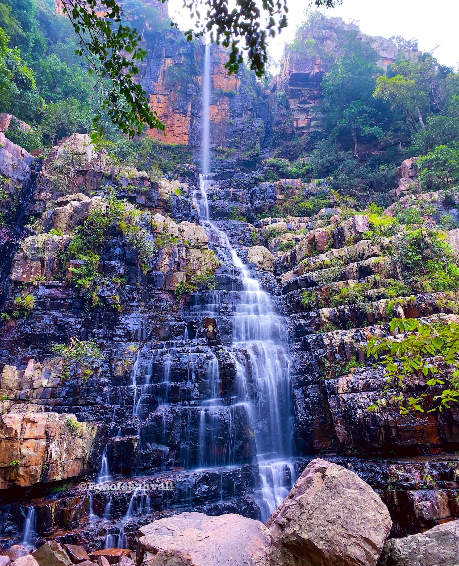
3. Talakona Waterfall Forest Walk

Snapshot
Itinerary
Walk from the visitor area through the forest approach to Talakona Waterfall and return; longer upper routes should be treated separately with local forest guidance.
Why it is essential
Andhra Pradesh’s tallest waterfall and a classic Eastern Ghats forest-waterfall day outing.
Equipment
Shoes with grip, water, rain protection in monsoon.
Hazards and notes
Slippery rocks, falling water/rock zones, forest access rules.
GPX / KML links
| Source | URL | Format / access | Reuse status |
|---|---|---|---|
| Tirupati district — Talakona Waterfall | tirupati.ap.gov.in | Source page | Site terms apply; no GPX found |
External links
4. Upper Ahobilam to Jwala Narasimha / Ugra Stambham Area
Snapshot
Itinerary
From Upper Ahobilam, walk the temple paths toward Varaha, Jwala Narasimha and Malola, with Ugra Stambham as a strenuous optional extension only if conditions and local guidance allow.
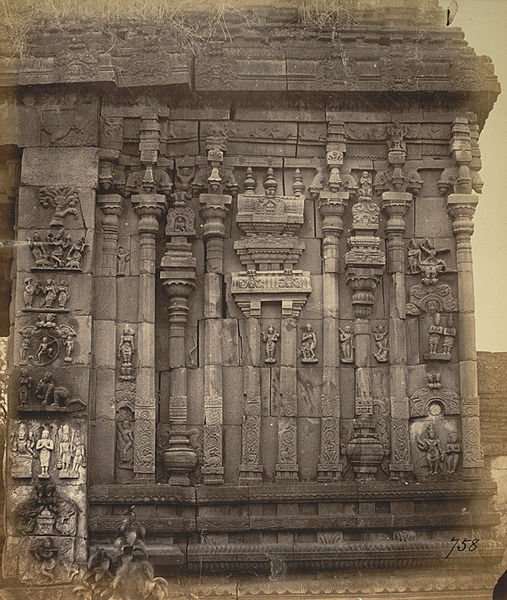
Why it is essential
The most culturally important Eastern Ghats hike in this set: a rugged sacred landscape of Nava Narasimha shrines in the Nallamala forest.
Equipment
Sturdy shoes, water, sun protection, modest temple-appropriate clothing, local guide strongly recommended.
Hazards and notes
Steep rocky paths, forest route-finding, monkeys, heat, slippery stream/rock sections.
GPX / KML links
| Source | URL | Format / access | Reuse status |
|---|---|---|---|
| Ahobila Mutt — Visiting Ahobilam | ahobilamutt.org | Source page | Site terms apply; no GPX found |
| Wikiloc — Ahobilam | wikiloc.com | Recorded track | Terms/reuse unresolved |
External links
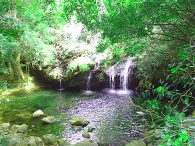
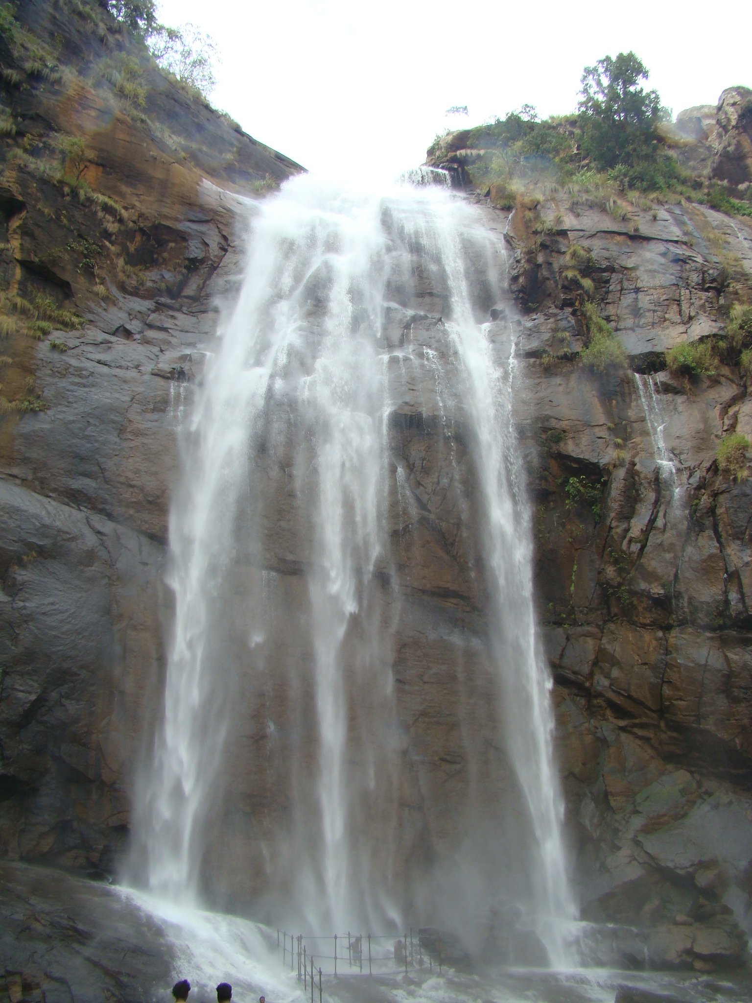
5. Agaya Gangai Waterfall, Kolli Hills
Snapshot
Itinerary
Descend the long stairway from the temple area to Agaya Gangai Waterfall, then climb back up the same steps.
Why it is essential
Signature Kolli Hills waterfall hike, combining Eastern Ghats forest, temple context, and a memorable stair climb.
Equipment
Grippy shoes, water, light rain layer; poles are awkward on steps but can help slower walkers.
Hazards and notes
Long stair climb, wet steps, crowding, heat/humidity.
GPX / KML links
| Source | URL | Format / access | Reuse status |
|---|---|---|---|
| Wikimedia Commons — Agaya Gangai category | commons.wikimedia.org | Category | Image/file licences vary |
| Holidify — Agaya Gangai Waterfalls | holidify.com | Source page | Site terms apply; no GPX found |
External links
External links
| Source | URL |
|---|---|
| Odisha Tourism — Deomali | odishatourism.gov.in |
| Tirupati district — Talakona Waterfall | tirupati.ap.gov.in |
| Ahobila Mutt — Visiting Ahobilam | ahobilamutt.org |
| Wikiloc — Nagalapuram Picnic Pool | wikiloc.com |
| Wikiloc — Ahobilam | wikiloc.com |
| Trekkerpedia — Nagala east trekking | trekkerpedia.com |
| Holidify — Agaya Gangai Waterfalls | holidify.com |